 Block
From the record
One of 12 National Register listings published here for Lyon County · listed in 1982 · category: Building.
Sources: the case file at the National Archives · the National Register database, National Park Service
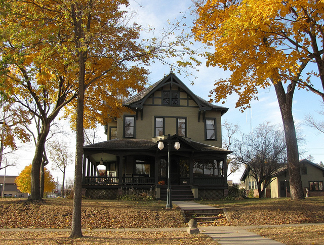
Listed on the National Register of Historic Places in 1982.
One of 12 National Register listings published here for Lyon County · listed in 1982 · category: Building.
Sources: the case file at the National Archives · the National Register database, National Park Service
The chapter on Marshall City in History of Lyon County, published 1884 names Marshall. This is what it says, exactly as the scans read.
This township, in which is located the village of Marshall, the couuty seat, is named from a lake which lies in the southeast part ot the town. It is six miles west of Redwood county and iwelve miles sou'ih ol Yellow Medicine, and is town 111, ran^e 41.
Passage source: History of Lyon County, published 1884.
March 8, 1872, a town meetmg to organize and elect officers was held at the house of C. H. Whitney and the following .first officers of the town were elected: road being built and operated to Marshall ia 1872. The towa site ot Marshall was laid out ia August this year by a corapauy of the W. & St. P- surveyors, consisting ot J. W. Blake, W. G. Ward, J. H. Jenkins and J. H. Stewart. The location chosen was in the c«'ntral part ot section 4, and the town assumed village projjortions very rapidly, of which proper mention will be made in another place
Passage source: History of Lyon County, published 1884.
Machine-read from a century-old scan, so expect the errors a machine makes: misspelled names, dropped words, stray characters.
Read the whole chapter on Marshall City - 11,741 words on its settlement, mills, schools and churches.
Regional context, not property-specific evidence. The federal wildfire occurrence database lists 1 fire within 5 miles of William F. Gieske House in 2013, burning about 4 acres in total. None started naturally. None was recorded as arson. Distance is straight-line from the map coordinates, so a fire counted here may appear on a neighbouring settlement's page as well.
| Reported cause | Fires |
|---|---|
| Debris and open burning | 1 |
The most recent of them, most recent first, with the day each was reported and the service that recorded it.
| Date | Cause | Size | Reported by | Name on the report |
|---|---|---|---|---|
| 13 May 2013 | Debris and open burning | 4.0 acres | Minnesota Department of Natural Resources | not named |
Regional context, not property-specific evidence. The federal mineral resources record lists 2 workings within 5 miles of William F. Gieske House: 2 producers. All of them still produce. What was taken out: Sand and Gravel, Construction. Distance is straight-line from the map coordinates, so a quarry counted here may appear on a neighbouring settlement's page as well.
| Where | Site | Commodity | Status | Recorded |
|---|---|---|---|---|
| Marshall Pit No 2 | Sand and Gravel, Construction | Producer | ||
| Marshall Pit and Mill | Sand and Gravel, Construction | Producer |
Regional context, not property-specific evidence. The National Weather Service names Marshall, the town this property stands in, in 83 storm reports between 1993 and 2025: 41 hail, 24 thunderstorm wind, 6 tornado, 6 flash flood. No death or injury is recorded in these reports. Each account below is quoted exactly as the forecast office filed it, from the NOAA Storm Events Database, and each date opens the federal record of that event.
| When | Event | Place named | Harm | What the report says |
|---|---|---|---|---|
| July 2011 | Thunderstorm Wind | Marshall | $300,000 | Thunderstorm winds caused widespread tree damage, including numerous trees blown down. Several roads were blocked by fallen trees. Roofs and siding of several homes were damaged directly by the wind, and also by falling trees and wind blown tree debris. The winds also blew down power poles and lines, causing a power outage. The winds were accompanied by large hail. |
| August 1996 | Thunderstorm Wind | Marshall | $300,000 | no account filed |
| July 2017 | Tornado (EF0) | Marshall | $30,000 | Most of the damage to the area was a result of 80 to 100 mph winds. However, there were indications of a very brief tornado that enhanced the damage. |
| July 2017 | Tornado (EF0) | Marshall | $25,000 | Most of the damage was a result of strong thunderstorm winds of 80 to 100 mph, but the damage survey results showed an indication of a brief tornado that resulted in an enhanced area of damage. |
| July 2011 | Hail | Marshall | $10,000 | Large hail, driven by damaging winds, broke windows, dented vehicles, and caused an unknown amount of crop damage. |
| April 2001 | Thunderstorm Wind | Marshall | $10,000 | no account filed |
| August 2012 | Thunderstorm Wind | Marshall | $5,000 | Thunderstorm winds damaged siding on mobile homes. |
| May 1996 | Thunderstorm Wind | Marshall | $5,000 | no account filed |
| July 2020 | Thunderstorm Wind | Marshall | $1,500 | An 11 inch diameter tree limb fell on a car, causing damage to the vehicle. Property damage costs are rough estimates. |
| August 2025 | Thunderstorm Wind | Marshall | - | Thunderstorm wind gusts caused major tree damage across the city of Marshall, with several downed trees blocking roadways. |
| July 2025 | Flash Flood | Marshall | - | Heavy rainfall from 4 to 8 inches in just a couple of hours led to flooding of numerous roads around Marshall. |
| July 2025 | Flash Flood | Marshall | - | Video showed flowing water roughly one foot deep across U.S. Highway 59 near the intersection of MN Highway 23. |
| July 2025 | Flash Flood | Marshall | - | The Marshall Fire Department performed a water rescue for a person trapped in a flooded car. |
| August 2025 | Flash Flood | Marshall | - | Heavy rainfall caused inundation and persistent flooding of County Road 6 between U.S. Highway 59 and County Road 35, resulting in closing of the road for several hours. |
| August 2025 | Flood | Marshall | - | Several county roads were under water and closed for several hours after the initial flooding, including 170th Street northwest of Balaton and County Road 6 south of Marshall. |
| July 2024 | Thunderstorm Wind | Marshall | - | A large tree limb from 6 to 10 inches in diameter was downed by thunderstorm wind gusts. |
| May 2022 | Thunderstorm Wind | Marshall | - | Trees downed by strong thunderstorm winds. |
| May 2022 | Thunderstorm Wind | Marshall | - | Numerous small tree limbs were downed by thunderstorm winds. |
| August 2022 | Thunderstorm Wind | Marshall | - | A storage shed was badly damaged by thunderstorm wind gusts at the Marshall, Minnesota School District CTE Center. |
| September 2018 | Hail | Marshall | - | Penny to nickel size hail fell, but spotter was not under the stronger part of the storm. |
| July 2018 | Flash Flood | Marshall | - | Water pooled quickly to a depth of more than 8 inches through a neighborhood in southern portions of Marshall. Water reached basements of many homes in the area. Rainfall at Marshall was 4.81 inches, with 4.02 inches just south of Marshall. |
| June 2017 | Thunderstorm Wind | Marshall | - | Personal weather station report received via social media. |
| June 2016 | Thunderstorm Wind | Marshall | - | Thunderstorm winds caused tree damage. |
| June 2015 | Thunderstorm Wind | Marshall | - | Thunderstorm winds caused tree damage, including trees blown over. The winds also damaged a billboard. |
| June 2014 | Tornado (EF0) | Marshall | - | A brief tornado caused no reported damage. |
| September 2013 | Thunderstorm Wind | Marshall | - | Thunderstorm winds caused tree damage, and blew three empty rail cars a distance down the tracks. |
| September 2013 | Thunderstorm Wind | Marshall | - | Thunderstorm winds caused tree damage, including several branches blown down. |
| June 2013 | Hail | Marshall | - | Large hail caused an unknown amount of damage to vehicles, roofs, and crops. |
| May 2012 | Flood | Marshall | - | Runoff from heavy rain caused minor lowland flooding of the Redwood River, with lowlands including some parkland affected. The river crested at 1.44 feet above flood stage at Russell on May 7th. |
| July 2011 | Flash Flood | Marshall | - | Heavy rain caused flash flooding of several streets in Marshall. |
| March 2010 | Flood | Marshall | - | Rapid melting of a heavy winter snowpack caused flooding of the Redwood River, with mainly farmland affected. The river crested at 2.8 feet above flood stage at Marshall and 1.65 feet above flood stage at Russell. |
| September 2010 | Flood | Marshall | - | Heavy rain caused moderate to record flooding of the Redwood River, with farmland and some roads near the river affected. The river crested at a record 6.01 feet above flood stage at Russell on September 25th. |
| March 2007 | Flood | Marshall | - | Warm temperatures caused a rapid snowmelt which caused the Redwood River to rise above flood stage for a few days. The flooding was generally minor, and no significant damage was reported. The river crested at around 2 feet above flood stage at Marshall on March 13th, and at Russel on March 14th. |
| June 2005 | Tornado (F0) | Marshall | - | A tornado caused no reported damage. |
| August 2004 | Lightning | Marshall | - | Lightning struck the joint law enforcement center, knocking out power and damaging some equipment. Some communications were lost for several hours, but emergency service was not affected. |
| June 2001 | Thunderstorm Wind | Marshall | - | Thunderstorm winds blew down light poles. |
| July 2000 | Tornado (F0) | Marshall | - | A brief tornado caused no reported damage. |
| May 1993 | Tornado (F1) | Marshall | - | A tornado traveled along an intermittent path to the south and east of Marshall damaging a few farm buildings and uprooting several trees. |
| July 2025 | Hail | Marshall | - | no account filed |
| July 2025 | Hail | Marshall | - | no account filed |
| September 2024 | Hail | Marshall | - | no account filed |
| September 2024 | Hail | Marshall | - | no account filed |
| September 2024 | Hail | Marshall | - | no account filed |
| August 2022 | Hail | Marshall | - | no account filed |
| September 2018 | Hail | Marshall | - | no account filed |
| September 2018 | Hail | Marshall | - | no account filed |
| June 2016 | Thunderstorm Wind | Marshall | - | no account filed |
| May 2014 | Hail | Marshall | - | no account filed |
| May 2014 | Hail | Marshall | - | no account filed |
| September 2013 | Thunderstorm Wind | Marshall | - | no account filed |
| August 2013 | Hail | Marshall | - | no account filed |
| August 2013 | Hail | Marshall | - | no account filed |
| August 2012 | Hail | Marshall | - | no account filed |
| June 2010 | Thunderstorm Wind | Marshall | - | no account filed |
| June 2010 | Thunderstorm Wind | Marshall | - | no account filed |
| August 2009 | Hail | Marshall | - | no account filed |
| June 2007 | Thunderstorm Wind | Marshall | - | no account filed |
| June 2006 | Hail | Marshall | - | no account filed |
| June 2006 | Hail | Marshall | - | no account filed |
| June 2006 | Hail | Marshall | - | no account filed |
No historic map-sheet match is published for this property yet. That does not mean no map exists. This record needs a coordinate-quality review before it can be joined to a sheet boundary. Browse the county's mapped places while that work is pending.
Other National Register properties close enough to walk or drive between, ordered by distance from this one. Both positions come from the same geocoding pass that matched these properties to their map sheets.
| Photograph | Property | Distance | Listed |
|---|---|---|---|
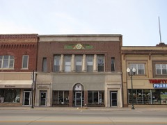 | Masonic Temple Delta Lodge No. 119 | 0.3 miles | 1982 |
 | Bridge No. 5083-Marshall | 0.4 miles | 1998 |
 | Bridge No. 5151-Marshall | 0.7 miles | 1998 |
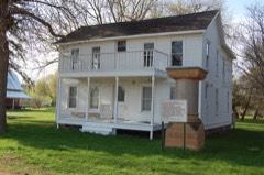 | Kiel & Morgan Hotel/Lyon County Courthouse | 6.3 miles | 1982 |
| National Archives record | The nomination case file for reference 82002982 in Record Group 79. |
| Lyon County | All 12 listed properties in this county. |