 Block
From the record
One of 76 National Register listings published here for Rice County · listed in 1982 · category: Building.
Sources: the case file at the National Archives · the National Register database, National Park Service

Listed on the National Register of Historic Places in 1982.
One of 76 National Register listings published here for Rice County · listed in 1982 · category: Building.
Sources: the case file at the National Archives · the National Register database, National Park Service
An account from the chapter on Northfield city. The inset identifies its exact source book and publication year.
In the autumn of 1862, after the Sioux massacre, the people in and about Northfield were in a chronic state of apprehension. Indians wore constantly passing in small bands, and while the days were passed with feelings of security, the nights were instinct with emotions of dread, every unusual sound was transformed into inJieatious of the approach of the blood-thirsty savage, and very many persons, who had retired for the night had the most gloomy forebodings, and felt that it
The chapter on Northfield City in History of Rice County, published 1882 names Northfield. This is what it says, exactly as the scans read.
Telegrams were at once started in all directi(jns to intercept the outlaws. Unfortunately the operator at Dundas was not in, or the whole gang might have been captured there. Parties were organized at various points, and the story of the flight with the wovinded man, the pursuit, with the attending escapades and hair-breadth escapes on lioth sides, affords a most exciting chapter in this kind of literature; for the whole country between here and Missouri, the headquarters of the gang, was excited and under arms, and the rtsult was that three were captured and ime more killed, making six left behind of the eight who started on this errand of plunder. The two who escaped were Jesse and Frank James, the latter being the oue wounded in Northfield. The names of those killed in Northfield were Clell Miller and Stiles. Charley Pitts, alias George Wells, was killed at Madeliu, where Cole, Robert, and James Younger were finally captured, and subsequently lodged in the Faribault jail. Rumors of a rescuing party oau.sed a guard to be placed outside the jail, and on the 3d of October, 1876, a watchman, who was coming to report for duty, was shot and instantly killed by Frank Glazier, a guard at the jail, who mistook him for the advance guard of a rescuing party. This was indeed a sad and fatal mistake, making the sixth human life destroyed in consequence of the attempt to rob the Northfield bank.
Passage source: History of Rice County, published 1882.
In the autumn of 1862, after the Sioux massacre, the people in and about Northfield were in a chronic state of apprehension. Indians wore constantly passing in small bands, and while the days were passed with feelings of security, the nights were instinct with emotions of dread, every unusual sound was transformed into inJieatious of the approach of the blood-thirsty savage, and very many persons, who had retired for the night had the most gloomy forebodings, and felt that it
Passage source: History of Rice County, published 1882.
Machine-read from a century-old scan, so expect the errors a machine makes: misspelled names, dropped words, stray characters.
Read the whole chapter on Northfield City - 17,076 words on its settlement, mills, schools and churches.
Regional context, not property-specific evidence. The federal wildfire occurrence database lists 8 fires within 5 miles of Steensland Library-St. Olaf College between 2001 and 2012, burning about 6 acres in total. None started naturally. None was recorded as arson. Distance is straight-line from the map coordinates, so a fire counted here may appear on a neighbouring settlement's page as well.
| Reported cause | Fires |
|---|---|
| Recreation and ceremony | 5 |
| Equipment and vehicle use | 2 |
| Missing data/not specified/undetermined | 1 |
The most recent of them, most recent first, with the day each was reported and the service that recorded it.
| Date | Cause | Size | Reported by | Name on the report |
|---|---|---|---|---|
| 13 September 2012 | Recreation and ceremony | under an acre | Minnesota Valley National Wildlife Refuge | CEDAR AVENUE |
| 23 August 2012 | Recreation and ceremony | under an acre | Minnesota Valley National Wildlife Refuge | BASS POND 4 |
| 1 May 2001 | Missing data/not specified/undetermined | 2.0 acres | Minnesota Valley National Wildlife Refuge | STOLAF |
| 20 April 2012 | Recreation and ceremony | under an acre | Minnesota Valley National Wildlife Refuge | BLACK DOG |
| 7 December 2012 | Recreation and ceremony | under an acre | Minnesota Valley National Wildlife Refuge | BLOOMINGOTN FERRY 1 |
| 29 November 2012 | Recreation and ceremony | under an acre | Minnesota Valley National Wildlife Refuge | SORENSON LANDING 1 |
| 22 October 2012 | Equipment and vehicle use | 1.0 acres | Minnesota Valley National Wildlife Refuge | CO RD 18 |
| 12 October 2012 | Equipment and vehicle use | 3.0 acres | Minnesota Valley National Wildlife Refuge | CO RD 101 |
Regional context, not property-specific evidence. The federal mineral resources record lists 1 working within 5 miles of Steensland Library-St. Olaf College: 1 producer. All of them still produce. What was taken out: Sand and Gravel, Construction. Distance is straight-line from the map coordinates, so a quarry counted here may appear on a neighbouring settlement's page as well.
| Where | Site | Commodity | Status | Recorded |
|---|---|---|---|---|
| Shilling Pit | Sand and Gravel, Construction | Producer |
Regional context, not property-specific evidence. The National Weather Service names Northfield, the town this property stands in, in 55 storm reports between 1997 and 2024: 19 thunderstorm wind, 18 hail, 9 heavy rain, 4 flash flood. The reports record 1 injury. Each account below is quoted exactly as the forecast office filed it, from the NOAA Storm Events Database, and each date opens the federal record of that event.
| When | Event | Place named | Harm | What the report says |
|---|---|---|---|---|
| May 2001 | Tornado (F2) | Northfield | 1 hurt, $9,000,000 | NWS damage survey rated the tornado an F2. Tornado touched down briefly in downtown Northfield, flipping over a semi trailer truck and lifting the roof off of one business. Three-fourths mile later, it touched down again on the east side of Northfield, and then remained on the ground for 11 miles. After being in Rice County for 5 miles, it crossed Highway 19 into Dakota County and then dissipated in Goodhue County 4 miles west of Cannon Falls, for a total of 12 miles. Numerous rear flank downdraft gusts estimated at 90 mph caused damage alongside the southern periphery of tornado track. One man sustained minor injuries when he was blown from a tractor, but did not require hospitalization. A total of 8 homes received major damage, 22 more had minor damage, and a turkey processing plant was destroyed. |
| August 2006 | Hail | Northfield | $50,000,000 | Hundreds and possibly thousands of vehicles damaged; many had to be totaled. Significant damage to many buildings and houses. Two car dealerships lost their entire inventory. Buildings on the St. Olaf college campus suffered roof and window damage. Approximately 17,000 acres of crops destroyed in Rice County. Unofficial reports of softball size hail. Damage total includes all storm reports from August 24 in Rice County. |
| June 2021 | Hail | Northfield | $2,500,000 | Baseball size hail was reported east of Northfield. The trained spotter emailed the picture of the large hail stone. |
| May 2017 | Lightning | Northfield | $25,000 | Lightning struck a home on the 1500 block of Lindberg Court Monday afternoon in Northfield. Northfield Area Fire and Rescue Service firefighters responded to the home around 1 p.m. Monday to extinguish the fire that started as a result of the strike.||The homeowner was inside the residence at the time of the strike, but no injuries were reported. Lightning struck the chimney liner on the roof, and followed that down to the mechanical room where it ignited storage items.||There was also smoke damage throughout the home. |
| July 2011 | Thunderstorm Wind | Northfield | $25,000 | The City of Northfield received widespread damage with many trees, some several large trees, were snapped off toward the top. Many power lines were also blown down. ||Some of the areas within the city included;|Highway 19 and Highway 3, |Highway 3 and 2nd Street,|Greenvale Avenue west of Highway 3,|Woodley Street east of Highway 3. |
| March 2012 | Thunderstorm Wind | Northfield | $10,000 | Several power poles and a street light were blown down in Northfield, Minnesota, due to severe thunderstorm wind gusts. |
| July 2010 | Thunderstorm Wind | Northfield | $5,000 | Trees and a few power lines were blown down near Northfield, Minnesota. An automated weather station west of Northfield, had a measured wind gust of 56 mph. |
| June 2001 | Thunderstorm Wind | Northfield | $1,000 | Numerous trees felled. Deck of home torn off. |
| June 2005 | Flash Flood | Northfield | $100 | Flooding was reported on the Highway 19 underpass at Interstate 35. |
| June 2024 | Heavy Rain | Northfield | - | Nearly 3 to 4 inches of rain fell in northern Rice county. |
| June 2024 | Heavy Rain | Northfield | - | A total of 3 to 5 inches of rain fell from multiple rounds of thunderstorms. CoCoRaHS observers measured 5.35 inches near Morristown. |
| June 2024 | Heavy Rain | Northfield | - | The storm total was 2.7 inches of rainfall. |
| August 2020 | Hail | Northfield | - | There was a picture of a 1.5-inch hailstone in Northfield. |
| June 2019 | Thunderstorm Wind | Northfield | - | A trained spotter measured a wind gust of 75 mph in the city of Northfield. |
| June 2019 | Thunderstorm Wind | Northfield | - | There were multiple reports of downed trees, up to three feet in diameter, across parts of Northfield. |
| September 2018 | Tornado (EF1) | Northfield | - | A NWS storm survey, plus areal footage of drone and satellite data, concluded that an EF1 tornado tracked 4.7 miles from southeast of Owatonna, east-northeast across mainly corn and soy bean fields before moving into Goodhue County, north of Dennison. However, near the intersection of 110th Street East, and Jacobs Ave, a barn that was a restaurant and event venue was destroyed. It was called the Red Barn and was completely blown off its foundation. The damage was consistent with EF1 damage with maximum wind speeds of 105 mph and a width of 550 yards. |
| July 2017 | Thunderstorm Wind | Northfield | - | Several trees were blown down south of Highway 19, near Northfield. |
| July 2013 | Heavy Rain | Northfield | - | A measured rainfall amount of 5.05 inches fell in less than 3 hours. In addition, Ames Park near the intersecton of Water Street and Highway 19 was flooded. |
| July 2013 | Heavy Rain | Northfield | - | A measured rainfall amount of 4.75 inches fell in less than 3 hours. |
| June 2012 | Thunderstorm Wind | Northfield | - | Several large trees were blown down at 9th and Water Street. |
| June 2012 | Heavy Rain | Northfield | - | A measured rainfall report of 5.51 inches occurred in less than 18 hours. |
| June 2012 | Heavy Rain | Northfield | - | A measured rainfall report of 7.13 inches occurred in less than 18 hours. |
| June 2012 | Flash Flood | Northfield | - | The City of Northfield received 6 to 9 inches of rain and closed parts of Highway 19. In addition, cars were half-submerged in flood waters across town. |
| June 2012 | Flash Flood | Northfield | - | Significant street flooding caused some roads to close around Northfield and Dundas. |
| August 2012 | Thunderstorm Wind | Northfield | - | A large tree limb, approximately 50 feet in length was blown down near Northfield. |
| July 2011 | Heavy Rain | Northfield | - | Minor ponding of water on city street was reported in Northfield, Minnesota, due to heavy rainfall. |
| September 2010 | Heavy Rain | Northfield | - | A cooperative observer measured 5.20 inches of rainfall overnight. |
| July 2008 | Thunderstorm Wind | Northfield | - | One foot diameter tree downed. |
| July 2008 | Thunderstorm Wind | Northfield | - | Trees downed, most one to two feet in diameter. |
| July 2008 | Thunderstorm Wind | Northfield | - | Six inch diameter tree limb severed near Archibald Lane. |
| July 2008 | Thunderstorm Wind | Northfield | - | Two and one half foot diameter tree felled. |
| August 2007 | Thunderstorm Wind | Northfield | - | Light pole and power lines knocked down. |
| May 2005 | Funnel Cloud | Northfield | - | An ambulance driver reported a funnel cloud at the Rice and Dakota County line. |
| June 2005 | Thunderstorm Wind | Northfield | - | Two foot diameter trees were downed on the St. Olaf College campus. Trees were also downed near the intersection of Lincoln Parkway and Second Street, and on Decker Avenue. A tree was downed onto a house on North Linden Street. A tree felled onto a power line started a fire at Ivanhoe Avenue. A utility pole was broken on Cedar Avenue. |
| June 2004 | Thunderstorm Wind | Northfield | - | A number of trees were downed. |
| May 1998 | Thunderstorm Wind | Northfield | - | Large tree uprooted. Estimated windspeed. |
| June 1998 | Thunderstorm Wind | Northfield | - | Measured at the Northfield Safety Center. |
| June 1998 | Flash Flood | Northfield | - | Between 4 and 6 inches of rain resulted in flash flooding in the Northfield area. Portion of county road 78 washed out resulting in train derailment. Highway 19 bridge collapsed under the weight of a semi-truck and trailer. Decker Avenue along Spring Creek washed out between 90th and 100th streets. Extensive flood damage to roadways around Dennison. |
| September 2024 | Hail | Northfield | - | no account filed |
| June 2021 | Thunderstorm Wind | Northfield | - | no account filed |
| August 2012 | Hail | Northfield | - | no account filed |
| June 2012 | Hail | Northfield | - | no account filed |
| July 2010 | Hail | Northfield | - | no account filed |
| August 2007 | Hail | Northfield | - | no account filed |
| July 2007 | Hail | Northfield | - | no account filed |
| August 2006 | Hail | Northfield | - | no account filed |
| August 2006 | Hail | Northfield | - | no account filed |
| June 2005 | Hail | Northfield | - | no account filed |
| April 2004 | Hail | Northfield | - | no account filed |
| July 2002 | Hail | Northfield | - | no account filed |
| May 2002 | Hail | Northfield | - | no account filed |
| May 2002 | Hail | Northfield | - | no account filed |
| June 1998 | Hail | Northfield | - | no account filed |
| June 1997 | Hail | Northfield | - | no account filed |
| July 1997 | Lightning | Northfield | - | no account filed |
No historic map-sheet match is published for this property yet. That does not mean no map exists. This record needs a coordinate-quality review before it can be joined to a sheet boundary. Browse the county's mapped places while that work is pending.
Other National Register properties close enough to walk or drive between, ordered by distance from this one. Both positions come from the same geocoding pass that matched these properties to their map sheets.
| Photograph | Property | Distance | Listed |
|---|---|---|---|
 | Old Main, St. Olaf College | under 500 feet | 1976 |
| O. E. Rolvaag House | 0.5 miles | 1969 | |
 | Northfield Commercial Historic District | 1.0 miles | 1979 |
 | Sciver Block Building | 1.0 miles | 1978 |
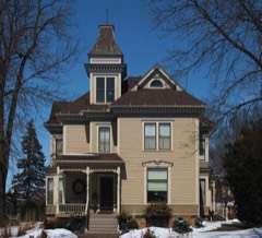 | Drew H. Lord House | 1.1 miles | 1982 |
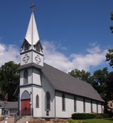 | All Saints Church-Episcopal | 1.2 miles | 1982 |
| National Archives record | The nomination case file for reference 82003020 in Record Group 79. |
| Rice County | All 76 listed properties in this county. |