

BlockBefore
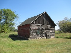
Photograph of Church of the Immaculate Conception-Catholic
Photograph by Gobonobo, CC BY-SA 3.0. Via Wikimedia Commons.

Church of the Immaculate Conception-Catholic

Built in 1902 (Romanesque Revival architecture). Listed on the National Register of Historic Places in 1982.

From the record

“The Church of the Immaculate Conception is a historic Roman Catholic church building in the unincorporated community of St. It is part of the Roman Catholic Diocese of Saint Cloud.”

Wikipedia article Church of the Immaculate Conception (St. Anna, Minnesota), CC BY-SA 4.0.

One of 36 National Register listings published here for Stearns County · listed in 1982 · category: Building · built in 1902, Romanesque Revival architecture.

Sources: the Wikipedia article · the case file at the National Archives · the National Register database, National Park Service · the Wikipedia article
The listing

  • What is counted as historic. The nomination lists 1 building as contributing to the listing.
  • Listed as. Church of the Immaculate Conception--Catholic - the National Register files a house under its owner's surname.
  • Address. Co. Hwy. 9, Avon, 56310
  • When was it listed? April 1982
  • Category. building
  • Also known as. Ethnic Hamlet Churches-Stearns County Catholic Settlement Churches TR
  • Township. Avon township
  • When was it built? 1902
  • Architectural style. Romanesque Revival architecture
  • National Register reference number. 82003038 - the number the National Park Service assigned this property when it was listed, and the key its nomination file is catalogued under at the National Archives.

The ground it stands on

848 words

The chapter on Avon Township in History of Stearns County, Minnesota, published 1915 names Avon. This is what it says, exactly as the scans read.

Avon is situated in the northeastern portion of the county, and is contained in township 125 north, range 30 west. It was originally covered with timber. It abounds in small lakes and marshes. The principal lakes are Pelican Lake, in the northwest portion of the town, and Spunk, Kepper, Anna, Lenman and Minnie lakes, in the vicinity of Avon village. The most beautiful of these is Spunk Lake. The area of the town is 23,040 acres. The St. Paul, Minneapolis & Manitoba railroad, now a part of the Great Northern, passes through the southern portion of the town,

Passage source: History of Stearns County, Minnesota, published 1915.

The village of Avon is situated on the beautiful Spunk Lakes in Sections 27 and 28 of township 125, range 30. It is an elegant place for summer resorts; having many lakes and excellent railroad facilities and not too far from the large cities of the state. It was incorporated in February, 1900.

Passage source: History of Stearns County, Minnesota, published 1915.

Machine-read from a century-old scan, so expect the errors a machine makes: misspelled names, dropped words, stray characters.

Read the whole chapter on Avon Township - 848 words on its settlement, mills, schools and churches.

Storms near this property

24 since 1994

Regional context, not property-specific evidence. The National Weather Service names Avon, the town this property stands in, in 24 storm reports between 1994 and 2023: 16 hail, 7 thunderstorm wind, 1 tornado. No death or injury is recorded in these reports. Each account below is quoted exactly as the forecast office filed it, from the NOAA Storm Events Database, and each date opens the federal record of that event.

WhenEvent Place namedHarm What the report says
August 2021Thunderstorm WindAvon-There were large trees blown down in Avon.
May 2018HailAvon-A swath of large hail was observed from southwest, to northwest of Avon, Minnesota. The largest hail stone was hen size. There was also a video of wind damage on Middle Swan Lake, which is west of Avon.
June 2013Thunderstorm WindAvon-A large tree was blown down near Avon.
August 2012Thunderstorm WindAvon-A few large trees were blown down in Avon.
August 2011Thunderstorm WindAvon-A few large trees were blown down, near Avon.
July 2011Thunderstorm WindAvon-A trained spotter measured a peak wind gust, along with several large trees blown down.
September 2007Thunderstorm WindAvon-Two large branches toppled onto vehicles. Three power poles snapped. A TV antenna blown over.
July 2000Thunderstorm WindAvon-Fifteen foot pine tree toppled.
July 2023HailAvon-no account filed
May 2022HailAvon-no account filed
September 2017HailAvon-no account filed
June 2012HailAvon-no account filed
July 2010HailAvon-no account filed
August 2006HailAvon-no account filed
July 2003HailAvon-no account filed
June 2002HailAvon-no account filed
August 2002HailAvon-no account filed
June 1999Tornado (F0)Avon-no account filed
July 1999HailAvon-no account filed
May 1998HailAvon-no account filed
July 1994HailAvon-no account filed

Every storm recorded in Stearns County

Map coverage status

No historic map-sheet match is published for this property yet. That does not mean no map exists. This record needs a coordinate-quality review before it can be joined to a sheet boundary. Browse the county's mapped places while that work is pending.

Listed places nearby

2 within 8 miles

Other National Register properties close enough to walk or drive between, ordered by distance from this one. Both positions come from the same geocoding pass that matched these properties to their map sheets.

Photograph PropertyDistance Listed
Anton Gogala Farmstead6.3 miles1982
St. John's Abbey and University Historic District6.7 miles1979

Sources for this property

National Archives recordThe nomination case file for reference 82003038 in Record Group 79.
Wikipedia articleCommunity-written account of this property, licensed CC BY-SA.
Stearns CountyAll 36 listed properties in this county.

Provenance

  • Listing record. National Park Service National Register of Historic Places, listed-properties dataset, current to 2026-05-22.
  • Map join. Address geocoded through the United States Census geocoder, then tested against the published boundary of every sheet in the USGS Historical Topographic Map Collection.
  • How this page is made. Listing fields come from federal records; map-sheet coverage is a labelled coordinate-to-boundary calculation, not a source-field claim.
  • Storms. NOAA National Centers for Environmental Information, Storm Events Database https://www.ncei.noaa.gov/stormevents/ A work of the United States government, no copyright under 17 U.S.C. 105. Narratives are quoted verbatim from the National Weather Service report and are not edited or summarised.