BlockBefore
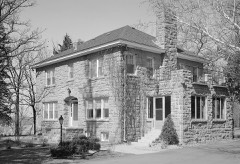
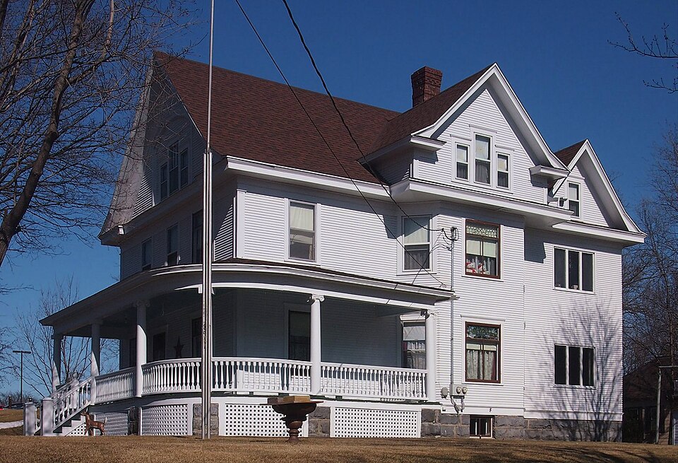
Photograph of Eugene Hermanutz House
Photograph by McGhiever, CC BY-SA 4.0. Via Wikimedia Commons.

Eugene Hermanutz House

Built in 1912. Listed on the National Register of Historic Places in 1982.

From the record

“The Eugene Hermanutz House is a historic house in Cold Spring, Minnesota, United States. It was built in 1912 for one of three co-owners of the Cold Spring Brewing Company.”

Wikipedia article Eugene Hermanutz House, CC BY-SA 4.0.

One of 36 National Register listings published here for Stearns County · listed in 1982 · category: Building · built in 1912.

Sources: the Wikipedia article · the case file at the National Archives · the National Register database, National Park Service
The listing

  • What is counted as historic. The nomination lists 1 building as contributing to the listing.
  • Listed as. Hermanutz, Eugene, House - the National Register files a house under its owner's surname.
  • Address. 302 N. Red River Ave., Cold Spring, 56320
  • When was it listed? April 1982
  • Category. building
  • Also known as. Cold Spring Brewers' Houses TR
  • Township. Wakefield township
  • When was it built? 1912
  • National Register reference number. 82003040 - the number the National Park Service assigned this property when it was listed, and the key its nomination file is catalogued under at the National Archives.

The ground it stands on

5,557 words

The chapter on Wakefield Township in History of Stearns County, Minnesota, published 1915 names Cold Spring. This is what it says, exactly as the scans read.

Wakefield lies in the southeast part of the county, and is bounded on the north by Collegeville, on the east by Rockville, on the south by Luxemburg, and on the west by Munson. It contains an area of 23,040 acres, of which about sixty per cent is under cultivation, and embraces the whole of township 123, range 30. The surface is undulating and in places quite broken. Originally the greater part of the township was covered with brush and poplar groves, with here and there a patch of open prairie. The soil is variable, but chiefly a rich, black loam, very productive, with clay and gravel subsoil. The Sauk river enters the town on section 30, and crosses in an easterly direction, forming an excellent water-power at Cold Spring.

Passage source: History of Stearns County, Minnesota, published 1915.

In 1853, William Buchanan, being directed by Gen. Lowry, then residing near St. Cloud, made a claim near the present site of Cold Spring City. He was accompanied by a number of Winnebago Indians, who assisted him in the erection of a log cabin, but only remained a few weeks.

Passage source: History of Stearns County, Minnesota, published 1915.

Machine-read from a century-old scan, so expect the errors a machine makes: misspelled names, dropped words, stray characters.

Read the whole chapter on Wakefield Township - 5,557 words on its settlement, mills, schools and churches.

Mines and quarries near this property

7 within 5 miles

Regional context, not property-specific evidence. The federal mineral resources record lists 7 workings within 5 miles of Eugene Hermanutz House: 7 producers. All of them still produce. What was taken out: Granite, Stone, Crushed/Broken, Sand and Gravel, Construction, Limestone, General. Distance is straight-line from the map coordinates, so a quarry counted here may appear on a neighbouring settlement's page as well.

Where SiteCommodity StatusRecorded
Gertkin Marl PitsLimestone, GeneralProducerMarl
Richmond Pit and MillSand and Gravel, ConstructionProducer
Cold Spring Crushing PlantStone, Crushed/BrokenProducer
Rockville ShopGranite, Stone, Crushed/BrokenProducer
Opalescent QuarryGraniteProducer
Rockville Quarry No 1GraniteProducer
Rockville Quarry No 2GraniteProducer

Every working recorded in Stearns County

Storms near this property

1 since 1996

Regional context, not property-specific evidence. The National Weather Service names Cold Spring, the town this property stands in, in 1 storm report in 1996: 1 thunderstorm wind. No death or injury is recorded in these reports. Each account below is quoted exactly as the forecast office filed it, from the NOAA Storm Events Database, and each date opens the federal record of that event.

WhenEvent Place namedHarm What the report says
October 1996Thunderstorm WindCold Spring-no account filed

Every storm recorded in Stearns County

Map coverage status

No historic map-sheet match is published for this property yet. That does not mean no map exists. This record needs a coordinate-quality review before it can be joined to a sheet boundary. Browse the county's mapped places while that work is pending.

Listed places nearby

3 within 8 miles

Other National Register properties close enough to walk or drive between, ordered by distance from this one. Both positions come from the same geocoding pass that matched these properties to their map sheets.

Photograph PropertyDistance Listed
Ferdinand Peters Houseunder 500 feet1982
John Oster Houseunder 500 feet1982
Clark and McCormack Quarry and House4.5 miles1982

Sources for this property

National Archives recordThe nomination case file for reference 82003040 in Record Group 79.
Wikipedia articleCommunity-written account of this property, licensed CC BY-SA.
Stearns CountyAll 36 listed properties in this county.

Provenance

  • Listing record. National Park Service National Register of Historic Places, listed-properties dataset, current to 2026-05-22.
  • Map join. Address geocoded through the United States Census geocoder, then tested against the published boundary of every sheet in the USGS Historical Topographic Map Collection.
  • How this page is made. Listing fields come from federal records; map-sheet coverage is a labelled coordinate-to-boundary calculation, not a source-field claim.
  • Mines and quarries. USGS Mineral Resources Data System (MRDS) https://mrdata.usgs.gov/mrds/ A work of the United States government, no copyright under 17 U.S.C. 105.
  • Storms. NOAA National Centers for Environmental Information, Storm Events Database https://www.ncei.noaa.gov/stormevents/ A work of the United States government, no copyright under 17 U.S.C. 105. Narratives are quoted verbatim from the National Weather Service report and are not edited or summarised.