 Block
From the record
One of 36 National Register listings published here for Fillmore County · listed in 1982 · category: Building.
Sources: the case file at the National Archives · the National Register database, National Park Service
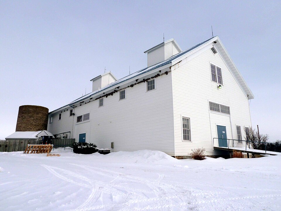
Listed on the National Register of Historic Places in 1982.
One of 36 National Register listings published here for Fillmore County · listed in 1982 · category: Building.
Sources: the case file at the National Archives · the National Register database, National Park Service
Regional context, not property-specific evidence. The federal wildfire occurrence database lists 13 fires within 5 miles of Allis Barn between 1994 and 2017, burning about 46 acres in total. None started naturally. None was recorded as arson. Distance is straight-line from the map coordinates, so a fire counted here may appear on a neighbouring settlement's page as well.
| Reported cause | Fires |
|---|---|
| Debris and open burning | 5 |
| Missing data/not specified/undetermined | 4 |
| Equipment and vehicle use | 2 |
| Smoking | 1 |
| Recreation and ceremony | 1 |
The most recent of them, most recent first, with the day each was reported and the service that recorded it.
| Date | Cause | Size | Reported by | Name on the report |
|---|---|---|---|---|
| 1 August 2017 | Missing data/not specified/undetermined | under an acre | Minnesota Department of Natural Resources | not named |
| 12 May 2003 | Recreation and ceremony | under an acre | Minnesota Department of Natural Resources | not named |
| 29 April 2001 | Equipment and vehicle use | 4.0 acres | Minnesota Department of Natural Resources | not named |
| 22 April 2009 | Missing data/not specified/undetermined | 3.0 acres | Minnesota Department of Natural Resources | not named |
| 19 April 1998 | Missing data/not specified/undetermined | 3.0 acres | Minnesota Department of Natural Resources | not named |
| 18 April 1994 | Debris and open burning | under an acre | Minnesota Department of Natural Resources | not named |
| 15 April 2003 | Debris and open burning | 2.0 acres | Minnesota Department of Natural Resources | not named |
| 11 April 1996 | Missing data/not specified/undetermined | 10 acres | Minnesota Department of Natural Resources | not named |
Regional context, not property-specific evidence. The federal mineral resources record lists 7 workings within 5 miles of Allis Barn: 6 producers, 1 occurrence. 6 still produce. What was taken out: Stone, Crushed/Broken, Silica, Sand and Gravel, Construction. Distance is straight-line from the map coordinates, so a quarry counted here may appear on a neighbouring settlement's page as well.
| Where | Site | Commodity | Status | Recorded |
|---|---|---|---|---|
| Fillmore County Sand Deposit | Silica | Occurrence | ||
| Hungerholt Pit | Sand and Gravel, Construction | Producer | ||
| Judy Quarry | Stone, Crushed/Broken | Producer | ||
| Larson Quarry | Stone, Crushed/Broken | Producer | ||
| Rissman Quarry | Stone, Crushed/Broken | Producer | ||
| Ruen Quarry | Stone, Crushed/Broken | Producer | ||
| Wendt Quarry | Stone, Crushed/Broken | Producer |
Regional context, not property-specific evidence. The National Weather Service names Lanesboro, the town this property stands in, in 18 storm reports between 1998 and 2022: 8 thunderstorm wind, 4 heavy rain, 2 hail, 2 flood. No death or injury is recorded in these reports. Each account below is quoted exactly as the forecast office filed it, from the NOAA Storm Events Database, and each date opens the federal record of that event.
| When | Event | Place named | Harm | What the report says |
|---|---|---|---|---|
| June 2008 | Flood | Lanesboro | $750,000 | The Root River went into flooding due to the heavy rains during the weekend of June 7-8. The South Branch of the Root River at Preston crested at 941.67 feet on June 9, which was the third highest crest on record. Flood stage is 937.0 feet. At Lanesboro, the South Branch of the Root River reached 14.17 feet with a flood stage there of 12 feet. |
| May 1998 | Hail | Lanesboro | $28,000 | no account filed |
| July 2016 | Thunderstorm Wind | Lanesboro | $15,000 | The roof was blown off a building near Lanesboro. |
| September 2016 | Flash Flood | Lanesboro | $10,000 | Flooding along the Root River washed out roads just outside of Lanesboro. State Highway 16 was closed southwest of Lanesboro because of a mudslide. |
| June 2017 | Thunderstorm Wind | Lanesboro | $6,000 | Several trees were blown down or damaged in Lanesboro, including at the golf course. One of the downed trees fell across a road. |
| July 2022 | Thunderstorm Wind | Lanesboro | $2,000 | Several trees were blown down in Lanesboro. |
| June 2018 | Thunderstorm Wind | Lanesboro | $2,000 | Trees were blown down in Lanesboro. |
| June 2004 | Thunderstorm Wind | Lanesboro | $1,200 | no account filed |
| June 2014 | Flash Flood | Lanesboro | $1,000 | A mudslide occurred north of Lanesboro across State Highway 250. |
| June 2008 | Thunderstorm Wind | Lanesboro | $500 | A large tree was blown down. |
| July 2005 | Thunderstorm Wind | Lanesboro | $500 | no account filed |
| June 2020 | Heavy Rain | Lanesboro | - | A mesonet reporting station measured 4.54 inches of rain in Lanesboro. |
| September 2016 | Heavy Rain | Lanesboro | - | The automated mesonet station in Lanesboro measured 5.55 inches of rain. |
| June 2014 | Heavy Rain | Lanesboro | - | A mesonet automated weather observing system measured 4.13 inches of rain. |
| June 2013 | Flood | Lanesboro | - | Runoff from heavy rain pushed the South Branch of the Root River out of its banks in Lanesboro. The river crested almost two feet over flood stage at 13.76 feet. |
| September 2010 | Heavy Rain | Lanesboro | - | The storm total rainfall was 4.51 inches. |
| August 2006 | Hail | Lanesboro | - | no account filed |
| June 2001 | Thunderstorm Wind | Lanesboro | - | no account filed |
No historic map-sheet match is published for this property yet. That does not mean no map exists. This record needs a coordinate-quality review before it can be joined to a sheet boundary. Browse the county's mapped places while that work is pending.
Other National Register properties close enough to walk or drive between, ordered by distance from this one. Both positions come from the same geocoding pass that matched these properties to their map sheets.
| Photograph | Property | Distance | Listed |
|---|---|---|---|
| Inspiration Point Wayside Rest | 2.2 miles | 2015 | |
 | Michael Scanlan House | 2.8 miles | 1982 |
| Lanesboro Historic District | 2.8 miles | 1982 | |
 | Preston Overlook | 3.3 miles | 2003 |
 | Preston Brewery | 3.4 miles | 1982 |
| Bridge No. L4770 | 3.7 miles | 1989 |
| National Archives record | The nomination case file for reference 82005038 in Record Group 79. |
| Fillmore County | All 36 listed properties in this county. |