Block
From the record
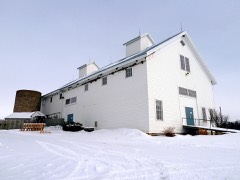
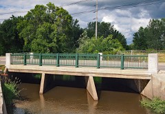
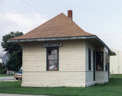
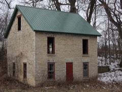
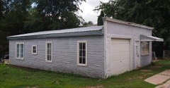
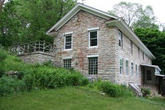
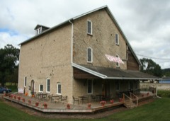
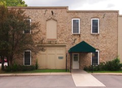
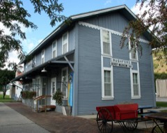
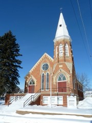
36 National Register listings published here.
Sources: the county history on the Internet Archive · the National Register database, National Park Service
42 topographic sheets cover 41 settlements here, and 36 properties are on the National Register of Historic Places.
36 National Register listings published here.
Sources: the county history on the Internet Archive · the National Register database, National Park Service
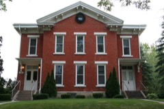
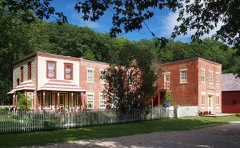
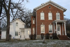
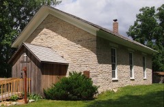
Every property in this county listed on the National Register of Historic Places, with the year it was listed and the federal nomination document.
Every wildfire the federal occurrence database records inside this county: 99 of them, burning about 530 acres. 1 started naturally and 19 were recorded as arson. Each settlement page carries the fires within five miles of it.
| Reported cause | Fires |
|---|---|
| Debris and open burning | 31 |
| Arson/incendiarism | 19 |
| Smoking | 17 |
| Missing data/not specified/undetermined | 15 |
| Equipment and vehicle use | 10 |
| Recreation and ceremony | 5 |
| Natural | 1 |
| Fireworks | 1 |
The five largest, by the area the report gives. None of them was recorded as arson.
| Date | Cause | Size | Reported by | Name on the report |
|---|---|---|---|---|
| 2 April 2000 | Debris and open burning | 54 acres | Minnesota Department of Natural Resources | not named |
| 19 April 1994 | Debris and open burning | 50 acres | Minnesota Department of Natural Resources | not named |
| 18 April 1994 | Debris and open burning | 30 acres | Minnesota Department of Natural Resources | not named |
| 30 March 1994 | Smoking | 30 acres | Minnesota Department of Natural Resources | not named |
| 18 April 1996 | Debris and open burning | 30 acres | Minnesota Department of Natural Resources | not named |
| 4 April 1998 | Smoking | 25 acres | Minnesota Department of Natural Resources | not named |
| 5 November 2007 | Smoking | 25 acres | Minnesota Department of Natural Resources | not named |
| 24 March 2003 | Debris and open burning | 20 acres | Minnesota Department of Natural Resources | not named |
Every settlement page carries the fires within five miles of it - see the settlement index below.
The NOAA Storm Events Database holds 474 reports for this county, causing 1 death, 22 injuries and about $71,730,000 in recorded property damage. Each settlement page carries the reports that name it.
| Kind of event | Reports |
|---|---|
| Thunderstorm Wind | 194 |
| Hail | 175 |
| Flash Flood | 34 |
| Heavy Rain | 27 |
| Tornado | 25 |
| Flood | 10 |
| Funnel Cloud | 8 |
| Lightning | 1 |
The most serious of them, by death, then injury, then recorded damage. The accounts are quoted exactly as the forecast office filed them.
| When | Event | Place named | Harm | What the report says |
|---|---|---|---|---|
| May 1953 | Tornado (F4) | not stated | 1 killed, 6 hurt, $2,500,000 | no account filed |
| July 1977 | Tornado (F2) | not stated | 10 hurt, $2,500,000 | no account filed |
| May 1965 | Tornado (F3) | not stated | 6 hurt, $2,500,000 | no account filed |
| August 2007 | Flash Flood | Rushford | $38,000,000 | Heavy rain that was centered north of the county caused Rush Creek to flash flood on historic levels. In addition to Rush Creek, every other creek that leads into Rushford had tremendous accumulation that led to flood waters raging into town. The water backed up against the levees normally used to keep flood waters out from the nearby Root River and ended up flooding most of the town, including the entire downtown area.||In Rushford specifically, two thirds of the town was under water at some point. About 300 people had to be rescued. 490 of the 766 homes were flooded or had damage (79 were declared structurally unsound). 58 of the 70 businesses in town were damaged impacting nearly 500 of the 600 jobs in town. A total of 4 churches and 40 apartment buildings were also impacted.||Damage was widespread across the county, especially the northeast parts. Infrastructure was hit hard with numerous road closures and bridge damage. Numerous mud slides were reported. At least 704 homes applied for FEMA assistance. |
| August 2007 | Flood | Rushford | $11,000,000 | Law enforcement officials reported some roads washed out or still under water. The town of Rushford was inundated with flood waters from Rush Creek. In addition, the Root River at Rushford reached at an all-time record crest of 28.98 feet. As a result of flood waters, numerous homes, businesses and vehicles were damaged. In fact, two-thirds of the homes in Rushford were estimated to have been extensively damaged. |
| June 2013 | Flash Flood | Fillmore | $3,500,000 | Heavy rain produced widespread flash flooding across the eastern half of Fillmore County. Mahoney Creek north of Lanesboro quickly came out of its banks sending water over State Highway 250. The South Branch of the Root River also rose rapidly causing a campground in Lanesboro to be evacuated and destroyed about a dozen RV's. Rescues were needed east of Whalan as numerous small creeks in the area flooded. Bridges were washed out on County Highway 23 and State Highway 43 near Choice, where a family was also stranded by flood water. The state fish hatchery near Lanesboro was inundated by flood waters which killed several fish and allowed the different species of trout to swim together. Workers spent many hours repairing the tubs used to store the fish in along with scooping up and sorting the fish the survived. |
| June 2008 | Flood | Spring Vly | $2,100,000 | Flooding was reported over the southern half of the county. Roads that were closed due to high water included Highway 63 in Spring Valley and County Highway 15. A rainfall total of 7.25 inches was recorded for the weekend of June 7-8 in Harmony where over 100 basements flooded. There were nearly 300 homes impacted in the county along with contaminated or collapsed wells. Other county roads closed due to high water included 17, 12, 30, and 8. In Preston, 12 business were affected and the city waste water treatment plant was flooded. Some evacuations were needed in Preston, along with Lanesboro. |
| June 2000 | Flash Flood | Countywide | $1,800,000 | no account filed |
| September 2016 | Flash Flood | Rushford | $1,600,000 | Heavy rain caused Sugar Creek to flood with water going over County Highway 8 west of Fountain. Flooding on Duschee Creek caused State Highway 16 to be closed southwest of Lanesboro. State Highway 16 was also closed west of Whalan due to a mudslide. Downed trees blocked U.S. Highway 52 south of Chatfield and State Highway 43 near Rushford. Ox Cart Road suffered severe damage from a mudslide. Flood waters completely covered Riverside Campground and 70 campers had to be evacuated from the Highway 250 Campground. Numerous township roads were also damaged by the flooding. |
| June 2008 | Flash Flood | Mabel | $750,000 | Flash flooding impacted a large part of the county, especially the southern half. High water was reported over Highways 30 and 44. Many area creeks rose very rapidly and caused infrastructure damage. |
| June 2008 | Flood | Lanesboro | $750,000 | The Root River went into flooding due to the heavy rains during the weekend of June 7-8. The South Branch of the Root River at Preston crested at 941.67 feet on June 9, which was the third highest crest on record. Flood stage is 937.0 feet. At Lanesboro, the South Branch of the Root River reached 14.17 feet with a flood stage there of 12 feet. |
| April 2022 | Tornado (EF1) | Ostrander | $650,000 | An EF1 tornado formed southwest of Spring Valley and moved almost due north before dissipating west of Spring Valley. The tornado blew down a barn and damaged several other farm buildings along its path. Several new power poles along County Highway 1 were leaning after the storm. |
| December 2021 | Tornado (EF0) | Preston | $275,000 | This was the second tornado of the night in Fillmore County. This narrow EF0 tornado moved across the eastern and northern parts of Preston. Houses, sheds, cars and trees were damaged along the path. The roofs of the fire department and city hall were both damaged. |
| December 2021 | Tornado (EF0) | Washington | $265,000 | This EF0 tornado moved across rural portions of northwest Fillmore County west of Chatfield. The tornado produced damage to several farm buildings and trees along its path. |
| May 2011 | Tornado (EF2) | York | $250,000 | This tornado moved into Fillmore County, west of Granger, shortly after 2 p.m. and continued to track northeast until dissipating northeast of Harmony. The worst damage from this tornado occurred southwest and west of Harmony where two farm silos were damaged and roofs were taken off structures. Damages were estimated to be around $250 thousand. |
| December 2021 | Tornado (EF1) | Preston | $230,000 | This was the third tornado of the night in Fillmore County. This EF1 tornado developed northeast of Preston and moved northeast for about 2 miles before dissipating. Farm outbuildings and trees were damaged along the path. |
| June 2018 | Flash Flood | Hamilton | $210,000 | Numerous rural roads were washed out or under water across the western and southern portions of Fillmore County and near Harmony. This included State Highway 16 east of Spring Valley. County Road 8 was washed out about five miles east of Spring Valley. A deputy sheriff was stranded by flood waters between County Road 30 and Klondike Road near Granger before moving to higher ground and finding an exit. Bristol and Forestville Townships suffered the most extensive damages with estimates of over $200,000. |
| May 2019 | Tornado (EF0) | York | $200,000 | A tornado that developed just south of the Minnesota state line moved into Fillmore County south of York and then moved north-northeast before dissipating near Greenleafton. A small barn and machine shed was destroyed and another sustained roof damage from the tornado. Another two farms also sustained some minor damage to buildings and a few homes sustained minor wind and tree damage. |
| July 2000 | Flash Flood | Countywide | $150,000 | no account filed |
| December 2021 | Tornado (EF1) | Bratsberg | $95,000 | This was the fifth tornado of the night in Fillmore County. This EF1 tornado formed south of Rushford and moved to the northeast before dissipating. The tornado destroyed some farm outbuildings and damaged trees along its path. |
| December 2021 | Thunderstorm Wind | Bristol | $90,000 | A path of wind damage was found near Bristol. An open air farm outbuilding was destroyed, the roof ripped off a large barn, trees and wooded electrical poles were snapped. |
| July 1999 | Flash Flood | Countywide | $85,000 | no account filed |
| May 2024 | Thunderstorm Wind | Spring Vly | $75,000 | A trained spotter reported power lines down in Spring Valley. |
| April 2022 | Thunderstorm Wind | Isinours | $75,000 | A half dozen campers were tipped over at a campground northeast of Preston. |
| September 2024 | Thunderstorm Wind | Etna | $65,000 | Law enforcement reported a semi-trailer blown over on State Highway 63 near Ostrander. The driver of the vehicle sustained minor injuries. |
| December 2021 | Thunderstorm Wind | Granger | $50,000 | An open air, metal outbuilding was destroyed north of Granger. |
| December 2021 | Thunderstorm Wind | Hutton | $50,000 | A path of wind damage occurred south of Preston. Trees were blown down and roofs were removed from a couple of cattle barns. |
| June 2019 | Flash Flood | Chatfield | $50,000 | Thunderstorms with heavy rain dropped 3 to 5 inches of rain across the northwest portions of Fillmore County. This caused some flash flooding to occur, which was mainly water going over roads. Water from Mill Creek flooded a park in the southwest side of Chatfield and went over County Road 2. |
| June 1998 | Thunderstorm Wind | Harmony | $50,000 | no account filed |
| June 1998 | Thunderstorm Wind | Mabel | $50,000 | no account filed |
| July 2024 | Thunderstorm Wind | Fountain | $45,000 | The public reported downed trees and power poles in Fountain. |
| June 2024 | Thunderstorm Wind | Cherry Grove | $45,000 | The public reported several trees and a couple powerlines blown down. |
| September 2010 | Flood | Ostrander | $45,000 | Heavy rain fell across the area which caused flooding of rivers, streams and creeks, as well as in low-lying areas. The flood waters caused closures of roads, while some of these roads incurred some minor damage. The majority of the rain fell from 3 p.m. on the 22nd through 9 a.m. on the 23rd as 4.60 inches was measured at Spring Valley in that time frame. |
| June 1998 | Thunderstorm Wind | Canton | $45,000 | no account filed |
| April 2022 | Thunderstorm Wind | Spring Vly | $40,000 | Power poles were blown down in Spring Valley from an estimated 60 mph gust. A pavillion was destroyed in a city park and the high school sustained some damage. |
| December 2021 | Tornado (EF1) | Arendahl | $40,000 | This was the fourth tornado of the night in Fillmore County. This EF1 tornado formed just south of the tiny town of Arendahl and was only on the ground for one minute as it moved rapidly northeast. The damage was limited to a large grove of trees northeast of Arendahl. |
| June 2019 | Flash Flood | Ostrander | $35,000 | Runoff from heavy rain produced some flash flooding across the western portions of Fillmore County. Water covered roads west of Spring Valley and several small creeks went out of their banks including Spring Valley, Little Kingsley, Deer and Bear. In the city of Spring Valley, water from Spring Valley creek flooded the downtown area for the first time in more than a decade. At least three people tried to drive their vehicles through the flood waters with all three vehicles becoming stranded. Two of the people needed assistance from the Spring Valley fire department to be safely removed from the flood waters. Near Ostrander, water went over County Road 14 and deposited debris from a farm field that made travel difficult after the water receded. |
| June 2000 | Flash Flood | Spring Vly | $35,000 | no account filed |
| July 2000 | Flash Flood | Countywide | $35,000 | no account filed |
| May 1998 | Thunderstorm Wind | Ostrander | $35,000 | no account filed |
| August 2024 | Thunderstorm Wind | Choice | $30,000 | Law enforcement reported trees and power lines down along the Highway 43 corridor. |
| July 2019 | Flash Flood | Rushford Vlg | $30,000 | Runoff from heavy rain caused flash flooding to occur along Coolridge and Rush Creeks in and north of Rushford. Some campers along Coolridge Creek had to evacuate, leaving their vehicles behind, which were severely damaged by the flooding. |
| April 2001 | Flash Flood | Spring Vly | $30,000 | no account filed |
| June 1999 | Thunderstorm Wind | Spring Vly | $30,000 | no account filed |
| May 1998 | Hail | Lanesboro | $28,000 | no account filed |
| April 2022 | Thunderstorm Wind | Spring Vly | $25,000 | The roof was blown off a farm outbuilding with a section of metal roofing taken off another and trees were snapped off northeast of Spring Valley. |
| May 2012 | Thunderstorm Wind | Fountain | $25,000 | Utility poles were blown down on Main Street in Fountain. Several trees were also blown down in the area with one landing on a small grain truck and another on a house causing damage to the roof. |
| June 1999 | Thunderstorm Wind | Spring Vly | $25,000 | no account filed |
| May 1998 | Thunderstorm Wind | Canton | $25,000 | no account filed |
| August 1998 | Flash Flood | Rushford | $25,000 | no account filed |
| June 1998 | Hail | Ostrander | $25,000 | no account filed |
| June 1998 | Flash Flood | Harmony | $25,000 | no account filed |
| May 1982 | Tornado (F0) | not stated | $25,000 | no account filed |
| April 1968 | Tornado (F1) | not stated | $25,000 | no account filed |
| May 1968 | Tornado (F1) | not stated | $25,000 | no account filed |
| September 2024 | Hail | Whalan | $23,000 | Trained spotters reported golf ball sized hail 2 miles east of Whalan. |
| April 2011 | Thunderstorm Wind | Canton | $22,000 | Trees and a barn were blown down from southwest to east of Canton. |
| June 2024 | Flash Flood | Spring Vly | $20,000 | The public reported flooding between Hudson Ave. and Washington Ave. to the north of Main Street. |
| December 2021 | Thunderstorm Wind | Rushford Vlg | $20,000 | A path of wind damage occurred west of Rushford where trees were blown down, snapped and uprooted. A farm outbuilding was also damaged. |
| May 2019 | Tornado (EF0) | Wykoff | $20,000 | A tornado briefly touched down east of Spring Valley. A cattle barn was heavily damaged just north of County Highway 16. |
The Survey's mineral resources record lists 103 workings inside this county. 38 still produce and 65 are closed or unrecorded. Each settlement page carries the workings within five miles of it.
| Commodity | Workings |
|---|---|
| Iron | 65 |
| Stone, Crushed/Broken | 31 |
| Sand and Gravel, Construction | 6 |
| Silica | 1 |
The least common of them first, because a county's hundredth gravel pit says nothing its first ten did not.
| Where | Site | Commodity | Status | Recorded |
|---|---|---|---|---|
| Fillmore County Sand Deposit | Silica | Occurrence | ||
| Apenhorst Pit | Sand and Gravel, Construction | Producer | ||
| Hungerholt Pit | Sand and Gravel, Construction | Producer | ||
| Isberg Pit | Sand and Gravel, Construction | Producer | ||
| L.J.'s Sand Pit | Sand and Gravel, Construction | Producer | ||
| La Crescent Sand & Gravel Pit | Sand and Gravel, Construction | Producer | ||
| Whalen Pit | Sand and Gravel, Construction | Producer | ||
| Anderson Quarry & Mill | Stone, Crushed/Broken | Producer | ||
| Baiers Quarry & Mill | Stone, Crushed/Broken | Producer | ||
| Blahniks Quarry and Mill | Stone, Crushed/Broken | Producer | ||
| Bly Quarry & Mill | Stone, Crushed/Broken | Producer | ||
| Brumm Quarry | Stone, Crushed/Broken | Producer | ||
| Eggert Quarry | Stone, Crushed/Broken | Producer | ||
| Fillmore Quarry | Stone, Crushed/Broken | Producer | ||
| Forde Quarry | Stone, Crushed/Broken | Producer | ||
| Fountain Quarry | Stone, Crushed/Broken | Producer | ||
| Franks Quarry | Stone, Crushed/Broken | Producer | ||
| Grabau Quarry | Stone, Crushed/Broken | Producer | ||
| Grebin Quarry & Mill | Stone, Crushed/Broken | Producer | ||
| Hoag Quarry & Mill | Stone, Crushed/Broken | Producer | ||
| Huntington Quarry | Stone, Crushed/Broken | Producer | ||
| Judy Quarry | Stone, Crushed/Broken | Producer | ||
| Lanesboro Quarry & Mill | Stone, Crushed/Broken | Producer | ||
| Larson Quarry | Stone, Crushed/Broken | Producer | ||
| Le Fleur Quarry | Stone, Crushed/Broken | Producer | ||
| Lustikow Quarry | Stone, Crushed/Broken | Producer | ||
| Newberg Mill | Stone, Crushed/Broken | Producer | ||
| Newberg Quarry | Stone, Crushed/Broken | Producer | ||
| Otterness Quarry | Stone, Crushed/Broken | Producer | ||
| Pederson Quarry & Mill | Stone, Crushed/Broken | Producer | ||
| Peterson Quarry | Stone, Crushed/Broken | Producer | ||
| Peterson Quarry | Stone, Crushed/Broken | Producer | ||
| Rifle Hill Quarry & Mill | Stone, Crushed/Broken | Producer | ||
| Rissman Quarry | Stone, Crushed/Broken | Producer | ||
| Roverud Quarry | Stone, Crushed/Broken | Producer | ||
| Ruen Quarry | Stone, Crushed/Broken | Producer | ||
| Thorne Quarry | Stone, Crushed/Broken | Producer | ||
| Wendt Quarry | Stone, Crushed/Broken | Producer | ||
| A Ramaker | Iron | Past Producer | ||
| Allen Mine | Iron | Past Producer | ||
| Barr Mine | Iron | Past Producer | ||
| Bjortomt Mine | Iron | Past Producer | ||
| Bonnerud Mine | Iron | Past Producer | ||
| Brehmer Mine | Iron | Past Producer | ||
| Churchill Reserve Mine | Iron | Prospect | ||
| Cooper Reserve | Iron | Prospect | ||
| D Ruesink Mine | Iron | Past Producer | ||
| Dettmer Mine | Iron | Past Producer | ||
| E Walterman Reserve Mine | Iron | Prospect | ||
| Eisenman Mine | Iron | Past Producer | ||
| Engel Mine | Iron | Past Producer | ||
| Evers No 1 Mine | Iron | Past Producer | ||
| Evers No 2 Mine | Iron | Past Producer | ||
| Fillmore County District Mines | Iron | Past Producer | WEATHERING RESIDUAL | |
| Fillmore County District Mines | Iron | Past Producer | WEATHERING RESIDUAL | |
| Finley Mine | Iron | Past Producer | ||
| Greenwood Mine | Iron | Past Producer | ||
| H Jones Mine Reserve | Iron | Prospect | ||
| Hallie Bly Mine | Iron | Past Producer | ||
| Hendrickson Mine | Iron | Past Producer | ||
| Hewitt Mine | Iron | Past Producer | ||
| Holsapple Mine | Iron | Past Producer | ||
| Hovey Reserve Mine | Iron | Prospect | ||
| Johnson Mine | Iron | Prospect | ||
| K Foster Mine | Iron | Past Producer | ||
| Kadders Mine | Iron | Past Producer | ||
| Koball Mine | Iron | Past Producer | ||
| Krueger Mine | Iron | Past Producer | ||
| Kunnert Mine Reserve No 1 | Iron | Prospect | ||
| L Johnson Mine | Iron | Past Producer | ||
| L Plenge Mine | Iron | Past Producer | ||
| Love Mine | Iron | Past Producer | ||
| Love Mine | Iron | Past Producer | ||
| Michener Mine | Iron | Past Producer | ||
| Nagel Reserve Mine | Iron | Prospect | ||
| O Jones Mine | Iron | Past Producer | ||
| O Kunnert Mine Reserve No 2 | Iron | Prospect | ||
| O Stockdale Mine | Iron | Past Producer | ||
| Osterud & Duncanson Mine | Iron | Past Producer | ||
| Otto Meyer Jr | Iron | Past Producer | ||
| P Jones Mine | Iron | Past Producer | ||
| P Ruesink Mine | Iron | Past Producer | ||
| Pearce No 2 Mine | Iron | Past Producer | ||
| Plenge Mine | Iron | Past Producer | ||
| Prinsen Mine | Iron | Past Producer | ||
| Q Baker Mine | Iron | Past Producer | ||
| R Johnson Mine | Iron | Past Producer | ||
| Ramaker Mine | Iron | Past Producer | ||
| Raymond Olson | Iron | Past Producer | ||
| Rindels Mine Reserve | Iron | Prospect | ||
| Root Mine | Iron | Past Producer | ||
| Sample Mine North | Iron | Past Producer | ||
| Sample Mine South | Iron | Past Producer | ||
| Sorum Portable Crusher No. 1 | Iron | Producer | ||
| Stockdale Mine | Iron | Past Producer | ||
| Tammel Mine | Iron | Past Producer | ||
| Tesmer Reserve Mine | Iron | Prospect | ||
| Tveito Mine | Iron | Past Producer | ||
| Van Sande Mine | Iron | Past Producer | ||
| W & V Foster | Iron | Past Producer | ||
| Watson Mine | Iron | Past Producer | ||
| Winter Mine | Iron | Past Producer | ||
| Wright Milne | Iron | Past Producer |
History of Fillmore County, Minnesota (Volume 1) devotes a chapter to each township: its boundaries and streams, who settled it and when, the mills, the schools and the churches. The one chapter is reproduced here in full. Each row shows the township's own shape and where it lies in the county, drawn from the Census Bureau's boundary. Which settlements belong to which township is computed from that same boundary, not taken from the book.
| Shape and position in the county | Township | Settlements in it | Length | Sections |
|---|---|---|---|---|
| Preble Township | Choice, Tawney | 24,784 words | 12 |
3 books written about this county, cut here where the book itself is cut, at its printed chapters: 98 chapters in all. Every chapter is public domain, machine-read from the scan and reproduced complete. A chapter already given under one of the county's towns is not repeated in this list.
| Chapter | Length |
|---|---|
| The whole text | 315,359 words in 20 parts |
Named settlements recorded in the Geographic Names Information System, each with the topographic sheets covering it. Villages, hamlets and abandoned places alike. Each is shown with the nearest named watercourse or landform and the survey quadrangle it falls on.
Forestville township · 55965 · On Forestville Creek · Fountain quadrangle
8 sheets, 1954 to 1985
Rushford Village city · 55971 · On Rush Creek · Rushford West quadrangle
10 sheets, 1954 to 1990