 Block
From the record
One of 192 National Register listings published here for Hennepin County · listed in 2021 · category: Building.
Sources: the National Register database, National Park Service
Listed on the National Register of Historic Places in 2021.
One of 192 National Register listings published here for Hennepin County · listed in 2021 · category: Building.
Sources: the National Register database, National Park Service
This property stands in Minnetonka City. History of Hennepin County and the City of Minneapolis, Including the Explorers and Pioneers of Minnesota, published 1881; History of Hennepin County and the City of Minneapolis, published 1881 gives that township a chapter of its own.
The chapter covers the township.
Machine-read from a century-old scan, so expect the errors a machine makes: misspelled names, dropped words, stray characters.
Read the whole chapter on Minnetonka City - 100 words on its settlement, mills, schools and churches.
Regional context, not property-specific evidence. The federal wildfire occurrence database lists 1 fire within 5 miles of Minnetonka Town Hall (Additional Documentation) in 2000, burning about 12 acres in total. None started naturally. 1 was recorded as arson. Distance is straight-line from the map coordinates, so a fire counted here may appear on a neighbouring settlement's page as well.
| Reported cause | Fires |
|---|---|
| Arson/incendiarism | 1 |
The most recent of them, most recent first, with the day each was reported and the service that recorded it.
| Date | Cause | Size | Reported by | Name on the report |
|---|---|---|---|---|
| 8 April 2000 | Arson/incendiarism | 12 acres | Minnesota Department of Natural Resources | not named |
Regional context, not property-specific evidence. The federal mineral resources record lists 4 workings within 5 miles of Minnetonka Town Hall (Additional Documentation): 4 producers. All of them still produce. What was taken out: Sand and Gravel, Construction. Distance is straight-line from the map coordinates, so a quarry counted here may appear on a neighbouring settlement's page as well.
| Where | Site | Commodity | Status | Recorded |
|---|---|---|---|---|
| Bury and Carlson Pit | Sand and Gravel, Construction | Producer | ||
| Glenn Pit | Sand and Gravel, Construction | Producer | ||
| Highway 18 Pit and Mill | Sand and Gravel, Construction | Producer | ||
| Hopkins Plant | Sand and Gravel, Construction | Producer |
Regional context, not property-specific evidence. The National Weather Service names Minnetonka, the town this property stands in, in 14 storm reports between 1996 and 2023: 9 hail, 4 thunderstorm wind, 1 funnel cloud. No death or injury is recorded in these reports. Each account below is quoted exactly as the forecast office filed it, from the NOAA Storm Events Database, and each date opens the federal record of that event.
| When | Event | Place named | Harm | What the report says |
|---|---|---|---|---|
| August 2023 | Hail | Minnetonka | - | A picture was shared on social media of 1.5 inch hail. |
| June 2015 | Hail | Minnetonka | - | Several reports of large hail occurred near the intersection of Interstate 494 and 394, south-southeast toward the city of Minnetonka. The largest hail stone was ping pong size. |
| June 2013 | Thunderstorm Wind | Minnetonka | - | A 24 inch diameter tree was uprooted and fell on a street near Essex and Platwood Roads, just southeast of the intersection of Interstates 394 and 494. |
| May 2007 | Hail | Minnetonka | - | Car windows broken, and one to two inch branches down. |
| May 2006 | Hail | Minnetonka | - | Reported at Fire Department near Interstate 394 and Carlson Parkway. |
| June 2005 | Thunderstorm Wind | Minnetonka | - | A tree was downed onto a car. A handful of other trees and power lines were downed across town. |
| May 1998 | Hail | Minnetonka | - | Strong winds also knocked down trees. |
| August 2013 | Hail | Minnetonka | - | no account filed |
| May 2006 | Hail | Minnetonka | - | no account filed |
| July 1998 | Thunderstorm Wind | Minnetonka | - | no account filed |
| May 1998 | Funnel Cloud | Minnetonka | - | no account filed |
| May 1998 | Thunderstorm Wind | Minnetonka | - | no account filed |
| May 1996 | Hail | Minnetonka | - | no account filed |
| May 1996 | Hail | Minnetonka | - | no account filed |
No historic map-sheet match is published for this property yet. That does not mean no map exists. This record needs a coordinate-quality review before it can be joined to a sheet boundary. Browse the county's mapped places while that work is pending.
Other National Register properties close enough to walk or drive between, ordered by distance from this one. Both positions come from the same geocoding pass that matched these properties to their map sheets.
| Photograph | Property | Distance | Listed |
|---|---|---|---|
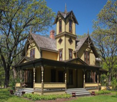 | Charles H. Burwell House | 0.3 miles | 1974 |
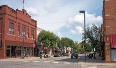 | Hopkins Commercial Historic District | 2.0 miles | 2022 |
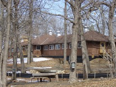 | Glen Lake Children's Camp | 3.7 miles | 1999 |
| Wayzata Section House | 3.7 miles | 2021 | |
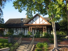 | Great Northern Railroad Depot | 4.0 miles | 1981 |
| Milwaukee Chicago St. Paul and Pacific Depot | 4.4 miles | 1969 |
| National Archives record | The nomination case file for reference 86003815 in Record Group 79. |
| Hennepin County | All 192 listed properties in this county. |