 Block
From the record
One of 28 National Register listings published here for Blue Earth County · listed in 1989 · category: District.
Sources: the case file at the National Archives · the National Register database, National Park Service
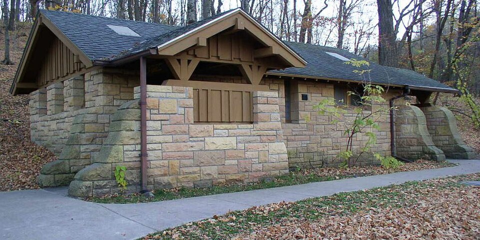
Listed on the National Register of Historic Places in 1989.
One of 28 National Register listings published here for Blue Earth County · listed in 1989 · category: District.
Sources: the case file at the National Archives · the National Register database, National Park Service
The chapter on South Bend Township in History of Blue Earth County and Biographies of Its Leading Citizens, published 1901 names Mankato. This is what it says, exactly as the scans read.
About 1860 South Bend had the distinetion of being the home of D. A. Allen (Tom Thumb ISTo. 2), who was then reported to be tlie smallest man in the United States. He was at that time twenty-two years old and only thirty-one inches in height, half an inch shorter than Barnum's famous Tom Thumb. His weight was only thirty-five pounds, much less than the great showman's prodigy-. Mr. Allen's parents lived in those days upon a farm, just west of Minneopa Creek on the Mankato and New Ulm road.
Passage source: History of Blue Earth County and Biographies of Its Leading Citizens, published 1901.
A number of stores and shops were built at South Bend village during 1856 and 1857. Pi'ominent among the stores in the fifties, were those owned by Eckstrom Bros, and Brown, Wm. Hewitt, McGibbon and Purnell, W. W. Davis and Lnrs Lee. During the same period A. K. Dahl had plow works; E. D. Price, D. D. Evans and E. K. Bangs had blacksmith shops; Peter Potts sold ready made clothing, Jonas Mohr (who in 1862 was killed by the Indians in Butternut Valley) had a hardware ; John D. Evans ran a =hoemakers shop ; Cake had a cooper shop ; Dr. Geo. W. Havens looked after the sick; Daniel Buck, the well known lawyer and jurist, and B. Parke Dewey, son of Judge Dewey, for many years on the Supreme bench of Indiana, assisted people in their legal quarrels; Geo. McGiviiey ]]ad a harness shop; And. Johnson conducted a tailor shop; Ever Severson had a cabinet shop; Joe -Barker, Hans Peter Olson, Joe Miller and Everett & Wright, (vi'ho were in the Lake Shetek massacre in 1862), helped to relieve the thirst of the pioneers; Horton W. Nelson, John IT. Goodsell, Wm. J. McCauley and J. T. Williams looked after the real estate booms of the growing metropolis; while Hon. D. C. Evans was General in Chief. In those early days. South Bend was a busy, bustling, trade center, full of hope and promise. It contained in its j)almy period nearly a hundred houses of all Irnds, and a population of 200 to 300. It continued to flourish until about 1868, when it was dealt a mortal blow by the St. Paul and Sioux City Railway Co. in its refusal to make it one of its stations. From that day forward it went down hill rapidly. W. W. Davis maintained a s-tore there off and on until May 1, 1896, when he sold, out to A. Lincoln, who was burned out in October, 1897. D. P. Davis and son conducted a store there continuously from the summer of 1867 until October, 1900, when he sold out to one Dethier and on the 11th of that month, this store and the old hotel building were burned to the ground. Since which time South Bend lias been a truly deserted village. The school house, the old Congregational church and the ancient stone building of Eckstrom Bros., which of late years has been transformed into a town hall, with a few scattered dwellings are all that remain of the town which once rivaled Mankato. South Bend postoffice was established in February, 1856, with Matthew Thompson as postmaster. He was succeeded by Daniel Buck, who lield the office until November, 1861, when Lars Ijce was appointed under the Eepublican administration. Paul P. Eckstrom in September, 1864, became his successor, and held the office until his departure from the village about 1870, when Wm. E. Price was appointed. March 19, 1878, David P. Davis, Jr., became postmaster, and was succeeded in 1885 by David P. Davis, Sr. W. W. Davis was appointed to the posifon in July, 1889, and in May, 1896, A. Lincoln succeeded him as postmaster and owner of the store. The store and postoffice were burned out in October,
Passage source: History of Blue Earth County and Biographies of Its Leading Citizens, published 1901.
Machine-read from a century-old scan, so expect the errors a machine makes: misspelled names, dropped words, stray characters.
Read the whole chapter on South Bend Township - 2,306 words on its settlement, mills, schools and churches.
Regional context, not property-specific evidence. The federal wildfire occurrence database lists 2 fires within 5 miles of Minneopa State Park WPA/Rustic Style Historic Resources between 2009 and 2013, burning about 6 acres in total. None started naturally. None was recorded as arson. Distance is straight-line from the map coordinates, so a fire counted here may appear on a neighbouring settlement's page as well.
| Reported cause | Fires |
|---|---|
| Railroad operations and maintenance | 1 |
| Fireworks | 1 |
The most recent of them, most recent first, with the day each was reported and the service that recorded it.
| Date | Cause | Size | Reported by | Name on the report |
|---|---|---|---|---|
| 5 July 2013 | Fireworks | 5.0 acres | Minnesota Department of Natural Resources | not named |
| 16 March 2009 | Railroad operations and maintenance | 1.0 acres | Minnesota Department of Natural Resources | not named |
Regional context, not property-specific evidence. The federal mineral resources record lists 5 workings within 5 miles of Minneopa State Park WPA/Rustic Style Historic Resources: 3 producers, 2 occurrences. 3 still produce. What was taken out: Sand and Gravel, Construction, Stone, Crushed/Broken, Silica, Clay. Distance is straight-line from the map coordinates, so a quarry counted here may appear on a neighbouring settlement's page as well.
| Where | Site | Commodity | Status | Recorded |
|---|---|---|---|---|
| Blue Earth County Clay Deposit No 2 | Clay | Occurrence | ||
| Blue Earth County Sand Bed | Silica | Occurrence | ||
| Lundin 8th Ave Quarry | Stone, Crushed/Broken | Producer | ||
| Guaranteed Gravel & Sand Pit | Sand and Gravel, Construction | Producer | ||
| Hanel Sand & Gravel Pit | Sand and Gravel, Construction | Producer |
Regional context, not property-specific evidence. The National Weather Service names Mankato, the town this property stands in, in 103 storm reports between 1993 and 2025: 49 hail, 42 thunderstorm wind, 6 flash flood, 3 heavy rain. The reports record 1 death and 2 injuries. Each account below is quoted exactly as the forecast office filed it, from the NOAA Storm Events Database, and each date opens the federal record of that event.
| When | Event | Place named | Harm | What the report says |
|---|---|---|---|---|
| September 2021 | Thunderstorm Wind | Mankato | 1 killed, 1 hurt | A tree branch fell onto a tent at the Land of Memories Park. A family was in the tent and a 4 year old girl was killed from injuries of the fallen tree branch. |
| May 1998 | Thunderstorm Wind | Mankato | 1 hurt | Measured at law enforcement center. Extensive tree damage. Windows blown out. Semitrailer blown over on highway 14 injuring one person. |
| May 1998 | Thunderstorm Wind | Mankato | $20,000,000 | Trees down. Roof damage. Estimated windspeed. Damage estimate for entire county. |
| July 2015 | Thunderstorm Wind | Mankato | $100,000 | An amphitheater outer shell was ripped off. It occurred near downtown Mankato, and near the Minnesota River. Several large trees were toppled across town. |
| July 2003 | Tornado (F1) | Mankato | $100,000 | The fifth tornado in a series touched down in a corn field, clipped a couple of storage buildings and a lawn care center, then moved across more fields and a meadow before dissipating. |
| June 2016 | Thunderstorm Wind | Mankato | $25,000 | A few trees and power lines were blown down in the city of Mankato. A few trees landed on houses and damaged them. |
| July 2019 | Thunderstorm Wind | Mankato | $15,000 | A large tree blew down and landed on a van. |
| June 2016 | Thunderstorm Wind | Mankato | $5,000 | A large tree fell onto a house southwest of Mankato. |
| June 1994 | Thunderstorm Wind | Mankato | $500 | Winds estimated at 65 miles an hour and dime-size hail were reported in the city of Mankato. |
| June 1994 | Hail | Mankato | $500 | Winds estimated at 65 miles an hour and dime-size hail were reported in the city of Mankato. |
| July 1994 | Thunderstorm Wind | Mankato | $500 | The observation site in Mankato recorded a wind gust of 83 mph. |
| August 2025 | Heavy Rain | Mankato | - | Cocorahs station MN-BU-23 Mankato 1ESE. 72 hour storm total of 5.15 inches. |
| June 2024 | Flash Flood | Mankato | - | One to two feet of water was reported near the intersection of Warren St. and Balcerzak Dr. |
| July 2023 | Thunderstorm Wind | Mankato | - | Strong thunderstorm winds brough down several trees and large branches down in the Skyline neighborhood in Mankato, MN. |
| July 2023 | Thunderstorm Wind | Mankato | - | Large branches downed from strong thunderstorm wind gusts in Lion Park. Mankato Regional Airport recorded a 50-mph gust at 11:56 PM. |
| August 2021 | Hail | Mankato | - | There was a social media picture of half dollar size hail in Mankato. |
| August 2021 | Hail | Mankato | - | There was a social media picture of golf ball size hail in the western portion of Mankato. |
| July 2020 | Thunderstorm Wind | Mankato | - | Several large tree branches were blown down in Mankato. |
| August 2019 | Thunderstorm Wind | Mankato | - | A few trees were blown down in Mankato. |
| September 2018 | Thunderstorm Wind | Mankato | - | A private weather wind sensor measured a 58 knot wind gust. |
| August 2016 | Thunderstorm Wind | Mankato | - | A large tree was blown down south of Mankato. |
| August 2015 | Hail | Mankato | - | The hail was photographed. |
| June 2014 | Heavy Rain | Mankato | - | There was a 24 hour measured rainfall amount of 4.75 inches west of Mankato. All of the rain fell late on the 17th and during the early morning hours of the 18th. |
| September 2014 | Thunderstorm Wind | Mankato | - | Numerous trees were blown down around the city of Mankato. There was also a measured wind gust of 51 mph at the Mankato Airport. |
| June 2014 | Heavy Rain | Mankato | - | There was a 24 hour measured rainfall amount of 5.10 inches southwest of downtown Mankato. All of the rain fell late on the 17th and during the early morning hours of the 18th. |
| June 2014 | Thunderstorm Wind | Mankato | - | A ten inch diameter tree was blown down south of Mankato. |
| June 2013 | Thunderstorm Wind | Mankato | - | A few large trees and large branches were blown down around Mankato. |
| August 2012 | Thunderstorm Wind | Mankato | - | A large tree was blown down across Baker Road. |
| June 2010 | Thunderstorm Wind | Mankato | - | Power lines were blown down across Highway 169, near Mankato, Minnesota. |
| June 2010 | Flash Flood | Mankato | - | Significant street flooding occurred on the northwest side of Mankato, Minnesota, where some streets south of Highway 14, and west of U.S. Highway 169 were impassable. |
| June 2010 | Thunderstorm Wind | Mankato | - | Several large trees were uprooted and blocking the intersections of Warren and Highland near Mankato, Minnesota. |
| July 2010 | Thunderstorm Wind | Mankato | - | Several trees were uprooted between Mankato, to Eagle Lake, Minnesota. |
| July 2008 | Thunderstorm Wind | Mankato | - | Medium size branch toppled onto automobile. Windshield cracked. |
| July 2008 | Hail | Mankato | - | Hail occurred at Country Rd. 90 and Hwy. 22 intersection. |
| July 2008 | Thunderstorm Wind | Mankato | - | Several trees reported downed around Mankato. |
| July 2008 | Thunderstorm Wind | Mankato | - | Six to ten inch diameter trees toppled, four inch diameter tree branches severed. |
| July 2008 | Thunderstorm Wind | Mankato | - | Minnesota Vikings training camp tents and crowd control fences blown over. Eight inch diameter tree limbs severed off tree at Mankato State University campus. In addition, several other 2 to 4 inch diameter tree branches severed at MSU. Power reported out in some areas near MSU. Three very large trees also reported toppled in Mankato. |
| August 2007 | Flash Flood | Mankato | - | Street flooding in Mankato, with a few cars stranded. Between 0130 and 0300 CST, rain totaled 4.56 inches two miles south of St. Clair. One mile north of Minnesota Lake, 5.32 inches fell as of 0700 CST August 19. |
| June 2006 | Flash Flood | Mankato | - | Mud slide reported on the southern edge of town after several inches of rain had fallen. |
| June 2006 | Thunderstorm Wind | Mankato | - | A tree collapsed onto a home on Record Street, with another tree falling near the intersection of Mound Avenue and Owatonna Street. Reported by Mankato Free Press. |
| May 2005 | Thunderstorm Wind | Mankato | - | A trained spotter recorded a wind gust of 62 MPH at the intersection of River Front and Main. |
| June 2005 | Thunderstorm Wind | Mankato | - | A trained spotter recorded a wind gust of 66 MPH. Numerous trees were downed. |
| June 2005 | Thunderstorm Wind | Mankato | - | A wind gust of 72 MPH was recorded by a spotter and was relayed via HAM Radio. |
| April 2004 | Thunderstorm Wind | Mankato | - | A shed and a few trees were downed. |
| July 2003 | Thunderstorm Wind | Mankato | - | Scattered trees felled. |
| May 2003 | Hail | Mankato | - | Hailed on the northeast side of Mankato. |
| August 2002 | Thunderstorm Wind | Mankato | - | Scattered trees felled. |
| August 2002 | Thunderstorm Wind | Mankato | - | Several trees downed. |
| August 2000 | Thunderstorm Wind | Mankato | - | Trees felled. As reported by Lake Crystal Tribune. Light to moderate damage of approximately 15,000 acres of field corn. Severe damaged sustained to approximately 2000 acres of sweet corn. |
| June 1999 | Thunderstorm Wind | Mankato | - | Trees and power lines toppled. Estimated windspeed. |
| August 1999 | Flood | Mankato | - | Urban flooding reported within the city limits.. Estimated rainfall of 3.5 inches. Time of event estimated. |
| June 1998 | Thunderstorm Wind | Mankato | - | Large branches down. Estimated windspeed. |
| July 1997 | Hail | Mankato | - | Hail fell for 10 minutes. |
| July 1997 | Thunderstorm Wind | Mankato | - | 10 inch diameter branches down. Estimated windspeed. |
| July 1995 | Thunderstorm Wind | Mankato | - | Radio station reported trees down. |
| June 1994 | Thunderstorm Wind | Mankato | - | A local radio station recorded a wind gust to 75 mph. |
| June 2025 | Hail | Mankato | - | no account filed |
| June 2025 | Hail | Mankato | - | no account filed |
| April 2022 | Hail | Mankato | - | no account filed |
| April 2022 | Hail | Mankato | - | no account filed |
No historic map-sheet match is published for this property yet. That does not mean no map exists. This record needs a coordinate-quality review before it can be joined to a sheet boundary. Browse the county's mapped places while that work is pending.
Other National Register properties close enough to walk or drive between, ordered by distance from this one. Both positions come from the same geocoding pass that matched these properties to their map sheets.
| Photograph | Property | Distance | Listed |
|---|---|---|---|
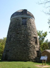 | Seppman Mill | 0.9 miles | 1971 |
 | Charles Chapman House | 2.6 miles | 1980 |
 | William Irving House | 3.4 miles | 1980 |
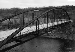 | Kern Bridge | 3.5 miles | 1980 |
 | J. R. Brandrup House | 4.0 miles | 1980 |
 | Lincoln Park Residential Historic District | 4.1 miles | 1995 |
| National Archives record | The nomination case file for reference 89001663 in Record Group 79. |
| Blue Earth County | All 28 listed properties in this county. |