Block
From the record
28 National Register listings published here · the county-history sources tell 1 story.
Sources: the county history on the Internet Archive · the National Register database, National Park Service
50 topographic sheets cover 28 settlements here, and 28 properties are on the National Register of Historic Places.
28 National Register listings published here · the county-history sources tell 1 story.
Sources: the county history on the Internet Archive · the National Register database, National Park Service
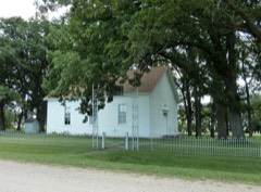
Among them: Cambria Red Cross Branch Surgical Dressing Class, Mapleton. These passages come from the identified county-history source books. Each inset names its own source and opens the exact section it comes from.
I he final draft, was brought home a victim of the dreaded epidemic, the influenza. A military funeral was held and burial took place in the cemetery, the Home Guard taking charge and the Red Cross members attended in a body. Rev. Paul Edsel, who officiated, preached his first English sermon.
Every property in this county listed on the National Register of Historic Places, with the year it was listed and the federal nomination document.
Every wildfire the federal occurrence database records inside this county: 22 of them, burning about 3,103 acres. 1 started naturally and 13 were recorded as arson. Each settlement page carries the fires within five miles of it.
| Reported cause | Fires |
|---|---|
| Arson/incendiarism | 13 |
| Equipment and vehicle use | 4 |
| Debris and open burning | 2 |
| Natural | 1 |
| Railroad operations and maintenance | 1 |
| Fireworks | 1 |
The five largest, by the area the report gives. Five of them were set deliberately.
| Date | Cause | Size | Reported by | Name on the report |
|---|---|---|---|---|
| 2 November 2006 | Arson/incendiarism | 2,909 acres | Minnesota Department of Natural Resources | not named |
| 16 June 2014 | Natural | 30 acres | Minnesota Department of Natural Resources | not named |
| 30 October 2006 | Arson/incendiarism | 26 acres | Minnesota Department of Natural Resources | not named |
| 11 October 2012 | Equipment and vehicle use | 26 acres | Minnesota Department of Natural Resources | not named |
| 8 November 2006 | Arson/incendiarism | 26 acres | Minnesota Department of Natural Resources | not named |
| 30 October 2006 | Arson/incendiarism | 23 acres | Minnesota Department of Natural Resources | not named |
| 30 October 2006 | Arson/incendiarism | 18 acres | Minnesota Department of Natural Resources | not named |
| 2 October 2006 | Equipment and vehicle use | 15 acres | Minnesota Department of Natural Resources | not named |
Every settlement page carries the fires within five miles of it - see the settlement index below.
The NOAA Storm Events Database holds 466 reports for this county, causing 2 deaths, 12 injuries and about $38,229,250 in recorded property damage. Each settlement page carries the reports that name it.
| Kind of event | Reports |
|---|---|
| Hail | 182 |
| Thunderstorm Wind | 170 |
| Tornado | 43 |
| Flash Flood | 22 |
| Heavy Rain | 19 |
| Funnel Cloud | 16 |
| Flood | 12 |
| Debris Flow | 1 |
| Lightning | 1 |
The most serious of them, by death, then injury, then recorded damage. The accounts are quoted exactly as the forecast office filed them.
| When | Event | Place named | Harm | What the report says |
|---|---|---|---|---|
| June 1976 | Tornado (F2) | not stated | 1 killed, 6 hurt, $2,500,000 | no account filed |
| September 2021 | Thunderstorm Wind | Mankato | 1 killed, 1 hurt | A tree branch fell onto a tent at the Land of Memories Park. A family was in the tent and a 4 year old girl was killed from injuries of the fallen tree branch. |
| August 1980 | Tornado (F2) | not stated | 1 hurt, $2,500,000 | no account filed |
| June 1994 | Tornado (F1) | St. Clair | 1 hurt, $500,000 | A tornado touchdown on a farmstead destroyed a 45 foot barn, numerous farm implements, and twisted trees to the ground. One woman on the farm was injured by flying debris. |
| July 1953 | Tornado (F2) | not stated | 1 hurt, $250,000 | no account filed |
| May 1998 | Thunderstorm Wind | Mankato | 1 hurt | Measured at law enforcement center. Extensive tree damage. Windows blown out. Semitrailer blown over on highway 14 injuring one person. |
| June 1990 | Thunderstorm Wind | not stated | 1 hurt | no account filed |
| May 1998 | Thunderstorm Wind | Mankato | $20,000,000 | Trees down. Roof damage. Estimated windspeed. Damage estimate for entire county. |
| June 1981 | Tornado (F1) | not stated | $2,500,000 | no account filed |
| June 2014 | Flood | Judson | $2,300,000 | There were multiple reports of road closures due to high water and debris along the Minnesota River. Flood waters caused around 70 people to move out of their apartment complex in Mankato. |
| September 2010 | Flood | Amboy | $2,100,000 | Numerous roads were closed due to excessive rainfall that fell on September 22nd and 23th. The major areal flooding didn't recede until late Saturday when most of the small streams and creeks had crested and only mainstem rivers remained flooded. |
| July 2003 | Tornado (F2) | St Clair | $2,000,000 | The sixth tornado in a series was the last of five to hit Blue Earth County. This one took direct aim on four farmsteads. Barns, sheds and outbuildings were downed. A roof was taken off a house and numerous trees were snapped. Law Enforcement video showed this to be a multiple vortex tornado. |
| July 2025 | Flash Flood | Minnesota Lake | $835,000 | Delayed report of widespread damage to public infrastructure throughout portions of Blue Earth County due to heavy rainfall and flooding. There was damage to several roads, culverts, and trails, as well as severe erosion to bridge R0410. |
| June 2014 | Thunderstorm Wind | Minnesota Lake | $500,000 | A storm survey concluded that severe straight-line winds caused damage to half of a metal building system north of Minnesota Lake. The building's metal wall and roof panels were peeled off with most of the northern half of the building collapsed. Empty grain bins nearby were bent or tipped. Two homes nearby sustained minor wind damage to shingles. |
| July 2003 | Tornado (F1) | Rapidan | $500,000 | The fourth tornado in a series formed atop a bluff on the west side of the Le Sueur River valley, struck two homes down in the river valley, then moved back up the bluffs on the east side of the valley, where it snapped many trees and produced minor damage to some more houses, sheds and outbuildings. Videotaped by storm chasers. |
| March 2010 | Flood | Pemberton | $400,000 | Numerous roads were flooded between Minnesota 22, and Minnesota 83, plus County Road 14 near Highway 30. Monetary costs were based on FEMA, State, and Local assistance which includes the following categories; debris removal, emergency protective measures, road systems and bridges, water control facilities, utilities and parks. |
| June 2010 | Hail | Pemberton | $250,000 | Hail varied from golf ball to softball size, breaking vehicle windows. The large hail also caused small branches to come down. |
| August 2016 | Thunderstorm Wind | Rapidan | $150,000 | A newly constructed grain bin blew down, and landed on a machine shed and another bin. |
| July 2015 | Thunderstorm Wind | Mankato | $100,000 | An amphitheater outer shell was ripped off. It occurred near downtown Mankato, and near the Minnesota River. Several large trees were toppled across town. |
| June 2014 | Thunderstorm Wind | Beauford | $100,000 | A storm survey concluded that severe straight-line winds caused damage to wooden electrical poles, trees, and power lines north of Mapleton along Highway 22 to 179th Street. One home north of Beauford sustained minor damage to some shingles. |
| July 2003 | Tornado (F2) | Lake Crystal | $100,000 | The second tornado from a cyclic tornadic supercell touched down on the western edge of a farmstead. It snapped a dozen trees and demolished a barn and sheds. The roof of a house was peeled away and four vehicles were moved. |
| July 2003 | Tornado (F1) | Mankato | $100,000 | The fifth tornado in a series touched down in a corn field, clipped a couple of storage buildings and a lawn care center, then moved across more fields and a meadow before dissipating. |
| September 1996 | Lightning | Lehillier | $100,000 | no account filed |
| September 2018 | Tornado (EF0) | Rapidan | $50,000 | A NWS storm survey, plus video from a drone, concluded that an EF0 tornado touched down north of Rapidan, and moved east for approximately a mile. Damage was confined to a field, and two homes. The main damage was to a home that had a tree fall on its roof. |
| June 2015 | Thunderstorm Wind | Vernon Center | $50,000 | Numerous trees were blown down along with a roof blown off a commercial building near Vernon Center. |
| August 1994 | Tornado (F2) | Vernon Center- | $50,000 | This tornado touched down near County Road 10 in Lyra Township, 3 miles east of Vernon Center. As it tracked to the southeast, it damaged 4 barns, 2 mobile homes and 2 homes. It then entered Sterling Township, caused significant crop damage by flattening a path through a corn field. It damaged 3 more barns and 9 more homes before lifting off the ground about 1 mile east of Sterling Center. Despite the amount of damage, there were no injuries or fatalities. Overall, 12-14 buildings received structural damage and 7 barns were damaged. |
| June 2016 | Thunderstorm Wind | Mankato | $25,000 | A few trees and power lines were blown down in the city of Mankato. A few trees landed on houses and damaged them. |
| May 2016 | Thunderstorm Wind | Minnesota Lake | $25,000 | A part of a roof was blown off at Nordaas American Homes building northwest of Minnesota Lake. Some of the materials at the business blew across an adjacent field. Some minor tree damage also occurred in the area. |
| April 1991 | Tornado (F1) | not stated | $25,000 | no account filed |
| April 1991 | Tornado (F1) | not stated | $25,000 | no account filed |
| June 1983 | Tornado (F0) | not stated | $25,000 | no account filed |
| June 1981 | Tornado (F1) | not stated | $25,000 | no account filed |
| May 1977 | Tornado (F1) | not stated | $25,000 | no account filed |
| August 1965 | Tornado (F1) | not stated | $25,000 | no account filed |
| May 1964 | Tornado (F0) | not stated | $25,000 | no account filed |
| May 2022 | Thunderstorm Wind | (Mkt)Mankato Muni Ar | $15,000 | In addition to this severe wind gust at the Mankato airport, a large tree fell onto a house just east of the airport. |
| July 2019 | Thunderstorm Wind | Mankato | $15,000 | A large tree blew down and landed on a van. |
| June 2014 | Thunderstorm Wind | Mapleton | $10,000 | A storm survey concluded that severe straight-line winds moved through the town of Mapleton, and areas to the southeast that caused extensive tree damage, and power poles to be blown down. However, no structural damage to buildings or houses was found other than some minor damage to shingles at two homes. |
| June 2019 | Thunderstorm Wind | Mapleton | $5,000 | A large tree limb broke off, and damaged a camper and truck. |
| June 2016 | Thunderstorm Wind | Mankato | $5,000 | A large tree fell onto a house southwest of Mankato. |
| July 2010 | Thunderstorm Wind | Madison Lake | $5,000 | A large tree blew down on a power line near Madison Lake, Minnesota. |
| June 1994 | Thunderstorm Wind | Mapleton | $5,000 | Strong thunderstorm winds uprooted a mature willow tree from a churchyard. |
| July 2011 | Thunderstorm Wind | Lake Crystal | $2,500 | A large tree was blown down and caused damage to a trailers roof. |
| May 2022 | Thunderstorm Wind | Pemberton | $2,000 | The leading edge of the squall line generated severe wind gusts and caused several large trees to be blown down north of Pemberton. |
| June 2001 | Thunderstorm Wind | Lake Crystal | $2,000 | Several 10 inch branches down. One branch fell on truck causing moderate damage. |
| May 2014 | Tornado (EF0) | Butternut | $1,000 | A tornado originated in extreme northeastern Watonwan County and traversed across extreme southeastern Brown County before moving into Blue Earth County. It was filmed by a storm chaser during its time in Blue Earth County. The tornado hit a farm and damaged the roofs of some hog barns and then dissipated. |
| June 1994 | Thunderstorm Wind | Mankato | $500 | Winds estimated at 65 miles an hour and dime-size hail were reported in the city of Mankato. |
| June 1994 | Hail | Mankato | $500 | Winds estimated at 65 miles an hour and dime-size hail were reported in the city of Mankato. |
| July 1994 | Thunderstorm Wind | Mankato | $500 | The observation site in Mankato recorded a wind gust of 83 mph. |
| June 2012 | Thunderstorm Wind | Lake Crystal | $250 | Several large tree limbs were blown down, with some damage to bleachers at the city park. |
| April 2026 | Tornado (EF1) | Amboy | - | The tornado moved into Blue Earth County from Watonwan County. Based on multiple storm chaser videos, ground contact was evident most of the way, but not always, as there were two or three occasions when ground circulation was not evident for one or two minutes. But some storm chaser video showed it to be entirely from the same parent circulation, hence one tornado. The tornado hit several farms. At one farm, both garage doors on either side of a house were buckled in, multiple trees were snapped or large branches broken. Two farm outbuildings had their garage doors blown out. Some shingles were also removed. Dozens of trees nearby were blown over. A small trailer was blown over 100 yards. Another farm had two small outbuildings that were destroyed and trees down or broken. The maximum wind speed was estimated at 90 mph. This was based on drone video and ground-based photos provided by the Blue Earth County Sheriff's Office. |
| March 2025 | Thunderstorm Wind | Garden City | - | A 61 mph wind gust was measured using a personal weather instrument by a storm chaser. |
| July 2025 | Flash Flood | Rapidan | - | A few local county roads closed and minor debris was deposited on rural roads due to flooding. Main areas impacted were south of MSU-Mankato and along County Road 1. |
| August 2025 | Heavy Rain | Beauford | - | Cocorahs station MN-BU-2 Mapleton 4N. 72 hour total of 5.70 inches. |
| August 2025 | Heavy Rain | Eagle Lake | - | Cocorahs station MN-BU-74 Eagle Lake 0.2 WSW. 72 hour storm total of 5.34 inches. |
| August 2025 | Heavy Rain | Lake Crystal | - | Cocorahs station MN-BU-85 Lake Crystal 0.2 NW. 72 hour storm total of 5.19 inches. |
| August 2025 | Heavy Rain | Mankato | - | Cocorahs station MN-BU-23 Mankato 1ESE. 72 hour storm total of 5.15 inches. |
| August 2025 | Heavy Rain | Sterling Center | - | Cocorahs station MN-BU-45 Good Thunder 2.0 W. 72 hour storm total of 5.05 inches. |
| August 2025 | Thunderstorm Wind | Searles | - | Thunderstorm winds estimated at 58 mph snapped a large tree branch that fell onto a truck in Judson Township. |
| June 2024 | Thunderstorm Wind | Mapleton | - | Measured by a MNDOT Road Weather Information System. |
The Survey's mineral resources record lists 15 workings inside this county. 11 still produce and 4 are closed or unrecorded. Each settlement page carries the workings within five miles of it.
| Commodity | Workings |
|---|---|
| Sand and Gravel, Construction | 6 |
| Stone, Crushed/Broken | 5 |
| Clay | 2 |
| Limestone, Dimension | 2 |
| Silica | 1 |
The least common of them first, because a county's hundredth gravel pit says nothing its first ten did not.
| Where | Site | Commodity | Status | Recorded |
|---|---|---|---|---|
| Blue Earth County Sand Bed | Silica | Occurrence | ||
| Blue Earth County Clay Deposit No 1 | Clay | Occurrence | ||
| Blue Earth County Clay Deposit No 2 | Clay | Occurrence | ||
| Mankato Stone Center | Limestone, Dimension, Stone, Crushed/Broken | Producer | ||
| Vetter Main Quarry & Mill | Limestone, Dimension | Producer | ||
| Lundin 8th Ave Quarry | Stone, Crushed/Broken | Producer | ||
| Lundin Quarry | Stone, Crushed/Broken | Producer | ||
| Mankago Aglime Quarry | Stone, Crushed/Broken | Producer | ||
| Mankato Aglime Mill | Stone, Crushed/Broken | Producer | ||
| Davis Price & Evans Pit | Sand and Gravel, Construction | Producer | ||
| Davis Price & Evans Sand & Gray Pit | Sand and Gravel, Construction | Producer | ||
| Guaranteed Gravel & Sand Pit | Sand and Gravel, Construction | Producer | ||
| Hanel Sand & Gravel Pit | Sand and Gravel, Construction | Producer | ||
| Prange Pit | Sand and Gravel, Construction | Producer | ||
| Schwartz Pit & Mill | Sand and Gravel, Construction | Past Producer |
History of Blue Earth County and Biographies of Its Leading Citizens devotes a chapter to each township: its boundaries and streams, who settled it and when, the mills, the schools and the churches. All 8 are reproduced here in full. Each row shows the township's own shape and where it lies in the county, drawn from the Census Bureau's boundary. Which settlements belong to which township is computed from that same boundary, not taken from the book.
| Shape and position in the county | Township | Settlements in it | Length | Sections |
|---|---|---|---|---|
| Beauford Township | Beauford | 4,152 words | 3 | |
| Judson Township | Judson | 5,837 words | 3 | |
| Lyra Township | Good Thunder | 2,360 words | 0 | |
| Mankato City | Belle Haven, Benning, Knollwood Park, Mankato, University Park of Mankato | 13,615 words | 3 | |
| Medo Township | Pemberton | 1,806 words | 1 | |
| Pleasant Mound Township | Willow Creek | 1,730 words | 0 | |
| Rapidan Township | Rapidan | 33,249 words | 6 | |
| South Bend Township | LeHillier | 2,306 words | 0 |
One book written about this county, cut here where the book itself is cut, at its printed chapters: 23 chapters in all. Every chapter is public domain, machine-read from the scan and reproduced complete. A chapter already given under one of the county's towns is not repeated in this list.
Named settlements recorded in the Geographic Names Information System, each with the topographic sheets covering it. Villages, hamlets and abandoned places alike. Each is shown with the nearest named watercourse or landform and the survey quadrangle it falls on.
Mankato city · 56001 · Near Thompson Ravine · Mankato East quadrangle
14 sheets, 1950 to 1985
South Bend township · 56001 · On Blue Earth River · Mankato West quadrangle
13 sheets, 1951 to 1991
Mankato city · 56001 · Near Thompson Ravine · Mankato East quadrangle
14 sheets, 1950 to 1985
Medo township · 56078 · On Bull Run Creek · Saint Clair quadrangle
13 sheets, 1950 to 1985
Sterling township · 56010 · On Rice Creek · Sterling Center quadrangle
6 sheets, 1954 to 1985