BlockBefore
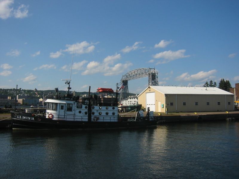
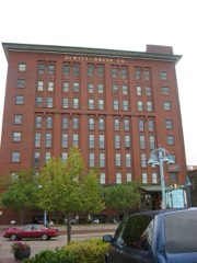
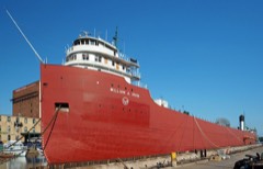
Photograph of U.S. Army Corps of Engineers Vessel Yard
Photograph by The original uploader was Appraiser at English Wikipedia, CC BY-SA 2.0. Via Wikimedia Commons.

United States Army Corps of Engineers Duluth Vessel Yard

Listed on the National Register of Historic Places in 1995.

From the record

“Army Corps of Engineers Duluth Vessel Yard is a federal port facility in Duluth, Minnesota, United States. It houses the United States Army Corps of Engineers (USACE) resources used to maintain the harbors of the Twin Ports of Duluth and Superior, Wisconsin.”

Wikipedia article U.S. Army Corps of Engineers Duluth Vessel Yard, CC BY-SA 4.0.

One of 126 National Register listings published here for St. Louis County · listed in 1995 · category: District.

Sources: the Wikipedia article · the case file at the National Archives · the National Register database, National Park Service

The listing

  • What is counted as historic. The nomination lists 5 buildingss, 3 structuress, 1 site, 1 object as contributing to the listing.
  • Address. Jct. of Ninth St., S. and Minnesota Ave., Duluth, 55802
  • When was it listed? October 1995
  • Category. district
  • City. Duluth city
  • National Register reference number. 95001163 - the number the National Park Service assigned this property when it was listed, and the key its nomination file is catalogued under at the National Archives.

The ground it stands on

231,703 words

The chapter on Duluth Township in Duluth and St. Louis County, Minnesota; Their Story and People; an Authentic Narrative of the Past, with Particular Attention to the Modern Era in the Commercial, Industrial, Educational, Civic and Social Development, published 1921 names Duluth. This is what it says, exactly as the scans read.

David T. Adams, a mining explorer of Duluth, whose first trip over the Mesabi range was in 1883, when he "was attracted to the possibility of the existence of commercial bodies of hematite ore on the southern slope, or in the lowlands of the Mesaba," was one of the most successful of the .early explorers of the Mesabi range. He was the first to discover marketable ore, finding it on the Cincinnati in 1891, Captain Kehoe almost simultaneously finding blue ore on the Biwabik workings. In the next year Adams, acting for A. E. Humphreys, George G. Atkins, and others, "had seventeen camps in operation in township 58-17," mainly in the Virginia district. In a narrative written specially for the current historical work Mr. Adams makes the following statements regarding his early operations in the Eveleth district:

Passage source: Duluth and St. Louis County, Minnesota; Their Story and People; an Authentic Narrative of the Past, with Particular Attention to the Modern Era in the Commercial, Industrial, Educational, Civic and Social Development, published 1921.

Adams Mine. - "This property is being developed by the Consolidated Company. The mine is in the north half of section 31, 58-17. It is operated on a lease from Chicago and Michigan lumberman, who own the fee. This deposit of ore is supposed to be one of the largest on the Mesabi range, and to contain ore of more than average value, because of its granular and shaly nature * * * It is being stripped at present. Ore was discovered here by Neil Mclnnis and D. T. Adams, of Duluth, in 1893. The superintendent is ]\Ir. J. H. Hearding.

Passage source: Duluth and St. Louis County, Minnesota; Their Story and People; an Authentic Narrative of the Past, with Particular Attention to the Modern Era in the Commercial, Industrial, Educational, Civic and Social Development, published 1921.

Machine-read from a century-old scan, so expect the errors a machine makes: misspelled names, dropped words, stray characters.

Read the whole chapter on Duluth Township - 231,703 words on its settlement, mills, schools and churches.

Fires near this property

51 since 1995

Regional context, not property-specific evidence. The federal wildfire occurrence database lists 51 fires within 5 miles of United States Army Corps of Engineers Duluth Vessel Yard between 1995 and 2020, burning about 12 acres in total. 1 started naturally. 14 were recorded as arson. Distance is straight-line from the map coordinates, so a fire counted here may appear on a neighbouring settlement's page as well.

Reported cause Fires
Arson/incendiarism14
Debris and open burning10
Missing data/not specified/undetermined8
Recreation and ceremony6
Power generation/transmission/distribution4
Fireworks2
Railroad operations and maintenance2
Equipment and vehicle use2
Natural1
Other causes1
Smoking1

The most recent of them, most recent first, with the day each was reported and the service that recorded it.

DateCause SizeReported by Name on the report
18 August 2019Debris and open burningunder an acreMinnesota Department of Natural Resourcesnot named
17 August 2019Debris and open burningunder an acreMinnesota Department of Natural Resourcesnot named
11 August 2019Debris and open burningunder an acreMinnesota Department of Natural Resourcesnot named
1 August 2019Arson/incendiarismunder an acreMinnesota Department of Natural Resourcesnot named
4 July 2017Fireworksunder an acreMinnesota Department of Natural Resourcesnot named
23 July 2019Recreation and ceremonyunder an acreMinnesota Department of Natural Resourcesnot named
8 June 2002Smokingunder an acreMinnesota Department of Natural Resourcesnot named
5 June 2017Debris and open burningunder an acreMinnesota Department of Natural Resourcesnot named

Every fire recorded in St. Louis County

Mines and quarries near this property

5 within 5 miles

Regional context, not property-specific evidence. The federal mineral resources record lists 5 workings within 5 miles of United States Army Corps of Engineers Duluth Vessel Yard: 3 producers, 2 plants. All of them still produce. What was taken out: Stone, Crushed/Broken, Sand and Gravel, Construction. Distance is straight-line from the map coordinates, so a quarry counted here may appear on a neighbouring settlement's page as well.

Where SiteCommodity StatusRecorded
Mailing PitSand and Gravel, ConstructionProducer
Arrowhead Blacktop CoStone, Crushed/BrokenProducer
Smith QuarryStone, Crushed/BrokenProducer
Superior Grinding PlantStone, Crushed/BrokenPlant
Superior Lime PlantStone, Crushed/BrokenPlant

Every working recorded in St. Louis County

Storms near this property

60 of 97 shown

Regional context, not property-specific evidence. The National Weather Service names Duluth, the town this property stands in, in 97 storm reports between 1995 and 2024: 56 hail, 28 thunderstorm wind, 6 flash flood, 6 lightning. The reports record 3 injuries. Each account below is quoted exactly as the forecast office filed it, from the NOAA Storm Events Database, and each date opens the federal record of that event.

WhenEvent Place namedHarm What the report says
October 2001LightningDuluth2 hurtLightening struck a hilltop soccer field, injuring a 13-year-old player and his adult coach. The boy was taken to the hospital and initially listed in critical condition. He was subsequently released. His coach was treated at the hospital and released.
July 1996LightningDuluth1 hurtno account filed
August 1998HailDuluth$50,000,000no account filed
July 1996Flash FloodDuluth$300,000no account filed
July 2003LightningDuluth$250,000Lightning struck a house on Woodland Avenue. The resulting fire destroyed the top two floors of the house.
August 2021LightningDuluth$185,000Fire crews were dispatched to the Hope City Church at approximately 7:45 PM on the evening of August 28th. One of the steeples of the church had taken a direct strike from a bolt of lightning and exploded, raining debris onto the street below and causing extensive damage to the steeple and the roof of the church that impacted the structural integrity of the building. In addition to the steeple damage, the lighting strike also led to a water main break at the intersection in front of the church. This sent a river of water down North 3rd Avenue East. Fortunately, the lightning strike did not start a fire at the church.
September 2023Flash FloodDuluth$100,000Heavy rainfall from backbuilding thunderstorms over Duluth led to 2 to 5 inches of rainfall in 2-3 hours. As the water rushed down the hillside to Lake Superior, it scoured out gravel alleys and sent around 1,000 cubic yards of construction debris, including sand, dirt, rock and other materials, onto Superior Street at the base of the hill. Superior Street at First Avenue East was closed for much of the 12th as crews worked to remove the piles of debris using heavy machinery.
June 1998LightningDuluth$75,000no account filed
May 2004LightningDuluth$30,000Lightning struck a home in West Duluth, blowing a back porch and stairway off the home and causing significant damage inside.
July 1995Thunderstorm WindNew Duluth$3,000Strong thunderstorm winds knocked down trees and destroyed a camper trailer. Patio furniture was thrown around.
June 2024Flash FloodDuluth-Video was received showing flood waters flowing across a road and a yard near Portland Manor on the corner of E. 4th Street and 9th Ave East.
June 2024Flash FloodDuluth-Video was received showing fast moving flood waters at least 6 inches deep over a sidewalk and street near homes and apartment buildings.
June 2024Flash FloodDuluth-Video was received of flash flooding in the I-35 tunnels resulting in their closure with stranded cars.
August 2020Thunderstorm WindDuluth-Metal roof sheeting was partially removed from a building and was dangling in the vicinity of power lines.
September 2018Thunderstorm WindNew Duluth-A 12 inch diameter pine tree was snapped off 6 feet above the ground by the thunderstorm winds.
July 2017Thunderstorm WindDuluth-A large tree was snapped off at its base on North 13th Avenue East.
July 2017Thunderstorm WindDuluth-Several trees were blown down on East 9th street and 9th Avenue.
June 2016HailNew Duluth-There was dime sized hail.
July 2016Thunderstorm WindDuluth-The Duluth Board of Trade Building in downtown Duluth was damaged. The chimney was first struck by lightning, then strong winds knocked it down and it crashed through the roof of the seventh floor. The damage also affected the storage room for costumes for the Minnesota Ballet. The anemometer is on top of the nearby county government building, which measured gusts to around 100 mph.
July 2016Thunderstorm WindDuluth-This was the weather station DULM5.
May 2012HailNew Duluth-The hail shredded leaves and damaged siding.
May 2009HailDuluth-The hail fell at Superior Street and 11th Avenue East.
May 2009HailDuluth-The hail fell in Hunters Park.
May 2009HailDuluth-The hail fell at Park Point.
August 2008HailDuluth-The report was received from the Lester Park neighborhood.
August 2008HailDuluth-Several reports of up to 1 inch hail in West Duluth were called in.
August 2008HailDuluth-The report was received from the Lester Park neighborhood.
August 2008HailDuluth-Penny sized hail covered the ground in Woodland.
August 2008HailDuluth-Quarter-sized hail covered the ground in Woodland.
August 2008HailDuluth-The report was called in from the Lakeside neighborhood.
September 2008Thunderstorm WindWest Duluth-A large tree up to two feet in diameter was blown down across 59th Avenue West, in West Duluth.
May 2007HailDuluth-The hail fell at the Kenwood Shopping Center.
October 2007FloodDuluth-Portions of Mall Drive and Maple Grove Road were flooded and closed after Miller Creek overflowed its banks during the evening of October 18. The flood waters receded during the early morning hours of October 19. The St. Louis County sheriff also reported flooded basements and culverts in many areas across Duluth.
May 2007HailDuluth-Golf ball size hail fell at the Duluth NWS office.
May 2007HailDuluth-The hail fell at the University of Minnesota Duluth campus.
May 2007HailDuluth-The hail fell at Canal Park.
May 2007HailDuluth-The hail fell in the Morley Heights neighborhood.
May 2007HailDuluth-The hail fell at the Duluth NWS office.
July 2007Thunderstorm WindDuluth-Large tree limbs were downed and at least one vehicle was severely damaged at 59th Avenue East and London Road.
July 2006HailDuluth-The hail fell on London Road.
July 2006Thunderstorm WindDuluth-Large tree branches were blown down in Gary-New Duluth.
July 2006HailWest Duluth-The hail fell for ten minutes.
July 2006Thunderstorm WindWest Duluth-A huge cottonwood tree and some smaller trees were blown down.
July 2006HailDuluth-The fail fell in the Lakeside neighborhood.
July 2006HailDuluth-The hail fell at Spirit Mountain and lasted four minutes.
July 2006HailDuluth-The hail fell at Midway Road and Interstate 35.
July 2006HailDuluth-Dime to quarter size hail fell for ten minutes at Park Point in Duluth. Some trees were blown down.
April 2004HailDuluth-The hail fell on Park Point. Three-quarter inch hail fell in West Duluth.
April 2004HailDuluth-The hail fell in the East Central Entrance corridor.
April 2004HailDuluth-The hail fell at Island Lake.
April 2004HailDuluth-The hail fell at Northstar Township.
May 2004HailDuluth-The hail fell at 63rd Avenue West and Rooselvelt Strees. Also, three-quarter inch hail fell at Skyline Avenue and 40th Avenue West.
May 2004HailDuluth-The hail fell at Park Point.
May 2004HailDuluth-The hail fell at 46th Avenue West and 7th Street.
May 2004HailDuluth-The hail fell at Cody Street in West Duluth.
July 2003HailDuluth-The hail fell in the Lincoln Park and Piedmont neighborhoods.
August 2003Thunderstorm WindDuluth-Large branches were blown down.
August 2003Thunderstorm WindDuluth-The wind was measured by the aerial lift bridge at the Duluth harbor.
August 2003Thunderstorm WindDuluth-Numerous trees were blown down in the Piedmont Heights, Lincoln Park, and West Duluth neighborhoods.
July 2003Thunderstorm WindDuluth-Numerous trees were blown down in West Duluth.

Every storm recorded in St. Louis County

Map coverage status

No historic map-sheet match is published for this property yet. That does not mean no map exists. This record needs a coordinate-quality review before it can be joined to a sheet boundary. Browse the county's mapped places while that work is pending.

Listed places nearby

6 within 8 miles

Other National Register properties close enough to walk or drive between, ordered by distance from this one. Both positions come from the same geocoding pass that matched these properties to their map sheets.

Sources for this property

National Archives recordThe nomination case file for reference 95001163 in Record Group 79.
Wikipedia articleCommunity-written account of this property, licensed CC BY-SA.
St. Louis CountyAll 126 listed properties in this county.

Provenance

  • Listing record. National Park Service National Register of Historic Places, listed-properties dataset, current to 2026-05-22.
  • Map join. Address geocoded through the United States Census geocoder, then tested against the published boundary of every sheet in the USGS Historical Topographic Map Collection.
  • How this page is made. Listing fields come from federal records; map-sheet coverage is a labelled coordinate-to-boundary calculation, not a source-field claim.
  • Wildfire. Short, Karen C. 2022. Spatial wildfire occurrence data for the United States, 1992-2020 [FPA_FOD_20221014]. 6th Edition. Fort Collins, CO: Forest Service Research Data Archive. https://doi.org/10.2737/RDS-2013-0009.6 Collected with United States Government funding and usable without additional permissions or fees.
  • Mines and quarries. USGS Mineral Resources Data System (MRDS) https://mrdata.usgs.gov/mrds/ A work of the United States government, no copyright under 17 U.S.C. 105.
  • Storms. NOAA National Centers for Environmental Information, Storm Events Database https://www.ncei.noaa.gov/stormevents/ A work of the United States government, no copyright under 17 U.S.C. 105. Narratives are quoted verbatim from the National Weather Service report and are not edited or summarised.