 Block
From the record
17 National Register listings published here, 1 of them a National Historic Landmark.
Sources: the National Register database, National Park Service
145 topographic sheets cover 51 settlements here, and 17 properties are on the National Register of Historic Places.
17 National Register listings published here, 1 of them a National Historic Landmark.
Sources: the National Register database, National Park Service
Every property in this county listed on the National Register of Historic Places, with the year it was listed and the federal nomination document.
| Photograph | Property | Type | Listed | Reference |
|---|---|---|---|---|
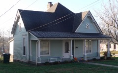 | M. Fred Bell Rental Cottage | building | 1997 | 97000627 |
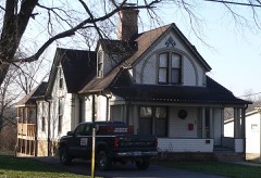 | M. Fred Bell Speculative Cottage | building | 1995 | 95000780 |
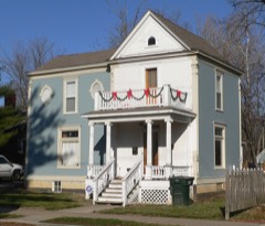 | Brandon-Bell-Collier House | building | 1998 | 98001545 |
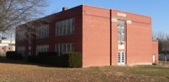 | George Washington Carver School | building | 1996 | 96001381 |
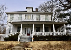 | Court Street Historic Residential District | district | 2007 | 07000817 |
 | Downtown Fulton Historic District | district | 2004 | 04000668 |
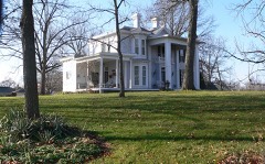 | John Augustus Hockaday House | building | 1980 | 80002321 |
| Middle River School | building | 2024 | 100010147 | |
| Oakley Chapel African Methodist Episcopal Church | building | 2008 | 08001192 | |
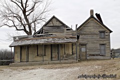 | Pitcher Store | building | 2001 | 01000235 |
| Richland Christian Church | building | 2001 | 01000122 | |
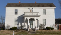 | Robnett-Payne House | building | 1998 | 98001136 |
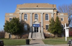 | Westminster College Gymnasium | building | 1968 | 68000030 |
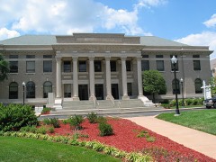 | Westminster College Historic District | building | 1982 | 82004633 |
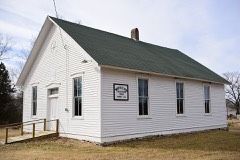 | White Cloud Presbyterian Church and Cemetery | building | 2010 | 10000817 |
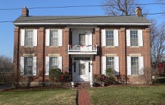 | Dr. George M. Willing House | building | 1980 | 80002322 |
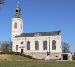 | Winston Churchill Memorial | building | 1972 | 72000708 |
Every wildfire the federal occurrence database records inside this county: 142 of them, burning about 741 acres. 1 started naturally and 5 were recorded as arson. Each settlement page carries the fires within five miles of it.
| Reported cause | Fires |
|---|---|
| Debris and open burning | 65 |
| Missing data/not specified/undetermined | 42 |
| Recreation and ceremony | 9 |
| Equipment and vehicle use | 8 |
| Smoking | 8 |
| Arson/incendiarism | 5 |
| Misuse of fire by a minor | 2 |
| Power generation/transmission/distribution | 1 |
| Natural | 1 |
| Other causes | 1 |
The five largest, by the area the report gives. None of them was recorded as arson.
| Date | Cause | Size | Reported by | Name on the report |
|---|---|---|---|---|
| 10 April 2019 | Power generation/transmission/distribution | 235 acres | Missouri Department of Conservation | 189996-01420-04102019-1838 |
| 3 March 2018 | Debris and open burning | 104 acres | Missouri Department of Conservation | 176471-01419-03032018-1319 |
| 25 January 2018 | Missing data/not specified/undetermined | 40 acres | Missouri Department of Conservation | 177297-01420-01252018-1511 |
| 25 February 2015 | Missing data/not specified/undetermined | 25 acres | Missouri Department of Conservation | 118870-01416-02252015-1256 |
| 25 March 2014 | Missing data/not specified/undetermined | 25 acres | Missouri Department of Conservation | not named |
| 29 March 2005 | Debris and open burning | 25 acres | Missouri State Fire Marshal's Office | not named |
| 31 March 1999 | Debris and open burning | 20 acres | Missouri Department of Conservation | not named |
| 6 March 2020 | Debris and open burning | 16 acres | Missouri Department of Conservation | 200536-01420-03062020-1425 |
Every settlement page carries the fires within five miles of it - see the settlement index below.
The NOAA Storm Events Database holds 487 reports for this county, causing 2 deaths, 7 injuries and about $3,888,472 in recorded property damage. Each settlement page carries the reports that name it.
| Kind of event | Reports |
|---|---|
| Thunderstorm Wind | 204 |
| Hail | 192 |
| Tornado | 42 |
| Flash Flood | 35 |
| Lightning | 7 |
| Flood | 5 |
| Funnel Cloud | 1 |
| Heavy Rain | 1 |
The most serious of them, by death, then injury, then recorded damage. The accounts are quoted exactly as the forecast office filed them.
| When | Event | Place named | Harm | What the report says |
|---|---|---|---|---|
| April 2001 | Tornado (F1) | Fulton | 1 killed, 2 hurt, $75,000 | no account filed |
| August 2014 | Lightning | Fulton | 1 killed | An 18-year old male was killed by a lighting strike while retrieving a book from a pick-up truck. |
| March 2006 | Tornado (F2) | Guthrie | 2 hurt | A tornado initially formed at approximately 12:30 am CST along County Road 337 about 2 miles northeast of Guthrie. Light tree damaged occurred in this area. The tornado traveled northeast and moderately damaged a home just north of County Road 328 approximately 1.5 miles west of US Highway 54. The home was moved approximately 25 feet off the foundation. Extensive tree damage occurred to the southwest and northeast of this location. Two people were injured at this location and were hospitalized for several days. Another home just to the east suffered roof damage. The damage width in this area was about 100 yards wide and was rated as F2 intensity. The tornado damaged a barn along US Highway 54 approximately 2 miles southwest of Fulton. Debris from the barn was thrown into the highway median. The track continued to the northeast and damaged trees along Highway NN, and damaged outbuildings along Highway C approximately 1.5 miles south of Fulton. The damage in this area was rated as F0 intensity. The tornado track continued northeast crossing Highways O and UU causing tree damage. The tornado dissipated approximately 3 miles east of Fulton along highway JJ. The damage in this area was rated as F0 intensity. The complete tornado track was approximately 13 miles long. |
| April 2025 | Tornado (EF2) | Guthrie | 1 hurt, $125,000 | The tornado touched down south of County Road 362 at 1:31 PM and quickly strengthened, blowing in the garage and removing a significant section of roof from a home along County Road 362. This was the worst observed damage and was rated as 120 mph (EF-2). The tornado then moved north-northeast, crossing State Road Y and removing siding from a church along Blessing Lane. The tornado dissipated along County Road 347 at 1:36 PM. Additional damage along the path mainly consisted of tree damage. The tornado was rated EF-2 with a path length of 2.61 miles and a maximum path width of 100 yards. |
| July 1964 | Tornado (F1) | not stated | 1 hurt, $2,500 | no account filed |
| July 2012 | Thunderstorm Wind | New Bloomfield | 1 hurt | Thunderstorm winds blew down numerous tree limbs in Holts Summit and in the New Bloomfield area. Also, the winds caused a semi to overturn in the median of U.S. Highway 54 just south of New Bloomfield. The driver sustained minor injuries. |
| June 2019 | Flood | Cedar City | $2,000,000 | The Missouri River at Jefferson City rose above 33 feet during the late evening hours of June 3rd, which is 3 feet above Major Flood stage and remained that high through the evening of June 8th. This was the period when the river was at it's highest levels for this event. The flooding affected Jefferson City Memorial Airport for a couple of months. The terminal building sustained more than 50 percent damage so will have to be torn down and rebuilt to FEMA floodplain standards. The airport tower was flooded as well. The ASOS unit had to be powered off beginning May 22nd until July 30th and had to be repaired once the flood waters went down. |
| October 2007 | Thunderstorm Wind | Calwood | $500,000 | A swath of damaging downburst winds extended from Calwood, along Highway Z towards Interstate 70. A grain elevator sustained major damage in Calwood. Also, numerous trees, tree limbs and power lines were blown down along the damage path. The width of the damage area ranged from 50 to 125 yards. |
| March 1982 | Tornado (F0) | not stated | $250,000 | no account filed |
| May 1980 | Tornado (F1) | not stated | $250,000 | no account filed |
| May 2004 | Hail | Fulton | $100,000 | no account filed |
| August 2016 | Lightning | Fulton | $50,000 | Lightning struck a wing of Reeves Library on the campus of Westminster College in Fulton, MO. Fortunately the school was renovating that part of the library, so damage was contained. Damage was estimated around $50,000. |
| October 2007 | Tornado (EF0) | Hatton | $50,000 | A tornado touched down and damaged a horse stable, double wide mobile home, trees and a large garage near CR 264. It briefly travelled to the northeast damaging additional trees before lifting and dissipating. |
| April 2000 | Tornado (F1) | Williamsburg | $50,000 | A small tornado struck a farm south of Williamsburg. One barn was completely destroyed as was a grain silo. Three outbuildings were also severely damaged. |
| April 1998 | Tornado (F1) | Kingdom City | $50,000 | A small tornado occurred along Highway 54 between Kingdom City and Fulton, destroying 4 mobile homes and damaging at least 6 others. The destroyed mobile homes were unoccupied. A nearby barn lost its roof and several nearby storage sheds were also destroyed. |
| June 1994 | Thunderstorm Wind | Fulton | $50,000 | A roof was torn off a church at Fulton and two metal stakes were driven into the side of a trailer. Power lines and large trees were blown down. Several large trees were also blown down in Mokane, New Bloomfield, and areas in-between. |
| May 2004 | Hail | Fulton | $50,000 | no account filed |
| May 1996 | Thunderstorm Wind | Hatton | $30,000 | no account filed |
| September 1992 | Tornado (F1) | not stated | $25,000 | no account filed |
| May 1980 | Tornado (F2) | not stated | $25,000 | no account filed |
| May 1966 | Tornado (F1) | not stated | $25,000 | no account filed |
| May 1966 | Tornado (F2) | not stated | $25,000 | no account filed |
| June 1960 | Tornado (F1) | not stated | $25,000 | no account filed |
| May 2024 | Thunderstorm Wind | Fulton | $20,000 | A garage was destroyed and a large tree branch fell onto a pickup truck. A power pole was also snapped. |
| May 2007 | Lightning | Fulton | $15,000 | Lightning strikes caused a power outage across most of downtown and in the North Business 54 area. At least 2 area homes also suffered minor damage from lightning strikes. |
| October 2021 | Thunderstorm Wind | Dixie | $10,000 | Thunderstorm winds blew down numerous trees across the southern portions of Callaway County. Several trees were blown down onto U.S. Highway 54 near Guthrie. Also, several trees were blown down onto Highway 94 near intersection with Highway AA and near Portland. |
| December 2021 | Thunderstorm Wind | Mc Credie | $10,000 | Widespread wind damage across portions of Kingdom City and Fulton. A large tree was blown down onto Route FF near intersection with Old U.S. Highway 40, blocking the roadway. Also, a large tree was blown down onto a house in Fulton causing moderate roof damage. Numerous large tree limbs and several additional trees were blown down. |
| May 2019 | Tornado (EF1) | (Jef)Jffrsn City Mem | $10,000 | The tornado crossed the Missouri River from Cole County into southern Callaway County. The only observed damage was to numerous trees before it lifted and dissipated near the Railwood Golf Club. The tornado was rated EF1 in Callaway County with a path length of 2.62 miles and a max path width of 100 yards. No deaths or injuries occurred in Callaway County. Overall the tornado was rated EF3 with a path length of 32.63 miles and a max path width of 1500 yards. Thirty three people sustained injuries from this tornado. |
| February 2023 | Thunderstorm Wind | Fulton | $5,000 | Thunderstorm winds blew down several power lines and a tree on the east side of town. |
| July 2021 | Thunderstorm Wind | Toledo | $5,000 | Thunderstorm winds blew down several large tree limbs onto Highway O near intersection with County Road 111. Also, in Mokane a large maple tree was blown over onto a home causing moderate roof damage. |
| August 2010 | Lightning | Fulton | $5,000 | A church was struck by lightning damaging the steeple and causing electrical damage. |
| May 2007 | Flood | (Jef)Jffrsn City Mem | $5,000 | The Missouri River flooded parts of the southern border area of Callaway County from the Jefferson City Airport to Portland. Some sandbagging was done to protect the airport from the floodwater. Otherwise the flooding was limited to low lying farmland in the flood plain and roads along the river. |
| May 2005 | Thunderstorm Wind | Fulton | $5,000 | Thunderstorm wind gusts tore the roof off a mobile home on Route NN. Damage was estimated at $5000. |
| April 1994 | Thunderstorm Wind | Fulton | $5,000 | Large trees and power lines were knocked down. Local power outages caused the WXL-45 NOAA weather radio transmission tower in Fulton to fail between 1900 and 2200 CST. |
| April 2005 | Hail | Wainwright | $5,000 | no account filed |
| September 1992 | Tornado (F0) | not stated | $2,500 | no account filed |
| July 1973 | Tornado (F1) | not stated | $2,500 | no account filed |
| November 1971 | Tornado (F1) | not stated | $2,500 | no account filed |
| September 1970 | Tornado (F1) | not stated | $2,500 | no account filed |
| July 1968 | Tornado (F0) | not stated | $2,500 | no account filed |
| June 1961 | Tornado (F1) | not stated | $2,500 | no account filed |
| June 1995 | Thunderstorm Wind | Fulton | $2,400 | Large trees were blown down across northwest parts of the county with 60 mph wind gusts reported near Auxvasse and along Interstate 70 around Kingdom City. As the line of storms moved through the Fulton area, several trees were blown down with one crushing a mobile home. Winds estimated at 70 mph also ripped sections of a roof off a lumber building. |
| July 1995 | Thunderstorm Wind | Fulton | $2,200 | A house roof in Fulton was sligtly damaged from high winds. Wind gusts in the Holts Summit area reached 60 mph. |
| June 2024 | Thunderstorm Wind | Tebbetts | $2,000 | A member of the public reported roof damage to a mobile home and large tree limbs down near Tebbetts. |
| December 2021 | Thunderstorm Wind | Holts Summit | $2,000 | Thunderstorm winds blew a large tree down at the intersection of State Highway AA and Platinum Road. |
| June 2013 | Flood | Cedar City | $2,000 | The Missouri River started the month in flood and rose to major flood levels cresting on the 2nd. The river then fell dropping below flood stage on the 7th. |
| July 1995 | Thunderstorm Wind | Kingdom City | $1,200 | Several highway signs and large trees were blown down south of Interstate 70. |
| March 2022 | Thunderstorm Wind | Mokane | $1,000 | Thunderstorm winds blew down a large tree. |
| April 2005 | Hail | Tebbetts | $1,000 | no account filed |
| April 1995 | Hail | Kingdom City | $800 | The county sheriff reported nickel-size hail along Interstate 70 east of Kingdom City for several minutes. Several automobile accidents were reported. |
| June 1995 | Thunderstorm Wind | Hatton | $300 | Large trees were blown down across northwest parts of the county with 60 mph wind gusts reported near Auxvasse and along Interstate 70 around Kingdom City. As the line of storms moved through the Fulton area, several trees were blown down with one crushing a mobile home. Winds estimated at 70 mph also ripped sections of a roof off a lumber building. |
| June 1995 | Thunderstorm Wind | Auxvasse | $300 | Large trees were blown down across northwest parts of the county with 60 mph wind gusts reported near Auxvasse and along Interstate 70 around Kingdom City. As the line of storms moved through the Fulton area, several trees were blown down with one crushing a mobile home. Winds estimated at 70 mph also ripped sections of a roof off a lumber building. |
| September 1959 | Tornado (F0) | not stated | $250 | no account filed |
| May 1995 | Thunderstorm Wind | Fulton | $200 | The county sheriff's department reported large trees down. |
| July 1995 | Thunderstorm Wind | Fulton | $200 | Large trees were blown down. |
| June 1995 | Thunderstorm Wind | Shamrock | $122 | Wind gusts reached 60 mph in Fulton and a mobile home was heavily damaged in the northeast part of the county. |
| April 2026 | Tornado (EF0) | Fulton Arpt | - | A brief tornado touched down southwest of Fulton where it caused mostly tree damage on its northeastward path. The tornado did partially uplift the roof of the Fulton-Elton Hensley Memorial Airport before lifting just west of Fulton proper. |
| April 2026 | Thunderstorm Wind | Carrington | - | Strong straight-line winds accompanied a brief tornado that approached Fulton from the southwest. These downed and damaged numerous trees between CR-325 and northwest Fulton. Winds ripped off the front part of a trailer near Carrington. In Fulton, the stoplights at Bluff and Industrial Ave were damaged, as was the Sonic restaurant sign on North Bluff Street. Numerous street lights sustained damage throughout town, and 2 utility poles were downed. The old KFAL radio tower was knocked down. Finally, large and healthy trees were uprooted on the Warson Woods University campus. Here, metal bleachers were blown over and debris was found in trees. |
| April 2025 | Thunderstorm Wind | (Jef)Jffrsn City Mem | - | The KJEF ASOS measured a 66 mph thunderstorm wind gust. |
| April 2025 | Thunderstorm Wind | Eastville | - | The NWS surveyed straight-line wind damage at a farm north-northwest of Kingdom City. Photos of the damage were provided by county law enforcement and showed extensive damage to multiple farm outbuildings. Large, healthy tree branches were also snapped on the property. |
The Survey's mineral resources record lists 219 workings inside this county. 11 still produce and 208 are closed or unrecorded. Each settlement page carries the workings within five miles of it.
| Commodity | Workings |
|---|---|
| Fire Clay (Refractory) | 160 |
| Stone, Crushed/Broken | 41 |
| Iron | 8 |
| Sand and Gravel, Construction | 7 |
| Coal, Iron | 1 |
| Silica | 1 |
| Clay | 1 |
The least common of them first, because a county's hundredth gravel pit says nothing its first ten did not.
| Where | Site | Commodity | Status | Recorded |
|---|---|---|---|---|
| Capitol Sand Company Dredge No.2 | Silica | Producer | ||
| Dunn Bank | Coal, Iron | Past Producer | ||
| Harbison-Walker Plant | Clay | Producer | ||
| Capitol Sand Co Dredge | Sand and Gravel, Construction | Producer | ||
| Laughlin Bros Dredge | Sand and Gravel, Construction | Producer | ||
| Unknown - S&G | Sand and Gravel, Construction | Past Producer | ||
| Unknown - S&G | Sand and Gravel, Construction | Past Producer | ||
| Unknown - S&G | Sand and Gravel, Construction | Past Producer | ||
| Unknown - S&G | Sand and Gravel, Construction | Past Producer | ||
| Unknown - S&G | Sand and Gravel, Construction | Past Producer | ||
| Bartlett Bank | Iron | Past Producer | ||
| Bloomfield Bank | Iron | Past Producer | ||
| Henderson Bank | Iron | Past Producer | ||
| Knight Bank | Iron | Past Producer | ||
| Murphy's Hill Mine | Iron | Past Producer | ||
| Old Diggings | Iron | Past Producer | ||
| Ralph Dunn Bank | Iron | Past Producer | ||
| Unknown - Iron | Iron | Past Producer | ||
| Auxvasse Stone Quarry & Mill | Stone, Crushed/Broken | Producer | ||
| Callaway Rock Quarry & Plant | Stone, Crushed/Broken | Producer | ||
| Holts Summit Quarry | Stone, Crushed/Broken | Producer | ||
| Jefferson City Quarry | Stone, Crushed/Broken | Producer | ||
| Martinsburg Limestone Quarry | Stone, Crushed/Broken | Producer | ||
| Miller Quarry | Stone, Crushed/Broken | Past Producer | ||
| New Mcclain Quarry | Stone, Crushed/Broken | Past Producer | ||
| Reform Quarry | Stone, Crushed/Broken | Producer | ||
| Unknown - Ls. | Stone, Crushed/Broken | Past Producer | ||
| Unknown - Ls. | Stone, Crushed/Broken | Past Producer | ||
| Unknown - Ls. | Stone, Crushed/Broken | Past Producer | ||
| Unknown - Ls. | Stone, Crushed/Broken | Past Producer | ||
| Unknown - Ls. | Stone, Crushed/Broken | Past Producer | ||
| Unknown - Ls. | Stone, Crushed/Broken | Past Producer | ||
| Unknown - Ls. | Stone, Crushed/Broken | Past Producer | ||
| Unknown - Ls. | Stone, Crushed/Broken | Past Producer | ||
| Unknown - Ls. | Stone, Crushed/Broken | Past Producer | ||
| Unknown - Ls. | Stone, Crushed/Broken | Past Producer | ||
| Unknown - Ls. | Stone, Crushed/Broken | Past Producer | ||
| Unknown - Ls. | Stone, Crushed/Broken | Past Producer | ||
| Unknown - Ls. | Stone, Crushed/Broken | Past Producer | ||
| Unknown - Ls. | Stone, Crushed/Broken | Past Producer | ||
| Unknown - Ls. | Stone, Crushed/Broken | Past Producer | ||
| Unknown - Ls. | Stone, Crushed/Broken | Past Producer | ||
| Unknown - Ls. | Stone, Crushed/Broken | Past Producer | ||
| Unknown - Ls. | Stone, Crushed/Broken | Past Producer | ||
| Unknown - Ls. | Stone, Crushed/Broken | Past Producer | ||
| Unknown - Ls. | Stone, Crushed/Broken | Past Producer | ||
| Unknown - Ls. | Stone, Crushed/Broken | Past Producer | ||
| Unknown - Ls. | Stone, Crushed/Broken | Past Producer | ||
| Unknown - Ls. | Stone, Crushed/Broken | Past Producer | ||
| Unknown - Ls. | Stone, Crushed/Broken | Past Producer | ||
| Unknown - Ls. | Stone, Crushed/Broken | Past Producer | ||
| Unknown - Ls. | Stone, Crushed/Broken | Past Producer | ||
| Unknown - Ls. | Stone, Crushed/Broken | Past Producer | ||
| Unknown - Ls. | Stone, Crushed/Broken | Past Producer | ||
| Unknown - Ls. | Stone, Crushed/Broken | Past Producer | ||
| Unknown - Ls. | Stone, Crushed/Broken | Past Producer | ||
| Unknown - Ls. | Stone, Crushed/Broken | Past Producer | ||
| Unknown - Ls. | Stone, Crushed/Broken | Past Producer | ||
| Unknown - Ls. | Stone, Crushed/Broken | Past Producer | ||
| A.P.Green Refractories,Fulton Plant | Fire Clay (Refractory) | Producer | ||
| A.V.Neal Pits | Fire Clay (Refractory) | Past Producer | ||
| Arthur Nichols Pit | Fire Clay (Refractory) | Past Producer | ||
| Aubuchon Pit | Fire Clay (Refractory) | Past Producer | ||
| Beaver Pit | Fire Clay (Refractory) | Past Producer | ||
| Ben Cole Pit | Fire Clay (Refractory) | Past Producer | ||
| Blansett Pit | Fire Clay (Refractory) | Past Producer | ||
| Blaussett Pits | Fire Clay (Refractory) | Past Producer | ||
| Breid Pits | Fire Clay (Refractory) | Past Producer | ||
| Brown Pit | Fire Clay (Refractory) | Past Producer | ||
| Brown Pits | Fire Clay (Refractory) | Past Producer | ||
| Cox Pits | Fire Clay (Refractory) | Past Producer | ||
| Dickson Pit | Fire Clay (Refractory) | Past Producer | ||
| E.F.Bush Pit | Fire Clay (Refractory) | Past Producer | ||
| Fulton Fire Brick Co. Mine # 1 | Fire Clay (Refractory) | Past Producer | ||
| Hachemeyer Clay Pit | Fire Clay (Refractory) | Past Producer | ||
| Harbison - Walker Pit | Fire Clay (Refractory) | Past Producer | ||
| Harris Bank | Fire Clay (Refractory) | Past Producer | ||
| Harris Pit | Fire Clay (Refractory) | Past Producer | ||
| Harrison Pits 5a & 5b | Fire Clay (Refractory) | Past Producer | ||
| Hays Farm Prospect | Fire Clay (Refractory) | Past Producer | ||
| Houchins Pit | Fire Clay (Refractory) | Past Producer | ||
| Huesgens Prospect | Fire Clay (Refractory) | Past Producer | ||
| Hughes Mine | Fire Clay (Refractory) | Past Producer | ||
| J.L.Davis Pit | Fire Clay (Refractory) | Past Producer | ||
| John P. Harrison Pit | Fire Clay (Refractory) | Past Producer | ||
| Kallmeyer Pit | Fire Clay (Refractory) | Past Producer | ||
| R.S.Lamar Pit | Fire Clay (Refractory) | Past Producer | ||
| Robertson Pit | Fire Clay (Refractory) | Past Producer | ||
| Robertson Pit | Fire Clay (Refractory) | Past Producer | ||
| Sherman & Bartley Claypits | Fire Clay (Refractory) | Past Producer | ||
| Sherman Land | Fire Clay (Refractory) | Past Producer | ||
| Sommer Mine | Fire Clay (Refractory) | Past Producer | ||
| Tate-Purvis Pit | Fire Clay (Refractory) | Past Producer | ||
| Thompson Pits | Fire Clay (Refractory) | Past Producer | ||
| Unknown - Clay | Fire Clay (Refractory) | Past Producer | ||
| Unknown - Clay | Fire Clay (Refractory) | Past Producer | ||
| Unknown - Clay | Fire Clay (Refractory) | Past Producer | ||
| Unknown - Clay | Fire Clay (Refractory) | Past Producer | ||
| Unknown - Clay | Fire Clay (Refractory) | Past Producer | ||
| Unknown - Clay | Fire Clay (Refractory) | Past Producer | ||
| Unknown - Clay | Fire Clay (Refractory) | Past Producer | ||
| Unknown - Clay | Fire Clay (Refractory) | Past Producer | ||
| Unknown - Clay | Fire Clay (Refractory) | Past Producer | ||
| Unknown - Clay | Fire Clay (Refractory) | Past Producer | ||
| Unknown - Clay | Fire Clay (Refractory) | Past Producer | ||
| Unknown - Clay | Fire Clay (Refractory) | Past Producer | ||
| Unknown - Clay | Fire Clay (Refractory) | Past Producer | ||
| Unknown - Clay | Fire Clay (Refractory) | Past Producer | ||
| Unknown - Clay | Fire Clay (Refractory) | Past Producer | ||
| Unknown - Clay | Fire Clay (Refractory) | Past Producer | ||
| Unknown - Clay | Fire Clay (Refractory) | Past Producer | ||
| Unknown - Clay | Fire Clay (Refractory) | Past Producer | ||
| Unknown - Clay | Fire Clay (Refractory) | Past Producer | ||
| Unknown - Clay | Fire Clay (Refractory) | Past Producer | ||
| Unknown - Clay | Fire Clay (Refractory) | Past Producer | ||
| Unknown - Clay | Fire Clay (Refractory) | Past Producer | ||
| Unknown - Clay | Fire Clay (Refractory) | Past Producer | ||
| Unknown - Clay | Fire Clay (Refractory) | Past Producer | ||
| Unknown - Clay | Fire Clay (Refractory) | Past Producer | ||
| Unknown - Clay | Fire Clay (Refractory) | Unknown | ||
| Unknown - Clay | Fire Clay (Refractory) | Past Producer | ||
| Unknown - Clay | Fire Clay (Refractory) | Past Producer | ||
| Unknown - Clay | Fire Clay (Refractory) | Past Producer | ||
| Unknown - Clay | Fire Clay (Refractory) | Past Producer | ||
| Unknown - Clay | Fire Clay (Refractory) | Past Producer | ||
| Unknown - Clay | Fire Clay (Refractory) | Past Producer | ||
| Unknown - Clay | Fire Clay (Refractory) | Past Producer | ||
| Unknown - Clay | Fire Clay (Refractory) | Past Producer | ||
| Unknown - Clay | Fire Clay (Refractory) | Past Producer | ||
| Unknown - Clay | Fire Clay (Refractory) | Past Producer | ||
| Unknown - Clay | Fire Clay (Refractory) | Past Producer | ||
| Unknown - Clay | Fire Clay (Refractory) | Past Producer | ||
| Unknown - Clay | Fire Clay (Refractory) | Past Producer | ||
| Unknown - Clay | Fire Clay (Refractory) | Past Producer | ||
| Unknown - Clay | Fire Clay (Refractory) | Past Producer | ||
| Unknown - Clay | Fire Clay (Refractory) | Past Producer | ||
| Unknown - Clay | Fire Clay (Refractory) | Past Producer | ||
| Unknown - Clay | Fire Clay (Refractory) | Past Producer | ||
| Unknown - Clay | Fire Clay (Refractory) | Past Producer | ||
| Unknown - Clay | Fire Clay (Refractory) | Past Producer | ||
| Unknown - Clay | Fire Clay (Refractory) | Past Producer | ||
| Unknown - Clay | Fire Clay (Refractory) | Past Producer | ||
| Unknown - Clay | Fire Clay (Refractory) | Past Producer | ||
| Unknown - Clay | Fire Clay (Refractory) | Past Producer | ||
| Unknown - Clay | Fire Clay (Refractory) | Past Producer | ||
| Unknown - Clay | Fire Clay (Refractory) | Past Producer | ||
| Unknown - Clay | Fire Clay (Refractory) | Past Producer | ||
| Unknown - Clay | Fire Clay (Refractory) | Past Producer | ||
| Unknown - Clay | Fire Clay (Refractory) | Past Producer | ||
| Unknown - Clay | Fire Clay (Refractory) | Past Producer | ||
| Unknown - Clay | Fire Clay (Refractory) | Past Producer | ||
| Unknown - Clay | Fire Clay (Refractory) | Past Producer | ||
| Unknown - Clay | Fire Clay (Refractory) | Past Producer | ||
| Unknown - Clay | Fire Clay (Refractory) | Past Producer | ||
| Unknown - Clay | Fire Clay (Refractory) | Past Producer | ||
| Unknown - Clay | Fire Clay (Refractory) | Past Producer | ||
| Unknown - Clay | Fire Clay (Refractory) | Past Producer | ||
| Unknown - Clay | Fire Clay (Refractory) | Past Producer | ||
| Unknown - Clay | Fire Clay (Refractory) | Past Producer | ||
| Unknown - Clay | Fire Clay (Refractory) | Past Producer | ||
| Unknown - Clay | Fire Clay (Refractory) | Past Producer | ||
| Unknown - Clay | Fire Clay (Refractory) | Past Producer | ||
| Unknown - Clay | Fire Clay (Refractory) | Past Producer | ||
| Unknown - Clay | Fire Clay (Refractory) | Past Producer | ||
| Unknown - Clay | Fire Clay (Refractory) | Past Producer | ||
| Unknown - Clay | Fire Clay (Refractory) | Past Producer | ||
| Unknown - Clay | Fire Clay (Refractory) | Past Producer | ||
| Unknown - Clay | Fire Clay (Refractory) | Past Producer | ||
| Unknown - Clay | Fire Clay (Refractory) | Past Producer | ||
| Unknown - Clay | Fire Clay (Refractory) | Past Producer | ||
| Unknown - Clay | Fire Clay (Refractory) | Past Producer | ||
| Unknown - Clay | Fire Clay (Refractory) | Past Producer | ||
| Unknown - Clay | Fire Clay (Refractory) | Past Producer | ||
| Unknown - Clay | Fire Clay (Refractory) | Past Producer | ||
| Unknown - Clay | Fire Clay (Refractory) | Past Producer | ||
| Unknown - Clay | Fire Clay (Refractory) | Past Producer | ||
| Unknown - Clay | Fire Clay (Refractory) | Past Producer | ||
| Unknown - Clay | Fire Clay (Refractory) | Past Producer | ||
| Unknown - Clay | Fire Clay (Refractory) | Past Producer | ||
| Unknown - Clay | Fire Clay (Refractory) | Past Producer | ||
| Unknown - Clay | Fire Clay (Refractory) | Past Producer | ||
| Unknown - Clay | Fire Clay (Refractory) | Past Producer | ||
| Unknown - Clay | Fire Clay (Refractory) | Past Producer | ||
| Unknown - Clay | Fire Clay (Refractory) | Past Producer | ||
| Unknown - Clay | Fire Clay (Refractory) | Past Producer | ||
| Unknown - Clay | Fire Clay (Refractory) | Past Producer | ||
| Unknown - Clay | Fire Clay (Refractory) | Past Producer | ||
| Unknown - Clay | Fire Clay (Refractory) | Past Producer | ||
| Unknown - Clay | Fire Clay (Refractory) | Past Producer | ||
| Unknown - Clay | Fire Clay (Refractory) | Past Producer | ||
| Unknown - Clay | Fire Clay (Refractory) | Past Producer | ||
| Unknown - Clay | Fire Clay (Refractory) | Past Producer | ||
| Unknown - Clay | Fire Clay (Refractory) | Past Producer | ||
| Unknown - Clay | Fire Clay (Refractory) | Past Producer | ||
| Unknown - Clay | Fire Clay (Refractory) | Past Producer | ||
| Unknown - Clay | Fire Clay (Refractory) | Past Producer | ||
| Unknown - Clay | Fire Clay (Refractory) | Past Producer | ||
| Unknown - Clay Pit | Fire Clay (Refractory) | Past Producer | ||
| Unknown - Clay Pits | Fire Clay (Refractory) | Past Producer | ||
| Unknown - Clay Pits | Fire Clay (Refractory) | Past Producer | ||
| Unknown - Clay Pits | Fire Clay (Refractory) | Past Producer | ||
| Unknown - Clay Pits | Fire Clay (Refractory) | Past Producer | ||
| Unknown - Clay Pits | Fire Clay (Refractory) | Past Producer | ||
| Unknown - Clay Pits | Fire Clay (Refractory) | Past Producer | ||
| Unknown - Clay Pits | Fire Clay (Refractory) | Past Producer | ||
| Unknown - Clay Pits | Fire Clay (Refractory) | Past Producer | ||
| Unknown - Clay Pits | Fire Clay (Refractory) | Past Producer | ||
| Unknown - Clay Pits | Fire Clay (Refractory) | Past Producer | ||
| Unknown - Clay Pits | Fire Clay (Refractory) | Past Producer | ||
| Unknown - Clay Pits | Fire Clay (Refractory) | Past Producer | ||
| Unknown - Clay Pits | Fire Clay (Refractory) | Past Producer | ||
| Unknown - Clay Pits | Fire Clay (Refractory) | Past Producer | ||
| Unknown - Clay Pits | Fire Clay (Refractory) | Past Producer | ||
| Unknown - Clay Pits | Fire Clay (Refractory) | Past Producer | ||
| Unknown - Ls. | Fire Clay (Refractory) | Past Producer | ||
| Unknown - Ls. | Fire Clay (Refractory) | Past Producer | ||
| Unknown - Ls. | Fire Clay (Refractory) | Past Producer | ||
| Weatherall & Lammers Pit | Fire Clay (Refractory) | Past Producer | ||
| Wink - Craighead Pit | Fire Clay (Refractory) | Past Producer |
Named settlements recorded in the Geographic Names Information System, each with the topographic sheets covering it. Villages, hamlets and abandoned places alike. Each is shown with the nearest named watercourse or landform and the survey quadrangle it falls on.
Cote Sans Dessein township · 65080 · On Rivaux Creek · Osage City quadrangle
23 sheets, 1886 to 1982
No longer a settlement
Round Prairie township · 65251 · On Smith Creek · Guthrie quadrangle
21 sheets, 1886 to 2000
Caldwell township · 65063 · On Prime Creek · Mokane West quadrangle
20 sheets, 1890 to 2000
Jackson township · 65231 · On Smith Branch · Auxvasse quadrangle
16 sheets, 1890 to 1986
No longer a settlement
East Fulton township · 65251 · On Sallees Branch · Kingdom City quadrangle
21 sheets, 1890 to 1985
Summit township · 65101 · On Turkey Creek · Jefferson City quadrangle
26 sheets, 1886 to 1982
Cote Sans Dessein township · 65080 · On Cote Sans Dessein · Loose Creek quadrangle
19 sheets, 1890 to 1985
No longer a settlement
Caldwell township · 65063 · On Caldwell Branch · New Bloomfield quadrangle
22 sheets, 1886 to 2000
Cote Sans Dessein township · 65080 · Mokane West quadrangle
20 sheets, 1890 to 2000
No longer a settlement
Cedar township · 65063 · On Murray Branch · New Bloomfield quadrangle
22 sheets, 1886 to 2000
No longer a settlement
Cedar township · 65063 · On Big Branch · Jefferson City NW quadrangle
24 sheets, 1886 to 2000
Auxvasse township · 65069 · Readsville quadrangle
21 sheets, 1890 to 1985
No longer a settlement
St. Aubert township · 65251 · On Lake Branch · Fulton quadrangle
22 sheets, 1890 to 2000
Auxvasse township · 65067 · On Eagle Creek · Morrison quadrangle
22 sheets, 1890 to 1985
No longer a settlement
Cote Sans Dessein township · 65080 · Mokane West quadrangle
20 sheets, 1890 to 2000
No longer a settlement
Summit township · 65043 · On Cason Branch · New Bloomfield quadrangle
22 sheets, 1886 to 2000
No longer a settlement
Cleveland township · 65202 · On Manacle Creek · Millersburg quadrangle
22 sheets, 1886 to 2000
McCredie township · 65262 · On Bynum Creek · Kingdom City quadrangle
21 sheets, 1890 to 1985
Round Prairie township · 65251 · By Mill Site Bluff · Millersburg SW quadrangle
23 sheets, 1886 to 2000
St. Aubert township · 65059 · On East Wing Creek · Mokane East quadrangle
21 sheets, 1890 to 2000
Cedar township · 65063 · On Murray Branch · New Bloomfield quadrangle
22 sheets, 1886 to 2000
Summit township · 65043 · On Alton Creek · Jefferson City quadrangle
26 sheets, 1886 to 1982
Shamrock township · 63361 · On Harrison Creek · Martinsburg quadrangle
16 sheets, 1890 to 1986
Cleveland township · 65202 · On Manacle Creek · Millersburg quadrangle
22 sheets, 1886 to 2000
Nine Mile Prairie township · 63388 · On Bragg Branch · Reform quadrangle
21 sheets, 1890 to 1985
The vanished settlements of Callaway County: the places named above that are no longer on the map.