 Block
Fulton, Missouri
22 topographic sheets cover this place, the earliest surveyed in 1890 and the latest in 2000. It stands in East Fulton Township. It lies in ZIP code area 65251. It stands on Smith Branch. The Survey maps it on the Fulton quadrangle. 12,600 people lived here at the 2020 count. It stands 764 feet above sea level.
Research this city
On record in Fulton
Buildings and businesses the archive holds for this place. Each opens its own page, with the source record it came from.
On the National Register 12 of 15 shown
 Westminster College GymnasiumNational Historic Landmark · listed 1968
 M. Fred Bell Rental Cottagelisted 1997
 M. Fred Bell Speculative Cottagelisted 1995
 Brandon-Bell-Collier Houselisted 1998
 George Washington Carver Schoollisted 1996
 Court Street Historic Residential Districtlisted 2007
 Downtown Fulton Historic Districtlisted 2004
 John Augustus Hockaday Houselisted 1980
 Pitcher Storelisted 2001
 Robnett-Payne Houselisted 1998
 Westminster College Historic Districtlisted 1982
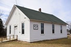 White Cloud Presbyterian Church and Cemeterylisted 2010
Population over time
2 figuresFulton fell from 12,790 to 12,600 between 2010 and 2020. These are the recorded population figures Wikidata holds for this place, reached through the Geographic Names Information System number this page is keyed on rather than by name, so they belong to this place and not to another of the same name. Most are census counts, but not all are: an early figure may be a founding or settlement estimate, and an estimate published within five years of a census is left out. The change column is computed, and is left blank where more than 20 years separate a figure from the one before it, because a gap that long is not a change between two counts.
| Year | People | Change |
|---|---|---|
| 2010 | 12,790 | |
| 2020 | 12,600 | -190 (-1%) |
Topographic sheets covering this place
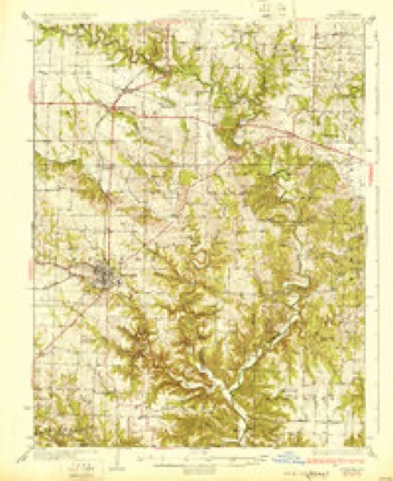
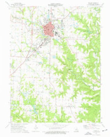
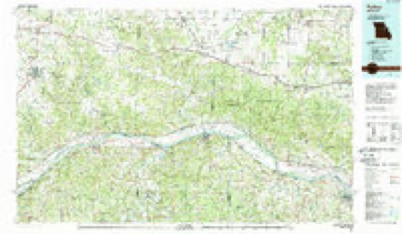
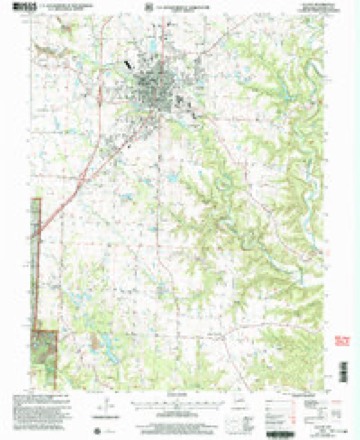
12 surveys from 22 printed sheetsMatched by testing this settlement's coordinate against the published boundary of every sheet in the United States Geological Survey's historical collection. Each opens the scanned sheet at the Survey.
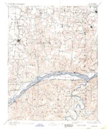
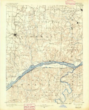
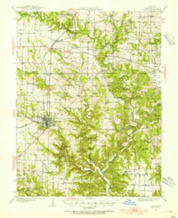
- 1890 USGS Chamois quadrangle1:125000, 2 printings
- 1890 USGS Fulton quadrangle1:125000, 3 printings
- 1928 USGS Fulton quadrangle1:62500, 2 printings
- 1931 USGS Fulton quadrangle1:62500, 2 printings
- 1949 USGS Saint Louis quadrangle1:250000
- 1949 USGS St. Louis quadrangle1:250000
- 1962 USGS St. Louis quadrangle1:250000
- 1963 USGS St. Louis quadrangle1:250000, 4 printings
- 1966 USGS St. Louis quadrangle1:250000
- 1975 USGS Fulton quadrangle1:24000, 2 printings
- 1985 USGS Fulton quadrangle1:100000, 2 printings
- 2000 USGS Fulton quadrangle1:24000





Fires near this place
5 since 1992Regional context, not property-specific evidence. The federal wildfire occurrence database lists 5 fires within 5 miles of Fulton between 1992 and 2018, burning about 18 acres in total. None started naturally. None was recorded as arson. Distance is straight-line from the map coordinates, so a fire counted here may appear on a neighbouring settlement's page as well.
| Reported cause | Fires |
|---|---|
| Debris and open burning | 3 |
| Missing data/not specified/undetermined | 1 |
| Equipment and vehicle use | 1 |
The most recent of them, most recent first, with the day each was reported and the service that recorded it.
| Date | Cause | Size | Reported by | Name on the report |
|---|---|---|---|---|
| 5 March 1992 | Debris and open burning | 4.0 acres | Missouri Department of Conservation | not named |
| 30 March 1993 | Debris and open burning | 3.0 acres | Missouri Department of Conservation | not named |
| 26 March 1999 | Debris and open burning | 1.0 acres | Missouri Department of Conservation | not named |
| 27 February 2018 | Missing data/not specified/undetermined | 7.9 acres | Missouri Department of Conservation | 177396-01420-02272018-1549 |
| 27 February 2018 | Equipment and vehicle use | 2.6 acres | Missouri Department of Conservation | 177797-01414-02272018-1547 |
Settlements close enough to share some of these fires:
Mines and quarries near this place
10 of 54 shownRegional context, not property-specific evidence. The federal mineral resources record lists 54 workings within 5 miles of Fulton: 52 past producers, 2 producers. 2 still produce. What was taken out: Fire Clay (Refractory), Stone, Crushed/Broken, Clay. Distance is straight-line from the map coordinates, so a quarry counted here may appear on a neighbouring settlement's page as well.
| Where | Site | Commodity | Status | Recorded |
|---|---|---|---|---|
| Harbison-Walker Plant | Clay | Producer | ||
| Miller Quarry | Stone, Crushed/Broken | Past Producer | ||
| Unknown - Ls. | Stone, Crushed/Broken | Past Producer | ||
| Unknown - Ls. | Stone, Crushed/Broken | Past Producer | ||
| Unknown - Ls. | Stone, Crushed/Broken | Past Producer | ||
| Unknown - Ls. | Stone, Crushed/Broken | Past Producer | ||
| A.P.Green Refractories,Fulton Plant | Fire Clay (Refractory) | Producer | ||
| Breid Pits | Fire Clay (Refractory) | Past Producer | ||
| Brown Pit | Fire Clay (Refractory) | Past Producer | ||
| Brown Pits | Fire Clay (Refractory) | Past Producer |
Storms near this place
60 of 81 shownRegional context, not property-specific evidence. The National Weather Service names Fulton in 81 storm reports between 1994 and 2024: 39 thunderstorm wind, 33 hail, 6 lightning, 2 tornado. The reports record 2 deaths and 2 injuries. Each account below is quoted exactly as the forecast office filed it, from the NOAA Storm Events Database, and each date opens the federal record of that event.
| When | Event | Place named | Harm | What the report says |
|---|---|---|---|---|
| April 2001 | Tornado (F1) | Fulton | 1 killed, 2 hurt, $75,000 | no account filed |
| August 2014 | Lightning | Fulton | 1 killed | An 18-year old male was killed by a lighting strike while retrieving a book from a pick-up truck. |
| May 2004 | Hail | Fulton | $100,000 | no account filed |
| August 2016 | Lightning | Fulton | $50,000 | Lightning struck a wing of Reeves Library on the campus of Westminster College in Fulton, MO. Fortunately the school was renovating that part of the library, so damage was contained. Damage was estimated around $50,000. |
| June 1994 | Thunderstorm Wind | Fulton | $50,000 | A roof was torn off a church at Fulton and two metal stakes were driven into the side of a trailer. Power lines and large trees were blown down. Several large trees were also blown down in Mokane, New Bloomfield, and areas in-between. |
| May 2004 | Hail | Fulton | $50,000 | no account filed |
| May 2024 | Thunderstorm Wind | Fulton | $20,000 | A garage was destroyed and a large tree branch fell onto a pickup truck. A power pole was also snapped. |
| May 2007 | Lightning | Fulton | $15,000 | Lightning strikes caused a power outage across most of downtown and in the North Business 54 area. At least 2 area homes also suffered minor damage from lightning strikes. |
| February 2023 | Thunderstorm Wind | Fulton | $5,000 | Thunderstorm winds blew down several power lines and a tree on the east side of town. |
| August 2010 | Lightning | Fulton | $5,000 | A church was struck by lightning damaging the steeple and causing electrical damage. |
| May 2005 | Thunderstorm Wind | Fulton | $5,000 | Thunderstorm wind gusts tore the roof off a mobile home on Route NN. Damage was estimated at $5000. |
| April 1994 | Thunderstorm Wind | Fulton | $5,000 | Large trees and power lines were knocked down. Local power outages caused the WXL-45 NOAA weather radio transmission tower in Fulton to fail between 1900 and 2200 CST. |
| June 1995 | Thunderstorm Wind | Fulton | $2,400 | Large trees were blown down across northwest parts of the county with 60 mph wind gusts reported near Auxvasse and along Interstate 70 around Kingdom City. As the line of storms moved through the Fulton area, several trees were blown down with one crushing a mobile home. Winds estimated at 70 mph also ripped sections of a roof off a lumber building. |
| July 1995 | Thunderstorm Wind | Fulton | $2,200 | A house roof in Fulton was sligtly damaged from high winds. Wind gusts in the Holts Summit area reached 60 mph. |
| May 1995 | Thunderstorm Wind | Fulton | $200 | The county sheriff's department reported large trees down. |
| July 1995 | Thunderstorm Wind | Fulton | $200 | Large trees were blown down. |
| May 2019 | Thunderstorm Wind | Fulton | - | Thunderstorm winds blew down several large trees around town as well as tree limbs and power lines. One large tree fell onto a house causing moderate damage. One barn had minor roof damage. |
| May 2019 | Thunderstorm Wind | Fulton | - | Thunderstorm winds blew over a semi on the Kingdom City overpass at the I-70, U.S. 54 exit. No injuries were reported. Also, several large trees were blown down, one of which blocked a road in Fulton. |
| May 2018 | Thunderstorm Wind | Fulton | - | Thunderstorm winds blew down several large trees. One tree was blown onto State Route C just south of Fulton and another one was blown down onto State Highway D near Yucatan. |
| August 2016 | Flash Flood | Fulton | - | After 3 days of heavy rain over the county, with up to 8 inches of rainfall, and a lot of rain in the month leading up to this, the dam on Glover Spring Lake, a 35 acre lake, failed. It washed out the bridge on County Road 101 just below it. No structures were affected near the dam or downstream on Dunlap Creek, Crows Fork Creek and Auxvasse Creek. The gage near Reform on Auxvasse Creek did show about a 23 foot rise in an 8 hour time period. |
| May 2011 | Thunderstorm Wind | Fulton | - | Thunderstorm winds blew down a large tree limb. The limb took down a few power lines when it fell. |
| July 2010 | Thunderstorm Wind | Fulton | - | Thunderstorm winds blew down at least a dozen large trees. One tree fell onto a garage causing moderate damage. |
| August 2010 | Thunderstorm Wind | Fulton | - | Thunderstorm winds blew down several trees throughout town. |
| January 2008 | Thunderstorm Wind | Fulton | - | Thunderstorm winds blew down several large tree limbs, as well as, several power lines on the west side of town. |
| July 2008 | Thunderstorm Wind | Fulton | - | Thunderstorm winds blew down numerous trees in Fulton. Also, the winds blew down a large tree onto Interstate 70 blocking the far right lane of the westbound side of the highway. This occurred near mile marker 156. |
| August 2007 | Thunderstorm Wind | Fulton | - | Some trees were blown down and a few were blocking roads. |
| March 2007 | Hail | Fulton | - | Quarter to golfball sized hail fell in a swath from just southwest of Fulton to 4 miles south of Williamsburg. Some roofs and vehicles sustained hail damage. |
| April 2006 | Hail | Fulton | - | Amateur radio spotters reported nickel size hail covering the ground. |
| June 2006 | Thunderstorm Wind | Fulton | - | Thunderstorm winds blew down several trees and power lines on Route F between Route KK and Route WW. |
| August 2006 | Thunderstorm Wind | Fulton | - | Storm spotters reported large tree limbs just north of Fulton. |
| July 2006 | Thunderstorm Wind | Fulton | - | Several large tree branches were blown down and one tree was uprooted near the intersection of county roads 102W and 113N. |
| April 2005 | Hail | Fulton | - | A storm spotter reported hail up to 1 inch fell in Fulton for at least 10 minutes. |
| April 2005 | Thunderstorm Wind | Fulton | - | The Sheriff Department reported power lines down in Fulton. |
| May 2005 | Hail | Fulton | - | The County Sheriff reported hail up to golfball size. |
| June 2005 | Hail | Fulton | - | Security at the AmerenUE Callaway Nuclear Power Plant reported 3/4 inch hail. |
| June 2005 | Hail | Fulton | - | A storm spotter reported 1 inch hail. |
| September 2005 | Thunderstorm Wind | Fulton | - | Local law enforcement reported several large trees down in Fulton. |
| September 2005 | Thunderstorm Wind | Fulton | - | The County Sheriff reported several large tree limbs blown down. |
| November 2005 | Hail | Fulton | - | Local law enforcement reported 3/4 inch hail northwest of Fulton. |
| May 2004 | Thunderstorm Wind | Fulton | - | The Sheriff Department reported trees and power lines down. |
| April 2004 | Thunderstorm Wind | Fulton | - | Local law enforcement reported trees down on Route Z near Fulton. |
| September 2003 | Thunderstorm Wind | Fulton | - | Scattered trees and power lines were reported down in various parts of Fulton. |
| April 2003 | Lightning | Fulton | - | Lightning struck a 69 kilovolt transmission line knocking out power to about 60 percent of town. Power was quickly restored to most of the town within about 5 minutes while some areas were out of power up to an hour. |
| August 2003 | Hail | Fulton | - | Storm spotters reported 3/4 inch hail west of Fulton. |
| June 2002 | Thunderstorm Wind | Fulton | - | Thunderstorm winds downed some power lines near Route HH. |
| April 2000 | Thunderstorm Wind | Fulton | - | The sheriff department reported trees and power lines down in several areas of Fulton. |
| September 1995 | Thunderstorm Wind | Fulton | - | Thunderstorm winds downed power lines in Fulton. Reported by county sheriff. |
| July 1995 | Tornado (F0) | Fulton | - | A brief touchdown was reported just east of Fulton. |
| June 1995 | Thunderstorm Wind | Fulton | - | Wind gusts reached 60 mph in Fulton and a mobile home was heavily damaged in the northeast part of the county. |
| March 2017 | Hail | Fulton | - | no account filed |
| May 2016 | Hail | Fulton | - | no account filed |
| June 2015 | Hail | Fulton | - | no account filed |
| April 2014 | Hail | Fulton | - | no account filed |
| May 2013 | Hail | Fulton | - | no account filed |
| April 2012 | Hail | Fulton | - | no account filed |
| March 2012 | Hail | Fulton | - | no account filed |
| April 2011 | Hail | Fulton | - | no account filed |
| March 2010 | Hail | Fulton | - | no account filed |
| April 2010 | Hail | Fulton | - | no account filed |
| March 2010 | Hail | Fulton | - | no account filed |
Nearest settlements
The eight closest, with where each one stands in the county. Distances are straight-line, computed from the Geographic Names Information System coordinates.
| Map | Place | Distance | Sheets |
|---|---|---|---|
| Callaway | 4.7 miles | 21 | |
| Hams Prairie | 5.7 miles | 22 | |
| Carrington | 6.5 miles | 21 | |
| Pitcher | 6.7 miles | 22 | |
| Toledo | 6.9 miles | 21 | |
| Calwood | 7.2 miles | 21 | |
| Kingdom City | 7.3 miles | 21 | |
| McCredie | 7.9 miles | 21 |
Elsewhere
Matched on this settlement's Geographic Names Information System number rather than its name, so it cannot be a different place of the same name in another state.
| Wikipedia article on Fulton | An encyclopaedic summary. Its text is share-alike, so it is linked here rather than copied. |
| Wikidata item Q839802 | The structured record the population and elevation above come from. Public domain (CC0). |
Provenance
This settlement is recorded in the Geographic Names Information System as feature 750008. The sheet list is computed by point-in-boundary test against the United States Geological Survey's historical topographic inventory. Both are works of the United States government and carry no copyright under 17 U.S.C. 105.
Wildfire. Short, Karen C. 2022. Spatial wildfire occurrence data for the United States, 1992-2020 [FPA_FOD_20221014]. 6th Edition. Fort Collins, CO: Forest Service Research Data Archive. https://doi.org/10.2737/RDS-2013-0009.6 Collected with United States Government funding and usable without additional permissions or fees.
Mines and quarries. USGS Mineral Resources Data System (MRDS) https://mrdata.usgs.gov/mrds/ A work of the United States government, no copyright under 17 U.S.C. 105.
Storms. NOAA National Centers for Environmental Information, Storm Events Database https://www.ncei.noaa.gov/stormevents/ A work of the United States government, no copyright under 17 U.S.C. 105. Narratives are quoted verbatim from the National Weather Service report and are not edited or summarised.