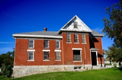
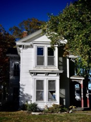
7 National Register listings published here · the county-history sources name 4 people · people the book names include Colonel R. H. Andrews (Bowling Green Township, 1883) (machine-read).
Every wildfire the federal occurrence
database records inside this county: 41 of them, burning
about 970 acres. 1 started naturally and 2 were recorded as arson. Each settlement page carries the fires within
five miles of it.
Reported cause
Fires
Debris and open burning
16
Missing data/not specified/undetermined
12
Equipment and vehicle use
5
Smoking
3
Recreation and ceremony
2
Arson/incendiarism
2
Natural
1
The five largest, by the area the report
gives. None of them was recorded as arson.
Date
Cause
Size
Reported by
Name on the report
8 March 2000
Smoking
380 acres
Swan Lake National Wildlife Refuge
ESIDEPRAIR
16 March 1992
Debris and open burning
125 acres
Missouri Department of Conservation
not named
17 February 2017
Missing data/not specified/undetermined
80 acres
Missouri Department of Conservation
not named
19 January 1992
Debris and open burning
80 acres
Missouri Department of Conservation
not named
6 March 2018
Natural
53 acres
Swan Lake National Wildlife Refuge
ELK CREEK
3 March 2018
Missing data/not specified/undetermined
45 acres
Missouri Department of Conservation
176382-05835-03032018-1032
30 September 2000
Debris and open burning
40 acres
Missouri Department of Conservation
not named
1 March 1992
Debris and open burning
17 acres
Missouri Department of Conservation
not named
Every settlement page carries the fires within five
miles of it - see the settlement index below.
Storms,
1955 to 2025
60 of 263 shown
The
NOAA Storm Events Database holds
263 reports for this county, causing no deaths, 8 injuries and about $14,220,280 in recorded property damage.
Each settlement page carries the reports that name it.
Kind of event
Reports
Hail
108
Thunderstorm Wind
94
Flood
30
Tornado
19
Flash Flood
12
The most serious of them, by death, then
injury, then recorded damage. The accounts are quoted exactly as the
forecast office filed them.
The Carroll County tornado continued northeast across Chariton County damaging or destroying several outbuildings near Mendon and 5 miles south of Marceline. In addition, a single family home suffered minor damage, and a mobile home was damaged 5 miles south of Marceline.
Large hail fell in an area seven miles wide and 15 miles long across the county in what some local residents claimed was the worst hail storm in 18 years. Farm vehicles and cars were heavily damaged with several roofs damaged beyond repair. High wind with the hail shattered windows, including 19 windows to one home alone, and destroyed thousands of acres of crops, leaving some fields completely wiped clean. A survey by the county's agricultural office indicated that 60,000 acres of crops were damaged overall with 40,000 completely destroyed. Several grain bins were also damaged.
Large hail fell in an area seven miles wide and 15 miles long across the county in what some local residents claimed was the worst hail storm in 18 years. Farm vehicles and cars were heavily damaged with several roofs damaged beyond repair. High wind with the hail shattered windows, including 19 windows to one home alone, and destroyed thousands of acres of crops, leaving some fields completely wiped clean. A survey by the county's agricultural office indicated that 60,000 acres of crops were damaged overall with 40,000 completely destroyed. Several grain bins were also damaged.
Large hail fell in an area seven miles wide and 15 miles long across the county in what some local residents claimed was the worst hail storm in 18 years. Farm vehicles and cars were heavily damaged with several roofs damaged beyond repair. High wind with the hail shattered windows, including 19 windows to one home alone, and destroyed thousands of acres of crops, leaving some fields completely wiped clean. A survey by the county's agricultural office indicated that 60,000 acres of crops were damaged overall with 40,000 completely destroyed. Several grain bins were also damaged.
Ongoing flooding along the Missouri River continued through the month of April and into May. Several roads were closed near the banks of the Missouri River. This flooding began in mid March and due to upstream releases and continued periods of heavy rain the flooding continued into May. Monetary damages are unknown despite the entry indicating 0 dollars of damages.
Heavy spring rains caused ongoing flooding along the Missouri River to Continue through the month. Some locations along the Missouri River experienced major flooding at times during the month. Damage estimates from roads washed out and crop damage are unknown at this time.
Heavy spring rains caused ongoing flooding along the Missouri River to Continue through the month. Some locations along the Missouri River experienced major flooding at times during the month. Damage estimates from roads washed out and crop damage are unknown at this time.
Multiple trees and power lines were down along Highway 24 between Keytesville and Salisbury. Also a grain bin was blown over and a shed roof was blown off along Highway 24.
Power poles snapped and 2x4's scattered across the road near Mendon.
Mines and
quarries
12 recorded
The Survey's mineral resources record
lists 12 workings inside this county. 2 still produce and 10 are closed or unrecorded. Each
settlement page carries the workings within five miles of it.
Commodity
Workings
Stone, Crushed/Broken
9
Sand and Gravel, Construction
2
Clay
1
The least common of them first, because a
county's hundredth gravel pit says nothing its first ten did not.
History of Howard and Chariton Counties, Missouri : Written and Compiled from the Most Official Authentic and Private Sources, Including a History of Its Townships, Towns, and Villages, Together with a Condensed History of Missouri .. devotes a chapter to each township:
its boundaries and streams, who settled it and when, the mills, the
schools and the churches. All 2 are reproduced here in full. Each row
shows the township's own shape and where it lies in the county, drawn from
the Census Bureau's boundary. Which settlements belong to which township
is computed from that same boundary, not taken from the book.
2 books written about this county, cut here
where the book itself is cut, at its printed chapters: 2 chapters in all.
Every chapter is public domain, machine-read from the scan and
reproduced complete. A chapter already given under one of the county's
towns is not repeated in this list.
History of Howard and Chariton Counties, Missouri : Written and Compiled from the Most Official Authentic and Private Sources, Including a History of Its Townships, Towns, and Villages, Together with a Condensed History of Missouri .. (1883)
Everyone History of Howard and Chariton Counties, Missouri : Written and Compiled from the Most Official Authentic and Private Sources, Including a History of Its Townships, Towns, and Villages, Together with a Condensed History of Missouri .. stops to write about, with
the section that describes them. Among them are the men who founded the
place and governed the Territory. Each name opens the passage itself, in
the words of 1883.
Named settlements recorded in the Geographic Names
Information System, each with the topographic sheets covering it. Villages,
hamlets and abandoned places alike. Each is shown with the nearest named
watercourse or landform and the survey quadrangle it falls on.
Topographic sheets. USGS Historical Topographic Map Collection, county index, measured from the bulk metadata.
Fire insurance maps. Library of Congress Sanborn collection, faceted to this county.
Photographs. Each place queried individually against the Library of Congress Prints and Photographs search.
Wildfire. Short, Karen C. 2022. Spatial wildfire occurrence data for the United States, 1992-2020 [FPA_FOD_20221014]. 6th Edition. Fort Collins, CO: Forest Service Research Data Archive. https://doi.org/10.2737/RDS-2013-0009.6 Collected with United States Government funding and usable without additional permissions or fees.
Mines and quarries. USGS Mineral Resources Data System (MRDS) https://mrdata.usgs.gov/mrds/ A work of the United States government, no copyright under 17 U.S.C. 105.
Storms. NOAA National Centers for Environmental Information, Storm Events Database https://www.ncei.noaa.gov/stormevents/ A work of the United States government, no copyright under 17 U.S.C. 105. Narratives are quoted verbatim from the National Weather Service report and are not edited or summarised.
 Block