 Block
Dalton, Missouri
15 topographic sheets cover this place, the earliest surveyed in 1890 and the latest in 1985. It stands in Bowling Green Township. It lies in ZIP code area 65246. The Survey maps it on the Keytesville quadrangle. 7 people lived here at the 2020 count. It stands 712 feet above sea level.
On record in Dalton
Buildings and businesses the archive holds for this place. Each opens its own page, with the source record it came from.
On the National Register 1 record
- Dalton Vocational School Historic Districtlisted 2002
Population over time
2 figuresDalton fell from 17 to 7 between 2010 and 2020. These are the recorded population figures Wikidata holds for this place, reached through the Geographic Names Information System number this page is keyed on rather than by name, so they belong to this place and not to another of the same name. Most are census counts, but not all are: an early figure may be a founding or settlement estimate, and an estimate published within five years of a census is left out. The change column is computed, and is left blank where more than 20 years separate a figure from the one before it, because a gap that long is not a change between two counts.
| Year | People | Change |
|---|---|---|
| 2010 | 17 | |
| 2020 | 7 | -10 (-59%) |
Topographic sheets covering this place
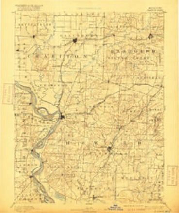
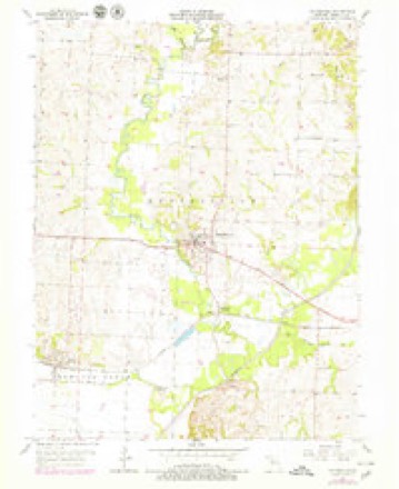
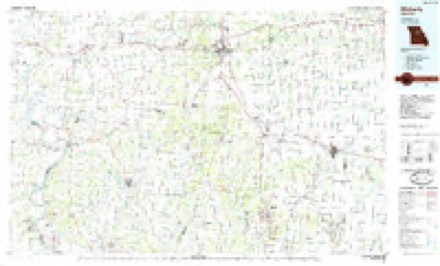
7 surveys from 15 printed sheetsMatched by testing this settlement's coordinate against the published boundary of every sheet in the United States Geological Survey's historical collection. Each opens the scanned sheet at the Survey.
- 1890 USGS Glasgow quadrangle1:125000, 5 printings
- 1953 USGS Moberly quadrangle1:250000
- 1954 USGS Moberly quadrangle1:250000, 3 printings
- 1956 USGS Keytesville quadrangle1:24000, 2 printings
- 1957 USGS Moberly quadrangle1:250000
- 1960 USGS Moberly quadrangle1:250000
- 1985 USGS Moberly quadrangle1:100000, 2 printings




In the county-history sources
40,192 words on this townshipHistory of Howard and Chariton Counties, Missouri : Written and Compiled from the Most Official Authentic and Private Sources, Including a History of Its Townships, Towns, and Villages, Together with a Condensed History of Missouri .., published 1883 names this settlement in its chapter on Bowling Green Township. These are the passages that mention it, exactly as the scans read.
The southwest corner of this township touches the Missouri river. Much of the township is bottom land and remarkably productive. The upland is also very fertile and constitutes tine farming land. One-fourth the area of the to\vuship is timbered. There are several Indian mounds along the line of the bluffs, and many relics of a prehistoric race have been found in them. The streams are Palmer creek, Lake and Lost creeks. There are a number of sloughs and lakelets. Coal has been mined to some extent at Dalton. Sandstone has been quarried in the township and is very hard in its character.
Passage source: History of Howard and Chariton Counties, Missouri : Written and Compiled from the Most Official Authentic and Private Sources, Including a History of Its Townships, Towns, and Villages, Together with a Condensed History of Missouri .., published 1883.
The first business house in Dalton was erected by Vcach Ov. flyers. The Wabash, St. Louis and Pacitic Railroad Company put up a good and commodious depot ; the ground upon which it stands, including about forty acres in the town, was donated to the railroad company by Mr. Dalton.
Passage source: History of Howard and Chariton Counties, Missouri : Written and Compiled from the Most Official Authentic and Private Sources, Including a History of Its Townships, Towns, and Villages, Together with a Condensed History of Missouri .., published 1883.
Prominent among the farmers is General E. W. Price, the piojn-iotor of the celel)ratcd Green Valley farm, hunted on Cowling Green ])rairie, four miles south of Dalton, ten miles east of Brunswick, and eight miles from Ke\tesville, the eouuty seat. This, tlio home farm, embraces an area of 800 acres of tlie finest agricultural land in the State. The soil is a rich, dark loam, from eight to fifteen feet deep, and is simply inexhaustible. Of tlie entii'c area of this splendid domain it is not exaggeration to say that there is scarcely a foot not susceptible of tillage. Tlie ordinal}' yield of wheat here is twenty-live bushels to the acre, and corn produces from seventy-tive to one hundred bushels per acre. GeneiTil Price grew, in 1880, on his farm 500 acres of wheat, which gave a magnificent yield, besides a lai'geareaof corn. His extensive [tastures tuid meadows of blue grass, clover and timothy are among the tiuest in the State. Ho also operates a saw mill located on a 200 acre tract of timber laud, which turns out from 5,000 to 7,000 feet per day of lundjer. His tobacco factory is one of the finest in the State. It is a building three stories high, and 200x1^0 feet ai'ea. The drying capacity of this factory is 200,000 pounds. His stud includes twehe thoroughbreil Kentucky racers, among which are the celebrated Bill Bass, Kusticus, an.d Adclade : Irene, a gray fill}" out ot Adclade, Don and others of wide reputation, making up one of the most valualde collections of thoroughbreds in the State. The General's spacious and elegant mansion is in correspondence with the character of its splendid surroundings. General E. W. Price attained the rank of brigadier-general in the Confederate service. He i? a sou of the distinguished General Price, formerly Govei-isoi- of the State of Missouri, and w hose name is intimately interwoven with our national history. As a polished gentleman and a popular citizen, no man is better or more favorably known throughout the State than General E. \V. Price.
Passage source: History of Howard and Chariton Counties, Missouri : Written and Compiled from the Most Official Authentic and Private Sources, Including a History of Its Townships, Towns, and Villages, Together with a Condensed History of Missouri .., published 1883.
Machine-read from a century-old scan, so expect the errors a machine makes: misspelled names, dropped words, stray characters.
Read the whole chapter on Bowling Green Township - it names this place 3 more 3 times.
Fires near this place
2 since 1997Regional context, not property-specific evidence. The federal wildfire occurrence database lists 2 fires within 5 miles of Dalton between 1997 and 2014, burning about 25 acres in total. None started naturally. None was recorded as arson. Distance is straight-line from the map coordinates, so a fire counted here may appear on a neighbouring settlement's page as well.
| Reported cause | Fires |
|---|---|
| Equipment and vehicle use | 1 |
| Recreation and ceremony | 1 |
The most recent of them, most recent first, with the day each was reported and the service that recorded it.
| Date | Cause | Size | Reported by | Name on the report |
|---|---|---|---|---|
| 4 November 2014 | Recreation and ceremony | 15 acres | Missouri Department of Conservation | not named |
| 5 January 1997 | Equipment and vehicle use | 10 acres | Missouri Department of Conservation | not named |
Settlements close enough to share some of these fires:
Mines and quarries near this place
1 within 5 milesRegional context, not property-specific evidence. The federal mineral resources record lists 1 working within 5 miles of Dalton: 1 past producer. None of them still produces. What was taken out: Sand and Gravel, Construction. Distance is straight-line from the map coordinates, so a quarry counted here may appear on a neighbouring settlement's page as well.
| Where | Site | Commodity | Status | Recorded |
|---|---|---|---|---|
| Unknown - S+G | Sand and Gravel, Construction | Past Producer |
Storms near this place
3 since 2002Regional context, not property-specific evidence. The National Weather Service names Dalton in 3 storm reports between 2002 and 2019: 2 thunderstorm wind, 1 flood. No death or injury is recorded in these reports. Each account below is quoted exactly as the forecast office filed it, from the NOAA Storm Events Database, and each date opens the federal record of that event.
| When | Event | Place named | Harm | What the report says |
|---|---|---|---|---|
| March 2002 | Thunderstorm Wind | Dalton | $2,000 | Small barn blown over. |
| April 2019 | Flood | Dalton | - | Ongoing flooding along the Missouri River continued through the month of April and into May. Several roads were closed near the banks of the Missouri River. This flooding began in mid March and due to upstream releases and continued periods of heavy rain the flooding continued into May. Monetary damages are unknown despite the entry indicating 0 dollars of damages. |
| June 2015 | Thunderstorm Wind | Dalton | - | A large tree was blown down over Highway 42 as a result of a 70 mph wind gust. |
Nearest settlements
The eight closest, with where each one stands in the county. Distances are straight-line, computed from the Geographic Names Information System coordinates.
| Map | Place | Distance | Sheets |
|---|---|---|---|
| Keytesville | 3.7 miles | 15 | |
| Namrash (historical) | 4.9 miles | 15 | |
| Rockford | 5.3 miles | 15 | |
| Grand River City (historical) | 5.6 miles | 17 | |
| Missouri Village (historical) | 6.2 miles | 17 | |
| Grand Port | 6.6 miles | 17 | |
| Cazzell | 6.7 miles | 15 | |
| Brunswick | 7.7 miles | 18 |
Elsewhere
Matched on this settlement's Geographic Names Information System number rather than its name, so it cannot be a different place of the same name in another state.
| Wikipedia article on Dalton | An encyclopaedic summary. Its text is share-alike, so it is linked here rather than copied. |
| Wikidata item Q958524 | The structured record the population and elevation above come from. Public domain (CC0). |
Provenance
This settlement is recorded in the Geographic Names Information System as feature 716651. The sheet list is computed by point-in-boundary test against the United States Geological Survey's historical topographic inventory. Both are works of the United States government and carry no copyright under 17 U.S.C. 105.
Wildfire. Short, Karen C. 2022. Spatial wildfire occurrence data for the United States, 1992-2020 [FPA_FOD_20221014]. 6th Edition. Fort Collins, CO: Forest Service Research Data Archive. https://doi.org/10.2737/RDS-2013-0009.6 Collected with United States Government funding and usable without additional permissions or fees.
Mines and quarries. USGS Mineral Resources Data System (MRDS) https://mrdata.usgs.gov/mrds/ A work of the United States government, no copyright under 17 U.S.C. 105.
Storms. NOAA National Centers for Environmental Information, Storm Events Database https://www.ncei.noaa.gov/stormevents/ A work of the United States government, no copyright under 17 U.S.C. 105. Narratives are quoted verbatim from the National Weather Service report and are not edited or summarised.