 Block
From the record
5 National Register listings published here.
Sources: the National Register database, National Park Service
52 topographic sheets cover 25 settlements here, and 5 properties are on the National Register of Historic Places.
5 National Register listings published here.
Sources: the National Register database, National Park Service
Every property in this county listed on the National Register of Historic Places, with the year it was listed and the federal nomination document.
| Photograph | Property | Type | Listed | Reference |
|---|---|---|---|---|
 | Clark County Courthouse | building | 1983 | 83000976 |
| Col. Hiram M. Hiller House | building | 1986 | 86001927 | |
| James Henning House | building | 2026 | 100012641 | |
 | Montgomery Opera House | building | 1988 | 88002018 |
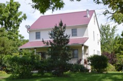 | Sickles Tavern | building | 1979 | 79001357 |
Every wildfire the federal occurrence database records inside this county: 49 of them, burning about 463 acres. None started naturally and 1 was recorded as arson. Each settlement page carries the fires within five miles of it.
| Reported cause | Fires |
|---|---|
| Debris and open burning | 29 |
| Missing data/not specified/undetermined | 16 |
| Recreation and ceremony | 1 |
| Smoking | 1 |
| Railroad operations and maintenance | 1 |
| Arson/incendiarism | 1 |
The five largest, by the area the report gives. None of them was recorded as arson.
| Date | Cause | Size | Reported by | Name on the report |
|---|---|---|---|---|
| 21 March 2016 | Missing data/not specified/undetermined | 80 acres | Missouri Department of Conservation | 135298-02309-03212016-1740 |
| 8 April 2014 | Debris and open burning | 50 acres | Iowa Department of Natural Resources | not named |
| 21 March 1997 | Debris and open burning | 50 acres | Missouri Department of Conservation | not named |
| 27 March 1997 | Debris and open burning | 40 acres | Missouri Department of Conservation | not named |
| 1 April 1997 | Smoking | 30 acres | Missouri Department of Conservation | not named |
| 24 April 2018 | Debris and open burning | 27 acres | Missouri Department of Conservation | 177055-02309-04242018-1705 |
| 11 April 1996 | Missing data/not specified/undetermined | 25 acres | Great Rivers National Wildlife Refuge | GREG LANDI |
| 26 March 1997 | Debris and open burning | 20 acres | Missouri Department of Conservation | not named |
Every settlement page carries the fires within five miles of it - see the settlement index below.
The NOAA Storm Events Database holds 340 reports for this county, causing 3 deaths, 24 injuries and about $12,064,650 in recorded property damage. Each settlement page carries the reports that name it.
| Kind of event | Reports |
|---|---|
| Thunderstorm Wind | 134 |
| Hail | 102 |
| Flash Flood | 45 |
| Flood | 33 |
| Tornado | 16 |
| Heavy Rain | 5 |
| Funnel Cloud | 3 |
| Lightning | 2 |
The most serious of them, by death, then injury, then recorded damage. The accounts are quoted exactly as the forecast office filed them.
| When | Event | Place named | Harm | What the report says |
|---|---|---|---|---|
| May 1973 | Tornado (F3) | not stated | 2 killed, 20 hurt, $2,500,000 | no account filed |
| June 2014 | Flood | Revere | 1 killed | A 68 year old male drowned in Dumas Creek near Revere, Missouri when the pick-up truck he was driving was swept into the creek. The incident occurred at a low-water crossing when the swift current pushed his truck into the creek. The man was able to exit his truck about 50 to 75 yards from the road but couldn't get himself to safety. His body was found about a half mile downstream a couple of days later. The incident occurred sometime during the evening but the exact time is unknown. A large area of rain and a few thunderstorms occurred from about noon to 4 pm with rain amounts of 2 inches reported. |
| May 1995 | Tornado (F2) | Arbela to | 3 hurt, $630,000 | A tornado touched down near Arbela damaging at least half a dozen moble homes at a camp ground. As it moved east, just north of Highway 136, several homes, businesses, barns, and outbuildings were destroyed. Two people were slightly injured when the windows in their car shattered as the vehicle was tossed around by the tornado. A woman was injured in the Granger area when the roof of her home was torn off and a 2x6 support beam fell in. The tornado crossed the county line around 1430 CST and leveled a home and nearby farm before dissipating over an open field northeast of Luray. |
| December 2017 | Tornado (EF2) | Wayland | 1 hurt, $100,000 | An NWS Storm Survey team found that an EF-2 tornado touched down in an open field southwest of Wayland, Missouri damaging trees and breaking windows. The tornado then moved east northeast over rural areas damaging trees. As the tornado approached Highway 27, it strengthened, causing EF-2 damage to power poles. The tornado hit a DOT facility, destroying doors and a salt shelter. When the tornado crossed the highway, a semi was overturned, causing one injury. The tornado crossed the Des Moines River into Iowa where it lifted. The peak estimated winds were 115 MPH. |
| May 2003 | Hail | Revere | $1,000,000 | no account filed |
| May 2003 | Hail | Athens | $1,000,000 | no account filed |
| June 2011 | Flood | Alexandria | $500,000 | Heavy rains during the second week of June caused the Fox River to flood Alexandria, MO during the third week of June. Much of the town was under flood waters. |
| May 2010 | Flood | Anson | $500,000 | Heavy rains during the second week of May resulted in the Fox River at Wayland going above the moderate flood stage level of 18 feet on May 13 around 330 pm. It crested around 19.3 feet around 1 pm May 14. It fell below the moderate flood stage level around 330 am May 15. |
| June 2010 | Flash Flood | Anson | $500,000 | Heavy rains resulted in flash flooding across much of Clark County during the evening of June 4. Water covered numerous roads across the county including Route 81 and Highway 136. Several streams and creeks overflowed their banks. |
| September 2008 | Flood | Anson | $500,000 | The Fox River near Wayland, MO experienced major flooding from the evening of September 13 to the afternoon of September 15. It crested near 20.6 feet during the early morning hours of September 15. The major flood stage level is 20.0 feet. |
| April 2014 | Lightning | St Francisville | $250,000 | Broadcast Media reported that lightning struck the Old Stone Church in St. Francsville around 4PM CDT on April 27th causing a fire. The church was built in 1853. |
| June 2011 | Flood | Anson | $250,000 | The Fox River at Wayland went above its major flood stage level of 20 feet on June 14 around 147 pm CDT. It crested around 23.09 feet around 649 am CDT June 15. It fell below the major flood stage level around 138 pm CDT June 16. |
| June 2010 | Flood | Anson | $250,000 | Heavy rains during the third week of June resulted in the Des Moines River at St. Francisville going above the moderate flood stage level of 22 feet on June 22 around 530 am. It crested around 22.8 feet around 7 am June 22. It fell below the moderate flood stage level around 930 pm June 22. |
| June 2010 | Flood | Anson | $250,000 | Heavy rains during the third week of June resulted in the Fox River at Wayland going up to the moderate flood stage level of 18 feet on June 23 around 1 am. It crested around 18 feet between 1 am and 7 am June 23. It fell below the moderate flood stage level around 7 am June 23. |
| June 2010 | Flood | Anson | $250,000 | Heavy rains during the second week of June resulted in the Des Moines River at St. Francisville going above the moderate flood stage level of 22 feet on June 13 around 12 pm. It crested around 22.2 feet around 7 pm June 13. It fell below the moderate flood stage level around 8 pm June 13. |
| May 2010 | Flood | Anson | $250,000 | Heavy rains during the second week of May resulted in the Des Moines River at St. Francisville going above the moderate flood stage level of 22 feet on May 13 around 6 am. It crested around 23 feet around 7 am May 13. It fell below the moderate flood stage level around 12 pm May 13. |
| July 2010 | Flood | Anson | $250,000 | no account filed |
| July 2010 | Flood | Anson | $250,000 | no account filed |
| August 2010 | Flood | Anson | $250,000 | no account filed |
| May 2003 | Tornado (F0) | Fairmont | $250,000 | no account filed |
| July 2003 | Thunderstorm Wind | Ashton | $200,000 | Trees down with roofs off porches |
| July 2003 | Flash Flood | Anson | $200,000 | Culvert 50% washed out; Possum Hollow Lane & CR 10 |
| June 2010 | Flood | St Francisville | $175,000 | Heavy rains during the third week of June resulted in the Mississippi River at Keokuk going above the moderate flood stage level of 17.5 feet on June 22 around 5 am. It crested around 18.6 feet around 7 pm June 22. It fell below the moderate flood stage level around 1 pm June 25.||The Mississippi River at Gregory Landing went above the moderate flood stage level of 18 feet on June 22 around 3 am. It crested around 19.7 feet around 1 am June 23. It fell below the moderate flood stage level around 8 am June 28. |
| May 2003 | Hail | Wyaconda | $150,000 | no account filed |
| June 2011 | Flood | Anson | $125,000 | The Des Moines River at St. Francisville went above its major flood stage level of 25 feet on June 14 around 1221 pm CDT. It crested around 26 feet around 7 am CDT June 15. It fell below the major flood stage level around 834 pm CDT June 15. |
| July 2010 | Flood | Anson | $125,000 | no account filed |
| August 2010 | Flood | Anson | $125,000 | no account filed |
| June 2010 | Flash Flood | Anson | $100,000 | Heavy rains resulted in widespread flash flooding of Clark County during the afternoon of June 12. Route M, Route H, and rural roads between Kahoka and Winchester were under water. |
| May 2003 | Thunderstorm Wind | Athens | $100,000 | 12 inch tree limbs down |
| July 2003 | Flash Flood | Revere | $100,000 | County Route DD partially washed out |
| July 2003 | Flash Flood | Kahoka | $100,000 | Road partially washed out Jct hwy 81 and County route C |
| July 2010 | Flood | Alexandria | $75,000 | no account filed |
| July 2003 | Thunderstorm Wind | Wayland | $70,000 | 12 to 14 inch limbs & power lines down; roof off shed |
| July 2003 | Thunderstorm Wind | Athens | $70,000 | Tree limbs down & trees topped |
| May 2014 | Thunderstorm Wind | Kahoka | $50,000 | Wind gusts estimated to be 75 mph blew down some large trees in Kahoka, MO around 350 pm CDT May 8. Some houses were damaged. |
| April 2012 | Hail | Kahoka | $50,000 | The emergency manager reports hail the size of baseballs knocked out car windows in Kahoka. |
| July 2010 | Thunderstorm Wind | Kahoka | $50,000 | Wind gusts estimated to be 70 mph blew down two trees which fell onto cars in Kahoka, MO at 108 pm CDT July 24. In addition, some power lines were also blown down. |
| August 2004 | Flash Flood | North Portion | $50,000 | Thunderstorms trained across northern Clarke County producing rainfall rates of up to 1.5 inches per hour. County roads 7 and 10 west northwest of Anson were closed due to high water. County Route K north of Luray was also closed due to high water with some damage to the roadbed. |
| July 2003 | Flash Flood | Anson | $50,000 | Water over County Route V |
| April 1998 | Tornado (F1) | Wayland | $50,000 | no account filed |
| July 2003 | Flash Flood | Anson | $30,000 | Jct Hwy 81 & County Route V; also on Hwy 81 at the Iowa/Missouri State line |
| June 2011 | Flash Flood | Anson | $25,000 | Heavy rains caused some flash flooding which washed out three water lines in Clark County #1 Water District during the morning of June 27. Boil orders were issued for the affected areas which included the County Road 45 and Highway NN area, areas north of Kahoka on Highway 81, areas north of Peaksville, and users on Highway C. WGEM also contributed to this report. |
| April 1974 | Tornado (F2) | not stated | $25,000 | no account filed |
| April 2006 | Thunderstorm Wind | Kahoka | $20,000 | Downburst pushed an older style house (built early 1900s) off its foundation resulting in its collapse. The house was around 1000 square feet and in liveable but not great condition. Based on reports from the spotter, winds were estimated at 70-78 knots (80-90 mph). |
| July 2003 | Thunderstorm Wind | Kahoka | $20,000 | Large tree down |
| May 2004 | Thunderstorm Wind | Luray | $15,000 | Windows blown out of a house with numerous 8 inch limbs down. |
| July 2003 | Flash Flood | Anson | $15,000 | Water over County Route V |
| June 2010 | Hail | Alexandria | $10,000 | Ping-pong ball sized hail fell in eastern Clark County, damaging crops, roofs, and siding on homes and other buildings. |
| May 2004 | Thunderstorm Wind | Kahoka | $10,000 | Trees and power lines down; wind estimated at 55 to 60 mph |
| August 2004 | Flash Flood | Kahoka | $10,000 | Route D closed due to high water. |
| July 2003 | Hail | Anson | $10,000 | no account filed |
| June 2003 | Thunderstorm Wind | Alexandria | $10,000 | no account filed |
| May 2004 | Thunderstorm Wind | Luray | $7,000 | Numerous 6 inch trees down. |
| July 2006 | Thunderstorm Wind | Revere | $6,000 | Numerous large trees and tree limbs down in town. |
| May 2014 | Thunderstorm Wind | Kahoka | $5,000 | Wind gusts estimated to be 70 mph blew down a 14 inch diameter tree, some 6 inch diameter tree limbs, and some power poles in Kahoka, MO around 350 pm CDT May 8. |
| May 2013 | Thunderstorm Wind | Kahoka | $5,000 | Wind gusts estimated to be 70 mph uprooted some trees and blew down several 4 to 5 inch diameter branches in town. |
| June 2011 | Flash Flood | Luray | $5,000 | Heavy rains caused some flash flooding about 6 miles west of Kahoka, MO during the morning of June 20. A woman drove into a flooded gravel road and needed to be rescued from the flood waters along with her daughter. |
| June 2010 | Flash Flood | Luray | $5,000 | Heavy rains resulted in flash flooding of several roads across Clark County during the morning of June 22. Route K was closed due to flooding in the Luray area. In the Alexandria area there was significant flooding of area roads, including US Highway 61, which was closed due to flash flooding. |
| June 2010 | Flash Flood | Anson | $5,000 | Heavy rains resulted in flash flooding in parts of northeastern Clark County during the morning of June 21. Debris and a large log was washed across the road about 1.2 miles west of the intersection of County V and Highway 81. In addition, flood waters were flowing across County V about 0.5 miles west of Highway 81. Debris was also found across Highway 81 about 100 yards north of County CC. |
| June 2010 | Flash Flood | Chambersburg | $5,000 | Heavy rains resulted in flash flooding of parts of rural Chambersburg, MO during the afternoon of June 13. A gravel road was washed out. |
The Survey's mineral resources record lists 12 workings inside this county. 3 still produce and 9 are closed or unrecorded. Each settlement page carries the workings within five miles of it.
| Commodity | Workings |
|---|---|
| Stone, Crushed/Broken | 9 |
| Sand and Gravel, Construction | 2 |
| Limestone, Dimension | 1 |
| Flagstone | 1 |
The least common of them first, because a county's hundredth gravel pit says nothing its first ten did not.
| Where | Site | Commodity | Status | Recorded |
|---|---|---|---|---|
| Casey Quarry | Limestone, Dimension, Stone, Crushed/Broken | Past Producer | ||
| Story Quarry | Flagstone | Past Producer | ||
| Wayland Sand Pit | Sand and Gravel, Construction | Producer | ||
| Wayland Sand Plant | Sand and Gravel, Construction | Producer | ||
| Baker Quarry - #2 | Stone, Crushed/Broken | Producer | ||
| Bakers Quarry | Stone, Crushed/Broken | Past Producer | ||
| Brooks Quarry | Stone, Crushed/Broken | Past Producer | ||
| Unk | Stone, Crushed/Broken | Past Producer | ||
| Unk | Stone, Crushed/Broken | Past Producer | ||
| Unk | Stone, Crushed/Broken | Past Producer | ||
| Unk | Stone, Crushed/Broken | Past Producer | ||
| Unk | Stone, Crushed/Broken | Past Producer |
Named settlements recorded in the Geographic Names Information System, each with the topographic sheets covering it. Villages, hamlets and abandoned places alike. Each is shown with the nearest named watercourse or landform and the survey quadrangle it falls on.
Jefferson township · 63445 · On Kaylor Branch · Anson quadrangle
12 sheets, 1958 to 1990
Wyaconda township · 63453 · On Old Channel North Wyaconda River · Wyaconda quadrangle
15 sheets, 1903 to 1990
Des Moines township · 63465 · On Weaver Branch · Wayland quadrangle
17 sheets, 1903 to 1990