 Block
Anson, Missouri
12 topographic sheets cover this place, the earliest surveyed in 1958 and the latest in 1990. It stands in Grant Township. It lies in ZIP code area 52626. The Survey maps it on the Anson quadrangle.
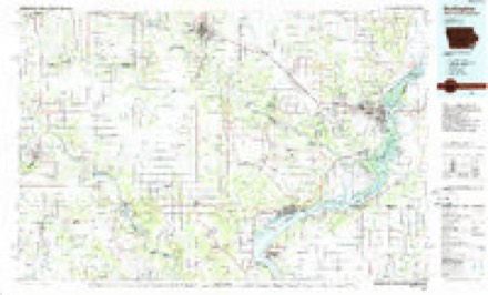
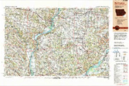
Topographic sheets covering this place
6 surveys from 12 printed sheetsMatched by testing this settlement's coordinate against the published boundary of every sheet in the United States Geological Survey's historical collection. Each opens the scanned sheet at the Survey.
- 1958 USGS Burlington quadrangle1:250000, 4 printings
- 1961 USGS Burlington quadrangle1:250000
- 1963 USGS Burlington quadrangle1:250000
- 1968 USGS Anson quadrangle1:24000, 2 printings
- 1985 USGS Burlington quadrangle1:100000, 2 printings
- 1990 USGS Burlington quadrangle1:250000, 2 printings
Fires near this place
12 since 2006Regional context, not property-specific evidence. The federal wildfire occurrence database lists 12 fires within 5 miles of Anson between 2006 and 2020, burning about 205 acres in total. None started naturally. 1 was recorded as arson. Distance is straight-line from the map coordinates, so a fire counted here may appear on a neighbouring settlement's page as well.
| Reported cause | Fires |
|---|---|
| Missing data/not specified/undetermined | 8 |
| Debris and open burning | 3 |
| Arson/incendiarism | 1 |
The most recent of them, most recent first, with the day each was reported and the service that recorded it.
| Date | Cause | Size | Reported by | Name on the report |
|---|---|---|---|---|
| 9 April 2014 | Debris and open burning | under an acre | Iowa Department of Natural Resources | not named |
| 8 April 2014 | Missing data/not specified/undetermined | 30 acres | Iowa Department of Natural Resources | not named |
| 16 April 2008 | Missing data/not specified/undetermined | under an acre | Iowa Department of Natural Resources | not named |
| 15 April 2014 | Debris and open burning | 2.0 acres | Iowa Department of Natural Resources | not named |
| 30 March 2014 | Debris and open burning | 75 acres | Iowa Department of Natural Resources | not named |
| 25 March 2008 | Missing data/not specified/undetermined | 1.0 acres | Iowa Department of Natural Resources | not named |
| 25 March 2008 | Missing data/not specified/undetermined | 60 acres | Iowa Department of Natural Resources | not named |
| 25 March 2008 | Missing data/not specified/undetermined | under an acre | Iowa Department of Natural Resources | not named |
Settlements close enough to share some of these fires:
Mines and quarries near this place
2 within 5 milesRegional context, not property-specific evidence. The federal mineral resources record lists 2 workings within 5 miles of Anson: 2 producers. All of them still produce. What was taken out: Stone, Crushed/Broken, Sand and Gravel, Construction. Distance is straight-line from the map coordinates, so a quarry counted here may appear on a neighbouring settlement's page as well.
| Where | Site | Commodity | Status | Recorded |
|---|---|---|---|---|
| Camanche Quarry | Stone, Crushed/Broken | Producer | ||
| Farmington Pit | Sand and Gravel, Construction | Producer |
Storms near this place
60 of 64 shownRegional context, not property-specific evidence. The National Weather Service names Anson in 64 storm reports between 2000 and 2026: 20 thunderstorm wind, 14 hail, 14 flood, 12 flash flood. No death or injury is recorded in these reports. Each account below is quoted exactly as the forecast office filed it, from the NOAA Storm Events Database, and each date opens the federal record of that event.
| When | Event | Place named | Harm | What the report says |
|---|---|---|---|---|
| May 2010 | Flood | Anson | $500,000 | Heavy rains during the second week of May resulted in the Fox River at Wayland going above the moderate flood stage level of 18 feet on May 13 around 330 pm. It crested around 19.3 feet around 1 pm May 14. It fell below the moderate flood stage level around 330 am May 15. |
| June 2010 | Flash Flood | Anson | $500,000 | Heavy rains resulted in flash flooding across much of Clark County during the evening of June 4. Water covered numerous roads across the county including Route 81 and Highway 136. Several streams and creeks overflowed their banks. |
| September 2008 | Flood | Anson | $500,000 | The Fox River near Wayland, MO experienced major flooding from the evening of September 13 to the afternoon of September 15. It crested near 20.6 feet during the early morning hours of September 15. The major flood stage level is 20.0 feet. |
| June 2011 | Flood | Anson | $250,000 | The Fox River at Wayland went above its major flood stage level of 20 feet on June 14 around 147 pm CDT. It crested around 23.09 feet around 649 am CDT June 15. It fell below the major flood stage level around 138 pm CDT June 16. |
| June 2010 | Flood | Anson | $250,000 | Heavy rains during the third week of June resulted in the Des Moines River at St. Francisville going above the moderate flood stage level of 22 feet on June 22 around 530 am. It crested around 22.8 feet around 7 am June 22. It fell below the moderate flood stage level around 930 pm June 22. |
| June 2010 | Flood | Anson | $250,000 | Heavy rains during the third week of June resulted in the Fox River at Wayland going up to the moderate flood stage level of 18 feet on June 23 around 1 am. It crested around 18 feet between 1 am and 7 am June 23. It fell below the moderate flood stage level around 7 am June 23. |
| June 2010 | Flood | Anson | $250,000 | Heavy rains during the second week of June resulted in the Des Moines River at St. Francisville going above the moderate flood stage level of 22 feet on June 13 around 12 pm. It crested around 22.2 feet around 7 pm June 13. It fell below the moderate flood stage level around 8 pm June 13. |
| May 2010 | Flood | Anson | $250,000 | Heavy rains during the second week of May resulted in the Des Moines River at St. Francisville going above the moderate flood stage level of 22 feet on May 13 around 6 am. It crested around 23 feet around 7 am May 13. It fell below the moderate flood stage level around 12 pm May 13. |
| July 2010 | Flood | Anson | $250,000 | no account filed |
| July 2010 | Flood | Anson | $250,000 | no account filed |
| August 2010 | Flood | Anson | $250,000 | no account filed |
| July 2003 | Flash Flood | Anson | $200,000 | Culvert 50% washed out; Possum Hollow Lane & CR 10 |
| June 2011 | Flood | Anson | $125,000 | The Des Moines River at St. Francisville went above its major flood stage level of 25 feet on June 14 around 1221 pm CDT. It crested around 26 feet around 7 am CDT June 15. It fell below the major flood stage level around 834 pm CDT June 15. |
| July 2010 | Flood | Anson | $125,000 | no account filed |
| August 2010 | Flood | Anson | $125,000 | no account filed |
| June 2010 | Flash Flood | Anson | $100,000 | Heavy rains resulted in widespread flash flooding of Clark County during the afternoon of June 12. Route M, Route H, and rural roads between Kahoka and Winchester were under water. |
| July 2003 | Flash Flood | Anson | $50,000 | Water over County Route V |
| July 2003 | Flash Flood | Anson | $30,000 | Jct Hwy 81 & County Route V; also on Hwy 81 at the Iowa/Missouri State line |
| June 2011 | Flash Flood | Anson | $25,000 | Heavy rains caused some flash flooding which washed out three water lines in Clark County #1 Water District during the morning of June 27. Boil orders were issued for the affected areas which included the County Road 45 and Highway NN area, areas north of Kahoka on Highway 81, areas north of Peaksville, and users on Highway C. WGEM also contributed to this report. |
| July 2003 | Flash Flood | Anson | $15,000 | Water over County Route V |
| July 2003 | Hail | Anson | $10,000 | no account filed |
| June 2010 | Flash Flood | Anson | $5,000 | Heavy rains resulted in flash flooding in parts of northeastern Clark County during the morning of June 21. Debris and a large log was washed across the road about 1.2 miles west of the intersection of County V and Highway 81. In addition, flood waters were flowing across County V about 0.5 miles west of Highway 81. Debris was also found across Highway 81 about 100 yards north of County CC. |
| July 2003 | Hail | Anson | $5,000 | no account filed |
| July 2003 | Heavy Rain | Anson | $5,000 | no account filed |
| September 2005 | Thunderstorm Wind | Anson | $4,000 | Corn was flattened on the Verkruyse Farm just south of County Route V. On the Gaston Farm just north of County V, a 12 inch diameter ash tree was felled along with a few shingles being pulled off an outbuilding. West of the intersection of County Route V and Highway 81 a telephone pole was snapped off at the base. |
| August 2005 | Thunderstorm Wind | Anson | $2,000 | Thunderstorm downburst snapped two 12 inch diameter trees off at the base; one tree each at separate farms a mile apart. |
| July 2003 | Heavy Rain | Anson | $2,000 | in 90 minutes |
| June 2000 | Thunderstorm Wind | Anson | $2,000 | Strong winds damaged a metal roof on a building and downed several tree limbs. |
| June 2005 | Thunderstorm Wind | Anson | $1,000 | 15 inch diameter tree down at the junction of County Route V and highway 81. |
| July 2003 | Heavy Rain | Anson | $1,000 | Fell in 10 minutes |
| March 2026 | Hail | Anson | - | A trained spotter reported a lot of dime to nickel size hail. |
| June 2024 | Thunderstorm Wind | Anson | - | There was a 6 inch diameter tree branch downed by the thunderstorm winds. |
| August 2024 | Thunderstorm Wind | Anson | - | A large tree branch was blown down, and a pine tree was uprooted. The time was estimated from radar data. |
| June 2022 | Thunderstorm Wind | Anson | - | A strong thunderstorm wind gust blew a 12 inch diameter tree onto a fence. Time of report was estimated from radar. |
| June 2020 | Flash Flood | Anson | - | A trained spotter reported that water was now coming up over the gravel road (Clark County Road 7) near her house. The spotter also reported that water was coming up over Road U as well which was north of their location. |
| June 2020 | Flash Flood | Anson | - | A trained spotter reported water over Highway V. |
| June 2018 | Thunderstorm Wind | Anson | - | A 12 inch diameter tree was blown down. |
| June 2018 | Thunderstorm Wind | Anson | - | A trained spotter estimated winds of 60 to 65 mph. |
| July 2018 | Thunderstorm Wind | Anson | - | Local broadcast media reported a large tree, several feet in diameter down at the intersection of of Missouri Highway 81 and County V. |
| July 2018 | Thunderstorm Wind | Anson | - | A trained spotter estimated winds gusting to 60 mph. |
| June 2015 | Thunderstorm Wind | Anson | - | A five inch diameter tree branch was blown down. |
| June 2015 | Hail | Anson | - | Pea to dime size hail was reported. |
| April 2014 | Thunderstorm Wind | Anson | - | A trained spotter reported that a 12X8 foot cow shed was flipped over. |
| June 2012 | Thunderstorm Wind | Anson | - | Wind gusts estimated to be 70 mph destroyed a machine shed at the intersection of State Highway 81 and County Road V about 1 mile north northeast of Anson, MO at 514 pm CDT June 16. |
| June 2012 | Thunderstorm Wind | Anson | - | Wind gusts estimated to be 60 mph broke a six inch limb off of a pear tree about 4 miles west northwest of Anson, MO at 518 pm CDT June 16. |
| June 2012 | Thunderstorm Wind | Anson | - | Wind gusts estimated to be 60 mph were observed about 4 miles west northwest of Anson, MO at 526 pm CDT June 16. |
| June 2012 | Hail | Anson | - | Nickel sized hail fell about 4 miles west northwest of Anson, MO at 526 pm CDT June 16. |
| June 2011 | Flash Flood | Anson | - | Heavy rains resulted in flash flooding across much of Clark County MO during the morning of June 14. Streets were flooded in Kahoka, MO and Routes A, D, K, NN, and AA were all closed due to flooding. |
| August 2009 | Flash Flood | Anson | - | Heavy rains resulted in flash flooding in parts of Clark County during the late afternoon and evening of August 27. The flood waters washed gavel 3 inches deep onto Highway 81 about 1.5 miles north of the Fox River Bridge or about 4 miles north northwest of Kahoka, MO just before 6 pm. |
| April 2008 | Thunderstorm Wind | Anson | - | Winds estimated to be 60 mph blew down a 4 inch diameter branch about 15 feet long off of a willow tree about 10 miles north of Luray. Delayed report. Time estimated. The trained spotter was not at home when it occurred. |
| July 2008 | Thunderstorm Wind | Anson | - | Wind gusts estimated to be 65 mph snapped a 14 inch diameter tree off near the ground about 5 miles southwest of Farmington, IA or about 2 miles west northwest of Anson, MO at 700 pm July 27. |
| July 2008 | Thunderstorm Wind | Anson | - | Wind gusts estimated to be 65 mph blew down two trees on Highway V about 10 miles north of Luray, MO around 700 pm July 27. |
| March 2006 | Hail | Anson | - | dime size hail |
| April 2006 | Hail | Anson | - | dime size hail |
| June 2006 | Thunderstorm Wind | Anson | - | 3 inch diameter branch broken. |
| August 2005 | Heavy Rain | Anson | - | 0.80 inches of rain in 25 minutes reported by cooperative observer. |
| March 2024 | Hail | Anson | - | no account filed |
| March 2024 | Hail | Anson | - | no account filed |
| August 2021 | Hail | Anson | - | no account filed |
| June 2021 | Hail | Anson | - | no account filed |
Nearest settlements
The eight closest, with where each one stands in the county. Distances are straight-line, computed from the Geographic Names Information System coordinates.
| Map | Place | Distance | Sheets |
|---|---|---|---|
| Athens | 3.6 miles | 12 | |
| Acasto | 3.9 miles | 12 | |
| Chambersburg | 4.1 miles | 12 | |
| Peaksville | 6.1 miles | 12 | |
| Revere | 7.4 miles | 17 | |
| Dumas | 7.9 miles | 12 | |
| Ashton | 9.3 miles | 16 | |
| Medill | 9.9 miles | 16 |
Provenance
This settlement is recorded in the Geographic Names Information System as feature 740627. The sheet list is computed by point-in-boundary test against the United States Geological Survey's historical topographic inventory. Both are works of the United States government and carry no copyright under 17 U.S.C. 105.
Wildfire. Short, Karen C. 2022. Spatial wildfire occurrence data for the United States, 1992-2020 [FPA_FOD_20221014]. 6th Edition. Fort Collins, CO: Forest Service Research Data Archive. https://doi.org/10.2737/RDS-2013-0009.6 Collected with United States Government funding and usable without additional permissions or fees.
Mines and quarries. USGS Mineral Resources Data System (MRDS) https://mrdata.usgs.gov/mrds/ A work of the United States government, no copyright under 17 U.S.C. 105.
Storms. NOAA National Centers for Environmental Information, Storm Events Database https://www.ncei.noaa.gov/stormevents/ A work of the United States government, no copyright under 17 U.S.C. 105. Narratives are quoted verbatim from the National Weather Service report and are not edited or summarised.