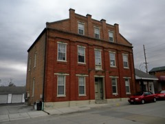
Block
From the record
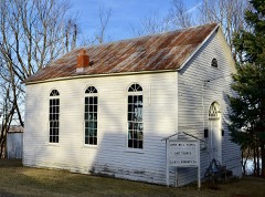
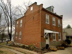
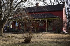
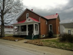
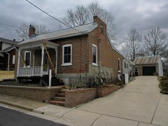
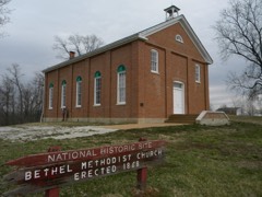
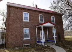
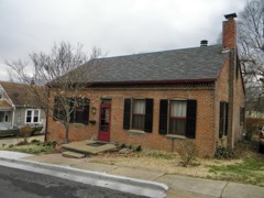
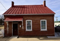
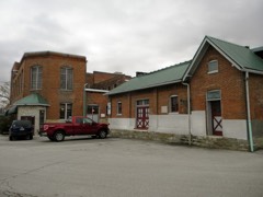
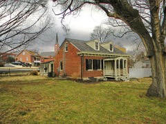
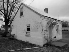
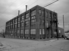
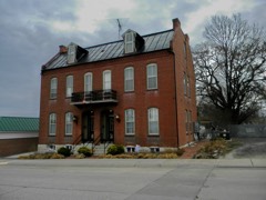
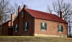
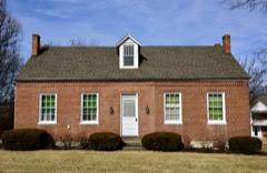
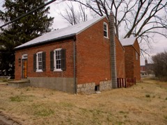
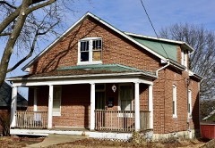
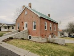
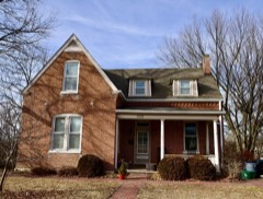
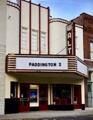
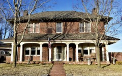
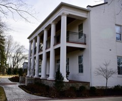
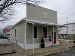
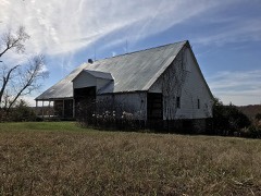
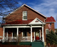
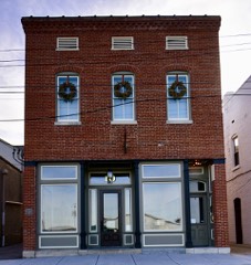
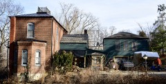
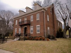
61 National Register listings published here.
Sources: the National Register database, National Park Service
141 topographic sheets cover 80 settlements here, and 61 properties are on the National Register of Historic Places.
61 National Register listings published here.
Sources: the National Register database, National Park Service
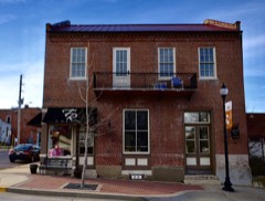
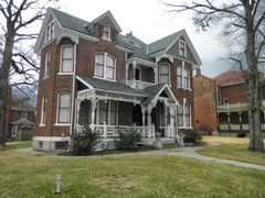
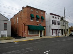
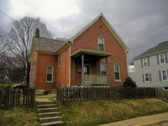
Every property in this county listed on the National Register of Historic Places, with the year it was listed and the federal nomination document.
Every wildfire the federal occurrence database records inside this county: 321 of them, burning about 1,718 acres. 2 started naturally and 19 were recorded as arson. Each settlement page carries the fires within five miles of it.
| Reported cause | Fires |
|---|---|
| Debris and open burning | 184 |
| Missing data/not specified/undetermined | 77 |
| Arson/incendiarism | 19 |
| Equipment and vehicle use | 13 |
| Recreation and ceremony | 10 |
| Smoking | 8 |
| Misuse of fire by a minor | 6 |
| Natural | 2 |
| Railroad operations and maintenance | 1 |
| Power generation/transmission/distribution | 1 |
The five largest, by the area the report gives. Two of them were set deliberately.
| Date | Cause | Size | Reported by | Name on the report |
|---|---|---|---|---|
| 29 October 1999 | Debris and open burning | 360 acres | Missouri Department of Conservation | not named |
| 12 March 2017 | Missing data/not specified/undetermined | 81 acres | Missouri Department of Conservation | not named |
| 20 February 1995 | Debris and open burning | 75 acres | Missouri Department of Conservation | not named |
| 11 November 1999 | Missing data/not specified/undetermined | 50 acres | Missouri Department of Conservation | not named |
| 1 December 1994 | Arson/incendiarism | 42 acres | Missouri Department of Conservation | not named |
| 8 March 2003 | Debris and open burning | 40 acres | Missouri State Fire Marshal's Office | not named |
| 14 April 1995 | Arson/incendiarism | 36 acres | Missouri Department of Conservation | not named |
| 9 July 2017 | Debris and open burning | 35 acres | Missouri Department of Conservation | not named |
Every settlement page carries the fires within five miles of it - see the settlement index below.
The NOAA Storm Events Database holds 733 reports for this county, causing 6 deaths, 43 injuries and about $107,232,147 in recorded property damage. Each settlement page carries the reports that name it.
| Kind of event | Reports |
|---|---|
| Thunderstorm Wind | 345 |
| Hail | 301 |
| Flash Flood | 36 |
| Tornado | 35 |
| Flood | 10 |
| Heavy Rain | 3 |
| Lightning | 2 |
| Funnel Cloud | 1 |
The most serious of them, by death, then injury, then recorded damage. The accounts are quoted exactly as the forecast office filed them.
| When | Event | Place named | Harm | What the report says |
|---|---|---|---|---|
| August 1996 | Thunderstorm Wind | Washington | 3 killed, 6 hurt | no account filed |
| May 2000 | Flash Flood | Countywide | 2 killed, $100,000,000 | A thunderstorm complex dropped up to 14 inches of rain on Franklin County from about Midnight to 6 am causing the worst flash flooding in county history. The rain fell at a rate of 3 inches an hour from about 2 to 3 am. A joint Federal-State Damage Assessment Team conducted for individual assistance determined that 98 structures were destroyed, 68 suffered major damage, 181 minor damage, and another 32 affected. Only 11% of the affected residences had insurance coverage. Greater than 60% of the families and individuals affected were in the low income bracket. Over 50 roads were closed at various times due to flooding. Almost every stream and creek in the county overflowed their banks. The worst flooding was in Union, MO. Flat Creek rose an estimated 15 feet and completely destroyed 2 mobile home parks. Miraculously, no one was killed in the parks as emergency workers acted quickly to evacuate the residents just before the major flooding started. 2 people were killed due to the flooding, both in vehicles. A 19 year-old female was killed when her van flipped over after driving into a flooded road. 6 other people in the van managed to escape. A 67 year-old man was killed near St. Clair when he tried to drive through a flooded low-water crossing. On the west side of Washington, MO. St. John's Creek rose an estimated 15 to 20 feet and caused major damage at the Industrial Park on the west side of town. About 2 dozen homes on the east side of town suffered flooded basements due to flooding from DuBouis and Busch Creeks. In St. Clair, the sewage treatment facility was damaged by a flooding Happy Sac Creek. |
| August 1996 | Thunderstorm Wind | St Clair | 1 killed | no account filed |
| February 1956 | Tornado (F4) | not stated | 16 hurt, $250,000 | no account filed |
| April 2013 | Thunderstorm Wind | Sullivan | 11 hurt | A microburst caused minor damage at Sullivan Regional Airport. A small section of one hanger was removed with a door of a nearby hanger also sustaining damage. Also, one private aircraft sustained minor damage. The AWOS recorded a wind gust of 101 mph with this microburst. Further downstream the damage from the microburst was sporadic. About a mile east southeast of the airport, south of I-44, the winds destroyed a vacant mobile home and caused considerable damage to 5 other mobile homes. One of the mobile homes had a large tree land on it, but only caused minor roof damage. No one was inside the destroyed mobile home at the time. However, three residents of the trailer park were taken to the hospital with minor injuries and eight other people walked into the hospital to be treated for minor injuries as well. |
| December 1982 | Tornado (F2) | not stated | 2 hurt, $250,000 | no account filed |
| November 2015 | Flood | Beemont | 2 hurt | Between 3 and 5 inches of rain fell over two days in Franklin County. This caused streams, creeks and low water crossings to flood. Two teenagers drove into a flooded roadway on Kriete Creek Road, south of Gerald, and became stranded in floodwater from Red Oak Creek, west of a bridge. The teens climbed to the roof of the vehicle. A rescue team retrieved them from the vehicle by boat. They only had minor injuries. |
| August 2012 | Thunderstorm Wind | Washington | 2 hurt | Thunderstorm winds caused widespread tree and power line damage across Washington. Two people sustained minor injuries from flying debris in the parking lot of the Washington Town and Country Fair. Also, several tents were blown down. Fortunately, the fair grounds had been evacuated. |
| June 2005 | Thunderstorm Wind | Washington | 2 hurt | no account filed |
| June 2014 | Thunderstorm Wind | Jeffriesburg | 1 hurt | Thunderstorm winds blew down several large trees and numerous tree limbs. Five miles west of Union on Highway AJ, three power poles were snapped. In Union, a man was briefly trapped in his car by fallen trees. He only sustained minor injuries. |
| July 2006 | Thunderstorm Wind | Pacific | 1 hurt | Numerous trees, tree limbs and power lines were blown down. One of the trees fell onto a trailer home injuring a woman inside of it. She suffered head and neck injuries. She was treated and released from the hospital. Also, several windows in a home were blown out. |
| December 2015 | Flood | Berger | $2,000,000 | Between 6 and 9 inches of rain fell across Franklin County during a 2 day period. All of this rain caused the creeks and rivers to rise. The Meramec River, Bourbeuse River and Missouri River all went into major flood with several points cresting at record levels. Almost 415 structures were either damaged or destroyed from the river flooding, with Union and Pacific being the worst hit in Franklin County. Damage estimates so far were around $2 million. |
| March 2025 | Tornado (EF2) | Villa Ridge | $1,500,000 | A tornado developed at 8:56pm on March 14th, 2025 on the east side of Villa Ridge, between American Inn Road and Saint Marys Road north of I-44. The tornado very quickly intensified as it moved into a neighborhood near the intersection of Interstate 44 and US Highway 100. In that neighborhood, the tornado damaged numerous homes, making several of them uninhabitable. The strongest estimated wind speeds in this neighborhood were estimated at 130 mph, based on significant damage to three of these homes. The tornado continued to the northeast, damaging an industrial facility before moving into a heavily wooded area in northeastern Franklin county. Here, the tornado resulted in a narrow track of concentrated, intense tree damage. There were also a number of homes in the path that sustained damage. Before crossing into St. Louis County, the tornado hit a microwave tower, knocking the top portion of the tower to the ground. These winds were also estimated to be 130mph. |
| April 2000 | Hail | St Clair | $500,000 | Storm spotters reported 1 1/2 inch hail. Newspaper accounts later reported numerous reports of broken windows, cracked windshields, and damaged roofs. |
| April 1994 | Thunderstorm Wind | New Haven | $500,000 | A mobile home was severely damaged after being turned over from high wind. Trees were also uprooted, a barn damaged, and windows blown out. Reported by a local newspaper. |
| April 1994 | Tornado (F0) | New Haven | $500,000 | A small tornado touched down just southwest of New Haven damaging the roof of a house. As the storm moved quickly east-northeast, it peeled the roof of a oil station off and pushed telephone poles along County Road C over. Just before crossing Highway 100, the tornado caused minor damage to the corner of a barn and snapped numerous large trees in half. The tornado lifted shortly after damaging a chicken house north of Highway 100. Witnesses said marble-size hail covered the ground and the storm sounded like a train passing by. |
| September 1993 | Tornado (F1) | Beaufort to | $500,000 | A narrow tornado touched down 5 miles north-northeast of Beaufort and tracked towards Washington. Damage was intermittent with numerous trees snapped off or knocked down. As many as 30 homes west and southwest of Washington had damage to roofs, siding, gazebos, or fences. |
| April 1980 | Tornado (F2) | not stated | $250,000 | no account filed |
| March 2025 | Tornado (EF1) | Elmont | $148,000 | At 8:29 PM a tornado began near the community of Elmont, MO, producing EF1 damage primarily to trees and one large barn. The tornado moved quickly to the northeast, and produced additional tree damage along Missouri route 185, and along Ridge Road within the Long Ridge Conservation Area. The tornado then continued northeast before ending very near Highway 47. Near the end of its path, the tornado damaged several homes, outbuildings, telephone poles and trees within the southern outskirts of Union, MO. The most significant of this damage occurred near N Bend Road, where damage to a home and barn suggested maximum wind speeds of approximately 105 miles per hour. |
| April 2000 | Thunderstorm Wind | New Haven | $100,000 | Thunderstorm wind gusts cause quite a bit of damage in the New Haven area. The roof of a gymnasium at a local school was blown off. Other homes suffered roof damage and numerous trees and power lines were downed. |
| April 1998 | Hail | Lonedell | $50,000 | Baseball size hail was reported in the Lonedel/Luebbering area. Wind-blown hail knocked holes in siding on homes, broke windows and windshields and dented cars. |
| April 1994 | Thunderstorm Wind | Washington | $50,000 | County officials reported roof damage to various homes in Washington. Several sheds and part of the fire department roof was damaged in Union. A radio station also sustained tower damage and was off the air for a period of time. |
| April 1994 | Thunderstorm Wind | Union | $50,000 | County officials reported roof damage to various homes in Washington. Several sheds and part of the fire department roof was damaged in Union. A radio station also sustained tower damage and was off the air for a period of time. |
| April 1993 | Thunderstorm Wind | Japan | $50,000 | Numerous trees were blown down and a barn roof destroyed in Japan. The county Emergency Management office also reported 0.75-inch-diameter hail along with wind gusts to 58 mph. Many trees were downed and electric poles blown over across central and eastern sections of the county. |
| September 1993 | Tornado (F0) | Washington | $50,000 | A tornado produced a 2-mile-track of minor damage to a few homes and trees southwest of Washington along County Road A. Damage was mainly to roofs and was not continuous. |
| December 2010 | Tornado (EF1) | Krakow | $40,000 | A tornado touched down along Country Club Road and produced minor tree damage. It continued to the northeast and struck Rivendell Farms, a horse farm, where it removed the majority of the roof from a large metal pole barn and caused minor injuries to one horse. Another outbuilding sustained roof damage and the residence had some shingles blown off. Also, a thirty five foot radio tower was blown down. The damage to the pole barn is rated EF1 intensity while the rest of the damage at this location is EF0. The tornado crossed Country Club Road near a sharp curve to the west. A house had shingles missing at this location as well as minor tree damage. The tornado lifted just past this point. |
| March 2025 | Tornado (EF1) | Boeufcreek | $35,000 | At approximately 8:33 PM a tornado began south of Kohl City, MO in Franklin County and continued northeastward for 5.5 miles before dissipating just southwest of Etlah, MO in Franklin County around 8:39 PM. Most damage was confined to tree limbs, but a few structures were damaged closer to Etlah. This tornado was assigned a rating of EF-1 with a maximum wind speed of 105 mph. |
| April 2024 | Thunderstorm Wind | Washington | $30,000 | There were reports of multiple downed trees and large branches in Washington impacting homes and power lines. AWOS at Washington Regional Airport reported a 72 mph gust at the time. |
| May 2022 | Tornado (EF1) | Greenstreet | $30,000 | A brief tornado occurred south of Leslie, MO in Franklin County. The tornado moved north-northwest through wooded areas producing tree damage. Maximum estimated wind speed was 100 mph. Overall, the tornado was rated EF1 with a path length of 1.27 miles and a max path width of 100 yards. No deaths or injuries were reported. |
| December 2021 | Thunderstorm Wind | Stanton | $25,000 | Widespread wind damage across Franklin County. A large tree was blown down onto roadway along St. Louis Inn Road about 5 miles southwest of St. Clair. Another large tree was blown down on to Highway 47 near intersection with Eastview Drive. On the southwest side of Union, several power lines were blown down at the intersection of Koelling Avenue and West Springfield Avenue. About 3 miles north northwest of Moselle, there were numerous trees damaged or uprooted, as well as damage to a car port, power lines blown down and damage to several roofs. Several trees were blown over on the northwest side of Pacific. |
| August 1965 | Tornado (F1) | not stated | $25,000 | no account filed |
| March 1954 | Tornado (F1) | not stated | $25,000 | no account filed |
| March 1954 | Tornado (F2) | not stated | $25,000 | no account filed |
| May 2022 | Thunderstorm Wind | Anaconda | $20,000 | Thunderstorm winds blew a large tree down onto a house causing moderate roof damage. |
| May 2022 | Tornado (EF0) | Anaconda | $20,000 | A tornado touched down around 4:16 PM along Anaconda Road approximately 2 miles southwest of St. Clair, MO in Franklin County. The tornado produced tree damage along its path as it headed north-northwest. It dissipated around 4:18 PM just south of Route WW. Overall, the tornado was rated EF0 with a path length of 2.53 miles and a max path width of 50 yards. No deaths or injuries were reported. |
| March 2026 | Thunderstorm Wind | Moselle | $15,000 | Thunderstorm winds removed the roofing of an outbuilding at an animal rescue. |
| May 2024 | Flash Flood | Sullivan | $10,000 | Multiple sources including the Department of Highways, law enforcement, and emergency management reported flooding in and around Sullivan, Stanton, Gerald, and Piney Park. Reports include water running over over roadways and deep pooling in yards in Sullivan and in the Melody Lakes subdivision near Gerald. Water was reported across east and westbound I-44 at mile marker 230. Missouri State Highway Patrol closed Highway 185 at East Vine in Sullivan due to a water rescue. They also closed Highway K and Chapel Hill Road near Piney Park. |
| May 2024 | Thunderstorm Wind | Sullivan Mem Arpt | $10,000 | A large tree was uprooted near Sullivan. In the same area, there was roof damage to a home including damage to the eaves and lifted shingles on one corner of the roof. |
| April 2023 | Thunderstorm Wind | Sullivan Mem Arpt | $10,000 | Thunderstorm winds snapped off a large tree at it's base. Also, numerous tree limbs were blown down around town. |
| May 2022 | Thunderstorm Wind | Noser Mill | $10,000 | Thunderstorm winds blew over a power pole as well as numerous tree limbs near Highway 185 just south of Beaufort. |
| June 2022 | Thunderstorm Wind | Gildehouse | $10,000 | Thunderstorm winds blew down numerous large tree limbs across portions of northeastern Franklin County, especially in Gray Summit, Labadie and Pacific. |
| December 2021 | Thunderstorm Wind | Gerald | $10,000 | A wide swath of damaging winds across Franklin County. In Gerald, several phone and power lines were blown down in town. Several large trees and power lines were blown down on Camp Mo-Val Road, as well as North Bend Loop, southwest of Union. Additional power lines were blown down in St. Clair. About 3 miles west northwest of Robertsville, a large tree was blown over onto Highway O near intersection with Route AM. |
| July 2007 | Thunderstorm Wind | Washington | $10,000 | Thunderstorm winds caused scattered tree damage in Washington. A large tree limb fell on a house on West Fourth Street causing some roof damage. Several trees and large limbs were downed along the Rotary Riverfront Trail. |
| July 2007 | Thunderstorm Wind | Pacific | $10,000 | Local emergency management reported some trees and power lines down in Pacific. About half the town lost power for 4 - 5 hours. |
| October 2001 | Thunderstorm Wind | Washington | $10,000 | no account filed |
| July 2001 | Thunderstorm Wind | Union | $8,000 | no account filed |
| July 2021 | Thunderstorm Wind | Labadie | $7,000 | Thunderstorm winds blew down numerous large tree limbs in Labadie. In Gray Summit, two trees were blown over onto structures near Highway 100, causing moderate damage. |
| May 1996 | Thunderstorm Wind | New Haven | $7,000 | no account filed |
| July 2022 | Thunderstorm Wind | Lonedell | $5,000 | Thunderstorm winds blew down several large tree limbs and caused minor shingle damage to a couple of homes. |
| June 2022 | Thunderstorm Wind | St Clair | $5,000 | Several large tree limbs were blown down around Lake St. Clair. |
| June 2022 | Thunderstorm Wind | Spring Bluff | $5,000 | Thunderstorm winds blew down several large tree limbs onto Highway 185 north of Sullivan. |
| May 2008 | Thunderstorm Wind | Sullivan | $5,000 | A couple of power lines were downed by thunderstorm wind gusts. |
| May 2008 | Thunderstorm Wind | Villa Ridge | $5,000 | Local law enforcement reported trees and power lines down. |
| May 2007 | Flood | Berger | $5,000 | The Missouri River flooded parts of the north border of Franklin County. The City Park along the river in Washington flooded, otherwise flooding was limited to farmland and a few roads along the river. |
| July 2007 | Thunderstorm Wind | Labadie | $5,000 | Local law enforcement reported several large tree limbs blocking roads in the Labadie area. A couple of power lines were also downed. |
| September 1993 | Tornado (F0) | Saint Clair | $5,000 | A tornado touched down briefly at the 244 mile marker along Interstate 44 damaging several trees. |
| April 1993 | Thunderstorm Wind | St. Clair | $5,000 | Numerous trees were blown down and a barn roof destroyed in Japan. The county Emergency Management office also reported 0.75-inch-diameter hail along with wind gusts to 58 mph. Many trees were downed and electric poles blown over across central and eastern sections of the county. |
| April 1993 | Thunderstorm Wind | Pacific | $5,000 | Numerous trees were blown down and a barn roof destroyed in Japan. The county Emergency Management office also reported 0.75-inch-diameter hail along with wind gusts to 58 mph. Many trees were downed and electric poles blown over across central and eastern sections of the county. |
| April 1993 | Thunderstorm Wind | New Haven | $5,000 | The Franklin County EOC reported wind gusts to an estimated 60 mph along Highway 100. |
| May 2022 | Thunderstorm Wind | Jeffriesburg | $3,000 | Thunderstorm winds blew down several power lines near the intersection of U.S. Highway 50 and Route AJ. |
The Survey's mineral resources record lists 407 workings inside this county. 18 still produce and 389 are closed or unrecorded. Each settlement page carries the workings within five miles of it.
| Commodity | Workings |
|---|---|
| Fire Clay (Refractory) | 190 |
| Stone, Crushed/Broken | 71 |
| Lead | 52 |
| Iron | 27 |
| Sand and Gravel, Construction | 21 |
| Lead, Zinc | 6 |
| Barium-Barite | 5 |
| Lead, Barium-Barite | 5 |
| Barium-Barite, Lead, Zinc | 4 |
| Sulfur-Pyrite | 3 |
| Barium-Barite, Lead | 3 |
| Flagstone | 3 |
| Copper | 2 |
| Copper, Iron | 2 |
The least common of them first, because a county's hundredth gravel pit says nothing its first ten did not.
| Where | Site | Commodity | Status | Recorded |
|---|---|---|---|---|
| Busch Pit | Clay | Past Producer | ||
| Goedeke Track | Fire Clay (Refractory), Iron | Past Producer | ||
| Hamilton Prospect | Barium-Barite, Iron | Past Producer | ||
| Tamm Mine | Zinc, Lead, Barium-Barite | Past Producer | ||
| Unknown - Pb&Fe | Lead, Iron | Past Producer | ||
| Unknown - Pb,Zn,Fe | Iron, Lead, Zinc | Past Producer | ||
| Bredell Mines | Copper | Past Producer | ||
| Copper Hollow | Copper, Iron | Past Producer | ||
| Copper Hollow Mine | Iron, Copper | Past Producer | ||
| Glaser Quarry | Silica | Past Producer | ||
| Pacific Quarry | Silica | Past Producer | ||
| Shotwell Mines | Lead, Zinc, Barium-Barite | Past Producer | ||
| Sickendick Land | Iron, Lead | Past Producer | ||
| Silver Hollow Mine | Copper, Iron | Past Producer | ||
| Unknown - Copper | Copper | Past Producer | ||
| Unknown - Cu & Fe | Iron, Copper | Past Producer | ||
| Unknown -Fe&Pb | Iron, Lead | Past Producer | ||
| Vieman Mines | Lead, Zinc, Barium-Barite | Past Producer | ||
| Kasmann Quarry | Flagstone | Past Producer | ||
| Kelsey Mine | Sulfur-Pyrite | Past Producer | ||
| Rueppele Copper Mine | Sulfur-Pyrite | Past Producer | ||
| Rueppele Mine | Sulfur-Pyrite | Past Producer | ||
| Short Mine | Barium-Barite, Lead | Past Producer | ||
| Skinner Mine | Barium-Barite, Lead | Past Producer | ||
| Unknown - Clay | Flagstone | Past Producer | ||
| Unknown - Pb /Ba | Barium-Barite, Lead | Past Producer | ||
| Unknown - Ss. | Flagstone | Past Producer | ||
| Burt Shaft | Barium-Barite, Lead, Zinc | Past Producer | ||
| Dugan Hill Mine | Barium-Barite, Lead, Zinc | Past Producer | ||
| Generally Diggings | Barium-Barite, Lead, Zinc | Past Producer | ||
| Northernland Mine | Barium-Barite, Lead, Zinc | Past Producer | ||
| Jans Barite Deposit | Barium-Barite | Prospect | Underground | |
| Jans Mine | Lead, Barium-Barite | Past Producer | ||
| Jeffries Mine | Lead, Barium-Barite | Past Producer | ||
| Paine Diggings | Lead, Barium-Barite | Past Producer | ||
| Unknown - Ba | Barium-Barite | Past Producer | ||
| Unknown - Ba | Barium-Barite | Past Producer | ||
| Unknown - Ba/Pb | Lead, Barium-Barite | Past Producer | ||
| Unknown - Pb & Ba | Lead, Barium-Barite | Past Producer | ||
| Venable Property | Lead, Barium-Barite | Past Producer | ||
| Virginia Mine | Barium-Barite | Producer | ||
| Darby Mine | Lead, Zinc | Past Producer | ||
| Elliot Mine | Lead, Zinc | Past Producer | ||
| Evans Mine | Lead, Zinc | Past Producer | ||
| South Virginia Mine | Lead, Zinc | Past Producer | ||
| Unknown - Pb / Zn | Lead, Zinc | Past Producer | ||
| Unknown - Pb-Zn | Lead, Zinc | Past Producer | ||
| Gravel Plant # 1 | Sand and Gravel, Construction | Producer | ||
| Gravel Plant # 2 | Sand and Gravel, Construction | Producer | ||
| Gray Summit Pit & Plant | Sand and Gravel, Construction | Producer | ||
| Jess Laubinger S&G | Sand and Gravel, Construction | Producer | ||
| K&R Excavating S&G Pit | Sand and Gravel, Construction | Producer | ||
| Meramec Aggregates Pit & Plant | Sand and Gravel, Construction | Producer | ||
| Unknown - S&G | Sand and Gravel, Construction | Past Producer | ||
| Unknown - S&G | Sand and Gravel, Construction | Past Producer | ||
| Unknown - S&G | Sand and Gravel, Construction | Past Producer | ||
| Unknown - S&G | Sand and Gravel, Construction | Past Producer | ||
| Unknown - S&G | Sand and Gravel, Construction | Past Producer | ||
| Unknown - S&G | Sand and Gravel, Construction | Past Producer | ||
| Unknown - S&G | Sand and Gravel, Construction | Past Producer | ||
| Unknown - S&G | Sand and Gravel, Construction | Past Producer | ||
| Unknown - S&G | Sand and Gravel, Construction | Past Producer | ||
| Unknown - S&G | Sand and Gravel, Construction | Past Producer | ||
| Unknown - S&G | Sand and Gravel, Construction | Past Producer | ||
| Unknown - S&G | Sand and Gravel, Construction | Past Producer | ||
| Unknown - S&G | Sand and Gravel, Construction | Past Producer | ||
| Unknown - Sand | Sand and Gravel, Construction | Past Producer | ||
| Washington Sand Co Dredge | Sand and Gravel, Construction | Producer | ||
| Bartle Mine | Iron | Past Producer | ||
| Booth Bank | Iron | Past Producer | ||
| Booth Mine | Iron | Past Producer | ||
| Denny Prospect | Iron | Past Producer | ||
| Drake Mine | Iron | Past Producer | ||
| Duckworth Mine | Iron | Past Producer | ||
| Fisher Prospect | Iron | Past Producer | ||
| Hibbard Mine | Iron | Past Producer | ||
| Hobelman Prospect | Iron | Unknown | ||
| Hollman Diggings | Iron | Past Producer | ||
| Iron Hill Mine | Iron | Past Producer | ||
| Iron Hill Mine | Iron | Past Producer | ||
| John Buskett Iron Mine | Iron | Past Producer | ||
| Judith Spring Mine | Iron | Past Producer | ||
| Kleins Ore Bank | Iron | Past Producer | ||
| Kratz Spring | Iron | Prospect | 1956 | |
| Leslie Mine | Iron | Past Producer | ||
| Mueller Prospect | Iron | Past Producer | ||
| Newbauer Property | Iron | Past Producer | ||
| Pickles Copper Hollow Prospect | Iron | Past Producer | ||
| Pletz Mine | Iron | Past Producer | ||
| Spring Bluff Mine | Iron | Past Producer | ||
| St Clair Mine | Iron | Past Producer | ||
| Temme Pit | Iron | Past Producer | ||
| Unknown - Iron | Iron | Past Producer | ||
| Unknown - Iron | Iron | Past Producer | ||
| Wildy's Mine | Iron | Past Producer | ||
| Bellew Mine | Lead | Past Producer | ||
| Cove Mine | Lead | Past Producer | ||
| Cruz Diggings | Lead | Past Producer | ||
| Eastwood Mines | Lead | Past Producer | ||
| Enterprise Mine | Lead | Past Producer | ||
| Farrar Mine | Lead | Past Producer | ||
| Fisher Mine | Lead | Past Producer | ||
| Franks Mine | Lead | Past Producer | ||
| Giles Mine | Lead | Past Producer | ||
| Golconda Mines | Lead | Past Producer | ||
| Hamilton Mine | Lead | Past Producer | ||
| Jack Mines | Lead | Past Producer | ||
| Jeffries Mine | Lead | Past Producer | ||
| Joseph Assek Farm | Lead | Past Producer | ||
| Lolla Mines | Lead | Past Producer | ||
| Massey's Mine | Lead | Past Producer | ||
| Maupin Mine | Lead | Past Producer | ||
| Maupin Mines | Lead | Past Producer | ||
| Mount Hope Mines | Lead | Past Producer | ||
| Negro Lode | Lead | Past Producer | ||
| Peninsula Mines | Lead | Past Producer | ||
| Petroleum Lead Mine | Lead | Past Producer | ||
| Pickles Blue Tiff Mine | Lead | Past Producer | ||
| Pickles Lead Prospect | Lead | Past Producer | ||
| Pittsburg Mine | Lead | Past Producer | ||
| Powers Shaft | Lead | Past Producer | ||
| Reliance Diggings | Lead | Past Producer | ||
| Rueppele Pit | Lead | Past Producer | ||
| Scott Lode | Lead | Past Producer | ||
| Thomas Mine | Lead | Past Producer | ||
| Thomas Mines | Lead | Past Producer | ||
| Thurmond Mine | Lead | Past Producer | ||
| Unknown - Lead | Lead | Unknown | ||
| Unknown - Lead | Lead | Past Producer | ||
| Unknown - Lead | Lead | Past Producer | ||
| Unknown - Lead | Lead | Past Producer | ||
| Unknown - Lead | Lead | Past Producer | ||
| Unknown - Lead | Lead | Past Producer | ||
| Unknown - Lead | Lead | Past Producer | ||
| Unknown - Lead | Lead | Past Producer | ||
| Unknown - Lead | Lead | Past Producer | ||
| Unknown - Pb | Lead | Past Producer | ||
| Unknown - Pb | Lead | Past Producer | ||
| Unknown - Pb | Lead | Past Producer | ||
| Unknown - Pb | Lead | Past Producer | ||
| Unknown - Pb. | Lead | Past Producer | ||
| Unknown - Pb. | Lead | Past Producer | ||
| Usher Mine | Lead | Past Producer | ||
| Whitmire Mine | Lead | Past Producer | ||
| Yellow Dog Mine | Lead | Past Producer | ||
| Zark Mine | Lead | Past Producer | ||
| B&D Stone Mill | Stone, Crushed/Broken | Producer | ||
| B&D Stone Quarry | Stone, Crushed/Broken | Producer | ||
| Barber Quarry | Stone, Crushed/Broken | Past Producer | ||
| Dawson Quarry and Mill | Stone, Crushed/Broken | Producer | ||
| Dundee Quarry | Stone, Crushed/Broken | Past Producer | ||
| Glaser Quarry | Stone, Crushed/Broken | Past Producer | ||
| Grabenthine Quarry | Stone, Crushed/Broken | Unknown | ||
| Grabenthine Quarry | Stone, Crushed/Broken | Past Producer | ||
| Grays Summit Quarry | Stone, Crushed/Broken | Past Producer | ||
| Jessup Quarry | Stone, Crushed/Broken | Past Producer | ||
| McKeever Quarry | Stone, Crushed/Broken | Past Producer | ||
| McKeever Quarry | Stone, Crushed/Broken | Past Producer | ||
| New Haven Quarry | Stone, Crushed/Broken | Producer | ||
| New Haven Quarry &Mill | Stone, Crushed/Broken | Producer | ||
| Schuab Quarry | Stone, Crushed/Broken | Past Producer | ||
| Schweer Pit | Stone, Crushed/Broken | Producer | 1875 | |
| Six Flags Matls Quarry | Stone, Crushed/Broken | Producer | ||
| St. Mary's Mill | Stone, Crushed/Broken | Producer | ||
| St. Mary's Quarry | Stone, Crushed/Broken | Producer | ||
| Tavern Rock Quarry | Stone, Crushed/Broken | Past Producer | ||
| Tourville Quarry | Stone, Crushed/Broken | Producer | ||
| Unknown - Clay | Stone, Crushed/Broken | Past Producer | ||
| Unknown - Ls | Stone, Crushed/Broken | Past Producer | ||
| Unknown - Ls | Stone, Crushed/Broken | Past Producer | ||
| Unknown - Ls | Stone, Crushed/Broken | Past Producer | ||
| Unknown - Ls | Stone, Crushed/Broken | Past Producer | ||
| Unknown - Ls | Stone, Crushed/Broken | Past Producer | ||
| Unknown - Ls | Stone, Crushed/Broken | Past Producer | ||
| Unknown - Ls | Stone, Crushed/Broken | Past Producer | ||
| Unknown - Ls | Stone, Crushed/Broken | Past Producer | ||
| Unknown - Ls | Stone, Crushed/Broken | Past Producer | ||
| Unknown - Ls. | Stone, Crushed/Broken | Past Producer | ||
| Unknown - Ls. | Stone, Crushed/Broken | Past Producer | ||
| Unknown - Ls. | Stone, Crushed/Broken | Past Producer | ||
| Unknown - Ls. | Stone, Crushed/Broken | Past Producer | ||
| Unknown - Ls. | Stone, Crushed/Broken | Past Producer | ||
| Unknown - Ls. | Stone, Crushed/Broken | Past Producer | ||
| Unknown - Ls. | Stone, Crushed/Broken | Past Producer | ||
| Unknown - Ls. | Stone, Crushed/Broken | Past Producer | ||
| Unknown - Ls. | Stone, Crushed/Broken | Past Producer | ||
| Unknown - Ls. | Stone, Crushed/Broken | Past Producer | ||
| Unknown - Ls. | Stone, Crushed/Broken | Past Producer | ||
| Unknown - Ls. | Stone, Crushed/Broken | Past Producer | ||
| Unknown - Ls. | Stone, Crushed/Broken | Past Producer | ||
| Unknown - Ls. | Stone, Crushed/Broken | Past Producer | ||
| Unknown - Ls. | Stone, Crushed/Broken | Past Producer | ||
| Unknown - Ls. | Stone, Crushed/Broken | Past Producer | ||
| Unknown - Ls. | Stone, Crushed/Broken | Past Producer | ||
| Unknown - Ls. | Stone, Crushed/Broken | Past Producer | ||
| Unknown - Ls. | Stone, Crushed/Broken | Past Producer | ||
| Unknown - Ls. | Stone, Crushed/Broken | Past Producer | ||
| Unknown - Ls. | Stone, Crushed/Broken | Past Producer | ||
| Unknown - Ls. | Stone, Crushed/Broken | Past Producer | ||
| Unknown - Ls. | Stone, Crushed/Broken | Past Producer | ||
| Unknown - Ls. | Stone, Crushed/Broken | Past Producer | ||
| Unknown - Ls. | Stone, Crushed/Broken | Past Producer | ||
| Unknown - Ls. | Stone, Crushed/Broken | Past Producer | ||
| Unknown - Ls. | Stone, Crushed/Broken | Past Producer | ||
| Unknown - Ls. | Stone, Crushed/Broken | Past Producer | ||
| Unknown - Ls. | Stone, Crushed/Broken | Past Producer | ||
| Unknown - Ls. | Stone, Crushed/Broken | Past Producer | ||
| Unknown - Ls. | Stone, Crushed/Broken | Past Producer | ||
| Unknown - Ls. | Stone, Crushed/Broken | Past Producer | ||
| Unknown - Ls. | Stone, Crushed/Broken | Past Producer | ||
| Unknown - Ls. | Stone, Crushed/Broken | Past Producer | ||
| Unknown - Ls. | Stone, Crushed/Broken | Past Producer | ||
| Unknown - Ls. | Stone, Crushed/Broken | Past Producer | ||
| Unknown - Ls. | Stone, Crushed/Broken | Past Producer | ||
| Unknown - Ls. | Stone, Crushed/Broken | Past Producer | ||
| Unknown - Ss. | Stone, Crushed/Broken | Past Producer | ||
| Zier Quarry | Stone, Crushed/Broken | Past Producer | ||
| Adams Pit | Fire Clay (Refractory) | Past Producer | ||
| Bacon Pit | Fire Clay (Refractory) | Past Producer | ||
| Bingaman # 2 | Fire Clay (Refractory) | Past Producer | ||
| Brown Pit | Fire Clay (Refractory) | Past Producer | ||
| Burton Pit | Fire Clay (Refractory) | Past Producer | ||
| Copleman Pit | Fire Clay (Refractory) | Past Producer | ||
| Copleman Pits | Fire Clay (Refractory) | Past Producer | ||
| Crow Pit | Fire Clay (Refractory) | Past Producer | ||
| Cuneo Pit | Fire Clay (Refractory) | Past Producer | ||
| D.B. Farrel Pit | Fire Clay (Refractory) | Past Producer | ||
| Emile Peterson New Clay Bank | Fire Clay (Refractory) | Past Producer | ||
| Fisher Clay Bank | Fire Clay (Refractory) | Past Producer | ||
| Frederick Pit | Fire Clay (Refractory) | Past Producer | ||
| Froelker Pit | Fire Clay (Refractory) | Past Producer | ||
| Froster # 1 | Fire Clay (Refractory) | Past Producer | ||
| G.V. Redden # 222 | Fire Clay (Refractory) | Past Producer | ||
| G.V. Redden Pit # 220 | Fire Clay (Refractory) | Past Producer | ||
| G.V. Redden Pit # 223 | Fire Clay (Refractory) | Past Producer | ||
| G.V. Redden Pit #219 | Fire Clay (Refractory) | Past Producer | ||
| Gelanf Pit | Fire Clay (Refractory) | Past Producer | ||
| Henneke Pit | Fire Clay (Refractory) | Past Producer | ||
| Hibbard Bank | Fire Clay (Refractory) | Past Producer | ||
| Johnson Bank | Fire Clay (Refractory) | Past Producer | ||
| Knoop Pit | Fire Clay (Refractory) | Past Producer | ||
| Lottman Pit | Fire Clay (Refractory) | Past Producer | ||
| Maha Pit | Fire Clay (Refractory) | Past Producer | ||
| Maune Pit | Fire Clay (Refractory) | Past Producer | ||
| Menner # 3 | Fire Clay (Refractory) | Past Producer | ||
| Meyer Pit | Fire Clay (Refractory) | Past Producer | ||
| Middleton Pit | Fire Clay (Refractory) | Past Producer | ||
| Mueller Pit | Fire Clay (Refractory) | Past Producer | ||
| Peterson Banks | Fire Clay (Refractory) | Past Producer | ||
| Pilkerton # 1 | Fire Clay (Refractory) | Past Producer | ||
| Raker Pit | Fire Clay (Refractory) | Past Producer | ||
| Rennick Pit | Fire Clay (Refractory) | Past Producer | ||
| Repetto Pit | Fire Clay (Refractory) | Past Producer | ||
| Ridder Pit | Fire Clay (Refractory) | Past Producer | ||
| Ridenhour Pit | Fire Clay (Refractory) | Past Producer | ||
| Sickendick Pit | Fire Clay (Refractory) | Past Producer | ||
| Sitterman Pit | Fire Clay (Refractory) | Past Producer | ||
| Swear Pit | Fire Clay (Refractory) | Past Producer | ||
| Tenhaus Pit | Fire Clay (Refractory) | Past Producer | ||
| Toelke Pit | Fire Clay (Refractory) | Past Producer | ||
| Unknown - Clay | Fire Clay (Refractory) | Past Producer | ||
| Unknown - Clay | Fire Clay (Refractory) | Past Producer | ||
| Unknown - Clay | Fire Clay (Refractory) | Past Producer | ||
| Unknown - Clay | Fire Clay (Refractory) | Past Producer | ||
| Unknown - Clay | Fire Clay (Refractory) | Past Producer | ||
| Unknown - Clay | Fire Clay (Refractory) | Past Producer | ||
| Unknown - Clay | Fire Clay (Refractory) | Past Producer | ||
| Unknown - Clay | Fire Clay (Refractory) | Past Producer | ||
| Unknown - Clay | Fire Clay (Refractory) | Past Producer | ||
| Unknown - Clay | Fire Clay (Refractory) | Past Producer | ||
| Unknown - Clay | Fire Clay (Refractory) | Past Producer | ||
| Unknown - Clay | Fire Clay (Refractory) | Past Producer | ||
| Unknown - Clay | Fire Clay (Refractory) | Past Producer | ||
| Unknown - Clay | Fire Clay (Refractory) | Past Producer | ||
| Unknown - Clay | Fire Clay (Refractory) | Past Producer | ||
| Unknown - Clay | Fire Clay (Refractory) | Past Producer | ||
| Unknown - Clay | Fire Clay (Refractory) | Unknown | ||
| Unknown - Clay | Fire Clay (Refractory) | Past Producer | ||
| Unknown - Clay | Fire Clay (Refractory) | Past Producer | ||
| Unknown - Clay | Fire Clay (Refractory) | Past Producer | ||
| Unknown - Clay | Fire Clay (Refractory) | Past Producer | ||
| Unknown - Clay | Fire Clay (Refractory) | Past Producer | ||
| Unknown - Clay | Fire Clay (Refractory) | Past Producer | ||
| Unknown - Clay | Fire Clay (Refractory) | Past Producer | ||
| Unknown - Clay | Fire Clay (Refractory) | Past Producer | ||
| Unknown - Clay | Fire Clay (Refractory) | Past Producer | ||
| Unknown - Clay | Fire Clay (Refractory) | Past Producer | ||
| Unknown - Clay | Fire Clay (Refractory) | Past Producer | ||
| Unknown - Clay | Fire Clay (Refractory) | Past Producer | ||
| Unknown - Clay | Fire Clay (Refractory) | Past Producer | ||
| Unknown - Clay | Fire Clay (Refractory) | Past Producer | ||
| Unknown - Clay | Fire Clay (Refractory) | Past Producer | ||
| Unknown - Clay | Fire Clay (Refractory) | Past Producer | ||
| Unknown - Clay | Fire Clay (Refractory) | Past Producer | ||
| Unknown - Clay | Fire Clay (Refractory) | Past Producer | ||
| Unknown - Clay | Fire Clay (Refractory) | Past Producer | ||
| Unknown - Clay | Fire Clay (Refractory) | Past Producer | ||
| Unknown - Clay | Fire Clay (Refractory) | Past Producer | ||
| Unknown - Clay | Fire Clay (Refractory) | Past Producer | ||
| Unknown - Clay | Fire Clay (Refractory) | Past Producer | ||
| Unknown - Clay | Fire Clay (Refractory) | Past Producer | ||
| Unknown - Clay | Fire Clay (Refractory) | Past Producer | ||
| Unknown - Clay | Fire Clay (Refractory) | Past Producer | ||
| Unknown - Clay | Fire Clay (Refractory) | Past Producer | ||
| Unknown - Clay | Fire Clay (Refractory) | Past Producer | ||
| Unknown - Clay | Fire Clay (Refractory) | Past Producer | ||
| Unknown - Clay | Fire Clay (Refractory) | Past Producer | ||
| Unknown - Clay | Fire Clay (Refractory) | Past Producer | ||
| Unknown - Clay | Fire Clay (Refractory) | Past Producer | ||
| Unknown - Clay | Fire Clay (Refractory) | Past Producer | ||
| Unknown - Clay | Fire Clay (Refractory) | Past Producer | ||
| Unknown - Clay | Fire Clay (Refractory) | Past Producer | ||
| Unknown - Clay | Fire Clay (Refractory) | Past Producer | ||
| Unknown - Clay | Fire Clay (Refractory) | Past Producer | ||
| Unknown - Clay | Fire Clay (Refractory) | Past Producer | ||
| Unknown - Clay | Fire Clay (Refractory) | Past Producer | ||
| Unknown - Clay | Fire Clay (Refractory) | Past Producer | ||
| Unknown - Clay | Fire Clay (Refractory) | Past Producer | ||
| Unknown - Clay | Fire Clay (Refractory) | Past Producer | ||
| Unknown - Clay | Fire Clay (Refractory) | Past Producer | ||
| Unknown - Clay | Fire Clay (Refractory) | Past Producer | ||
| Unknown - Clay | Fire Clay (Refractory) | Past Producer | ||
| Unknown - Clay | Fire Clay (Refractory) | Past Producer | ||
| Unknown - Clay | Fire Clay (Refractory) | Past Producer | ||
| Unknown - Clay | Fire Clay (Refractory) | Past Producer | ||
| Unknown - Clay | Fire Clay (Refractory) | Past Producer | ||
| Unknown - Clay | Fire Clay (Refractory) | Past Producer | ||
| Unknown - Clay | Fire Clay (Refractory) | Past Producer | ||
| Unknown - Clay | Fire Clay (Refractory) | Past Producer | ||
| Unknown - Clay | Fire Clay (Refractory) | Past Producer | ||
| Unknown - Clay | Fire Clay (Refractory) | Past Producer | ||
| Unknown - Clay | Fire Clay (Refractory) | Past Producer | ||
| Unknown - Clay | Fire Clay (Refractory) | Past Producer | ||
| Unknown - Clay | Fire Clay (Refractory) | Past Producer | ||
| Unknown - Clay | Fire Clay (Refractory) | Past Producer | ||
| Unknown - Clay | Fire Clay (Refractory) | Past Producer | ||
| Unknown - Clay | Fire Clay (Refractory) | Past Producer | ||
| Unknown - Clay | Fire Clay (Refractory) | Past Producer | ||
| Unknown - Clay | Fire Clay (Refractory) | Past Producer | ||
| Unknown - Clay | Fire Clay (Refractory) | Past Producer | ||
| Unknown - Clay | Fire Clay (Refractory) | Past Producer | ||
| Unknown - Clay | Fire Clay (Refractory) | Past Producer | ||
| Unknown - Clay | Fire Clay (Refractory) | Past Producer | ||
| Unknown - Clay | Fire Clay (Refractory) | Past Producer | ||
| Unknown - Clay | Fire Clay (Refractory) | Past Producer | ||
| Unknown - Clay | Fire Clay (Refractory) | Past Producer | ||
| Unknown - Clay | Fire Clay (Refractory) | Past Producer | ||
| Unknown - Clay | Fire Clay (Refractory) | Past Producer | ||
| Unknown - Clay | Fire Clay (Refractory) | Past Producer | ||
| Unknown - Clay | Fire Clay (Refractory) | Past Producer | ||
| Unknown - Clay | Fire Clay (Refractory) | Past Producer | ||
| Unknown - Clay | Fire Clay (Refractory) | Past Producer | ||
| Unknown - Clay | Fire Clay (Refractory) | Past Producer | ||
| Unknown - Clay | Fire Clay (Refractory) | Past Producer | ||
| Unknown - Clay | Fire Clay (Refractory) | Past Producer | ||
| Unknown - Clay | Fire Clay (Refractory) | Past Producer | ||
| Unknown - Clay | Fire Clay (Refractory) | Past Producer | ||
| Unknown - Clay | Fire Clay (Refractory) | Past Producer | ||
| Unknown - Clay | Fire Clay (Refractory) | Past Producer | ||
| Unknown - Clay | Fire Clay (Refractory) | Past Producer | ||
| Unknown - Clay | Fire Clay (Refractory) | Past Producer | ||
| Unknown - Clay | Fire Clay (Refractory) | Past Producer | ||
| Unknown - Clay | Fire Clay (Refractory) | Past Producer | ||
| Unknown - Clay | Fire Clay (Refractory) | Past Producer | ||
| Unknown - Clay | Fire Clay (Refractory) | Past Producer | ||
| Unknown - Clay | Fire Clay (Refractory) | Past Producer | ||
| Unknown - Clay | Fire Clay (Refractory) | Past Producer | ||
| Unknown - Clay | Fire Clay (Refractory) | Past Producer | ||
| Unknown - Clay | Fire Clay (Refractory) | Past Producer | ||
| Unknown - Clay | Fire Clay (Refractory) | Past Producer | ||
| Unknown - Clay | Fire Clay (Refractory) | Past Producer | ||
| Unknown - Clay | Fire Clay (Refractory) | Past Producer | ||
| Unknown - Clay | Fire Clay (Refractory) | Past Producer | ||
| Unknown - Clay | Fire Clay (Refractory) | Past Producer | ||
| Unknown - Clay | Fire Clay (Refractory) | Past Producer | ||
| Unknown - Clay | Fire Clay (Refractory) | Past Producer | ||
| Unknown - Clay | Fire Clay (Refractory) | Past Producer | ||
| Unknown - Clay | Fire Clay (Refractory) | Past Producer | ||
| Unknown - Clay | Fire Clay (Refractory) | Past Producer | ||
| Unknown - Clay | Fire Clay (Refractory) | Past Producer | ||
| Unknown - Clay | Fire Clay (Refractory) | Past Producer | ||
| Unknown - Clay | Fire Clay (Refractory) | Past Producer | ||
| Unknown - Clay | Fire Clay (Refractory) | Past Producer | ||
| Unknown - Clay | Fire Clay (Refractory) | Past Producer | ||
| Unknown - Clay | Fire Clay (Refractory) | Past Producer | ||
| Unknown - Clay | Fire Clay (Refractory) | Past Producer | ||
| Unknown - Clay | Fire Clay (Refractory) | Past Producer | ||
| Unknown - Clay | Fire Clay (Refractory) | Past Producer | ||
| Unknown - Clay | Fire Clay (Refractory) | Past Producer | ||
| Unknown - Clay | Fire Clay (Refractory) | Past Producer | ||
| Unknown - Clay | Fire Clay (Refractory) | Past Producer | ||
| Unknown - Clay | Fire Clay (Refractory) | Past Producer | ||
| Unknown - Clay | Fire Clay (Refractory) | Past Producer | ||
| Unknown - Clay | Fire Clay (Refractory) | Past Producer | ||
| Unknown - Clay | Fire Clay (Refractory) | Past Producer | ||
| Unknown - Clay | Fire Clay (Refractory) | Past Producer | ||
| Unknown - Clay | Fire Clay (Refractory) | Past Producer | ||
| Unknown - Clay | Fire Clay (Refractory) | Past Producer | ||
| Unknown - Clay | Fire Clay (Refractory) | Past Producer | ||
| Unknown - Clay | Fire Clay (Refractory) | Past Producer | ||
| W.F.Westerman & Frank Toeldee Pit | Fire Clay (Refractory) | Past Producer | ||
| Ware Pit | Fire Clay (Refractory) | Past Producer | ||
| Weiskopf # 4 Pit | Fire Clay (Refractory) | Past Producer | ||
| Weiskopf Clay Pits | Fire Clay (Refractory) | Past Producer | ||
| Western Pit | Fire Clay (Refractory) | Past Producer | ||
| Williams Pit | Fire Clay (Refractory) | Past Producer | ||
| Wilson Pit # 1 | Fire Clay (Refractory) | Past Producer |
Named settlements recorded in the Geographic Names Information System, each with the topographic sheets covering it. Villages, hamlets and abandoned places alike. Each is shown with the nearest named watercourse or landform and the survey quadrangle it falls on.
Boeuf township · 63068 · On Big Berger Creek · New Haven quadrangle
20 sheets, 1890 to 1985
Boles township · 63055 · On Dunn Spring Creek · Washington East quadrangle
21 sheets, 1903 to 1985
Boone township · 63080 · On Little Bourbeuse River · Strain quadrangle
20 sheets, 1903 to 1985
No longer a settlement
Meramec township · 63080 · Near Sleepy Hollow · Meramec State Park quadrangle
27 sheets, 1903 to 1985
Calvey township · 63015 · On Calvey Creek · Gray Summit quadrangle
19 sheets, 1901 to 1985
Meramec township · 63079 · Near Twin Springs Hollow · Stanton quadrangle
21 sheets, 1903 to 1985
St. Johns township · 63090 · On Slaughter Branch · Washington West quadrangle
21 sheets, 1890 to 1985
Boeuf township · 63090 · On Little Boeuf Creek · Washington West quadrangle
21 sheets, 1890 to 1985
Prairie township · 63080 · On Little Indian Creek · Cyclone Hollow quadrangle
19 sheets, 1901 to 1985
No longer a settlement
Boone township · 63056 · On Ausbin Creek · Spring Bluff quadrangle
20 sheets, 1903 to 1985
Calvey township · 63072 · On Woods Creek · Gray Summit quadrangle
19 sheets, 1901 to 1985
Meramec township · 63080 · Near Wet Hollow · Meramec State Park quadrangle
27 sheets, 1903 to 1985
New Haven township · 63068 · On Big Berger Creek · New Haven quadrangle
20 sheets, 1890 to 1985
Boone township · 63056 · On Little Creek · Spring Bluff quadrangle
20 sheets, 1903 to 1985
Meramec township · 63080 · On Hoosier Creek · Saint Clair quadrangle
21 sheets, 1901 to 1985
Calvey township · 63072 · On Woods Creek · Gray Summit quadrangle
19 sheets, 1901 to 1985
Boles township · 63073 · On Little Tavern Creek · Labadie quadrangle
22 sheets, 1903 to 1985
Meramec township · 63056 · On Boehms Creek · Spring Bluff quadrangle
20 sheets, 1903 to 1985
Boeuf township · 63068 · Dissen quadrangle
21 sheets, 1890 to 1985
No longer a settlement
Washington township · 63090 · On Busch Creek · Washington East quadrangle
21 sheets, 1903 to 1985
No longer a settlement
Boone township · 63080 · On Hecht Creek · Spring Bluff quadrangle
20 sheets, 1903 to 1985
Central township · 63077 · In Twin Springs Hollow · Stanton quadrangle
21 sheets, 1903 to 1985
Boone township · 63037 · On Black Oak Branch · Strain quadrangle
20 sheets, 1903 to 1985
No longer a settlement
Washington township · 63090 · On Saint Johns Creek · Washington West quadrangle
21 sheets, 1890 to 1985
The vanished settlements of Franklin County: the places named above that are no longer on the map.