 Block
From the record
10 National Register listings published here.
Sources: the National Register database, National Park Service
123 topographic sheets cover 84 settlements here, and 10 properties are on the National Register of Historic Places.
10 National Register listings published here.
Sources: the National Register database, National Park Service
Every property in this county listed on the National Register of Historic Places, with the year it was listed and the federal nomination document.
| Photograph | Property | Type | Listed | Reference |
|---|---|---|---|---|
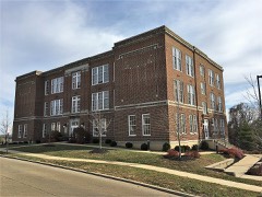 | Central School Campus | building | 2009 | 09000813 |
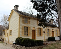 | Thomas C. Fletcher House | building | 1974 | 74001076 |
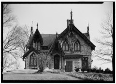 | Gustave Greystone-Meissner House | district | 1974 | 74001078 |
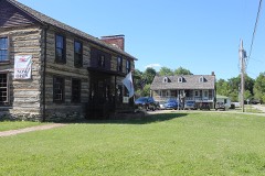 | Kimmswick Historic District | district | 2007 | 07000752 |
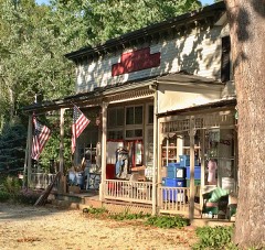 | Valentine Leight General Store | building | 1992 | 92001014 |
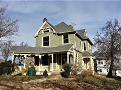 | Louis J. and Harriet Rozier House | building | 2006 | 06000221 |
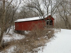 | Sandy Creek Covered Bridge | structure | 1970 | 70000337 |
 | Stonebrook | building | 2011 | 10001130 |
| Waggener Dairy Barn | building | 2022 | 100006081 | |
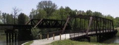 | Windsor Harbor Road Bridge | structure | 1983 | 83001024 |
Jefferson County has 1 covered bridge on the National Register. Each is a listed structure with a federal nomination on file.
| Sandy Creek Covered Bridge | Listed 1970 |
Every wildfire the federal occurrence database records inside this county: 547 of them, burning about 1,687 acres. 10 started naturally and 38 were recorded as arson. Each settlement page carries the fires within five miles of it.
| Reported cause | Fires |
|---|---|
| Missing data/not specified/undetermined | 302 |
| Debris and open burning | 119 |
| Arson/incendiarism | 38 |
| Recreation and ceremony | 33 |
| Equipment and vehicle use | 24 |
| Smoking | 16 |
| Natural | 10 |
| Misuse of fire by a minor | 3 |
| Railroad operations and maintenance | 2 |
The five largest, by the area the report gives. One of them was set deliberately.
| Date | Cause | Size | Reported by | Name on the report |
|---|---|---|---|---|
| 24 March 1997 | Debris and open burning | 270 acres | Missouri Department of Conservation | not named |
| 30 March 2005 | Natural | 225 acres | Middle Mississippi National Wildlife Refuge | HARLOW ISLAND |
| 15 March 2014 | Missing data/not specified/undetermined | 150 acres | Missouri Department of Conservation | not named |
| 12 January 2002 | Natural | 150 acres | Great Rivers National Wildlife Refuge | HARLOW ISL |
| 28 February 2004 | Recreation and ceremony | 56 acres | Missouri State Fire Marshal's Office | not named |
| 26 March 2003 | Arson/incendiarism | 50 acres | Missouri State Fire Marshal's Office | not named |
| 13 November 2011 | Missing data/not specified/undetermined | 40 acres | Missouri Department of Conservation | not named |
| 13 February 2017 | Missing data/not specified/undetermined | 40 acres | Missouri Department of Conservation | not named |
Every settlement page carries the fires within five miles of it - see the settlement index below.
The NOAA Storm Events Database holds 654 reports for this county, causing 9 deaths, 4 injuries and about $17,550,400 in recorded property damage. Each settlement page carries the reports that name it.
| Kind of event | Reports |
|---|---|
| Hail | 312 |
| Thunderstorm Wind | 236 |
| Tornado | 44 |
| Flash Flood | 41 |
| Flood | 9 |
| Lightning | 8 |
| Heavy Rain | 4 |
The most serious of them, by death, then injury, then recorded damage. The accounts are quoted exactly as the forecast office filed them.
| When | Event | Place named | Harm | What the report says |
|---|---|---|---|---|
| July 2015 | Flash Flood | Kimmswick | 2 killed, $4,000,000 | Up to 7 inches of rain fell in a short amount of time onto already saturated soils causing flash flooding. The main band of heavy rain extended from northwest of Cedar Hill southeastward to southeastern Jefferson County, south of Festus. Four vehicles were swept off of Meyer Road, just west of intersection with U.S. Highway 67, when Buck Creek rose well above its banks. All four vehicles were swept downstream but only two were occupied, the other two had been in a nearby parking lot. Two bodies were found further downstream, a 35 year old female and a 50 year old female. Authorities say that the owners of the other two vehicles have been accounted for. Several rescues had to be performed including on Montauk Drive just off of U.S. Highway 67, about 2 miles north northeast of Olympian Village. Also, a levee was over topped on Plattin Creek next to Lakeside Manor Mobile Home Park. Four to five feet of water flooded the mobile home park. Sixty to seventy people had to be rescued. Three people were injured and brought to a local hospital. Numerous businesses were flooded. One business had about a dozen ATVs damaged or ruined by the flood waters. Mercy Hospital in Crystal City had to close its emergency department for a couple of days when flood waters came into that area of the hospital, the rest of the hospital remained open. Several homes along Cotter Creek, off of Hillsboro Victoria Road near intersection with Highway P, were damaged/destroyed from flood waters as the creek quickly rose there. One person had to be rescued after her vehicle was swept into Cotter Creek by the flood waters. She was clinging to a tree for over an hour before being rescued. Several roads were washed out due to the flash flooding. Damage to the roads and bridges was estimated around $1.5 million with total damage estimated close to $3-4 million. |
| April 1981 | Tornado (F3) | not stated | 1 killed, $2,500,000 | no account filed |
| August 2020 | Thunderstorm Wind | Arnold | 1 killed | A line of severe storms moved across Jefferson County. Numerous trees, tree limbs and power lines were blown down. In Pevely, a 51 year old woman was killed when a tree was uprooted by the thunderstorm winds and it fell on her. She had been helping her boyfriend move a hard top from a Jeep to prevent damage to it from the approaching severe storms. The boyfriend was not injured by the fallen tree. In Arnold, a large maple tree was blown over onto a house. The house suffered damage to the awning and gutters before rolling off the slanted roof. Just southwest of Festus a tree was blown down onto Route CC. Several unoccupied vehicles sustained damage from fallen trees and tree limbs. |
| April 2017 | Flood | Hoene Spg | 1 killed | The Meramec and Big Rivers rose above major flood stage in the late evening hours of April 30th due to the heavy rainfall. A number of roads were closed due to the river flooding. A 77-year old man drowned when he walked to a creek (that feeds into the nearby Big River) near his house (off of Mimi Mountain Road and Highway BB) to survey the rising water, slipped and was swept away by the current. His body was recovered about three quarters of a mile downstream. |
| June 2016 | Lightning | Danby | 1 killed | A 72 year old man and his dog were struck and killed by lightning as storms moved through the area. They were in the front yard of the residence when it happened. |
| April 2013 | Flash Flood | De Soto Arpt | 1 killed | Up to five inches of rain fell in a 24 hour period. This caused flash flooding on Joachim Creek in DeSoto. The creek rose quickly and numerous roads on the east side of town were flooded. The water rose high enough that the fire station on East Miller Street had over a foot of water in it throughout the offices and engine room. About 125 homes were affected by the flash flooding. Also, an 80 year old woman drove into the flood waters on Veterans Drive. Despite attempts by emergency workers to block the car, it plunged into the rushing creek with the woman inside. Several hours later the water receded enough for the emergency workers to find her body in the vehicle a little ways downstream. |
| May 2003 | Flash Flood | De Soto | 1 killed | no account filed |
| June 1998 | Flood | Countywide | 1 killed | no account filed |
| July 2006 | Thunderstorm Wind | Arnold | 2 hurt | Several large trees were blown down. One tree fell onto a home destroying it and causing two people in the home to be injured. |
| April 2023 | Tornado (EF1) | Silica | 1 hurt | A tornado formed northeast of Festus, MO along Old A Highway just after 6:30pm CDT on April 15. It moved northeastward through a subdivision off of Old A Highway and west of West City Park, producing sporadic minor structural damage. As the tornado moved into West City Park, it increased in strength, snapping and uprooting several trees. As it moved over Horine Road, it reached peak strength and produced significant damage to a home. The tornado weakened slightly as it continued on to Interstate 55, producing minor damage to homes, outbuildings, and trees as it did so. As the tornado crossed I-55, it overturned a southbound semi causing minor injuries to the driver. After crossing Interstate 55, the tornado turned more northeasterly and crossed McNutt Street and Lake Drive in Herculaneum, continuing to produce additional minor structural and tree damage. The tornado then turned more easterly and tracked along Joachim Avenue and just south of Herculaneum High School, where it produced minor roof damage to a church and knocked over light poles. As it entered the Dunkin and Fletcher Memorial Park it weakened and dissipated. Overall the tornado was rated EF1 with a max wind speed of 100 mph. The path length was 3.97 miles with a max path width of 360 yards. One injury was reported, but no fatalities. |
| September 2003 | Thunderstorm Wind | Pevely | 1 hurt | Thunderstorm wind gusts caused problems at the Pevely Fall Festival. Several tents were blown down and booths damaged. One woman suffered minor injuries when she was struck by a tent pole. |
| April 1994 | Tornado (F1) | Barnhart to | $5,000,000 | A tornado touched down in Barnhart and nearly destroyed two mobile homes and heavily damaged five homes in a subdivision. Power poles were snapped off near the track with nearby trees uprooted or snapped off at the base. As the tornado moved north-northeast, it crossed County Road M and traveled along Highways 61-67 damaging the roof of a modern one story brick building. Several other homes had roof damage and a car dealership reported broken automobile windows from debris. Before lifting, the tornado damaged five other homes near Kimmswick and one mobile home, but no injuries were reported. |
| December 2015 | Flood | Wickes | $2,200,000 | Between 5 and 8 inches of rain fell across Jefferson County during a 2 day period. All of this rain caused the creeks and rivers to rise. The Meramec River and Big River went into major flood with several points cresting at record levels. Forty four homes were destroyed, 975 buildings had major damage and 308 buildings had minor damage from the river flooding, with Arnold being the worst hit in Jefferson County. Also, the High Ridge District 2 water treatment plant was inundated by the flood waters on December 30th, cutting off water supply to at least 20,000 residents. Damage estimates so far were around $2.2 million. |
| March 2025 | Tornado (EF2) | Morse Mill | $825,000 | At approximately 9:18 PM a tornado began just south of Morse Mill, MO causing damage to trees and homes as it moved northeast. The worst damage in Jefferson County occurred in the southwest corner of Arnold where the roof of a residence was torn off on Shelley Lynn Drive. The tornado then passed into south St. Louis County. In Jefferson County the tornado had a path length of 20.9 miles and a maximum path width of 850 yards. It was rated an EF2. |
| May 2000 | Flash Flood | West Central Portion | $500,000 | Rainfall up to 8 inches fell on western Jefferson County causing widespread flash flooding. A joint Federal -State Damage Assessment Team concluded that 1 structure was destroyed, 9 suffered major damage, 42 minor damage and another 7 were affected. Some areas, especially along the Big River, were spared major damage because of buyouts that were made after flooding in 1993. |
| April 1994 | Tornado (F0) | Cedar Hill to | $500,000 | Numerous large trees were uprooted or snapped at the base when a small tornado touched down initially west of Cedar Hill. The tornado moved rapidly east and uplifted the roof of a small business complex located near the intersection of Highway 30 and County Road BB. A florist shop also experienced minor roof damage. Two nearby buildings also sustained minor roof damage and numerous large trees were knocked down. |
| April 1994 | Hail | Arnold | $500,000 | County officials reported golf ball-size hail and wind gusts to 60 mph in Cedar Hill. A local television station reported hail up to softball-size near Arnold a few minutes later. Several cars were damaged and house windows broke out. |
| December 1982 | Tornado (F1) | not stated | $250,000 | no account filed |
| May 1978 | Tornado | not stated | $250,000 | no account filed |
| August 2022 | Flash Flood | High Ridge | $120,000 | Up to five inches of rain fell in a short amount of time causing flash flooding in the far northern portions of the county. Numerous roads were flooded including Highway 141. There were multiple water rescues on Highway 141, but no injuries were reported. Also, several water evacuations were performed at homes near the intersection of Romaine Creek Road and Konert Road. Twenty four home sustained minor flood damage. |
| April 2024 | Tornado (EF1) | Hoene Spg | $100,000 | The tornado touched down in a subdivision southwest of Eureka in rural St. Louis County where it caused minor tree damage. The tornado moved east across the Meramec River into Jefferson County where it damaged two large metal outbuildings and snapped wooden electrical poles on Twin River Rd Between the Meramec and Big Rivers. The tornado continued to the east where it caused tree damage before lifting southeast of High Ridge. |
| July 2000 | Flash Flood | North Portion | $100,000 | Heavy rain caused flash flooding across northeast Jefferson County. Glaize Creek flooded affecting a narrow area north of new Highway M from just west of Antonia to Highway 61-67 at Barnhart. Several businesses flooded, including a couple automobile repair shops. Seven vehicles from the shops were washed away by the flood water. Six people had to be rescued from flooded vehicles. Several county roads and a couple of bridges were damaged by the flood water. |
| June 1997 | Thunderstorm Wind | De Soto | $100,000 | County sheriff reported numerous trees and power lines down. About a dozen homes were damaged mainly from the falling trees. About 10 vehicles were also damaged by the falling trees. |
| November 2024 | Flash Flood | Oermann | $50,000 | Flash flooding resulted in cropland, yard, basement, and road flooding around Jefferson County. Water flooded residences in a mobile home park in High Ridge, with several homes and mobile homes being evacuated. Multiple water rescues were also reported in House Springs. |
| April 1994 | Tornado (F0) | Ottoville to | $50,000 | A small tornado touched down causing roof damage to a large lumber storage building along Highway 21. Large trees were uprooted or snapped at the base as the tornado approached Antonia. A barn was also damaged. |
| April 1993 | Thunderstorm Wind | De Soto | $50,000 | A local newspaper reported wind damage to trees and a mobile home southeast of De Soto. Part of the roof was blown some distance from the original spot. A storm spotter reported wind gusts to 60 mph. |
| April 1999 | Lightning | Hillsboro | $35,000 | no account filed |
| April 2011 | Hail | Hillsboro | $32,000 | A large swath of one and three quarter to two and a half inch diameter hail fell in the Hillsboro area. One home sustained a broken window from the large hail. Also, eleven county vehicles were damaged by the large hail, in some cases knocking both the front and rear windshields out. |
| July 2021 | Flash Flood | High Ridge | $30,000 | Up to four inches of rain fell in a short amount of time causing flash flooding. Several road were flooded including Romaine Creek Road where it goes over Sugar Creek, which was well out of it's banks at this location. Several cars became stranded in the flood waters in this area. |
| August 2016 | Flash Flood | Oakvale | $25,000 | Up to 6 inches of rain fell onto already saturated soils causing flash flooding. Joachim Creek rose well above it's banks flooding several businesses, homes and a fire department on the east side of De Soto. Three city parks sustained damage as well. No injuries were reported. |
| April 1968 | Tornado (F1) | not stated | $25,000 | no account filed |
| May 1968 | Tornado (F1) | not stated | $25,000 | no account filed |
| October 1967 | Tornado (F1) | not stated | $25,000 | no account filed |
| May 1967 | Tornado (F2) | not stated | $25,000 | no account filed |
| June 1967 | Tornado (F2) | not stated | $25,000 | no account filed |
| May 1961 | Tornado (F1) | not stated | $25,000 | no account filed |
| February 2000 | Hail | Herculaneum | $20,000 | no account filed |
| April 2025 | Flash Flood | Kimmswick | $15,000 | Heavy rain caused a few road closures in Jefferson County. One road closure was near Regina on Missouri BB and Regina Road. Here, downed power poles were reported. The other was near Imperial around US Highway 61/67 and Scott Lane/Mill Creek Drive/Montebello Road. |
| April 2001 | Lightning | Festus | $15,000 | Lightning struck the Danby-Rush Tower Middle School south of Festus causing considerable to the telephone system. The strike apparently came in through the telephone lines and and knocked out the computerized switchboard. Other parts of the computer system were also damaged. |
| May 2025 | Thunderstorm Wind | High Ridge | $10,000 | Thunderstorm winds downed numerous trees and wires in northern Jefferson County around the High Ridge and Saline Valley area. |
| May 2024 | Tornado (EF0) | Paulina Hills | $10,000 | A tornado touched down at the intersection of Highway 141 and Fiedler Lane blowing down a traffic light. As it tracked to the northeast it caused some minor siding damage to one house, uprooted at tree and blew down several large tree limbs. Further northeast it uprooted a large tree that landed on a house causing some porch and moderate roof damage. The tornado then lifted and dissipated. Overall, the tornado was rated EF0 with a path length of 0.21 miles and a max path width of 100 yards. No deaths or injuries were reported. |
| June 2022 | Thunderstorm Wind | Byrnesville | $10,000 | Widespread wind damage across northern portions of Jefferson County. Numerous large tree limbs were blown down in House Springs, Cedar Hill and Kimmswick. Some of the tree limbs blocked roads in the area. |
| July 2002 | Thunderstorm Wind | De Soto | $10,000 | no account filed |
| April 2024 | Thunderstorm Wind | Dittmer | $5,000 | A tree limb snapped and fell on a home. |
| April 2024 | Thunderstorm Wind | Maxville | $5,000 | Shingles were blown off of at least 1 home and 1 inch diameter tree limbs were broken. |
| March 2023 | Thunderstorm Wind | Pevely | $5,000 | Thunderstorm winds blew a large down across a road. |
| August 2022 | Thunderstorm Wind | De Soto | $5,000 | Thunderstorm winds blew down numerous large tree limbs in DeSoto. Also, a large tree was blown over onto Highway V just northwest of Valles Mines. |
| April 2022 | Hail | Hematite | $5,000 | The hail caused minor dings and dents to cars in the area. |
| July 2021 | Thunderstorm Wind | Parkdale | $5,000 | Several large trees were blown down just northwest of Parkdale. |
| October 2021 | Thunderstorm Wind | Paulina Hills | $5,000 | Thunderstorm winds blew down several trees around town. |
| May 2008 | Thunderstorm Wind | High Ridge | $5,000 | Local law enforcement reported trees and power lines down. |
| April 1994 | Hail | Cedar Hill | $5,000 | County officials reported golf ball-size hail and wind gusts to 60 mph in Cedar Hill. A local television station reported hail up to softball-size near Arnold a few minutes later. Several cars were damaged and house windows broke out. |
| April 1994 | Hail | Festus | $5,000 | County officials reported golf ball-size hail southwest of Festus. |
| April 1994 | Hail | Festus | $5,000 | The public reported golf ball-size hail but reported damage was minor, limited to mainly automobiles. |
| April 1994 | Tornado (F0) | Crystal City | $5,000 | A small tornado touched down briefly damaging a small area of power poles and trees. |
| April 1994 | Thunderstorm Wind | Cedar Hill | $5,000 | County officials reported golf ball-size hail and wind gusts to 60 mph in Cedar Hill. A local television station reported hail up to softball-size near Arnold a few minutes later. Several cars were damaged and house windows broke out. |
| August 1993 | Thunderstorm Wind | High Ridge | $5,000 | The county sheriff reported large trees knocked down across northern parts of the county. |
| July 1998 | Thunderstorm Wind | Arnold | $5,000 | no account filed |
| July 1981 | Tornado (F1) | not stated | $2,500 | no account filed |
| September 1965 | Tornado (F1) | not stated | $2,500 | no account filed |
The Survey's mineral resources record lists 198 workings inside this county. 29 still produce and 169 are closed or unrecorded. Each settlement page carries the workings within five miles of it.
| Commodity | Workings |
|---|---|
| Stone, Crushed/Broken | 60 |
| Lead | 57 |
| Sand and Gravel, Construction | 15 |
| Barium-Barite | 14 |
| Lead, Zinc | 14 |
| Zinc, Lead | 8 |
| Barium-Barite, Lead | 6 |
| Iron | 6 |
| Silica | 5 |
| Clay | 3 |
| Copper | 3 |
| Barium-Barite, Lead, Zinc | 2 |
| Sand and Gravel, Construction, Silica | 1 |
| Barium-Barite, Clay, Lead, Zinc | 1 |
The least common of them first, because a county's hundredth gravel pit says nothing its first ten did not.
| Where | Site | Commodity | Status | Recorded |
|---|---|---|---|---|
| (Facility) Herculaneum Smelter | Lead, Smelter | Plant | ||
| Crystal City Sand Plant | Sand and Gravel, Construction, Silica | Producer | ||
| Gray's Diggings | Zinc, Barium-Barite | Past Producer | ||
| Mammoth Mine | Barium-Barite, Clay, Lead, Zinc | Past Producer | ||
| Sandy Mines | Lead, Zinc, Barium-Barite | Past Producer | ||
| Unknown - Barite & Lead | Lead, Barium-Barite | Past Producer | ||
| Garatee Mines | Barium-Barite, Lead, Zinc | Past Producer | ||
| Tarpley Mines | Barium-Barite, Lead, Zinc | Past Producer | ||
| Mandel Ball-Clay Pit | Clay | Past Producer | ||
| Selma Quarry Ls & Ss & Plant | Stone, Crushed/Broken, Clay | Producer | ||
| Skewe's & Valle's Copper Mines | Copper | Past Producer | ||
| Unknown - Copper | Copper | Past Producer | ||
| Unknown - Copper | Copper | Past Producer | ||
| Unknown - Shale & Clay | Clay | Past Producer | ||
| Festus Pit & Plant | Silica | Past Producer | ||
| Martin Marietta Sand Pit | Silica | Producer | ||
| Master Bros Pit & Plant | Silica | Producer | ||
| Unimin Mine | Silica | Producer | ||
| Unimin Plant | Silica | Producer | ||
| Darby Diggings | Barium-Barite, Lead | Past Producer | ||
| De Lore Prospect | Iron | Past Producer | ||
| Ditch Lead Mines | Barium-Barite, Lead | Past Producer | ||
| Prentiss Mine | Iron | Past Producer | ||
| Quinn Mine | Barium-Barite, Lead | Past Producer | ||
| Shady Diggings | Barium-Barite, Lead | Past Producer | ||
| Unknown - Iron | Iron | Past Producer | ||
| Unknown - Iron | Iron | Past Producer | ||
| Unknown - Iron | Iron | Past Producer | ||
| Unknown - Lead + Barite | Barium-Barite, Lead | Past Producer | ||
| Unknown - Lead + Barite | Barium-Barite, Lead | Past Producer | ||
| Vineland Tunnel & Hill Shaft | Iron | Past Producer | ||
| Bogy's Diggings | Zinc, Lead | Past Producer | ||
| Corn Stalk Diggings | Zinc, Lead | Past Producer | ||
| Ditch Mine | Zinc, Lead | Past Producer | ||
| Fletcher Washer Mine | Zinc, Lead | Past Producer | ||
| Garraty Mines | Zinc, Lead | Past Producer | ||
| Miller Mine | Zinc, Lead | Past Producer | ||
| Rocky Digs Mines | Zinc, Lead | Past Producer | ||
| Yankee Diggings | Zinc, Lead | Past Producer | ||
| A.E.Stocking Mine | Barium-Barite | Past Producer | ||
| Blackwell Mine & Washer | Barium-Barite | Producer | ||
| Campbell Mine | Lead, Zinc | Past Producer | ||
| Deep Digs Mines | Lead, Zinc | Past Producer | ||
| Dresser Mine No. 10 | Barium-Barite | Producer | 1972, 1974 | |
| Dresser Mine No. 11 | Barium-Barite | Producer | 1975, 1977 | |
| Dresser Minerals Pit 10 | Barium-Barite | Producer | ||
| Dresser Minerals Pit 11 | Barium-Barite | Producer | ||
| Dresser Minerals Plant 10 | Barium-Barite | Producer | ||
| Dresser Minerals Plant 11 | Barium-Barite | Producer | ||
| Dresser Minerals Plant No. 11 | Barium-Barite | Producer | ||
| Fletcher Property | Barium-Barite | Prospect | 1977, 1979 | |
| Frumet Mines | Lead, Zinc | Past Producer | ||
| Gray's Mines | Lead, Zinc | Past Producer | ||
| How's Mines | Lead, Zinc | Past Producer | ||
| Lee's Diggings | Lead, Zinc | Past Producer | ||
| Leon Mine | Lead, Zinc | Past Producer | ||
| Mccormick Mines | Lead, Zinc | Past Producer | ||
| Unknown - Barite | Barium-Barite | Past Producer | ||
| Unknown - Barite | Barium-Barite | Past Producer | ||
| Unknown - Barite | Barium-Barite | Past Producer | ||
| Unknown - Barite | Barium-Barite | Past Producer | ||
| Unknown - Lead & Zinc | Lead, Zinc | Past Producer | ||
| Unknown - Lead & Zinc | Lead, Zinc | Past Producer | ||
| Unknown - Lead & Zinc | Lead, Zinc | Past Producer | ||
| Unknown - Lead + Zinc | Lead, Zinc | Past Producer | ||
| Unknown - Lead + Zinc | Lead, Zinc | Past Producer | ||
| Unknown - Zinc & Lead | Lead, Zinc | Past Producer | ||
| Norman Goad Const Co Pit/Plant | Sand and Gravel, Construction | Producer | ||
| Sand & Gravel Plant 2 | Sand and Gravel, Construction | Producer | ||
| Sand & Gravel Plant 1 | Sand and Gravel, Construction | Producer | ||
| Simpson South Pit & Plant | Sand and Gravel, Construction | Producer | ||
| Unknown - S&G | Sand and Gravel, Construction | Past Producer | ||
| Unknown - S&G | Sand and Gravel, Construction | Past Producer | ||
| Unknown - S&G | Sand and Gravel, Construction | Past Producer | ||
| Unknown - S&G | Sand and Gravel, Construction | Past Producer | ||
| Unknown - S&G | Sand and Gravel, Construction | Past Producer | ||
| Unknown - S&G | Sand and Gravel, Construction | Past Producer | ||
| Unknown - S&G | Sand and Gravel, Construction | Past Producer | ||
| Unknown - S&G | Sand and Gravel, Construction | Past Producer | ||
| Unknown - S&G | Sand and Gravel, Construction | Past Producer | ||
| Unknown - S&G | Sand and Gravel, Construction | Past Producer | ||
| Unknown - S&G | Sand and Gravel, Construction | Past Producer | ||
| Bailey Mines | Lead | Past Producer | ||
| Bisch + Daly's Mines | Lead | Past Producer | ||
| Frank Appleberry Mine | Lead | Past Producer | ||
| Frissel's Mines | Lead | Past Producer | ||
| Garrity Mines | Lead | Past Producer | ||
| Herculaneum Mines | Lead | Past Producer | ||
| Hunt's Mines | Lead | Past Producer | ||
| Kelly's Diggings | Lead | Past Producer | ||
| McClenahan's Mines | Lead | Past Producer | ||
| Mead's Mines | Lead | Past Producer | ||
| Miller's Diggings | Lead | Past Producer | ||
| Morse Mine | Lead | Past Producer | ||
| Nashville Mines | Lead | Past Producer | ||
| Robbin's Lead Mine | Lead | Past Producer | ||
| Robinson's Diggings | Lead | Past Producer | ||
| Sandy Mines | Lead | Past Producer | ||
| Skewe's & Valle's Mine | Lead | Past Producer | ||
| Tyler & Poston Mines | Lead | Past Producer | ||
| Unknown - Lead | Lead | Past Producer | ||
| Unknown - Lead | Lead | Past Producer | ||
| Unknown - Lead | Lead | Past Producer | ||
| Unknown - Lead | Lead | Past Producer | ||
| Unknown - Lead | Lead | Past Producer | ||
| Unknown - Lead | Lead | Past Producer | ||
| Unknown - Lead | Lead | Past Producer | ||
| Unknown - Lead | Lead | Past Producer | ||
| Unknown - Lead | Lead | Past Producer | ||
| Unknown - Lead | Lead | Past Producer | ||
| Unknown - Lead | Lead | Past Producer | ||
| Unknown - Lead | Lead | Past Producer | ||
| Unknown - Lead | Lead | Past Producer | ||
| Unknown - Lead | Lead | Past Producer | ||
| Unknown - Lead | Lead | Past Producer | ||
| Unknown - Lead | Lead | Past Producer | ||
| Unknown - Lead | Lead | Past Producer | ||
| Unknown - Lead | Lead | Past Producer | ||
| Unknown - Lead | Lead | Past Producer | ||
| Unknown - Lead | Lead | Past Producer | ||
| Unknown - Lead | Lead | Past Producer | ||
| Unknown - Lead | Lead | Past Producer | ||
| Unknown - Lead | Lead | Past Producer | ||
| Unknown - Lead | Lead | Past Producer | ||
| Unknown - Lead | Lead | Past Producer | ||
| Unknown - Lead | Lead | Past Producer | ||
| Unknown - Lead | Lead | Past Producer | ||
| Unknown - Lead | Lead | Past Producer | ||
| Unknown - Lead | Lead | Past Producer | ||
| Unknown - Lead | Lead | Past Producer | ||
| Unknown - Lead | Lead | Past Producer | ||
| Unknown - Lead | Lead | Past Producer | ||
| Unknown - Lead | Lead | Past Producer | ||
| Unknown - Lead | Lead | Past Producer | ||
| Unknown - Lead | Lead | Past Producer | ||
| Unknown - Lead | Lead | Past Producer | ||
| Unknown - Lead | Lead | Past Producer | ||
| Unknown - Lead | Lead | Past Producer | ||
| Unknown - Lead | Lead | Past Producer | ||
| Arch Johnston Excav Quarry/Plant | Stone, Crushed/Broken | Producer | ||
| Arrowhead Quarry | Stone, Crushed/Broken | Past Producer | ||
| Aubuchon's Mine | Stone, Crushed/Broken | Past Producer | ||
| Bussen Antire Quarry & Plant | Stone, Crushed/Broken | Producer | ||
| Des Peres Quarry | Stone, Crushed/Broken | Past Producer | ||
| Festus Quarry & Plant | Stone, Crushed/Broken | Producer | ||
| Frech Quarry | Stone, Crushed/Broken | Past Producer | ||
| Glen Park Quarry | Stone, Crushed/Broken | Producer | ||
| Goetz Quarry | Stone, Crushed/Broken | Past Producer | ||
| Gray Quarry | Stone, Crushed/Broken | Past Producer | ||
| Harrison Bros Sandstone Quarry | Stone, Crushed/Broken | Past Producer | ||
| House Springs Mill | Stone, Crushed/Broken | Producer | ||
| House Springs Quarry & Plant | Stone, Crushed/Broken | Producer | ||
| Jefferson County Quarry | Stone, Crushed/Broken | Producer | ||
| Kitson Material Quarry & Plant | Stone, Crushed/Broken | Producer | ||
| Martin Marietta Quarry | Stone, Crushed/Broken | Past Producer | ||
| North Tunnel Quarry | Stone, Crushed/Broken | Past Producer | ||
| Old Goetz Quarry | Stone, Crushed/Broken | Past Producer | ||
| Rush Tower Mine & Plant | Stone, Crushed/Broken | Producer | ||
| South Tunnel Quarry | Stone, Crushed/Broken | Past Producer | ||
| Trautman Quarry & Plant | Stone, Crushed/Broken | Producer | ||
| Unknown - Ls | Stone, Crushed/Broken | Past Producer | ||
| Unknown - Ls | Stone, Crushed/Broken | Past Producer | ||
| Unknown - Ls | Stone, Crushed/Broken | Past Producer | ||
| Unknown - Ls | Stone, Crushed/Broken | Past Producer | ||
| Unknown - Ls | Stone, Crushed/Broken | Past Producer | ||
| Unknown - Ls | Stone, Crushed/Broken | Past Producer | ||
| Unknown - Ls | Stone, Crushed/Broken | Past Producer | ||
| Unknown - Ls | Stone, Crushed/Broken | Past Producer | ||
| Unknown - Ls | Stone, Crushed/Broken | Past Producer | ||
| Unknown - Ls | Stone, Crushed/Broken | Past Producer | ||
| Unknown - Ls | Stone, Crushed/Broken | Past Producer | ||
| Unknown - Ls | Stone, Crushed/Broken | Past Producer | ||
| Unknown - Ls | Stone, Crushed/Broken | Past Producer | ||
| Unknown - Ls | Stone, Crushed/Broken | Past Producer | ||
| Unknown - Ls | Stone, Crushed/Broken | Past Producer | ||
| Unknown - Ls | Stone, Crushed/Broken | Past Producer | ||
| Unknown - Ls | Stone, Crushed/Broken | Past Producer | ||
| Unknown - Ls | Stone, Crushed/Broken | Past Producer | ||
| Unknown - Ls | Stone, Crushed/Broken | Past Producer | ||
| Unknown - Ls | Stone, Crushed/Broken | Past Producer | ||
| Unknown - Ls | Stone, Crushed/Broken | Past Producer | ||
| Unknown - Ls | Stone, Crushed/Broken | Past Producer | ||
| Unknown - Ss | Stone, Crushed/Broken | Past Producer | ||
| Unknown - Ss | Stone, Crushed/Broken | Past Producer | ||
| Unknown - Ss | Stone, Crushed/Broken | Past Producer | ||
| Unknown - Ss | Stone, Crushed/Broken | Past Producer | ||
| Unknown - Ss | Stone, Crushed/Broken | Past Producer | ||
| Unknown - Ss | Stone, Crushed/Broken | Past Producer | ||
| Unknown - Ss | Stone, Crushed/Broken | Past Producer | ||
| Unknown - Ss | Stone, Crushed/Broken | Past Producer | ||
| Unknown - Ss | Stone, Crushed/Broken | Past Producer | ||
| Unknown - Ss | Stone, Crushed/Broken | Past Producer | ||
| Unknown - Ss | Stone, Crushed/Broken | Past Producer | ||
| Unknown - Ss | Stone, Crushed/Broken | Past Producer | ||
| Vigus Antire Quarry | Stone, Crushed/Broken | Past Producer | ||
| Weaver's Quarry | Stone, Crushed/Broken | Past Producer | ||
| Westlake South Quarry | Stone, Crushed/Broken | Past Producer | ||
| Wickes Quarry | Stone, Crushed/Broken | Past Producer |
Named settlements recorded in the Geographic Names Information System, each with the topographic sheets covering it. Villages, hamlets and abandoned places alike. Each is shown with the nearest named watercourse or landform and the survey quadrangle it falls on.
Imperial township · 63012 · On Glaize Creek · Herculaneum quadrangle
25 sheets, 1912 to 1993
Valle township · 63020 · On Fritz Creek · De Soto quadrangle
20 sheets, 1901 to 1985
High Ridge township · 63051 · On Heads Creek · House Springs quadrangle
24 sheets, 1901 to 1985
Meramec township · 63016 · On Skullbones Creek · Cedar Hill quadrangle
22 sheets, 1901 to 1985
Meramec township · 63016 · On Skullbones Creek · Cedar Hill quadrangle
22 sheets, 1901 to 1985
Meramec township · 63016 · On Dutch Creek · Cedar Hill quadrangle
22 sheets, 1901 to 1985
Big River township · 63050 · On Reynolds Creek · Fletcher quadrangle
18 sheets, 1901 to 1985
River View township · 63019 · On Plattin Creek · Festus quadrangle
17 sheets, 1915 to 1985
Joachim township · 63070 · On Glaize Creek · Herculaneum quadrangle
25 sheets, 1912 to 1993
No longer a settlement
Big River township · 63020 · Near Grassy Hollow · Fletcher quadrangle
18 sheets, 1901 to 1985
Joachim township · 63048 · On Joachim Creek · Herculaneum quadrangle
25 sheets, 1912 to 1993
Meramec township · 63025 · On Big River · House Springs quadrangle
24 sheets, 1901 to 1985
High Ridge township · 63051 · On Bear Creek · House Springs quadrangle
24 sheets, 1901 to 1985
Arnold township · 63010 · Oakville quadrangle
28 sheets, 1912 to 1998
No longer a settlement
Big River township · 63023 · On Dry Creek · Cedar Hill quadrangle
22 sheets, 1901 to 1985
Meramec township · 63016 · On Skullbones Creek · Cedar Hill quadrangle
22 sheets, 1901 to 1985
Rock township · 63010 · On Romaine Creek · Maxville quadrangle
25 sheets, 1912 to 1985
Central township · 63050 · On Galligher Creek · Belews Creek quadrangle
21 sheets, 1901 to 1985
High Ridge township · 63025 · On Heads Creek · House Springs quadrangle
24 sheets, 1901 to 1985
High Ridge township · 63051 · On Bourne Creek · House Springs quadrangle
24 sheets, 1901 to 1985
Windsor township · 63052 · On Glaize Creek · Valmeyer quadrangle
26 sheets, 1912 to 1993
Valle township · 63020 · Near Dripping Springs Hollow · Vineland quadrangle
21 sheets, 1901 to 1985
The vanished settlements of Jefferson County: the places named above that are no longer on the map.