BlockBefore
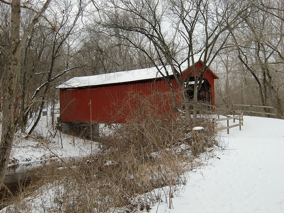
Photograph of Sandy Creek Covered Bridge State Historic Site
Photograph by Chuck Morris, CC BY-SA 3.0. Via Wikimedia Commons.

Sandy Creek Covered Bridge

Listed on the National Register of Historic Places in 1970.

From the record

“Sandy Creek Covered Bridge State Historic Site is a publicly owned property in Jefferson County, Missouri, administered by the Missouri Department of Natural Resources, preserving the Sandy Creek Covered Bridge. The bridge is one of four remaining covered bridges in Missouri, which once numbered about 30.”

Wikipedia article Sandy Creek Covered Bridge State Historic Site, CC BY-SA 4.0.

One of 10 National Register listings published here for Jefferson County · listed in 1970 · category: Structure.

Sources: the Wikipedia article · the case file at the National Archives · the National Register database, National Park Service
The listing

  • What is counted as historic. The nomination lists 1 structure as contributing to the listing.
  • Address. 5 mi. N of Hillsboro off U.S. 21, Hillsboro, 63050
  • When was it listed? July 1970
  • Category. structure
  • Township. Central township
  • National Register reference number. 70000337 - the number the National Park Service assigned this property when it was listed, and the key its nomination file is catalogued under at the National Archives.

Fires near this property

57 since 2004

Regional context, not property-specific evidence. The federal wildfire occurrence database lists 57 fires within 5 miles of Sandy Creek Covered Bridge between 2004 and 2020, burning about 52 acres in total. None started naturally. 1 was recorded as arson. Distance is straight-line from the map coordinates, so a fire counted here may appear on a neighbouring settlement's page as well.

Reported cause Fires
Missing data/not specified/undetermined43
Debris and open burning7
Recreation and ceremony3
Smoking2
Equipment and vehicle use1
Arson/incendiarism1

The most recent of them, most recent first, with the day each was reported and the service that recorded it.

DateCause SizeReported by Name on the report
8 September 2005Missing data/not specified/undetermined1.0 acresMissouri State Fire Marshal's Officenot named
7 September 2013Equipment and vehicle use1.0 acresMissouri Department of Conservationnot named
6 September 2013Smoking1.0 acresMissouri Department of Conservationnot named
5 September 2011Recreation and ceremony1.0 acresMissouri Department of Conservationnot named
24 September 2013Missing data/not specified/undetermined1.0 acresMissouri Department of Conservationnot named
20 September 2011Missing data/not specified/undetermined1.0 acresMissouri Department of Conservationnot named
10 September 2005Smokingunder an acreMissouri State Fire Marshal's Officenot named
9 August 2006Missing data/not specified/undetermined1.0 acresMissouri State Fire Marshal's Officenot named

Every fire recorded in Jefferson County

Mines and quarries near this property

10 of 20 shown

Regional context, not property-specific evidence. The federal mineral resources record lists 20 workings within 5 miles of Sandy Creek Covered Bridge: 17 past producers, 3 producers. 3 still produce. What was taken out: Lead, Stone, Crushed/Broken, Sand and Gravel, Construction, Lead, Zinc, Barium-Barite. Distance is straight-line from the map coordinates, so a quarry counted here may appear on a neighbouring settlement's page as well.

Where SiteCommodity StatusRecorded
Master Bros Pit & PlantSilicaProducer
Sandy MinesLead, Zinc, Barium-BaritePast Producer
Sand & Gravel Plant 2Sand and Gravel, ConstructionProducer
Sand & Gravel Plant 1Sand and Gravel, ConstructionProducer
Herculaneum MinesLeadPast Producer
Sandy MinesLeadPast Producer
Unknown - LeadLeadPast Producer

Every working recorded in Jefferson County

Storms near this property

54 since 1996

Regional context, not property-specific evidence. The National Weather Service names Hillsboro, the town this property stands in, in 54 storm reports between 1996 and 2024: 30 hail, 17 thunderstorm wind, 3 tornado, 2 lightning. No death or injury is recorded in these reports. Each account below is quoted exactly as the forecast office filed it, from the NOAA Storm Events Database, and each date opens the federal record of that event.

WhenEvent Place namedHarm What the report says
April 1999LightningHillsboro$35,000no account filed
April 2011HailHillsboro$32,000A large swath of one and three quarter to two and a half inch diameter hail fell in the Hillsboro area. One home sustained a broken window from the large hail. Also, eleven county vehicles were damaged by the large hail, in some cases knocking both the front and rear windshields out.
May 2008HailHillsboro$2,000Storm spotters reported hail up to 1 1/4 inch in diameter. There was minor damage to some automobiles.
March 2024HailHillsboro-A discrete cell rapidly intensified over Jefferson County, producing hailstones between 1 and 1.50 inches in diameter over the course of 45 minutes in Hillsboro, Olympian Village, Crystal City, and Festus. No damage was reported. The thunderstorm kept producing severe hail after it exited into Illinois.
April 2023Tornado (EF0)Hillsboro-A tornado formed around 6:24pm CDT near the corner of Elm and 3rd streets on the northwest side of downtown Hillsboro, causing minor damage to the siding of the Good Shepherd Catholic Church. It continued eastward along the northern periphery of the downtown area, producing sporadic minor tree damage as it did so. When it approached Business Highway 21, the tornado damaged the facade and steeple of the First Baptist Church. Across the highway along 4th Street, the roof of the fire department building and a residence received minor damage. As the tornado moved over Vreeland Road and tracked along Sunny Lane, it briefly intensified, with several trees uprooted along the lane and minor roof damage occurring on an outbuilding. The tornado then weakened as it neared the end of Sunny Lane, dissipating in the wooded area just beyond the end of the roadway. Overall the tornado was rated EF0 with a max wind speed of 77 mph. The path length was 0.57 miles with a max path width of 200 yards. No deaths or injuries were reported.
April 2023HailHillsboro-A wide swath of large hail fell across Jefferson County. Large hail was reported in Hillsboro, Pevely, Festus, Crystal City and Herculaneum.
April 2021Thunderstorm WindHillsboro-Thunderstorm winds snapped off a large tree limb.
November 2017HailHillsboro-Numerous reports of large hail fell in a wide swath from Hillsboro to the Festus/Crystal City area. One inch or larger hail was also reported in Herculaneum and Hematite. The largest hailstones, around 3 inches in diameter were reported one mile north of Festus.
March 2017Thunderstorm WindHillsboro-Thunderstorm winds caused some roof, soffit and fence damage both south and north of tornado track.
March 2017Tornado (EF0)Hillsboro-A tornado touched down near Hillsboro High School where some trees were topped. It moved across the football field where bleachers, hurdles and other school equipment were destroyed and blown up to 300 yards down the track of the tornado. Tree damage continued from the back side of the Hillsboro High School toward the Jefferson County Fairgrounds. Several buildings, including barns and small outbuildings suffered major roof failures and numerous trees were uprooted across the fairgrounds with debris tossed up to 200 yards to the east northeast. The tornado continued east damaging the roof of a social services building and tossing insulation in the trees. It crossed Business Highway 21 topping more trees and causing minor roof damage to a number of homes on Micah Lane. The tornado dissipated near Lake Wauwanoka Road with only a few limbs broken off. Overall, the tornado was rated EF0 with a path length of 1.14 miles and a max path width of 75 yards.
September 2012Thunderstorm WindHillsboro-Thunderstorm winds blew down several trees onto Amy Clark Road east of Hillsboro.
August 2012Thunderstorm WindHillsboro-Thunderstorm winds blew down several power lines in town.
June 2009Thunderstorm WindHillsboro-Thunderstorm winds caused minor to moderate roof and siding damage to several homes under construction.
December 2008Flash FloodHillsboro-Several inches of rain fell in a short amount of time on frozen ground causing flash flooding. Just northwest of Hillsboro, some water was flowing over Highway BB.
July 2008Thunderstorm WindHillsboro-Thunderstorm winds flattened corn fields to the east and southeast of Hillsboro.
October 2007Thunderstorm WindHillsboro-The top of a large tree was taken down by damaging winds on Highway A near the intersection with Highway 21 just north of Hillsboro.
January 2006HailHillsboro-The public reported 3/4 inch hail in Hillsboro.
May 2004Tornado (F0)Hillsboro-A small tornado hit the Raintree Plantation northwest of Hillsboro. Three homes suffered minor roof damage, a boat dock was damaged, and trees and power lines were down.
May 2004Thunderstorm WindHillsboro-Amateur radio spotters reported several trees down just southwest of Hillsboro.
August 2004Thunderstorm WindHillsboro-Local law enforcement reported large tree branches down.
June 2002Flash FloodHillsboro-Heavy rain flooded several roads in the Hillsboro area. The intersection of routes Y and C was flooded and closed. Several other county roads in the area were flooded and impassable.
March 1998Thunderstorm WindHillsboro-Thunderstorm wind gusts downed some trees near Hillsboro.
May 2024HailHillsboro-no account filed
June 2018HailHillsboro-no account filed
April 2014HailHillsboro-no account filed
July 2013HailHillsboro-no account filed
April 2011HailHillsboro-no account filed
October 2010HailHillsboro-no account filed
December 2010HailHillsboro-no account filed
July 2009HailHillsboro-no account filed
June 2008HailHillsboro-no account filed
April 2007HailHillsboro-no account filed
March 2006HailHillsboro-no account filed
April 2006HailHillsboro-no account filed
May 2005HailHillsboro-no account filed
May 2002Thunderstorm WindHillsboro-no account filed
July 2002Thunderstorm WindHillsboro-no account filed
July 2002LightningHillsboro-no account filed
July 2001Thunderstorm WindHillsboro-no account filed
April 2000HailHillsboro-no account filed
September 2000Thunderstorm WindHillsboro-no account filed
November 1998Thunderstorm WindHillsboro-no account filed
October 1996HailHillsboro-no account filed
April 1996HailHillsboro-no account filed
April 1996Thunderstorm WindHillsboro-no account filed
April 1996HailHillsboro-no account filed

Every storm recorded in Jefferson County

Map coverage status

No historic map-sheet match is published for this property yet. That does not mean no map exists. This record needs a coordinate-quality review before it can be joined to a sheet boundary. Browse the county's mapped places while that work is pending.

Listed places nearby

3 within 8 miles

Other National Register properties close enough to walk or drive between, ordered by distance from this one. Both positions come from the same geocoding pass that matched these properties to their map sheets.

Photograph PropertyDistance Listed
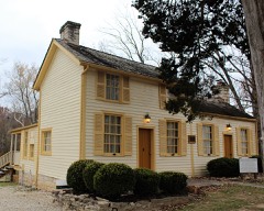
Thomas C. Fletcher House5.0 miles1974
Stonebrook5.6 miles2011
Gustave Greystone-Meissner House7.5 miles1974

Sources for this property

National Archives recordThe nomination case file for reference 70000337 in Record Group 79.
Wikipedia articleCommunity-written account of this property, licensed CC BY-SA.
Jefferson CountyAll 10 listed properties in this county.

Provenance

  • Listing record. National Park Service National Register of Historic Places, listed-properties dataset, current to 2026-05-22.
  • Map join. Address geocoded through the United States Census geocoder, then tested against the published boundary of every sheet in the USGS Historical Topographic Map Collection.
  • How this page is made. Listing fields come from federal records; map-sheet coverage is a labelled coordinate-to-boundary calculation, not a source-field claim.
  • Wildfire. Short, Karen C. 2022. Spatial wildfire occurrence data for the United States, 1992-2020 [FPA_FOD_20221014]. 6th Edition. Fort Collins, CO: Forest Service Research Data Archive. https://doi.org/10.2737/RDS-2013-0009.6 Collected with United States Government funding and usable without additional permissions or fees.
  • Mines and quarries. USGS Mineral Resources Data System (MRDS) https://mrdata.usgs.gov/mrds/ A work of the United States government, no copyright under 17 U.S.C. 105.
  • Storms. NOAA National Centers for Environmental Information, Storm Events Database https://www.ncei.noaa.gov/stormevents/ A work of the United States government, no copyright under 17 U.S.C. 105. Narratives are quoted verbatim from the National Weather Service report and are not edited or summarised.