Block
From the record
39 National Register listings published here, 1 of them a National Historic Landmark.
Sources: the National Register database, National Park Service
57 topographic sheets cover 39 settlements here, and 39 properties are on the National Register of Historic Places.
39 National Register listings published here, 1 of them a National Historic Landmark.
Sources: the National Register database, National Park Service
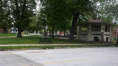
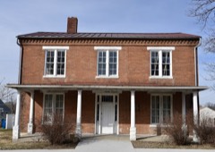
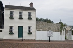
Every property in this county listed on the National Register of Historic Places, with the year it was listed and the federal nomination document.
Every wildfire the federal occurrence database records inside this county: 74 of them, burning about 511 acres. None started naturally and none was recorded as arson. Each settlement page carries the fires within five miles of it.
| Reported cause | Fires |
|---|---|
| Missing data/not specified/undetermined | 46 |
| Debris and open burning | 18 |
| Equipment and vehicle use | 4 |
| Fireworks | 2 |
| Smoking | 1 |
| Railroad operations and maintenance | 1 |
| Other causes | 1 |
| Power generation/transmission/distribution | 1 |
The five largest, by the area the report gives. None of them was recorded as arson.
| Date | Cause | Size | Reported by | Name on the report |
|---|---|---|---|---|
| 18 November 1999 | Equipment and vehicle use | 238 acres | Missouri Department of Conservation | not named |
| 3 August 1996 | Missing data/not specified/undetermined | 40 acres | Missouri Department of Conservation | not named |
| 13 March 2020 | Missing data/not specified/undetermined | 36 acres | Missouri Department of Conservation | 190282-06426-03132020-1910 |
| 14 March 2018 | Missing data/not specified/undetermined | 31 acres | Missouri Department of Conservation | 177436-06438-03142018-1337 |
| 3 April 2019 | Missing data/not specified/undetermined | 22 acres | Missouri Department of Conservation | 179004-06426-04032019-1800 |
| 23 March 2002 | Missing data/not specified/undetermined | 16 acres | Missouri Department of Conservation | not named |
| 2 December 1994 | Debris and open burning | 15 acres | Missouri Department of Conservation | not named |
| 23 March 2019 | Missing data/not specified/undetermined | 10 acres | Missouri Department of Conservation | 179003-06426-03232019-1415 |
Every settlement page carries the fires within five miles of it - see the settlement index below.
The NOAA Storm Events Database holds 298 reports for this county, causing no deaths, 5 injuries and about $9,023,200 in recorded property damage. Each settlement page carries the reports that name it.
| Kind of event | Reports |
|---|---|
| Thunderstorm Wind | 142 |
| Hail | 111 |
| Flash Flood | 19 |
| Tornado | 12 |
| Flood | 10 |
| Lightning | 4 |
The most serious of them, by death, then injury, then recorded damage. The accounts are quoted exactly as the forecast office filed them.
| When | Event | Place named | Harm | What the report says |
|---|---|---|---|---|
| June 2011 | Thunderstorm Wind | Warren | 3 hurt | Thunderstorm winds blew a mobile home off its foundation and destroyed it. Three people were in the mobile home at the time, two adults and one infant. All three suffered only minor injuries. |
| October 2007 | Tornado (EF1) | Woodland | 1 hurt, $100,000 | A tornado touched down half a mile east of the intersection of Highway F and CR 255, about one and a quarter miles east of Woodland. Several trees and large tree limbs were blown down at this location. The tornado traveled to the northeast, damaging a machine shed near the intersection of CR 279 and CR 264. It continued to move to the northeast and skipped over a tree line before moving into the southern part of Palmyra where it damaged the Consolidated Machine & Welding Company on US Highway 61. Three of the four large corrugated steel buildings were severely damaged. One semi trailer was lifted and dropped onto 2 other trailers at this location. It then damaged a church and structures around the church. Further northeast a trucking company sustained minor building damage. From this point it crossed US Highway 61, where it picked up a car that was traveling south on the highway and flipped it twice. Fortunately the driver was wearing her seatbelt and only sustained minor injuries. It then caused additional tree damage a quarter of a mile northeast of the highway before lifting and dissipating. |
| August 2006 | Lightning | Hannibal | 1 hurt, $25,000 | Lightning struck a house on Ridgewood causing a fire resulting in one injury and moderate damage. A woman was treated at a local hospital for smoke inhalation. |
| June 2008 | Flood | Mark | $7,100,000 | The Mississippi River at Hannibal, MO crested at 29.54 feet on 6/18/2008. This is the second highest crest ever recorded. The City of Hannibal escaped relatively unscathed as the flood wall and most levees north and south of town held due to work by the National Guard and volunteers. Plastic and sandbags were used to raise and cover about 60% of the levees in the County. The Mark Bottoms levee was over topped resulting in 19 homes being flooded. Highway 79 in the south part of Hannibal was closed. No other towns in the county were affected as the remainder of the land along the river is used for agriculture or conservation purposes. County Extension Service personnel estimated agricultural losses at $13.3 million. Emergency management personnel reported $7.1 million in infrastructure damages. |
| May 2008 | Hail | Hannibal | $1,000,000 | Hail up to golf ball size fell on Hannibal. Most of the large hail fell on the south part of town. About 200 cars in a manufacturing company parking lot were damaged. |
| September 1977 | Tornado (F2) | not stated | $250,000 | no account filed |
| July 2010 | Flash Flood | Hannibal | $200,000 | Up to 6 inches of rain fell in a short amount of time causing flash flooding. Numerous roads were flooded including several in Hannibal. Also, Bear Creek in Hannibal overflowed its banks flooding a nearby parking lot with two feet of water and 35 to 40 residents along the creek had to be rescued from their homes by boat due to the flooding. |
| February 2011 | Thunderstorm Wind | Hannibal Muni Arpt | $100,000 | Thunderstorm winds flipped over a Cessna plane destroying it and damaged three other planes at the Hannibal Regional Airport. Further to the east in town, several large trees were blown over. One large tree landed on an unoccupied car causing major damage. Also, several power lines were blown down. |
| June 2025 | Thunderstorm Wind | Palmyra | $50,000 | Thunderstorm winds knocked a large tree onto power lines at the intersection of Hamilton and Dickerson in Palmyra. This caused a power outage that affected about 100 residences. |
| October 2007 | Tornado (EF0) | Palmyra | $50,000 | The tornado initially touched down near the intersection of West Church Street and South Breckenridge Avenue with minor tree damage. As the tornado travelled to the east northeast, additional tree damage occurred in a residential area near the far western end of West Lafayette Street. The tornado then caused damage to 3 large corrigated buildings on South Bradley Street between West Lafayette Street and West Main Cross Street. Tree and power line damage was also observed in this area. The tornado caused minor roof damage to a store on Main Street before lifting and dissipating. |
| April 2025 | Thunderstorm Wind | Withers Mill | $35,000 | Two sources reported estimated 70 mph thunderstorm wind gusts west of Hannibal. Multiple instances of damage around Hannibal due to thunderstorm winds were reported, including the destruction of a trailer near Hannibal Regional Hospital. |
| July 2025 | Thunderstorm Wind | Palmyra | $20,000 | Thunderstorm winds snapped several trees in and around Palmyra, including a large tree that fell on the roof of a home. |
| August 2022 | Thunderstorm Wind | Palmyra | $20,000 | Thunderstorm winds knocked down several power lines around town. Also, several power poles were leaning on the west side of town. A large tree was blown down, as well as numerous tree limbs. |
| July 2021 | Thunderstorm Wind | Palmyra | $20,000 | Widespread wind damage across the central sections of Marion County. Numerous trees, tree limbs and power lines were blown down. Some of the debris landed on roads blocking them. |
| June 2022 | Thunderstorm Wind | Hannibal Muni Arpt | $15,000 | Numerous tree limbs were blown down around town. Also, a large tree was blown over onto a house causing minor roof damage. |
| April 2024 | Thunderstorm Wind | Palmyra | $10,000 | There was a report of damage to a metal outbuilding in Palmyra. |
| July 2003 | Thunderstorm Wind | Hannibal | $10,000 | Thunderstorm wind gusts downed some trees in Hannibal. One large tree fell on a car causing major damage. |
| April 2013 | Flood | West Quincy | $5,000 | The Mississippi River rose to major flood levels along the Marion County border. The river crested on April 21st, but remained above flood stage into May. Damage was limited to a few roads closed and agricultural lowlands. |
| August 2022 | Thunderstorm Wind | Mungers | $3,000 | Thunderstorm winds blew down numerous large tree limbs around town. |
| April 1977 | Tornado (F0) | not stated | $2,500 | no account filed |
| June 2013 | Flood | West Quincy | $2,000 | The Mississippi River started June in flood and hit major flood levels cresting on the 1st. The river fell the rest of the month but remained in flood into July. |
| April 2013 | Flood | Taylor | $2,000 | The South Fabius River crested at major flood level on April 19th. |
| May 1995 | Thunderstorm Wind | Palmyra | $1,300 | The county sheriff reported several large trees down along Highways 24 and 61 south of Palmyra. Two large 10- by 10-foot signs were blown down in the southern part of the county several minutes later. |
| May 2013 | Flood | West Quincy | $1,000 | The Mississippi continued in flood along the border of Marion County through May. The river started at major flood levels, dropped some in the middle of the month, but then rose again to major levels at the end of May. The flood wall in Hannibal kept the tourist areas nice and dry. Damage was limited to some closed roads and flooded farmland. |
| April 2013 | Flood | Woodland | $1,000 | The North River crested at major flood level on April 18th. Damage was limited to a few closed roads and flooded farmland. |
| September 2010 | Lightning | Palmyra | $200 | Lightning struck a tree next to a house in rural Palmyra. The lightning then travelled into the house at the breaker box in the basement. It caught fire, but the family heard the lightning strike and was able to put out the fire before it spread further. No injuries were reported. |
| May 1995 | Thunderstorm Wind | Palmyra | $200 | The county sheriff reported several large trees down along Highways 24 and 61 south of Palmyra. Two large 10- by 10-foot signs were blown down in the southern part of the county several minutes later. |
| May 2025 | Thunderstorm Wind | Withers Mill | - | Thunderstorm winds downed two trees near the split of US 61 and US 24 at the intersection of Route F south of Palmyra. These trees blocked traffic at this intersection. Northeast of Palmyra, thunderstorm winds downed trees along Missouri 168 near Route JJ. |
| August 2025 | Thunderstorm Wind | Hester | - | A Marion County ambulance at Highway 6 and Highway V in Maywood had to pull over due to estimated 70+ mph winds, zero visibility, and heavily leaning trees. |
| August 2025 | Thunderstorm Wind | West Quincy | - | A spotter estimated 60 mph winds on the west side of Quincy. |
| March 2025 | Thunderstorm Wind | Withers Mill | - | At 7:28 pm CDT, ambulance drivers estimated 70 mph winds near the intersection of Highway 24 and Highway 61 just northwest of Hannibal. Six minutes later, permanent MoDOT signs were reported downed near the intersection of Highway 61 and County Road 421, just east of the initial report. |
| July 2025 | Thunderstorm Wind | Palmyra | - | Thunderstorm winds downed a tree approximately 2.5 feet in diameter. |
| July 2025 | Thunderstorm Wind | Hannibal | - | Thunderstorm winds downed 2 trees in Hannibal. The trees were approximately 2.5 feet in diameter. |
| June 2024 | Thunderstorm Wind | Emerson | - | A large portion of a healthy tree was snapped lengthwise from its base. |
| October 2024 | Thunderstorm Wind | Ely | - | Thunderstorm winds downed two large trees on the north side of Monroe City. |
| October 2024 | Thunderstorm Wind | Hannibal | - | Thunderstorm winds downed a 2 foot diameter tree on Market Street and downed a 1 foot diameter tree on Beech Street both in Hannibal. |
| March 2023 | Hail | Hannibal | - | Another wide swath of large hail up to 2.5 inches in diameter fell across Hannibal. Numerous cars sustained damage as well as siding on homes. |
| March 2023 | Hail | Withers Mill | - | Large hail up to baseball size fell over southern portions of Marion County. One house sustained siding and window damage. |
| March 2023 | Hail | Hannibal | - | A wide swath of large hail up to golf ball sized fell across Hannibal. |
| June 2023 | Thunderstorm Wind | Heather | - | Widespread tree damage across the central portions of Marion County, from near Philadelphia to just east of Palmyra. In Palmyra, the door to a pizza restaurant was blown off. Also, numerous power lines were blown down due to fallen trees and tree limbs. A large 4 foot diameter tree was snapped off on Highway 168 just east of Palmyra. |
| June 2023 | Thunderstorm Wind | Hannibal | - | Thunderstorm winds blew down a couple of large trees and numerous tree limbs. One tree fell onto a house causing moderate roof damage. |
| June 2023 | Thunderstorm Wind | Hannibal | - | A strong outflow boundary from a supercell that was north of Hannibal moved through the city. A large tree was blown over onto a house, causing minor damage. |
| August 2023 | Thunderstorm Wind | West Ely | - | The leading edge of the storm impacted Rensselaer and Palmyra at nearly the same time, causing widespread damage to a farm and destroying a garage in Rensselaer. Several trees were downed there as well, and a 10 inch diameter tree fell in Palmyra. |
| June 2021 | Thunderstorm Wind | Withers Mill | - | Thunderstorm winds broke off a large section of a tree. |
| June 2021 | Tornado (EF0) | White Bear | - | A brief tornado touched down to the northeast of Renseselaer very early in the morning on June 25th. The tornado first touched down along County Road 429. The tornado quickly pushed northeast, doing damage to a few sheds at the intersection of County Road 429 and Highway MM. One shed was completely destroyed and its roof was lifted into a nearby tree. The tornado spread northeast across Highway MM, before lifting just to the north of Highway MM. The tornado was rated EF0 with a path length of 0.21 miles and a max path width of 50 yards. No injuries or deaths were reported. |
| June 2021 | Tornado (EF0) | Mungers | - | A brief, narrow tornado touched down in a residential subdivision northwest of Hannibal, MO early Friday morning. The tornado first touched down along Rosewood Drive, where it ripped the siding off the westward facing wall of a residential home. The tornado then continued northeast towards Deer Ridge, completely destroying a couple of vinyl fences and breaking limbs off a large tree on the north side of Deer Ridge. The tornado quickly lifted as it pushed east towards Munger Lane. The tornado was rated EF0 with a path length of 0.13 miles and a max path width of 25 yards. No injuries or deaths were reported. |
| June 2021 | Thunderstorm Wind | Hannibal | - | Thunderstorm winds caused widespread damage across Hannibal. Several large tree limbs and minor roof damage was reported on Lilly Street. Several trees were blown down onto Lindell Avenue. |
| June 2021 | Thunderstorm Wind | West Ely | - | Thunderstorm winds blew down numerous tree limbs around the intersection of U.S. Highway 36 and Highway H. |
| June 2021 | Flash Flood | Hannibal | - | Up to four inches of rain in a short amount of time caused flash flooding in Hannibal, especially for areas along Bear Creek. Numerous streets in the area were flooded due to Bear Creek rising well above its banks. |
| July 2021 | Flash Flood | White Bear | - | Up to four inches of rain fell in a short amount of time causing flash flooding, especially in and around Palmyra and Hannibal. Several roads were flooded including the intersection of U.S. Highway 61 and Ross Street in Palmyra. In Hannibal the intersection of Lindell Avenue and Patchen Street was flooded. |
| August 2021 | Thunderstorm Wind | Hannibal | - | Widespread damaging winds occurred across Hannibal. Numerous large trees, tree limbs and power lines were blown down. One tree was blown down onto an unoccupied camper and another tree was blown down onto an unoccupied car. A hardware store in town sustained moderate roof damage. Also, a large portion of a flat metal roof was removed from a building on the Hannibal-LaGrange University Campus. Several trees and numerous tree limbs were blown down on campus as well. |
| June 2020 | Flash Flood | West Quincy | - | Up to five inches fell in about a 3 hour period causing flash flooding. Numerous roads were flooded including County Road 195 near North River. Also, County Road 230 bridge over Big Branch Creek was washed out. |
| July 2019 | Thunderstorm Wind | Hannibal | - | Thunderstorm winds blew down several trees and power lines around town. |
| June 2019 | Thunderstorm Wind | Palmyra | - | Thunderstorm winds blew down several power lines around town. |
| September 2019 | Thunderstorm Wind | Huiskamp | - | Thunderstorm winds blew a tree down onto Highway 168 east northeast of Palmyra. |
| May 2018 | Thunderstorm Wind | Withers Mill | - | Thunderstorm winds blew down numerous trees, tree limbs and power lines. Some trees were blown down at the intersection of County Road 426 and Highway MM. In Hannibal, numerous trees were blown down. Two large tree limbs landed on two unoccupied cars causing considerable damage to both. |
| June 2018 | Thunderstorm Wind | Palmyra | - | Thunderstorm winds blew down several large tree limbs and a couple of trees in town. |
| July 2017 | Flash Flood | West Quincy | - | Up to three inches of rain fell in less than an hour causing flash flooding. County Road 306 near Taylor had 6 to 8 inches of fast flowing water over it. |
| June 2017 | Thunderstorm Wind | West Ely | - | Thunderstorm winds blew down several trees onto U.S. Highways 61/24 south of Palmyra and a few were blown down onto County Road 272, just west of West Ely. |
| June 2017 | Thunderstorm Wind | Woodland | - | Two severe storms tracked southeastward across Marion County. Several trees were blown down between Palmyra and Hannibal. |
The Survey's mineral resources record lists 39 workings inside this county. 6 still produce and 33 are closed or unrecorded. Each settlement page carries the workings within five miles of it.
| Commodity | Workings |
|---|---|
| Stone, Crushed/Broken | 25 |
| Clay | 9 |
| Sand and Gravel, Construction | 4 |
| Gemstone | 1 |
The least common of them first, because a county's hundredth gravel pit says nothing its first ten did not.
| Where | Site | Commodity | Status | Recorded |
|---|---|---|---|---|
| Missouri Geodes | Gemstone | Producer | 1967 | |
| Bleigh Sand Pit | Sand and Gravel, Construction | Producer | ||
| Gen Stewart S&G Pit | Sand and Gravel, Construction | Producer | ||
| Poage Pit | Sand and Gravel, Construction | Producer | ||
| Unknown | Sand and Gravel, Construction | Past Producer | ||
| Unknown | Clay | Past Producer | ||
| Unknown | Clay | Past Producer | ||
| Unknown | Clay | Past Producer | ||
| Unknown | Clay | Past Producer | ||
| Unknown | Clay | Past Producer | ||
| Unknown | Clay | Past Producer | ||
| Unknown | Clay | Past Producer | ||
| Unknown | Clay | Past Producer | ||
| Unknown | Clay | Past Producer | ||
| Central Stone #7 Quarry | Stone, Crushed/Broken | Past Producer | ||
| Christner Quarry | Stone, Crushed/Broken | Producer | ||
| City Quarry | Stone, Crushed/Broken | Past Producer | ||
| Fessenden Lime Quarry | Stone, Crushed/Broken | Past Producer | ||
| Marblehead Lime Quarry | Stone, Crushed/Broken | Past Producer | ||
| Martin Quarry | Stone, Crushed/Broken | Past Producer | ||
| Stewart Quarry #1 | Stone, Crushed/Broken | Producer | ||
| Unknown | Stone, Crushed/Broken | Past Producer | ||
| Unknown | Stone, Crushed/Broken | Past Producer | ||
| Unknown | Stone, Crushed/Broken | Past Producer | ||
| Unknown | Stone, Crushed/Broken | Past Producer | ||
| Unknown | Stone, Crushed/Broken | Past Producer | ||
| Unknown | Stone, Crushed/Broken | Past Producer | ||
| Unknown | Stone, Crushed/Broken | Past Producer | ||
| Unknown | Stone, Crushed/Broken | Past Producer | ||
| Unknown | Stone, Crushed/Broken | Past Producer | ||
| Unknown | Stone, Crushed/Broken | Past Producer | ||
| Unknown | Stone, Crushed/Broken | Past Producer | ||
| Unknown | Stone, Crushed/Broken | Past Producer | ||
| Unknown | Stone, Crushed/Broken | Past Producer | ||
| Unknown | Stone, Crushed/Broken | Past Producer | ||
| Unknown | Stone, Crushed/Broken | Past Producer | ||
| Unknown | Stone, Crushed/Broken | Past Producer | ||
| Unknown | Stone, Crushed/Broken | Past Producer | ||
| White Bear Quarry | Stone, Crushed/Broken | Past Producer |
Named settlements recorded in the Geographic Names Information System, each with the topographic sheets covering it. Villages, hamlets and abandoned places alike. Each is shown with the nearest named watercourse or landform and the survey quadrangle it falls on.
South River township · 63401 · On College Branch · Rensselaer quadrangle
11 sheets, 1903 to 1986
Mason township · 63401 · Near Fall Creek Gorge · Hannibal East quadrangle
17 sheets, 1932 to 1993
Union township · 63463 · Nelsonville quadrangle
10 sheets, 1903 to 1986
No longer a settlement
Round Grove township · 63454 · On Troublesome Creek · Durham quadrangle
13 sheets, 1903 to 1986
Miller township · 63401 · Near Murphy Island · Hannibal West quadrangle
17 sheets, 1932 to 1986
Liberty township · 63461 · Quincy SW quadrangle
18 sheets, 1925 to 1996
No longer a settlement
Fabius township · 63471 · On Old Channel North Fabius River · Quincy West quadrangle
18 sheets, 1925 to 1996
Warren township · 63456 · On Newmarket Branch · Philadelphia quadrangle
12 sheets, 1903 to 1986
Mason township · 63401 · Near Rickey Hollow · Hannibal West quadrangle
17 sheets, 1932 to 1986
Liberty township · 63461 · On South River · Quincy SW quadrangle
18 sheets, 1925 to 1996
Fabius township · 63471 · Near Poage Island · Quincy West quadrangle
18 sheets, 1925 to 1996
Miller township · 63401 · On Little Bear Creek · Hannibal West quadrangle
17 sheets, 1932 to 1986
The vanished settlements of Marion County: the places named above that are no longer on the map.