 Block
From the record
5 National Register listings published here.
Sources: the National Register database, National Park Service
115 topographic sheets cover 55 settlements here, and 5 properties are on the National Register of Historic Places.
5 National Register listings published here.
Sources: the National Register database, National Park Service
Every property in this county listed on the National Register of Historic Places, with the year it was listed and the federal nomination document.
| Photograph | Property | Type | Listed | Reference |
|---|---|---|---|---|
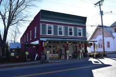 | Caledonia Historic District | district | 1986 | 86003389 |
| George Cresswell Furnace | structure | 1988 | 88000613 | |
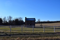 | Harrison Queen House | building | 2002 | 02000700 |
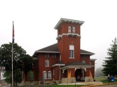 | Washington County Courthouse | building | 2011 | 11000765 |
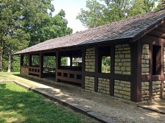 | Washington State Park CCC Historic District | district | 1985 | 85000517 |
Every wildfire the federal occurrence database records inside this county: 762 of them, burning about 13,163 acres. 4 started naturally and 159 were recorded as arson. Each settlement page carries the fires within five miles of it.
| Reported cause | Fires |
|---|---|
| Missing data/not specified/undetermined | 276 |
| Debris and open burning | 270 |
| Arson/incendiarism | 159 |
| Smoking | 15 |
| Recreation and ceremony | 11 |
| Power generation/transmission/distribution | 9 |
| Equipment and vehicle use | 8 |
| Misuse of fire by a minor | 5 |
| Railroad operations and maintenance | 5 |
| Natural | 4 |
The five largest, by the area the report gives. Two of them were set deliberately.
| Date | Cause | Size | Reported by | Name on the report |
|---|---|---|---|---|
| 18 April 2004 | Missing data/not specified/undetermined | 1,026 acres | Missouri Department of Conservation | CICERO CREEK |
| 4 April 2016 | Missing data/not specified/undetermined | 800 acres | Missouri Department of Conservation | 135362-11043-04042016-0745 |
| 24 March 1997 | Misuse of fire by a minor | 522 acres | Mark Twain National Forest | FLATWOODS |
| 30 March 2005 | Power generation/transmission/distribution | 387 acres | Mark Twain National Forest | FOUR POINTS |
| 10 April 2019 | Arson/incendiarism | 365 acres | Mark Twain National Forest | FLINT HILL |
| 6 March 2012 | Misuse of fire by a minor | 325 acres | Mark Twain National Forest | DIAMOND |
| 16 March 2006 | Missing data/not specified/undetermined | 300 acres | Missouri Department of Conservation | UPLAND WINGS |
| 6 April 2011 | Arson/incendiarism | 265 acres | Mark Twain National Forest | RABBIT HOLLOW |
Every settlement page carries the fires within five miles of it - see the settlement index below.
The NOAA Storm Events Database holds 355 reports for this county, causing 6 deaths, 100 injuries and about $57,581,200 in recorded property damage. Each settlement page carries the reports that name it.
| Kind of event | Reports |
|---|---|
| Hail | 174 |
| Thunderstorm Wind | 124 |
| Tornado | 28 |
| Flash Flood | 25 |
| Heavy Rain | 2 |
| Flood | 2 |
The most serious of them, by death, then injury, then recorded damage. The accounts are quoted exactly as the forecast office filed them.
| When | Event | Place named | Harm | What the report says |
|---|---|---|---|---|
| December 1967 | Tornado (F4) | not stated | 3 killed, 47 hurt, $2,500,000 | no account filed |
| June 1969 | Tornado (F4) | not stated | 2 killed, 22 hurt, $2,500,000 | no account filed |
| November 1984 | Tornado (F2) | not stated | 1 killed, 15 hurt, $25,000,000 | no account filed |
| October 2004 | Tornado (F1) | Potosi | 7 hurt | The 1st in a series of 5 small tornadoes struck just northeast of Potosi along Highway 21. The Potosi Lumberyard was severely damaged. Seven people were injured with one kept overnight at a local hospital. |
| May 2016 | Flash Flood | Cruise | 4 hurt | Up to four inches of rain in a short amount of time caused flash flooding across the northern portions of Washington County. Several water rescues had to be performed around the Richwoods area. Numerous roads were closed due to flooding including Highway 47 near Richwoods. Four people were treated for minor injuries. |
| December 1966 | Tornado (F3) | not stated | 2 hurt, $250,000 | no account filed |
| December 1971 | Tornado (F1) | not stated | 2 hurt, $25,000 | no account filed |
| May 1957 | Tornado (F3) | not stated | 1 hurt, $25,000,000 | no account filed |
| April 2025 | Tornado (EF3) | Brazil | $685,000 | The tornado then entered Washington County and crossed West State Highway 8 east of Berryman. The tornado continued northeast, damaging mobile homes and snapping trees around Cape Lakewood before approaching State Highway 185 and the town of Latty. Once there, the tornado strengthened and caused significant damage to homes in the northwest part of town. This damage was the worst observed, with winds estimated as strong as 165 mph. The tornado continued northeast into rural areas northwest of Old Mines before lifting at 3:39 PM. In Washington County the tornado had a path length of 19.63 miles with a maximum path width of 200 yards. It was rated an EF3. |
| April 1994 | Thunderstorm Wind | Caledonia | $500,000 | Strong winds tore the roofs off a laundromat and feed store along Highways 21 and 32. Union Electric had to clear pieces of sheet metal and building material from overhead power lines. Trees were also uprooted or blown down through out the community. Many of the trees fell on buildings or cars causing further damage. |
| April 1993 | Tornado (F1) | Potosi | $500,000 | A small tornado initially touched down near the intersection of Highway P and State Road 8, damaging a door and windows of a large garage. The tornado then traveled across a city park damaging several trees, sections of a chain-linked fence, and several advertisement bill boards. Before lifting numerous trees were downed, several mobile homes were flipped, and minor roof damage was caused to a service station just east of the intersection of State Roads 8 and 21. |
| May 1971 | Tornado (F2) | not stated | $250,000 | no account filed |
| December 1966 | Tornado (F3) | not stated | $250,000 | no account filed |
| April 2025 | Tornado (EF1) | Springtown | $50,000 | A brief tornado touched down just west of Bates Creek Camp near Potosi during the afternoon. Here, the tornado caused building and tree damage. Most notably it destroyed the garage of a home in Bates Creek Camp. The tornado then moved northeast into southern Potosi, causing tree damage along the way. It then lifted near Washington County Memorial Hospital where it caused minor tree damage. The tornado was rated EF-1 with a path length of 4.24 miles and a maximum path width of 150 yards. |
| May 1957 | Tornado (F1) | not stated | $25,000 | no account filed |
| May 2022 | Hail | Sunlight | $15,000 | Large hail up to golf ball sized fell across the southern portions of Washington County. A number of cars and campers sustained hail damage. |
| July 2022 | Thunderstorm Wind | Irondale | $10,000 | Thunderstorm winds blew down a large tree branch onto the roof of a house. The roof sustained minor damage. |
| August 2021 | Thunderstorm Wind | Old Mines | $10,000 | Thunderstorm winds blew down numerous trees, tree limbs and several power lines across eastern portions of Washington County. One tree was blown down at the intersection of Highways 21 and 47, just south of Old Mines. Another tree was blown down at the intersection of Highway 21 and State Highway E. On the east side of Ironton, a tree was blown down at the intersection of Scout Camp Road and Nursing Home Road. |
| June 2022 | Thunderstorm Wind | Richwoods | $5,000 | Thunderstorm winds blew down several large trees in Richwoods. |
| May 1995 | Thunderstorm Wind | Richwoods | $3,200 | Minor structural damage was caused to a home and large trees were blown over. Gold ball-size hail was also reported. |
| April 1995 | Hail | Richwoods | $1,200 | Hail the size of marbles began several minutes earlier damaging cars. Size increased to golf ball-size and completely covered the ground at one point. |
| July 2021 | Thunderstorm Wind | Old Mines | $1,000 | Several large tree branches were blown down. |
| April 1994 | Thunderstorm Wind | Racola | $500 | The county sheriff reported several large trees down. |
| July 1995 | Thunderstorm Wind | Potosi | $300 | Large trees and power lines were blown down just south of Potosi. |
| March 2026 | Flash Flood | Irondale | - | Heavy rain caused Germania Road (listed as St. Francois Road on Google Maps) to flood along the Washington - St. Francois county line. |
| April 2026 | Hail | Pea Ridge | - | Numerous hailstones measuring 2 inches to 4 inches. |
| March 2025 | Hail | Caledonia | - | Quarter sized hail fell in Caledonia. Some hailstones may have been slightly larger than quarters. |
| May 2025 | Tornado (EF0) | Sunlight | - | The tornado crossed the Iron/Washington County line where it continued to uproot and damage trees. It dissipated at 20:01 along Highway DD just north of its junction with Martin Road. |
| May 2025 | Tornado (EF0) | Cruise | - | A tornado touched down near Eight Wheeler Road outside of Richwoods and caused tree damage as it moved north-northeast before dissipating just north of Highway H. The peak wind speed was 80 mph and the path was 2.21 miles long and 140 yards wide. |
| April 2025 | Flash Flood | Caledonia | - | The Dent Branch of the Big River was reportedly swiftly running over Highway C where a bridge crosses the road. Rainfall totals through the event were on the order of 2.5 to 4.3 inches. |
| May 2024 | Thunderstorm Wind | Brazil | - | A 911 call center reported a tree down on Highway 8 near Berryman. |
| May 2024 | Thunderstorm Wind | Hunters Mill | - | A tree fell over power lines on Gilday Road south of Potosi. |
| May 2024 | Thunderstorm Wind | Potosi Wshngtn Co Ar | - | Thunderstorm winds reportedly knocked a tree down blocking the road at New Diggins Road and Cook Subdivision Road near Mineral Point. |
| April 2024 | Thunderstorm Wind | Hopewell | - | A 911 call center reported downed power lines at Route 21 and Macon Road south of Potosi. |
| November 2024 | Flash Flood | Baryties | - | Heavy rain caused water to run over Route CC near Highway 21 and Route E east of Potosi. |
| November 2024 | Heavy Rain | Potosi | - | A Cocorahs station 3.2 W Potosi measured 8.8 inches of storm total rainfall between November 4th and 5th. |
| August 2023 | Thunderstorm Wind | Potosi | - | Thunderstorm winds blew down numerous trees, tree limbs and power lines from Potosi to Mineral Point. |
| August 2023 | Thunderstorm Wind | Bliss | - | Thunderstorm winds blew down several trees onto Highway 47 around the intersection with Highway 21. |
| July 2023 | Thunderstorm Wind | Shirley | - | Thunderstorm winds blew down several trees as well as numerous tree limbs. |
| July 2023 | Thunderstorm Wind | Anthonies Mill | - | Thunderstorm winds blew down several large trees and numerous tree limbs in the Woodland Lakes community. Also, several campers and awnings were damaged either due to fallen trees and/or tree limbs. Numerous power lines were knocked down as well. |
| July 2023 | Thunderstorm Wind | Old Mines | - | Thunderstorm winds blew down several large tree limbs just northwest of Blackwell. |
| April 2021 | Flash Flood | Pea Ridge | - | Up to three inches of rain fell in a short amount of time onto already saturated soil. This caused flash flooding. Many small creeks were flooded across northern portions of the county. Also, several low water crossings and roads had several feet of water over them, especially in the Richwoods area. |
| July 2021 | Flash Flood | Anthonies Mill | - | Up to 4 inches of rain fell in a short amount of time causing flash flooding. Several roads were flooded, especially around the Potosi area. |
| April 2020 | Thunderstorm Wind | Maryden | - | Thunderstorm winds caused moderate damage to several barns and a couple of trees were blown down. |
| November 2020 | Thunderstorm Wind | Anthonies Mill | - | Thunderstorm winds blew a large tree over onto Highway W. |
| March 2019 | Tornado (EF0) | Cadet | - | A few branches were broken off in this location where law enforcement witnessed a|brief tornado touchdown just southwest of the intersection of Highway E and Route 47. The tornado was rated EF0 with a max wind speed of 65 mph. The path length was 0.01 mile with a max path width of 20 yards. No deaths or injuries were reported. |
| June 2019 | Thunderstorm Wind | Hopewell | - | Thunderstorm winds blew down a large tree. |
| June 2019 | Thunderstorm Wind | Caledonia | - | Thunderstorm winds blew down two large trees in town. |
| October 2019 | Thunderstorm Wind | Caledonia | - | A trained spotter reported that his personal weather station recorded an unofficial wind gust of 85 mph at 346 am as the storms moved through. There were numerous trees blown down along Highway 21 south of Caledonia, as well as along Highway 32 east of town. Just west northwest of Irondale, several trees were blown down along State Highway U near Hunt Lane. |
| October 2019 | Thunderstorm Wind | Troutt | - | Thunderstorm winds blew down several trees near the intersection of State Highway 185 and State Route T. Also, several power lines were blown down at the intersection of State Highways H and A, just east of Richwoods. |
| December 2018 | Thunderstorm Wind | Hunters Mill | - | Thunderstorm winds blew down a large tree blocking the southbound lane of Highway 21 just south of intersection with Furnace Creek Road. |
| May 2018 | Thunderstorm Wind | Hopewell | - | Thunderstorm winds blew down several trees and tree limbs. |
| May 2017 | Thunderstorm Wind | Hunters Mill | - | Thunderstorm winds blew down numerous trees and power lines between Caledonia and Potosi. One large tree was blown down onto Highway 8 south of Mineral Point. |
| April 2017 | Flash Flood | Courtois | - | Between 5 and 7 inches of rain fell causing widespread flash flooding. Numerous roads were flooded including Route CC between Highway 21 and Route E. |
| August 2016 | Flash Flood | Maryden | - | Up to 6 inches of rain fell over already saturated soil causing flash flooding. Numerous roads were flooded across the southeastern and eastern portions of Washington County. Holiday Shores Road was flooded and a water rescue had to be performed in this area. Also, Mounts Road (County Road 511) bridge over the Big River was under about 4 feet of water. The intersection of Highways 21 and 32 in Caledonia was flooded. |
| July 2016 | Thunderstorm Wind | Caledonia | - | Thunderstorm winds snapped off a power pole in Caledonia. |
| May 2016 | Thunderstorm Wind | Richwoods | - | Thunderstorm winds blew the roof off of a mobile home. No one was injured. |
| July 2016 | Thunderstorm Wind | Shirley | - | Thunderstorm winds blew down several large trees 5 miles southwest of Potosi and several large trees in Old Mines. |
| July 2016 | Thunderstorm Wind | Caledonia | - | Thunderstorm winds blew down a tree. It fell onto nearby power lines, pulling them down as well. |
| August 2015 | Flash Flood | Courtois | - | Up to five inches of rain fell in a short amount of time causing flash flooding. Numerous roads were flooded. Highway C, three miles east northeast of Courtois, was closed both ways due to Cub Creek well out of its banks. |
The Survey's mineral resources record lists 325 workings inside this county. 43 still produce and 282 are closed or unrecorded. Each settlement page carries the workings within five miles of it.
| Commodity | Workings |
|---|---|
| Barium-Barite | 165 |
| Lead | 94 |
| Iron | 26 |
| Lead, Zinc | 13 |
| Barium-Barite, Lead | 6 |
| Zinc, Lead | 4 |
| Lead, Barium-Barite | 3 |
| Stone, Crushed/Broken | 3 |
| Copper | 2 |
| Zinc | 2 |
| Lead, Silver, Zinc | 1 |
| Phosphorus-Phosphates | 1 |
| Lead, Barium-Barite, Zinc | 1 |
| Lead, Zinc, Barium-Barite | 1 |
The least common of them first, because a county's hundredth gravel pit says nothing its first ten did not.
| Where | Site | Commodity | Status | Recorded |
|---|---|---|---|---|
| Abbeyville Mines | Lead, Iron, Barium-Barite | Past Producer | ||
| Cook Prospect | Sulfur-Pyrite | Past Producer | ||
| Indian Creek Division | Lead, Copper, Silver, Zinc, Nickel, Cobalt, Cadmium | Past Producer | 1948, 1954 | |
| Kellogg Shaft | Lead, Barium-Barite, Zinc | Occurrence | Barite, Galena, Sphalerite | |
| Pea Ridge | Iron, Phosphorus-Phosphates | Producer | 1954, 1964 | |
| Pea Ridge Mine | Iron, REE, Cobalt, Phosphorus-Phosphates | Producer | 1953, 1964 | |
| Peach Orchard Diggings | Lead, Silver, Zinc | Occurrence | Galena, Smithsonite | |
| Potosi | Lead, Barium-Barite, Zinc, Copper, Manganese, Iron | Past Producer | 1763 | |
| Strawberry Diggings | Lead, Zinc, Barium-Barite | Past Producer | Residual | |
| Unknown - Clay | Clay | Past Producer | ||
| Unknown - Iron & Zinc | Zinc, Iron | Past Producer | ||
| Unknown-Ss | Flagstone | Past Producer | ||
| Wolf Quarry | Dolomite, Stone, Crushed/Broken, Iron | Past Producer | ||
| Evans Mine | Zinc | Past Producer | ||
| Jordans Copper Diggings | Copper | Past Producer | ||
| Unknown - Copper | Copper | Past Producer | ||
| Washington County Zinc Works | Zinc | Past Producer | ||
| Mineral Point Group | Lead, Barium-Barite | Past Producer | Barite, Galena | |
| Unknown - Ls | Stone, Crushed/Broken | Past Producer | ||
| Unknown -Ba and Pb | Lead, Barium-Barite | Past Producer | ||
| Unknown-Ls | Stone, Crushed/Broken | Past Producer | ||
| Unknown-Ls | Stone, Crushed/Broken | Past Producer | ||
| Krueger Zinc Mine | Zinc, Lead | Past Producer | ||
| Poverty Flat Workings | Zinc, Lead | Past Producer | 1890 | |
| Unknown - Lead and Zinc | Zinc, Lead | Past Producer | ||
| Unknown - Lead and Zinc | Zinc, Lead | Past Producer | ||
| Cyclone Mine | Barium-Barite, Lead | Past Producer | ||
| Duclois Diggings | Barium-Barite, Lead | Unknown | ||
| Kellogg Shaft | Barium-Barite, Lead | Past Producer | ||
| Parole Mine | Barium-Barite, Lead | Past Producer | 1814 | |
| Pierce and Willoughby's Diggings | Barium-Barite, Lead | Past Producer | ||
| Unknown - Lead and Barite | Barium-Barite, Lead | Past Producer | ||
| Bee and Scott Diggings | Lead, Zinc | Past Producer | ||
| Dry Bone Shaft | Lead, Zinc | Occurrence | Galena, Sphalerite | |
| Elliot Mines | Lead, Zinc | Past Producer | ||
| Faguaher Diggings | Lead, Zinc | Past Producer | Galena, Smithsonite | |
| French Diggings | Lead, Zinc | Past Producer | ||
| Labeaume Diggings | Lead, Zinc | Past Producer | ||
| Little Saturday Mine | Lead, Zinc | Past Producer | ||
| Poverty Flat Diggings | Lead, Zinc | Past Producer | ||
| Shore Diggings | Lead, Zinc | Past Producer | ||
| Unknown - Lead and Zinc | Lead, Zinc | Past Producer | ||
| Unknown - Lead and Zinc | Lead, Zinc | Past Producer | ||
| Unknown-Lead and Zinc | Lead, Zinc | Past Producer | ||
| Unknown-Zinc and Lead | Lead, Zinc | Past Producer | ||
| Adams Property | Iron | Occurrence | ||
| Adams Property | Iron | Past Producer | ||
| Blanton Limonite Bank | Iron | Past Producer | ||
| Blanton Specular Mine | Iron | Past Producer | ||
| Desloge Land | Iron | Occurrence | ||
| Ives Mines | Iron | Past Producer | ||
| Nicholson Bank | Iron | Past Producer | ||
| Nicholson Bank | Iron | Past Producer | ||
| Old Hamilton Iron Works | Iron | Past Producer | ||
| Old McKindsey Mine | Iron | Past Producer | ||
| Palmer | Lead, Barium-Barite, Iron | Past Producer | REPLACEMENT | |
| Pea Ridge Pellet Plant | Iron | Plant | ||
| Prewitt Mountain | Iron | Occurrence | ||
| Primrose Hill Mine | Iron | Past Producer | ||
| Pruitt Mountain Mine | Iron | Past Producer | ||
| St. Joe Iron Mine | Iron | Producer | ||
| Tirrel Mine | Iron | Past Producer | ||
| Unknown - Iron | Iron | Past Producer | ||
| Unknown - Iron | Iron | Past Producer | ||
| Unknown - Iron | Iron | Past Producer | ||
| Unknown - Iron | Iron | Past Producer | ||
| Unknown-Fe and Zn | Iron | Past Producer | ||
| Unknown-Iron | Iron | Past Producer | ||
| Unknown-Iron | Iron | Past Producer | ||
| Bellefontaine Mines | Lead | Past Producer | ||
| Ben Hornie's Diggings | Lead | Past Producer | ||
| Booth Mine | Lead | Past Producer | ||
| Brock Diggings | Lead | Past Producer | ||
| Broks Mine | Lead | Past Producer | ||
| Bugg Shaft | Lead | Past Producer | ||
| Buzzard Roost Diggings | Lead | Past Producer | ||
| Cannon Mines | Lead | Past Producer | ||
| Careys Mine | Lead | Past Producer | ||
| Casey and Clancy Diggings | Lead | Past Producer | ||
| Coffee Pot Diggings | Lead | Past Producer | ||
| Darley Lead Mine | Lead | Past Producer | ||
| Dry Bone Shaft | Lead | Past Producer | ||
| Dry Fork Diggings | Lead | Past Producer | ||
| Eversole Mine | Lead | Past Producer | ||
| Fourche A Courtois Mine | Lead | Past Producer | ||
| Guignon Lagiaue Mine | Lead | Past Producer | ||
| Gulf Prospect | Lead | Past Producer | ||
| Hinkson Diggings | Lead | Past Producer | ||
| Irondale Mine and Blast Furnace | Lead | Past Producer | ||
| Little Saturday Shaft | Lead | Occurrence | Galena | |
| Luaton Mine | Lead | Past Producer | ||
| Lynch Mine | Lead | Past Producer | ||
| Murphy's Mine | Lead | Past Producer | ||
| New Diggings | Lead | Past Producer | ||
| Palmer Lead Furnace | Lead | Past Producer | ||
| Picayune Diggings | Lead | Past Producer | ||
| Plaffy Diggings | Lead | Past Producer | ||
| Prairie Diggings | Lead | Past Producer | ||
| Rogers Diggings | Lead | Past Producer | ||
| Swallow Mine | Lead | Past Producer | ||
| Unknown - ? | Lead | Past Producer | ||
| Unknown - Lead | Lead | Past Producer | ||
| Unknown - Lead | Lead | Unknown | ||
| Unknown - Lead | Lead | Past Producer | ||
| Unknown - Lead | Lead | Past Producer | ||
| Unknown - Lead | Lead | Past Producer | ||
| Unknown - Lead | Lead | Past Producer | ||
| Unknown - Lead | Lead | Past Producer | ||
| Unknown - Lead | Lead | Past Producer | ||
| Unknown - Lead | Lead | Past Producer | ||
| Unknown - Lead | Lead | Past Producer | ||
| Unknown - Lead | Lead | Past Producer | ||
| Unknown - Lead | Lead | Past Producer | ||
| Unknown - Lead | Lead | Past Producer | ||
| Unknown - Lead | Lead | Past Producer | ||
| Unknown - Lead | Lead | Past Producer | ||
| Unknown - Lead | Lead | Past Producer | ||
| Unknown - Lead | Lead | Past Producer | ||
| Unknown - Lead | Lead | Past Producer | ||
| Unknown - Lead | Lead | Past Producer | ||
| Unknown - Lead | Lead | Past Producer | ||
| Unknown - Lead | Lead | Past Producer | ||
| Unknown - Lead | Lead | Past Producer | ||
| Unknown - Lead | Lead | Past Producer | ||
| Unknown - Lead | Lead | Past Producer | ||
| Unknown - Lead | Lead | Past Producer | ||
| Unknown - Lead | Lead | Past Producer | ||
| Unknown - Lead | Lead | Past Producer | ||
| Unknown - Lead | Lead | Past Producer | ||
| Unknown - Lead | Lead | Past Producer | ||
| Unknown - Lead | Lead | Past Producer | ||
| Unknown - Lead | Lead | Past Producer | ||
| Unknown - Lead | Lead | Past Producer | ||
| Unknown - Lead | Lead | Past Producer | ||
| Unknown - Lead Furnace | Lead | Past Producer | ||
| Unknown - Lead Furnace | Lead | Past Producer | ||
| Unknown-Lead | Lead | Past Producer | ||
| Unknown-Lead | Lead | Past Producer | ||
| Unknown-Lead | Lead | Past Producer | ||
| Unknown-Lead | Lead | Past Producer | ||
| Unknown-Lead | Lead | Past Producer | ||
| Unknown-Lead | Lead | Past Producer | ||
| Unknown-Lead | Lead | Past Producer | ||
| Unknown-Lead | Lead | Past Producer | ||
| Unknown-Lead | Lead | Past Producer | ||
| Unknown-Lead | Lead | Past Producer | ||
| Unknown-Lead | Lead | Past Producer | ||
| Unknown-Lead | Lead | Past Producer | ||
| Unknown-Lead | Lead | Past Producer | ||
| Unknown-Lead | Lead | Past Producer | ||
| Unknown-Lead | Lead | Past Producer | ||
| Unknown-Lead | Lead | Past Producer | ||
| Unknown-Lead | Lead | Past Producer | ||
| Unknown-Lead | Lead | Past Producer | ||
| Unknown-Lead | Lead | Past Producer | ||
| Unknown-Lead | Lead | Past Producer | ||
| Unknown-Lead | Lead | Past Producer | ||
| Unknown-Lead | Lead | Past Producer | ||
| Unknown-Lead | Lead | Past Producer | ||
| Unknown-Lead | Lead | Past Producer | ||
| Williams Diggings | Lead | Producer | ||
| A W Wood Mine | Barium-Barite | Past Producer | ||
| A-Plant & Quarry | Barium-Barite | Producer | ||
| Amex Mine | Barium-Barite | Producer | ||
| Apex/Mineral Point | Barium-Barite | Producer | 1866, 1955 | |
| Arnault Branch | Barium-Barite | Past Producer | Surface | |
| Arnault Mine | Barium-Barite | Producer | Barite | |
| Arnault Mine & Plant | Barium-Barite | Past Producer | ||
| B-Plant & Quarry | Barium-Barite | Producer | ||
| Big 4 Pit | Barium-Barite | Producer | ||
| Big Four | Barium-Barite | Producer | 1963, 1965 | |
| Big River Mine | Barium-Barite | Past Producer | ||
| Blackwell Area | Barium-Barite | Past Producer | Surface | |
| Blackwell Mine | Barium-Barite | Producer | 1950, 1952 | |
| Blackwell Pit | Barium-Barite | Producer | Barite | |
| Blackwell Pit and Plant | Barium-Barite | Producer | ||
| Bottom Diggings | Barium-Barite | Past Producer | ||
| Breton Creek Mine | Barium-Barite | Past Producer | ||
| Buckman Laboratories Inc. | Barium-Barite | Prospect | Surface | |
| Cadet | Barium-Barite | Producer | 1925 | |
| Cadet | Barium-Barite | Producer | 1954, 1956 | |
| Cadet Barite Mine | Barium-Barite | Producer | Barite | |
| Carter Mining Co Mine | Barium-Barite | Past Producer | ||
| Crawfish Diggings | Barium-Barite | Prospect | ||
| Dresser Mine # 6 | Barium-Barite | Past Producer | ||
| Dresser Minerals Mill | Barium-Barite | Producer | ||
| Dresser No 4 Mine | Barium-Barite | Producer | 1955, 1956 | |
| Dresser No. 7 Mine | Barium-Barite | Past Producer | Barite | |
| Dresser No. 7 Mine | Barium-Barite | Past Producer | ||
| Faquaher Diggings | Barium-Barite | Past Producer | ||
| Fertile Mine | Barium-Barite | Past Producer | ||
| Fountain Farm Mill | Barium-Barite | Producer | ||
| Gun Club Mine | Barium-Barite | Past Producer | ||
| Hornsey Bros. Mine | Barium-Barite | Producer | Barite | |
| Hornsey Brothers Mine | Barium-Barite | Past Producer | 1963, 1965 | |
| Joe Smith Mine | Barium-Barite | Past Producer | ||
| Keyes Branch | Barium-Barite | Producer | 1720, 1904 | |
| Keyes Branch Pit | Barium-Barite | Producer | Barite | |
| Keyes Branch Pit & Plant | Barium-Barite | Producer | ||
| Kingston Mine | Barium-Barite | Producer | 1850, 1957 | |
| M+B Mine | Barium-Barite | Past Producer | ||
| Mcgregor Tract | Barium-Barite | Past Producer | ||
| Milchem Grinding Plant | Barium-Barite | Producer | ||
| Mineral Point Area | Barium-Barite | Past Producer | Surface | |
| Mineral Point Mine | Barium-Barite | Past Producer | ||
| Old Mines Mine | Barium-Barite | Producer | 1962, 1964 | |
| Old Mines Mine | Barium-Barite | Producer | 1866, 1964 | |
| Ozark Products Co | Barium-Barite | Past Producer | ||
| Palmer Mine | Barium-Barite | Past Producer | Barite | |
| Palmer Mine | Barium-Barite | Past Producer | ||
| Parole Mine and Mill | Barium-Barite | Producer | ||
| Plant A | Barium-Barite | Producer | 1942, 1944 | |
| Plant B | Barium-Barite | Producer | 1955, 1957 | |
| Racola Mine | Barium-Barite | Past Producer | ||
| Richwoods | Barium-Barite | Producer | 1850, 1945 | |
| Settle Mine | Barium-Barite | Past Producer | ||
| Southeast Washington | Barium-Barite | Producer | ||
| Star Mine | Barium-Barite | Past Producer | ||
| Stone Spring | Barium-Barite | Prospect | Surface | |
| Sun Mine | Barium-Barite | Prospect | Surface | |
| Sun Mine | Barium-Barite | Producer | 1866, 1946 | |
| Superior Minerals Plant | Barium-Barite | Past Producer | ||
| Tailings Pond -Barite | Barium-Barite | Past Producer | ||
| Tailings Pond -Barite | Barium-Barite | Past Producer | ||
| Tailings Pond -Barite - | Barium-Barite | Past Producer | ||
| Tailings Pond -Barite - | Barium-Barite | Unknown | ||
| Tailings Pond -Barite - | Barium-Barite | Unknown | ||
| Tailings Pond -Barite - | Barium-Barite | Past Producer | ||
| Tailings Pond -Barite - | Barium-Barite | Past Producer | ||
| Tailings Pond -Barite - Amex Plant | Barium-Barite | Producer | ||
| Tailings Pond -Barite -A.W-Wood Min | Barium-Barite | Past Producer | ||
| Tailings Pond -Barite -Arnault Schl | Barium-Barite | Past Producer | ||
| Tailings Pond -Barite -Baroid | Barium-Barite | Past Producer | ||
| Tailings Pond -Barite -Baroid Div | Barium-Barite | Past Producer | ||
| Tailings Pond -Barite -Big Four | Barium-Barite | Past Producer | ||
| Tailings Pond -Barite -Big River | Barium-Barite | Past Producer | ||
| Tailings Pond -Barite -Blackwell | Barium-Barite | Producer | ||
| Tailings Pond -Barite -Bottom Pond | Barium-Barite | Past Producer | ||
| Tailings Pond -Barite -Breton Creek | Barium-Barite | Past Producer | ||
| Tailings Pond -Barite -Cadet Plant | Barium-Barite | Past Producer | ||
| Tailings Pond -Barite -Cadet Plant | Barium-Barite | Producer | ||
| Tailings Pond -Barite -Cadet Plant | Barium-Barite | Producer | ||
| Tailings Pond -Barite -Carter Min C | Barium-Barite | Past Producer | ||
| Tailings Pond -Barite -Desoto Min | Barium-Barite | Past Producer | ||
| Tailings Pond -Barite -Desoto Min | Barium-Barite | Past Producer | ||
| Tailings Pond -Barite -Desoto Min | Barium-Barite | Past Producer | ||
| Tailings Pond -Barite -Desoto Min | Barium-Barite | Past Producer | ||
| Tailings Pond -Barite -Dresser # 6 | Barium-Barite | Past Producer | ||
| Tailings Pond -Barite -Eagle Picher | Barium-Barite | Past Producer | ||
| Tailings Pond -Barite -Fertile Mine | Barium-Barite | Past Producer | ||
| Tailings Pond -Barite -Gun Club | Barium-Barite | Past Producer | ||
| Tailings Pond -Barite -Gun Club | Barium-Barite | Past Producer | ||
| Tailings Pond -Barite -Howell Mine | Barium-Barite | Past Producer | ||
| Tailings Pond -Barite -Kingston | Barium-Barite | Past Producer | ||
| Tailings Pond -Barite -M+B Mining | Barium-Barite | Past Producer | ||
| Tailings Pond -Barite -Mine # 7 | Barium-Barite | Past Producer | ||
| Tailings Pond -Barite -Mo Mining A | Barium-Barite | Producer | ||
| Tailings Pond -Barite -Mo Mining B | Barium-Barite | Producer | ||
| Tailings Pond -Barite -Palmer Mine | Barium-Barite | Producer | ||
| Tailings Pond -Barite -Parole Mine | Barium-Barite | Past Producer | ||
| Tailings Pond -Barite -Pfizer Inc | Barium-Barite | Past Producer | ||
| Tailings Pond -Barite -Pfizer Inc | Barium-Barite | Past Producer | ||
| Tailings Pond -Barite -Polite Bros | Barium-Barite | Past Producer | ||
| Tailings Pond -Barite -Racola Mine | Barium-Barite | Past Producer | ||
| Tailings Pond -Barite -Settle Mine | Barium-Barite | Past Producer | ||
| Tailings Pond -Barite -Star Pond | Barium-Barite | Past Producer | ||
| Tailings Pond -Barite -Sun Mine | Barium-Barite | Past Producer | ||
| Tailings Pond -Barite -Superior Min | Barium-Barite | Past Producer | ||
| Tailings Pond -Barite -Superior Min | Barium-Barite | Past Producer | ||
| Tailings Pond -Barite -Terrace Min | Barium-Barite | Past Producer | ||
| Tailings Pond -Barite -Tiff Pond | Barium-Barite | Unknown | ||
| Tailings Pond -Barite -Water Supply | Barium-Barite | Past Producer | ||
| Tailings Pond -Barite -Whaley-Scott | Barium-Barite | Past Producer | ||
| Tailings Pond -Barite -Wolf Pond | Barium-Barite | Past Producer | ||
| Tailings Pond -Barite -Woods Pond | Barium-Barite | Past Producer | ||
| Thornhill Property | Barium-Barite | Past Producer | ||
| Tiff Mine | Barium-Barite | Unknown | ||
| Unknown - Ba | Barium-Barite | Past Producer | ||
| Unknown - Ba | Barium-Barite | Past Producer | ||
| Unknown - Ba | Barium-Barite | Past Producer | ||
| Unknown - Ba | Barium-Barite | Past Producer | ||
| Unknown - Ba | Barium-Barite | Past Producer | ||
| Unknown - Ba | Barium-Barite | Past Producer | ||
| Unknown - Ba | Barium-Barite | Unknown | ||
| Unknown - Ba | Barium-Barite | Past Producer | ||
| Unknown - Ba | Barium-Barite | Past Producer | ||
| Unknown - Ba. | Barium-Barite | Past Producer | ||
| Unknown - Ba. | Barium-Barite | Producer | ||
| Unknown - Ba. | Barium-Barite | Past Producer | ||
| Unknown - Barite | Barium-Barite | Past Producer | ||
| Unknown - Barite | Barium-Barite | Past Producer | ||
| Unknown - Barite | Barium-Barite | Past Producer | ||
| Unknown - Barite | Barium-Barite | Past Producer | ||
| Unknown - Barite | Barium-Barite | Past Producer | ||
| Unknown - Barite | Barium-Barite | Past Producer | ||
| Unknown - Barite | Barium-Barite | Past Producer | ||
| Unknown - Barite | Barium-Barite | Past Producer | ||
| Unknown - Barite | Barium-Barite | Past Producer | ||
| Unknown - Barite | Barium-Barite | Past Producer | ||
| Unknown - Barite | Barium-Barite | Past Producer | ||
| Unknown-Barite | Barium-Barite | Past Producer | ||
| Unknown-Barite | Barium-Barite | Past Producer | ||
| Unknown-Barite | Barium-Barite | Past Producer | ||
| Unknown-Barite | Barium-Barite | Past Producer | ||
| Unknown-Barite | Barium-Barite | Past Producer | ||
| Unknown-Barite | Barium-Barite | Past Producer | ||
| Unknown-Barite | Barium-Barite | Past Producer | ||
| Unknown-Barite | Barium-Barite | Past Producer | ||
| Unknown-Barite | Barium-Barite | Past Producer | ||
| Unknown-Barite | Barium-Barite | Past Producer | ||
| Unknown-Barite | Barium-Barite | Past Producer | ||
| Unknown-Barite | Barium-Barite | Past Producer | ||
| Unknown-Barite | Barium-Barite | Past Producer | ||
| Unknown-Barite | Barium-Barite | Past Producer | ||
| Unknown-Barite | Barium-Barite | Past Producer | ||
| Unknown-Barite | Barium-Barite | Past Producer | ||
| Unknown-Barite | Barium-Barite | Past Producer | ||
| Unknown-Barite | Barium-Barite | Past Producer | ||
| Unknown-Barite | Barium-Barite | Past Producer | ||
| West Blackwell Property | Barium-Barite | Prospect | 1977, 1979 | |
| Whaley-Scott Mine | Barium-Barite | Past Producer | Barite | |
| Whaley-Scott Mine | Barium-Barite | Past Producer | ||
| Whaley-Scott West Mine | Barium-Barite | Past Producer | ||
| Wolf-Superior Minerals Mine | Barium-Barite | Past Producer | ||
| Woods Mine | Barium-Barite | Past Producer |
Named settlements recorded in the Geographic Names Information System, each with the topographic sheets covering it. Villages, hamlets and abandoned places alike. Each is shown with the nearest named watercourse or landform and the survey quadrangle it falls on.
Union township · 63630 · Near Long Hollow · Mineral Point quadrangle
20 sheets, 1905 to 1989
No longer a settlement
Johnson township · 65441 · On Ashley Branch · Anthonies Mill quadrangle
21 sheets, 1903 to 1985
Union township · 63630 · On Fountain Farm Branch · Mineral Point quadrangle
20 sheets, 1905 to 1989
Bellevue township · 63631 · On Reynolds Branch · Belgrade quadrangle
21 sheets, 1906 to 1989
Walton township · 63664 · On Montgomery Creek · Shirley quadrangle
22 sheets, 1906 to 1999
Kingston township · 63626 · On Rabbitville Branch · Tiff quadrangle
18 sheets, 1901 to 1985
Union township · 63630 · Near Long Hollow · Mineral Point quadrangle
20 sheets, 1905 to 1989
Liberty township · 63664 · Near Rabbit Hollow · Ebo quadrangle
19 sheets, 1901 to 1985
No longer a settlement
Union township · 63630 · Near Bezidek Hill (historical) · Tiff quadrangle
18 sheets, 1901 to 1985
Kingston township · 63626 · On Clancy Branch · Tiff quadrangle
18 sheets, 1901 to 1985
Breton township · 63660 · On East Branch Mill Creek · Mineral Point quadrangle
20 sheets, 1905 to 1989
Johnson township · 63080 · On Pea Ridge · Meramec State Park quadrangle
27 sheets, 1903 to 1985
Kingston township · 63630 · On Salt Pine Creek · Tiff quadrangle
18 sheets, 1901 to 1985
Richwoods township · 63071 · On Papoose Creek · Richwoods quadrangle
19 sheets, 1901 to 1985
Union township · 63630 · Near Bezidek Hill (historical) · Tiff quadrangle
18 sheets, 1901 to 1985
Union township · 63630 · On Fountain Farm Branch · Mineral Point quadrangle
20 sheets, 1905 to 1989
No longer a settlement
The vanished settlements of Washington County: the places named above that are no longer on the map.