 Block
From the record
5 National Register listings published here, 1 of them a National Historic Landmark.
Sources: the National Register database, National Park Service
56 topographic sheets cover 41 settlements here, and 5 properties are on the National Register of Historic Places.
5 National Register listings published here, 1 of them a National Historic Landmark.
Sources: the National Register database, National Park Service
Every property in this county listed on the National Register of Historic Places, with the year it was listed and the federal nomination document.
| Photograph | Property | Type | Listed | Reference |
|---|---|---|---|---|
 | Administration Building, Missouri State Fruit Experiment Station | building | 1979 | 79001398 |
| Kelton House | building | 1983 | 86002803 | |
| Mountain Grove Bandstand | building | 1989 | 88003218 | |
| Mountain Grove City Hall | building | 2012 | 12000050 | |
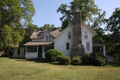 | Laura Ingalls Wilder House | building | 1970 | 70000353 |
Every wildfire the federal occurrence database records inside this county: 357 of them, burning about 6,257 acres. 2 started naturally and 48 were recorded as arson. Each settlement page carries the fires within five miles of it.
| Reported cause | Fires |
|---|---|
| Debris and open burning | 234 |
| Arson/incendiarism | 48 |
| Missing data/not specified/undetermined | 33 |
| Equipment and vehicle use | 28 |
| Railroad operations and maintenance | 6 |
| Smoking | 5 |
| Natural | 2 |
| Power generation/transmission/distribution | 1 |
The five largest, by the area the report gives. Five of them were set deliberately.
| Date | Cause | Size | Reported by | Name on the report |
|---|---|---|---|---|
| 2 April 1995 | Arson/incendiarism | 498 acres | Missouri Department of Conservation | not named |
| 4 April 2005 | Missing data/not specified/undetermined | 366 acres | Missouri Department of Conservation | MEADS LANE |
| 16 March 1992 | Arson/incendiarism | 352 acres | Missouri Department of Conservation | not named |
| 20 November 2008 | Arson/incendiarism | 311 acres | Mark Twain National Forest | WOLF |
| 21 November 2008 | Arson/incendiarism | 256 acres | Mark Twain National Forest | DOOLITTLE CREEK |
| 19 October 1995 | Debris and open burning | 147 acres | Missouri Department of Conservation | not named |
| 5 April 2000 | Debris and open burning | 140 acres | Missouri Department of Conservation | not named |
| 15 March 1994 | Arson/incendiarism | 135 acres | Missouri Department of Conservation | not named |
Every settlement page carries the fires within five miles of it - see the settlement index below.
The NOAA Storm Events Database holds 754 reports for this county, causing 7 deaths, 18 injuries and about $26,192,330 in recorded property damage. Each settlement page carries the reports that name it.
| Kind of event | Reports |
|---|---|
| Hail | 208 |
| Thunderstorm Wind | 201 |
| Flood | 149 |
| Flash Flood | 118 |
| Heavy Rain | 39 |
| Tornado | 31 |
| Lightning | 8 |
The most serious of them, by death, then injury, then recorded damage. The accounts are quoted exactly as the forecast office filed them.
| When | Event | Place named | Harm | What the report says |
|---|---|---|---|---|
| March 2023 | Flash Flood | Grovespring | 2 killed, 2 hurt | Shortly after midnight a vehicle containing 6 occupants attempted to cross a low water crossing on Highway M at Parks Creek. The vehicle was swept off the roadway by high water. Four of the occupants were able to self rescue but two became trapped and drowned as a result. |
| November 2024 | Flood | Manes | 2 killed, $25,000 | A vehicle driving on Highway H two miles east of Manes in Wright County was swept off the road into flood waters at Beaver Creek. The two occupants, ages 70 and 73 attempted to swim to dry ground and reportedly drowned. |
| April 2008 | Flash Flood | Loring | 1 killed, $10,000 | One to three inches of rain fell over Wright County. Any areas that typically flood during periods of excessive rainfall were flooded. A 54 year old male attempted to cross Austin Ford Bridge, which was experiencing significant flooding. Austin Ford Bridge is a bridge along Highway E that crosses the Gasconade River. His truck was swept into the swift flowing water where he drowned. |
| November 2020 | Flood | Mansfield | 1 killed | A vehicle was swept of the low water crossing on Highway AB at Wolfe Creek during the early morning. An 18-year old female drove into the flooded low water crossing around 12:30 AM, and drowned while trying to escape her vehicle. |
| May 2002 | Flash Flood | Grovespring | 1 killed | no account filed |
| December 1982 | Tornado (F2) | not stated | 9 hurt, $2,500,000 | no account filed |
| April 1974 | Tornado (F2) | not stated | 2 hurt, $25,000 | no account filed |
| August 2012 | Lightning | Hartville | 2 hurt, $1,000 | A mother and her daughter were struck by lightning. The bolt hit the house and traveled through a kitchen outlet. The two women were taken to a local hospital and were later released. No fire was caused by the bolt but some minor damage from the bolt was visible in the kitchen by charring around the outlet. |
| August 2012 | Lightning | Loring | 2 hurt | no account filed |
| February 1976 | Tornado (F1) | not stated | 1 hurt, $25,000 | no account filed |
| May 2019 | Tornado (EF1) | Cedar Gap | $5,000,000 | A National Weather Service storm survey confirmed an EF-1 tornado with maximum winds of 110 mph traveled along a nearly 24 mile path that began 2 miles west of Mansfield and ended near Highway H about 2 miles west of Manes. Numerous trees were snapped and uprooted along the path, including in Mansfield and Hartville. Several large trees fell onto a home in Hartville causing moderate damage to the home. A grocery store in Hartville had the store front collapse and the back of the store blown in. Additional light roof damage occurred to several homes and other buildings. |
| April 2001 | Thunderstorm Wind | Hartville | $3,000,000 | no account filed |
| May 1990 | Tornado (F2) | not stated | $2,500,000 | no account filed |
| April 2017 | Flash Flood | Hartville | $2,000,000 | At least 22 homes and business sustained severe flood damage across Wright County. Numerous roads and bridges were severely damaged or washed away across the county. This report will contain the total dollar estimate for flood damage to infrastructure, businesses, and homes across Wright County. |
| November 2024 | Flash Flood | Mansfield | $1,760,000 | Route AB at Wolf Creek was closed due to flooding. Additional county property damages were reported throughout the entire county, primarily to dirt roads and bridges. Damage cost estimates are a reflection of the county as a whole. |
| July 2015 | Flash Flood | Norwood | $1,000,000 | Mobile homes and residences had water up to the structures and with some flooded foundations. One mobile home lost the propane tank when it floated away. One home had the basement flooded. This storm report will contain the overall flood damage estimates across Wright County for this storm event. There were several episodes and heavy rainfall events which led to a compound affect to the flooding damage. Numerous roads, bridges, and low water crossings were heavily damaged. |
| March 2008 | Flash Flood | Loring | $1,000,000 | Widespread rainfall amounts ranged from seven to nine inches over Wright County. All low areas that flood during periods of excessive rainfall were flooded. Major road and bridge damage occurred on county roads. |
| December 2015 | Flash Flood | Mansfield | $500,000 | County Road AB was closed due to flooding at Wolf Creek. Portions of the town of Mountain Grove were evacuated for the potential of a dam breach at Lily Lake. The railroad tracks along the earthen dam at Lily Lake were washed out and needed repairs. Numerous roads and low water crossings suffered flood damage throughout the county. There was one business and one home destroyed by flood water. This storm report will contain the damage estimates for the entire county for this event. |
| April 2011 | Flash Flood | Hartville | $500,000 | Numerous low water crossing on rural roads were reported flooded throughout the county.||The total cost estimate for flooding damages for Wright County for this entire episode has been included. This includes roads, bridges, and structures which were affected. |
| April 2001 | Hail | Mountain Grove | $500,000 | no account filed |
| April 1996 | Thunderstorm Wind | Hartville | $500,000 | no account filed |
| March 2006 | Tornado (F2) | Hartville | $450,000 | This tornado is a continuation of the second Webster County tornado that crossed into Wright County approximately one mile north of Duncan. The tornado continued to produce significant structural damage across rural northwest Wright County. The tornado eventually crossed into Laclede County near the community of Competition. 23 structures were damaged while six structures were completely destroyed. |
| April 2026 | Hail | Norwood | $400,000 | Golf ball sized hail was reported in downtown. Several vehicles, homes and businesses suffered minor damage. |
| May 2020 | Thunderstorm Wind | Mansfield | $400,000 | Numerous large trees were reported from Mansfield to Mountain Grove as strong straight line winds moved across the County. Just east of Mansfield several buildings suffered roof damage. Significant roof damage occurred to the Mansfield High School. Near Mountain Grove a recreational vehicle was flipped and significantly damaged. |
| April 2018 | Tornado (EF2) | Macomb | $300,000 | An EF-2 tornado with a width of 100 yards and a track on the ground for 9 miles tore through portions of Wright County. The tornado had a maximum estimated wind speed of 130 mph. The track started near Macomb and lifted about 5 miles north of Norwood. One home was completely destroyed in additional to numerous trees and outbuildings blown down or damaged. |
| March 2020 | Hail | Hartville | $250,000 | A swath of hail from ping pong ball to tennis ball size was reported as a storm moved through Hartville to the east. Numerous vehicles, businesses and residential roofs sustained damage as the storm proceeded from just west of town to the east with the last report of hail occurring near the intersection of Highway 38 and Lawson Road. |
| April 2019 | Tornado (EF1) | Macomb | $250,000 | A National Weather Service survey determined that an EF-1 tornado touched down southeast of Macomb along Cottengin Road and traveled north northeast, lifting near the intersection of Highways A and K. Along the path, a saw mill sustained significant damage and an office building was damaged. The maximum winds speeds were estimated at 105 mph. |
| June 2015 | Flash Flood | Rayborn | $250,000 | Route E near Buzzard Bluff Access and the Gasconade River was closed because of flash flooding. This storm report will contain the overall storm damage estimates across Wright County for this storm event. Numerous roads, bridges, and low water crossings were heavily damaged. |
| September 2000 | Thunderstorm Wind | Mountain Grove | $250,000 | no account filed |
| September 1959 | Tornado (F4) | not stated | $250,000 | no account filed |
| February 2023 | Hail | Mountain Grove | $200,000 | Hail to the size of a lime or hen egg was reported in town. numerous vehicles suffered hail damage along with damage to roofs and siding of multiple businesses and homes. |
| August 2013 | Flash Flood | Norwood | $140,000 | This storm report will include the total estimated damage for the flooding event. Several low water crossings and roadways were damaged due to flood waters. Highway C south of Norwood was impassable due to flood waters. |
| May 2024 | Tornado (EF1) | Midway | $100,000 | A NWS storm survey concluded that an EF-1 tornado touched down in a hilly wooded area to the northwest Mansfield near Highway F and quickly intensified to producing winds to 100 mph. Numerous trees were downed across portions of Davies and Red Oak Roads before dissipating near Highway V. |
| December 2021 | Tornado (EF1) | Grovespring | $100,000 | This is the continuation of the storm survey of the EF-1 tornado touched down southeast of Niangua in Webster County and travelled northeast for just over 6 miles into Wright County before lifting a few miles west-southwest of Grovespring. In Wright County the tornado snapped or uprooted numerous trees and caused minor damage a home. |
| April 2019 | Tornado (EF0) | Mountain Grve Mem Ar | $100,000 | A National Weather Service storm survey confirmed an EF-0 tornado. Numerous videos and pictures were taken of the tornado as it touched down west of Bell Crossing Drive and north of Highway ZZ to the southwest of Mountain Grove. As it tracked northwest toward Mountain Grove, it passed near the Mountain Grove Airport, and damaged hundreds of trees and approximately a dozen outbuildings. Minor damage occurred to approximately five homes as well. Maximum winds were estimated at 84 mph. |
| July 2015 | Flash Flood | Hartville | $100,000 | There were numerous low lying areas that were flooded across the county. This storm report will contain the overall storm damage estimates across Wright County for this storm event. Numerous roads, bridges, and low water crossings were heavily damaged. |
| January 2008 | Tornado (EF0) | Dawson | $100,000 | A National Weather Service storm survey revealed that an EF-1 tornado tracked over rural areas north of Mountain Grove causing damage to a few barns and outbuildings. |
| January 2008 | Flash Flood | Grovespring | $100,000 | Training severe thunderstorms caused several areas of Wright County to experience flash flooding. Severel roads and low water crossing were washed away, as one to four inches of rain was measured in a six hour period. A couple of specific locations that were flooded include city streets in Hartville and the intersection of Highway 5 and Highway 38. |
| April 2001 | Hail | Norwood | $100,000 | no account filed |
| August 2020 | Thunderstorm Wind | Mountain Grove | $75,000 | Thunderstorm winds damaged a grocery store awning and a car wash partially collapsed onto a vehicle. |
| December 2002 | Tornado (F0) | Grovespring | $75,000 | no account filed |
| April 2019 | Tornado (EF1) | Norwood | $60,000 | A National Weather Service storm survey revealed that an EF-1 tornado produced a concentrated convergent damage path in rural sections of southern Wright County. The tornado destroyed three outbuildings on the Wright County Commisioner's property, and snapped hardwood trees at the base of the trunk. Wind speeds were estimated at 105 mph. |
| June 2004 | Lightning | Mansfield | $60,000 | A lightning induced fire destroyed a business in Mansfield. |
| July 2023 | Lightning | Mountain Grove | $50,000 | The Mountain Grove fire department responded to at least 3 lightning-related fires. One was at a residence while the others were tree related. |
| December 2021 | Thunderstorm Wind | Hartville | $50,000 | Minor roof damage to a few buildings in the downtown area and power outages were reported. |
| June 2015 | Flash Flood | Odin | $50,000 | Route 38 was closed due to flooding. Two houses were flooded in the Odin area along the Woods Fork of the Gasconade River. |
| May 2011 | Hail | Cedar Gap | $50,000 | Hail fell in town producing roof and car damage. |
| April 2011 | Hail | Norwood | $50,000 | Baseball size hail damaged cars and stripped leaves from trees in the city limits. |
| April 2011 | Hail | Mansfield | $50,000 | There were several reports of cars dented by hail. |
| May 2009 | Tornado (EF1) | Loring | $50,000 | A National Weather Service storm survey revealed that an EF-1 tornado with 90 to 100 mph winds occurred four miles northwest of Hartville. The tornado destroyed several outbuildings and uprooted numerous trees. |
| April 1994 | Tornado (F1) | Grovespring | $50,000 | A total of five buildings, including two barns and a mobile home, were destroyed when a tornado touched down just east of Grovespring. |
| April 1996 | Thunderstorm Wind | Cedar Gap | $50,000 | no account filed |
| July 2023 | Thunderstorm Wind | Hartville | $40,000 | Multiple tree limbs up to 2 inches in diameter were reported down by high winds. Some of the limbs fell on power lines causing power outages. A tent in the park was reported to have blown into the lake at the park. |
| April 2011 | Hail | Mountain Grove | $40,000 | The hail stripped leaves from trees and dented many cars. |
| February 2006 | Thunderstorm Wind | Mountain Grove | $30,000 | Damaging straight line winds from a supercell thunderstorm caused damage to two dairy facilities in rural east central Wright County. One block building was heavily damaged with one side of it completely blown down. Another building sustained major roof damage as the roof was shifted out of position. |
| March 2025 | Tornado (EF1) | Odin | $25,000 | An EF1 tornado with maximum wind speeds of 100 mph continued into Wright County near Duncan. In Wright County the tornado uprooted numerous trees and damaged outbuildings. The tornado ended near Highway Z north of Hartville. |
| April 2025 | Tornado (EF0) | Mansfield | $25,000 | A National Weather Service survey indicated that at 4:59 PM on April 20, 2025, an EF-0 tornado touched down just west of Highway 5 in Wright County, about 5 miles south of Hartville. The tornado traveled northeast and crossed the highway before lifting at Wolf Creek at 5:01 PM. This tornado damaged numerous trees and uprooted a few others. One of the tree limbs fell on a house, which caused significant roof damage. |
| May 2024 | Hail | Graff | $25,000 | Report of baseball size hail. |
| October 2019 | Thunderstorm Wind | Fuson | $25,000 | A National Weather Service storm survey found straight line winds of 70mph damaged numerous tree limbs along with minor roof and outbuilding damage off of State Highway Z. |
| April 2018 | Tornado (EF1) | Dawson | $25,000 | An EF-1 tornado with a maximum width of 75 yards and estimated maximum wind speed up to 100 mph tracked approximately 5 miles across eastern rural Wright County. Numerous trees and outbuildings were damaged. |
The Survey's mineral resources record lists 58 workings inside this county. 3 still produce and 55 are closed or unrecorded. Each settlement page carries the workings within five miles of it.
| Commodity | Workings |
|---|---|
| Lead, Zinc | 21 |
| Stone, Crushed/Broken | 15 |
| Lead | 9 |
| Zinc | 6 |
| Zinc, Lead | 5 |
| Sand and Gravel, Construction | 1 |
| Sulfur-Pyrite | 1 |
The least common of them first, because a county's hundredth gravel pit says nothing its first ten did not.
| Where | Site | Commodity | Status | Recorded |
|---|---|---|---|---|
| Hinote Prospect | Sulfur-Pyrite | Prospect | ||
| Unknown - S + G | Sand and Gravel, Construction | Past Producer | ||
| Mcmullin Mines | Zinc, Lead | Past Producer | ||
| Unknown - Lead + Zinc | Zinc, Lead | Past Producer | ||
| Unknown - Lead + Zinc | Zinc, Lead | Past Producer | ||
| Unknown - Lead +Zinc | Zinc, Lead | Past Producer | ||
| Unknown- Lead + Zinc | Zinc, Lead | Past Producer | ||
| Berry Mine | Zinc | Past Producer | ||
| Gaskill Mine | Zinc | Past Producer | ||
| Headley Shaft Number One | Zinc | Past Producer | ||
| Headley Shaft Number Two | Zinc | Past Producer | ||
| Old Headley Shaft | Zinc | Past Producer | ||
| Tarbutton Mine | Zinc | Past Producer | ||
| Brazelton Mines | Lead | Past Producer | ||
| Chickasaw Mine | Lead | Past Producer | ||
| Lead Hill Mines | Lead | Past Producer | ||
| Prock Diggings | Lead | Past Producer | ||
| St Joe Mine | Lead | Past Producer | ||
| Unknown - Lead | Lead | Past Producer | ||
| Unknown - Lead | Lead | Past Producer | ||
| Unknown-Lead | Lead | Past Producer | ||
| Unknown-Lead | Lead | Past Producer | ||
| Macomb Quarry | Stone, Crushed/Broken | Producer | ||
| Mansfield Quarry | Stone, Crushed/Broken | Producer | ||
| Mt Grove Quarry | Stone, Crushed/Broken | Producer | ||
| O D Rush Quarry | Stone, Crushed/Broken | Past Producer | ||
| O D Rush Quarry | Stone, Crushed/Broken | Past Producer | ||
| Railroad Co Quarry | Stone, Crushed/Broken | Past Producer | ||
| Thompson Quarry | Stone, Crushed/Broken | Past Producer | ||
| Unknown - Ls | Stone, Crushed/Broken | Past Producer | ||
| Unknown - Ls | Stone, Crushed/Broken | Past Producer | ||
| Unknown - Ls | Stone, Crushed/Broken | Past Producer | ||
| Unknown - Ls | Stone, Crushed/Broken | Past Producer | ||
| Unknown - Ls | Stone, Crushed/Broken | Past Producer | ||
| Unknown - Ls | Stone, Crushed/Broken | Past Producer | ||
| Unknown -Ls | Stone, Crushed/Broken | Past Producer | ||
| Wilson Quarry | Stone, Crushed/Broken | Past Producer | ||
| Alma Mine | Lead, Zinc | Past Producer | ||
| Baltimore Mine | Lead, Zinc | Past Producer | ||
| Black Cat Mine | Lead, Zinc | Past Producer | ||
| Conway Mine | Lead, Zinc | Past Producer | ||
| Crow Mine | Lead, Zinc | Past Producer | ||
| Grey Goose Mine | Lead, Zinc | Past Producer | ||
| Grey Hound Mine | Lead, Zinc | Past Producer | ||
| Harris Mine | Lead, Zinc | Past Producer | ||
| McKee Mine | Lead, Zinc | Past Producer | ||
| Mcclain West Mine | Lead, Zinc | Past Producer | ||
| Miner Mine | Lead, Zinc | Past Producer | ||
| Red Bird Mine | Lead, Zinc | Past Producer | ||
| Stewart Mine | Lead, Zinc | Past Producer | ||
| Unknown - Lead + Zinc | Lead, Zinc | Past Producer | ||
| Unknown - Lead + Zinc | Lead, Zinc | Past Producer | ||
| Unknown - Lead + Zinc | Lead, Zinc | Past Producer | ||
| Unknown - Lead + Zinc | Lead, Zinc | Past Producer | ||
| Unknown Lead + Zinc | Lead, Zinc | Past Producer | ||
| Upoton Mine | Lead, Zinc | Past Producer | ||
| Watkin +Conway Mine | Lead, Zinc | Past Producer | ||
| West Mine | Lead, Zinc | Past Producer |
Named settlements recorded in the Geographic Names Information System, each with the topographic sheets covering it. Villages, hamlets and abandoned places alike. Each is shown with the nearest named watercourse or landform and the survey quadrangle it falls on.
Wood township · 65711 · Mountain Grove North quadrangle
12 sheets, 1951 to 1983
No longer a settlement
Gasconade township · 65704 · Near Pleasant Knob · Mansfield NW quadrangle
12 sheets, 1951 to 1985
Montgomery township · 65660 · Near Schoolhouse Hollow · Manes quadrangle
17 sheets, 1931 to 2004
Montgomery township · 65667 · Near Hillhouse Hollow · Competition quadrangle
17 sheets, 1931 to 2004
Wood township · 65711 · Near Leonard Hollow · Owens quadrangle
13 sheets, 1951 to 1983
Van Buren township · 65667 · Near Young Hollow · Fuson quadrangle
16 sheets, 1931 to 1987
Union township · 65662 · Near Buttrom Hollow · Grovespring quadrangle
12 sheets, 1954 to 1983
Hart township · 65667 · On Woods Fork Gasconade River · Hartville quadrangle
12 sheets, 1954 to 1983
Wood township · 65711 · On Plemmons Branch · Mountain Grove North quadrangle
12 sheets, 1951 to 1983
No longer a settlement
Van Buren township · 65667 · On Slickrock Branch · Fuson quadrangle
16 sheets, 1931 to 1987
Gasconade township · 65704 · Near Pleasant Knob · Mansfield NW quadrangle
12 sheets, 1951 to 1985
Montgomery township · 65543 · On Shelby Branch · Manes quadrangle
17 sheets, 1931 to 2004
Mountain Grove township · 65711 · Near Bald Knob Mountain · Mountain Grove North quadrangle
12 sheets, 1951 to 1983
Gasconade township · 65746 · On Bowman Branch · Mansfield NW quadrangle
12 sheets, 1951 to 1985
Van Buren township · 65711 · Near Prairie Hollow · Dawson quadrangle
17 sheets, 1931 to 2004
Gasconade township · 65667 · Near Dugger Hollow · Mansfield NE quadrangle
12 sheets, 1951 to 1983
No longer a settlement
Elk Creek township · 65662 · On Scotts Branch · Grovespring quadrangle
12 sheets, 1954 to 1983
Gasconade township · 65704 · On Baker Creek · Mansfield NE quadrangle
12 sheets, 1951 to 1983
The vanished settlements of Wright County: the places named above that are no longer on the map.