 Block
Allenton, Missouri
28 topographic sheets cover this place, the earliest surveyed in 1903 and the latest in 1985. It stands in Meramec Township. It lies in ZIP code area 63025. It lies near Pinhook Hollow. The Survey maps it on the Eureka quadrangle.
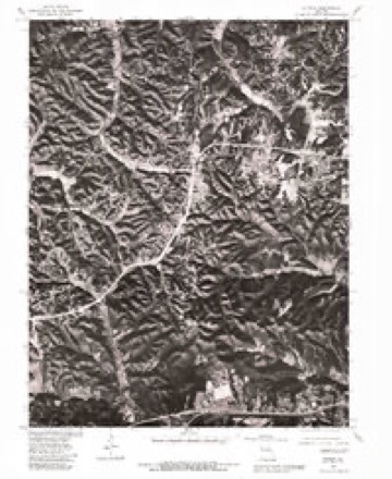
Topographic sheets covering this place
11 surveys from 28 printed sheetsMatched by testing this settlement's coordinate against the published boundary of every sheet in the United States Geological Survey's historical collection. Each opens the scanned sheet at the Survey.
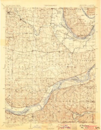
- 1903 USGS O'Fallon quadrangle1:125000, 5 printings
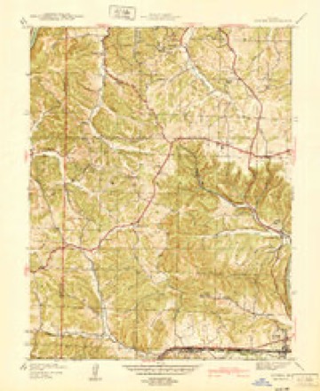
- 1940 USGS Eureka quadrangle1:24000
- 1944 USGS Eureka quadrangle1:24000, 3 printings
- 1949 USGS Saint Louis quadrangle1:250000
- 1949 USGS St. Louis quadrangle1:250000
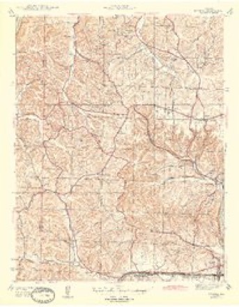
- 1954 USGS Eureka quadrangle1:24000, 7 printings
- 1962 USGS St. Louis quadrangle1:250000
- 1963 USGS St. Louis quadrangle1:250000, 4 printings
- 1966 USGS St. Louis quadrangle1:250000
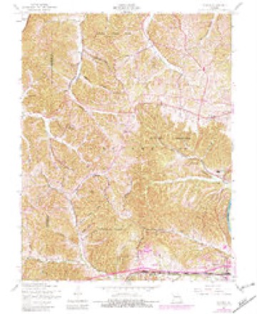
- 1979 USGS Eureka quadrangle1:24000
- 1985 USGS St Louis quadrangle1:100000, 3 printings






Fires near this place
24 since 2011Regional context, not property-specific evidence. The federal wildfire occurrence database lists 24 fires within 5 miles of Allenton between 2011 and 2018, burning about 21 acres in total. 1 started naturally. None was recorded as arson. Distance is straight-line from the map coordinates, so a fire counted here may appear on a neighbouring settlement's page as well.
| Reported cause | Fires |
|---|---|
| Debris and open burning | 13 |
| Missing data/not specified/undetermined | 5 |
| Recreation and ceremony | 2 |
| Natural | 1 |
| Misuse of fire by a minor | 1 |
| Equipment and vehicle use | 1 |
| Railroad operations and maintenance | 1 |
The most recent of them, most recent first, with the day each was reported and the service that recorded it.
| Date | Cause | Size | Reported by | Name on the report |
|---|---|---|---|---|
| 4 July 2015 | Missing data/not specified/undetermined | under an acre | Missouri Department of Conservation | 126531-03655-07042015-1433 |
| 29 July 2013 | Debris and open burning | 1.0 acres | Missouri Department of Conservation | not named |
| 22 June 2014 | Natural | 1.0 acres | Missouri Department of Conservation | not named |
| 6 May 2014 | Debris and open burning | 1.0 acres | Missouri Department of Conservation | not named |
| 21 May 2014 | Railroad operations and maintenance | 1.0 acres | Missouri Department of Conservation | not named |
| 6 April 2013 | Debris and open burning | 1.0 acres | Missouri Department of Conservation | not named |
| 3 April 2011 | Debris and open burning | 1.5 acres | Missouri Department of Conservation | not named |
| 30 March 2014 | Debris and open burning | 1.0 acres | Missouri Department of Conservation | not named |
Settlements close enough to share some of these fires:
Mines and quarries near this place
10 of 25 shownRegional context, not property-specific evidence. The federal mineral resources record lists 25 workings within 5 miles of Allenton: 23 past producers, 2 producers. 2 still produce. What was taken out: Stone, Crushed/Broken, Sand and Gravel, Construction, Silica, Fire Clay (Refractory). Distance is straight-line from the map coordinates, so a quarry counted here may appear on a neighbouring settlement's page as well.
| Where | Site | Commodity | Status | Recorded |
|---|---|---|---|---|
| Brown Bank | Clay | Past Producer | ||
| US Silica Pacific Mine and Plant | Sand and Gravel, Industrial, Sand and Gravel, Construction, Sand and Gravel, Industrial/Frac Sand | Producer | Sand | |
| Renneberg Land | Fire Clay (Refractory) | Past Producer | ||
| Renneberg Pit | Fire Clay (Refractory) | Past Producer | ||
| Glaser Quarry | Silica | Past Producer | ||
| Pacific Quarry | Silica | Past Producer | ||
| Pacific Underground Mill | Silica | Producer | ||
| Unknown - S&G | Sand and Gravel, Construction | Past Producer | ||
| Unknown - S&G | Sand and Gravel, Construction | Past Producer | ||
| Unknown - S&G | Sand and Gravel, Construction | Past Producer |
Storms near this place
16 since 2008Regional context, not property-specific evidence. The National Weather Service names Allenton in 16 storm reports between 2008 and 2024: 4 flood, 4 thunderstorm wind, 4 hail, 3 flash flood. No death or injury is recorded in these reports. Each account below is quoted exactly as the forecast office filed it, from the NOAA Storm Events Database, and each date opens the federal record of that event.
| When | Event | Place named | Harm | What the report says |
|---|---|---|---|---|
| December 2015 | Flood | Allenton | $235,000,000 | Between 7 and 10 inches of rain fell across St. Louis County during a 2 day period. All of this rain caused the creeks and rivers to rise. The Meramec River went into major flood with several points cresting at record levels. Almost 900 structures were either damaged or destroyed from the river flooding, with Eureka, Valley Park and Fenton being some of the worst hit areas in St. Louis County. One school, Eureka High School, sustained some flooding damage, mainly to the gymnasium area, which included the wood gym floors, locker rooms, wrestling room, aerobics room and a storage area. Also, two Metropolitan St. Louis Sewer District wastewater treatment plants were inundated by the flood waters from the Meramec River. Damage to the plants was estimated around $16 million. The river flooding caused two major interstate highways to be shut down for a couple of days, I-55 just north of Arnold and I-44 in Valley Park. Total damage estimates so far were around $235 million. |
| August 2019 | Flash Flood | Allenton | $100,000 | Up to six inches of rain fell in a short amount of time causing flash flooding. The hardest hit areas were in Eureka, Peerless Park, Fenton, Valley Park, Wildwood and Chesterfield. Near Eureka, a woman drove into flood waters on a rural road not realizing how deep it was. She became stranded and had no cell service. Fortunately her car had OnStar and was able to call for help. She abandoned her vehicle and clung to a tree for 40 minutes before being rescued. Another water rescue was performed at Meramec Station and Smizer Mill Road. Another driver was trying to turn around on Hwy 109 near LaSalle Springs Middle School to avoid the flood waters when another vehicle coming towards them caused a wave that swapped their car and caused it to stall. A man in a large truck was able to rescue the driver before it floated away. Highway 141 was flooded once again where it goes under I-44 and had to be closed for a time. Fox Creek just southwest of Allenton rose well above its banks in the southern portion of a large campground. Staff were able to warn people camped in that area to move to higher ground. The ball fields at Eureka High School were flooded for a second time in a month due to the nearby creek rising well out of its banks. In Wildwood, a horse was swept away by the flood waters. Fortunately he was found safe and sound about a quarter mile downstream. Portions of downtown Eureka were flooded once again. Several businesses sustained flood damage. No deaths or injuries were reported from the flash flooding. |
| May 2022 | Thunderstorm Wind | Allenton | $10,000 | Widespread wind damage extending from just northeast of Pacific, northeastward into Chesterfield around the intersection of River Bend Road and River Valley Road. A large tree was blown down onto Model Realty Road northeast of Pacific. Another large tree was blown down onto Strecker Road in Clarkson Valley. Several trees were blown down near the intersection of River Bend Road and River Valley Road. |
| May 2024 | Hail | Allenton | - | Numerous reports of severe hailstones came in in the cities of Eureka, Wildwood, Ellisville, Ballwin, Manchester, Twin Oaks, Valley Park, Fenton, Des Peres, Frontenac, Kirkwood, Webster Groves, Sappington, Shrewsbury, Maplewood, Affton, Mehlville, Lakeshire, Crestwood, Oakland, and Lemay. The largest stones were 2 to 2.5 inches and fell in Peerless Park, Crestwood, and Webster Groves. There were reports of wind driven hail causing damage to the siding of homes. |
| April 2024 | Tornado (EF0) | Allenton | - | The tornado touched down in a subdivision southwest of Eureka in rural St. Louis County where it caused minor tree damage. |
| April 2023 | Hail | Allenton | - | A swath of large hail fell from just east of Pacific to Eureka. |
| August 2020 | Flash Flood | Allenton | - | Up to 7 inches of rain fell in about a four hour period causing flash flooding, especially across the northern half of the county. Numerous roads were flooded and at least 13 water rescues were performed after vehicles were driven into flood waters. One of the rescues involved two vehicles that were swept away as a creek had risen well out of its banks near the intersection of Conway and White Roads. Three total occupants were rescued. No injuries or deaths were reported. |
| August 2019 | Flash Flood | Allenton | - | Up to five inches fell in a short amount of time onto already saturated soils, this caused flash flooding in a number of locations. At least a foot and a half of water was flowing over 5th Street in Eureka and the athletic fields at Eureka High School were flooded once again. At the intersection of Chesterfield Parkway and Justus Post Road in Chesterfield, two feet of water was over the roadway and several water rescues had to be performed in the area. Highway 141 was flooded where it goes under I-44 in Valley Park. Another water rescue was performed near the intersection of Meramec Station and Smizer Mill Road in Fenton. A swift water rescue was performed on Fox Creek Crossing Drive where it crosses Little Fox Creek. It was well out of it's banks and a red truck was stranded in the rapidly rising water there. The fire department had to throw a rope and life jacket to the man and pull him to safety. There was also flowing water over the intersection of Big Bend Road and Sanders Drive and on Manchester Road just east of intersection with Brentwood Blvd. No injuries were reported with any of the rescues. |
| May 2017 | Flood | Allenton | - | The Meramec River at Eureka and Valley Park crested well above major flood stage in the late evening hours of May 2nd/early morning hours of May 3rd, due to the heavy rainfall. A number of roads were closed due to the river flooding including I-44, Highway 141 where it goes under I-44. |
| May 2017 | Thunderstorm Wind | Allenton | - | Thunderstorm winds blew down or uprooted several trees around town as well as broke off numerous tree limbs around town. One tree was blown over onto the east bound lanes of I-44 near exit 261. |
| January 2016 | Flood | Allenton | - | Meramec, Missouri and Mississippi Rivers remained in moderate to major flood through the afternoon hours of January 3rd. The flooding was due to the record rainfall in late December. |
| July 2011 | Thunderstorm Wind | Allenton | - | Thunderstorm winds blew down numerous large tree limbs and damaged a sign at an amusement park. |
| July 2009 | Thunderstorm Wind | Allenton | - | Thunderstorm winds blew down several 2 to 3 foot diameter trees near Six Flags. Also, a large tree was blown down blocking all west bound lanes of Interstate 44 near mile marker 262. |
| June 2023 | Hail | Allenton | - | no account filed |
| April 2013 | Hail | Allenton | - | no account filed |
| March 2008 | Flood | Allenton | - | no account filed |
Nearest settlements
The eight closest, with where each one stands in the county. Distances are straight-line, computed from the Geographic Names Information System coordinates.
| Map | Place | Distance | Sheets |
|---|---|---|---|
| Camp Wyman | 1.5 miles | 28 | |
| Eureka | 2.5 miles | 28 | |
| Ashland (historical) | 3.3 miles | 23 | |
| Hollow | 3.6 miles | 28 | |
| Crescent | 3.9 miles | 29 | |
| Times Beach (historical) | 3.9 miles | 29 | |
| Glencoe | 3.9 miles | 29 | |
| Yeatman | 4.4 miles | 29 |
Provenance
This settlement is recorded in the Geographic Names Information System as feature 755683. The sheet list is computed by point-in-boundary test against the United States Geological Survey's historical topographic inventory. Both are works of the United States government and carry no copyright under 17 U.S.C. 105.
Wildfire. Short, Karen C. 2022. Spatial wildfire occurrence data for the United States, 1992-2020 [FPA_FOD_20221014]. 6th Edition. Fort Collins, CO: Forest Service Research Data Archive. https://doi.org/10.2737/RDS-2013-0009.6 Collected with United States Government funding and usable without additional permissions or fees.
Mines and quarries. USGS Mineral Resources Data System (MRDS) https://mrdata.usgs.gov/mrds/ A work of the United States government, no copyright under 17 U.S.C. 105.
Storms. NOAA National Centers for Environmental Information, Storm Events Database https://www.ncei.noaa.gov/stormevents/ A work of the United States government, no copyright under 17 U.S.C. 105. Narratives are quoted verbatim from the National Weather Service report and are not edited or summarised.