 Block
Augusta, Missouri
21 topographic sheets cover this place, the earliest surveyed in 1903 and the latest in 1985. It stands in Boone Township. It lies in ZIP code area 63332. It lies near Point Lavvadie Island (historical). The Survey maps it on the Washington East quadrangle. 270 people lived here at the 2020 count. It stands 561 feet above sea level.
On record in Augusta
Buildings and businesses the archive holds for this place. Each opens its own page, with the source record it came from.
On the National Register 11 records
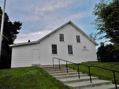 Augusta Harmonie Vereinlisted 1995
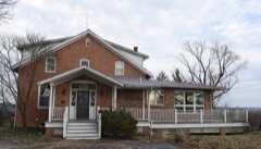 Robert Ewich Farmsteadlisted 1995
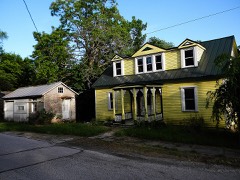 Charles McLee Farris Houselisted 1995
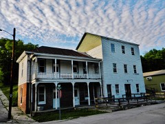 Mindrup House-Storelisted 1995
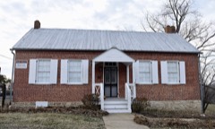 Mt. Pleasant Winery Historic Districtlisted 1994
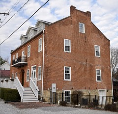 J. F. Schroer House-Storelisted 1995
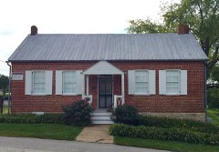 August Sehrt Houselisted 1994
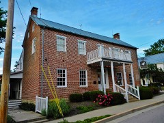 Staudinger-Grumke House-Storelisted 1992
 Walnut Street Historic Districtlisted 1994
- Dr. C. L. Gerling Houselisted 1995
- Harold-Knoernschild Farmstead Historic Districtlisted 1994
Population over time
2 figuresAugusta grew from 253 to 270 between 2010 and 2020. These are the recorded population figures Wikidata holds for this place, reached through the Geographic Names Information System number this page is keyed on rather than by name, so they belong to this place and not to another of the same name. Most are census counts, but not all are: an early figure may be a founding or settlement estimate, and an estimate published within five years of a census is left out. The change column is computed, and is left blank where more than 20 years separate a figure from the one before it, because a gap that long is not a change between two counts.
| Year | People | Change |
|---|---|---|
| 2010 | 253 | |
| 2020 | 270 | +17 (+7%) |
Topographic sheets covering this place
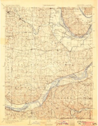
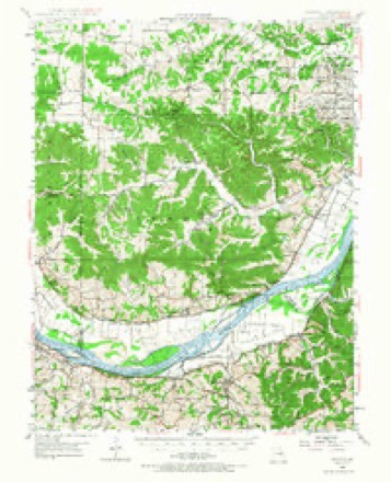
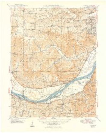
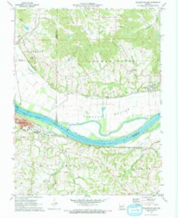
10 surveys from 21 printed sheetsMatched by testing this settlement's coordinate against the published boundary of every sheet in the United States Geological Survey's historical collection. Each opens the scanned sheet at the Survey.
- 1903 USGS O'Fallon quadrangle1:125000, 5 printings
- 1948 USGS Augusta quadrangle1:62500, 2 printings
- 1949 USGS Augusta quadrangle1:62500, 2 printings
- 1949 USGS Saint Louis quadrangle1:250000
- 1949 USGS St. Louis quadrangle1:250000
- 1962 USGS St. Louis quadrangle1:250000
- 1963 USGS St. Louis quadrangle1:250000, 4 printings
- 1966 USGS St. Louis quadrangle1:250000
- 1972 USGS Washington East quadrangle1:24000
- 1985 USGS St Louis quadrangle1:100000, 3 printings






Fires near this place
12 since 2006Regional context, not property-specific evidence. The federal wildfire occurrence database lists 12 fires within 5 miles of Augusta between 2006 and 2020, burning about 15 acres in total. None started naturally. None was recorded as arson. Distance is straight-line from the map coordinates, so a fire counted here may appear on a neighbouring settlement's page as well.
| Reported cause | Fires |
|---|---|
| Missing data/not specified/undetermined | 8 |
| Debris and open burning | 4 |
The most recent of them, most recent first, with the day each was reported and the service that recorded it.
| Date | Cause | Size | Reported by | Name on the report |
|---|---|---|---|---|
| 12 July 2017 | Missing data/not specified/undetermined | under an acre | Missouri Department of Conservation | not named |
| 7 June 2020 | Missing data/not specified/undetermined | under an acre | Missouri Department of Conservation | 241106-09222-06072020-2042 |
| 3 April 2011 | Missing data/not specified/undetermined | 3.0 acres | Missouri Department of Conservation | not named |
| 13 April 2020 | Missing data/not specified/undetermined | under an acre | Missouri Department of Conservation | 241107-09222-04132020-0443 |
| 8 March 2020 | Missing data/not specified/undetermined | 5.0 acres | Missouri Department of Conservation | 241101-09222-03082020-1526 |
| 8 March 2020 | Missing data/not specified/undetermined | under an acre | Missouri Department of Conservation | 241104-09222-03082020-1951 |
| 6 March 2006 | Missing data/not specified/undetermined | under an acre | Missouri State Fire Marshal's Office | not named |
| 11 March 2014 | Debris and open burning | 1.0 acres | Missouri Department of Conservation | not named |
Settlements close enough to share some of these fires:
Mines and quarries near this place
9 within 5 milesRegional context, not property-specific evidence. The federal mineral resources record lists 9 workings within 5 miles of Augusta: 8 past producers, 1 unknown. None of them still produces. What was taken out: Stone, Crushed/Broken, Silica. Distance is straight-line from the map coordinates, so a quarry counted here may appear on a neighbouring settlement's page as well.
| Where | Site | Commodity | Status | Recorded |
|---|---|---|---|---|
| Penn. Glass-Klondike Sand Pit | Silica | Past Producer | ||
| Matson Qsuarry | Stone, Crushed/Broken | Unknown | ||
| Shuttqy Mine | Stone, Crushed/Broken | Past Producer | ||
| Unk | Stone, Crushed/Broken | Past Producer | ||
| Unk | Stone, Crushed/Broken | Past Producer | ||
| Unk | Stone, Crushed/Broken | Past Producer | ||
| Unknown - Ls. | Stone, Crushed/Broken | Past Producer | ||
| Unknown - Ls. | Stone, Crushed/Broken | Past Producer | ||
| Unknown - Ls. | Stone, Crushed/Broken | Past Producer |
Storms near this place
19 since 1997Regional context, not property-specific evidence. The National Weather Service names Augusta in 19 storm reports between 1997 and 2023: 6 hail, 4 thunderstorm wind, 4 flood, 3 tornado. No death or injury is recorded in these reports. Each account below is quoted exactly as the forecast office filed it, from the NOAA Storm Events Database, and each date opens the federal record of that event.
| When | Event | Place named | Harm | What the report says |
|---|---|---|---|---|
| December 2015 | Flood | Augusta | $2,300,000 | Between 7 and 11 inches of rain fell across St. Charles County during a 2 day period. All of this rain caused the creeks and rivers to rise. The Missouri and Mississippi Rivers went into major flood as well as Dardenne Creek. Almost 300 structures were either damaged or destroyed from the river flooding, with St. Peters and St. Charles being the worst hit areas in St. Charles County. Damage estimates so far were around $2.3 million. |
| May 2007 | Flood | Augusta | $2,000 | The Missouri River flooded parts of the southern border of St. Charles County from Agusta to the Mississippi River. Frontier Park in St. Charles flooded, otherwise flooding was limited to some farmland and a few roads along the river. |
| July 2023 | Thunderstorm Wind | Augusta | - | Thunderstorm winds blew down numerous tree limbs along Highway 94, especially between Augusta and Definance. |
| August 2019 | Flash Flood | Augusta | - | Up to five inches of rain fell in the southwestern portions of St. Charles County causing flash flooding. Femme Osage Creek Road had portions of it washed out due to flash flooding between Cappeln Osage Road and Becker-Joerling Road. |
| May 2019 | Tornado (EF1) | Augusta | - | After crossing the Missouri River into St. Charles County, the tornado uprooted and snapped off numerous trees on Sanders Road and caused extensive damage to a farm outbuilding. Further northeast as it crossed Terry Road, where it caused extensive tree damage. As it continued northeast it caused minor structural damage on a barn and outbuilding on Coates Lane, before causing minor roof damage to a house as well as snapping off several trees. The tornado lifted and dissipated just southeast of the intersection of Coates Lane and Duke Road. This portion of the tornado was rated EF1 with a path length of 4 miles and a max path width of 250 yards. Overall the tornado was rated EF1 with a path length of 5.94 miles and a max path width of 250 yards. No deaths or injuries were reported. |
| January 2016 | Flood | Augusta | - | Missouri River remained at moderate flood stage through midday on January 2nd. The flooding was a result of record rainfall in late December. |
| December 2015 | Flood | Augusta | - | The flooding persisted across St. Charles County on December 27th and 28th. Numerous roads remained flooded. Interstate 70 had to be shut down between exits 220 and 222 because Dardenne Creek rose 6 feet above flood stage in St. Peters (DRCM7). This caused the Interstate to be flooded by several feet of water. The highway was shut down both directions around Noon on December 27th. Westbound I-70 was reopened at 645 am and eastbound was finally reopened at 130 pm on December 28th. |
| September 2012 | Thunderstorm Wind | Augusta | - | Thunderstorm winds snapped a foot and a half diameter oak tree about 15 feet up from its base. |
| February 2011 | Tornado (EF1) | Augusta | - | The tornado touched down near the Balducci Winery, about 3 miles west-northwest of Augusta. The tornado then continued to the east, producing intermittent damage along Highway 94 before moving into the Missouri River Valley about 4 miles southwest of Defiance. The tornado crossed the Missouri River into extreme northeast Franklin County. The width ranged from 50 to 200 yards. Maximum damage, noted at several locations along the path, was estimated at EF1. Some of the more significant damage included the total removal of a roof from a century old home at the Balducci Winery, significant tree and home damage 1 to 2 miles east of the winery, large trees snapped at a catholic church 1 mile northwest of Augusta, and structural damage to a home just northeast of Klondike Park. The total overall length of the tornado for both St. Charles and Franklin counties was 9.35 miles. |
| December 2010 | Tornado (EF0) | Augusta | - | A tornado touched down on the Missouri River flood plain south of Augusta Bottom Road. A barn was knocked down along August Bottom Road and had part of its roof thrown across the road. The tornado travelled north northeast up the bluff towards Highway 94. A tree was uprooted and a house sustained minor exterior damage on the south side of Highway 94. The tornado crossed Highway 94 and removed part of the metal roof of an outbuilding. The roof debris was blown several hundred yards from the structure. Some of the sheet metal was found in a tree line well north of the building where the tornado lifted. |
| May 2008 | Flash Flood | Augusta | - | Heavy rain caused localized flash flooding. Several roads around New Melle were blocked due to high water. |
| May 2004 | Hail | Augusta | - | Storm spotters reported 3/4 inch hail in Augusta. |
| May 2004 | Hail | Augusta | - | Storm spotters reported 1 inch hail. |
| December 2002 | Hail | Augusta | - | A retired NWS meteorologist reported 1 inch hail. |
| April 2013 | Thunderstorm Wind | Augusta | - | no account filed |
| November 2010 | Hail | Augusta | - | no account filed |
| September 2008 | Hail | Augusta | - | no account filed |
| August 2000 | Thunderstorm Wind | Augusta | - | no account filed |
| April 1997 | Hail | Augusta | - | no account filed |
Nearest settlements
The eight closest, with where each one stands in the county. Distances are straight-line, computed from the Geographic Names Information System coordinates.
| Map | Place | Distance | Sheets |
|---|---|---|---|
| Dartmound (historical) | 1.1 miles | 21 | |
| Klondike | 2.1 miles | 22 | |
| Nona | 3.1 miles | 21 | |
| Schluersburg | 4.2 miles | 24 | |
| Matson | 5.1 miles | 22 | |
| Femme Osage | 5.4 miles | 22 | |
| Defiance | 6.9 miles | 24 | |
| Cappeln | 8.3 miles | 22 |
Elsewhere
Matched on this settlement's Geographic Names Information System number rather than its name, so it cannot be a different place of the same name in another state.
| Wikipedia article on Augusta | An encyclopaedic summary. Its text is share-alike, so it is linked here rather than copied. |
| Wikidata item Q961881 | The structured record the population and elevation above come from. Public domain (CC0). |
Provenance
This settlement is recorded in the Geographic Names Information System as feature 755706. The sheet list is computed by point-in-boundary test against the United States Geological Survey's historical topographic inventory. Both are works of the United States government and carry no copyright under 17 U.S.C. 105.
Wildfire. Short, Karen C. 2022. Spatial wildfire occurrence data for the United States, 1992-2020 [FPA_FOD_20221014]. 6th Edition. Fort Collins, CO: Forest Service Research Data Archive. https://doi.org/10.2737/RDS-2013-0009.6 Collected with United States Government funding and usable without additional permissions or fees.
Mines and quarries. USGS Mineral Resources Data System (MRDS) https://mrdata.usgs.gov/mrds/ A work of the United States government, no copyright under 17 U.S.C. 105.
Storms. NOAA National Centers for Environmental Information, Storm Events Database https://www.ncei.noaa.gov/stormevents/ A work of the United States government, no copyright under 17 U.S.C. 105. Narratives are quoted verbatim from the National Weather Service report and are not edited or summarised.