Block
From the record
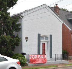
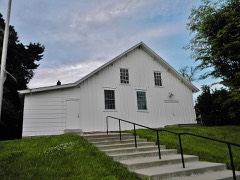
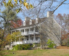
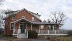
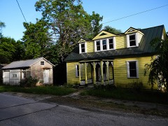
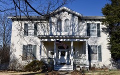
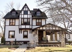
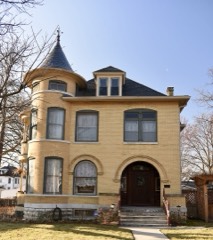
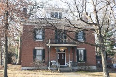
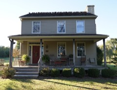
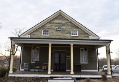
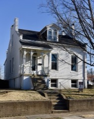
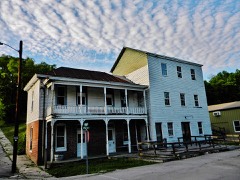
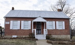
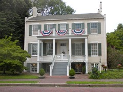
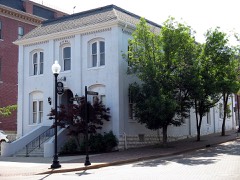
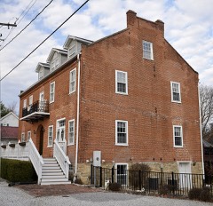
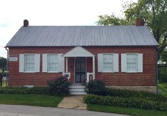
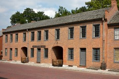
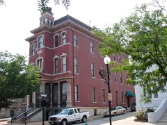
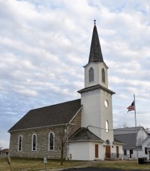
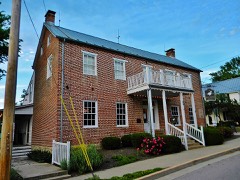
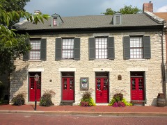
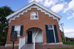
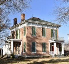
40 National Register listings published here.
Sources: the National Register database, National Park Service
133 topographic sheets cover 71 settlements here, and 40 properties are on the National Register of Historic Places.
40 National Register listings published here.
Sources: the National Register database, National Park Service
Every property in this county listed on the National Register of Historic Places, with the year it was listed and the federal nomination document.
Every wildfire the federal occurrence database records inside this county: 102 of them, burning about 65 acres. 1 started naturally and 7 were recorded as arson. Each settlement page carries the fires within five miles of it.
| Reported cause | Fires |
|---|---|
| Missing data/not specified/undetermined | 58 |
| Debris and open burning | 24 |
| Arson/incendiarism | 7 |
| Smoking | 5 |
| Equipment and vehicle use | 4 |
| Recreation and ceremony | 3 |
| Natural | 1 |
The five largest, by the area the report gives. None of them was recorded as arson.
| Date | Cause | Size | Reported by | Name on the report |
|---|---|---|---|---|
| 19 November 2020 | Debris and open burning | 5.4 acres | Missouri Department of Conservation | 261390-09221-11192020-1211 |
| 8 March 2020 | Missing data/not specified/undetermined | 5.0 acres | Missouri Department of Conservation | 241101-09222-03082020-1526 |
| 3 April 2011 | Missing data/not specified/undetermined | 3.0 acres | Missouri Department of Conservation | not named |
| 29 April 2018 | Debris and open burning | 2.5 acres | Missouri Department of Conservation | 176730-09221-04292018-1414 |
| 17 January 2015 | Debris and open burning | 2.0 acres | Missouri Department of Conservation | 116910-09222-01172015-1735 |
| 31 December 2016 | Missing data/not specified/undetermined | 2.0 acres | Missouri Department of Conservation | 143232-09222-12312016-1455 |
| 31 January 2014 | Debris and open burning | 2.0 acres | Missouri Department of Conservation | not named |
| 19 November 2020 | Debris and open burning | 2.0 acres | Missouri Department of Conservation | 261391-09221-11192020-1433 |
Every settlement page carries the fires within five miles of it - see the settlement index below.
The NOAA Storm Events Database holds 816 reports for this county, causing 4 deaths, 111 injuries and about $337,051,180 in recorded property damage. Each settlement page carries the reports that name it.
| Kind of event | Reports |
|---|---|
| Thunderstorm Wind | 367 |
| Hail | 344 |
| Tornado | 43 |
| Flash Flood | 40 |
| Flood | 11 |
| Lightning | 6 |
| Heavy Rain | 5 |
The most serious of them, by death, then injury, then recorded damage. The accounts are quoted exactly as the forecast office filed them.
| When | Event | Place named | Harm | What the report says |
|---|---|---|---|---|
| May 2019 | Flood | Orchard Farm | 2 killed | The Mississippi River went into Major flood at Grafton, IL on May 3rd and remained at those levels through May 16th. During this period, numerous roads were flooded. Two people were in a vehicle that drove into the flood waters somewhere near the intersection of Sioux Drive and Hideaway Harbor Drive. They drowned in this location. The car and bodies of a 20 year old man and a 19 year old woman were not recovered til the 24th of May once the water receded a bit. |
| December 2021 | Tornado (EF3) | Femme Osage | 1 killed, 2 hurt, $3,400,000 | The tornado developed about a third of a mile northeast of the intersection of Highway 94 and Osage Ridge Road in southwestern St. Charles County around 7:32 PM CDT. As it moved to the northeast, two houses sustained minor damage and one outbuilding was destroyed on Highway T, just north of intersection with Hemsath Road. The tornado continued northeast and strengthened as it approached Highway F, northwest of Defiance. Multiple homesteads and farms suffered varying degrees of property damage along Highway F to Highway 94. Two homes were completely destroyed. The first home was 110 years old and did not appear to have any anchoring to the concrete foundation. The second home just 100 yards east of the first was swept clean to the subfloor, which was still anchored to the concrete foundation. One fatality and two injuries occurred at this location. The damage was rated EF3 with winds to 165 mph. The tornado continued northeast, crossing the Missouri River and Howell Island before entering St. Louis County in Chesterfield Valley. Dollar amount damage is estimated around $3.4 million. |
| July 1986 | Thunderstorm Wind | not stated | 1 killed, 2 hurt | no account filed |
| November 1990 | Tornado (F2) | not stated | 30 hurt, $25,000,000 | no account filed |
| October 1966 | Tornado (F3) | not stated | 26 hurt, $2,500,000 | no account filed |
| November 1988 | Tornado (F3) | not stated | 10 hurt, $2,500,000 | no account filed |
| April 1997 | Thunderstorm Wind | St Peters | 10 hurt, $100,000 | no account filed |
| May 2013 | Tornado (EF3) | Defiance | 8 hurt, $50,000,000 | A tornado touched down about four miles southwest of Weldon Spring in St. Charles County, Missouri. It downed trees, blew over empty tractor trailers, and caused minor damage to construction equipment. It moved east-northeast into Weldon Spring Heights and the Missouri Research Park (on the south side of Weldon Spring) causing roof, window, and solar panel damage to a few structures as well as downing more trees before crossing Interstate 64. The tornado passed within one half of a mile of the National Weather Service Weather Forecast Office which is located in the Missouri Research Park. The tornado continued moving east-northeast through densely populated residential areas of southern St. Charles County, south of Highway 94. Roofing was torn off of Bryan Middle School and blown 100 yards, many houses suffered varying degrees of roof (from minor damage to removal of entire roof), wall (from minor damage to total collapse), and overall structural damage, and thousands of trees were damaged. The most intense damage, rated EF3, occurred on Haversham Drive where only the interior walls were left standing of three homes. The tornado began to move a bit more easterly, widening to nearly 1000 yards (or a half-mile), causing damage in residential areas and the St. Charles Family Arena before crossing the Missouri River into St. Louis County just south of Interstate 70.||The tornado caused damage to 765 homes in St. Charles County. Seven hundred twenty-three homes suffered minor damage, 34 homes suffered major damage, and 8 homes were destroyed. Three hundred forty-eight businesses sustained minor damage, while 25 businesses had major damage. Cleanup costs alone for St. Charles County was 2.4 million dollars, with approximately 50,000 tons of tree and limb debris removed. There were 8 minor injuries due to the tornado.||The path length of the tornado in St. Charles County was 14.8 miles with a max path width of 950 yards. The damage for this segment was estimated to be EF3 with max wind speeds of 150 MPH. Overall, the entire tornado path length was 31.8 miles with a max path width of 1 mile and a maximum damage rating of EF3. |
| October 1967 | Tornado (F2) | not stated | 5 hurt, $25,000 | no account filed |
| May 1983 | Tornado (F2) | not stated | 3 hurt, $2,500,000 | no account filed |
| July 2017 | Thunderstorm Wind | O Fallon | 3 hurt | A wide swath of damaging winds extended from O'Fallon through northern St. Peters to the Portage Des Sioux. In O'Fallon, numerous large tree limbs were blown down as well as a couple of trees and fences. A 5th wheel camper was rolled over at 370 Lakeside RV Campground. Three people were briefly trapped inside. All 3 sustained minor injuries. Two other campers were moved off their bases but not rolled over. At St Charles County Airport, Smartt Field, a small place was flipped over. A 71 mph wind gust was measured at the airport. |
| March 2017 | Tornado (EF1) | Foristell | 3 hurt | The second tornado associated with the small vortex developed along the South Service Road of Interstate 70 west of South Pointe Prairie Road. The tornado crossed Interstate 70 and causing roof and siding damage to a number of homes and uprooted or snapped trees along its path as it moved east across Langtree Drive, Shadow Point Circle, Shadow Point Drive, Giotto Court, Cabot Court, Tiffany Lynn Court, Huntsdale Drive, Tiger Drive and Ivybrook Drive. The tornado once again approached Interstate 70 causing damage to several businesses along W Pierce Blvd. The tornado crossed the interstate, flipping over a large camper trailer along Thomas RV Way and flattening several road signs. The tornado tracked east paralleling Interstate 70, causing varying degrees of damage to buildings along Swantherville Drive and Ruggeri Drive. The tornado then caused significant roof damage to a building along P&A Drywall Drive before crossing Interstate 70 for the third and final time. The tornado continued east into a mobile home park where it flipped one trailer over and damaged many more. This is where the three minor injuries occurred. The tornado continued east northeast just to the south of West Main Street through downtown Wentzville causing mainly minor damage to many residences and businesses. The exception was a lumber business along South Church Street which took the brunt of the tornado and had a large building destroyed. The tornado finally dissipated near the intersection of E. Pitman Avenue and S. Tally Street. Overall, the tornado was rated EF1 with a path length of 3.15 miles and a max path width of 100 yards. |
| May 2015 | Thunderstorm Wind | Kampville | 2 hurt | As a thunderstorm moved through Lakeside 370 RV Park and Campground, winds around 50 mph struck two RVs broadside and rolled them over. Several tents and tables were also blown down/overturned. Four people were injured. One person had a broken leg and another had a shoulder injury. The other two just had minor injuries. Only the person with the broken leg was transported to the hospital. |
| July 2011 | Lightning | Foristell | 2 hurt | Lightning hit a tree and transferred to power lines causing some electrical damage. Two people were injured by the lightning strike and one had to be briefly hospitalized. |
| August 2010 | Thunderstorm Wind | Wentzville | 1 hurt, $200,000 | Thunderstorm winds blew down numerous trees, tree limbs and power lines in an area from the Stone Meadows Subdivision northeastward towards the GM Plant that is north of I-70 and east of U.S. Highway 61. The width of the damage path was about half a mile to a mile wide. Also, numerous light poles were blown down in parking lots and a couple of small sheds sustained minor to moderate damage. A semi was blown over onto a car on east bound I-70 near the Highway A exit. One person sustained moderate injuries and was taken to a local hospital. In the Stone Meadows Subdivision, one house sustained a large section of siding damage and a house two doors down lost about half of its roof. |
| May 1958 | Tornado (F1) | not stated | 1 hurt, $25,000 | no account filed |
| August 2010 | Thunderstorm Wind | Harvester | 1 hurt | Thunderstorm winds caused considerable damage in the Harvester area. Numerous trees, tree limbs and power lines were blown down. Also, several buildings sustained minor to moderate roof damage. At an auto repair business, an employee sustained a cut to his hand due to flying debris. A nearby stripmall had major roof damage and an air conditioning unit on the roof was blown off. A little further to the east, an 80 foot by 40 foot tent was blown over and the produce that was being sold there was scattered on the ground. |
| June 2008 | Lightning | Elm Pt | 1 hurt | A 26 year old male was struck by lightning at the Deerfield Mobile Home Park. He was revived on the scene by paramedics and taken to the hospital. |
| May 1998 | Tornado (F1) | Harvester | 1 hurt | no account filed |
| April 2001 | Hail | St Charles | $100,000,000 | no account filed |
| April 2001 | Hail | St Peters | $50,000,000 | no account filed |
| April 2001 | Hail | Cottleville | $50,000,000 | no account filed |
| March 2024 | Hail | Foristell | $20,000,000 | A wide swath of very large hail fell along the I-70 corridor in St. Charles County. The largest hail stones were around three inches in diameter. The cities that the large hail affected were Wentzville, Saint Paul, O'Fallon, Lake St. Louis, Flint Hill, Saint Peters, Cottleville, and Saint Charles. Numerous vehicles sustained hail damage including thousands of individual cars and at 12 car dealerships. One dealership alone had 450 cars damaged from the large hail. Also, hundreds of homes and businesses sustained roof and siding damage. One school sustained damage to skylights. |
| July 2022 | Flash Flood | Foristell | $10,000,000 | Up to 13 inches of rain fell in a 6 to 10 hour period causing widespread flash flooding. The axis of heaviest rain extended from just north of Wentzville east southeastward through northern portions of O'Fallon through St. Peters and into St. Charles. Numerous roads were flooded throughout St. Charles County. Interstate 70 was flooded with up to five feet of water around the intersection with Mid Rivers Mall Drive. Fire and rescue searched and cleared several dozen vehicles in this area and rescued 8 people from the rising waters. Also, in the area of Harry S. Truman Blvd and Premier Parkway, several drivers were rescued from their flooded vehicles. In the area of Mexico Road and Spencer Road, multiple vehicles were trapped by rapidly rising waters of Spencer Creek. One vehicle in this area was swept off the roadway into Spencer Creek. The driver escaped but was clinging to a tree in the fast moving water that was over 8 feet deep. He was rescued and was not injured. Between 1 am and 11 am, 87 people were evacuated from homes or businesses in St. Charles County. One hundred seventeen buildings were damaged from the flooding. Forty Nine of them sustained major damage, 46 sustained moderate damage and 22 buildings sustained minor damage. So far damage is estimated to be around $10 million dollars. |
| April 2001 | Tornado (F1) | Lake St Louis | $5,000,000 | The 5th tornado spawned by the Heavy Precipitation Supercell that moved across the NWS St. Louis County Warning Area formed in Lake St. Louis. Most of the damage was at the Mystic Village apartment complex where the tornado was briefly F1 in intensity. Altogether, 2 buildings were considered destroyed, 14 homes/apartment/businesses had major damage, and 8 other homes/apartments/.businesses had minor damage. |
| May 2016 | Hail | St Charles | $4,000,000 | Very large hail up to 4 inches in diameter fell across portions of St. Charles County. The hardest hit areas stretched from near Dardenne Prairie, O'Fallon and Weldon Spring east to Cottleville, St. Peters and St. Charles. Damage from this hail storm will be many millions of dollars as thousands of homes, vehicles and businesses were impacted and suffered damage. One hundred twenty cars at a car dealership near the intersection of I-64/Highway 94, sustained busted windows and lots of dents from large hail, some that were as big as baseballs. Reports of windows blown out, roofing and siding damage were common. |
| April 1980 | Tornado (F3) | not stated | $2,500,000 | no account filed |
| December 2015 | Flood | Augusta | $2,300,000 | Between 7 and 11 inches of rain fell across St. Charles County during a 2 day period. All of this rain caused the creeks and rivers to rise. The Missouri and Mississippi Rivers went into major flood as well as Dardenne Creek. Almost 300 structures were either damaged or destroyed from the river flooding, with St. Peters and St. Charles being the worst hit areas in St. Charles County. Damage estimates so far were around $2.3 million. |
| May 2002 | Thunderstorm Wind | Portage Des Sioux | $1,750,000 | no account filed |
| June 2008 | Flood | St Paul | $1,700,000 | The Mississippi River at Grafton, IL (just across the river from St. Charles County) crested at 30.80 feet on 6/29/2008. This is the fourth highest crest ever recorded. At Alton, IL (also just across the river from St. Charles County) the river crested at 33.08 feet. This is the seventh highest crest ever recorded. The majority of the land flooded is used for agriculture, however several communities in the flood plain suffered damages. Among those are Portage des Sioux, Karmill Wood, Lake Shore, Sherwood Harbor, Alta Villa, and unincorporated areas north of St Peters, MO where an agricultural levee failed. Damage assessments form the State Emergency Management Agency showed 426 homes affected. 257 were listed as destroyed, 66 had major damage, 73 minor, and 30 as affected. Damage to local infrastructure was listed by emergency management officials at $1,670,000. Area wildlife was also affected by the flooding. At one point, local police had to stop traffic on Highway 370 to allow herds of deer to cross the road. The St. Charles Farm Service Agency estimated agricultural losses to be $10.8 million. |
| May 2019 | Flash Flood | Elm Pt | $1,000,000 | The Elm Point Levee had a major breach allowing the flood waters from the Mississippi River to rapidly flow in. Several businesses were flooded as well as soccer fields. A nearby mobile home park was not affected at this time. One business was an RV storage lot. The multiple owners of the vehicles were notified of the breach and the majority of them were able to move their property to higher ground. |
| June 2014 | Lightning | Harvester | $487,000 | Lightning struck a home on Woodmere Trail Court around 802 pm on June 21st. It smoldered for several hours. It became fully engulfed in flames by 2 am and that is when it was noticed by neighbors and they called 911. The family that lives there was out of town for the weekend. So no injuries reported. The house was destroyed and damage was estimated around $487,000. |
| October 2001 | Thunderstorm Wind | Portage Des Sioux | $250,000 | no account filed |
| October 1967 | Tornado (F3) | not stated | $250,000 | no account filed |
| June 1958 | Tornado (F2) | not stated | $250,000 | no account filed |
| March 2025 | Tornado (EF2) | West Alton | $222,000 | The tornado continued into St. Charles County after exiting St. Louis County at approximately 9:43 PM. The tornado was nearly mile wide as it entered St. Charles County. Some of the most significant damage of the track occurred as the tornado passed through West Alton. Multiple homes sustained damage in the city. The tornado then passed into Madison County, IL. In St. Charles County the tornado had a path length of 4.22 miles with a maximum path width of 1125 yards. It was rated an EF2. |
| January 1996 | Thunderstorm Wind | St Peters | $200,000 | no account filed |
| July 2019 | Flash Flood | Ft Zumwalt | $100,000 | Up to three inches of rain fell in about an hour and a half. This caused several local creeks to rise well out of their banks. Belleau Creek flooded Belleau Creek Road with over 6 inches of water, just south of intersection with I-70. Also a creek that feeds into Dardenne Creek in the St. Peters Golf Club rose well above it's banks flooding Salt Lick Road at the intersection with Timberbrook Drive and flooded sections of Four Winds and South Winds Drives. A couple of cars had to be abandoned on Salt Lick Road after the drivers drove into the flood waters and stalled their cars. No water rescues needed to be performed. Also, on Four Winds Drive at least half a dozen parked cars were flooded. |
| December 2015 | Flash Flood | St Paul | $100,000 | Between 5 and 6 inches of rain fell causing flash flooding. Numerous roads were flooded across the county including Highway N between Highway K and Weiss Road. Dardenne Creek was well out of its banks in this location. At least one home was flooded with about 3 to 4 feet of water. Several water rescues occurred in this area as between 6 to 8 vehicles became stranded in the flood waters. Other roads closed were Routes C, B and D as well as Highway 94 near Defiance. Another water rescue occurred on Highway F one mile northwest of Defiance. |
| December 2015 | Flash Flood | St Paul | $100,000 | Another round of heavy rain, between 4 and 6 inches of rain fell across St. Charles County December 27th and 28th. This caused more flash flooding. Numerous roads were flooded. |
| May 2008 | Flash Flood | Flint Hill | $100,000 | Rainfall over 6 inches in some locations caused flash flooding across Northern St. Charles County. Fifteen water rescues were performed by local emergency service agencies. Highway 61 was closed at two locations due to water rapidly flowing across the road. Big Creek, Peruque Creek, and Dardenne Creek all overflowed. Flint Hill suffered the most damage as a small creek in town became a roaring river. At a Amerigas facility, at least 7 propane tanks were picked up and deposited about one mile downstream. The baseball fields in town were heavily damaged due to as much as 3 feet of water flowing through. Highway 79, County Highways P, M, and C were all flooded and closed. |
| June 2025 | Flash Flood | Harvester | $50,000 | Heavy rain caused Jacobs Station Road near Towers Road to flood. Neighborhood yards also had about 1 foot of water in them. 2 miles west of Harvester, there was maybe a foot of water over an unnamed road. A small 2 door car stalled in these waters. Dardenne Creek rose onto St. Peters Howell Road. Up to 1 foot deep water was reported in nearby homes from the creek. |
| June 2022 | Thunderstorm Wind | Wentzville | $50,000 | Widespread tree damage across St. Charles County. Numerous tree limbs, trees and power lines were blown down in Wentzville, Lake St. Louis, O'Fallon, Saint Peters, Weldon Spring, Cottleville, Harvester, Saint Charles and Orchard Farms. A large wooden fence was blown over in O'Fallon. Also, a large tree was blown onto a house in St. Peters causing moderate roof damage. |
| June 2008 | Flash Flood | Kampville | $50,000 | The Elm Point Levee failed causing flood waters to pour into a portion of far northern St. Charles county. The area affected was from just north of Highway 370 to Huster Road on the east to Elm Point Road on the south and Truman Boulevard on the west. The St. Louis Youth Association's 18 soccer fields were flooded and about 500 acres of farmland were affected. A couple of businesses were flooded as well. Highway 370 was closed for a brief time as there were hundreds of deer and other wildlife crossing the highway to higher ground and they were causing a major hazard to traffic in the area. |
| April 1994 | Hail | O'Fallon | $50,000 | Hail up to two inches in diameter dented numerous cars and damaged plants. |
| March 2026 | Thunderstorm Wind | Orchard Farm | $41,100 | Thunderstorm winds caused damage to multiple structures in St. Charles County. A roof was removed from an older, open-side car/boat shed along Wilson Road in St. Charles. A barn in northwest St. Charles County sustained significant damage. Winds also broke 3 power poles. |
| June 2018 | Thunderstorm Wind | Orchard Farm | $34,000 | A wide swath of damaging winds moved across the eastern half of St. Charles County. There were numerous reports of large trees, tree branches and power lines blown down. In Portage Des Sioux at two local marinas on the Mississippi River, several boats were cast into the main channel. Also, a dock was flipped over as well as a pickup truck. Near West Alton, a wooden barn was flattened and several large trees blown down. Winds were estimated between 60 and 80 MPH in the Portage Des Sioux area. |
| May 2022 | Thunderstorm Wind | New Melle | $30,000 | A swath of damaging winds moved through western portions of St. Charles County. Four miles north northwest of New Melle multiple trees were blown down. In Wentzville, a home sustained minor siding and shingle damage. In Lake St. Louis, a home sustained minor shingle damage and a couple of telephone poles were snapped in half and minor tree damage near the intersection of Civic Center Drive and Dauphine Drive. |
| November 1988 | Tornado (F1) | not stated | $25,000 | no account filed |
| May 1957 | Tornado (F2) | not stated | $25,000 | no account filed |
| March 1954 | Tornado (F3) | not stated | $25,000 | no account filed |
| July 2021 | Thunderstorm Wind | Wentzville | $20,000 | Damaging thunderstorm winds moved from north to south across the western portions of St. Charles County. At the intersection of Highway T and Highway D, several power poles were snapped off. A large tree was blown down near the intersection of Lake St. Louis Boulevard and Locksley Manor Drive. A tree and power lines were knocked down near the intersection of Sonderen Street and E. Elm Street. Also, a large tree was blown down on to Highway 94 just northeast of Defiance. |
| May 2024 | Thunderstorm Wind | All Saints Vlg | $10,000 | Multiple sources including the public, emergency management, broadcast media, and an NWS employee reported large trees uprooted and snapped and large limbs downed. There were also reports of a fence down, a flagpole snapped, and nuisance flooding. Communities impacted include O'Fallon, St. Peters, Harvester, and St. Charles. |
| September 2023 | Hail | Foristell | $10,000 | The thunderstorm that produced quarter sized hail in Warren County intensified quickly as it entered St. Charles County. There were numerous reports of severe hail in and around Wentzville, ranging from quarters to golf balls. Hailstones damaged windows and siding in multiple neighborhoods in Wentzville before weakening after passing the city. |
| April 2013 | Flood | Peruque | $10,000 | The Mississippi River rose to major flood levels along the border of St. Charles County. The river crested on April 25th but remained above flood stage into May. Flooding at the St. Charles Smartt Field Airport caused the National Weather Service to remove the Automated Surface Observing System (ASOS). Damage was limited to fishing cabins along the river, some road closures, and agricultural lowlands. |
| August 2010 | Lightning | Weldon | $10,000 | A lightning strike knocked the National Weather Service radar out for about 24 hours until it could be repaired. |
| November 2024 | Tornado (EF0) | Foristell | $5,000 | An EF-0 tornado touched down just after 9:30pm CST on the evening of Monday, November 4th in northwestern St. Charles County. The tornado tracked to the northeast for just under 5 miles, damaging several trees, a pole barn and causing minor damage to a residence. It then tracked into southern Lincoln County. The tornado had a path length of 4.94 miles and a max path width of 75 yards in St. Charles County. No deaths or injuries were reported. |
| February 2006 | Hail | Weldon Spg | $5,000 | Hail up to 1 inch in diameter covered the ground at the National Weather Service office. Several cars in the parking lot were damaged by the hail. |
| April 1994 | Thunderstorm Wind | Lake St. Louis | $5,000 | Several large trees were uprooted. Reported by ham radio spotters. |
| May 1996 | Lightning | St Charles | $5,000 | no account filed |
The Survey's mineral resources record lists 63 workings inside this county. 7 still produce and 56 are closed or unrecorded. Each settlement page carries the workings within five miles of it.
| Commodity | Workings |
|---|---|
| Stone, Crushed/Broken | 40 |
| Clay | 14 |
| Sand and Gravel, Construction | 7 |
| Silica | 1 |
| Stone, Dimension | 1 |
The least common of them first, because a county's hundredth gravel pit says nothing its first ten did not.
| Where | Site | Commodity | Status | Recorded |
|---|---|---|---|---|
| Hamburg Squarry | Stone, Dimension | Unknown | ||
| Penn. Glass-Klondike Sand Pit | Silica | Past Producer | ||
| Sand Plant | Sand and Gravel, Construction | Producer | ||
| Unk | Sand and Gravel, Construction | Past Producer | ||
| Unk | Sand and Gravel, Construction | Past Producer | ||
| Unk | Sand and Gravel, Construction | Past Producer | ||
| Unk | Sand and Gravel, Construction | Past Producer | ||
| Unk | Sand and Gravel, Construction | Past Producer | ||
| Unk | Sand and Gravel, Construction | Past Producer | ||
| Thomas Mine #2 | Clay | Past Producer | ||
| Unk | Clay | Past Producer | ||
| Unk | Clay | Past Producer | ||
| Unk | Clay | Past Producer | ||
| Unk | Clay | Past Producer | ||
| Unk | Clay | Past Producer | ||
| Unk | Clay | Past Producer | ||
| Unk | Clay | Past Producer | ||
| Unk | Clay | Past Producer | ||
| Unk | Clay | Past Producer | ||
| Unk | Clay | Past Producer | ||
| Unk | Clay | Past Producer | ||
| Unk | Clay | Past Producer | ||
| Unk | Clay | Past Producer | ||
| Camp Creek Quarry | Stone, Crushed/Broken | Past Producer | ||
| Defiance Quarry and Mill | Stone, Crushed/Broken | Producer | ||
| Joerling Bros Quarry #1 & Plant | Stone, Crushed/Broken | Producer | ||
| Matson Qsuarry | Stone, Crushed/Broken | Unknown | ||
| Meyer Quarry | Stone, Crushed/Broken | Past Producer | ||
| Missouri Pacific Rr Co.Quarry | Stone, Crushed/Broken | Past Producer | ||
| O'Fallon Quarry & Plant | Stone, Crushed/Broken | Producer | ||
| Schiermeier Quarry 8 Mill | Stone, Crushed/Broken | Producer | ||
| Shuttqy Mine | Stone, Crushed/Broken | Past Producer | ||
| St Charles Quarry - Plant | Stone, Crushed/Broken | Producer | ||
| St Charles Quarry and Mill | Stone, Crushed/Broken | Producer | ||
| Thompson and Gray Company Quarry | Stone, Crushed/Broken | Past Producer | ||
| Unk | Stone, Crushed/Broken | Past Producer | ||
| Unk | Stone, Crushed/Broken | Past Producer | ||
| Unk | Stone, Crushed/Broken | Past Producer | ||
| Unk | Stone, Crushed/Broken | Past Producer | ||
| Unk | Stone, Crushed/Broken | Past Producer | ||
| Unk | Stone, Crushed/Broken | Past Producer | ||
| Unk | Stone, Crushed/Broken | Past Producer | ||
| Unk | Stone, Crushed/Broken | Past Producer | ||
| Unk | Stone, Crushed/Broken | Past Producer | ||
| Unk | Stone, Crushed/Broken | Past Producer | ||
| Unk | Stone, Crushed/Broken | Past Producer | ||
| Unk | Stone, Crushed/Broken | Past Producer | ||
| Unk | Stone, Crushed/Broken | Past Producer | ||
| Unk | Stone, Crushed/Broken | Past Producer | ||
| Unk | Stone, Crushed/Broken | Past Producer | ||
| Unk | Stone, Crushed/Broken | Past Producer | ||
| Unk | Stone, Crushed/Broken | Past Producer | ||
| Unk | Stone, Crushed/Broken | Past Producer | ||
| Unk | Stone, Crushed/Broken | Past Producer | ||
| Unk | Stone, Crushed/Broken | Past Producer | ||
| Unk | Stone, Crushed/Broken | Past Producer | ||
| Unk | Stone, Crushed/Broken | Past Producer | ||
| Unk | Stone, Crushed/Broken | Past Producer | ||
| Unk | Stone, Crushed/Broken | Past Producer | ||
| Unk | Stone, Crushed/Broken | Past Producer | ||
| Unk | Stone, Crushed/Broken | Past Producer | ||
| Unk | Stone, Crushed/Broken | Past Producer | ||
| Weldon Springs Quarry | Stone, Crushed/Broken | Past Producer |
Named settlements recorded in the Geographic Names Information System, each with the topographic sheets covering it. Villages, hamlets and abandoned places alike. Each is shown with the nearest named watercourse or landform and the survey quadrangle it falls on.
Dardenne township · 63376 · On Crooked Creek · O'Fallon quadrangle
29 sheets, 1903 to 2002
Boone township · 63332 · Near Point Lavvadie Island (historical) · Washington East quadrangle
21 sheets, 1903 to 1985
Rivers township · 63373 · Near Island 526 · Grafton quadrangle
23 sheets, 1927 to 1990
No longer a settlement
Dardenne township · 63304 · On Crooked Creek · Weldon Spring quadrangle
25 sheets, 1903 to 1994
Wentzville township · 63385 · On Peine Ridge Creek · Wentzville quadrangle
24 sheets, 1903 to 2000
Boone township · 63332 · On Sehrt Creek · Washington East quadrangle
21 sheets, 1903 to 1985
No longer a settlement
Wentzville township · 63385 · On Crossroads Creek · Wentzville quadrangle
24 sheets, 1903 to 2000
Wentzville township · 63385 · On Fountains Creek · Foristell quadrangle
24 sheets, 1903 to 1985
Wentzville township · 63385 · On Great Oaks Creek · Foristell quadrangle
24 sheets, 1903 to 1985
Boone township · 63304 · On Femme Osage Creek · Weldon Spring quadrangle
25 sheets, 1903 to 1994
Wentzville township · 63385 · On Great Oaks Creek · Foristell quadrangle
24 sheets, 1903 to 1985
Wentzville township · 63385 · On Rio Run Creek · Wentzville quadrangle
24 sheets, 1903 to 2000
Wentzville township · 63385 · On Fountains Creek · Foristell quadrangle
24 sheets, 1903 to 1985
Harvester township · 63304 · Near Bonhomme Island · Chesterfield quadrangle
26 sheets, 1903 to 1994
Wentzville township · 63385 · On Silver Spring Creek · Wentzville quadrangle
24 sheets, 1903 to 2000
Rivers township · 63301 · On Dardenne Creek · Kampville quadrangle
28 sheets, 1903 to 1994
Rivers township · 63386 · Near Green Island (historical) · Columbia Bottom quadrangle
27 sheets, 1927 to 1998
No longer a settlement
Rivers township · 63301 · Near Two Branch Island · Kampville quadrangle
28 sheets, 1903 to 1994
Wentzville township · 63385 · On Crossroads Creek · Wentzville quadrangle
24 sheets, 1903 to 2000
Wentzville township · 63385 · On Great Oaks Creek · Foristell quadrangle
24 sheets, 1903 to 1985
Rivers township · 63301 · Near Two Branch Island · Kampville quadrangle
28 sheets, 1903 to 1994
Rivers township · 63373 · Near Portage Island · Elsah quadrangle
22 sheets, 1927 to 1991
Boone township · 63332 · On Schluersburg Creek · Defiance quadrangle
24 sheets, 1903 to 2000
Rivers township · 63301 · On Dardenne Creek · Kampville quadrangle
28 sheets, 1903 to 1994
Rivers township · 63301 · Near Dardenne Island · Kampville quadrangle
28 sheets, 1903 to 1994
Rivers township · 63301 · Near Dardenne Island · Kampville quadrangle
28 sheets, 1903 to 1994
Wentzville township · 63348 · On Fountains Creek · Foristell quadrangle
24 sheets, 1903 to 1985
Wentzville township · 63385 · On Great Oaks Creek · Wentzville quadrangle
24 sheets, 1903 to 2000
Rivers township · 63301 · Near Bolter Island · Brussels quadrangle
27 sheets, 1903 to 1990
Wentzville township · 63385 · On Rio Run Creek · Wentzville quadrangle
24 sheets, 1903 to 2000
Wentzville township · 63385 · On Progress Creek · Wentzville quadrangle
24 sheets, 1903 to 2000
Rivers township · 63386 · Near Littles Island · Columbia Bottom quadrangle
27 sheets, 1927 to 1998
Wentzville township · 63385 · On Lower Peine Creek · Foristell quadrangle
24 sheets, 1903 to 1985
The vanished settlements of St. Charles County: the places named above that are no longer on the map.