 Block
Avilla, Missouri
18 topographic sheets cover this place, the earliest surveyed in 1886 and the latest in 1991. It stands in McDonald Township. It lies in ZIP code area 64859. The Survey maps it on the Avilla quadrangle. 103 people lived here at the 2020 count. It stands 1,122 feet above sea level.
On record in Avilla
Buildings and businesses the archive holds for this place. Each opens its own page, with the source record it came from.
On the National Register 1 record
- Bank of Avillalisted 2022
Population over time
2 figuresAvilla fell from 125 to 103 between 2010 and 2020. These are the recorded population figures Wikidata holds for this place, reached through the Geographic Names Information System number this page is keyed on rather than by name, so they belong to this place and not to another of the same name. Most are census counts, but not all are: an early figure may be a founding or settlement estimate, and an estimate published within five years of a census is left out. The change column is computed, and is left blank where more than 20 years separate a figure from the one before it, because a gap that long is not a change between two counts.
| Year | People | Change |
|---|---|---|
| 2010 | 125 | |
| 2020 | 103 | -22 (-18%) |
Topographic sheets covering this place
11 surveys from 18 printed sheetsMatched by testing this settlement's coordinate against the published boundary of every sheet in the United States Geological Survey's historical collection. Each opens the scanned sheet at the Survey.
- 1886 USGS Carthage quadrangle1:125000
- 1894 USGS Carthage quadrangle1:125000, 5 printings
- 1921 USGS Sarcoxie quadrangle1:62500, 2 printings
- 1947 USGS Joplin quadrangle1:250000
- 1949 USGS Joplin quadrangle1:250000
- 1954 USGS Joplin quadrangle1:250000, 3 printings
- 1958 USGS Joplin quadrangle1:250000
- 1959 USGS Joplin quadrangle1:250000
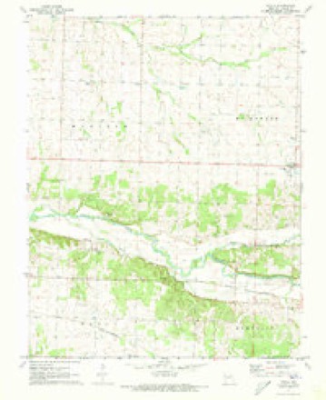
- 1971 USGS Avilla quadrangle1:24000
- 1986 USGS Joplin quadrangle1:100000
- 1991 USGS Joplin quadrangle1:100000
In the county-history sources
12,395 words on this townshipThe History of Jasper County, Missouri : Including a Condensed History of the State, a Complete History of Carthage and Joplin, Other Towns and Townships : Together with Numerous Portraits of Prominent Men : Cuts of Elegant Residences and Public Buildings : a Sectional Map of the County : Biographical Sketches of Many Enterprising Farmers, Merchants, Mechanics, Professional, and Business Men : the Constitution of the State : an Abstract of Laws : an Elaborate History of Jasper County - Its Topography, Natural History, Pioneers, Organization, Political History, Courts and Bar, Religious, Educational, Medical, Agricultural, Mining, and Horticultural, Its Commercial and Business Interests, Etc, published 1883 names this settlement in its chapter on McDonald Township. These are the passages that mention it, exactly as the scans read.
Avilla. - The pleasant little rural village of Avilla is located in the eastern portion of Jasper county, about four miles west of the Lawrence county line. It stands in one of the finest agricultural regions of southwest Mis- souri and has been, and is destined to be, a place of considerable importance. Close to the south is the timber skirting White Oak Creek, and towards the north and west stretch fertile prairies and rich and beautiful fields. The first merchant was D. S. Holman, who was also the first postmaster. Shortly after Messrs. Geo. and John Jones opened up the second store. The first hotel, the Avilla House, was erected by Justice Hall about the year 1868. The first physician was Dr. Young, who came here previous to the war and engaged in practice. There are now two general stores carrying an excellent stock of dry goods, clothing, etc.; two grocery stores, one notion store, one drug store, two boot and shoe stores, one livery and feed stable, one good hotel, three churches, and two secret societies. School advantages are quite good, the citizens taking great interest in the education of the youth. A new school-house will soon be erected.
Avilla was platted and laid out for public use July 23, 1858, by David S. Holman and Andrew L. Love, proprietors of the land on which the site was taken. The town was located on the southeast quarter of section 30, of township 29, range 29, and on the northeast quarter of section 31 in township 29, range 29. Benjamin Binney's addition to the town of Avilla was made June 11, 1868. Joseph S. Tam's addition was made June 18, 1873. Avilla Post-office. - The Avilla post-ofiice was established about the year 1858. The first postmaster was D. S. Holman. Those succeeding are wanting up to 1866; since, the following gentlemen have had charge: J. M. Berry, Josephus Kelley, T. S. Haughawont, N. H. Roberts, and J. E.. Spencer. Mr. Spencer took charge of the ofiice in April 1873 and received his commission on December 18, following. At that time it was a salaried office at $10 per month. Reports for quarter ending March 31, 1882: Commission allowed, ^69.57; amount of stamps, etc., sold, $110.85; box rent, $9.20; waste paper, $1.25; amount forwarded department, $52.23. Reports for quarter ending March 31, 1883: Commission allowed $76.89; stamps sold, $115.75; box rents, $9.85; waste paper, $2.60; registered letters sold in 1882, 485; number received, 81
M. E. Church. - Thirteen years ago Rev. J. C. Willoughby, then stationed at Carthage, traveled over Jasper county preaching in the private houses and organizing little bands of Methodists into classes. One of these classes was organized at Avilla, then a thriving town. Among those who met in these early official meetings are the names of D. H. Budloug, J. K. Glassford, J. JS". Renfro, D. S. DeWitt, James Haygard, W. B, Hamelton, D. B. Reaves, Dr. Stemmons, and others. This territory now comprises seven charges, all self-supporting, maintaining their Sunday-schools and other church institutions. The Avilla charge, as it is now, has been under the following pastors: Revs, J. C. Willoughby, Eli Wills, A. M. Stephens, Isaac Er.twhistle, John Garner, E. Hopkins, A. Barber, Jasper A. Smith, and J. J, Martin, who is present pastor. The society is now building, and arranging to build, three new church-houses within the charge; one in the country, one at Jasper, and one at Chambersville. At Avilla there is a Sunday-school, with John J. Stemmons as superintendent, with an average of fifty in attendance. The church has a membership of 196.
Machine-read from a century-old scan, so expect the errors a machine makes: misspelled names, dropped words, stray characters.
Read the whole chapter on McDonald Township - it names this place 30 more 30 times.
Mines and quarries near this place
8 within 5 milesRegional context, not property-specific evidence. The federal mineral resources record lists 8 workings within 5 miles of Avilla: 8 past producers. None of them still produces. What was taken out: Stone, Crushed/Broken, Lead, Zinc, Lead, Zinc, Lead. Distance is straight-line from the map coordinates, so a quarry counted here may appear on a neighbouring settlement's page as well.
| Where | Site | Commodity | Status | Recorded |
|---|---|---|---|---|
| Mcclurgs Place | Lead | Past Producer | ||
| Unknown - Zn & Pb | Zinc, Lead | Past Producer | ||
| Unknown - Zn & Pb | Lead, Zinc | Past Producer | ||
| Unknown - Zn & Pb | Lead, Zinc | Past Producer | ||
| Unknown - Ls | Stone, Crushed/Broken | Past Producer | ||
| Unknown - Ls | Stone, Crushed/Broken | Past Producer | ||
| Unknown - Ss | Stone, Crushed/Broken | Past Producer | ||
| Unknown - Ss | Stone, Crushed/Broken | Past Producer |
Storms near this place
17 since 1995Regional context, not property-specific evidence. The National Weather Service names Avilla in 17 storm reports between 1995 and 2024: 7 thunderstorm wind, 5 hail, 4 flash flood, 1 flood. No death or injury is recorded in these reports. Each account below is quoted exactly as the forecast office filed it, from the NOAA Storm Events Database, and each date opens the federal record of that event.
| When | Event | Place named | Harm | What the report says |
|---|---|---|---|---|
| May 2024 | Thunderstorm Wind | Avilla | $75,000 | Report of a roof blown off of a house and damage to its walls. |
| September 2006 | Thunderstorm Wind | Avilla | $65,000 | Severe thunderstorm wind gusts damaged three buildings just north of Avilla. |
| June 2009 | Thunderstorm Wind | Avilla | $20,000 | A pulse thunderstorm created downburst winds that caused damage to several trees, one vehicle, and one home. This damage occurred near the intersection of Incline Road and County Road 65. |
| June 2008 | Thunderstorm Wind | Avilla | $3,000 | Severe thunderstorm wind gusts knocked over a small wellhouse and damaged its water pipes. |
| November 2020 | Thunderstorm Wind | Avilla | $500 | A large tree was reported uprooted and metal sheeting was peeled of a shed. |
| April 2015 | Flood | Avilla | - | Missouri Highway 37 was closed at the Spring River and White Oak Creek due to flooding. |
| May 2010 | Thunderstorm Wind | Avilla | - | Several trees were uprooted at the intersection of County Road 60 and Locust Road. |
| August 2007 | Flash Flood | Avilla | - | The remnants of Tropical Storm Erin caused flash flooding in several areas of eastern Jasper County. Low lying areas and roads experienced flooding for several hours prior to receding to below flood status later that afternoon. Specific locations where flooding was observed include, a section of Highway 96 near Avilla, a section of Highway 37 south of Avilla, and several other county roads in eastern Jasper County. |
| September 2007 | Flash Flood | Avilla | - | Heavy rain flooded a section of Highway 96 near Avilla. |
| September 2007 | Flash Flood | Avilla | - | Widespread flooding was observed across much of Jasper County. Locations that flooded included the intersection of Fairview and Laurel in Carthage, a section of Highway 96 east of Avilla, the intersection of County Road 140 and Nutmeg, a section of Highway 71, a section of Civil War Street in Carthage, a section of County Road 150, a section of Locust Street in Carthage, the intersection of 7th and Maiden streets in Joplin, the intersection of 4th and Turk streets in Joplin, the intersection of 7th and Illinois streets in Joplin, a large section of County Road 90 near the Spring River, and a section of Highway 96 near its intersection with County Road 70. |
| July 2004 | Flash Flood | Avilla | - | Flash flooding inundated the intersection of Oak and County Road 30 north of Avilla. |
| May 1995 | Thunderstorm Wind | Avilla | - | Numerous trees were blown down by thunderstorm winds. |
| April 2012 | Hail | Avilla | - | no account filed |
| May 2009 | Hail | Avilla | - | no account filed |
| June 2007 | Hail | Avilla | - | no account filed |
| April 2005 | Hail | Avilla | - | no account filed |
| May 1997 | Hail | Avilla | - | no account filed |
Nearest settlements
The eight closest, with where each one stands in the county. Distances are straight-line, computed from the Geographic Names Information System coordinates.
| Map | Place | Distance | Sheets |
|---|---|---|---|
| Maple Grove | 4.0 miles | 16 | |
| Forest Mills | 4.7 miles | 18 | |
| La Russell | 5.2 miles | 18 | |
| Reeds | 5.8 miles | 18 | |
| Maxville | 7.3 miles | 17 | |
| Knights | 7.5 miles | 17 | |
| Dudenville | 8.0 miles | 17 | |
| Sarcoxie | 8.7 miles | 18 |
Elsewhere
Matched on this settlement's Geographic Names Information System number rather than its name, so it cannot be a different place of the same name in another state.
| Wikipedia article on Avilla | An encyclopaedic summary. Its text is share-alike, so it is linked here rather than copied. |
| Wikidata item Q958804 | The structured record the population and elevation above come from. Public domain (CC0). |
Provenance
This settlement is recorded in the Geographic Names Information System as feature 713507. The sheet list is computed by point-in-boundary test against the United States Geological Survey's historical topographic inventory. Both are works of the United States government and carry no copyright under 17 U.S.C. 105.
Mines and quarries. USGS Mineral Resources Data System (MRDS) https://mrdata.usgs.gov/mrds/ A work of the United States government, no copyright under 17 U.S.C. 105.
Storms. NOAA National Centers for Environmental Information, Storm Events Database https://www.ncei.noaa.gov/stormevents/ A work of the United States government, no copyright under 17 U.S.C. 105. Narratives are quoted verbatim from the National Weather Service report and are not edited or summarised.