 Block
Boonville, Missouri
18 topographic sheets cover this place, the earliest surveyed in 1888 and the latest in 1982. It stands in Boonville Township. It lies in ZIP code area 65233. It stands on Rupe Branch. The Survey maps it on the Boonville quadrangle. 7,964 people lived here at the 2020 count. It stands 666 feet above sea level.
Research this city
On record in Boonville
Buildings and businesses the archive holds for this place. Each opens its own page, with the source record it came from.
On the National Register 12 of 29 shown
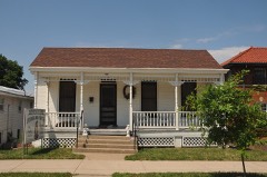 Andrews-Wing Houselisted 1990
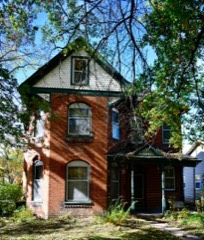 William S. and Mary Beckett Houselisted 1990
 Albert Gallatin Blakey Houselisted 1990
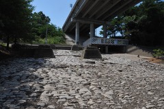 Cobblestone Streetlisted 1990
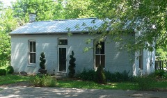 Duke and Mary Diggs Houselisted 1990
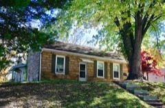 Andrew Gantner Houselisted 1990
 Hamilton-Brown Shoe Company Buildinglisted 1990
 Historic District Dlisted 1983
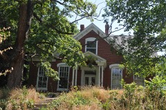 Juliet Trigg Johnson Houselisted 1990
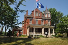 Wilbur T. and Rhoda Stephens Johnson Houselisted 1990
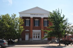 Lyric Theaterlisted 1969
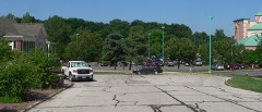 Meierhoffer Sand Company Office Buildinglisted 1990
Population over time
2 figuresBoonville fell from 8,319 to 7,964 between 2010 and 2020. These are the recorded population figures Wikidata holds for this place, reached through the Geographic Names Information System number this page is keyed on rather than by name, so they belong to this place and not to another of the same name. Most are census counts, but not all are: an early figure may be a founding or settlement estimate, and an estimate published within five years of a census is left out. The change column is computed, and is left blank where more than 20 years separate a figure from the one before it, because a gap that long is not a change between two counts.
| Year | People | Change |
|---|---|---|
| 2010 | 8,319 | |
| 2020 | 7,964 | -355 (-4%) |
Topographic sheets covering this place
8 surveys from 18 printed sheetsMatched by testing this settlement's coordinate against the published boundary of every sheet in the United States Geological Survey's historical collection. Each opens the scanned sheet at the Survey.
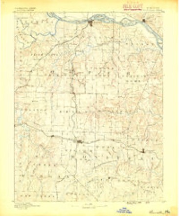
- 1888 USGS Boonville quadrangle1:125000, 5 printings
- 1947 USGS Jefferson City quadrangle1:250000
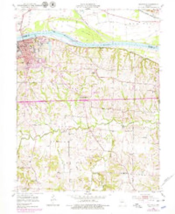
- 1952 USGS Boonville quadrangle1:24000, 3 printings
- 1954 USGS Jefferson City quadrangle1:250000, 2 printings
- 1955 USGS Jefferson City quadrangle1:250000, 4 printings
- 1958 USGS Jefferson City quadrangle1:250000
- 1959 USGS Jefferson City quadrangle1:250000
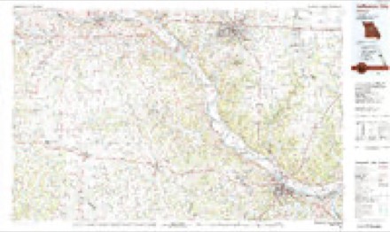
- 1982 USGS Jefferson City quadrangle1:100000





In the county-history sources
4,051 words on this townshipA History of Cooper County, Missouri, from the First Visit by White Men in February, 1804, to the Fifth Day of July, 1876, published 1876 names this settlement in its chapter on Boonville Township. These are the passages that mention it, exactly as the scans read.
The Missouri, Kansas & Texas railway crosses the river here, on the great iron, bridge, putting the city in direct communication with the lakes at Chicago, and the Gulf of Mexico at Galveston, Texas. And the Osage Valley & Southern Kansas railroad connects Boonville with the Missouri Pacific railroad at Tipton.
Passage source: A History of Cooper County, Missouri, from the First Visit by White Men in February, 1804, to the Fifth Day of July, 1876, published 1876.
Mrs. Hannah Cole, mother of Capt. Samuel Cole, made the first settlement on a part of the land on which Boonville is located, in the year 1810, and took a pre-emption, which she sold to Bird Lockhart and Henry Carroll, January 25th, 1819, for a trifle. The first settler in the old limits of Boonville was Gilliard Roupe, who built his residence on the lot now owned and occupied by Capt. James Thompson, on the south side of Spring street, near the cement factory. (This information was obtained from Samuel Cole, William Gibson and Judge McFarland.) The stream in the western portion of the ''old town" was called from his name, "Roupe's Branch." The next was a ferry house, built by Roupe, at the mouth of the above branch, where he had a ferry landing. The first ferry was kept by the widow Cole's boys. There were several houses built on the flat below the branch, extending south as far as the corner of Morgan and Second streets, before the town was located.
Passage source: A History of Cooper County, Missouri, from the First Visit by White Men in February, 1804, to the Fifth Day of July, 1876, published 1876.
A Frenchman named Reubadeaux kept the first store in Boonville, in a cabin built of poles. Shortly afterwards a man named Nolin kept a grocery on the fiat, at the mouth of the branch ; Mrs. Reavis and William Bartlett kept boarding houses in the same locality ; and Thomas Rogers built a house on the corner of High and Second streets, and used it as a residence, hotel and store.
Passage source: A History of Cooper County, Missouri, from the First Visit by White Men in February, 1804, to the Fifth Day of July, 1876, published 1876.
Machine-read from a century-old scan, so expect the errors a machine makes: misspelled names, dropped words, stray characters.
Read the whole chapter on Boonville Township - it names this place 13 more 13 times.
Fires near this place
28 since 1999Regional context, not property-specific evidence. The federal wildfire occurrence database lists 28 fires within 5 miles of Boonville between 1999 and 2020, burning about 112 acres in total. None started naturally. None was recorded as arson. Distance is straight-line from the map coordinates, so a fire counted here may appear on a neighbouring settlement's page as well.
| Reported cause | Fires |
|---|---|
| Missing data/not specified/undetermined | 14 |
| Debris and open burning | 8 |
| Smoking | 3 |
| Equipment and vehicle use | 1 |
| Power generation/transmission/distribution | 1 |
| Fireworks | 1 |
The most recent of them, most recent first, with the day each was reported and the service that recorded it.
| Date | Cause | Size | Reported by | Name on the report |
|---|---|---|---|---|
| 29 September 1999 | Smoking | 1.0 acres | Missouri Department of Conservation | not named |
| 26 September 2020 | Missing data/not specified/undetermined | under an acre | Missouri Department of Conservation | 251267-02732-09262020-2010 |
| 2 September 1999 | Smoking | 1.0 acres | Missouri Department of Conservation | not named |
| 16 September 2019 | Missing data/not specified/undetermined | under an acre | Missouri Department of Conservation | 190053-02732-09162019-1015 |
| 2 August 2019 | Missing data/not specified/undetermined | under an acre | Missouri Department of Conservation | 190049-02732-08022019-1115 |
| 17 August 2020 | Equipment and vehicle use | under an acre | Missouri Department of Conservation | 251265-02732-08172020-1610 |
| 16 August 1999 | Smoking | 1.0 acres | Missouri Department of Conservation | not named |
| 28 July 1999 | Missing data/not specified/undetermined | 1.0 acres | Missouri Department of Conservation | not named |
Settlements close enough to share some of these fires:
Mines and quarries near this place
5 within 5 milesRegional context, not property-specific evidence. The federal mineral resources record lists 5 workings within 5 miles of Boonville: 4 past producers, 1 producer. 1 still produces. What was taken out: Stone, Crushed/Broken. Distance is straight-line from the map coordinates, so a quarry counted here may appear on a neighbouring settlement's page as well.
| Where | Site | Commodity | Status | Recorded |
|---|---|---|---|---|
| Booneville Quarry & Plant | Stone, Crushed/Broken | Producer | ||
| Klusmeyer Mine | Stone, Crushed/Broken | Past Producer | ||
| Unknown - Ls | Stone, Crushed/Broken | Past Producer | ||
| Unknown - Ls | Stone, Crushed/Broken | Past Producer | ||
| Unknown - Ls | Stone, Crushed/Broken | Past Producer |
Storms near this place
60 of 107 shownRegional context, not property-specific evidence. The National Weather Service names Boonville in 107 storm reports between 1993 and 2025: 57 hail, 31 thunderstorm wind, 10 flash flood, 5 flood. No death or injury is recorded in these reports. Each account below is quoted exactly as the forecast office filed it, from the NOAA Storm Events Database, and each date opens the federal record of that event.
| When | Event | Place named | Harm | What the report says |
|---|---|---|---|---|
| April 1999 | Tornado (F1) | Boonville | $750,000 | A tornado developed 4 miles south of Boonville and moved quickly northeast, damaging a church and downing several trees and power poles 4 miles south of Boonville. Three eighteen-wheelers were overturned. |
| August 2005 | Tornado (F0) | Boonville | $50,000 | F0 gustnado along the leading edge of a line of thunderstorms produced damage to several homes in southwest Boonville. Also roofs torn off trailers, and numerous trees downed. |
| April 1999 | Thunderstorm Wind | Boonville | $50,000 | Thunderstorm winds blew the roof off of a church. |
| June 1994 | Thunderstorm Wind | Boonville | $50,000 | Strong wind tore one-fourth of the roof off a school building. |
| August 1993 | Thunderstorm Wind | Boonville | $50,000 | Strong winds broke large tree limbs and blew down power lines. |
| June 2000 | Thunderstorm Wind | Boonville | $30,000 | Thunderstorm winds gusted to near hurricane strength in Boonville, downing power lines and trees. A vehicle was damaged when a large tree fell on it, and several residents reported damage to their roofs. |
| June 2009 | Hail | Boonville | $10,000 | no account filed |
| August 2011 | Thunderstorm Wind | Boonville | $5,000 | A barn roof was blown off. Large tree branches were down, and power outages were reported. Thunderstorm wind gusts were estimated up to 70 mph. |
| May 2000 | Lightning | Boonville | $5,000 | A house in Boonville was damaged by a lightning strike. |
| March 1993 | Thunderstorm Wind | Boonville | $5,000 | Three billboards were blown down and destroyed at the junction of Interstate 70 and Highway 87. |
| March 1993 | Hail | Boonville | $5,000 | Golfball-size hail was reported by a weather spotter. |
| October 2009 | Thunderstorm Wind | Boonville | $2,000 | A shed was blown onto a truck, and windows were blown out of a house, on Prairie Lick Road. |
| July 2002 | Thunderstorm Wind | Boonville | $2,000 | Minor roof damage reported. |
| October 2007 | Thunderstorm Wind | Boonville | $1,000 | Window blown out of a downtown Boonville building. |
| May 2002 | Thunderstorm Wind | Boonville | $1,000 | Power lines reported down. |
| May 2025 | Thunderstorm Wind | Boonville | - | Downed wires and power outages on the southeast side of Boonville. |
| June 2025 | Thunderstorm Wind | Boonville | - | Downed tree and wires near Sycamore Street in Boonville. |
| June 2024 | Hail | Boonville | - | Quarter size hail was reported south of Boonville. |
| June 2022 | Thunderstorm Wind | Boonville | - | Powerlines were reported down in front of KWRT radio station in Boonville. There were also several trees down across the area. |
| June 2021 | Thunderstorm Wind | Boonville | - | Multiple trees down in and around Boonville. |
| June 2021 | Flash Flood | Boonville | - | Several roads were flooding with running water in Boonville. |
| August 2020 | Thunderstorm Wind | Boonville | - | A maple tree was downed in Boonville. Numerous other tress were damaged or broken. |
| May 2018 | Thunderstorm Wind | Boonville | - | Power lines and a tree came down in Booneville. |
| May 2017 | Thunderstorm Wind | Boonville | - | Emergency Manager reported power lines down near Boonville. |
| March 2016 | Thunderstorm Wind | Boonville | - | Several large trees were blown down in the city of Booneville, Missouri and power outages were reported. |
| September 2014 | Flash Flood | Boonville | - | Highway U and Doyle Road were closed due to high water. Highway 87, 500 feet from Interstate 70 overpass was closed due to high water and several reports of accidents due to hydroplaning. |
| May 2013 | Flash Flood | Boonville | - | One foot of water was reported over U Highway and Doyle Road. |
| June 2009 | Thunderstorm Wind | Boonville | - | Numerous trees were reported blown down. |
| April 2008 | Flood | Boonville | - | The Petite Saline Creek near Boonville crested at 21.68 feet, or 5.68 feet above flood stage. |
| June 2007 | Flood | Boonville | - | The Petite Saline Creek near Boonville crested at 16.85 feet, or 0.85 feet above flood stage. |
| February 2007 | Flood | Boonville | - | The Petite Saline Creek near Boonville crested at 18.25 feet, or 2.25 feet above flood stage. |
| February 2007 | Flood | Boonville | - | Snow and ice melt caused the Petite Saline Creek near Boonville to crest at 17.30 feet, or 1.30 feet above flood stage. |
| April 2006 | Flood | Boonville | - | The Petite Saline Creek near Boonville crested at 16.00 feet, or right at flood stage. |
| July 2006 | Thunderstorm Wind | Boonville | - | Large tree limbs down. |
| May 2004 | Thunderstorm Wind | Boonville | - | Large trees blown down in Boonville. |
| May 2004 | Flash Flood | Boonville | - | County roads under water. |
| June 2004 | Thunderstorm Wind | Boonville | - | Trees reported down on Highway 40. |
| August 2004 | Flash Flood | Boonville | - | Heavy rains caused flooding on several roads. |
| August 2004 | Flash Flood | Boonville | - | Heavy rains caused flooding on several roads. |
| May 2002 | Flash Flood | Boonville | - | Doyle road and U highway closed due to high water. |
| May 2002 | Flash Flood | Boonville | - | U highway near Boonville closed due to high water over the road. |
| August 2001 | Thunderstorm Wind | Boonville | - | Tree blocking highway 90. |
| August 2000 | Thunderstorm Wind | Boonville | - | Boonville police reported 60 mph wind gusts. |
| August 2000 | Hail | Boonville | - | Dime size hail was reported at mile marker 106 on Interstate 70. |
| June 1998 | Thunderstorm Wind | Boonville | - | A spotter reported trees down in Boonville as a result of a 59 MPH gust during a thunderstorm. The damaging thunderstorm winds also blew a 10 inch diameter tree on top of a house in Boonville. |
| June 1998 | Hail | Boonville | - | The Cooper County Sheriff's Office reported dime-size hail during a severe thunderstorm at Boonville. |
| June 1998 | Hail | Boonville | - | Nickel-size hail was reported during a severe thunderstorm in Boonville by the Cooper County Sheriff's Office. |
| March 1998 | Thunderstorm Wind | Boonville | - | The Cooper County Sheriff's office reported a wind gust to 64 MPH in Boonville. On the west side of Boonville, a tree 14 inches in diameter was blown down resulting in a blocked roadway. |
| February 1998 | Heavy Rain | Boonville | - | One to three inches of rain fell over Cooper County on the evening of the 20th and early morning hours of the 21st. This resulted in flooding of roadways. Route U, about 2 miles south of I-70 was completely closed due to high water. |
| July 1997 | Hail | Boonville | - | A severe weather spotter reported half dollar-size hail in Boonville at the intersection of Interstate 70 and Route 87. |
| April 1997 | Thunderstorm Wind | Boonville | - | Severe thunderstorm winds gusted to 70 MPH and knocked down 4 large trees in Boonville near the intersection of 87 Highway and Interstate 70. |
| February 2017 | Hail | Boonville | - | no account filed |
| April 2014 | Hail | Boonville | - | no account filed |
| March 2012 | Hail | Boonville | - | no account filed |
| September 2012 | Hail | Boonville | - | no account filed |
| May 2011 | Hail | Boonville | - | no account filed |
| May 2011 | Hail | Boonville | - | no account filed |
| June 2011 | Hail | Boonville | - | no account filed |
| June 2011 | Hail | Boonville | - | no account filed |
| June 2011 | Hail | Boonville | - | no account filed |
Nearest settlements
The eight closest, with where each one stands in the county. Distances are straight-line, computed from the Geographic Names Information System coordinates.
| Map | Place | Distance | Sheets |
|---|---|---|---|
| Windsor Place | 3.9 miles | 18 | |
| Merna | 5.0 miles | 18 | |
| Billingsville | 5.6 miles | 18 | |
| Lamine | 7.2 miles | 18 | |
| Clarks Fork | 7.7 miles | 18 | |
| Chouteau Springs | 8.7 miles | 17 | |
| Overton | 9.0 miles | 19 | |
| Speed | 9.2 miles | 18 |
Elsewhere
Matched on this settlement's Geographic Names Information System number rather than its name, so it cannot be a different place of the same name in another state.
| Wikipedia article on Boonville | An encyclopaedic summary. Its text is share-alike, so it is linked here rather than copied. |
| Wikidata item Q963325 | The structured record the population and elevation above come from. Public domain (CC0). |
Provenance
This settlement is recorded in the Geographic Names Information System as feature 714540. The sheet list is computed by point-in-boundary test against the United States Geological Survey's historical topographic inventory. Both are works of the United States government and carry no copyright under 17 U.S.C. 105.
Wildfire. Short, Karen C. 2022. Spatial wildfire occurrence data for the United States, 1992-2020 [FPA_FOD_20221014]. 6th Edition. Fort Collins, CO: Forest Service Research Data Archive. https://doi.org/10.2737/RDS-2013-0009.6 Collected with United States Government funding and usable without additional permissions or fees.
Mines and quarries. USGS Mineral Resources Data System (MRDS) https://mrdata.usgs.gov/mrds/ A work of the United States government, no copyright under 17 U.S.C. 105.
Storms. NOAA National Centers for Environmental Information, Storm Events Database https://www.ncei.noaa.gov/stormevents/ A work of the United States government, no copyright under 17 U.S.C. 105. Narratives are quoted verbatim from the National Weather Service report and are not edited or summarised.