Block
From the record
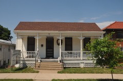
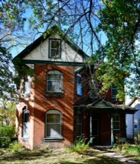
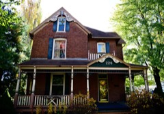
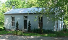
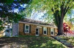
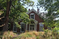
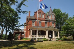
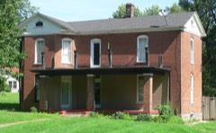
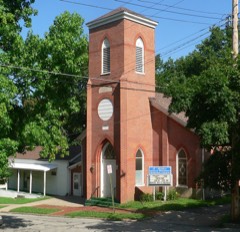
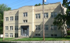
39 National Register listings published here.
Sources: the county history on the Internet Archive · the National Register database, National Park Service
54 topographic sheets cover 28 settlements here, and 39 properties are on the National Register of Historic Places.
39 National Register listings published here.
Sources: the county history on the Internet Archive · the National Register database, National Park Service
Every property in this county listed on the National Register of Historic Places, with the year it was listed and the federal nomination document.
Every wildfire the federal occurrence database records inside this county: 122 of them, burning about 533 acres. 1 started naturally and 2 were recorded as arson. Each settlement page carries the fires within five miles of it.
| Reported cause | Fires |
|---|---|
| Missing data/not specified/undetermined | 53 |
| Debris and open burning | 40 |
| Equipment and vehicle use | 11 |
| Smoking | 8 |
| Recreation and ceremony | 5 |
| Arson/incendiarism | 2 |
| Natural | 1 |
| Power generation/transmission/distribution | 1 |
| Fireworks | 1 |
The five largest, by the area the report gives. One of them was set deliberately.
| Date | Cause | Size | Reported by | Name on the report |
|---|---|---|---|---|
| 18 February 2002 | Equipment and vehicle use | 150 acres | Missouri Department of Conservation | not named |
| 16 March 1999 | Debris and open burning | 100 acres | Missouri Department of Conservation | not named |
| 13 November 2001 | Debris and open burning | 50 acres | Missouri Department of Conservation | not named |
| 27 April 2019 | Missing data/not specified/undetermined | 35 acres | Missouri Department of Conservation | 178940-02732-04272019-1825 |
| 14 February 2018 | Debris and open burning | 22 acres | Missouri Department of Conservation | 178236-06845-02142018-1525 |
| 9 April 2001 | Arson/incendiarism | 20 acres | Missouri Department of Conservation | not named |
| 30 March 1999 | Debris and open burning | 20 acres | Missouri Department of Conservation | not named |
| 13 March 2018 | Debris and open burning | 13 acres | Missouri Department of Conservation | 178238-06845-03132018-1620 |
Every settlement page carries the fires within five miles of it - see the settlement index below.
The NOAA Storm Events Database holds 353 reports for this county, causing 1 death, 2 injuries and about $1,497,530 in recorded property damage. Each settlement page carries the reports that name it.
| Kind of event | Reports |
|---|---|
| Hail | 148 |
| Thunderstorm Wind | 123 |
| Flash Flood | 33 |
| Flood | 28 |
| Tornado | 19 |
| Heavy Rain | 1 |
| Lightning | 1 |
The most serious of them, by death, then injury, then recorded damage. The accounts are quoted exactly as the forecast office filed them.
| When | Event | Place named | Harm | What the report says |
|---|---|---|---|---|
| June 2015 | Flash Flood | Pisgah | 1 killed | Female victim was camping along Moniteau Creek near Prairie Home, Missouri. Authorities believe she was swept away by flash flood waters. Her body was discovered along Red Bud Road in Moniteau County Missouri. |
| July 1992 | Thunderstorm Wind | not stated | 2 hurt | no account filed |
| April 1999 | Tornado (F1) | Boonville | $750,000 | A tornado developed 4 miles south of Boonville and moved quickly northeast, damaging a church and downing several trees and power poles 4 miles south of Boonville. Three eighteen-wheelers were overturned. |
| September 1992 | Tornado (F2) | not stated | $250,000 | no account filed |
| April 2025 | Tornado (EF2) | Pilot Grove | $100,000 | A tornado with an estimated peak wind of 115 mph (EF-2) traveled for around 6.3 miles across portions of western Cooper County, Missouri, impacting the town of Pilot Grove and surrounding areas. The tornado damage path began just southwest of downtown Pilot Grove, where it caused some minor damage to an outbuilding at a farmstead. The tornado then traveled to the northeast, where it caused minor damage to the roofs of homes on W Bock Street and the Katy Manor on Prospect Street. It then caused damage to several structures along W Harris Street near the intersection of W 3rd Street. In this location, a manufactured home was thrown 100 feet off its cinder blocks and completely destroyed. Large trees were uprooted onto the roof of a home next to the destroyed manufactured home, and an outbuilding was destroyed. The tornado continued to move to the north northeast, where it caused severe damage to a newly well built barndominium style home along Route M just south of Immele Road. After this, the tornado roughly paralleled Route 135, where it damaged numerous houses, completely destroyed outbuildings, caused extensive tree damage, and snapped numerous power poles. The area between the barndominium near Route M and Immele Road and along Route 135 up to Chouteau Springs Rd is where the most extensive damage occurred, with maximum estimated winds up to 115 mph (EF-2), as well as the widest part of the tornado damage path (up to 200 yards). The tornado then turned more northward, with limited observed damage. A small outbuilding was severely damaged along the south outer road of Interstate 70. No damage was observed north of Interstate 70. |
| August 2005 | Tornado (F0) | Boonville | $50,000 | F0 gustnado along the leading edge of a line of thunderstorms produced damage to several homes in southwest Boonville. Also roofs torn off trailers, and numerous trees downed. |
| April 1999 | Thunderstorm Wind | Boonville | $50,000 | Thunderstorm winds blew the roof off of a church. |
| June 1994 | Thunderstorm Wind | Boonville | $50,000 | Strong wind tore one-fourth of the roof off a school building. |
| August 1993 | Thunderstorm Wind | Boonville | $50,000 | Strong winds broke large tree limbs and blew down power lines. |
| June 2000 | Thunderstorm Wind | Boonville | $30,000 | Thunderstorm winds gusted to near hurricane strength in Boonville, downing power lines and trees. A vehicle was damaged when a large tree fell on it, and several residents reported damage to their roofs. |
| April 2001 | Tornado (F1) | Pilot Grove | $25,000 | Tornado on the ground around Pilot Grove for 5 minutes, moving east. It produced minor roof damage to two homes. There were also downed trees and power lines. It was accompanied by baseball sized hail. |
| May 1982 | Tornado (F2) | not stated | $25,000 | no account filed |
| May 1982 | Tornado (F1) | not stated | $25,000 | no account filed |
| April 1973 | Tornado (F2) | not stated | $25,000 | no account filed |
| June 2009 | Hail | Boonville | $10,000 | no account filed |
| August 2011 | Thunderstorm Wind | Boonville | $5,000 | A barn roof was blown off. Large tree branches were down, and power outages were reported. Thunderstorm wind gusts were estimated up to 70 mph. |
| July 2010 | Thunderstorm Wind | Boonville Viertel Ar | $5,000 | Thunderstorm wind gusts were estimated up to 70 mph, around a half mile south of Interstate 70. One half of a roof was blown off an auto sales building. Numerous trees were blown down, and a flag pole was bent. |
| March 2006 | Tornado (F0) | Blackwater | $5,000 | F0 tornado crossed from Pettis county into Cooper county at 1604 CST...3 miles south-southwest of Blackwater. The tornado moved northeast over rural areas...and dissipated 4 miles east-northeast of Blackwater at 1617 CST. The tornado crossed Interstate 70 near mile marker 88 and blew over a tractor trailer. This closed the west bound lanes of I-70 for a time. |
| May 2000 | Lightning | Boonville | $5,000 | A house in Boonville was damaged by a lightning strike. |
| March 1993 | Thunderstorm Wind | Boonville | $5,000 | Three billboards were blown down and destroyed at the junction of Interstate 70 and Highway 87. |
| March 1993 | Hail | Boonville | $5,000 | Golfball-size hail was reported by a weather spotter. |
| April 1993 | Hail | Blackwater | $5,000 | no account filed |
| July 1995 | Thunderstorm Wind | Booneville | $3,000 | Trees and power lines reported down in Booneville as a result of thunderstorm winds. |
| July 1975 | Tornado (F0) | not stated | $2,500 | no account filed |
| April 1973 | Tornado (F1) | not stated | $2,500 | no account filed |
| May 1973 | Tornado (F1) | not stated | $2,500 | no account filed |
| October 2009 | Thunderstorm Wind | Boonville | $2,000 | A shed was blown onto a truck, and windows were blown out of a house, on Prairie Lick Road. |
| June 2007 | Flash Flood | Bunceton | $2,000 | Two cars were swept off Highway 5. |
| October 2007 | Thunderstorm Wind | Boonville Arpt | $2,000 | Electric lines down in the city of Boonville. |
| July 2002 | Thunderstorm Wind | Boonville | $2,000 | Minor roof damage reported. |
| October 2007 | Thunderstorm Wind | Boonville | $1,000 | Window blown out of a downtown Boonville building. |
| May 2002 | Thunderstorm Wind | Boonville | $1,000 | Power lines reported down. |
| August 1995 | Thunderstorm Wind | Lamine | $1,000 | Strong thunderstorms knocked down trees in Lamine. |
| April 2001 | Thunderstorm Wind | Bunceton | $1,000 | no account filed |
| June 1968 | Tornado (F0) | not stated | $30 | no account filed |
| May 2025 | Thunderstorm Wind | Lick | - | Downed wires southwest of Boonville near I-70. |
| May 2025 | Thunderstorm Wind | Boonville Arpt | - | Multiple reports of downed trees and wires near Katy Trail State Park. |
| May 2025 | Thunderstorm Wind | Bunceton | - | Downed wires in Bunceton. |
| May 2025 | Thunderstorm Wind | Boonville | - | Downed wires and power outages on the southeast side of Boonville. |
| June 2025 | Thunderstorm Wind | Boonville | - | Downed tree and wires near Sycamore Street in Boonville. |
| June 2025 | Thunderstorm Wind | Boonville Arpt | - | Social media video of a downed tree at a residence in Boonville. |
| June 2025 | Thunderstorm Wind | Billingsville | - | Downed wires and power outages near Billingsville Road south of Boonville. |
| June 2025 | Thunderstorm Wind | Lick | - | Downed tree and wires near Sportsman Road in Boonville. |
| June 2025 | Thunderstorm Wind | Pilot Grove | - | Emergency Manager reports large trees down in Pilot Grove. |
| June 2025 | Thunderstorm Wind | Blackwater | - | Downed tree limbs and wires in the Blackwater area. |
| September 2025 | Thunderstorm Wind | Lone Elm | - | Power pole knocked down east of Bunceton. |
| September 2025 | Thunderstorm Wind | Blackwater | - | Power pole downed north of Blackwater. |
| June 2024 | Thunderstorm Wind | Wooldridge | - | Large tree branches across roadway entering into Wooldridge. |
| June 2024 | Hail | Boonville | - | Quarter size hail was reported south of Boonville. |
| June 2024 | Thunderstorm Wind | Wooldridge | - | Large tree branches across roadway entering into Wooldridge. |
| May 2024 | Thunderstorm Wind | Bunceton | - | Large tree uprooted. |
| February 2023 | Thunderstorm Wind | Bunceton | - | A squall line produced a measured wind gusts of 70 mph just west of Bunceton. |
| March 2023 | Hail | Blackwater | - | A supercell produced 1.25 hail in Blackwater in northwestern Cooper County. |
| March 2023 | Hail | Blackwater | - | A supercell produced 1 hail in just east of Nelson in northwestern Cooper County. |
| June 2023 | Hail | Boonville Arpt | - | Golf ball sized hail was reported at Isle of Capri Casino in Boonville. |
| August 2023 | Thunderstorm Wind | Bunceton | - | Estimated 60 mph winds south of Bunceton. |
| August 2023 | Thunderstorm Wind | Prairie Home | - | Tree down and shingles blown off roof. |
| August 2023 | Thunderstorm Wind | Clifton City | - | Estimated 60 mph winds in Clifton City. |
| April 2022 | Thunderstorm Wind | Chouteau Spgs | - | Nearby a ham radio operator reported 70 to 80 mph wind gusts, just before power lines were blown across Highway 135 at this location. |
| April 2022 | Thunderstorm Wind | Lamine | - | Ham radio operator reported 70 to 80 mph winds at this location. |
The Survey's mineral resources record lists 51 workings inside this county. 6 still produce and 45 are closed or unrecorded. Each settlement page carries the workings within five miles of it.
| Commodity | Workings |
|---|---|
| Stone, Crushed/Broken | 31 |
| Barium-Barite | 6 |
| Sand and Gravel, Construction | 3 |
| Bituminous, Zinc | 2 |
| Lead | 2 |
| Lead, Zinc | 2 |
| Barium-Barite, Lead | 2 |
| Bituminous, Lead, Zinc | 2 |
| Barium-Barite, Lead, Zinc | 1 |
The least common of them first, because a county's hundredth gravel pit says nothing its first ten did not.
| Where | Site | Commodity | Status | Recorded |
|---|---|---|---|---|
| Collins Diggings | Barium-Barite, Lead, Zinc | Past Producer | ||
| Lane Mine | Bituminous, Zinc | Past Producer | ||
| Mccauley-Widel | Barium-Barite, Lead | Producer | 1834, 1836 | |
| Poindexter Mine | Barium-Barite, Lead | Past Producer | ||
| Scott Mine | Lead | Past Producer | ||
| Shackleford Diggings | Bituminous, Lead, Zinc | Past Producer | ||
| Unknown - Coal Zinc | Bituminous, Zinc | Past Producer | ||
| Unknown - Lead | Lead | Past Producer | ||
| Unknown - Lead Zinc | Lead, Zinc | Past Producer | ||
| Wyant Trigg + Bryan Diggings | Lead, Zinc | Past Producer | ||
| Zinc Creek Mine | Bituminous, Lead, Zinc | Past Producer | ||
| Daniel Boone Dredge | Sand and Gravel, Construction | Producer | ||
| Unknown - S+G | Sand and Gravel, Construction | Past Producer | ||
| Unknown - S+G | Sand and Gravel, Construction | Past Producer | ||
| Blackeagle Mine & Plant | Barium-Barite | Producer | ||
| Frank Smith Land | Barium-Barite | Prospect | ||
| H A Kaiser Land | Barium-Barite | Past Producer | ||
| Honorbrink Land | Barium-Barite | Past Producer | ||
| Unknown - Barite | Barium-Barite | Prospect | ||
| Unknown - Barite | Barium-Barite | Past Producer | ||
| Blackwater Quarry | Stone, Crushed/Broken | Past Producer | ||
| Booneville Quarry & Plant | Stone, Crushed/Broken | Producer | ||
| Colyer Brothers Quarry | Stone, Crushed/Broken | Past Producer | ||
| Leonard Quarry | Stone, Crushed/Broken | Past Producer | ||
| Otterville Quarry & Plant | Stone, Crushed/Broken | Producer | ||
| Prestage Quarry & Mill | Stone, Crushed/Broken | Producer | ||
| Sweeny Quarry | Stone, Crushed/Broken | Past Producer | ||
| Unknown - Ls | Stone, Crushed/Broken | Past Producer | ||
| Unknown - Ls | Stone, Crushed/Broken | Past Producer | ||
| Unknown - Ls | Stone, Crushed/Broken | Past Producer | ||
| Unknown - Ls | Stone, Crushed/Broken | Past Producer | ||
| Unknown - Ls | Stone, Crushed/Broken | Past Producer | ||
| Unknown - Ls | Stone, Crushed/Broken | Past Producer | ||
| Unknown - Ls | Stone, Crushed/Broken | Past Producer | ||
| Unknown - Ls | Stone, Crushed/Broken | Past Producer | ||
| Unknown - Ls | Stone, Crushed/Broken | Past Producer | ||
| Unknown - Ls | Stone, Crushed/Broken | Past Producer | ||
| Unknown - Ls | Stone, Crushed/Broken | Past Producer | ||
| Unknown - Ls | Stone, Crushed/Broken | Past Producer | ||
| Unknown - Ls | Stone, Crushed/Broken | Past Producer | ||
| Unknown - Ls | Stone, Crushed/Broken | Past Producer | ||
| Unknown - Ls | Stone, Crushed/Broken | Past Producer | ||
| Unknown - Ls | Stone, Crushed/Broken | Past Producer | ||
| Unknown - Ls | Stone, Crushed/Broken | Past Producer | ||
| Unknown - Ls | Stone, Crushed/Broken | Past Producer | ||
| Unknown - Ls | Stone, Crushed/Broken | Past Producer | ||
| Unknown - Ls | Stone, Crushed/Broken | Past Producer | ||
| Unknown - Ls | Stone, Crushed/Broken | Past Producer | ||
| Unknown - Ls | Stone, Crushed/Broken | Past Producer | ||
| Unknown - Ls | Stone, Crushed/Broken | Past Producer | ||
| Unknown - Ls | Stone, Crushed/Broken | Past Producer |
History of Cooper County, Missouri devotes a chapter to each township: its boundaries and streams, who settled it and when, the mills, the schools and the churches. All 10 are reproduced here in full. Each row shows the township's own shape and where it lies in the county, drawn from the Census Bureau's boundary. Which settlements belong to which township is computed from that same boundary, not taken from the book.
| Shape and position in the county | Township | Settlements in it | Length | Sections |
|---|---|---|---|---|
| Blackwater Township | Blackwater, Shackleford Crossing | 322 words | 0 | |
| Boonville Township | Billingsville, Boonville, Merna, Windsor Place | 4,051 words | 2 | |
| Clear Creek Township | Corioli, Harriston, Hoffman, Pleasant Green | 682 words | 0 | |
| Kelly Township | Bunceton, Petersburg | 705 words | 0 | |
| Lamine Township | Lamine | 3,356 words | 0 | |
| Otterville Township | Clifton City, Otterville | 226 words | 0 | |
| Palestine Township | Bellair, Speed | 2,130 words | 0 | |
| Pilot Grove Township | Chouteau Springs, Pilot Grove | 1,894 words | 1 | |
| Prairie Home Township | Prairie Home | 1,874 words | 0 | |
| Saline Township | Overton, Pleasant Grove, Wooldridge | 2,620 words | 0 |
2 books written about this county, cut here where the book itself is cut, at its printed chapters: 41 chapters in all. Every chapter is public domain, machine-read from the scan and reproduced complete. A chapter already given under one of the county's towns is not repeated in this list.
| Chapter | Length |
|---|---|
| Chapter 21 | 1,016 words |
| Chapter with an unread heading (no. 2 of those read) | 2,809 words |
| Chapter with an unread heading (no. 3 of those read) | 2,694 words |
| Chapter 3 | 3,155 words |
| Chapter 4 | 2,680 words |
| Chapter 5 | 1,786 words |
| Chapter 6 | 2,414 words |
| Chapter 7 | 977 words |
| Chapter 8 | 965 words |
| Chapter 10 | 2,364 words |
| Chapter with an unread heading (no. 12 of those read) | 6,883 words |
| Chapter 12 | 1,873 words |
| Chapter 15 | 5,341 words |
| Chapter 17 | 1,970 words |
| Chapter 18 | 1,490 words |
| Chapter 19: Tresext Condition of Cooper County | 1,194 words |
| Chapter with an unread heading (no. 22 of those read) | 829 words |
| Chapter | Length |
|---|---|
| Chapter 1: Archeology | 2,750 words |
| Chapter 2: Explorations | 4,908 words |
| Chapter 3: Early Settlements | 7,491 words |
| Chapter 4: Pioneer Life | 3,900 words |
| Chapter 5: Transportation and Highways | 8,409 words |
| Chapter 6: The War of 1812 and Indian Troubles | 10,234 words |
| Chapter 7: From 1815 to 1819 | 6,147 words |
| Chapter 8: From 1819 to 1821 | 5,238 words |
| Chapter 9: From 1821 to 1834 | 2,504 words |
| Chapter 10: From 1834 to 1847 | 4,219 words |
| Continuation of 1834-1847 and Up to 1861 | 4,187 words |
| Chapter 12: Civil War Period | 7,189 words |
| Chapter 13: Incidents of the War | 4,735 words |
| Chapter 14: Period of Readjustment | 1,363 words |
| Chapter 15: Townships | 12,636 words |
| Chapter 16: Schools | 4,352 words |
| Chapter 17: Churches | 4,778 words |
| Chapter 18: Agriculture | 11,326 words |
| Chapter 19: The Press | 2,395 words |
| Chapter 20: Banking and Currency | 2,688 words |
| Chapter 21: Floods and Storms | 2,621 words |
| Chapter 22: The World War | 1,668 words |
| Chapter 23: Miscellaneous | 3,525 words |
| Biographical sketches | 368,613 words in 24 parts |
Named settlements recorded in the Geographic Names Information System, each with the topographic sheets covering it. Villages, hamlets and abandoned places alike. Each is shown with the nearest named watercourse or landform and the survey quadrangle it falls on.
Boonville township · 65233 · On Stephens Branch · Billingsville quadrangle
18 sheets, 1888 to 1982
Blackwater township · 65322 · On Flat Creek · Pilot Grove North quadrangle
17 sheets, 1888 to 1982
Boonville township · 65233 · On Rupe Branch · Boonville quadrangle
18 sheets, 1888 to 1982
Lebanon township · 65354 · Otterville East quadrangle
18 sheets, 1888 to 1982
No longer a settlement
Pilot Grove township · 65276 · On Chouteau Branch · Pilot Grove North quadrangle
17 sheets, 1888 to 1982
Clark Fork township · 65233 · On West Branch Clark Fork · Boonville quadrangle
18 sheets, 1888 to 1982
Clear Creek township · 65276 · On Brush Creek · Pilot Grove North quadrangle
17 sheets, 1888 to 1982
No longer a settlement
Clear Creek township · 65276 · On Taylor Branch · Pilot Grove South quadrangle
18 sheets, 1888 to 1982
Lamine township · 65233 · On Martin Branch · Billingsville quadrangle
18 sheets, 1888 to 1982
Otterville township · 65348 · On Long Branch · Otterville West quadrangle
18 sheets, 1887 to 1983
Kelly township · 65237 · On Tutt Branch · Bunceton quadrangle
18 sheets, 1888 to 1982
No longer a settlement
Pilot Grove township · 65276 · On Mount Vernon Branch · Pilot Grove South quadrangle
18 sheets, 1888 to 1982
Clear Creek township · 65276 · On Taylor Branch · Pilot Grove South quadrangle
18 sheets, 1888 to 1982
Blackwater township · 65347 · On Clear Creek · Nelson quadrangle
18 sheets, 1887 to 1983
Palestine township · 65233 · On Hutchison Branch · Bunceton quadrangle
18 sheets, 1888 to 1982
Boonville township · 65233 · On Clark Fork · Boonville quadrangle
18 sheets, 1888 to 1982
The vanished settlements of Cooper County: the places named above that are no longer on the map.