 Block
Conception, Missouri
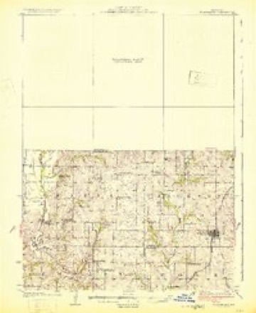
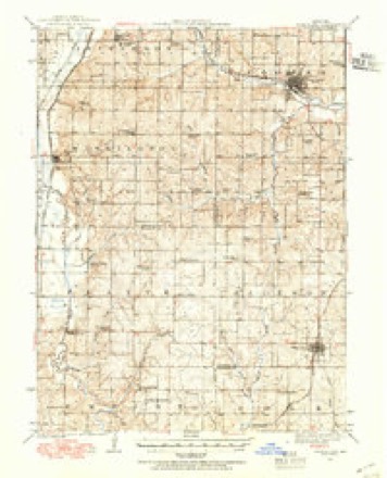
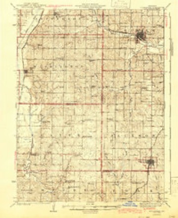
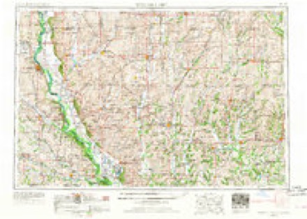
13 topographic sheets cover this place, the earliest surveyed in 1925 and the latest in 1986. It stands in Jefferson Township. It lies in ZIP code area 64433. The Survey maps it on the Guilford quadrangle. 111 people lived here at the 2020 count. It stands 1,119 feet above sea level.
Population over time
2 figuresConception fell from 210 to 111 between 2010 and 2020. These are the recorded population figures Wikidata holds for this place, reached through the Geographic Names Information System number this page is keyed on rather than by name, so they belong to this place and not to another of the same name. Most are census counts, but not all are: an early figure may be a founding or settlement estimate, and an estimate published within five years of a census is left out. The change column is computed, and is left blank where more than 20 years separate a figure from the one before it, because a gap that long is not a change between two counts.
| Year | People | Change |
|---|---|---|
| 2010 | 210 | |
| 2020 | 111 | -99 (-47%) |
Topographic sheets covering this place
8 surveys from 13 printed sheetsMatched by testing this settlement's coordinate against the published boundary of every sheet in the United States Geological Survey's historical collection. Each opens the scanned sheet at the Survey.
- 1925 USGS Stanberry quadrangle1:62500, 3 printings
- 1939 USGS Stanberry quadrangle1:62500
- 1943 USGS Stanberry quadrangle1:62500
- 1955 USGS Nebraska City quadrangle1:250000, 3 printings
- 1957 USGS Nebraska City quadrangle1:250000
- 1958 USGS Nebraska City quadrangle1:250000
- 1985 USGS Guilford quadrangle1:24000
- 1986 USGS Maryville quadrangle1:100000, 2 printings
In the county-history sources
8,539 words on this townshipThe History of Nodaway County, Missouri, Containing a History of the County, Its Cities, Towns, Etc., Biographical Sketches of Its Citizens, published 1882 names this settlement in its chapter on Jefferson Township. These are the passages that mention it, exactly as the scans read.
Silas Best, at an early day, emigrated from Washington Township, and with four sons, took a claim on the east side of the Platte River, in the edge of the timber. He built a house on the northeast corner of section 14, township 63, range 34, and increased his possessions until he owned over a thousand acres of land. He died in the year 1875.
Passage source: The History of Nodaway County, Missouri, Containing a History of the County, Its Cities, Towns, Etc., Biographical Sketches of Its Citizens, published 1882.
Father James Powers came from Reading, Pennsylvania, in the year 1856, and entered the land where the town of Conception is now located, in behalf of a company of which he was a member. The company was composed of Father Powers, Owen Reilly, and Anthony Felix, as above mentioned. They selected 20,000 acres of land in Nodaway and Gentry Counties. Father Powers and William Brady laid out the town of Conception in i860. On June 9, i860, the colony house and chapel were finished and dedicated. There were forty acres laid out and platted as a town site, described as the southwest quarter of section 24, township 63, range 34. The first lot was sold to Mr. Saul for $1.00, who put up a store for general merchandise, the second building in the town. A blacksmith shop was erected by Joseph Heffner, who also built a dwelling. Mr. A. Blyley put up the next house for a dwelling, and moved into it, and he also erected another building for a dwelling. Soon afterward, Frank Enos built a blacksmith shop and a dwelling, and Father Tuerk erected a house for a dwelling. In the year 1870, Ignatius Richlin put up a dwelling and moved into it. In 1871, he put on an addition to Mr. Saul's store building and opened a stock of general merchandise. In 1871, Henry Mclntire erected a dwelling, and Augustus Enos put up a dwelling the same year. A store and a dwelling were soon afterward built by Joseph Wonderly. He moved into the dwelling and commenced keeping store, opening a general stock of merchandise. About this time a dwelling was erected by Gerhard Arens, and another one by John B. Krotch. Dwelling houses were also erected by the Sisters, Mr. Terriso Ikleman, Mrs. Elizabeth Koons, Mrs. Elizabeth Myers, Mrs. Margeret Smith, Mr. Barnard Nathan, and Dr. James Bickett. Joseph Sholze erected a dwelling and drug store combined. Dwellings were also erected by Joseph Wonderly and Anthony Match. Nicholas Burns put up a saloon, and Christian Voelker erected a dwelling and shoe shop.
Passage source: The History of Nodaway County, Missouri, Containing a History of the County, Its Cities, Towns, Etc., Biographical Sketches of Its Citizens, published 1882.
In the year 1880, a Monastery was erected in Conception, but during the present year it has been elevated to the dignity of an Abbey, and called Benedictine Abbey New Englberg. The portion completed is 33x140 feet with ell 40x60 feet, four stories high with stone basement and attic. There are 46 rooms and 5 halls. On the north end of the present building the new church will be built, and will be 80x208, 66 feet in height. It will run east and west and will be one of the most magnificent structures of the kind in the United States. It will be surmounted by three grand towers reaching some 140 feet in the air from the ground. At the southeast corner of the church another wing similar to the one now completed will be built and extended to the southeast corner of the present building, making the total building in size 208 X208 feet square, covering over one acre of ground. It is to be built of cut stone and pressed brick. The material for the buildings is mostly obtained on their farm. The whole structure will be built in pure Roman style with court in the center, and will cost some $250,000. It will require upwards of 3,000,000 brick to complete the building.
Passage source: The History of Nodaway County, Missouri, Containing a History of the County, Its Cities, Towns, Etc., Biographical Sketches of Its Citizens, published 1882.
Machine-read from a century-old scan, so expect the errors a machine makes: misspelled names, dropped words, stray characters.
Read the whole chapter on Jefferson Township - it names this place 14 more 14 times.
Mines and quarries near this place
2 within 5 milesRegional context, not property-specific evidence. The federal mineral resources record lists 2 workings within 5 miles of Conception: 2 past producers. None of them still produces. What was taken out: Sand and Gravel, Construction. Distance is straight-line from the map coordinates, so a quarry counted here may appear on a neighbouring settlement's page as well.
| Where | Site | Commodity | Status | Recorded |
|---|---|---|---|---|
| Conception Junction Sand Pit+Plant | Sand and Gravel, Construction | Past Producer | ||
| Unk | Sand and Gravel, Construction | Past Producer |
Storms near this place
12 since 1995Regional context, not property-specific evidence. The National Weather Service names Conception in 12 storm reports between 1995 and 2025: 8 hail, 2 thunderstorm wind, 1 flash flood, 1 heavy rain. No death or injury is recorded in these reports. Each account below is quoted exactly as the forecast office filed it, from the NOAA Storm Events Database, and each date opens the federal record of that event.
| When | Event | Place named | Harm | What the report says |
|---|---|---|---|---|
| August 2011 | Thunderstorm Wind | Conception | $2,000 | Power lines were reported down on Highway 136. Thunderstorm wind gusts were estimated up to 70 mph. |
| June 2025 | Heavy Rain | Conception | - | Observer in Conception reports 5.92 inches of rain from the evening of June 23 into the morning of June 24. |
| May 2023 | Hail | Conception | - | Tennis ball sized hail was reported in Conception. |
| August 2019 | Flash Flood | Conception | - | Four to five inches of water was running over the road. |
| June 2000 | Thunderstorm Wind | Conception | - | The NWS co-op observer at Conception estimated wind gusts at 65 mph. |
| July 1995 | Hail | Conception | - | Half-dollar-size hail was reported in thunderstorms four miles south-southeast of Conception Junction. |
| March 2017 | Hail | Conception | - | no account filed |
| May 2014 | Hail | Conception | - | no account filed |
| June 2011 | Hail | Conception | - | no account filed |
| June 2011 | Hail | Conception | - | no account filed |
| June 2011 | Hail | Conception | - | no account filed |
| April 2010 | Hail | Conception | - | no account filed |
Nearest settlements
The eight closest, with where each one stands in the county. Distances are straight-line, computed from the Geographic Names Information System coordinates.
Elsewhere
Matched on this settlement's Geographic Names Information System number rather than its name, so it cannot be a different place of the same name in another state.
| Wikipedia article on Conception | An encyclopaedic summary. Its text is share-alike, so it is linked here rather than copied. |
| Wikidata item Q3469209 | The structured record the population and elevation above come from. Public domain (CC0). |
Provenance
This settlement is recorded in the Geographic Names Information System as feature 716165. The sheet list is computed by point-in-boundary test against the United States Geological Survey's historical topographic inventory. Both are works of the United States government and carry no copyright under 17 U.S.C. 105.
Mines and quarries. USGS Mineral Resources Data System (MRDS) https://mrdata.usgs.gov/mrds/ A work of the United States government, no copyright under 17 U.S.C. 105.
Storms. NOAA National Centers for Environmental Information, Storm Events Database https://www.ncei.noaa.gov/stormevents/ A work of the United States government, no copyright under 17 U.S.C. 105. Narratives are quoted verbatim from the National Weather Service report and are not edited or summarised.