 Block
East Prairie, Missouri
11 topographic sheets cover this place, the earliest surveyed in 1939 and the latest in 1985. It stands in St. James Township. It lies in ZIP code area 63845. The Survey maps it on the East Prairie quadrangle. 2,943 people lived here at the 2020 count. It stands 305 feet above sea level.
Population over time
2 figuresEast Prairie fell from 3,176 to 2,943 between 2010 and 2020. These are the recorded population figures Wikidata holds for this place, reached through the Geographic Names Information System number this page is keyed on rather than by name, so they belong to this place and not to another of the same name. Most are census counts, but not all are: an early figure may be a founding or settlement estimate, and an estimate published within five years of a census is left out. The change column is computed, and is left blank where more than 20 years separate a figure from the one before it, because a gap that long is not a change between two counts.
| Year | People | Change |
|---|---|---|
| 2010 | 3,176 | |
| 2020 | 2,943 | -233 (-7%) |
Topographic sheets covering this place
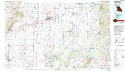
5 surveys from 11 printed sheetsMatched by testing this settlement's coordinate against the published boundary of every sheet in the United States Geological Survey's historical collection. Each opens the scanned sheet at the Survey.
- 1939 USGS Charleston quadrangle1:62500, 2 printings
- 1954 USGS Charleston quadrangle1:62500, 2 printings
- 1956 USGS Dyersburg quadrangle1:250000, 4 printings
- 1969 USGS East Prairie quadrangle1:24000
- 1985 USGS Sikeston quadrangle1:100000, 2 printings
Storms near this place
50 since 1995Regional context, not property-specific evidence. The National Weather Service names East Prairie in 50 storm reports between 1995 and 2024: 29 thunderstorm wind, 10 hail, 3 tornado, 3 heavy rain. The reports record 4 injuries. Each account below is quoted exactly as the forecast office filed it, from the NOAA Storm Events Database, and each date opens the federal record of that event.
| When | Event | Place named | Harm | What the report says |
|---|---|---|---|---|
| January 1996 | Tornado (F1) | East Prairie | 1 hurt, $750,000 | no account filed |
| April 2010 | Thunderstorm Wind | East Prairie | 1 hurt, $250,000 | A macroburst approximately eight miles long and three miles wide struck the East Prairie area with winds up to 120 mph. The origins of the macroburst were in New Madrid County, but the vast majority of the event occurred in Mississippi County. The highest concentration of damage was in East Prairie. On County Road 535 on the outskirts of East Prairie, two mobile homes were demolished. A single-wide mobile home was completely separated from the frame, which was blown 100 yards until it struck a brick house. The sole occupant of the mobile home was a young adult who received only numerous minor abrasions that did not require hospitalization. A second nearby single-wide mobile home was blown a very short distance into trees and destroyed. This mobile home had been vacant for years. Both mobile homes were tied down. A nearby house lost most of the roof, and a large section of the windward-facing exterior wall was blown in. In the city of East Prairie, three industrial buildings were heavily damaged or destroyed. A large industrial block building was partially unroofed, a wood frame metal building was destroyed, and a wooden industrial shop was destroyed. The roof of the police department was damaged. Numerous trees were blown down in and near East Prairie, some damaging homes. Several farm buildings received minor to major damage southwest of town. Outside of town, several irrigation pivots were blown over, a barn was damaged, and a travel trailer was overturned. An empty grain bin was blown away. The peak wind of 120 mph was supported by damage to several structures, including the industrial buildings in East Prairie and the house and mobile homes on the outskirts of town. This was among the strongest downbursts ever documented in southeast Missouri. |
| June 1995 | Thunderstorm Wind | East Prairie | 1 hurt, $200,000 | Severe thunderstorm winds caused moderate damage to three homes. In addition, two grain bins were destroyed, each with a capacity of about 8,000 bushels. Five non-residential buildings were destroyed, including three small storage buildings and two shops. The shops were about 4,000 square feet in size. Several tractors and other farm equipment in the buildings was damaged. |
| April 2008 | Lightning | East Prairie | 1 hurt | A man was struck by lightning while walking home with an umbrella. He received burns and was taken to a St. Louis hospital. He was released within a week. |
| March 2017 | Thunderstorm Wind | East Prairie | $200,000 | Eight grain bins were destroyed along County Road 407 north of East Prairie. Elsewhere in Mississippi County, there were numerous houses with shingle damage. This was part of a larger area of wind damage that surrounded the EF-1 tornado that tracked across western Mississippi County. |
| May 2006 | Hail | East Prairie | $200,000 | Many homes and vehicles sustained damage from baseball size hail. |
| April 2018 | Lightning | East Prairie | $60,000 | A home caught fire due to lightning. The home was a total loss. |
| January 2007 | Flash Flood | East Prairie | $50,000 | Extensive flooding occurred in East Prairie. Over 5 inches of rain was measured at the city's water treatment plant over a four-day period. Several streets were flooded badly. Subdivisions around the outskirts of town were flooded, including some that flood very rarely. Water was over portions of U.S. Highway 60/62 east of Charleston. |
| July 1997 | Thunderstorm Wind | East Prairie | $50,000 | A microburst caused a small but intense damage path just north of East Prairie. Shingles were blown from roofs, a trailer was blown off its foundations, large trees were uprooted, and one camper was demolished. Some utility poles were blown over. In the city of East Prairie, the only damage was due to falling trees and limbs. |
| February 2008 | Thunderstorm Wind | East Prairie | $40,000 | Five utility poles were knocked down on Highway 105 near East Prairie. Several trees were toppled, including one that landed on a housing complex in Charleston. |
| June 1995 | Thunderstorm Wind | East Prairie | $40,000 | Two farm buildings were damaged by severe thunderstorm winds. Many trees were downed in the Charleston and East Prairie areas. |
| May 2011 | Thunderstorm Wind | East Prairie | $25,000 | A large tree was uprooted. The tree landed on a house, causing significant damage. Another structure received minor wind damage. |
| June 2018 | Thunderstorm Wind | East Prairie | $15,000 | Very localized wind damage occurred. A large tree was uprooted and fell on a home, causing minor damage to the home and a vehicle. One side of the house had damaged shingles from high wind. A carport was destroyed. |
| April 2018 | Thunderstorm Wind | East Prairie | $10,000 | Telephone poles were down. Tree limbs were blown down. A house sustained some minor roof damage. |
| September 2006 | Thunderstorm Wind | East Prairie | $10,000 | The roof of a museum was damaged, allowing rainwater to cause additional damage. |
| August 1997 | Thunderstorm Wind | East Prairie | $8,000 | A utility pole snapped in high winds, and four or five others were either knocked down or were leaning toward the road. The microburst was very localized and isolated. |
| July 2016 | Thunderstorm Wind | East Prairie | $7,000 | A large tree fell onto a house, splitting the house in two. |
| July 2022 | Thunderstorm Wind | East Prairie | $6,000 | Scattered four-inch tree limbs were down around town, along with some power outages. |
| May 2020 | Thunderstorm Wind | East Prairie | $5,000 | Several trees were down in and around East Prairie. |
| May 2018 | Thunderstorm Wind | East Prairie | $5,000 | Numerous tree limbs were down, including some that were two to three inches in diameter. |
| January 2013 | Thunderstorm Wind | East Prairie | $5,000 | A large tree was uprooted, causing minor damage to a nearby home. A hole was ripped in the window screen. |
| April 2007 | Thunderstorm Wind | East Prairie | $5,000 | Two trees and numerous tree limbs were blown down. |
| October 2007 | Thunderstorm Wind | East Prairie | $5,000 | There were two separate instances of power lines blown down. A few large trees were down. |
| January 2000 | Thunderstorm Wind | East Prairie | $5,000 | Tree limbs and power lines were down. |
| December 2015 | Thunderstorm Wind | East Prairie | $3,000 | A power line was down, blocking a road. |
| July 1997 | Thunderstorm Wind | East Prairie | $3,000 | A few trees were blown down. |
| September 1996 | Thunderstorm Wind | East Prairie | $2,000 | no account filed |
| June 2019 | Thunderstorm Wind | East Prairie | $1,000 | Large tree limbs were down in East Prairie. |
| June 2005 | Thunderstorm Wind | East Prairie | $1,000 | Some tin and metal roofing was blown from sheds. Large tree limbs were blown down on county roads. |
| May 2024 | Hail | East Prairie | - | Hail estimated to quarter size fell in East Prairie as a supercell moved eastward through Mississippi County. |
| May 2023 | Thunderstorm Wind | East Prairie | - | A trained spotter estimated a wind gust to 70 mph. |
| June 2018 | Funnel Cloud | East Prairie | - | A trained spotter reported a funnel cloud. |
| October 2013 | Heavy Rain | East Prairie | - | Minor low-lying street flooding was reported. |
| April 2010 | Heavy Rain | East Prairie | - | A trained spotter measured 1.8 inches of rain within two hours. |
| October 2009 | Heavy Rain | East Prairie | - | Minor street flooding was reported. |
| April 2006 | Tornado (F0) | East Prairie | - | A landspout between Anniston and East Prairie was witnessed by law enforcement officers. A photograph taken by a resident near East Prairie showed a rope-like funnel extending below a tree line in the distance. The area was open farmland, and no damage was reported. |
| May 2006 | Thunderstorm Wind | East Prairie | - | Numerous large tree limbs were blown down all across town. |
| August 2006 | Thunderstorm Wind | East Prairie | - | A trained spotter estimated wind gusts near 70 MPH downed a number of trees and limbs. |
| November 2005 | Tornado (F0) | East Prairie | - | A brief, short-lived tornado was reported over open farm country. No damage occurred. |
| October 2004 | Thunderstorm Wind | East Prairie | - | A trained spotter estimated wind gusts to 60 MPH on Highway 105 between East Prairie and Charleston. Large tree limbs were down on Highway 105 near East Prairie. |
| December 2021 | Hail | East Prairie | - | no account filed |
| May 2020 | Funnel Cloud | East Prairie | - | no account filed |
| March 2017 | Hail | East Prairie | - | no account filed |
| February 2017 | Hail | East Prairie | - | no account filed |
| April 2015 | Hail | East Prairie | - | no account filed |
| April 2011 | Hail | East Prairie | - | no account filed |
| April 2007 | Hail | East Prairie | - | no account filed |
| April 2006 | Hail | East Prairie | - | no account filed |
| May 1999 | Hail | East Prairie | - | no account filed |
| April 1996 | Thunderstorm Wind | East Prairie | - | no account filed |
Nearest settlements
The eight closest, with where each one stands in the county. Distances are straight-line, computed from the Geographic Names Information System coordinates.
Elsewhere
Matched on this settlement's Geographic Names Information System number rather than its name, so it cannot be a different place of the same name in another state.
| Wikipedia article on East Prairie | An encyclopaedic summary. Its text is share-alike, so it is linked here rather than copied. |
| Wikidata item Q607653 | The structured record the population and elevation above come from. Public domain (CC0). |
Provenance
This settlement is recorded in the Geographic Names Information System as feature 717337. The sheet list is computed by point-in-boundary test against the United States Geological Survey's historical topographic inventory. Both are works of the United States government and carry no copyright under 17 U.S.C. 105.
Storms. NOAA National Centers for Environmental Information, Storm Events Database https://www.ncei.noaa.gov/stormevents/ A work of the United States government, no copyright under 17 U.S.C. 105. Narratives are quoted verbatim from the National Weather Service report and are not edited or summarised.