 Block
From the record
5 National Register listings published here.
Sources: the National Register database, National Park Service
60 topographic sheets cover 35 settlements here, and 5 properties are on the National Register of Historic Places.
5 National Register listings published here.
Sources: the National Register database, National Park Service
Every property in this county listed on the National Register of Historic Places, with the year it was listed and the federal nomination document.
| Photograph | Property | Type | Listed | Reference |
|---|---|---|---|---|
 | McCutchen Theatre | building | 2019 | 100004271 |
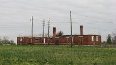 | Missouri Pacific Depot | building | 1972 | 72000722 |
 | Moore House | building | 1980 | 80002380 |
| Russell Hotel | building | 2022 | 100007832 | |
 | Jacob Swank House | building | 1973 | 73001048 |
Every wildfire the federal occurrence database records inside this county: 8 of them, burning about 4 acres. None started naturally and none was recorded as arson. Each settlement page carries the fires within five miles of it.
| Reported cause | Fires |
|---|---|
| Missing data/not specified/undetermined | 4 |
| Debris and open burning | 4 |
The five largest, by the area the report gives. None of them was recorded as arson.
| Date | Cause | Size | Reported by | Name on the report |
|---|---|---|---|---|
| 26 June 2019 | Missing data/not specified/undetermined | 1.2 acres | Missouri Department of Conservation | 179343-06732-06262019-1415 |
| 26 November 2017 | Missing data/not specified/undetermined | 1.0 acres | Missouri Department of Conservation | not named |
| 9 January 2019 | Missing data/not specified/undetermined | under an acre | Missouri Department of Conservation | 178198-80001-01092019-0940 |
| 4 July 2019 | Missing data/not specified/undetermined | under an acre | Missouri Department of Conservation | 179342-06732-07042019-1525 |
| 4 September 2019 | Debris and open burning | under an acre | Missouri Department of Conservation | 179341-06732-09042019-1535 |
| 27 September 2019 | Debris and open burning | under an acre | Missouri Department of Conservation | 179340-06732-09272019-2220 |
| 2 January 2019 | Debris and open burning | under an acre | Missouri Department of Conservation | 178197-80001-01022019-1650 |
| 22 March 2019 | Debris and open burning | under an acre | Missouri Department of Conservation | 179344-06732-03222019-1830 |
Every settlement page carries the fires within five miles of it - see the settlement index below.
The NOAA Storm Events Database holds 235 reports for this county, causing 1 death, 41 injuries and about $181,529,780 in recorded property damage. Each settlement page carries the reports that name it.
| Kind of event | Reports |
|---|---|
| Thunderstorm Wind | 100 |
| Hail | 51 |
| Tornado | 28 |
| Flood | 25 |
| Flash Flood | 10 |
| Heavy Rain | 10 |
| Funnel Cloud | 7 |
| Lightning | 3 |
| Dust Devil | 1 |
The most serious of them, by death, then injury, then recorded damage. The accounts are quoted exactly as the forecast office filed them.
| When | Event | Place named | Harm | What the report says |
|---|---|---|---|---|
| April 1981 | Tornado (F4) | not stated | 1 killed, 6 hurt, $25,000,000 | no account filed |
| March 1955 | Tornado (F3) | not stated | 17 hurt, $250,000 | no account filed |
| July 1971 | Tornado (F2) | not stated | 6 hurt, $25,000 | no account filed |
| April 1970 | Tornado (F2) | not stated | 4 hurt, $25,000 | no account filed |
| January 1999 | Thunderstorm Wind | Charleston | 3 hurt, $100,000 | Thunderstorm winds overturned a mobile home and blew down a barn. The roof was removed from the Farm Bureau building in Charleston. At the Charleston Inn, windows were blown out and the roof was damaged. A large sign was snapped off, and a steel light post was snapped. Lots of trees were down in Charleston. The three occupants of the overturned mobile home were transported to a hospital. |
| January 1996 | Tornado (F1) | East Prairie | 1 hurt, $750,000 | no account filed |
| April 2010 | Thunderstorm Wind | East Prairie | 1 hurt, $250,000 | A macroburst approximately eight miles long and three miles wide struck the East Prairie area with winds up to 120 mph. The origins of the macroburst were in New Madrid County, but the vast majority of the event occurred in Mississippi County. The highest concentration of damage was in East Prairie. On County Road 535 on the outskirts of East Prairie, two mobile homes were demolished. A single-wide mobile home was completely separated from the frame, which was blown 100 yards until it struck a brick house. The sole occupant of the mobile home was a young adult who received only numerous minor abrasions that did not require hospitalization. A second nearby single-wide mobile home was blown a very short distance into trees and destroyed. This mobile home had been vacant for years. Both mobile homes were tied down. A nearby house lost most of the roof, and a large section of the windward-facing exterior wall was blown in. In the city of East Prairie, three industrial buildings were heavily damaged or destroyed. A large industrial block building was partially unroofed, a wood frame metal building was destroyed, and a wooden industrial shop was destroyed. The roof of the police department was damaged. Numerous trees were blown down in and near East Prairie, some damaging homes. Several farm buildings received minor to major damage southwest of town. Outside of town, several irrigation pivots were blown over, a barn was damaged, and a travel trailer was overturned. An empty grain bin was blown away. The peak wind of 120 mph was supported by damage to several structures, including the industrial buildings in East Prairie and the house and mobile homes on the outskirts of town. This was among the strongest downbursts ever documented in southeast Missouri. |
| June 1995 | Thunderstorm Wind | East Prairie | 1 hurt, $200,000 | Severe thunderstorm winds caused moderate damage to three homes. In addition, two grain bins were destroyed, each with a capacity of about 8,000 bushels. Five non-residential buildings were destroyed, including three small storage buildings and two shops. The shops were about 4,000 square feet in size. Several tractors and other farm equipment in the buildings was damaged. |
| March 1997 | Flash Flood | Charleston | 1 hurt, $40,000 | no account filed |
| April 2008 | Lightning | East Prairie | 1 hurt | A man was struck by lightning while walking home with an umbrella. He received burns and was taken to a St. Louis hospital. He was released within a week. |
| May 2011 | Flash Flood | Birds Pt | $150,000,000 | The U.S. Army Corps of Engineers activated the New Madrid Floodway by detonating a levee at Birds Point. The intentional levee breach relieved pressure on levees along the lower Ohio River and portions of the Mississippi River. The blast that opened the 11,000-foot gap in the levee shattered windows in Mississippi County and rattled windows as far away as Paducah, Kentucky. The flash flood caused by the levee breach was anticipated for days, and evacuations had been completed beforehand. Over 130,000 acres of prime farmland were submerged. About 100 homes were flooded, forcing the evacuation of 300 residents. The tiny community of Pinhook was inundated, and no decision had been made by residents on whether to rebuild the community. A primary national insurer estimated private property losses were around 100 million dollars within the floodway. Mississippi County officials estimated the cost to repair public infrastructure such as roads, bridges, and ditches was nearly 75 million dollars. The westward extent of the flash flood was limited by a second set of levees (called setback levees) designed to channel the water back toward the Mississippi River. The floodway remained submerged for the remainder of the month. |
| March 2008 | Flood | Bertrand | $900,000 | Many streets were flooded in East Prairie. Almost one million dollars in damage occurred to public infrastructure such as roads. A rainfall total of 4.32 inches was measured at the airport near East Prairie. |
| March 2006 | Thunderstorm Wind | Countywide | $250,000 | Extensive damage occurred throughout the city of East Prairie, where a wind gust to 70 MPH was estimated by a spotter. The city hall was partially unroofed, and a communications tower was blown down onto the building. Bricks were blown off the wall of a nearby shop building. Parts of the roof were blown off an auto parts business. Another building lost a large front window. Minor roof damage occurred to numerous structures. Two baseball dugouts were demolished. Numerous tree limbs, power poles, and power lines were blown down. A trailer home was destroyed by a fallen tree off Highway 80 east of East Prairie. Close to Anniston, power poles were blown over on Highway 105 near the intersection of Highway 75. At a trailer park on Highway 105, one trailer was torn open, metal siding was peeled off another, and a third was shifted off its foundation. At a nearby farm store, a large tank was blown through a fence and across Highway 105. A trampoline was wrapped around a tree just west of Anniston. The entire town of Anniston was without power for about 24 hours. The utility company serving the county reported at least 100 poles were broken off, including two 55-foot transmission poles carrying a main feeder line. In Charleston, Wyatt, and Bertrand, damage was relatively minor. Shingles were blown off roofs, and tree limbs were down. In the Wolf Island area, signs were downed, and irrigation systems were blown over. In Dogwood, the gazebo was damaged. Sheds and barns were damaged or destroyed around the county. Schools were closed the following day due to power outages. Mississippi County was designated a federal disaster area, enabling individual residents to apply for relief. |
| May 1991 | Tornado (F1) | not stated | $250,000 | no account filed |
| November 1973 | Tornado (F2) | not stated | $250,000 | no account filed |
| November 1973 | Tornado (F2) | not stated | $250,000 | no account filed |
| March 1971 | Tornado (F1) | not stated | $250,000 | no account filed |
| March 2017 | Tornado (EF1) | Dogwood | $200,000 | The tornado moved east from New Madrid County, passing across sparsely populated farmland before lifting about three miles north-northeast of Anniston. Significant roof damage occurred to a house, and its attached garage was destroyed. A barn was heavily damaged, and numerous irrigation systems were blown over. Dozens of trees were damaged or uprooted. Numerous power poles were snapped. Peak winds in the Mississippi County portion of the damage path were estimated near 100 mph. |
| March 2017 | Thunderstorm Wind | East Prairie | $200,000 | Eight grain bins were destroyed along County Road 407 north of East Prairie. Elsewhere in Mississippi County, there were numerous houses with shingle damage. This was part of a larger area of wind damage that surrounded the EF-1 tornado that tracked across western Mississippi County. |
| May 2006 | Hail | East Prairie | $200,000 | Many homes and vehicles sustained damage from baseball size hail. |
| April 1997 | Thunderstorm Wind | Anniston | $200,000 | no account filed |
| January 2016 | Flood | Birds Pt | $100,000 | Mississippi River levels continued their climb from December, and major flooding occurred early in the month. The river gage upriver at Cape Girardeau crested at a new record of 48.86 feet on the 1st. However, the river gage downriver at New Madrid only experienced moderate flooding. Mississippi County is very rural, and most of the developed land is protected by a levee system. Although extensive cropland flooding occurred, very little of it was planted in the middle of winter. County roads outside of the levee system were flooded. |
| July 2009 | Thunderstorm Wind | Charleston | $100,000 | In Charleston, numerous tree limbs were down, especially north of Highway 62. The historical society building suffered roof damage and a broken chimney. A few houses had minor roof damage. Trees were blown down. Power outages occurred. A bowling alley just south of Charleston on Highway 105 suffered window damage. A nearby church steeple was toppled. In Samos, a large pole barn was partially destroyed along Highway J. |
| January 2008 | Thunderstorm Wind | Alfalfa Center | $100,000 | A couple of metal buildings were blown across fields. Approximately 20 telephone poles were snapped off. |
| January 1999 | Thunderstorm Wind | Dogwood | $100,000 | A large metal machine shop was destroyed in the community of Dogwood. Debris from the shop was scattered across a field east of Highway B. The roof of a nearby house received some damage. At the Dogwood Cemetery, a section of heavy chain-link fence was blown down, and 83 tombstones were blown over. Five to six utility poles were down along Highway 105 east of Dogwood. Much of the town of East Prairie was without power until early afternoon on the 22nd. A building was damaged and irrigation equipment was flipped over just north of Charleston. |
| October 2013 | Tornado (EF1) | Wyatt | $90,000 | Peak winds in this tornado were estimated near 100 mph. The damage began on the south side of Wyatt. Homes in this area received roof damage, and a concrete block building was heavily damaged. The roof of a large pole barn was destroyed. Numerous trees and tree limbs were broken off. The tornado exited Wyatt around Highway EE and continued travelling northeast and uprooted a large tree on Highway HH. A small cemetery off of County Road 307 had several large tree branches snapped, and adjacent bean fields showed signs of wind damage. Further northeast near Brewer Lake, several trees were snapped or large branches were broken off. A few tree tops were broken off on the levee near the Mississippi River. The tornado crossed the Mississippi River into Ballard County, Kentucky just south of Wickliffe. |
| May 2021 | Tornado (EF1) | Dorena | $85,000 | The tornado began in open farmland, where it uprooted and snapped several large trees along Highway 77, then proceeded east-northeast toward the Mississippi River, damaging a pivot sprinkler system and totally destroying an equipment shed near the levee. Many trees on the east side of the levee had trunks and limbs snapped, and some trees were uprooted. To the south of the tornado path, sporadic straight-line wind damage occurred to trees along Highway A (a levee road) and along County Road 507 (a levee road). Peak winds were estimated near 105 mph. |
| January 2013 | Thunderstorm Wind | Charleston | $80,000 | At exit 10 along Interstate 57, an irrigation rig was turned over. A barn was destroyed and strewn across Highway 60 between Charleston and Wyatt. |
| April 2011 | Thunderstorm Wind | Charleston | $80,000 | On the west side of Charleston, two power poles were blown down. There was minor roof damage. A couple of trees were down. On Highway UU south of Charleston, a grain bin was heavily damaged. |
| April 2008 | Flood | Bertrand | $80,000 | County Road 401 collapsed due to heavy rainfall. Between 40 and 50 county roads were impassable. In the city of East Prairie, at least five roads were impassable. Two schools dismissed early due to sewer overflows. Several state highways were closed due to flooding, including the entire length of Routes YY and B. U.S. Highway 60 near Bertrand was reduced to one lane. |
| January 2005 | Thunderstorm Wind | Bertrand | $75,000 | A thunderstorm downburst, with estimated peak winds near 75 MPH, struck this farming community located just off Interstate 57. A couple of irrigation systems were overturned. A co-op building received minor damage, including a corner of the metal roof peeled back. Shingles were blown off a home. A few mobile homes were damaged, including two with significant roof damage and one shifted off its foundation. The roof was peeled off a large storage shed. A half dozen trees were uprooted, and several large tree branches were down. The width of the damage area was about one-quarter mile. This downburst was the second one produced by this thunderstorm complex in southeast Missouri. The first downburst occurred just east of Poplar Bluff. |
| April 2002 | Tornado (F1) | Charleston | $68,000 | The tornado path extended from Interstate 57 on the east side of Charleston to about 1.8 miles southeast of Charleston. Peak wind speeds in the tornado were estimated at 100 MPH. An anchored mobile home was lifted and rolled, destroying it. The residents of the mobile home escaped injury by abandoning it moments before the tornado struck. Stationary automobiles were moved about. Several mature hardwood trees were snapped off or uprooted. Minor damage occurred to outbuildings and metal pole-framed structures on the southeast edge of Charleston. |
| April 2018 | Lightning | East Prairie | $60,000 | A home caught fire due to lightning. The home was a total loss. |
| January 2012 | Thunderstorm Wind | Charleston | $50,000 | Damage was reported at the agricultural warehouse of a growers' association. The farm store and seed warehouse were totally destroyed. Both structures were large wood and metal storage sheds that were not of sturdy construction. The oil warehouse was damaged, but there were no leaks or ruptures. |
| January 2007 | Flash Flood | East Prairie | $50,000 | Extensive flooding occurred in East Prairie. Over 5 inches of rain was measured at the city's water treatment plant over a four-day period. Several streets were flooded badly. Subdivisions around the outskirts of town were flooded, including some that flood very rarely. Water was over portions of U.S. Highway 60/62 east of Charleston. |
| July 1997 | Thunderstorm Wind | East Prairie | $50,000 | A microburst caused a small but intense damage path just north of East Prairie. Shingles were blown from roofs, a trailer was blown off its foundations, large trees were uprooted, and one camper was demolished. Some utility poles were blown over. In the city of East Prairie, the only damage was due to falling trees and limbs. |
| May 2011 | Thunderstorm Wind | Charleston | $40,000 | The roof of a commercial building was heavily damaged. Wind-blown debris damaged numerous vehicles. Windows were broken in a couple of buildings. |
| May 2011 | Flood | Wolf Is | $40,000 | Historic flooding continued along the Mississippi River from April. Levees protected large parts of the county until the evening of May 2, when the U.S. Army Corps of Engineers detonated the levee at Birds Point. The levee was opened as part of the activation of the New Madrid Floodway. The floodway was opened to relieve pressure on levees along the lower Ohio River and parts of the Mississippi River. Much of the floodway land is located in Mississippi County. Flooding caused by the intentional levee breaks is detailed in a flash flood entry located elsewhere in this report. The communities of East Prairie and Anniston were threatened by extensive backwater flooding. Widespread street flooding occurred in both communities. Large pumps kept water levels manageable in both cities. |
| April 2009 | Thunderstorm Wind | Charleston | $40,000 | A car wash was destroyed. A gas station canopy was blown down. |
| February 2008 | Thunderstorm Wind | East Prairie | $40,000 | Five utility poles were knocked down on Highway 105 near East Prairie. Several trees were toppled, including one that landed on a housing complex in Charleston. |
| June 1995 | Thunderstorm Wind | East Prairie | $40,000 | Two farm buildings were damaged by severe thunderstorm winds. Many trees were downed in the Charleston and East Prairie areas. |
| June 2024 | Thunderstorm Wind | Bertrand | $35,000 | Thunderstorm outflow winds blew down a line of 8 power poles across Hwy 62. No tree damage occurred in the area. |
| July 2023 | Thunderstorm Wind | Wolf Is | $30,000 | Trees and power lines were down across the area. Trees were down on houses. |
| September 2006 | Flash Flood | Countywide | $30,000 | Streets were flooded in East Prairie and Charleston. Some county roads were closed because of high water or washouts. State Highway HH was closed. Highway 80 was under water but not closed near the junction of Highway 75. The main economic effect was crop-related in this heavily agricultural county. Harvesting of the soybean crop was only just beginning. An extensive amount of acreage was under water for days. Up to one fifth of the soybean crop was estimated to be under water. The flooding was the result of copious rainfall, unofficially as high as 14 inches in the southern end of the county over a three-day span. At the county's main airport, 9.29 inches was measured. |
| January 1999 | Lightning | Bertrand | $30,000 | Lightning struck a residence, setting it on fire. The house was destroyed. |
| May 2011 | Flood | Alfalfa Center | $30,000 | no account filed |
| May 2011 | Thunderstorm Wind | East Prairie | $25,000 | A large tree was uprooted. The tree landed on a house, causing significant damage. Another structure received minor wind damage. |
| October 2001 | Thunderstorm Wind | Countywide | $25,000 | The most significant damage was in and near Charleston, where four homes sustained roof damage. North of Charleston, a barn was blown away, and several other farm buildings were damaged. Elsewhere in the county, a couple of trees were down on Highways N and O. |
| May 1974 | Tornado (F1) | not stated | $25,000 | no account filed |
| July 1971 | Tornado (F2) | not stated | $25,000 | no account filed |
| February 1962 | Tornado (F2) | not stated | $25,000 | no account filed |
| May 1957 | Tornado (F2) | not stated | $25,000 | no account filed |
| May 1999 | Thunderstorm Wind | Charleston | $20,000 | At Birds Point, an empty trailer was damaged. Scattered trees and limbs were blown down at East Prairie and Charleston. |
| May 1995 | Thunderstorm Wind | New Madrid | $20,000 | no account filed |
| July 2025 | Thunderstorm Wind | Dorena | $15,000 | A pivot irrigation system was tipped over by a thunderstorm outflow. Time estimated by radar. |
| March 2019 | Thunderstorm Wind | Wolf Is | $15,000 | A barn was destroyed near the intersection of FF Highway and AA Highway, about a mile north of Pinhook. |
| June 2018 | Thunderstorm Wind | East Prairie | $15,000 | Very localized wind damage occurred. A large tree was uprooted and fell on a home, causing minor damage to the home and a vehicle. One side of the house had damaged shingles from high wind. A carport was destroyed. |
| June 2019 | Flood | Birds Pt | $10,000 | The Mississippi River experienced major flooding above the confluence with the Ohio River. The river gage upriver at Cape Girardeau crested at 46.36 feet, which was the fifth highest crest on record. However, the river gage downriver at New Madrid only experienced minor flooding. Mississippi County is mostly agricultural, and most of the impacts were on cropland. County roads outside of the levee system were flooded. State Route VV was flooded and closed. |
| April 2018 | Thunderstorm Wind | East Prairie | $10,000 | Telephone poles were down. Tree limbs were blown down. A house sustained some minor roof damage. |
| September 2006 | Thunderstorm Wind | East Prairie | $10,000 | The roof of a museum was damaged, allowing rainwater to cause additional damage. |
The Survey's mineral resources record lists 2 workings inside this county. None of them still produces: all are closed or unrecorded. Each settlement page carries the workings within five miles of it.
| Commodity | Workings |
|---|---|
| Sand and Gravel, Construction | 2 |
The least common of them first, because a county's hundredth gravel pit says nothing its first ten did not.
Named settlements recorded in the Geographic Names Information System, each with the topographic sheets covering it. Villages, hamlets and abandoned places alike. Each is shown with the nearest named watercourse or landform and the survey quadrangle it falls on.
Mississippi township · 63834 · On Number 3 Chute · Arlington quadrangle
16 sheets, 1939 to 1985
Tywappity township · 63834 · Charleston quadrangle
13 sheets, 1939 to 1993
No longer a settlement
Long Prairie township · 63823 · Bertrand quadrangle
11 sheets, 1939 to 1985
No longer a settlement
Tywappity township · 63834 · Charleston quadrangle
13 sheets, 1939 to 1993
No longer a settlement
The vanished settlements of Mississippi County: the places named above that are no longer on the map.