 Block
Fair Grove, Missouri
20 topographic sheets cover this place, the earliest surveyed in 1884 and the latest in 1982. It stands in Jackson No. 1 Township. It lies in ZIP code area 65648. It stands on Fair Grove Mound. The Survey maps it on the Fair Grove quadrangle. 1,582 people lived here at the 2020 count. It stands 1,211 feet above sea level.
On record in Fair Grove
Buildings and businesses the archive holds for this place. Each opens its own page, with the source record it came from.
On the National Register 1 record
 Boegel and Hine Flour Mill-Wommack Milllisted 1986
Population over time
2 figuresFair Grove grew from 1,393 to 1,582 between 2010 and 2020. These are the recorded population figures Wikidata holds for this place, reached through the Geographic Names Information System number this page is keyed on rather than by name, so they belong to this place and not to another of the same name. Most are census counts, but not all are: an early figure may be a founding or settlement estimate, and an estimate published within five years of a census is left out. The change column is computed, and is left blank where more than 20 years separate a figure from the one before it, because a gap that long is not a change between two counts.
| Year | People | Change |
|---|---|---|
| 2010 | 1,393 | |
| 2020 | 1,582 | +189 (+14%) |
Topographic sheets covering this place
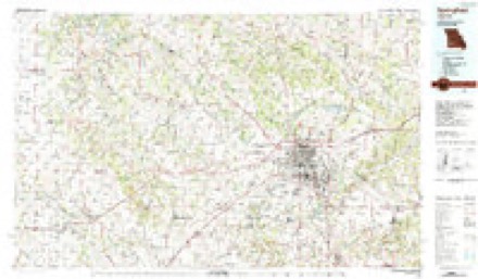
9 surveys from 20 printed sheetsMatched by testing this settlement's coordinate against the published boundary of every sheet in the United States Geological Survey's historical collection. Each opens the scanned sheet at the Survey.
- 1884 USGS Springfield quadrangle1:125000
- 1886 USGS Springfield quadrangle1:125000, 5 printings
- 1947 USGS Strafford quadrangle1:62500
- 1948 USGS Strafford quadrangle1:62500, 2 printings
- 1954 USGS Springfield quadrangle1:250000, 6 printings
- 1958 USGS Springfield quadrangle1:250000
- 1959 USGS Springfield quadrangle1:250000
- 1970 USGS Fair Grove quadrangle1:24000, 2 printings
- 1982 USGS Springfield quadrangle1:100000
Fires near this place
75 since 1995Regional context, not property-specific evidence. The federal wildfire occurrence database lists 75 fires within 5 miles of Fair Grove between 1995 and 2020, burning about 413 acres in total. 1 started naturally. None was recorded as arson. Distance is straight-line from the map coordinates, so a fire counted here may appear on a neighbouring settlement's page as well.
| Reported cause | Fires |
|---|---|
| Missing data/not specified/undetermined | 32 |
| Debris and open burning | 26 |
| Equipment and vehicle use | 15 |
| Smoking | 1 |
| Natural | 1 |
The most recent of them, most recent first, with the day each was reported and the service that recorded it.
| Date | Cause | Size | Reported by | Name on the report |
|---|---|---|---|---|
| 9 September 2013 | Missing data/not specified/undetermined | 1.0 acres | Missouri Department of Conservation | not named |
| 9 September 2013 | Missing data/not specified/undetermined | 1.0 acres | Missouri Department of Conservation | not named |
| 20 September 2020 | Debris and open burning | 1.1 acres | Missouri Department of Conservation | 230709-03906-09202020-1200 |
| 8 August 2014 | Debris and open burning | 1.0 acres | Missouri Department of Conservation | not named |
| 5 August 2014 | Debris and open burning | 3.0 acres | Missouri Department of Conservation | not named |
| 28 August 1995 | Debris and open burning | 1.0 acres | Missouri Department of Conservation | not named |
| 22 August 2014 | Smoking | 1.0 acres | Missouri Department of Conservation | not named |
| 5 July 2013 | Debris and open burning | 1.0 acres | Missouri Department of Conservation | not named |
Settlements close enough to share some of these fires:
Mines and quarries near this place
3 within 5 milesRegional context, not property-specific evidence. The federal mineral resources record lists 3 workings within 5 miles of Fair Grove: 3 past producers. None of them still produces. What was taken out: Lead, Zinc, Sand and Gravel, Construction. Distance is straight-line from the map coordinates, so a quarry counted here may appear on a neighbouring settlement's page as well.
| Where | Site | Commodity | Status | Recorded |
|---|---|---|---|---|
| Unknown | Sand and Gravel, Construction | Past Producer | ||
| Bullwinkle Mine | Lead, Zinc | Past Producer | ||
| Unknown | Lead, Zinc | Past Producer |
Storms near this place
60 of 96 shownRegional context, not property-specific evidence. The National Weather Service names Fair Grove in 96 storm reports between 1993 and 2025: 34 thunderstorm wind, 32 hail, 17 flash flood, 6 flood. The reports record 3 injuries. Each account below is quoted exactly as the forecast office filed it, from the NOAA Storm Events Database, and each date opens the federal record of that event.
| When | Event | Place named | Harm | What the report says |
|---|---|---|---|---|
| May 2013 | Lightning | Fair Grove | 2 hurt | Two people were struck by lightning and knocked unconscious at an outdoor rodeo. Both individuals were taken to an area hospital and later released. |
| November 1996 | Flash Flood | Fair Grove | 1 hurt | no account filed |
| May 2023 | Tornado (EF0) | Fair Grove | $100,000 | A National Weather Service storm survey determined that an intermittent EF-0 tornado touched down near Fair Grove, Missouri and tracked to the northwest about a mile and a half. Maximum wind speeds were 77 mph with a maximum path width of 75 yards. At the start point of the tornado, a home sustained minor damage to siding., otherwise sporadic and sparse tree damage was noted along the tornadoes path. Just before lifting, several outbuildings suffered significant damage. |
| April 2013 | Lightning | Fair Grove | $50,000 | An apparent lightning strike started a fire which destroyed a storage building. A car and boat along with tools were in the building and was a total loss. The strike happened near the intersection of Farm Road 203 and Langtry Lane. Time was estimated. |
| April 1993 | Thunderstorm Wind | Fair Grove | $50,000 | Numerous large trees were blown down. At Fair Grove, several small sheds and outbuildings were destroyed. |
| December 2018 | Thunderstorm Wind | Fair Grove | $25,000 | The Fair Grove Police Department utility pole, with attached city infrastructure equipment, snapped in half at 70 East Willow Street. |
| March 2009 | Thunderstorm Wind | Fair Grove | $20,000 | The Upper Elementary school roof was pealed off. A National Weather Service storm revealed that this damage was the result of straight line winds. |
| April 2024 | Thunderstorm Wind | Fair Grove | $15,000 | A large trees were reported down on a vehicle damaging the vehicle. |
| June 2010 | Thunderstorm Wind | Fair Grove | $6,000 | Thunderstorm winds downed numerous tree branches in Fair Grove. The largest tree limbs were eight inches in diameter. A free standing business marquee in a parking lot and a fireworks tent were blown down. A telephone wiring junction box was also blown down. |
| February 2018 | Flood | Fair Grove | $5,000 | There was a water rescue on Highway CC near Farm Road 199. |
| July 2015 | Thunderstorm Wind | Fair Grove | $5,000 | A tree was blown down on to a house in Fair Grove. |
| June 2011 | Thunderstorm Wind | Fair Grove | $5,000 | Minor roof damage occurred to the Kum and Go gas station in town. |
| July 2015 | Thunderstorm Wind | Fair Grove | $1,000 | A road sigh was blown down along with several trees. |
| October 2014 | Thunderstorm Wind | Fair Grove | $1,000 | A radio antenna was damaged by estimated 60 mph wind gusts. |
| April 2025 | Flash Flood | Fair Grove | - | Route CC at the Little Pomme De Terre River was flooded and impassable. |
| April 2025 | Thunderstorm Wind | Fair Grove | - | Several large limbs of greater than 3 inch diameter were reported down. |
| April 2025 | Flash Flood | Fair Grove | - | Farm Road 199 about 0.5 miles south of Route CC at the Little Pomme De Terre River was flooded and impassable. |
| May 2025 | Flash Flood | Fair Grove | - | Route CC at the Little Pomme De Terre River was closed due to flooding. |
| May 2024 | Thunderstorm Wind | Fair Grove | - | Social media report of a tree that was uprooted and fell on a truck. |
| April 2024 | Thunderstorm Wind | Fair Grove | - | A large tree was uprooted. |
| April 2024 | Thunderstorm Wind | Fair Grove | - | Multiple large tree limbs were reported down with a few trees split. |
| April 2024 | Thunderstorm Wind | Fair Grove | - | A large tree was reported uprooted. |
| July 2023 | Hail | Fair Grove | - | Hail up to quarters in size was reported. |
| January 2021 | Flash Flood | Fair Grove | - | Heavy rainfall caused Highway CC to be closed due to flooding. |
| March 2021 | Flood | Fair Grove | - | The low water crossing on Highway CC at the Little Pomme De Terre River was closed due to flooding. |
| May 2020 | Flood | Fair Grove | - | Highway CC was closed due to flooding at the Little Pomme De Terre River low water crossing. |
| January 2020 | Flash Flood | Fair Grove | - | Highway CC was closed near Farm Road 193 due to flooding. |
| March 2019 | Flash Flood | Fair Grove | - | Highway CC was closed between Farm Roads 193 and 199 with flowing water several feet deep over the roadway. |
| March 2019 | Flood | Fair Grove | - | Flooding of the low water crossing at Farm Road 231 and Cabin Creek closed the road. |
| July 2019 | Heavy Rain | Fair Grove | - | A 24 hour rainfall of 3.50 inches was measured. |
| May 2019 | Flash Flood | Fair Grove | - | The Fair Grove Emergency Manager reported water flowing over Highway AA and Farm Road 2 where Cabin Creek was flowing out of its banks. |
| May 2019 | Flash Flood | Fair Grove | - | Water was over roadways and barriers placed at Farm Road 199 to Sunset Street and Farm Roads 199 to 193 in Fair Grove where the Little Pomme de Terre River and multiple smaller creeks and tributaries were flowing out of their banks. |
| May 2019 | Thunderstorm Wind | Fair Grove | - | Law enforcement reported wind gusts between 65 and 70 MPH. |
| May 2019 | Flash Flood | Fair Grove | - | Debris was reported on roadway with high water up to 10 inches over the roadway at Main and Saddleclub Roads in Fair Grove. |
| May 2019 | Thunderstorm Wind | Fair Grove | - | Several pictures of 3 inch diameter tree branches broken on orchard road were received from the public in Fair Grove. |
| September 2018 | Heavy Rain | Fair Grove | - | A private weather station located off of State Highway 125 southeast of Fair Grove reported a 24 hour accumulation of 5.35 inches. |
| September 2018 | Heavy Rain | Fair Grove | - | The Mesonet station F2176,reported a 24 rain total of 3.63 inches. |
| September 2018 | Flash Flood | Fair Grove | - | Flooding was reported at Main Street and Saddle Club Road making the road impassable to traffic. Several feet of water was covering other streets in town at the time as well. |
| September 2018 | Flash Flood | Fair Grove | - | A water rescue occurred near the Greene and Polk County line where flood waters impacted County Road AF near North Farm Road 193. No injuries were reported. |
| September 2018 | Flash Flood | Fair Grove | - | Heavy rain caused flooding and impassable roads on Highway CC between Farm Roads 193 and 199. |
| July 2018 | Hail | Fair Grove | - | Quarter-sized hail was reported just west and south west of Fair Grove. The time was estimated by radar. |
| March 2017 | Hail | Fair Grove | - | Ping pong size hail was reported on the north side of Fellows Lake. This report was from social media with a picture. |
| March 2017 | Thunderstorm Wind | Fair Grove | - | Several medium size trees were blown down blocking Farm Road 209 near Fair Grove. |
| May 2017 | Thunderstorm Wind | Fair Grove | - | The Fair Grove Emergency Manager reported a 60 mph wind gust and at least one tree down. |
| October 2017 | Thunderstorm Wind | Fair Grove | - | A wind gust of 61 mph was measured on the south side of Fair Grove. |
| April 2016 | Hail | Fair Grove | - | Quarter size hail was reported near Farm Road 225 north of Farm Road 22. |
| July 2016 | Flash Flood | Fair Grove | - | Excessive rainfall caused flash flooding along the Little Pomme De Terre River. Highway CC was closed and impassable to motorists. |
| July 2015 | Thunderstorm Wind | Fair Grove | - | Large tree limbs snapped near Fair Grove along Highway 125. |
| July 2015 | Thunderstorm Wind | Fair Grove | - | A tree was blown down near Main Street and Maple Street in the city of Fair Grove. |
| April 2013 | Flood | Fair Grove | - | Highway CC was closed due to flooding. |
| September 2012 | Thunderstorm Wind | Fair Grove | - | Several trees were reported down. |
| June 2011 | Thunderstorm Wind | Fair Grove | - | Winds were estimated by a trained spotter. A few limbs were also reported down. |
| June 2011 | Thunderstorm Wind | Fair Grove | - | Several trees and power lines were reported down along Farm Road 34. |
| August 2010 | Thunderstorm Wind | Fair Grove | - | A large tree down was reported down. |
| September 2010 | Flash Flood | Fair Grove | - | Route CC was closed due to flooding. |
| September 2009 | Flash Flood | Fair Grove | - | State Route CC was closed due to flooding. |
| September 2009 | Heavy Rain | Fair Grove | - | A COOP Observer measured 3.20 inches of rainfall with runoff causing a small pond to overflow. |
| January 2008 | Hail | Fair Grove | - | Baseball sized hail fell in Fair Grove. |
| May 2007 | Flash Flood | Fair Grove | - | Numerous roads across northern Greene County experienced signficant flash flooding. |
| June 2007 | Flood | Fair Grove | - | Flooding continued along the Pomme De Terre River in northeast Greene County. Low areas along the Sac, Little Sac, and the North Dry Sac also remained flooded. |
Nearest settlements
The eight closest, with where each one stands in the county. Distances are straight-line, computed from the Geographic Names Information System coordinates.
| Map | Place | Distance | Sheets |
|---|---|---|---|
| Bassville | 2.9 miles | 23 | |
| Fruitland | 4.4 miles | 20 | |
| Hickory Barren | 4.5 miles | 23 | |
| Avalon Park | 7.1 miles | 20 | |
| Strafford | 8.2 miles | 20 | |
| Alsup | 8.2 miles | 17 | |
| Ebenezer | 8.8 miles | 20 | |
| Nogo | 9.1 miles | 23 |
Elsewhere
Matched on this settlement's Geographic Names Information System number rather than its name, so it cannot be a different place of the same name in another state.
| Wikipedia article on Fair Grove | An encyclopaedic summary. Its text is share-alike, so it is linked here rather than copied. |
| Wikidata item Q965643 | The structured record the population and elevation above come from. Public domain (CC0). |
Provenance
This settlement is recorded in the Geographic Names Information System as feature 717724. The sheet list is computed by point-in-boundary test against the United States Geological Survey's historical topographic inventory. Both are works of the United States government and carry no copyright under 17 U.S.C. 105.
Wildfire. Short, Karen C. 2022. Spatial wildfire occurrence data for the United States, 1992-2020 [FPA_FOD_20221014]. 6th Edition. Fort Collins, CO: Forest Service Research Data Archive. https://doi.org/10.2737/RDS-2013-0009.6 Collected with United States Government funding and usable without additional permissions or fees.
Mines and quarries. USGS Mineral Resources Data System (MRDS) https://mrdata.usgs.gov/mrds/ A work of the United States government, no copyright under 17 U.S.C. 105.
Storms. NOAA National Centers for Environmental Information, Storm Events Database https://www.ncei.noaa.gov/stormevents/ A work of the United States government, no copyright under 17 U.S.C. 105. Narratives are quoted verbatim from the National Weather Service report and are not edited or summarised.