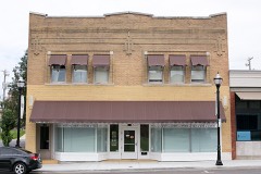
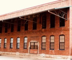
BlockBefore

Greene County, Missouri

103 topographic sheets cover 52 settlements here, and 76 properties are on the National Register of Historic Places.

Research this county

From the record

“Norfleet is the son of David and Elizabeth (Shackleford) Norfleet, and was born Miirch 10, 182i3, in Wayne county, Kentucky. His parents emigrated to Polk county, Missouri, in 1838, and at the age of eighteen William came to Springfield, and went to school to J. Stephens, who was killed by Zagonyi's men in their charge into Springfield, in 1861.”

William S. Noefleet - History of Greene County, Missouri .. (1883). Machine-read text.

76 National Register listings published here · the county-history sources tell 22 stories and name 423 people · people the book names include James Abbott (Cass Township, 1883) · Peter L. Anderson (Brookline Township, 1883) (machine-read).

Sources: the county history on the Internet Archive · the National Register database, National Park Service

Missouri within the United States
Greene County within Missouri

What the record shows

  • 1,096 topographic sheet readings cover the county's settlements.
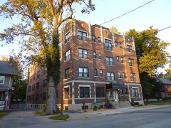
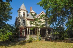
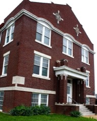
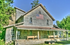
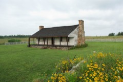
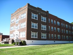
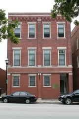
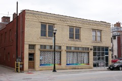
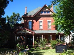
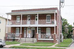
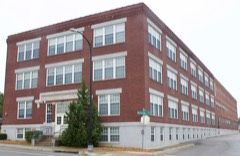
  • 76 properties here are on the National Register of Historic Places: 54 buildings, 18 districts, 3 sites and 1 structure.
  • 3 of the 76 listings were added during the 1970s.
  • The Geographic Names Information System records 53 populated places in this county; 52 are covered by at least one topographic sheet.
  • 4 public-domain county histories, 1883 to 1916, supply 147,367 words of narrative reproduced here.

What happened here

22 accounts

Among them: A Bushwhacker Fight; Chapter Xxix History Of The City Of Springfield; Early Historic Incidents. These passages come from the identified county-history source books. Each inset names its own source and opens the exact section it comes from.

From History of Greene County, Missouri .., published 1883 - Cass Township

A Bushwhacker Fight

In August, 1863, a party of bushwhackers, supposed to be under the command of one Captain Lotspeich, were attacked on the Ralph Lotspeich farm, in this township, by Capt. S. H. Julian and about 30 Home Guards, or militia. The bushwhackers numbered 17, and were encamped in a dense thicket unconscious of danger.

Read the rest of this passage

From History of Greene County, Missouri .., published 1883 - Cass Township

Chapter Xxix History Of The City Of Springfield

Early Histor}' - Indians and Mound Builders - Delaware Town - Burnett's Cabin - Juvenile Vandalism - First Election - Temporary County Seat - Early Days - Hospitality - Early Sports - Origin of the Name "Springfield" - First Merchants - The "Firsts," Births, Deaths and Marriages - Primitive Church - Pioneer School - First Blacksmith - First Frame - Brick Making - First Postmaster - Pioneer Press - Incidents - Permanent County Seat - Deeding the Town Site - Roberts Tragedy - Incorporation - Britt-Renno Tragedy - Primitive Amusements - Items - 1850 to 1860 - Epidemic - R.

Read the rest of this passage

From History of Greene County, Missouri .., published 1883 - Cass Township

Early Historic Incidents

In the month of June, 1835, Asiatic cholera visited Springfield and carried off four or five victims. In July Jeremiah N. Sloan and Geo. M. Gibson, of Barry county, and Markham Fristoe, commissioners appointed by act of the Legislature, met and selected Springfield as the " permanent county seat of Greene county." About the first of September, 1835, the U.

Read the rest of this passage

From History of Greene County, Missouri .., published 1883 - Cass Township

Thomas J. Delaney

Mr. Delaney is the son of James and Alice (Mahon) Delaney, and was born at New Orleans, La., May 10, 1859. His parents were natives of Ireland, and came to this country when still 3-oung. They first stopped in New York city, but moved to New Orleans in 1858.^ They had four daughters and one son. His father was a Confederate soldier, and was killed in battle.

Read the rest of this passage

From History of Greene County, Missouri .., published 1883 - Cass Township

Killing Of James Coleman By John Orr

On the 25th of January one James Coleman, a young man living in the countr}^ was shot and killed in Springfield by a policeman named John Orr. The circumstances were that James Coleman, his brother Samuel, and another man named Bingham, rode into town that day and got on a spree. As they were riding out on South street Bingham, who was very drunk, began whooping and yelling.

Read the rest of this passage

From History of Greene County, Missouri .., published 1883 - Cass Township

Resume From 1865 To 1875

As soon as the debris of the war had been swept away, Springfield began to improve very rapidly and very substantially. Indeed, the town outgrew the country tributary to its local trade, and, to use the common but incorrect expression, business of all kinds was " overdone." The effects were soon felt.

Read the rest of this passage

From History of Greene County, Missouri .., published 1883 - Cass Township

William S. Norfleet

Mr. Norfleet is the sou of David and Elizabeth (Shackleford) Norfleet, and was born March 10, 182G, in Wayne county, Kentucky. His parents emigrated to Polk county, Missouri, in 1838, and at the n.'j,e of eighteen William came to Springfield, and went to school to J. A. Stephens, who was killed by Zagonyi's men in their charge into Springfield, in 1861.

Read the rest of this passage

From History of Greene County, Missouri .., published 1883 - Cass Township

John. H. Onstott

Mr. Onstott is the son of Jonh W. and Rebecca Onstott, and was one of a family of two sons and two daughters, born in Fayetteville, Arkansas, Julj' 23, 1839. His father, John W., was a native of Kentucky, born in Shelbyville in 1781. He served in the "war of 1812," and was in the same company with Dick Johnson, who killed Tecumseh, enlisting as a private, but coming out as a commissioned officer.

Read the rest of this passage

From History of Greene County, Missouri .., published 1883 - Cass Township

Dr. Edward A. Roberts

Dr. Roberts was born and brought up in the State of Georgia. In May, 1866, he came to St. Louis, from there to New Orleans, but returned to St. Louis, July 11, same year, and passed through the terrible cholera ordeal of that year. In August took the cholera - after partial recovery became a patient of St.

Read the rest of this passage

From History of Greene County, Missouri .., published 1883 - Cass Township

Thomas E. Quicksell

Was born in Montezuma, New York, August 8, 1834. When fourteen years old he began working at a saw mill, at which he continued four years. He next went on a farm and remained till July, 1862, when he° joined company C, of the 74th Indiana volunteer infantry, serving in the civil war till July, 1865. He had been in the battles of Stone River, Munfordsville, Mission Ridge, and several other fights and skirmishes, and was once captured at the battle of Munfordsville.

Read the rest of this passage

From History of Greene County, Missouri .., published 1883 - Taylor Township

Early Settlers And Settlements

The very first settler in Taylor township was one Davis, mentioned in the first chapter of this work, who came, it is said, in 1822, or soon afterward, and located on the farm now (1883) owned by Col. John H. Price, in section 13-29-20. Mr. Davis was afterward killed by the Indians. Edward Thompson occupied the farm after Davis, and then came Samuel G.

Read the rest of this passage

From History of Greene County, Missouri .., published 1883 - Brookline Township

History Of Greene Countv

Since the completion of the r;iilro;id three men have been killed near Brookline. In 1872, an engineer accidentally shot himself at the Winfield crossing, about one mile and a half north of town. He was on his engine at the time, and seeing some prairie chickens, he caught up his gun to shoot them, when the weapon was accidentally discharged, and the unfortunate man was instantly killed.

Read the rest of this passage

From History of Greene County, Missouri .., published 1883 - Cass Township

A Bushwhacker Fight

In August, 1863, a party of bushwhackers, supposed to be under the command of one Captain Lotspeich, were attacked on the Ralph Lotspeich farm, in this township, by Capt. S. H. Julian and about 30 Home Guards, oi- militia. The bushwhackers numbered 17, and were encamped in a dense thicket unconscious of danger.

Read the rest of this passage

From History of Greene County, Missouri .., published 1883 - Cass Township

Chapter Xxix History Of The City Of Springfield

Earh- History - Indians and Mound Builders ^ - Delaware Town - - Burnett's Cabin - Juvenile Vandalism - First Election - Temporary County Seat - Early Days - Hospitality - Early Sports - Origin of the Name "Springfield" - First Merchants - The "Firsts," Births, Deaths and Marriages - Primitive Church - Pioneer School - First Blacksmith - First Frame - Brick Making - First Postmaster - Pioneer Press - Incidents - Permanent County Seat - Deeding the Town Site - Roberts Tragedy - Incorporation - Britt-Renno Tragedy - Primitive Amusements - Items - 1850 to 1860 - Epidemic - E.

Read the rest of this passage

From History of Greene County, Missouri .., published 1883 - Cass Township

Early Historic Incidents

In the month of June, 1835, Asiatic cholera visited Springfield and carried off four or five victims. In July Jeremiah N. Sloan and Geo. M. Gibson, of Barry county, and Markham Fristoe, commissioners appointed by act of the Legislature, met and selected Springfield as the " permanent county seat of Greene county." About the first of September, 1835, the U.

Read the rest of this passage

From History of Greene County, Missouri .., published 1883 - Cass Township

Thomas J. Delaney

Mr. Delaney is the son of James and Alice (Mahon) Delaney, and was born at New Orleans, La., May 10, 1859. His parents were natives of Ireland, and came to this country when still young. They first stopped in New York city, but moved to New Orleans in 1858. They had four daughters and one son. His father was a Confederate soldier, and was killed in battle.

Read the rest of this passage

From History of Greene County, Missouri .., published 1883 - Cass Township

Killing Of James Coleman By John Orr

On the 25th of January one James Coleman, a young man living in the country, was shot and killed in Springfield by a policeman named John Orr. The circumstances were that James Coleman, his brother Samuel, and another man named Bingham, rode into town that day and got on a spree. As they were riding out on South street Bingham, who was very drunk, began whooping and yelling.

Read the rest of this passage

From History of Greene County, Missouri .., published 1883 - Cass Township

Resume From 1865 To 1875

As soon as the debris of the war had been swept away, Springfield began to improve very rapidly and very substantially. Indeed, the town outgrew the country tributary to its local trade, and, to use the common but incorrect expression, business of all kinds was "overdone." The effects were soon felt. About the summer of 1870, shortly after the completion of the present St.

Read the rest of this passage

From History of Greene County, Missouri .., published 1883 - Cass Township

William S. Noefleet

Mr. Norfleet is the son of David and Elizabeth (Shackleford) Norfleet, and was born Miirch 10, 182i3, in Wayne county, Kentucky. His parents emigrated to Polk county, Missouri, in 1838, and at the age of eighteen William came to Springfield, and went to school to J. A. Stephens, who was killed by Zagonyi's men in their charge into Springfield, in 1861.

Read the rest of this passage

From History of Greene County, Missouri .., published 1883 - Cass Township

Dr. Edward A. Roberts

Dr. Roberts was born and brought up in the State of Georgia. In May, 1866, he came to St. Louis, from there to New Orleans, but returned to St. Louis, .July 11, same year, and passed through the terrible cholera ordeal of that year. In August took the cholera - after partial recovery became a patient of St.

Read the rest of this passage

From History of Greene County, Missouri .., published 1883 - Cass Township

Thomas E. Quicksell

Was born in Montezuma, New York, August 8, 1834. When fourteen years old he began at a saw mill, at which he continued four j'ears. He next went on a farm and remained till July, 1862, when he' joined company 0, of the 74th Indiana volunteer infantry, serving in the civil war till July, 1865. He had been in the battles of Stone River, Munfordsville, Mission Ridge, and several other fights and skirmishes, and was once captured at the battle of Munfordsville.

Read the rest of this passage

From History of Greene County, Missouri .., published 1883 - Taylor Township

Early Settlers And Settlements

The very first settler in Taylor township was one Davis, mentioned in the first chapter of this work, who came, it is said, in 1822, or soon afterward, and located on the farm now (1883) owned by Col. John H. Price, in section 13-29-20. Mr. Davis was afterward killed by the Indians. Edward Thompson occupied the farm after Davis, and then came Samuel G.

Read the rest of this passage

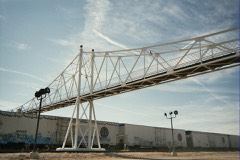
Places on the National Register

76

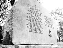
Every property in this county listed on the National Register of Historic Places, with the year it was listed and the federal nomination document.

Photograph PropertyType ListedReference
Abou Ben Adhem Shrine Mosquebuilding198282003137
Ambassador Apartmentsbuilding200808001023
Elijah Teague Anderson Housebuilding198080002353
Bailey Schoolbuilding201616000749
Bentley Housebuilding198080002354
Benton Avenue AME Churchbuilding200101001109
Berry Cemeterysite200404001224
Beverly Apartmentsbuilding2017100001299
Boegel and Hine Flour Mill-Wommack Millbuilding198686003140
Nathan Boone Housebuilding196969000103
Camp Manor Apartmentsbuilding200505001374
Campbell Avenue Historic Districtdistrict199999000714
Campbell Avenue Historic District (Boundary Increase I)district200505001433
College Apartmentsbuilding200303000319
Commercial Street Historic Districtdistrict198383000991
Day Housebuilding197676001110
Fallin Brothers Buildingbuilding201212000435
Fallin Garagebuilding2023100009384
Finkbiner Buildingbuilding200505000469
Franklin Springfield Motor Co. Buildingbuilding200606001027
Gillioz Theaterbuilding199191000887
Gilmore Barnbuilding199494000316
Gottfried Furniture Company Buildingbuilding200707001289
Greene County Courthousebuilding200707001185
Heer's Department Storebuilding200202001207
Heercleffbuilding201616000763
Holland Buildingbuilding200000001373
Hotel Sansonebuilding200000000430
Jefferson Street Footbridgestructure200303000865
Keet-McElhany Housebuilding198484002545
J.E. King Manufacturing Companybuilding200505000751
Robert B. and Vitae A. Kite Apartment Buildingbuilding200403001504
Landers Theaterbuilding197777000806
Lincoln Schoolbuilding200000000508
Marquette Hotelbuilding200000000431
Marx-Hurlburt Buildingbuilding200303000864
McDaniel Buildingbuilding201414000871
Mid-Town Historic Districtdistrict198989000938
Mid-town Historic District (Boundary Increase I)district200202000851
Netter-Ullman Buildingbuilding200303000255
D.M. Oberman Manufacturing Co. Buildingbuilding200202000379
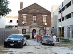
Old Calabossebuilding198080002355
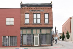
Palace Hotelbuilding200202001419
Pearl Apartments and Windsor Apartmentsbuilding200505001376
Producers Ice and Manufacturing Companybuilding2018100002031
Producers Produce Company Plantbuilding201010000181
Pythian Home of Missouribuilding200909000812
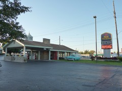
Rail Haven Motelbuilding201010000245
Roberts Farmsteaddistrict2025100011400
Rock Fountain Court Historic Districtdistrict200303000179
Route 66 Steak 'n Shakebuilding201212000462
Henry Schneider Buildingbuilding200606000535
South Avenue Commercial Historic Districtdistrict199999000713
South-McDaniel-Patton Commercial Historic Districtdistrict200303000088
Springfield Furniture Companybuilding200606000536
Springfield Grocer Company Warehousebuilding201010000462
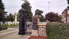
Springfield National Cemeterysite199999001045
Springfield Public Square Historic Districtdistrict200606000331
Springfield Public Square Historic District (Boundary Increase)district201009000281
Springfield Seed Co. Office and Warehousebuilding200606000863
Springfield Warehouse and Industrial Historic Districtdistrict199999000715
St. John's Mercy Hospital Buildingbuilding200303000867
St. Paul Blockbuilding200908001322
Stone Chapelbuilding198282000583
U.S. Customhouse and Post Officebuilding197979001360
Walnut Street Commercial Historic Districtdistrict199999000717
Walnut Street Historic Districtdistrict198585000623
Walnut Street Historic District (Boundary Decrease)district200101001128
Walnut Street Historic District (Boundary Increase I)district200202000833
West Walnut Street Commercial Historic Districtdistrict200202000211
E.M. Wilhoit Buildingbuilding200504001576
Edward M. and Della C. Wilhoit Housebuilding200404001384
Wilshire Apartmentsbuilding200808000266
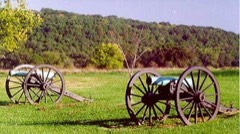
Wilson's Creek National Battlefieldsite196666000113
Wise Feed Company Buildingbuilding200302001685
Woods-Evertz Stove Company Historic Districtdistrict200303001071

Wildfire, 1992 to 2020

432 fires

Every wildfire the federal occurrence database records inside this county: 432 of them, burning about 2,824 acres. 2 started naturally and 24 were recorded as arson. Each settlement page carries the fires within five miles of it.

Reported cause Fires
Debris and open burning239
Missing data/not specified/undetermined90
Equipment and vehicle use43
Arson/incendiarism24
Smoking21
Recreation and ceremony8
Railroad operations and maintenance2
Natural2
Power generation/transmission/distribution1
Misuse of fire by a minor1
Fireworks1

The five largest, by the area the report gives. One of them was set deliberately.

DateCause SizeReported by Name on the report
19 July 2012Missing data/not specified/undetermined590 acresMissouri Department of ConservationWALNUT GROVE
18 February 1997Debris and open burning177 acresMissouri Department of Conservationnot named
1 March 1992Debris and open burning100 acresMissouri Department of Conservationnot named
4 November 1999Missing data/not specified/undetermined100 acresMissouri Department of Conservationnot named
5 April 1994Arson/incendiarism90 acresMissouri Department of Conservationnot named
11 March 2014Missing data/not specified/undetermined80 acresMissouri Department of Conservationnot named
15 March 2013Missing data/not specified/undetermined80 acresMissouri Department of Conservationnot named
7 March 2014Missing data/not specified/undetermined80 acresMissouri Department of Conservationnot named

Every settlement page carries the fires within five miles of it - see the settlement index below.

Storms, 1950 to 2026

60 of 2,106 shown

The NOAA Storm Events Database holds 2,106 reports for this county, causing 12 deaths, 149 injuries and about $496,320,230 in recorded property damage. Each settlement page carries the reports that name it.

Kind of event Reports
Thunderstorm Wind867
Hail675
Flash Flood297
Heavy Rain121
Flood73
Tornado59
Lightning13
Funnel Cloud1

The most serious of them, by death, then injury, then recorded damage. The accounts are quoted exactly as the forecast office filed them.

WhenEvent Place namedHarm What the report says
August 2002LightningWillard4 killedno account filed
November 1991Tornado (F4)not stated2 killed, 64 hurt, $25,000,000no account filed
December 1971Tornado (F2)not stated1 killed, 22 hurt, $2,500,000no account filed
April 1983Tornado (F3)not stated1 killed, 19 hurt, $25,000,000no account filed
May 2003Tornado (F3)Battlefield1 killed, 12 hurt, $14,700,000no account filed
January 2008Tornado (EF3)Mulroy1 killed, $1,000,000A National Weather Service storm survey revealed that an EF-3 tornado tracked across rural east central Greene County causing extensive damage to homes and outbuildings north of Strafford. An 84 year old female was killed when her wood constructed home was destroyed by the tornado. The tornado continued into Webster County.
June 2025Thunderstorm WindBattlefield1 killed, $15,000A large tree was blown over due to high winds and landed on top of a vehicle in Battlefield. There was one fatality in the vehicle.
December 2015Flash FloodEbenezer1 killedA 42 year old man attempted to drive through a flooded low water crossing on Highway CC at Sims Branch. That person was swept away and drowned. An indirect fatality occurred when a 60 year old man tow truck driver was attempting to retrieve a car off the roadway. He was electrocuted by a downed power line near Farm Road 112 and Farm Road 125.
September 1975Tornado (F2)not stated5 hurt, $2,500,000no account filed
October 2001Tornado (F1)Springfield5 hurt, $250,000no account filed
May 2009Thunderstorm WindPlano4 hurt, $15,000,000Sixty to 90 mph winds caused widespread tree, power pole, and structural damage across much of Greene County. Major roof damage to schools included Willard North Elementary, Fair Grove High School, Ash Grove High School, Bois D' Arc Elementary, and Glendale High School. Four students were injured at Fair Grove High School as debris fell into the school while the roof was peeling off. Portions of the elementary and middle school were completely destroyed, along with some light poles on the baseball field. The Ebenezer fire station and fire trucks sustained major damage. Several billboards west of Springfield along Interstate 44 were destroyed. The Sam's Club on Highway 65 and Sunshine had a temporary wall that was peeled off of the building. The Willard High School baseball field had major damage to the press box and dugouts. At Fellows Lake, the marina was broken into three pieces, and jammed the boat docks up onto the boat ramp. Thousands of residences across Greene County lost power up to three days.
March 2006Tornado (F2)Battlefield4 hurt, $650,000This tornado is a continuation of the Christian and Lawrence County tornado. The tornado tracked across extreme southern Springfield causing damage to approximately 27 homes. None of the homes or structures were completely destroyed. The tornado quickly became weaker and only produced intermittent tree damage from Highway 65 over to the Webster County line.
April 1983Tornado (F2)not stated3 hurt, $2,500,000no account filed
May 2013LightningFair Grove2 hurtTwo people were struck by lightning and knocked unconscious at an outdoor rodeo. Both individuals were taken to an area hospital and later released.
April 2019Tornado (EF2)Mentor1 hurt, $3,900,000This is the continuation of the EF-2 supercell tornado that touched down and tracked from two miles north of Ozark, Missouri to five miles northwest of Rogersville, Missouri. The tornado was on the ground for approximately 20 minutes along its 10.3 mile total track with maximum wind speeds estimated at 134 mph. The tornado crossed out of Christian County along East County Line Road just west of South Farm Road 203 and tracked northeast to five miles northwest of Rogersville before lifting in a forested area just east of the intersection of S Lloyd Drive and East Missouri Route AD in eastern Greene County. As the tornado tracked for eight miles across southwestern Greene County it damaged 90 homes and a large barn. Of the homes, three were reported as total losses. Three horses were killed at the barn from debris. One person was injured but refused treatment. Hundreds of trees were snapped or uprooted and multiple power poles and lines were downed.
December 1982Tornado (F2)not stated1 hurt, $2,500,000no account filed
May 2024Tornado (EF0)Cave Spg1 hurt, $67,000A NWS storm survey team determined that an EF-0 tornado with maximum wind speeds of 80 mph touched down in Greene County and continued tracking northeast. The tornado both uprooted trees and downed large limbs out of numerous other trees, and damaged or destroyed several outbuildings along an intermittent path extending from Greene Hills Country Club northwest of Willard across northern Greene County before reaching the Greene/Polk County line. Two homes were damaged by falling trees, with one injury reported in one of these homes. The tornado continued to track into Polk and Dallas counties.
June 2025Thunderstorm WindBattlefield1 hurt, $30,000A fireworks tent was blown over in Battlefield. One person was treated for minor injuries.
July 2014Thunderstorm WindWildwood Estates1 hurt, $5,000A FEDEX truck was blown over on the James River Freeway just west of the Highway 65 interchange. The driver of the truck suffered minor injuries.
March 1961Tornado (F1)not stated1 hurt, $2,500no account filed
June 2009LightningMulroy1 hurtA 46 year old man sustained injuries from a lightning strike. He was loading hay onto a trailer in a hay field near the intersection of Interstate 44 and Mulroy Road.
November 1996Flash FloodFair Grove1 hurtno account filed
July 1992Thunderstorm Windnot stated1 hurtno account filed
April 2026HailRepublic$314,900,000A hail swath from a mile to 3 miles wide began southwest of Republic and continued to the northeast across Greene County. Hail from quarters to 4.75 inches in size fell along a path from Republic to northwestern Springfield to Fair Grove as an intensifying left moving supercell moved to the northeast across the County. Along the storms path, numerous homes, vehicles, businesses, equipment, crops, livestock and other structures were damaged by hail before the storm passed into northwestern Webster County. ||As the storm moved across northwestern Springfield, it moved over the Springfield-Branson National Airport where 4 commuter jets, two cargo jets and up to 25 general aviation aircraft were on the TARMAC. Over 1200 vehicles were in the short and long term parking lot. The storm them moved over the Springfield Zoo killing an Emu and injuring another. At least two dozen people were injured by hail by being outside during the hail.
November 1988Tornado (F1)not stated$25,000,000no account filed
April 2025Thunderstorm WindSgf Downtown Arpt$10,000,000Multiple trees and powerlines were reported down throughout Springfield and portions of western and southern Greene County. Springfield City Utilities reported hundreds of poles and transformers along with miles of line. Tree damage was extensive with an estimated 30,000 cubic yards of tree debris collected.
July 2000Flash FloodCountywide$8,430,000no account filed
December 2015Flash FloodBattlefield$5,000,000Farm Road 174 and Oakwood Street to Farm Road 174 and Route ZZ was impassable due to high water. Nearly all low water crossings were under water and impassable. Approximately 630 homes and 16 business sustained water damage. Numerous roads, bridges, and culverts across the county sustained damage from the water. There were at least 120 water rescues across the county. There was an estimate of up to 500 problem spots on local roads will need repairs. A local car dealership in Republic was flooded by high water with numerous cars affected. This storm report will contain the damage estimates for the entire county during this event.
April 2023HailRepublic$4,000,000Tennis ball sized hail was reported in the western portion of Greene County stretching from northern sections of Republic into west Springfield and northward into Willard. More than 100 homes and dozens of cars suffered damage. This entry will include damages for all entries for Greene County for this event.
July 2023Thunderstorm WindNichols$2,500,000Numerous trees and power lines were downed by high winds across the Springfield Metro. At lease 40 homes had trees on the roof causing shingle, gutter, vent, soffit and siding damage. Weather heads were pulled out or damaged on several homes. several fences were damages or destroyed by falling limbs and trees. At lease a dozen outbuilding were damages with one a total loss. In excess of a dozen vehicles were damaged by falling limbs and trees. As many 4 light poles were bent or down along with many power poles and lines. Around 15,500 homes were without power.
December 1971Tornado (F2)not stated$2,500,000no account filed
May 2020HailBattlefield$2,000,000A severe thunderstorm producing hail from nickle size to as large as 2.25 inches moved across southern Greene County which included the towns of Battlefield, Southern portions of Springfield, Galloway and areas west of Rogersville. Numerous homes and vehichles suffered minor to moderate damage from the swath of hail. Several car dealerships were impacted as the storm moved across south Springfield.
January 2008Tornado (EF2)Republic$2,000,000A National Weather Service storm survey revealed that an EF-2 tornado impacted northern sections of Republic. Numerous buildings and houses sustained damage. Nearly 15 houses were severly damaged or destroyed. The E3 elementary school in Republic experienced a direct hit causing major damage to the roof, which led to water damage on the west wing of the school. The contracter responsible for rebuilding the roof stated that in order for this type of damage to occur, wind speeds were in excess of 100 mph.
August 2007Flash FloodWalnut Grove$2,000,000Excessive rainfall associated with the remnants of Tropical Storm Erin impacted northern Greene County. Numerous roads and low water crossings were washed out and had to be fully repaired. Flooding also impacted a bank in Walnut Grove. Specific locations that were impacted include, hundreds of sections of secondary roads across northern Greene County, a section there Route V between Highway 160 and Route BB, and numerous sections of Highway 123 between Walnut Grove and Willard.
January 2020HailSgf Downtown Arpt$1,000,000A picture of golf ball sized hail was received from the east side of Springfield. The combination of wind and hail led to hundreds of vehicles suffering damage.
July 2015FloodSpringfield Bar H Ar$1,000,000Farm Road 134 at the James River was flooded with about 200 yards of the roadway under 2 to 3 feet of water near the Greene and Webster County line. This storm report will contain the overall flood damage estimates across Greene County for this storm event. There were several episodes and heavy rainfall events which led to a compound affect to the flooding damage. Numerous roads, bridges, and low water crossings were heavily damaged.
June 2013Flash FloodWildwood Estates$1,000,000Near the intersection of South Campbell Road and Republic Road, there were several roadways that were underwater up to 3 feet deep. Water flooded several businesses in that area. Several cars were stranded in high water.||This storm report will contain the entire estimated damage cost for the severe storm that affected south Springfield with flash flooding, hail damage, wind damage, and lightning strikes. Numerous roadways and neighborhoods had flooding as well as several homes being affected by flood waters. Flash flooding affected some of the infrastructure like washing out communication lines and boxes in south Springfield. Lightning hit several substations and transformers in that area as well as several homes in neighborhoods were affected by direct and indirect lightning strikes. Hail up to the size of golf balls damaged some cars and broke windows of houses as well as damaged some roofs along with the wind. Again, this will be the damage estimate for the entire storm system that affected southern Greene County and south Springfield.
May 2009Tornado (EF1)Republic$1,000,000The Republic Emergency Management Director visually spotted and tracked a tornado that touched down southwest of Republic and moved across the city. Approximately 50 structures were damaged. The heaviest damage appeared to be concentrated on Kristopher Street.
January 2008Tornado (EF2)Mulroy$1,000,000A National Weather Service storm survey revealed that an EF-2 tornado tracked across rural areas of east central Greene County south of Strafford. Several homes and outbuildings sustained damage prior to the tornado tracking into Webster County.
March 2008Flash FloodWalnut Grove$1,000,000Four to seven inches of rain fell over Greene County. Nearly all county roads experienced flooding. The Greene County Emergency Management Director stated that the county had insufficient barracades to block all flooded areas from motorists. An elderly couple was surveying flooded areas along the James River from a park in southeast Springfield when the river was rising so quickly that it eventually surrounded their vehicle and swept them into the river. The 67 year old husband died from a heart attack from the stress of being swept into the river. The wife was later rescued by the Rogersville Swift Water Rescue Team. The rescue attempt took two hours and the car was almost fully submerged by the time the rescue team had positioned themselves near the car.



June 2025Thunderstorm WindLangston$500,000Trees were down on power lines across a large portion of Springfield. Numerous poles were broken and lines down across the city.
April 2017Flash FloodGalloway$500,000Several homes and business sustained flood damage across Greene County. Several homes had flooded basements. This report will contain the total dollar estimate for flood damage to infrastructure, businesses, and homes across Greene County.
March 2016Flash FloodSpringfield$500,000There were numerous water rescues and stalled out vehicles due to flash flooding over the central and eastern portions of Springfield. Numerous streets were flooded and impassable. The Springfield Fire Department and the swift water rescue team performed approximately 50 water rescues in central and eastern Springfield at a total cost of just over $11,000 to the department in staff time and equipment costs. At least a dozen homes and businesses experienced flash flooding or flood damage near the downtown area and along Jordan Creek. The intersection of Chestnut Expressway and U.S. 65 saw the highest rainfall amount in the city limits at 6.42 inches in about 2 hours. This storm report will include the entire estimate of damage for this flash flood event including damages to buildings, cars, and infrastructure.
June 2015Flash FloodSpringfield Bar H Ar$500,000State Route 125 was flooded and closed north of Highway 60. There were numerous additional roads flooded along the James River. Numerous roads, bridges, and low water crossings were heavily damaged.
June 2015FloodMumford$500,000At least two homes on Farm Road 193 just north of Sunshine Avenue on the east side of Springfield had several feet of water inside the homes from the historic James River flood. Several cars were flooded in the neighborhood.
April 2011Flash FloodSpringfield Bar H Ar$500,000Route 125 was closed due to flooding.||The total cost estimate for flooding damages for Greene County for this entire episode has been included. This includes roads, bridges, and structures which were affected.
January 2020Tornado (EF0)Sgf Downtown Arpt$400,000A National Weather Service Survey determined that an EF-1 tornado touched down east of Highway 65 on East Mill Street, just east of Springfield. The tornado tracked to the northeast crossing East Division Street. As the tornado approached Interstate 44, damage was sustained to an automobile service building. The service building lost a couple of overhead doors and two box trucks were overturned. Damage to the roof was also sustained. As it crossed Interstate 44 into Strafford, there was damage to several homes. The damage included a significant loss of roof covering material, damage to gutters, and collapse of garage doors inward. Numerous trees were snapped or uprooted along the path. The tornado lifted just before Highway 125 near East Farm Road 84. The tornado produced EF1 damage with maximum winds up to 98 mph and a max width of 75 yards. The tornado was on the ground for 11 minutes along a 7 mile path.
March 1995HailSpringfield$400,000A severe thunderstorm with up to baseball-size hail damaged hundreds of homes and automobiles across extreme southern Greene County.
June 2020Thunderstorm Wind(Sgf)Springfield Arp$350,000A line of thunderstorms moved from northwest to southeast across Greene County producing straight line winds between 60 and 80 mph. The ASOS at the Springfield/Branson National Airport recorded a 61 mph gust as the storms moved through. Numerous reports were received of large trees uprooted or snapped, large limbs down, power poles and line from the airport, south to Battlefield and southeast to Galloway. Several trees and limbs fell on homes causing minor to moderate roof or siding damage as the storms moved southeast. Roofs were peeled of the north facing sides of homes at Farm Road 135 and Hanover Street, in south Christy Avenue and on West Morning Side Place. A store front on Commercial Street also reported damage and a large sign was blown down.
February 2009Tornado (EF1)Battlefield$350,000A National Weather Service storm survey revealed that an EF-1 tornado intermittently caused damage to around one dozen homes and businesses across south and central Springfield. This tornado initially touched down near the intersection of Scenic and Republic Road, and ended near St. Johns Hospital.
April 2019Tornado (EF1)Sacville$300,000A National Weather Service storm survey confirmed an EF-1 tornado tracked from four miles northeast of Willard, Missouri to five miles northeast of Willard. The tornado was on the ground for approximately two minutes along its 1.7 mile total track with maximum wind speeds estimated at 100 mph. The first observed signs of this tornado was substantial damage to a farm house, a large pole barn and six outbuildings within an area of cyclonic tree fall pattern along North Farm Road 117. Observers noted similar tree patterns along a ridge top to the west of the farmhouse and other light tree damage along the Little Sac River valley. An intermittent path of mainly light tree damage and damage to two outbuildings was then noted eastward to Farm Road 123. There was a noticeable break along the southern (right) flank of this tornadic path where a swath of up to 70 mph straight line winds damaged or uprooted numerous trees south along and south of Farm Road 54.
May 2015LightningRepublic$300,000A large home near Republic was destroyed by a fire which was started by a lightning strike. Time was estimated.
February 2013LightningMentor$300,000A fire caused by a lightning strike destroyed an office building of the Journagan Construction quarry operations near Farm Road 194 and Farm Road 195. Time was estimated.
January 2008HailElwood$300,000Windows were broken and shingles were blown off roofs in the Meadows Subdivision.
June 2008Thunderstorm WindMumford$300,000Major tree and power line damage occurred within a neighborhood in east Springfield. This damage was due to the rear flank downdraft winds of a tornadic supercell. Several homes also experienced damage from large trees falling into them.
May 1995Tornado (F1)Springfield$300,000A severe thunderstorm became tornadic on the east side of Springfield. Pockets of cyclonicly orientated damage within the debris path indicated the tornado was multi-vortex. The tornado downed numerous trees, heavily damaged outbuildings and blew a garage door into a garage.
April 2026HailWalnut Grove$250,000Golf ball sized hail was reported in Walnut Grove. Some vehicles, homes and businesses suffered minor damage.
April 2025Thunderstorm WindBassville$250,000A large tree was on a home causing moderate roof and structural damage. Trees were also down a multiple (7) outbuildings causing minor to significant damage.
July 2023Thunderstorm WindNichols$250,000Multiple large trees, some at least 2 feet in diameter, were uprooted and laying across city streets. One uprooted tree damaged decking around a home, and other split and fell on a home causing minor roof and gutter damage. Numerous large limbs were down across the city from west to east, some falling on and damaging fences. One large limb fell on a pickup truck causing minor damage. Some power lines were downed by trees and limbs causing power outages as transformer blew.
July 2015Flash FloodEbenezer$250,000Water was over the road at Highway 13 and Farm Road 34. This storm report will contain the overall storm damage estimates across Greene County for this storm event. Numerous roads, bridges, and low water crossings were heavily damaged.

Mines and quarries

120 recorded

The Survey's mineral resources record lists 120 workings inside this county. 7 still produce and 113 are closed or unrecorded. Each settlement page carries the workings within five miles of it.

Commodity Workings
Stone, Crushed/Broken45
Zinc32
Iron21
Lead, Zinc16
Copper2
Clay, Iron1
Limestone, Dimension1
Clay1
Lead1
Sand and Gravel, Construction1

The least common of them first, because a county's hundredth gravel pit says nothing its first ten did not.

Where SiteCommodity StatusRecorded
Clutter MineClay, IronPast Producer
Duncan MineLead, ZincPast Producer
Kelso ShaftClayPast Producer
UnknownLimestone, DimensionPast Producer
UnknownSand and Gravel, ConstructionPast Producer
UnknownCopperPast Producer
Bullwinkle MineLead, ZincPast Producer
Gem MineLead, ZincPast Producer
Getty MineLead, ZincPast Producer
Murray MtnesLead, ZincPast Producer
Pennsylvania Company'sS ShaftLead, ZincPast Producer
Phelps MinesLead, ZincPast Producer
Pickerel Creek DiggingsLead, ZincPast Producer
UnknownLead, ZincPast Producer
Wolverine Shaft Number ThreeLead, ZincPast Producer
Bayliss LandIronPast Producer
Helm MineIronPast Producer
Jackson BankIronPast Producer
Jennings BankIronPast Producer
John Jackson MineIronPast Producer
Noble MineIronPast Producer
Pollack MineIronPast Producer
Studley Mine - Pit 1IronPast Producer
UnknownIronPast Producer
Welsh MineIronPast Producer
Badger MineZincPast Producer
Choteau ShaftZincPast Producer
Clark ShaftZincPast Producer
Daisey ShaftZincPast Producer
Diemer ShaftZincPast Producer
Eversol ShaftZincPast Producer
Lewis + Benz ShaftZincPast Producer
Meyers ShaftZincPast Producer
Mill ShaftZincPast Producer
Missing Link MineZincPast Producer
Nineteen -Fourteen ShaftZincPast Producer
Santa Claus ShaftZincPast Producer
Snowball ShaftZincPast Producer
UnknownZincPast Producer
UnknownZincProspect
UnknownZincPast Producer
UnknownZincProspect
UnknownZincPast Producer
Wolverine MineZincPast Producer
Wolverine Shaft Number OneZincPast Producer
Wolverine Shaft Number TwoZincPast Producer
Ash Grove Cement Co - PlantStone, Crushed/BrokenProducerSurface
Ash Grove MineStone, Crushed/BrokenProducer
Ash Grove QuarryStone, Crushed/BrokenProducer
Brown QuarryStone, Crushed/BrokenPast Producer
Conco QuarryStone, Crushed/BrokenProducer
Denton QuarryStone, Crushed/BrokenPast Producer
Doling Park QuarryStone, Crushed/BrokenPast Producer
Edwards QuarryStone, Crushed/BrokenPast Producer
Graystone QuarryStone, Crushed/BrokenProducer
Griesemer Plant #1-MineStone, Crushed/BrokenProducer
Holman QuarryStone, Crushed/BrokenPast Producer
Lovette QuarryStone, Crushed/BrokenPast Producer
Marblehead QuarryStone, Crushed/BrokenPast Producer
Mugen QuarryStone, Crushed/BrokenPast Producer
Plant No 1 Mine and MillStone, Crushed/BrokenProducer
Tindell QuarryStone, Crushed/BrokenPast Producer
UnknownStone, Crushed/BrokenPast Producer

The townships, in 1915

147,367 words

Past and Present of Greene County Missouri; Early and Recent History and Genealogical Records of Many of the Representative Citizens devotes a chapter to each township: its boundaries and streams, who settled it and when, the mills, the schools and the churches. All 7 are reproduced here in full. Each row shows the township's own shape and where it lies in the county, drawn from the Census Bureau's boundary. Which settlements belong to which township is computed from that same boundary, not taken from the book.

The county's history books

734,934 words

2 books written about this county, cut here where the book itself is cut, at its printed chapters: 40 chapters in all. Every chapter is public domain, machine-read from the scan and reproduced complete. A chapter already given under one of the county's towns is not repeated in this list.

History of Greene County, Missouri .. (1883)

ChapterLength
Louisiana Purchase11,338 words
Chapter 8: Civil War in Missouri2,492 words
Chapter 9: Early Military Record1,965 words
Chapter 10: Agriculture and Material Wealth1,739 words
Education1,734 words
Religious Denominations1,955 words
Chapter with an unread heading (no. 7 of those read)11,225 words
Chapter 1: Pioneer History14,131 words
Chapter 2: From the 0r(>anizati0n of the County to 184013,752 words
Chapter 3: History of the County from 1840 to 18508,673 words
Chapter 4: History of the County from 1850 to 18568,671 words
Chapter 5: History of the County from 1856 to 186012,332 words
Chapter 6: From 1860 to the "goose Pond" Meeting, June 11, 18616,199 words
Chapter 7: From the Meeting of the Military in June, to the Battle of Wilson's Creek6,931 words
Chapter 8: The Battle of Wilson's Creek - the Union or Federal12,975 words
Chapter 913,044 words
Chapter 10: From the Battle of Wilson's Creek to the Close of 186115,854 words
Chapter 11: History of the County During 186210,000 words
Chapter 12: History of the County in 1863 - Battle of Springfield14,322 words
Chapter 13: From 1864 to the Close of the Civil War8,155 words
Chapter 14: History of the County from April, 1865, to 187013,942 words
Chapter 15: History of the County from 1870 to 18758,708 words
Chapter 16: History of the County from 18758,431 words
Chapter 17: Geology of Greene County944 words
Chapter 18: Biographies of Some of the Prominent Citizens Identified with the History of Greene County14,158 words
Boone Township2,920 words
Biographical sketches (1 of 6 so headed)8,683 words
Center Township. 13,064 words
Biographical sketches (2 of 6 so headed)11,810 words
Chapter 24: Wilson Township3,762 words
Chapter 25: Clay Township1,269 words
Biographical sketches (3 of 6 so headed)4,252 words
Campbell Township1,916 words
Biographical sketches (4 of 6 so headed)10,710 words
Franklin Township2,032 words
Biographical sketches (5 of 6 so headed)2,065 words
Jackson Township2,681 words
Biographical sketches (6 of 6 so headed)3,221 words
Robberson Township941 words

Past and Present of Greene County Missouri; Early and Recent History and Genealogical Records of Many of the Representative Citizens (1915)

ChapterLength
Biographical sketches451,938 words in 29 parts

The people it describes

423 named

Everyone Past and Present of Greene County Missouri; Early and Recent History and Genealogical Records of Many of the Representative Citizens stops to write about, with the section that describes them. Among them are the men who founded the place and governed the Territory. Each name opens the passage itself, in the words of 1915.

Every populated place in the county

53

Named settlements recorded in the Geographic Names Information System, each with the topographic sheets covering it. Villages, hamlets and abandoned places alike. Each is shown with the nearest named watercourse or landform and the survey quadrangle it falls on.

The vanished settlements of Greene County: the places named above that are no longer on the map.

Provenance

  • Topographic sheets. USGS Historical Topographic Map Collection, county index, measured from the bulk metadata.
  • Fire insurance maps. Library of Congress Sanborn collection, faceted to this county.
  • Photographs. Each place queried individually against the Library of Congress Prints and Photographs search.
  • Wildfire. Short, Karen C. 2022. Spatial wildfire occurrence data for the United States, 1992-2020 [FPA_FOD_20221014]. 6th Edition. Fort Collins, CO: Forest Service Research Data Archive. https://doi.org/10.2737/RDS-2013-0009.6 Collected with United States Government funding and usable without additional permissions or fees.
  • Mines and quarries. USGS Mineral Resources Data System (MRDS) https://mrdata.usgs.gov/mrds/ A work of the United States government, no copyright under 17 U.S.C. 105.
  • Storms. NOAA National Centers for Environmental Information, Storm Events Database https://www.ncei.noaa.gov/stormevents/ A work of the United States government, no copyright under 17 U.S.C. 105. Narratives are quoted verbatim from the National Weather Service report and are not edited or summarised.