 Block
Foristell, Missouri
24 topographic sheets cover this place, the earliest surveyed in 1903 and the latest in 1985. It stands in Boone Township. It lies in ZIP code area 63348. The Survey maps it on the Foristell quadrangle. 550 people lived here at the 2020 count. It stands 709 feet above sea level.
Population over time
2 figuresForistell grew from 505 to 550 between 2010 and 2020. These are the recorded population figures Wikidata holds for this place, reached through the Geographic Names Information System number this page is keyed on rather than by name, so they belong to this place and not to another of the same name. Most are census counts, but not all are: an early figure may be a founding or settlement estimate, and an estimate published within five years of a census is left out. The change column is computed, and is left blank where more than 20 years separate a figure from the one before it, because a gap that long is not a change between two counts.
| Year | People | Change |
|---|---|---|
| 2010 | 505 | |
| 2020 | 550 | +45 (+9%) |
Topographic sheets covering this place
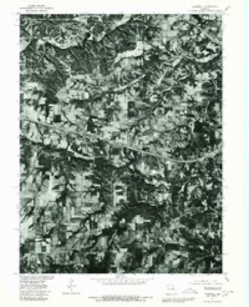
11 surveys from 24 printed sheetsMatched by testing this settlement's coordinate against the published boundary of every sheet in the United States Geological Survey's historical collection. Each opens the scanned sheet at the Survey.
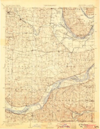
- 1903 USGS O'Fallon quadrangle1:125000, 5 printings
- 1941 USGS Troy quadrangle1:62500, 2 printings
- 1945 USGS Troy quadrangle1:62500, 2 printings
- 1949 USGS Saint Louis quadrangle1:250000
- 1949 USGS St. Louis quadrangle1:250000
- 1962 USGS St. Louis quadrangle1:250000
- 1963 USGS St. Louis quadrangle1:250000, 4 printings
- 1966 USGS St. Louis quadrangle1:250000
- 1972 USGS Foristell quadrangle1:24000, 3 printings
- 1979 USGS Foristell quadrangle1:24000
- 1985 USGS St Louis quadrangle1:100000, 3 printings






Fires near this place
20 since 1994Regional context, not property-specific evidence. The federal wildfire occurrence database lists 20 fires within 5 miles of Foristell between 1994 and 2020, burning about 46 acres in total. None started naturally. None was recorded as arson. Distance is straight-line from the map coordinates, so a fire counted here may appear on a neighbouring settlement's page as well.
| Reported cause | Fires |
|---|---|
| Missing data/not specified/undetermined | 9 |
| Debris and open burning | 9 |
| Recreation and ceremony | 1 |
| Railroad operations and maintenance | 1 |
The most recent of them, most recent first, with the day each was reported and the service that recorded it.
| Date | Cause | Size | Reported by | Name on the report |
|---|---|---|---|---|
| 14 August 1996 | Railroad operations and maintenance | 1.0 acres | Missouri Department of Conservation | not named |
| 30 May 2016 | Missing data/not specified/undetermined | under an acre | Missouri Department of Conservation | 137292-10952-05302016-1646 |
| 28 May 2016 | Debris and open burning | under an acre | Missouri Department of Conservation | 137052-10952-05282016-1049 |
| 6 April 2016 | Missing data/not specified/undetermined | under an acre | Missouri Department of Conservation | 135333-10952-04062016-0710 |
| 30 April 2018 | Debris and open burning | 1.4 acres | Missouri Department of Conservation | 176926-10952-04302018-1723 |
| 30 April 2015 | Missing data/not specified/undetermined | under an acre | Missouri Department of Conservation | 123450-10952-04302015-1410 |
| 19 April 2017 | Missing data/not specified/undetermined | under an acre | Missouri Department of Conservation | not named |
| 6 March 2020 | Debris and open burning | 1.1 acres | Missouri Department of Conservation | 190142-10952-03062020-1408 |
Settlements close enough to share some of these fires:
Mines and quarries near this place
10 of 27 shownRegional context, not property-specific evidence. The federal mineral resources record lists 27 workings within 5 miles of Foristell: 27 past producers. None of them still produces. What was taken out: Clay, Stone, Crushed/Broken, Lead, Sand and Gravel, Construction. Distance is straight-line from the map coordinates, so a quarry counted here may appear on a neighbouring settlement's page as well.
| Where | Site | Commodity | Status | Recorded |
|---|---|---|---|---|
| Unk | Sand and Gravel, Construction | Past Producer | ||
| Unknown - Pb | Lead | Past Producer | ||
| Camp Creek Quarry | Stone, Crushed/Broken | Past Producer | ||
| Unk | Stone, Crushed/Broken | Past Producer | ||
| Unk | Stone, Crushed/Broken | Past Producer | ||
| Unk | Stone, Crushed/Broken | Past Producer | ||
| Unknown - Ls | Stone, Crushed/Broken | Past Producer | ||
| Unknown - Ls | Stone, Crushed/Broken | Past Producer | ||
| Unknown - Ls | Stone, Crushed/Broken | Past Producer | ||
| Unknown - Ls | Stone, Crushed/Broken | Past Producer |
Storms near this place
16 since 1998Regional context, not property-specific evidence. The National Weather Service names Foristell in 16 storm reports between 1998 and 2024: 5 hail, 4 tornado, 4 thunderstorm wind, 2 flash flood. The reports record 5 injuries. Each account below is quoted exactly as the forecast office filed it, from the NOAA Storm Events Database, and each date opens the federal record of that event.
| When | Event | Place named | Harm | What the report says |
|---|---|---|---|---|
| March 2017 | Tornado (EF1) | Foristell | 3 hurt | The second tornado associated with the small vortex developed along the South Service Road of Interstate 70 west of South Pointe Prairie Road. The tornado crossed Interstate 70 and causing roof and siding damage to a number of homes and uprooted or snapped trees along its path as it moved east across Langtree Drive, Shadow Point Circle, Shadow Point Drive, Giotto Court, Cabot Court, Tiffany Lynn Court, Huntsdale Drive, Tiger Drive and Ivybrook Drive. The tornado once again approached Interstate 70 causing damage to several businesses along W Pierce Blvd. The tornado crossed the interstate, flipping over a large camper trailer along Thomas RV Way and flattening several road signs. The tornado tracked east paralleling Interstate 70, causing varying degrees of damage to buildings along Swantherville Drive and Ruggeri Drive. The tornado then caused significant roof damage to a building along P&A Drywall Drive before crossing Interstate 70 for the third and final time. The tornado continued east into a mobile home park where it flipped one trailer over and damaged many more. This is where the three minor injuries occurred. The tornado continued east northeast just to the south of West Main Street through downtown Wentzville causing mainly minor damage to many residences and businesses. The exception was a lumber business along South Church Street which took the brunt of the tornado and had a large building destroyed. The tornado finally dissipated near the intersection of E. Pitman Avenue and S. Tally Street. Overall, the tornado was rated EF1 with a path length of 3.15 miles and a max path width of 100 yards. |
| July 2011 | Lightning | Foristell | 2 hurt | Lightning hit a tree and transferred to power lines causing some electrical damage. Two people were injured by the lightning strike and one had to be briefly hospitalized. |
| March 2024 | Hail | Foristell | $20,000,000 | A wide swath of very large hail fell along the I-70 corridor in St. Charles County. The largest hail stones were around three inches in diameter. The cities that the large hail affected were Wentzville, Saint Paul, O'Fallon, Lake St. Louis, Flint Hill, Saint Peters, Cottleville, and Saint Charles. Numerous vehicles sustained hail damage including thousands of individual cars and at 12 car dealerships. One dealership alone had 450 cars damaged from the large hail. Also, hundreds of homes and businesses sustained roof and siding damage. One school sustained damage to skylights. |
| July 2022 | Flash Flood | Foristell | $10,000,000 | Up to 13 inches of rain fell in a 6 to 10 hour period causing widespread flash flooding. The axis of heaviest rain extended from just north of Wentzville east southeastward through northern portions of O'Fallon through St. Peters and into St. Charles. Numerous roads were flooded throughout St. Charles County. Interstate 70 was flooded with up to five feet of water around the intersection with Mid Rivers Mall Drive. Fire and rescue searched and cleared several dozen vehicles in this area and rescued 8 people from the rising waters. Also, in the area of Harry S. Truman Blvd and Premier Parkway, several drivers were rescued from their flooded vehicles. In the area of Mexico Road and Spencer Road, multiple vehicles were trapped by rapidly rising waters of Spencer Creek. One vehicle in this area was swept off the roadway into Spencer Creek. The driver escaped but was clinging to a tree in the fast moving water that was over 8 feet deep. He was rescued and was not injured. Between 1 am and 11 am, 87 people were evacuated from homes or businesses in St. Charles County. One hundred seventeen buildings were damaged from the flooding. Forty Nine of them sustained major damage, 46 sustained moderate damage and 22 buildings sustained minor damage. So far damage is estimated to be around $10 million dollars. |
| September 2023 | Hail | Foristell | $10,000 | The thunderstorm that produced quarter sized hail in Warren County intensified quickly as it entered St. Charles County. There were numerous reports of severe hail in and around Wentzville, ranging from quarters to golf balls. Hailstones damaged windows and siding in multiple neighborhoods in Wentzville before weakening after passing the city. |
| November 2024 | Tornado (EF0) | Foristell | $5,000 | An EF-0 tornado touched down just after 9:30pm CST on the evening of Monday, November 4th in northwestern St. Charles County. The tornado tracked to the northeast for just under 5 miles, damaging several trees, a pole barn and causing minor damage to a residence. It then tracked into southern Lincoln County. The tornado had a path length of 4.94 miles and a max path width of 75 yards in St. Charles County. No deaths or injuries were reported. |
| May 2023 | Hail | Foristell | - | A swath of large hail fell between Foristell and Wentzville/Flint Hill area. The largest hail stones reported were 1.5 inches in diameter. |
| August 2021 | Thunderstorm Wind | Foristell | - | Widespread damaging winds across the western portions of St. Charles County. Numerous trees, tree limbs and power lines were blown down. One large tree was blown down onto W. Meyer Road in Wentzville. Also, several trees were blown down near the intersection of Mexico Road and Belleau Creek Road, and the intersection of Highways K and N. A tree and power line were blown down over Highway DD near intersection with Highway 94. |
| October 2012 | Thunderstorm Wind | Foristell | - | A line of severe thunderstorms moved through Foristell and Wentzville. Several trees and power lines were blown down. Also, the goal posts at Progress Park on northeast side of Wentzville were blown over. |
| June 2009 | Flash Flood | Foristell | - | Up to four inches of rain fell in a short amount of time over a large portion of St. Charles county. Numerous secondary roads were flooded. An off duty weather service employee reported several feet of flowing water through his back yard in St. Peters. Numerous streams were out of their banks and several homes in Wentzville had a couple of feet of water in their basements. |
| April 2001 | Tornado (F0) | Foristell | - | The 4th tornado spawned by the Heavy Precipitation Supercell that crossed central and eastern Missouri formed just east of Foristell and traveled 4 miles to just west of Wentzville. The tornado formed along the outer road of Interstate 70 where it destroyed a garage and blew a tractor-trailer onto some railroad tracks. The tornado caused minor damage to 3 homes, an automotive repair shop and a restaurant. Several trees and power poles were snapped along the path. |
| May 2022 | Hail | Foristell | - | no account filed |
| March 2019 | Hail | Foristell | - | no account filed |
| July 2011 | Thunderstorm Wind | Foristell | - | no account filed |
| August 1999 | Thunderstorm Wind | Foristell | - | no account filed |
| April 1998 | Tornado (F0) | Foristell | - | no account filed |
Nearest settlements
The eight closest, with where each one stands in the county. Distances are straight-line, computed from the Geographic Names Information System coordinates.
| Map | Place | Distance | Sheets |
|---|---|---|---|
| Stonemoor | 2.2 miles | 24 | |
| Fountains at Bear Creek | 2.5 miles | 24 | |
| Pauldingville | 2.8 miles | 24 | |
| Huntsdale | 3.1 miles | 24 | |
| Woodlands at Bear Creek | 3.5 miles | 24 | |
| Peine Woods | 4.1 miles | 24 | |
| Great Oaks | 4.4 miles | 24 | |
| Crystal Creek | 4.6 miles | 24 |
Elsewhere
Matched on this settlement's Geographic Names Information System number rather than its name, so it cannot be a different place of the same name in another state.
| Wikipedia article on Foristell | An encyclopaedic summary. Its text is share-alike, so it is linked here rather than copied. |
| Wikidata item Q970328 | The structured record the population and elevation above come from. Public domain (CC0). |
Provenance
This settlement is recorded in the Geographic Names Information System as feature 756069. The sheet list is computed by point-in-boundary test against the United States Geological Survey's historical topographic inventory. Both are works of the United States government and carry no copyright under 17 U.S.C. 105.
Wildfire. Short, Karen C. 2022. Spatial wildfire occurrence data for the United States, 1992-2020 [FPA_FOD_20221014]. 6th Edition. Fort Collins, CO: Forest Service Research Data Archive. https://doi.org/10.2737/RDS-2013-0009.6 Collected with United States Government funding and usable without additional permissions or fees.
Mines and quarries. USGS Mineral Resources Data System (MRDS) https://mrdata.usgs.gov/mrds/ A work of the United States government, no copyright under 17 U.S.C. 105.
Storms. NOAA National Centers for Environmental Information, Storm Events Database https://www.ncei.noaa.gov/stormevents/ A work of the United States government, no copyright under 17 U.S.C. 105. Narratives are quoted verbatim from the National Weather Service report and are not edited or summarised.