 Block
Glasgow, Missouri
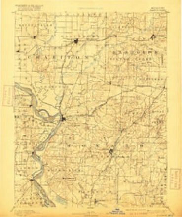
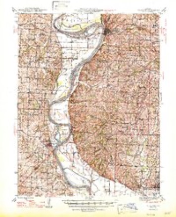
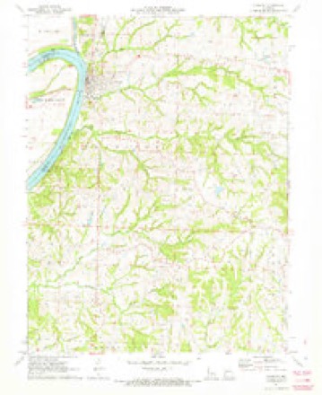
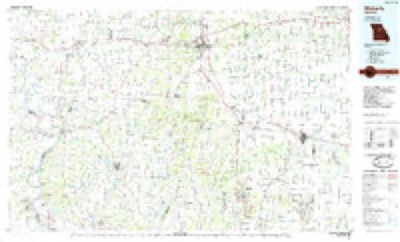
16 topographic sheets cover this place, the earliest surveyed in 1890 and the latest in 1985. It stands in Chariton Township. It lies in ZIP code area 65254. It stands on Greggs Creek. The Survey maps it on the Glasgow quadrangle.
On record in Glasgow
Buildings and businesses the archive holds for this place. Each opens its own page, with the source record it came from.
On the National Register 5 records
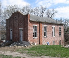 Campbell Chapel African Methodist Episcopal Churchlisted 1997
 Glasgow Commercial Historic Districtlisted 1992
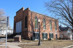 Glasgow Presbyterian Churchlisted 1982
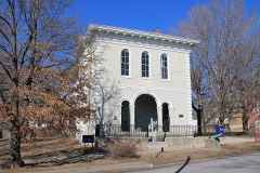 Glasgow Public Librarylisted 1969
- Inglewoodlisted 1990
Topographic sheets covering this place
8 surveys from 16 printed sheetsMatched by testing this settlement's coordinate against the published boundary of every sheet in the United States Geological Survey's historical collection. Each opens the scanned sheet at the Survey.
- 1890 USGS Glasgow quadrangle1:125000, 5 printings
- 1947 USGS Glasgow quadrangle1:62500, 2 printings
- 1953 USGS Moberly quadrangle1:250000
- 1954 USGS Moberly quadrangle1:250000, 3 printings
- 1957 USGS Moberly quadrangle1:250000
- 1960 USGS Moberly quadrangle1:250000
- 1971 USGS Glasgow quadrangle1:24000
- 1985 USGS Moberly quadrangle1:100000, 2 printings




Mines and quarries near this place
10 of 11 shownRegional context, not property-specific evidence. The federal mineral resources record lists 11 workings within 5 miles of Glasgow: 10 past producers, 1 producer. 1 still produces. What was taken out: Sand and Gravel, Construction, Stone, Crushed/Broken. Distance is straight-line from the map coordinates, so a quarry counted here may appear on a neighbouring settlement's page as well.
| Where | Site | Commodity | Status | Recorded |
|---|---|---|---|---|
| Unknown - Ls | Stone, Crushed/Broken | Past Producer | ||
| Unknown - Ls | Stone, Crushed/Broken | Past Producer | ||
| Unknown - Ls | Stone, Crushed/Broken | Past Producer | ||
| Yeager Quarry | Stone, Crushed/Broken | Past Producer | ||
| Glasgow Sand Pit | Sand and Gravel, Construction | Producer | ||
| Unknown - S+G | Sand and Gravel, Construction | Past Producer | ||
| Unknown - S+G | Sand and Gravel, Construction | Past Producer | ||
| Unknown - S+G | Sand and Gravel, Construction | Past Producer | ||
| Unknown - S+G | Sand and Gravel, Construction | Past Producer | ||
| Unknown - S+G | Sand and Gravel, Construction | Past Producer |
Storms near this place
16 since 1995Regional context, not property-specific evidence. The National Weather Service names Glasgow in 16 storm reports between 1995 and 2019: 8 hail, 6 thunderstorm wind, 1 tornado, 1 flood. No death or injury is recorded in these reports. Each account below is quoted exactly as the forecast office filed it, from the NOAA Storm Events Database, and each date opens the federal record of that event.
| When | Event | Place named | Harm | What the report says |
|---|---|---|---|---|
| March 2006 | Tornado (F3) | Glasgow | $450,000 | Tornado crossed from Saline county into Howard county...8 miles southwest of Glasgow at 2046 CST. F2 damage was noted to several farmsteads to the northwest of Fayette before the tornado dissipated at 2102 CST...2 miles east of Armstrong. |
| August 2000 | Thunderstorm Wind | Glasgow | $75,000 | Thunderstorm winds caused damage on several farms in northwestern Howard County. Several outbuildings were damaged, including a machine barn that was destroyed. A combine was damaged when part of the machine barn landed on it. Several large trees were downed, also damaging a house and a pickup truck. |
| August 2006 | Thunderstorm Wind | Glasgow | $5,000 | House roof damaged...several outbuildings damaged...and numerous trees down. |
| September 1995 | Thunderstorm Wind | Glasgow | $5,000 | A severe thunderstorm moved through the northern half of Howard county. Winds gusted up to 60 mph five miles east of Glasgow knocking down trees and destroying a utility shed. |
| April 2019 | Flood | Glasgow | - | Ongoing flooding along the Missouri River continued through the month of April and into May. Several roads were closed near the banks of the Missouri River. This flooding began in mid March and due to upstream releases and continued periods of heavy rain the flooding continued into May. Monetary damages are unknown despite the entry indicating 0 dollars of damages. |
| June 2017 | Thunderstorm Wind | Glasgow | - | Numerous large trees were down throughout the city. Utility poles were also snapped in half. |
| June 2017 | Thunderstorm Wind | Glasgow | - | Power lines and large trees limbs were down. |
| February 1999 | Thunderstorm Wind | Glasgow | - | Several large trees downed by thunderstorm winds. |
| June 1998 | Hail | Glasgow | - | Dime-size hail was reported by the public during a thunderstorm in Glasgow. |
| April 2014 | Hail | Glasgow | - | no account filed |
| April 2006 | Hail | Glasgow | - | no account filed |
| April 2006 | Hail | Glasgow | - | no account filed |
| August 2006 | Hail | Glasgow | - | no account filed |
| June 2005 | Hail | Glasgow | - | no account filed |
| April 2001 | Hail | Glasgow | - | no account filed |
| April 1999 | Hail | Glasgow | - | no account filed |
Nearest settlements
The eight closest, with where each one stands in the county. Distances are straight-line, computed from the Geographic Names Information System coordinates.
| Map | Place | Distance | Sheets |
|---|---|---|---|
| Steinmetz | 4.7 miles | 16 | |
| Armstrong | 8.2 miles | 15 | |
| Lisbon | 8.9 miles | 17 | |
| Fayette | 10.3 miles | 16 | |
| Boonesboro | 10.4 miles | 17 | |
| Petersburg | 11.9 miles | 17 | |
| Burton | 12.5 miles | 16 | |
| Estill | 13.5 miles | 15 |
Provenance
This settlement is recorded in the Geographic Names Information System as feature 718486. The sheet list is computed by point-in-boundary test against the United States Geological Survey's historical topographic inventory. Both are works of the United States government and carry no copyright under 17 U.S.C. 105.
Mines and quarries. USGS Mineral Resources Data System (MRDS) https://mrdata.usgs.gov/mrds/ A work of the United States government, no copyright under 17 U.S.C. 105.
Storms. NOAA National Centers for Environmental Information, Storm Events Database https://www.ncei.noaa.gov/stormevents/ A work of the United States government, no copyright under 17 U.S.C. 105. Narratives are quoted verbatim from the National Weather Service report and are not edited or summarised.