BlockBefore

Howard County, Missouri

32 topographic sheets cover 16 settlements here, and 25 properties are on the National Register of Historic Places.

Research this county

From the record

25 National Register listings published here · the county-history sources tell 2 stories and name 15 people · people the book names include Grkat Central F.Mr (Prairie Township, 1883) (machine-read).

Sources: the county history on the Internet Archive · the National Register database, National Park Service

Missouri within the United States
Howard County within Missouri

What the record shows

  • 255 topographic sheet readings cover the county's settlements.
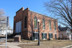
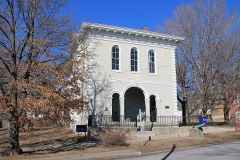
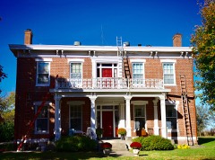
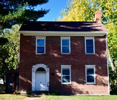
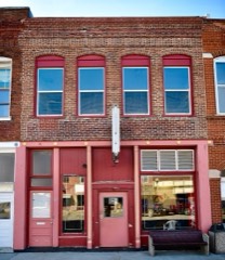
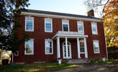
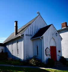
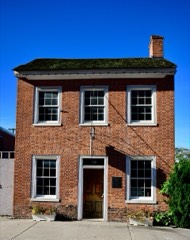
  • 25 properties here are on the National Register of Historic Places: 18 buildings, 6 districts and 1 site.
  • 2 of the 25 listings were added during the 1970s.
  • The Geographic Names Information System records 16 populated places in this county; 16 are covered by at least one topographic sheet.
  • 1 public-domain county history, 1883, supplies 59,164 words of narrative reproduced here.

What happened here

2 accounts

Among them: General Ignatius P. Owen; Lucky Killed Saffaeans. These passages come from the identified county-history source books. Each inset names its own source and opens the exact section it comes from.

From History of Howard and Chariton Counties, Missouri : Written and Compiled from the Most Official Authentic and Private Sources, Including a History of Its Townships, Towns, and Villages, Together with a Condensed History of Missouri .., published 1883 - Prairie Township

General Ignatius P. Owen

Davis was a. ji'.wver of some eminence, and afterwanU- tilled several important ofKcial positions in Howard count}'. General (.)wL'n had commanded the militia in the early history of the county, and had been honored with the title of lirigadier g'eneral. At tiie time lie was killed, he was the proprietor of a hotel which stood upion the corner now oceu})ied hv the Inisiness house, of Bonghner, Tolson i^ Smith.

Read the rest of this passage

From History of Howard and Chariton Counties, Missouri : Written and Compiled from the Most Official Authentic and Private Sources, Including a History of Its Townships, Towns, and Villages, Together with a Condensed History of Missouri .., published 1883 - Prairie Township

Lucky Killed Saffaeans

In the spring of 18.'i8, Fnoch Lucky killed Eiifus Saflarans. Lucky was a man well advanced in years, but strong and active for one of his age. Satfarans was young and stalwart, and physiealh' was said to be the equal of any man in the county. Both men frequented saloons when in Fayette, and had had one or two altercations when discussing their strength of limb and achievements as " fighters." On the day of tlie trau'ed}- they had been drinking, and nu't in a saloon, when Salf'arans took a walking cane from Lucky and beat him over the head and iiody, l)ruising him l)adly.

Read the rest of this passage

Places on the National Register

25

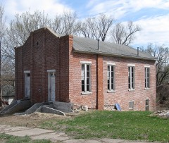
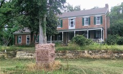
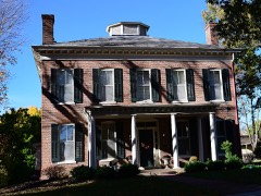
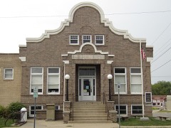
Every property in this county listed on the National Register of Historic Places, with the year it was listed and the federal nomination document.

Photograph PropertyType ListedReference
Edwin and Nora Payne Bedford Housebuilding199897001666
Boonslick State Parksite196969000104
Campbell Chapel African Methodist Episcopal Churchbuilding199797001427
Cedar Grovebuilding198282003140
Central Methodist College Campus Historic Districtdistrict198080002357
Coleman Hallbuilding198686001326
Fayette City Park Swimming Poolbuilding199999000457
Fayette Courthouse Square Historic Districtdistrict199898000069
Fayette Residential Historic Districtdistrict200909000681
Finks-Harvey Plantationbuilding197878001649
Glasgow Commercial Historic Districtdistrict199291001915
Glasgow Presbyterian Churchbuilding198282003141
Glasgow Public Librarybuilding196969000106
Greenwoodbuilding198383000994
Harris-Chilton-Ruble Housebuilding198080002359
Thomas Hickman Housebuilding200606000627
Inglewoodbuilding199090000981
Prior Jackson Homeplacebuilding198080002358
Alfred W. Morrison Housebuilding196969000105
New Franklin Commercial Historic Districtdistrict201312001207
Oakwoodbuilding198282003138
Rivercenebuilding197373001039
South Main Street Historic Districtdistrict199999000083
St. Mary's Episcopal Churchbuilding198282003139
Dr. Uriel S. Wright Officebuilding198787001727

Wildfire, 1993 to 2017

4 fires

Every wildfire the federal occurrence database records inside this county: 4 of them, burning about 66 acres. None started naturally and none was recorded as arson. Each settlement page carries the fires within five miles of it.

Reported cause Fires
Debris and open burning2
Missing data/not specified/undetermined1
Recreation and ceremony1

The five largest, by the area the report gives. None of them was recorded as arson.

DateCause SizeReported by Name on the report
6 February 2017Missing data/not specified/undetermined50 acresMissouri Department of Conservationnot named
21 May 1993Debris and open burning10 acresMissouri Department of Conservationnot named
21 May 1993Debris and open burning5.0 acresMissouri Department of Conservationnot named
12 April 2002Recreation and ceremony1.0 acresMissouri Department of Conservationnot named

Every settlement page carries the fires within five miles of it - see the settlement index below.

Storms, 1956 to 2025

60 of 228 shown

The NOAA Storm Events Database holds 228 reports for this county, causing no deaths, 1 injury and about $1,760,060 in recorded property damage. Each settlement page carries the reports that name it.

Kind of event Reports
Hail103
Thunderstorm Wind75
Flash Flood20
Flood19
Tornado10
Heavy Rain1

The most serious of them, by death, then injury, then recorded damage. The accounts are quoted exactly as the forecast office filed them.

WhenEvent Place namedHarm What the report says
May 1983Tornado (F1)not stated1 hurt, $250,000no account filed
March 2006Tornado (F3)Glasgow$450,000Tornado crossed from Saline county into Howard county...8 miles southwest of Glasgow at 2046 CST. F2 damage was noted to several farmsteads to the northwest of Fayette before the tornado dissipated at 2102 CST...2 miles east of Armstrong.
April 1981Tornado (F1)not stated$250,000no account filed
July 2002Thunderstorm WindFayette$200,000Downtown portions of Fayette, reported moderate to severe damage to several buildings, including a church and city hall. Large trees and power lines were also knocked down.
June 2019Flash FloodPetersburg$100,000The breakdown of the Howard County District #2 levee caused at least two other levees to fail, which caused more running water to enter into the farmlands of southern Howard County, as well as the towns of Franklin and New Franklin. The overall value of the damage from this event is unknown.
June 2019Flash FloodPetersburg$100,000This is a continuation of the flash flooding as a result of a levee failure near Petersburg, Missouri. Howard County District #2 levee failed the night before, allowing the already flooding Missouri River to spill into low lying areas of southern Howard County. Most of this area consisted of farmland, but the cities of Franklin and New Franklin received several inches of running water. News articles from across the local region indicated that crops planted earlier in the growing season in the southern part of the county were lost. Monetary damages are unknown from this flood event.
May 2019Flash FloodPetersburg$100,000Howard County District #2 levee failed allowing the already flooding Missouri River to spill into low lying areas of southern Howard County. Most of this area consisted of farmland, but the cities of Franklin and New Franklin received several inches of running water. News articles from across the local region indicated that crops planted earlier in the growing season in the southern part of the county were lost. Monetary damages are unknown from this flood event. This flash flooding event carried into the first couple days of June.
August 2000Thunderstorm WindGlasgow$75,000Thunderstorm winds caused damage on several farms in northwestern Howard County. Several outbuildings were damaged, including a machine barn that was destroyed. A combine was damaged when part of the machine barn landed on it. Several large trees were downed, also damaging a house and a pickup truck.
April 1993HailNew Franklin$50,000Tennis ball size hail broke several car windows and dented parked cars at a nearby lumber yard. The New Franklin Police Department and an area farmer reported 1.00-inch-diameter hail and smaller covering the ground as deep as 3 inches in and east of New Franklin.
April 2006HailFayette$50,000no account filed
September 1959Tornado (F2)not stated$25,000no account filed
June 2001Thunderstorm WindBurton$10,000no account filed
March 2006Thunderstorm WindNew Franklin$5,000Roof damage reported.
August 2006Thunderstorm WindGlasgow$5,000House roof damaged...several outbuildings damaged...and numerous trees down.
September 1995Thunderstorm WindGlasgow$5,000A severe thunderstorm moved through the northern half of Howard county. Winds gusted up to 60 mph five miles east of Glasgow knocking down trees and destroying a utility shed.
June 1995Thunderstorm WindFayette$5,000Severe thunderstorms produced damaging winds which downed numerous trees and power lines in Fayette.
June 1994Thunderstorm WindNew Franklin$5,000Numerous power lines and poles were blown down.
March 1993HailNew Franklin$5,000Reported by the New Franklin Police Department.
March 1993Thunderstorm WindNew Franklin$5,000Reported by the New Franklin Police Department.
March 1993HailHarrisburg$5,000Reported by the Boone County Sheriff's Office.
April 2011Thunderstorm WindArmstrong$4,000A metal roof was blown off a house. Thunderstorm wind gusts were estimated up to 70 mph.
July 2004Thunderstorm WindFayette$2,000Numerous trees and power lines down.
July 1995Thunderstorm WindFayette$2,000Howard County Sheriff's Office reported a downed pole on the west side of Fayette. There were also several reports of small hail throughout Howard County.
August 2005Thunderstorm WindNew Franklin$1,000Power lines downed.
June 2013Thunderstorm WindNew Franklin$500A large tree was reported uprooted, with several smaller trees snapped off. A carport was lifted up and then blown down. Thunderstorm wind gusts were estimated up to 60 mph.
May 2013Thunderstorm WindNew Franklin$500Thunderstorm winds gusted up to 60 mph, with damage observed to a carport, that was lifted into the air and and blown down. A large tree was uprooted and several smaller trees were also snapped off.
May 1966Tornado (F0)not stated$30no account filed
June 1958Tornado (F0)not stated$30no account filed
June 2025Thunderstorm WindNew Franklin-Downed tree and wires near Chancellor Street in New Franklin.
June 2025Thunderstorm WindFayette Fld Arpt-Several downed trees and wires near County Road 419 south of Fayette.
June 2025Thunderstorm WindFayette Fld Arpt-Multiple broken power poles south of Fayette.
June 2025Thunderstorm WindNorth Boonville-Downed wires near County Road 345 near Franklin/New Franklin.
June 2025Thunderstorm WindHilldale-Downed wires near County Road 433 near Rocheport.
June 2025Thunderstorm WindFayette Fld Arpt-Downed tree limbs and wires near Route 240.
June 2025Thunderstorm WindSteinmetz-Downed wires and power outages in the Glasgow area.
June 2025Thunderstorm WindNew Franklin-Downed tree and wires near County Road 448.
July 2025Thunderstorm WindFayette-MPING report of trees down Herndon Street.
September 2025Thunderstorm WindNew Franklin-Multiple tree limbs and wires down just north of New Franklin.
September 2025Thunderstorm WindFayette Fld Arpt-Several reports of downed wires and power outages southeast of Fayette.
September 2025Thunderstorm WindBurton-Multiple reports of downed powerlines near Route A south of Bunker Hill.
September 2025Thunderstorm WindNew Franklin-Social media photos of multiple trees and limbs down between Franklin and New Franklin.
September 2025Thunderstorm WindFranklin-Several reports of downed power lines northwest of New Franklin.
September 2025Thunderstorm WindEstill-Power Pole downed in rural Howard County.
June 2024Thunderstorm WindFayette-Large tree limbs and power wires down across Fayette with power outages. Large tree downed at Highway 124 and 101.
June 2024Thunderstorm WindNew Franklin-Tree limbs and wires down with power outages.
April 2023HailNorth Boonville-Hen egg sized hail was reported near New Franklin.
April 2023HailNew Franklin-Hen egg sized hail was reported in New Franklin.
March 2023HailBurton-Three inch hail fell near Fayette. No damage was reported with this hail report.
November 2020Thunderstorm WindFayette-Law enforcement dispatch reported a tree over County Road 209, just north of Fayette.
June 2020FloodFranklin-State Highway Z was closed due to flooding.
June 2020FloodBurton-State Highway H was closed due to flooding.
June 2020FloodHilldale-State Highway 124 was closed near Moniteau Creek due to flooding.
April 2019FloodGlasgow-Ongoing flooding along the Missouri River continued through the month of April and into May. Several roads were closed near the banks of the Missouri River. This flooding began in mid March and due to upstream releases and continued periods of heavy rain the flooding continued into May. Monetary damages are unknown despite the entry indicating 0 dollars of damages.
June 2019FloodGlasgow Arpt-Heavy spring rains caused ongoing flooding along the Missouri River to Continue through the month. Some locations along the Missouri River experienced major flooding at times during the month. Damage estimates from roads washed out and crop damage are unknown at this time.
May 2019FloodNorth Boonville-Heavy spring rains caused ongoing flooding along the Missouri River to Continue through the month. Some locations along the Missouri River experienced major flooding at times during the month. Damage estimates from roads washed out and crop damage are unknown at this time.
May 2019Tornado (EF0)Armstrong-A weak and brief tornado formed near Armstrong. Little to no damage and no injuries were reported as a result of this tornado.
May 2018Thunderstorm WindHilldale-Trees were reported down along HWY 124 near Fayette.
June 2017Thunderstorm WindGlasgow-Numerous large trees were down throughout the city. Utility poles were also snapped in half.

Mines and quarries

28 recorded

The Survey's mineral resources record lists 28 workings inside this county. 2 still produce and 26 are closed or unrecorded. Each settlement page carries the workings within five miles of it.

Commodity Workings
Stone, Crushed/Broken26
Sand and Gravel, Construction1
Barium-Barite1

The least common of them first, because a county's hundredth gravel pit says nothing its first ten did not.

Where SiteCommodity StatusRecorded
Glasgow Sand PitSand and Gravel, ConstructionProducer
Unknown - BariteBarium-BaritePast Producer
Alkive QuarryStone, Crushed/BrokenPast Producer
Cox QuarryStone, Crushed/BrokenPast Producer
Glasgow Quarry and MillStone, Crushed/BrokenProducer
Hall + Riley QuarryStone, Crushed/BrokenPast Producer
Klusmeyer MineStone, Crushed/BrokenPast Producer
Old QuarryStone, Crushed/BrokenPast Producer
Unknown - LsStone, Crushed/BrokenPast Producer
Yeager QuarryStone, Crushed/BrokenPast Producer

The townships, in 1883

59,164 words

History of Howard and Chariton Counties, Missouri : Written and Compiled from the Most Official Authentic and Private Sources, Including a History of Its Townships, Towns, and Villages, Together with a Condensed History of Missouri .. devotes a chapter to each township: its boundaries and streams, who settled it and when, the mills, the schools and the churches. The one chapter is reproduced here in full. Each row shows the township's own shape and where it lies in the county, drawn from the Census Bureau's boundary. Which settlements belong to which township is computed from that same boundary, not taken from the book.

Shape and position in the county TownshipSettlements in it LengthSections
Prairie TownshipArmstrong, Steinmetz59,164 words78

The county's history books

54,838 words

One book written about this county, cut here where the book itself is cut, at its printed chapters: 2 chapters in all. Every chapter is public domain, machine-read from the scan and reproduced complete. A chapter already given under one of the county's towns is not repeated in this list.

History of Howard and Chariton Counties, Missouri : Written and Compiled from the Most Official Authentic and Private Sources, Including a History of Its Townships, Towns, and Villages, Together with a Condensed History of Missouri .. (1883)

The people it describes

15 named

Everyone History of Howard and Chariton Counties, Missouri : Written and Compiled from the Most Official Authentic and Private Sources, Including a History of Its Townships, Towns, and Villages, Together with a Condensed History of Missouri .. stops to write about, with the section that describes them. Among them are the men who founded the place and governed the Territory. Each name opens the passage itself, in the words of 1883.

Every populated place in the county

16

Named settlements recorded in the Geographic Names Information System, each with the topographic sheets covering it. Villages, hamlets and abandoned places alike. Each is shown with the nearest named watercourse or landform and the survey quadrangle it falls on.

The vanished settlements of Howard County: the places named above that are no longer on the map.

Provenance

  • Topographic sheets. USGS Historical Topographic Map Collection, county index, measured from the bulk metadata.
  • Fire insurance maps. Library of Congress Sanborn collection, faceted to this county.
  • Photographs. Each place queried individually against the Library of Congress Prints and Photographs search.
  • Wildfire. Short, Karen C. 2022. Spatial wildfire occurrence data for the United States, 1992-2020 [FPA_FOD_20221014]. 6th Edition. Fort Collins, CO: Forest Service Research Data Archive. https://doi.org/10.2737/RDS-2013-0009.6 Collected with United States Government funding and usable without additional permissions or fees.
  • Mines and quarries. USGS Mineral Resources Data System (MRDS) https://mrdata.usgs.gov/mrds/ A work of the United States government, no copyright under 17 U.S.C. 105.
  • Storms. NOAA National Centers for Environmental Information, Storm Events Database https://www.ncei.noaa.gov/stormevents/ A work of the United States government, no copyright under 17 U.S.C. 105. Narratives are quoted verbatim from the National Weather Service report and are not edited or summarised.