 Block
Green Ridge, Missouri
19 topographic sheets cover this place, the earliest surveyed in 1887 and the latest in 1983. It stands in Green Ridge Township. It lies in ZIP code area 65332. The Survey maps it on the Green Ridge South quadrangle. 468 people lived here at the 2020 count. It stands 902 feet above sea level.
Population over time
2 figuresGreen Ridge fell from 476 to 468 between 2010 and 2020. These are the recorded population figures Wikidata holds for this place, reached through the Geographic Names Information System number this page is keyed on rather than by name, so they belong to this place and not to another of the same name. Most are census counts, but not all are: an early figure may be a founding or settlement estimate, and an estimate published within five years of a census is left out. The change column is computed, and is left blank where more than 20 years separate a figure from the one before it, because a gap that long is not a change between two counts.
| Year | People | Change |
|---|---|---|
| 2010 | 476 | |
| 2020 | 468 | -8 (-2%) |
Topographic sheets covering this place
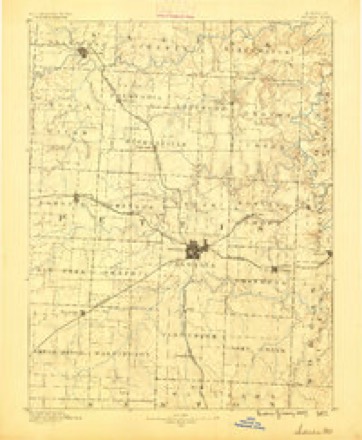
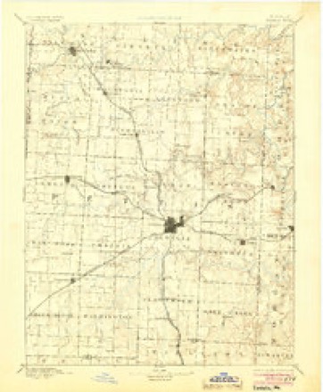
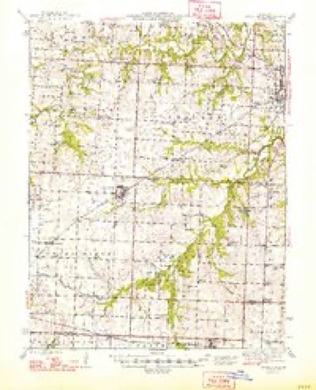
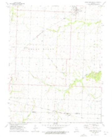
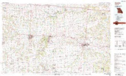
10 surveys from 19 printed sheetsMatched by testing this settlement's coordinate against the published boundary of every sheet in the United States Geological Survey's historical collection. Each opens the scanned sheet at the Survey.
- 1887 USGS Sedalia quadrangle1:125000
- 1894 USGS Sedalia quadrangle1:125000, 5 printings
- 1947 USGS Jefferson City quadrangle1:250000
- 1948 USGS Green Ridge quadrangle1:62500, 2 printings
- 1954 USGS Jefferson City quadrangle1:250000, 2 printings
- 1955 USGS Jefferson City quadrangle1:250000, 4 printings
- 1958 USGS Jefferson City quadrangle1:250000
- 1959 USGS Jefferson City quadrangle1:250000
- 1973 USGS Green Ridge South quadrangle1:24000
- 1983 USGS Sedalia quadrangle1:100000





In the county-history sources
8,944 words on this townshipThe History of Pettis County, Missouri, Including an Authentic History of Sedalia, Other Towns and Townships, Together with ... Biographical Sketches .., published 1882 names this settlement in its chapter on Green Ridge Township. These are the passages that mention it, exactly as the scans read.
The subject of this sketch, Mr. Bell, was born in Paris, Edj^ar County, Ills., Sept. 4. 1835, where, until twenty years of age, he resided upon a farm. At that age, in 1855, he came to Green Ridge Township, Pettis County, Mo., and entered 320 acres of government land at $1.25 per acre. He was married in Johnson County, Mo., in 1857, to Miss Nanc3^ J. Coats, a native of Fulton, in this State. The result of this marriage is five children, viz: James O., John, Lillie, Robt. B. and Benjamin F. Mr. Bell died Sept. 20, 1873, in the faith of the gospel, having been a member of the O. S. Presbyterian church since his seventeenth year. John Coats, the father of Mrs. Bell, was the first sheriff of Callaway County, upon whom the duty of hanging a criminal devolved, and her mother, now living in Johnson County in her seventy-eighth year, rode on the first boat that came up the Missouri River. Mrs. Bell and her children have charge of a large and well improved farm.
Passage source: The History of Pettis County, Missouri, Including an Authentic History of Sedalia, Other Towns and Townships, Together with ... Biographical Sketches .., published 1882.
The subject of this sketch, Mr. Christian, was born near Lexington, Fayette County, Ky., in 1831. His father brought him, when but nine years old, to Boone County, Mo., and settled on a farm near Ashland, and the subject of our sketch became inured there to farm life and obtained an excellent education at the neighborhood schools. In 1852 he was married in that county to Miss Mary Black, and in 1854, with his small family, he came to Green Ridge Township, Pettis County, where he bought and improved his farm. But in 1861 his wife returned to Boone County, Mo., with her children, and died near Ashland in 1863, leaving four children, viz: David M., Louamma A., Katie and William S. At the beginning of the hostilities in 1861, Mr. Christian espoused the Confederate cause, and joined Col. B. F. Gordon's regiment, in the brigade of Gen. J. O. Shelby, so distinguished for raids and desperate fighting in concert with and independent of Gen. Sterling Price. But Mr. Christian obtained a transfer to Price's escort in the fall of 1863, with which he remained until the war closed. He participated in all the principal battles fought by Gen. Price, and surrendered with his comrades at Shreveport, La. He then returned to Boone County, Mo., gathered up the surviving members of his family, and in the fall of 1865 was again industriously laboring to repair his broken fortunes upon his farm in Pettis County, Mo. He was married the second time Dec. 24, 1865, in Callaway County, this State, to Miss JuHa A. Blythe, a native resident of said county. Through this union they have eight children, viz: Churchill, Sallie, Samuel M., Thomas, John, Charles R., Frank H. and Edmund F. Another child, Lee, died in November, 1871. Mr. Christian still suffers from a fever contracted while following the hard life of a soldier in 1862. He was taken prisoner once during the war, near Huntsville, on the War Eagle River, in Arkansas, but was released immediately afterwards and returned to his regiment. He has been a member of the Baptist Church for thirty-one years; his wife also has been a member for twenty odd years. He is an industrious farmer and very popular in his neighborhood.
Passage source: The History of Pettis County, Missouri, Including an Authentic History of Sedalia, Other Towns and Townships, Together with ... Biographical Sketches .., published 1882.
Mr. Doherty was born May 22, 1841, in Kilkenny County, Ireland, where he lived until he was ten years old, attending the private schools. May 4, 1854, having crossed the Atlantic Ocean, he located at Peoria, 111., and during the seven years of his residence there he attended school. He then went to Livingston County, 111., where he rented a farm and followed that vocation for seven years. During part of this time he was constable of Pike Township, Livingston County. Mr. D. was married Oct. 1.5, 1865, to Miss Elizabeth Murphy, a native of Columbus, O. They have five children living, Edward W., Katie, Jno. T., Mar}- E. and Clarence J., and one dead, Nellie, who departed from this life in 1877. In November, 1868, he removed to Green Ridge Township, Pettis County, Mo., where he purchased a farm of 160 acres of land. He now has 480. He also has 100 head of steers, six cows, ten head of horses and a house whose elegance is in keeping with the surroundings, proving that all who come across the waters to America do not come here in vain.
Passage source: The History of Pettis County, Missouri, Including an Authentic History of Sedalia, Other Towns and Townships, Together with ... Biographical Sketches .., published 1882.
Machine-read from a century-old scan, so expect the errors a machine makes: misspelled names, dropped words, stray characters.
Read the whole chapter on Green Ridge Township - it names this place 22 more 22 times.
Fires near this place
22 since 1994Regional context, not property-specific evidence. The federal wildfire occurrence database lists 22 fires within 5 miles of Green Ridge between 1994 and 2020, burning about 76 acres in total. None started naturally. 3 were recorded as arson. Distance is straight-line from the map coordinates, so a fire counted here may appear on a neighbouring settlement's page as well.
| Reported cause | Fires |
|---|---|
| Debris and open burning | 9 |
| Missing data/not specified/undetermined | 6 |
| Equipment and vehicle use | 3 |
| Arson/incendiarism | 3 |
| Power generation/transmission/distribution | 1 |
The most recent of them, most recent first, with the day each was reported and the service that recorded it.
| Date | Cause | Size | Reported by | Name on the report |
|---|---|---|---|---|
| 30 September 2020 | Debris and open burning | 3.7 acres | Missouri Department of Conservation | 230786-08048-09302020-1600 |
| 24 September 2020 | Missing data/not specified/undetermined | under an acre | Missouri Department of Conservation | 230728-04281-09242020-1407 |
| 8 August 2018 | Equipment and vehicle use | under an acre | Missouri Department of Conservation | 178044-08048-08082018-1658 |
| 15 August 2020 | Missing data/not specified/undetermined | under an acre | Missouri Department of Conservation | 220623-08048-08152020-1945 |
| 5 May 2020 | Power generation/transmission/distribution | under an acre | Missouri Department of Conservation | 200513-08048-05052020-1400 |
| 26 April 2018 | Missing data/not specified/undetermined | under an acre | Missouri Department of Conservation | 178043-08048-04262018-2212 |
| 7 March 2018 | Missing data/not specified/undetermined | under an acre | Missouri Department of Conservation | 178040-08048-03072018-1356 |
| 3 March 2018 | Debris and open burning | under an acre | Missouri Department of Conservation | 178038-08048-03032018-1138 |
Settlements close enough to share some of these fires:
Mines and quarries near this place
1 within 5 milesRegional context, not property-specific evidence. The federal mineral resources record lists 1 working within 5 miles of Green Ridge: 1 past producer. None of them still produces. What was taken out: Stone, Crushed/Broken. Distance is straight-line from the map coordinates, so a quarry counted here may appear on a neighbouring settlement's page as well.
| Where | Site | Commodity | Status | Recorded |
|---|---|---|---|---|
| Unknown - Ls | Stone, Crushed/Broken | Past Producer |
Storms near this place
40 since 1997Regional context, not property-specific evidence. The National Weather Service names Green Ridge in 40 storm reports between 1997 and 2025: 22 hail, 10 thunderstorm wind, 3 flash flood, 3 tornado. The reports record 2 deaths and 6 injuries. Each account below is quoted exactly as the forecast office filed it, from the NOAA Storm Events Database, and each date opens the federal record of that event.
| When | Event | Place named | Harm | What the report says |
|---|---|---|---|---|
| March 2006 | Tornado (F2) | Green Ridge | 1 killed, 6 hurt, $2,500,000 | F2 tornado touched down 6.5 miles east of Green Ridge at 1612 CST and moved northeast. The tornado caused the death of one woman...when the trailer she was fleeing was blown on top of her. Another 6 people were injured as well. Numerous homes suffered varying degrees of damage. The tornado lifted one mile southwest of Smithton at 1625 CST. |
| March 2006 | Tornado (F1) | Green Ridge | 1 killed, $450,000 | Tornado touched down at 2028 CST 2 miles northwest of green Ridge producing damage to trees. The tornado traveled northeast and crossed Highway 50 just west of Sedalia. It produced high end F0 damage to a Morton Building and to a farmstead. Low end F1 damage was noted to a home 3 miles north of Sedalia...just west of Highway 65...where a modular home lost its roof and a large calenabra on a broadcast tower was bent. The tornado damaged a total of 57 homes, with one being completely destroyed. The tornado lifted after this at 2042 CST. A 66 year old man injured in the tornado, died from his injuries on June 15th. |
| May 2000 | Lightning | Green Ridge | $10,000 | Lightning struck a transformer near Green Ridge. |
| July 2010 | Thunderstorm Wind | Green Ridge | $1,000 | Thunderstorm wind gusts were estimated up to 70 mph. The high winds knocked down 2 foot diameter trees, and also brought down power lines. |
| September 2025 | Thunderstorm Wind | Green Ridge | - | Personal Weather Station measured a 52 knot wind gust in Green Ridge. |
| March 2022 | Thunderstorm Wind | Green Ridge | - | Several tree branches were down, along with damage to a shed. |
| June 2021 | Thunderstorm Wind | Green Ridge | - | Public estimated 60 to 65 mph wind near Green Ridge. |
| August 2019 | Thunderstorm Wind | Green Ridge | - | A large tree was down. This report was gathered via Facebook. |
| September 2019 | Flash Flood | Green Ridge | - | Sheriff's office reported a foot to a foot and a half of water flowing over Highway 127 just south of Green Ridge. |
| October 2017 | Thunderstorm Wind | Green Ridge | - | The public reported a 65 mph wind gust near Green Ridge. |
| March 2017 | Thunderstorm Wind | Green Ridge | - | Power lines were down across HWY 127 near Green Ridge. |
| March 2017 | Thunderstorm Wind | Green Ridge | - | Powerlines were down across the roadway near Green Ridge. |
| July 2016 | Thunderstorm Wind | Green Ridge | - | Winds were estimated at 60 mph. |
| July 2015 | Thunderstorm Wind | Green Ridge | - | Six inch tree limbs were blown down. |
| July 2010 | Flash Flood | Green Ridge | - | The emergency manager reported one and a half feet of water over Highway 127. |
| March 2006 | Tornado (F0) | Green Ridge | - | F0 tornado crossed from Johnson county into Pettis county 5 miles west of Green Ridge at 2024 CST. The tornado dissipated 2 miles northwest of Green Ridge at 2027 CST. No significant damage was observed. |
| January 2005 | Flash Flood | Green Ridge | - | Highway 127 flooded. |
| June 1998 | Hail | Green Ridge | - | Pettis County spotters reported dime-size hail at Green Ridge and 5 miles north of Greenridge. |
| June 1997 | Flood | Green Ridge | - | Heavy rain from slow moving thunderstorms resulted in a foot of water building over Highway 127 and Route B. |
| July 2018 | Hail | Green Ridge | - | no account filed |
| May 2018 | Hail | Green Ridge | - | no account filed |
| May 2017 | Hail | Green Ridge | - | no account filed |
| February 2017 | Hail | Green Ridge | - | no account filed |
| August 2016 | Hail | Green Ridge | - | no account filed |
| March 2014 | Hail | Green Ridge | - | no account filed |
| March 2014 | Hail | Green Ridge | - | no account filed |
| May 2013 | Hail | Green Ridge | - | no account filed |
| February 2009 | Hail | Green Ridge | - | no account filed |
| May 2009 | Hail | Green Ridge | - | no account filed |
| April 2007 | Hail | Green Ridge | - | no account filed |
| March 2006 | Hail | Green Ridge | - | no account filed |
| April 2005 | Hail | Green Ridge | - | no account filed |
| June 2005 | Hail | Green Ridge | - | no account filed |
| May 2003 | Hail | Green Ridge | - | no account filed |
| May 2002 | Hail | Green Ridge | - | no account filed |
| April 2001 | Hail | Green Ridge | - | no account filed |
| April 2001 | Hail | Green Ridge | - | no account filed |
| June 2001 | Hail | Green Ridge | - | no account filed |
| March 2000 | Hail | Green Ridge | - | no account filed |
| May 2000 | Hail | Green Ridge | - | no account filed |
Nearest settlements
The eight closest, with where each one stands in the county. Distances are straight-line, computed from the Geographic Names Information System coordinates.
| Map | Place | Distance | Sheets |
|---|---|---|---|
| Bryson | 4.6 miles | 19 | |
| Manila | 6.1 miles | 19 | |
| Spring Fork | 9.5 miles | 18 | |
| Dresden | 9.9 miles | 23 | |
| La Monte | 10.7 miles | 23 | |
| Sedalia | 11.2 miles | 22 | |
| Georgetown | 13.2 miles | 18 | |
| Bahner | 15.3 miles | 18 |
Elsewhere
Matched on this settlement's Geographic Names Information System number rather than its name, so it cannot be a different place of the same name in another state.
| Wikipedia article on Green Ridge | An encyclopaedic summary. Its text is share-alike, so it is linked here rather than copied. |
| Wikidata item Q952655 | The structured record the population and elevation above come from. Public domain (CC0). |
Provenance
This settlement is recorded in the Geographic Names Information System as feature 729748. The sheet list is computed by point-in-boundary test against the United States Geological Survey's historical topographic inventory. Both are works of the United States government and carry no copyright under 17 U.S.C. 105.
Wildfire. Short, Karen C. 2022. Spatial wildfire occurrence data for the United States, 1992-2020 [FPA_FOD_20221014]. 6th Edition. Fort Collins, CO: Forest Service Research Data Archive. https://doi.org/10.2737/RDS-2013-0009.6 Collected with United States Government funding and usable without additional permissions or fees.
Mines and quarries. USGS Mineral Resources Data System (MRDS) https://mrdata.usgs.gov/mrds/ A work of the United States government, no copyright under 17 U.S.C. 105.
Storms. NOAA National Centers for Environmental Information, Storm Events Database https://www.ncei.noaa.gov/stormevents/ A work of the United States government, no copyright under 17 U.S.C. 105. Narratives are quoted verbatim from the National Weather Service report and are not edited or summarised.