 Block
Sedalia, Missouri
22 topographic sheets cover this place, the earliest surveyed in 1887 and the latest in 1983. It stands in Sedalia Township. It lies in ZIP code area 65301. It stands on North Branch Pearl River. The Survey maps it on the Sedalia East quadrangle. 21,725 people lived here at the 2020 count. It stands 909 feet above sea level.
Research this city
On record in Sedalia
Buildings and businesses the archive holds for this place. Each opens its own page, with the source record it came from.
On the National Register 12 of 16 shown
 Building at 217 West Main Streetlisted 1996
 G and G Veterinary Hospitallisted 2011
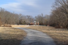 William H. Gentry Houselisted 1997
 Harris Houselisted 1979
 John T. and Lillian Heard Houselisted 2011
 Hotel Bothwelllisted 1989
 C.C. Hubbard High Schoollisted 1997
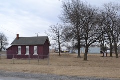 McVey Schoollisted 1999
 Missouri, Kansas and Texas Railroad Depotlisted 1979
 Missouri/Sedalia Trust Companylisted 1983
 Sedalia Public Librarylisted 1980
- Henry Jones Farmsteadlisted 2008
Population over time
2 figuresSedalia grew from 21,387 to 21,725 between 2010 and 2020. These are the recorded population figures Wikidata holds for this place, reached through the Geographic Names Information System number this page is keyed on rather than by name, so they belong to this place and not to another of the same name. Most are census counts, but not all are: an early figure may be a founding or settlement estimate, and an estimate published within five years of a census is left out. The change column is computed, and is left blank where more than 20 years separate a figure from the one before it, because a gap that long is not a change between two counts.
| Year | People | Change |
|---|---|---|
| 2010 | 21,387 | |
| 2020 | 21,725 | +338 (+2%) |
Topographic sheets covering this place
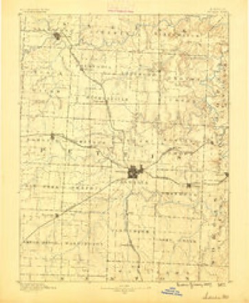
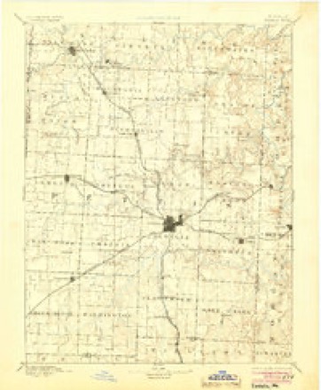
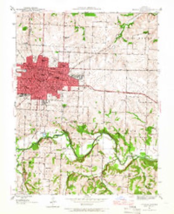
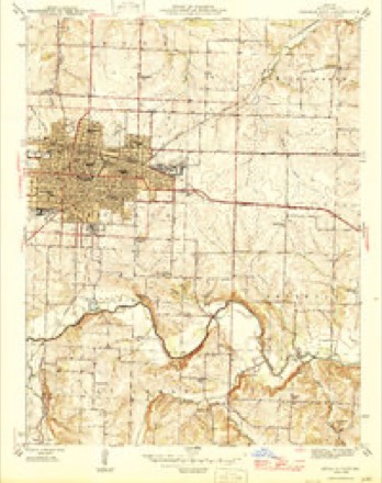
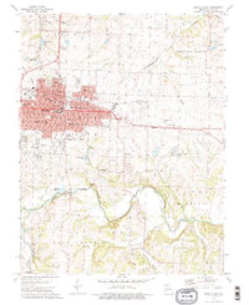
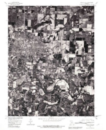
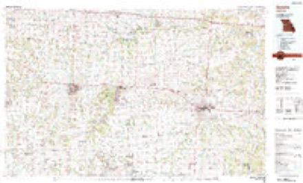
12 surveys from 22 printed sheetsMatched by testing this settlement's coordinate against the published boundary of every sheet in the United States Geological Survey's historical collection. Each opens the scanned sheet at the Survey.
- 1887 USGS Sedalia quadrangle1:125000
- 1894 USGS Sedalia quadrangle1:125000, 5 printings
- 1944 USGS Sedalia East quadrangle1:24000
- 1946 USGS Sedalia East quadrangle1:24000, 2 printings
- 1947 USGS Jefferson City quadrangle1:250000
- 1954 USGS Jefferson City quadrangle1:250000, 2 printings
- 1955 USGS Jefferson City quadrangle1:250000, 4 printings
- 1958 USGS Jefferson City quadrangle1:250000
- 1959 USGS Jefferson City quadrangle1:250000
- 1973 USGS Sedalia East quadrangle1:24000, 2 printings
- 1980 USGS Sedalia East quadrangle1:24000
- 1983 USGS Sedalia quadrangle1:100000





In the county-history sources
986 words on this townshipThe History of Pettis County, Missouri, Including an Authentic History of Sedalia, Other Towns and Townships, Together with ... Biographical Sketches .., published 1882 names this settlement in its chapter on Sedalia Township. These are the passages that mention it, exactly as the scans read.
The volume has greatly exceeded the limits originally intended. In the prospectus it was promised that the book should contain from TOO to 900 pages, but it has been found impossible to comprise the material in less than 1,120 pages. The history of Sedalia has been written and prepared complete in itself, expressly for this volume, chiefly from the able pen of Mr. I. Mac D. Demuth, who has long lived amid the scenes he describes, and to whom, with two other prominent, well-informed citizens, the proof-sheets were all submitted for corrections.
Passage source: The History of Pettis County, Missouri, Including an Authentic History of Sedalia, Other Towns and Townships, Together with ... Biographical Sketches .., published 1882.
Among the many worthy advocates of progress and enterprises in Pettis Count}', the publishers desire to express their grateful acklowledgments to F. A. Sampson, Esq., for the chapter on Natural History and correcting the proof-sheets of Sedalia history; to I. Mac D. Demuth for much ot Sedalia's history; to Rev. Dr. John Montgomery for the history of the Presbyterian Church; to Rev. John Letts for the history of the Baptist Church; to Rev. A. H. Stevens for the history of the Cumberland Presbyterian Church; to Elder J. H. Duncan for the history of the Christian Church; to Rev. J. B. Fuller, Rev. G. A. Beattie, Rev. H. R. Miller, Rev. R. A. Johns and others for church history; Mr. C. A. Leach for the chapter on Courts and Bar, also the chapter on Pettis Countv Live Stock; to Col. A. D. Jaynes, Col. Thomas F. Houston, Maj. William Gentry, R. W. Gentry, Dr. J. W. Trader, O. A. Crandall, the custodians of the county records, to the editors of the several newspapers and to many others, by whose liberal support and material aid the work has been carried foward to a successful completion, to all and singular much credit is due, and many thanks are tendered by
Passage source: The History of Pettis County, Missouri, Including an Authentic History of Sedalia, Other Towns and Townships, Together with ... Biographical Sketches .., published 1882.
Machine-read from a century-old scan, so expect the errors a machine makes: misspelled names, dropped words, stray characters.
Mines and quarries near this place
10 of 23 shownRegional context, not property-specific evidence. The federal mineral resources record lists 23 workings within 5 miles of Sedalia: 22 past producers, 1 producer. 1 still produces. What was taken out: Stone, Crushed/Broken. Distance is straight-line from the map coordinates, so a quarry counted here may appear on a neighbouring settlement's page as well.
| Where | Site | Commodity | Status | Recorded |
|---|---|---|---|---|
| Biggs Quarry | Stone, Crushed/Broken | Past Producer | ||
| Bradford Quarry No 2 & Plant | Stone, Crushed/Broken | Producer | ||
| Dunham Quarry | Stone, Crushed/Broken | Past Producer | ||
| Jenkins Quarry | Stone, Crushed/Broken | Past Producer | ||
| Johnson Quarry | Stone, Crushed/Broken | Past Producer | ||
| Main Road Quarry | Stone, Crushed/Broken | Past Producer | ||
| Mcenroe Quarry | Stone, Crushed/Broken | Past Producer | ||
| Rymer Brothers Quarry | Stone, Crushed/Broken | Past Producer | ||
| Unknown - Ls | Stone, Crushed/Broken | Past Producer | ||
| Unknown - Ls | Stone, Crushed/Broken | Past Producer |
Storms near this place
60 of 127 shownRegional context, not property-specific evidence. The National Weather Service names Sedalia in 127 storm reports between 1993 and 2025: 62 thunderstorm wind, 47 hail, 9 flash flood, 5 tornado. The reports record 22 injuries. Each account below is quoted exactly as the forecast office filed it, from the NOAA Storm Events Database, and each date opens the federal record of that event.
| When | Event | Place named | Harm | What the report says |
|---|---|---|---|---|
| May 2011 | Tornado (EF2) | Sedalia | 20 hurt, $4,000,000 | At 1122CST an EF2 tornado touched down 2.7 miles south southeast of Sedalia. The tornado traveled north, and lifted 0.7 miles southeast of Sedalia at 1128CST. Heavy damage to several businesses, was observed along highway 65, with 70 mobile homes in two different mobile home parks, destroyed or heavily damaged. Several homes were also damaged or destroyed. A tanker truck was overturned. Power poles were snapped off. Twenty people suffered minor injuries. |
| May 2003 | Tornado (F0) | Sedalia | 2 hurt, $2,000 | Tornado from Johnson county continued into Pettis county, tracking north of Green Ridge and just south and southeast of Sedalia. Large concrete I-blocks were overturned and trees uprooted. Two men were slightly injured as they sought shelter in a shed east of Sedalia. |
| March 2006 | Hail | Sedalia | $2,000,000 | Extensive hail damage noted in Sedalia, where golfball hail piled up into 2 feet drifts. Many roofs in town had to be replaced. |
| April 1999 | Thunderstorm Wind | Sedalia | $75,000 | Thunderstorm winds knocked down a pole barn and several large signs; 7 vehicles were damaged |
| June 1994 | Hail | Sedalia | $50,000 | Large hail fell on many locations in the north side of Sedalia and north of town. |
| September 1993 | Thunderstorm Wind | Sedalia | $50,000 | Wind gusts to 60 mph in Sedalia and 80 mph 3 miles west of Sedalia downed numerous trees and several power lines. |
| April 1995 | Thunderstorm Wind | Sedalia | $30,000 | Golf ball-sized hail fell in Sedalia, accompanied by winds up to 65 mph. |
| July 2004 | Thunderstorm Wind | Sedalia | $25,000 | Numerous trees blown down with 10 houses sustaining damage from falling trees. |
| June 2011 | Thunderstorm Wind | Sedalia | $20,000 | Thunderstorm wind gusts were estimated up to 70 mph. A roof came off one home and landed on another. |
| April 1995 | Hail | Sedalia | $15,000 | Golf ball-sized hail fell in Sedalia, accompanied by winds up to 65 mph. |
| July 2005 | Thunderstorm Wind | Sedalia | $10,000 | Tree fell on a car. |
| May 2000 | Lightning | Sedalia | $10,000 | Lightning struck a transformer on the north side of Sedalia. |
| June 2000 | Thunderstorm Wind | Sedalia | $10,000 | Winds estimated at 70 mph downed numerous large trees and power lines near Sedalia. |
| May 2010 | Tornado (EF0) | Sedalia | $8,000 | An EF0 tornado touched down at 17:46 CST about one mile southwest of Sedalia. The tornado was on the ground for 3 minutes, and lift at 17:49 CST, aorund a half mile southwest of Sedalia. Emergency manager reported some minor roof and shingle damage to 10 to 12 homes, in the Katy Trail Estates, just southeast of the intersection of Quisenberry Road and Highway Y. |
| March 2006 | Tornado (F0) | Sedalia | $5,000 | Gustnado briefly touched down and produced damage to an older barn. A power pole was sheared off near U.S. Highway 65. |
| July 2004 | Thunderstorm Wind | Sedalia | $5,000 | Garage destroyed by high winds. |
| May 1995 | Thunderstorm Wind | Sedalia | $5,000 | Severe thunderstorms produced wind gusts up to 70 mph in both La Monte and Sedalia. Several large trees were blown down, and a television antenna was toppled just northwest of La Monte. |
| June 1994 | Hail | Sedalia | $5,000 | Large hail fell on many locations in the north side of Sedalia and north of town. |
| March 1993 | Thunderstorm Wind | Sedalia | $5,000 | The County Emergency Operations Center (EOC) reported a measured wind gust of 60 to 70 mph in the city of Sedalia. Some damage was reported. The Sedalia Police Department reported trees and telephone poles blown down north of the city along with a boat and trailer blown across the road. |
| March 1993 | Hail | Sedalia | $5,000 | The County Emergency Operations Center (EOC) reported a measured wind gust of 60 to 70 mph in the city of Sedalia. Some damage was reported. The Sedalia Police Department reported trees and telephone poles blown down north of the city along with a boat and trailer blown across the road. |
| March 1993 | Thunderstorm Wind | Sedalia | $5,000 | The County Emergency Operations Center (EOC) reported a measured wind gust of 60 to 70 mph in the city of Sedalia. Some damage was reported. The Sedalia Police Department reported trees and telephone poles blown down north of the city along with a boat and trailer blown across the road. |
| April 1993 | Hail | Sedalia | $5,000 | County officials reported hail covering the ground on the west side of the city of Sedalia. |
| April 1993 | Hail | Sedalia | $5,000 | Spotters reported golf ball-size hail in Manila. The Sedalia Police Department reported 0.75-inch-diameter hail also. |
| April 1993 | Hail | Sedalia | $5,000 | One-inch-diameter hail was reported by the Pettis County EOC. Storm spotters also reported golf ball-size hail. |
| August 2011 | Thunderstorm Wind | Sedalia | $3,000 | Numerous tents and power lines were reported to have been blown down at the State Fair grounds. |
| June 2008 | Thunderstorm Wind | Sedalia | $2,000 | Shingles were blown off several roofs, and there were a few powerlines down in Sedalia. |
| June 2005 | Thunderstorm Wind | Sedalia | $1,000 | Metal light poles knocked over. |
| June 2025 | Thunderstorm Wind | Sedalia | - | Several reports of downed tree limbs and power lines in Sedalia and surrounding areas. |
| July 2025 | Thunderstorm Wind | Sedalia | - | Multiple reports of wires down and power outages in Sedalia. Sedalia Airport ASOS measured a peak gust of 50 mph. |
| September 2025 | Thunderstorm Wind | Sedalia | - | Social media reports of a downed tree at a local business in Sedalia. Another posted video of very strong winds at a residence with small limbs downed. |
| April 2024 | Thunderstorm Wind | Sedalia | - | Downed power lines near Quisenberry Road southwest of Sedalia. |
| May 2024 | Thunderstorm Wind | Sedalia | - | Dispatch reports several road signs blown down. |
| May 2024 | Thunderstorm Wind | Sedalia | - | Trees down, including tree branch on a powerline. |
| October 2021 | Tornado (EF0) | Sedalia | - | Corn swirls were found by NWS survey crew just east of Highway 65, south of Sedalia. |
| September 2020 | Thunderstorm Wind | Sedalia | - | Emergency management reported a 61 mph wind gust. |
| June 2019 | Thunderstorm Wind | Sedalia | - | Emergency manager reported 65 mph wind at 15th and Engineer. |
| September 2019 | Flash Flood | Sedalia | - | Sheriff's office reported several roads in Sedalia covered with water. |
| June 2018 | Thunderstorm Wind | Sedalia | - | Large tree limbs were down near and in Sedalia. |
| June 2017 | Thunderstorm Wind | Sedalia | - | A few trees down in Sedalia with some power outages. |
| October 2017 | Thunderstorm Wind | Sedalia | - | An AWOS near Sedalia reported a 58 mph wind gust. |
| April 2016 | Thunderstorm Wind | Sedalia | - | Significant wind damage from the north side of Sedalia to near the Sedalia airport was reported. A roof was ripped off a business on the north side of Sedalia. Four power poles were snapped further east. Highway signs at US 765 and MO 765 and a barn on Griessen Road north of the airport were heavily damaged. |
| July 2015 | Thunderstorm Wind | Sedalia | - | Several power poles down on Highway B. |
| March 2014 | Hail | Sedalia | - | Also reported 50 to 55 mph winds. |
| July 2014 | Thunderstorm Wind | Sedalia | - | A trained spotter reported a 60 mph wind near Sedalia. |
| July 2014 | Thunderstorm Wind | Sedalia | - | The ASOS station in Sedalia reported a 60 mph wind gust. |
| October 2014 | Thunderstorm Wind | Sedalia | - | A four foot diameter tree was uprooted. |
| October 2014 | Thunderstorm Wind | Sedalia | - | Measured at the Sedalia High School. |
| June 2013 | Thunderstorm Wind | Sedalia | - | Thunderstorm wind gusts were estimated up to 60 mph, with a 2 foot in diameter tree blown down. |
| June 2013 | Thunderstorm Wind | Sedalia | - | Two 4 inch tree limbs were snapped off, by thunderstorm winds estimated up to 60 mph. |
| May 2013 | Thunderstorm Wind | Sedalia | - | Thunderstorm wind gusts were estimated up to 60 mph, with a 2 foot diameter tree uprooted. |
| May 2013 | Thunderstorm Wind | Sedalia | - | Thunderstorm wind gusts were estimated up to 60 mph. |
| May 2013 | Thunderstorm Wind | Sedalia | - | Thunderstorm wind gusts were estimated up to 60 mph, with 4 to 6 inch tree limbs snapped off. |
| August 2011 | Thunderstorm Wind | Sedalia | - | Thunderstorm wind gusts were estimated up to 60 mph. |
| August 2011 | Thunderstorm Wind | Sedalia | - | Thunderstorm wind gust was measured at 62 mph. |
| July 2010 | Thunderstorm Wind | Sedalia | - | Thunderstorm wind gusts were estimated up to 60 mph, with power outages reported in Sedalia. |
| July 2010 | Thunderstorm Wind | Sedalia | - | Tree limbs up to 6 inches in diameter were reported snapped off. Thunderstorm wind gusts were estimated up to 60 mph. |
| July 2010 | Thunderstorm Wind | Sedalia | - | A four foot in diameter tree, was reported knocked down next to the courthouse. Thunderstorm wind gusts were estimated up to 60 mph. |
| June 2009 | Thunderstorm Wind | Sedalia | - | Wind gusts were estimated up to 60 mph, and lasted for 10 minutes. |
| June 2009 | Flash Flood | Sedalia | - | Water is reported to cover area roads. |
| June 2009 | Thunderstorm Wind | Sedalia | - | A 2 foot diameter tree was blown down in the Maplewood area. |
Nearest settlements
The eight closest, with where each one stands in the county. Distances are straight-line, computed from the Geographic Names Information System coordinates.
| Map | Place | Distance | Sheets |
|---|---|---|---|
| Georgetown | 3.8 miles | 18 | |
| Beaman | 6.2 miles | 18 | |
| Dresden | 6.5 miles | 23 | |
| Smithton | 7.4 miles | 18 | |
| Newland | 7.8 miles | 18 | |
| Spring Fork | 8.7 miles | 18 | |
| Hughesville | 9.9 miles | 23 | |
| Bahner | 10.7 miles | 18 |
Elsewhere
Matched on this settlement's Geographic Names Information System number rather than its name, so it cannot be a different place of the same name in another state.
| Wikipedia article on Sedalia | An encyclopaedic summary. Its text is share-alike, so it is linked here rather than copied. |
| Wikidata item Q966486 | The structured record the population and elevation above come from. Public domain (CC0). |
Provenance
This settlement is recorded in the Geographic Names Information System as feature 729812. The sheet list is computed by point-in-boundary test against the United States Geological Survey's historical topographic inventory. Both are works of the United States government and carry no copyright under 17 U.S.C. 105.
Mines and quarries. USGS Mineral Resources Data System (MRDS) https://mrdata.usgs.gov/mrds/ A work of the United States government, no copyright under 17 U.S.C. 105.
Storms. NOAA National Centers for Environmental Information, Storm Events Database https://www.ncei.noaa.gov/stormevents/ A work of the United States government, no copyright under 17 U.S.C. 105. Narratives are quoted verbatim from the National Weather Service report and are not edited or summarised.