 Block
Hopkins, Missouri
11 topographic sheets cover this place, the earliest surveyed in 1940 and the latest in 1985. It stands in Hopkins Township. It lies in ZIP code area 64461. It stands on Middle Fork One Hundred and Two River. The Survey maps it on the Hopkins quadrangle. 472 people lived here at the 2020 count. It stands 1,050 feet above sea level.
Population over time
2 figuresHopkins fell from 532 to 472 between 2010 and 2020. These are the recorded population figures Wikidata holds for this place, reached through the Geographic Names Information System number this page is keyed on rather than by name, so they belong to this place and not to another of the same name. Most are census counts, but not all are: an early figure may be a founding or settlement estimate, and an estimate published within five years of a census is left out. The change column is computed, and is left blank where more than 20 years separate a figure from the one before it, because a gap that long is not a change between two counts.
| Year | People | Change |
|---|---|---|
| 2010 | 532 | |
| 2020 | 472 | -60 (-11%) |
Topographic sheets covering this place
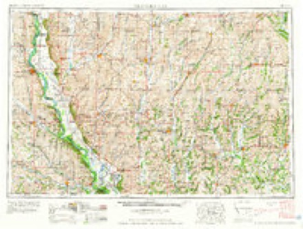
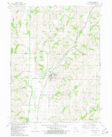
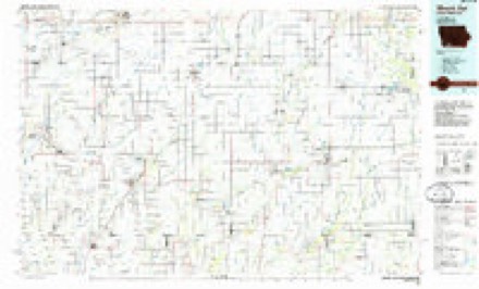
7 surveys from 11 printed sheetsMatched by testing this settlement's coordinate against the published boundary of every sheet in the United States Geological Survey's historical collection. Each opens the scanned sheet at the Survey.
- 1940 USGS New Market quadrangle1:62500
- 1943 USGS New Market quadrangle1:62500, 2 printings
- 1955 USGS Nebraska City quadrangle1:250000, 3 printings
- 1957 USGS Nebraska City quadrangle1:250000
- 1958 USGS Nebraska City quadrangle1:250000
- 1980 USGS Hopkins quadrangle1:24000
- 1985 USGS Mount Ayr quadrangle1:100000, 2 printings
In the county-history sources
470 words on this townshipPast and Present of Nodaway County, Missouri, published 1910 names this settlement in its chapter on Hopkins Township. These are the passages that mention it, exactly as the scans read.
Hopkins, the only trading place within the township bearing the same name, and which was named after A. L. Hopkins, then superintendent of the Kansas City, St. Joseph & Council Bluffs Railroad Company, is situated a half mile to the east of the East fork of the One Hundred and Two river. It dates its platting from 1870 and its survey was completed in the spring of 1871. William Brady, of Jefferson township, executed the survey of the town plat. The company that platted the place was composed of Roseberry & Morehouse, the railroad company, Colonel Strong, of St. Joseph, and S. Mc¬ Farland.
Passage source: Past and Present of Nodaway County, Missouri, published 1910.
The town of Hopkins was incorporated October 21, 1872. and the first board of trustees was composed of W. W. Kennison, chairman, Judge E. Dunlin, William H. Cochrane and B. S. Martin. The first building erected was a boarding house built by Thomas Gladman. The pioneer firm was Donlin Brothers, who began business in 1871. Porter, Girard & Hughes erected a drug store in 1871. The first dry goods were handled by Mr. Robinson, who erected a suitable store building.
Passage source: Past and Present of Nodaway County, Missouri, published 1910.
In 1871 William R. Johnston built the Johnston House, on Roseberry street, and commenced keeping a good hotel. About the same date Mr. Crouch built the Hopkins House, but sold out to David Bender. Still later the Central House was opened by a Mr. Kinson. Plants Brothers established the first banking house.
Passage source: Past and Present of Nodaway County, Missouri, published 1910.
Machine-read from a century-old scan, so expect the errors a machine makes: misspelled names, dropped words, stray characters.
Read the whole chapter on Hopkins Township - it names this place 1 more 1 time.
Mines and quarries near this place
5 within 5 milesRegional context, not property-specific evidence. The federal mineral resources record lists 5 workings within 5 miles of Hopkins: 5 past producers. None of them still produces. What was taken out: Sand and Gravel, Construction, Stone, Crushed/Broken. Distance is straight-line from the map coordinates, so a quarry counted here may appear on a neighbouring settlement's page as well.
| Where | Site | Commodity | Status | Recorded |
|---|---|---|---|---|
| Hopkins Quarry | Stone, Crushed/Broken | Past Producer | ||
| Unk | Stone, Crushed/Broken | Past Producer | ||
| Unk | Sand and Gravel, Construction | Past Producer | ||
| Unk | Sand and Gravel, Construction | Past Producer | ||
| Unk | Sand and Gravel, Construction | Past Producer |
Storms near this place
40 since 1994Regional context, not property-specific evidence. The National Weather Service names Hopkins in 40 storm reports between 1994 and 2024: 23 hail, 14 thunderstorm wind, 2 flash flood, 1 tornado. No death or injury is recorded in these reports. Each account below is quoted exactly as the forecast office filed it, from the NOAA Storm Events Database, and each date opens the federal record of that event.
| When | Event | Place named | Harm | What the report says |
|---|---|---|---|---|
| April 1994 | Thunderstorm Wind | Hopkins | $50,000 | Several farm buildings were blown down, including a hog confinement building and machine shed. |
| May 2022 | Thunderstorm Wind | Hopkins | $10,000 | Several garage doors were blown in on large metal buildings. |
| May 2002 | Hail | Hopkins | $5,000 | Hail damage to several cars. |
| June 2002 | Thunderstorm Wind | Hopkins | $5,000 | Several trees uprooted and there was minor roof damage reported. |
| August 2006 | Thunderstorm Wind | Hopkins | $2,000 | Power lines down. |
| April 2024 | Tornado (EF1) | Hopkins | - | NWS storm survey confirms a brief EF-1 tornado occurred around 9 AM local time west of Hopkins. The tornado damaged structures at two properties along State Highway FF. |
| October 2024 | Thunderstorm Wind | Hopkins | - | Several reports of trees down in northern portions of Nodaway County. |
| July 2016 | Thunderstorm Wind | Hopkins | - | Damage to a fence was done by a large tree that fell on it. This report was received via social media. |
| September 2013 | Thunderstorm Wind | Hopkins | - | Large tree limbs were reported down with thunderstorm wind gusts estimated up to 60 mph. |
| September 2013 | Thunderstorm Wind | Hopkins | - | Thunderstorm wind gusts were estimated up to 60 mph. |
| June 2008 | Flash Flood | Hopkins | - | Water was reported draining off of fields and flowing onto Highway 148 just north of Hopkins. |
| August 2007 | Thunderstorm Wind | Hopkins | - | Broken tree limbs up to six inches in diameter. |
| August 2007 | Flash Flood | Hopkins | - | Water over Highway JJ between Jade Road and Highway FF. |
| June 2000 | Thunderstorm Wind | Hopkins | - | A flag pole was bent over by thunderstorm winds estimated at 70 mph, and tree limbs over a foot in diameter were downed. Part of a maple tree fell on a house and caused unspecified damage. |
| July 1998 | Thunderstorm Wind | Hopkins | - | Thunderstorm winds knocked down a tree two feet in diameter. |
| June 1998 | Hail | Hopkins | - | Dime-size hail was reported during a severe thunderstorm a mile south of Hopkins. |
| April 2023 | Hail | Hopkins | - | no account filed |
| May 2022 | Hail | Hopkins | - | no account filed |
| April 2017 | Hail | Hopkins | - | no account filed |
| August 2015 | Hail | Hopkins | - | no account filed |
| August 2015 | Hail | Hopkins | - | no account filed |
| June 2015 | Hail | Hopkins | - | no account filed |
| June 2014 | Hail | Hopkins | - | no account filed |
| June 2014 | Hail | Hopkins | - | no account filed |
| April 2011 | Hail | Hopkins | - | no account filed |
| August 2009 | Hail | Hopkins | - | no account filed |
| August 2009 | Hail | Hopkins | - | no account filed |
| June 2008 | Hail | Hopkins | - | no account filed |
| May 2007 | Hail | Hopkins | - | no account filed |
| May 2006 | Hail | Hopkins | - | no account filed |
| May 2004 | Thunderstorm Wind | Hopkins | - | no account filed |
| June 2004 | Hail | Hopkins | - | no account filed |
| April 2002 | Hail | Hopkins | - | no account filed |
| May 2002 | Hail | Hopkins | - | no account filed |
| June 2002 | Hail | Hopkins | - | no account filed |
| June 2001 | Hail | Hopkins | - | no account filed |
| July 2001 | Thunderstorm Wind | Hopkins | - | no account filed |
| February 2000 | Hail | Hopkins | - | no account filed |
| April 1999 | Hail | Hopkins | - | no account filed |
| April 1999 | Thunderstorm Wind | Hopkins | - | no account filed |
Nearest settlements
The eight closest, with where each one stands in the county. Distances are straight-line, computed from the Geographic Names Information System coordinates.
Elsewhere
Matched on this settlement's Geographic Names Information System number rather than its name, so it cannot be a different place of the same name in another state.
| Wikipedia article on Hopkins | An encyclopaedic summary. Its text is share-alike, so it is linked here rather than copied. |
| Wikidata item Q965823 | The structured record the population and elevation above come from. Public domain (CC0). |
Provenance
This settlement is recorded in the Geographic Names Information System as feature 719816. The sheet list is computed by point-in-boundary test against the United States Geological Survey's historical topographic inventory. Both are works of the United States government and carry no copyright under 17 U.S.C. 105.
Mines and quarries. USGS Mineral Resources Data System (MRDS) https://mrdata.usgs.gov/mrds/ A work of the United States government, no copyright under 17 U.S.C. 105.
Storms. NOAA National Centers for Environmental Information, Storm Events Database https://www.ncei.noaa.gov/stormevents/ A work of the United States government, no copyright under 17 U.S.C. 105. Narratives are quoted verbatim from the National Weather Service report and are not edited or summarised.