 Block
Jasper, Missouri
17 topographic sheets cover this place, the earliest surveyed in 1886 and the latest in 1991. It stands in Preston Township. It lies in ZIP code area 64755. It stands on Cripple Creek. The Survey maps it on the Jasper quadrangle. 906 people lived here at the 2020 count. It stands 948 feet above sea level.
Population over time
2 figuresJasper fell from 931 to 906 between 2010 and 2020. These are the recorded population figures Wikidata holds for this place, reached through the Geographic Names Information System number this page is keyed on rather than by name, so they belong to this place and not to another of the same name. Most are census counts, but not all are: an early figure may be a founding or settlement estimate, and an estimate published within five years of a census is left out. The change column is computed, and is left blank where more than 20 years separate a figure from the one before it, because a gap that long is not a change between two counts.
| Year | People | Change |
|---|---|---|
| 2010 | 931 | |
| 2020 | 906 | -25 (-3%) |
Topographic sheets covering this place
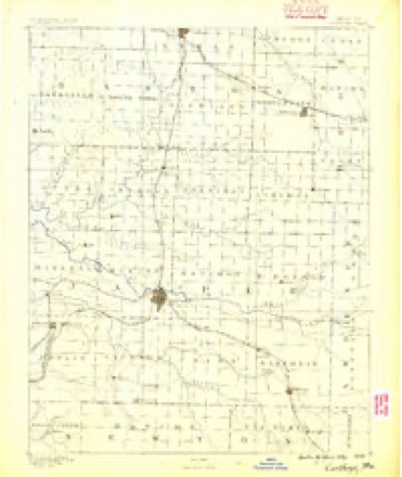
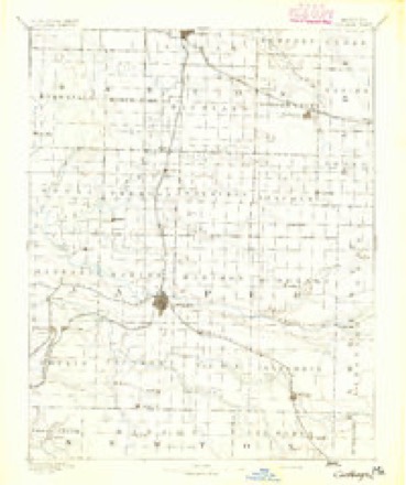
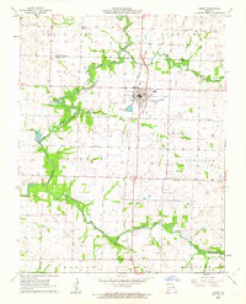
10 surveys from 17 printed sheetsMatched by testing this settlement's coordinate against the published boundary of every sheet in the United States Geological Survey's historical collection. Each opens the scanned sheet at the Survey.
- 1886 USGS Carthage quadrangle1:125000
- 1894 USGS Carthage quadrangle1:125000, 5 printings
- 1947 USGS Joplin quadrangle1:250000
- 1949 USGS Joplin quadrangle1:250000
- 1954 USGS Joplin quadrangle1:250000, 3 printings
- 1958 USGS Joplin quadrangle1:250000
- 1959 USGS Joplin quadrangle1:250000
- 1962 USGS Jasper quadrangle1:24000, 2 printings
- 1986 USGS Joplin quadrangle1:100000
- 1991 USGS Joplin quadrangle1:100000
In the county-history sources
3,484 words on this townshipThe History of Jasper County, Missouri : Including a Condensed History of the State, a Complete History of Carthage and Joplin, Other Towns and Townships : Together with Numerous Portraits of Prominent Men : Cuts of Elegant Residences and Public Buildings : a Sectional Map of the County : Biographical Sketches of Many Enterprising Farmers, Merchants, Mechanics, Professional, and Business Men : the Constitution of the State : an Abstract of Laws : an Elaborate History of Jasper County - Its Topography, Natural History, Pioneers, Organization, Political History, Courts and Bar, Religious, Educational, Medical, Agricultural, Mining, and Horticultural, Its Commercial and Business Interests, Etc, published 1883 names this settlement in its chapter on Preston Township. These are the passages that mention it, exactly as the scans read.
Indiana when a young man. His mother is a native of Indiana. G. "W". Tabler went to Illinois in 1850; was in Macon county for two years; then resided in Christian county until 1857; from there removed to Newton county, Mo. After looking for land he finally bought 100 acres in Barton county. In February, 1882, he settled on his present farm of 240 acres, in section 14, township 30, range 31, Jasper county; 160 acres are under cultivation, the rest is timber. Was married to Ursula Rankin, May 9, 1875, daughter of S. Rankin, who was a very successful trader and stock dealer. Mr. Tabler's children are William S., Elmer E., and Arthur.
EGBERT N. WARDLGW was born in Brown county, Ghio, March 28, 1826, and was raised on a farm. His father, Philander Wardlow, was one of the early settlers of Ghio. Young Robert had meager school advantages. He married Susanna Heaton, who was also a native of Brown county, Ghio, April 26, 1846; she was born May 13, 1830. In 1855 Mr. Wardlow removed to Appanoose county, Iowa, where he remained several years; then removed to Putnam county. Mo,, and after one season again removed to Iowa and settled in Davis county. In March, 1880, he came to Jasper county, Mo., and bought his present farm of 100 acres, 60 of which is under a high state of cultivation and the remainder under fence. He has a fine orchard and about 40 acres of timber. Their family consists of ten children: Samuel E., born March 24, 1847; married Temperance Craig, and now resides in Barton county; John T., born June 5, 1849; married Elzada Kincart in November, 1873, and now resides in Taylorsville, Cal.; Alfred J., born July 1, 1858; Robert B., born Jan. 30, 1856; married Martha Draper Jan. 13, 1878, and now resides in Wilmington, Cal.; Benjamin F., born Get. 18, 1860; married Mary E. Clarkson Feb. 7, 1878, and is now living at Dublin, Barton county. Mo.; James G., born Dec. 18, 1862; Ida Belle, born Dec. 12, 1865; Elbert C, born July 8, 1868; William L., born June 12, 1851; married Laura E. Kincart April 7, 1873, and is now living at Dublin, Barton county; Thomas T., born Dec. 28, 1872. Mr. Wardlow is highly respected by his neighbors and friends for his many good qualities as an upright man and an honest constituent of society.
1869, and lived there twenty-two months, and then moved to Jasper county and settled on his present farm of forty acres, well improved, with a good orchard. The subject of this sketch is now living with him and carrying on the farm. He was married to Ella A. Griffin Dec. 30, 1879. She died July 17, 1881. Mr. Ward bids fair to become a leading man.
Machine-read from a century-old scan, so expect the errors a machine makes: misspelled names, dropped words, stray characters.
Read the whole chapter on Preston Township - it names this place 14 more 14 times.
Fires near this place
23 since 1994Regional context, not property-specific evidence. The federal wildfire occurrence database lists 23 fires within 5 miles of Jasper between 1994 and 2020, burning about 204 acres in total. None started naturally. 1 was recorded as arson. Distance is straight-line from the map coordinates, so a fire counted here may appear on a neighbouring settlement's page as well.
| Reported cause | Fires |
|---|---|
| Debris and open burning | 10 |
| Missing data/not specified/undetermined | 6 |
| Equipment and vehicle use | 4 |
| Smoking | 2 |
| Arson/incendiarism | 1 |
The most recent of them, most recent first, with the day each was reported and the service that recorded it.
| Date | Cause | Size | Reported by | Name on the report |
|---|---|---|---|---|
| 25 September 2020 | Debris and open burning | 7.4 acres | Missouri Department of Conservation | 230753-02439-09252020-1455 |
| 12 August 2020 | Equipment and vehicle use | under an acre | Missouri Department of Conservation | 220624-02439-08122020-1950 |
| 8 July 2020 | Arson/incendiarism | under an acre | Missouri Department of Conservation | 220555-02439-07082020-2335 |
| 5 July 2020 | Equipment and vehicle use | under an acre | Missouri Department of Conservation | 220553-02439-07052020-1720 |
| 31 July 2019 | Missing data/not specified/undetermined | under an acre | Missouri Department of Conservation | 200519-02439-07312019-1745 |
| 17 May 2019 | Debris and open burning | 1.5 acres | Missouri Department of Conservation | 200515-02439-05172019-0655 |
| 5 March 1994 | Missing data/not specified/undetermined | 5.0 acres | Missouri Department of Conservation | not named |
| 5 February 2017 | Debris and open burning | 2.0 acres | Missouri Department of Conservation | not named |
Settlements close enough to share some of these fires:
Mines and quarries near this place
3 within 5 milesRegional context, not property-specific evidence. The federal mineral resources record lists 3 workings within 5 miles of Jasper: 2 past producers, 1 producer. 1 still produces. What was taken out: Stone, Crushed/Broken. Distance is straight-line from the map coordinates, so a quarry counted here may appear on a neighbouring settlement's page as well.
| Where | Site | Commodity | Status | Recorded |
|---|---|---|---|---|
| Jasper Quarry #1 & Mill | Stone, Crushed/Broken | Producer | ||
| Unknown - Ls | Stone, Crushed/Broken | Past Producer | ||
| Unknown - Ls | Stone, Crushed/Broken | Past Producer |
Storms near this place
54 since 1995Regional context, not property-specific evidence. The National Weather Service names Jasper in 54 storm reports between 1995 and 2026: 23 thunderstorm wind, 14 hail, 10 flood, 5 flash flood. No death or injury is recorded in these reports. Each account below is quoted exactly as the forecast office filed it, from the NOAA Storm Events Database, and each date opens the federal record of that event.
| When | Event | Place named | Harm | What the report says |
|---|---|---|---|---|
| May 2019 | Tornado (EF3) | Jasper | $275,000 | A National Weather Service storm survey confirmed an EF-3 tornado with maximum winds of 142 mph. This was the last in a series of at least four tornadoes produced by a supercell that tracked out of northeast Oklahoma and southeast Kansas into Jasper County, Missouri. The tornado touched down near the intersection of Redbud and CR 100, downing power lines and uprooting trees. Wind speeds increased to an estimated 120 mph as it took the roof off a residence on Redbud before tracking northeast and damaging homes and outbuildings as it crossed the intersections of Sumac and County Road 90, Thorn and Highway T, and then into Barton County. |
| March 2017 | Hail | Jasper | $100,000 | Baseball size hail was report on social media with a picture. Hail damaged a few cars and homes in the town of Jasper. This report will include a damage estimate. |
| August 2012 | Thunderstorm Wind | Jasper | $100,000 | Numerous power poles and trees blown down in the city of Jasper. Power lines and poles were blown down across Highway 71 causing traffic to back up. Several tin roof structures were either peeled off or blown completely off structures. Several downtown businesses had their windows blown out. |
| April 2019 | Thunderstorm Wind | Jasper | $50,000 | Two large machine sheds sustained damaged near the intersection of County Road 150 and Redbud Road and two large transmission lines were blown down at County Road 160 and Redbud Road. |
| December 2002 | Tornado (F1) | Jasper | $50,000 | no account filed |
| May 2023 | Thunderstorm Wind | Jasper | $30,000 | A significant portion of the roof of a business was removed by high winds. |
| April 2019 | Thunderstorm Wind | Jasper | $30,000 | Multiple powerlines were reported down. |
| June 2011 | Thunderstorm Wind | Jasper | $15,000 | Minor roof damage was reported to a few structures in the city of Jasper. One outbuilding had some tin roof panels removed. Large limbs were removed from a few trees. At least one old outbuilding was blown down. |
| April 2025 | Thunderstorm Wind | Jasper | $10,000 | A barn suffered minor damage. |
| March 2021 | Thunderstorm Wind | Jasper | $5,000 | Minor damage was reported to the roof of a trailer home. |
| August 2020 | Thunderstorm Wind | Jasper | $5,000 | A utility pole was reported down in town. |
| August 2001 | Thunderstorm Wind | Jasper | $5,000 | no account filed |
| September 2010 | Thunderstorm Wind | Jasper | $2,000 | A large window was blown out of a business by strong thunderstorm winds. |
| October 2017 | Thunderstorm Wind | Jasper | $1,000 | A power line was blown down in the town of Jasper. |
| May 2000 | Thunderstorm Wind | Jasper | $1,000 | no account filed |
| April 2026 | Flash Flood | Jasper | - | Water was reported over Baseline Boulevard at several low water areas. |
| April 2025 | Flood | Jasper | - | County Road 134 at Coons Creek was flooded and impassable. |
| July 2023 | Thunderstorm Wind | Jasper | - | A wind gust of 60 MPH was measured just north of Jasper. |
| May 2022 | Flood | Jasper | - | Highway M at the low water crossing on the North Fork of the Spring River was closed due to flooding. |
| May 2022 | Flood | Jasper | - | Highway H at the low water bridge on the North Fork Spring River was closed due to flooding. |
| May 2022 | Flood | Jasper | - | Main street at Coon Creek was closed due to flooding. |
| March 2020 | Flood | Jasper | - | Main Street was closed due to flooding from Coons Creek. |
| March 2020 | Flood | Jasper | - | State Highway H was closed due to flooding at the North Fork Spring River. |
| March 2017 | Hail | Jasper | - | Tea cup size hail was reported south of Jasper. |
| March 2017 | Hail | Jasper | - | Hen egg size hail was report on social media with a picture. |
| May 2017 | Flood | Jasper | - | Main Street was closed due to flooding along Coon Creek. |
| September 2017 | Thunderstorm Wind | Jasper | - | Pictures from social media showed tree limbs blown down and broken near Jasper. |
| August 2017 | Flash Flood | Jasper | - | Main and Morrison Roads had water flowing over it. Grand and 4th Street were flooded. |
| July 2015 | Flash Flood | Jasper | - | Redbud Road was flooded. Three and a half inches of rainfall was reported in 1 hour. |
| June 2014 | Flood | Jasper | - | Highway K had several sections with water over the road. |
| May 2013 | Flood | Jasper | - | Several roads were flooded across Jasper County. These included Jackpine Road from County Road 160 to County Road 170. County Road 180 from Highway 96 to Kafir Road was flooded. County Road 90 from Harmony Road to Ivory Road was flooded. These roadways were along the Spring River. |
| July 2013 | Flash Flood | Jasper | - | County Road 170 was closed at Sumac Road due to flooding. |
| March 2010 | Flood | Jasper | - | Highway H was closed due to flooding near the intersection of Highway H and Highway J. |
| September 2010 | Thunderstorm Wind | Jasper | - | A storm chaser estimated severe wind gusts. |
| August 2009 | Thunderstorm Wind | Jasper | - | The emergency manager measured a wind gust of 60 mph. |
| April 2005 | Thunderstorm Wind | Jasper | - | Several trees were downed from severe thunderstorm wind gusts along Highway 71 south of Jasper. |
| September 2005 | Thunderstorm Wind | Jasper | - | Severe thunderstorm wind gusts uprooted trees near the intersection of Highways T and K. |
| April 2004 | Thunderstorm Wind | Jasper | - | Large trees were downed and blocking a road from severe thunderstorm wind gusts. |
| March 2017 | Hail | Jasper | - | no account filed |
| May 2011 | Hail | Jasper | - | no account filed |
| May 2010 | Hail | Jasper | - | no account filed |
| June 2008 | Thunderstorm Wind | Jasper | - | no account filed |
| June 2008 | Thunderstorm Wind | Jasper | - | no account filed |
| March 2006 | Hail | Jasper | - | no account filed |
| April 2005 | Hail | Jasper | - | no account filed |
| August 2003 | Thunderstorm Wind | Jasper | - | no account filed |
| May 2003 | Hail | Jasper | - | no account filed |
| July 2003 | Hail | Jasper | - | no account filed |
| July 2003 | Thunderstorm Wind | Jasper | - | no account filed |
| December 2002 | Hail | Jasper | - | no account filed |
| May 2002 | Flash Flood | Jasper | - | no account filed |
| November 1997 | Hail | Jasper | - | no account filed |
| April 1996 | Hail | Jasper | - | no account filed |
| November 1995 | Hail | Jasper | - | no account filed |
Nearest settlements
The eight closest, with where each one stands in the county. Distances are straight-line, computed from the Geographic Names Information System coordinates.
Elsewhere
Matched on this settlement's Geographic Names Information System number rather than its name, so it cannot be a different place of the same name in another state.
| Wikipedia article on Jasper | An encyclopaedic summary. Its text is share-alike, so it is linked here rather than copied. |
| Wikidata item Q943002 | The structured record the population and elevation above come from. Public domain (CC0). |
Provenance
This settlement is recorded in the Geographic Names Information System as feature 729908. The sheet list is computed by point-in-boundary test against the United States Geological Survey's historical topographic inventory. Both are works of the United States government and carry no copyright under 17 U.S.C. 105.
Wildfire. Short, Karen C. 2022. Spatial wildfire occurrence data for the United States, 1992-2020 [FPA_FOD_20221014]. 6th Edition. Fort Collins, CO: Forest Service Research Data Archive. https://doi.org/10.2737/RDS-2013-0009.6 Collected with United States Government funding and usable without additional permissions or fees.
Mines and quarries. USGS Mineral Resources Data System (MRDS) https://mrdata.usgs.gov/mrds/ A work of the United States government, no copyright under 17 U.S.C. 105.
Storms. NOAA National Centers for Environmental Information, Storm Events Database https://www.ncei.noaa.gov/stormevents/ A work of the United States government, no copyright under 17 U.S.C. 105. Narratives are quoted verbatim from the National Weather Service report and are not edited or summarised.