 Block
Kirkwood, Missouri
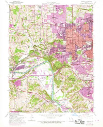
22 topographic sheets cover this place, the earliest surveyed in 1933 and the latest in 1985. It stands in Bonhomme Township. It lies in ZIP code area 63122. The Survey maps it on the Kirkwood quadrangle. 29,461 people lived here at the 2020 count. It stands 659 feet above sea level.
On record in Kirkwood
Buildings and businesses the archive holds for this place. Each opens its own page, with the source record it came from.
On the National Register 12 of 29 shown
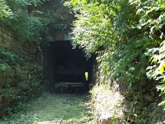 Barretts Tunnelslisted 1978
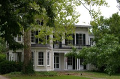 Romanzo N. Bayley Houselisted 2002
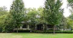 John P. and Dora Blake Houselisted 2002
 William Bopp Houselisted 2006
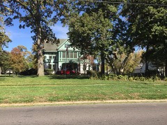 Judge Enos Clarke Houselisted 2002
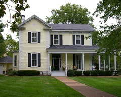 James H. and Marietta Comfort Houselisted 2002
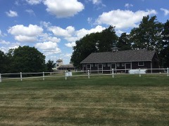 Cragwoldlisted 2009
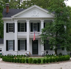 George W. and Virginia Fishback Houselisted 2002
 Grace Episcopal Churchlisted 1982
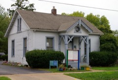 Egbert W. Halsey Cottagelisted 2002
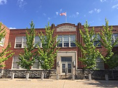 J. Milton Turner Schoollisted 2002
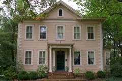 David Keith Houselisted 2002
Population over time
2 figuresKirkwood grew from 27,540 to 29,461 between 2010 and 2020. These are the recorded population figures Wikidata holds for this place, reached through the Geographic Names Information System number this page is keyed on rather than by name, so they belong to this place and not to another of the same name. Most are census counts, but not all are: an early figure may be a founding or settlement estimate, and an estimate published within five years of a census is left out. The change column is computed, and is left blank where more than 20 years separate a figure from the one before it, because a gap that long is not a change between two counts.
| Year | People | Change |
|---|---|---|
| 2010 | 27,540 | |
| 2020 | 29,461 | +1,921 (+7%) |
Topographic sheets covering this place
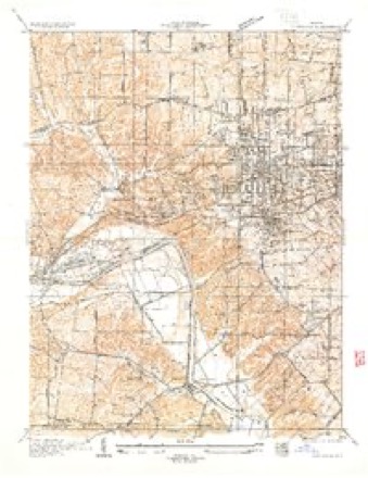
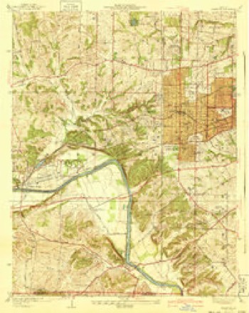
9 surveys from 22 printed sheetsMatched by testing this settlement's coordinate against the published boundary of every sheet in the United States Geological Survey's historical collection. Each opens the scanned sheet at the Survey.
- 1933 USGS Kirkwood quadrangle1:24000
- 1940 USGS Kirkwood quadrangle1:24000, 3 printings
- 1949 USGS Saint Louis quadrangle1:250000
- 1949 USGS St. Louis quadrangle1:250000
- 1954 USGS Kirkwood quadrangle1:24000, 7 printings
- 1962 USGS St. Louis quadrangle1:250000
- 1963 USGS St. Louis quadrangle1:250000, 4 printings
- 1966 USGS St. Louis quadrangle1:250000
- 1985 USGS St Louis quadrangle1:100000, 3 printings






Fires near this place
1 since 2007Regional context, not property-specific evidence. The federal wildfire occurrence database lists 1 fire within 5 miles of Kirkwood in 2007, burning under an acre in total. None started naturally. None was recorded as arson. Distance is straight-line from the map coordinates, so a fire counted here may appear on a neighbouring settlement's page as well.
| Reported cause | Fires |
|---|---|
| Missing data/not specified/undetermined | 1 |
The most recent of them, most recent first, with the day each was reported and the service that recorded it.
| Date | Cause | Size | Reported by | Name on the report |
|---|---|---|---|---|
| 15 August 2007 | Missing data/not specified/undetermined | under an acre | Missouri State Fire Marshal's Office | not named |
Settlements close enough to share some of these fires:
Mines and quarries near this place
10 of 31 shownRegional context, not property-specific evidence. The federal mineral resources record lists 31 workings within 5 miles of Kirkwood: 31 past producers. None of them still produces. What was taken out: Stone, Crushed/Broken, Sand and Gravel, Construction, Fire Clay (Refractory). Distance is straight-line from the map coordinates, so a quarry counted here may appear on a neighbouring settlement's page as well.
| Where | Site | Commodity | Status | Recorded |
|---|---|---|---|---|
| Jamieson Mine | Fire Clay (Refractory) | Past Producer | ||
| Unknown - S&G | Sand and Gravel, Construction | Past Producer | ||
| Unknown - S&G | Sand and Gravel, Construction | Past Producer | ||
| Big Bend Quarry | Stone, Crushed/Broken | Past Producer | ||
| Grant Quarry | Stone, Crushed/Broken | Past Producer | ||
| Kempf Quarry | Stone, Crushed/Broken | Past Producer | ||
| Mutual Quarry | Stone, Crushed/Broken | Past Producer | ||
| Osage Hills Quarry | Stone, Crushed/Broken | Past Producer | ||
| Rock Hill Quarry | Stone, Crushed/Broken | Past Producer | ||
| Unknown - Ls | Stone, Crushed/Broken | Past Producer |
Storms near this place
24 since 1994Regional context, not property-specific evidence. The National Weather Service names Kirkwood in 24 storm reports between 1994 and 2020: 11 hail, 10 thunderstorm wind, 1 lightning, 1 flash flood. The reports record 1 injury. Each account below is quoted exactly as the forecast office filed it, from the NOAA Storm Events Database, and each date opens the federal record of that event.
| When | Event | Place named | Harm | What the report says |
|---|---|---|---|---|
| April 2006 | Thunderstorm Wind | Kirkwood | 1 hurt | A local high school teacher and coach was severely injured by a downed tree while he was jogging with his dog near his home on North Woodlawn Avenue. The man suffered a punctured lung, broken ribs, a broken shoulder and other injuries. |
| February 1999 | Hail | Kirkwood | $100,000 | no account filed |
| May 1996 | Lightning | Kirkwood | $50,000 | no account filed |
| June 2007 | Thunderstorm Wind | Kirkwood | $5,000 | Thunderstorm wind gusts blew down large tree limbs in the Forever Oak Hill Cemetary. Some headstones were damaged by the downed limbs. |
| July 2020 | Thunderstorm Wind | Kirkwood | - | Thunderstorm winds blew down a 4 foot diameter tree as well as nearby power lines. |
| April 2010 | Tornado (EF0) | Kirkwood | - | The tornado touched down approximately 0.3 of a mile north of Dougherty Ferry Road near Lynkirk Rd. and moved north northwest through part of a subdivision. The tornado lifted briefly, then touched down again near the intersection of Ballas Rd. and Kirk Place Dr. before lifting and disspating just east of West County Mall. The path was approximately six tenths of a mile long and a maximum width around 300 yards across part of the subdivision and an average width of less than 200 yards elsewhere. Widespread tree damage and minor roof damage was observed across the subdivision but the overall lack of structural damage suggests winds did not exceed 70 to 80 mph. In the subdivision, several large healthy trees were uprooted and some roofs had missing or damaged shingles. At least one healthy tree was snapped several feet above its base. More extensive tree damage was observed with the second touchdown near Ballas Rd. and Kirk Place Dr. where several healthy pine trees were snapped at the midpoint and the debris pattern indicated a convergent circulation. Tree damage in this area also downed several powerlines along Ballas Road. |
| June 2009 | Thunderstorm Wind | Kirkwood | - | Thunderstorm winds blew down several power lines. |
| May 2008 | Hail | Kirkwood | - | Storm spotters reported one inch hail just northwest of Kirkwood. |
| May 2008 | Hail | Kirkwood | - | Storm spotters reported 3/4 inch hail at Manchester and Geyer roads. |
| May 2007 | Flash Flood | Kirkwood | - | Storm spotters reported Ballas Road flooded in the Sugar Creek Valley near Daugherty Ferry Road. |
| August 2007 | Thunderstorm Wind | Kirkwood | - | A severe thunderstorm moved across southern St. Louis county producing damaging downburst winds (including microbursts) over this region. Some of the hardest hit areas extended from just east of downtown Kirkwood through Oakland then into Shrewsbury. Some of the fallen trees and numerous large tree limbs damaged homes and vehicles over this area. One large tree fell onto an apartment building causing moderate damage. Surface winds were estimated between 65 and 75 mph. No injuries were reported. |
| July 2006 | Thunderstorm Wind | Kirkwood | - | Numerous trees, tree limbs and power lines were blown down. A few of the trees landed on homes and car causing minor to moderate damage. |
| April 2000 | Hail | Kirkwood | - | Storm spotters reported 1 inch hail. |
| April 1994 | Hail | Kirkwood | - | The public reported 0.75-inch-diameter hail in numerous other suburbs of St. Louis. |
| June 2009 | Hail | Kirkwood | - | no account filed |
| June 2008 | Hail | Kirkwood | - | no account filed |
| July 2006 | Thunderstorm Wind | Kirkwood | - | no account filed |
| August 2005 | Thunderstorm Wind | Kirkwood | - | no account filed |
| May 2004 | Hail | Kirkwood | - | no account filed |
| July 2004 | Hail | Kirkwood | - | no account filed |
| July 2004 | Thunderstorm Wind | Kirkwood | - | no account filed |
| July 2004 | Hail | Kirkwood | - | no account filed |
| April 2003 | Hail | Kirkwood | - | no account filed |
| July 2003 | Thunderstorm Wind | Kirkwood | - | no account filed |
Nearest settlements
The eight closest, with where each one stands in the county. Distances are straight-line, computed from the Geographic Names Information System coordinates.
| Map | Place | Distance | Sheets |
|---|---|---|---|
| Windsor Springs | 1.2 miles | 22 | |
| Oakland | 1.2 miles | 22 | |
| Meacham Park | 1.5 miles | 22 | |
| Woodhine Heights | 1.7 miles | 22 | |
| Glendale | 1.8 miles | 22 | |
| Des Peres | 1.8 miles | 22 | |
| Warson Woods | 2.1 miles | 22 | |
| Rock Hill | 2.2 miles | 22 |
Elsewhere
Matched on this settlement's Geographic Names Information System number rather than its name, so it cannot be a different place of the same name in another state.
| Wikipedia article on Kirkwood | An encyclopaedic summary. Its text is share-alike, so it is linked here rather than copied. |
| Wikidata item Q963572 | The structured record the population and elevation above come from. Public domain (CC0). |
Provenance
This settlement is recorded in the Geographic Names Information System as feature 756252. The sheet list is computed by point-in-boundary test against the United States Geological Survey's historical topographic inventory. Both are works of the United States government and carry no copyright under 17 U.S.C. 105.
Wildfire. Short, Karen C. 2022. Spatial wildfire occurrence data for the United States, 1992-2020 [FPA_FOD_20221014]. 6th Edition. Fort Collins, CO: Forest Service Research Data Archive. https://doi.org/10.2737/RDS-2013-0009.6 Collected with United States Government funding and usable without additional permissions or fees.
Mines and quarries. USGS Mineral Resources Data System (MRDS) https://mrdata.usgs.gov/mrds/ A work of the United States government, no copyright under 17 U.S.C. 105.
Storms. NOAA National Centers for Environmental Information, Storm Events Database https://www.ncei.noaa.gov/stormevents/ A work of the United States government, no copyright under 17 U.S.C. 105. Narratives are quoted verbatim from the National Weather Service report and are not edited or summarised.