 Block
Liberty, Missouri
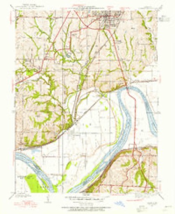
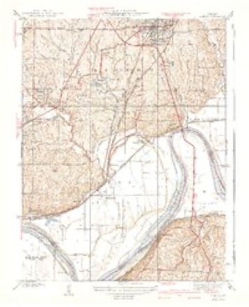
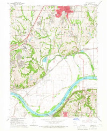
24 topographic sheets cover this place, the earliest surveyed in 1894 and the latest in 1996. It stands in Liberty Township. It lies in ZIP code area 64068. The Survey maps it on the Liberty quadrangle. 30,167 people lived here at the 2020 count. It stands 886 feet above sea level.
Research this city
On record in Liberty
Buildings and businesses the archive holds for this place. Each opens its own page, with the source record it came from.
On the National Register 12 of 15 shown
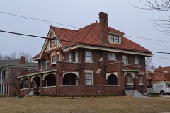 Arthur-Leonard Historic Districtlisted 2001
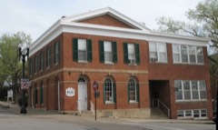 Clay County Savings Association Buildinglisted 1992
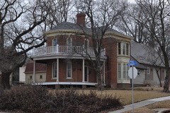 Clinton Houselisted 1978
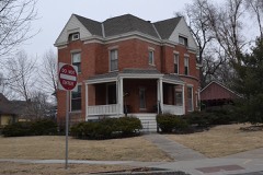 Dougherty-Prospect Heights Historic Districtlisted 2001
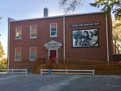 Garrison School Historic Districtlisted 2001
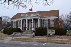 Frank Hughes Memorial Librarylisted 1992
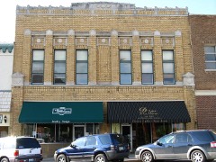 IOOF Liberty Lodge No. 49listed 1992
 Jewell Halllisted 1978
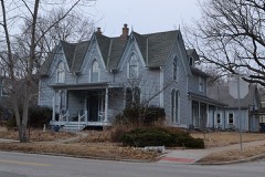 Jewell-Lightburne Historic Districtlisted 2001
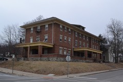 Major Hotellisted 1992
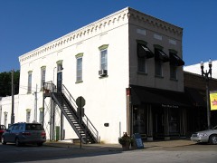 Miller Buildinglisted 1992
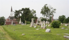 Mt. Memorial Cemeterylisted 2012
Population over time
2 figuresLiberty grew from 29,149 to 30,167 between 2010 and 2020. These are the recorded population figures Wikidata holds for this place, reached through the Geographic Names Information System number this page is keyed on rather than by name, so they belong to this place and not to another of the same name. Most are census counts, but not all are: an early figure may be a founding or settlement estimate, and an estimate published within five years of a census is left out. The change column is computed, and is left blank where more than 20 years separate a figure from the one before it, because a gap that long is not a change between two counts.
| Year | People | Change |
|---|---|---|
| 2010 | 29,149 | |
| 2020 | 30,167 | +1,018 (+3%) |
Topographic sheets covering this place
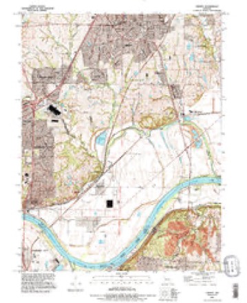
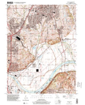
11 surveys from 24 printed sheetsMatched by testing this settlement's coordinate against the published boundary of every sheet in the United States Geological Survey's historical collection. Each opens the scanned sheet at the Survey.
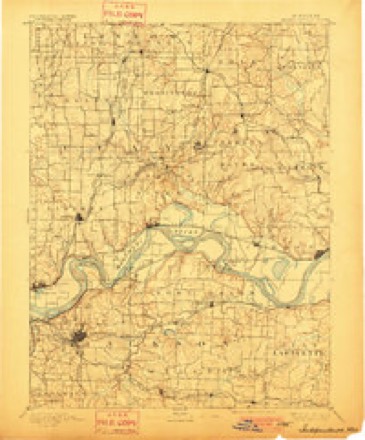
- 1894 USGS Independence quadrangle1:125000, 5 printings
- 1935 USGS Liberty quadrangle1:24000, 2 printings
- 1940 USGS Liberty quadrangle1:31680, 2 printings
- 1950 USGS Kansas City quadrangle1:250000
- 1954 USGS Kansas City quadrangle1:250000
- 1956 USGS Kansas City quadrangle1:250000, 4 printings
- 1960 USGS Kansas City quadrangle1:250000, 3 printings
- 1965 USGS Liberty quadrangle1:24000, 3 printings
- 1983 USGS Kansas City quadrangle1:100000
- 1990 USGS Liberty quadrangle1:24000
- 1996 USGS Liberty quadrangle1:24000




In the county-history sources
47 words on this townshipHistory of Clay County, Missouri, published 1920 has no passage naming this settlement, which was common for smaller places. Its township is covered in full.
The chapter on Liberty Township covers position and description, early settlers, liberty landing, country churches, city of liberty, first lacorporatiou.
Read the chapter on Liberty Township - 47 words.
Fires near this place
25 since 2004Regional context, not property-specific evidence. The federal wildfire occurrence database lists 25 fires within 5 miles of Liberty between 2004 and 2019, burning about 18 acres in total. None started naturally. 2 were recorded as arson. Distance is straight-line from the map coordinates, so a fire counted here may appear on a neighbouring settlement's page as well.
| Reported cause | Fires |
|---|---|
| Missing data/not specified/undetermined | 8 |
| Debris and open burning | 6 |
| Recreation and ceremony | 6 |
| Arson/incendiarism | 2 |
| Equipment and vehicle use | 2 |
| Power generation/transmission/distribution | 1 |
The most recent of them, most recent first, with the day each was reported and the service that recorded it.
| Date | Cause | Size | Reported by | Name on the report |
|---|---|---|---|---|
| 9 September 2007 | Missing data/not specified/undetermined | under an acre | Missouri State Fire Marshal's Office | not named |
| 13 September 2007 | Arson/incendiarism | under an acre | Missouri State Fire Marshal's Office | not named |
| 7 August 2007 | Equipment and vehicle use | under an acre | Missouri State Fire Marshal's Office | not named |
| 29 August 2007 | Missing data/not specified/undetermined | under an acre | Missouri State Fire Marshal's Office | not named |
| 26 August 2007 | Missing data/not specified/undetermined | under an acre | Missouri State Fire Marshal's Office | not named |
| 12 August 2018 | Debris and open burning | under an acre | Missouri Department of Conservation | 177819-02412-08122018-1657 |
| 7 July 2004 | Missing data/not specified/undetermined | under an acre | Missouri State Fire Marshal's Office | not named |
| 3 July 2006 | Arson/incendiarism | under an acre | Missouri State Fire Marshal's Office | not named |
Settlements close enough to share some of these fires:
Mines and quarries near this place
10 of 38 shownRegional context, not property-specific evidence. The federal mineral resources record lists 38 workings within 5 miles of Liberty: 36 past producers, 2 producers. 2 still produce. What was taken out: Stone, Crushed/Broken, Sand and Gravel, Construction, Clay. Distance is straight-line from the map coordinates, so a quarry counted here may appear on a neighbouring settlement's page as well.
| Where | Site | Commodity | Status | Recorded |
|---|---|---|---|---|
| Unknown | Clay | Past Producer | ||
| City Wide Sand | Sand and Gravel, Construction | Producer | ||
| Unknown | Sand and Gravel, Construction | Past Producer | ||
| Atwood Quarry | Stone, Crushed/Broken | Past Producer | ||
| Borrow Pit | Stone, Crushed/Broken | Past Producer | ||
| Dever Quarry | Stone, Crushed/Broken | Past Producer | ||
| Missouri Rock Plant #2 Quarry | Stone, Crushed/Broken | Past Producer | ||
| Randolph Mine and Mill | Stone, Crushed/Broken | Producer | ||
| Schell Quarry | Stone, Crushed/Broken | Past Producer | ||
| Unknown | Stone, Crushed/Broken | Past Producer |
Storms near this place
60 of 115 shownRegional context, not property-specific evidence. The National Weather Service names Liberty in 115 storm reports between 1993 and 2025: 60 hail, 45 thunderstorm wind, 6 flash flood, 3 tornado. No death or injury is recorded in these reports. Each account below is quoted exactly as the forecast office filed it, from the NOAA Storm Events Database, and each date opens the federal record of that event.
| When | Event | Place named | Harm | What the report says |
|---|---|---|---|---|
| May 2003 | Tornado (F2) | Liberty | $60,000,000 | Tornado reported on the ground near Missouri Route 291, south of Missouri Route 152, it produced spotty damage northeast to downtown Liberty. Substantial damage was noted near the square in Libery, and to William Jewel College. The tornado tracked east along Missouri Route H into rural portions of Clay county before dissipating. Maximum intensity damage noted in the area was F2, based on surveys and input from local emergency management. |
| March 2006 | Hail | Liberty | $750,000 | Car dealerships hit hard by afternoon hail storm. Roof damage also noted throughout town. |
| April 1994 | Thunderstorm Wind | Liberty | $500,000 | The roof and front section of a roller skating rink were blown off from wind gusts estimated at 70 mph. Damages were estimated at just under $500,000. Other damage included home roofs, large trees limbs, as well as trees blown down. The storm also produced golf ball- size hail at Paradise Point. |
| March 2006 | Hail | Liberty | $200,000 | Widespread damage to cars and roofs. |
| March 2006 | Hail | Liberty | $20,000 | no account filed |
| August 2006 | Thunderstorm Wind | Liberty | $19,000 | Nine utility poles snapped and one transformer destroyed from thunderstorm winds. |
| August 2006 | Thunderstorm Wind | Liberty | $15,000 | Street light poles damaged...street signs bent...and siding ripped off several homes. |
| March 2006 | Thunderstorm Wind | Liberty | $10,000 | Barn damaged and power poles down 1 mile northeast of the Highway 291 and Highway 210 intersection. |
| July 2004 | Thunderstorm Wind | Liberty | $8,000 | no account filed |
| June 2001 | Thunderstorm Wind | Liberty | $5,000 | Large trees reported blown down by law enforcement. |
| July 2004 | Thunderstorm Wind | Liberty | $5,000 | no account filed |
| May 1996 | Thunderstorm Wind | Liberty | $5,000 | no account filed |
| May 1996 | Thunderstorm Wind | Liberty | $5,000 | no account filed |
| June 2009 | Thunderstorm Wind | Liberty | $1,000 | A 4 inch tree limb was snapped off, and a transformer blew. |
| June 2003 | Thunderstorm Wind | Liberty | $1,000 | Several trees and power lines down. |
| May 2025 | Thunderstorm Wind | South Liberty | - | Downed tree limbs and wires in the Courtney and River Bend areas. |
| June 2025 | Thunderstorm Wind | South Liberty | - | Downed wires near Current Street south of Liberty. |
| July 2025 | Thunderstorm Wind | Liberty | - | Report of tree limbs down in Liberty. Utility company also reported power outages in the area around this time. Likely caused by thunderstorm outflow. |
| July 2024 | Thunderstorm Wind | South Liberty | - | Estimated 60 mph wind gusts south southeast of Liberty. |
| October 2024 | Thunderstorm Wind | Liberty | - | Social media report of downed trees and limbs near Orchard Avenue. |
| October 2024 | Thunderstorm Wind | Liberty | - | Social media report of a downed tree into a shed and a fence at a residence. |
| October 2024 | Thunderstorm Wind | Liberty | - | Route 291 closed between Liberty Drive and Kansas Street due to downed power lines. |
| October 2024 | Thunderstorm Wind | Liberty | - | Multiple reports of power lines down and power outages, with social media photos and video provided. |
| June 2024 | Thunderstorm Wind | Liberty | - | Downed power lines with power outages near Liberty. |
| September 2023 | Hail | Liberty | - | Tennis ball sized hail was reported in Liberty. |
| September 2023 | Hail | South Liberty | - | Mping report of ping pong ball sized hail south of Liberty. |
| September 2023 | Thunderstorm Wind | Liberty | - | Mature trees were snapped due to microburst. |
| June 2022 | Thunderstorm Wind | Liberty | - | A one-foot diameter tree was snapped at the base, with some damage to a nearby metal building. |
| July 2020 | Thunderstorm Wind | Liberty | - | Isolated downburst within otherwise non-severe storms produced some tree damage, which caused some powerlines to come down in Liberty. |
| September 2019 | Hail | Liberty | - | Report received via social media. |
| September 2019 | Hail | Liberty | - | Report received via social media. |
| May 2017 | Thunderstorm Wind | Liberty | - | A trained spotter reported a 60 mph wind. |
| May 2017 | Thunderstorm Wind | Liberty | - | A trained spotter reported a 75 mph wind gust. |
| July 2017 | Thunderstorm Wind | Liberty | - | Winds of 70 to 80 mph went through Liberty and did some minor, superficial structural damage to a few residences. |
| August 2017 | Flash Flood | Liberty | - | The bridge over Rush Creek was closed due to high water running over the bridge. |
| October 2017 | Thunderstorm Wind | Liberty | - | Broadcast media reported a 60 mph wind gust. |
| April 2016 | Hail | Liberty | - | This hail was reported at the intersection of HWY 291 and HWY 152. |
| July 2016 | Thunderstorm Wind | Liberty | - | A large tree was down across the roadway on Liberty Drive near Fairview. |
| November 2016 | Hail | Liberty | - | Report came from the corner of Jewell and Kansas Streets. |
| May 2015 | Flash Flood | Liberty | - | Water was half way up the doors of cars at William Jewell College in Liberty. |
| May 2014 | Hail | Liberty | - | This hail report was relayed via social media. |
| June 2014 | Thunderstorm Wind | Liberty | - | Several trees were blown down blocking the road at Main and Manor. Power lines were also reported to be blown down. |
| June 2014 | Tornado (EF1) | South Liberty | - | This tornado did significant tree damage southeast of Liberty, MO near the intersection of Raines Rd and Highway 210. |
| June 2014 | Thunderstorm Wind | Liberty | - | Numerous trees damaged in south Liberty. |
| June 2014 | Thunderstorm Wind | Liberty | - | A piece of an office buildings roof was blown off. Numerous trees damaged and some blown onto cars. |
| May 2011 | Tornado (EF0) | Liberty | - | At 1133CST a brief EFO tornado touchdown, was observed about a mile west of Liberty. The tornado touched down and then went right back up. No damage was reported. |
| August 2010 | Thunderstorm Wind | Liberty | - | Tree limbs down in Liberty, with winds estimated up to 80 mph. |
| July 2010 | Funnel Cloud | Liberty | - | A funnel cloud was observed 1 mile southeast of Liberty. |
| June 2009 | Thunderstorm Wind | Liberty | - | Winds were estimated to gust up to 60 mph. |
| June 2009 | Thunderstorm Wind | Liberty | - | There were several reports of trees splitting. |
| May 2009 | Flash Flood | Liberty | - | Up to 9 inches of water was reported over roads in Liberty. |
| July 2008 | Thunderstorm Wind | Liberty | - | Winds gusted to 78 mph with a 12 inch diameter tree, snapped near the intersections of Mill and Cherry Streets. |
| May 2007 | Flash Flood | Liberty | - | Several inches of water was reported running over I-35. |
| June 2007 | Hail | Liberty | - | Quarter sized hail was reported at the intersection of HWY 291 and I-35. |
| August 2005 | Flash Flood | Liberty | - | Hwy 291 and Skyview closed due to high water. |
| September 2004 | Flash Flood | Liberty | - | Flash flooding reported along old Highway 210 between Bluff Road and Raines Road. |
| August 2000 | Thunderstorm Wind | Liberty | - | Power poles were downed along US 69 between Liberty and Mosby. |
| June 1998 | Hail | Liberty | - | One inch diameter hail was reported by the public at Liberty. |
| September 1998 | Hail | Liberty | - | A severe thunderstorm dropped large hail over several sections of Clay County on the evening of September 28th. The Clay County Sheriff's Office reported two inch diameter hail in Excelsior Springs and golf ball-size hail at the intersection of Highways 291 and 169. In Liberty, police reported golf ball-size hail and the Kansas City fire Department reported dime-size hail at the intersection of 99th and Oak. |
| June 1998 | Thunderstorm Wind | Liberty | - | Severe thunderstorm winds gusted to 90 MPH in Liberty resulting in a crane toppling into Liberty Hospital. A 200 foot, fully extended crane smashed into the hospital garage just a few feet shy of the emergency room roof. A window adjacent to a hospital waiting room was shattered. There were no injuries but 10 to 15 patients were evacuated from the emergency room due to a leaking roof. Two ambulance attendants were placed at the front door of the hospital to accept emergencies. The damaging thunderstorm winds also caused widespread power and telephone outages in the Liberty area. The winds also resulted in fallen large tree limbs on many lawns. |
Nearest settlements
The eight closest, with where each one stands in the county. Distances are straight-line, computed from the Geographic Names Information System coordinates.
| Map | Place | Distance | Sheets |
|---|---|---|---|
| White Hall Fields | 2.0 miles | 24 | |
| Glenaire | 2.4 miles | 24 | |
| Liberty Landing (historical) | 3.5 miles | 24 | |
| South Liberty | 3.5 miles | 24 | |
| Roosterville | 3.5 miles | 23 | |
| Pleasant Valley | 4.0 miles | 24 | |
| Chandler | 4.2 miles | 23 | |
| Ravena Gardens | 4.3 miles | 24 |
Elsewhere
Matched on this settlement's Geographic Names Information System number rather than its name, so it cannot be a different place of the same name in another state.
| Wikipedia article on Liberty | An encyclopaedic summary. Its text is share-alike, so it is linked here rather than copied. |
| Wikidata item Q959398 | The structured record the population and elevation above come from. Public domain (CC0). |
Provenance
This settlement is recorded in the Geographic Names Information System as feature 730132. The sheet list is computed by point-in-boundary test against the United States Geological Survey's historical topographic inventory. Both are works of the United States government and carry no copyright under 17 U.S.C. 105.
Wildfire. Short, Karen C. 2022. Spatial wildfire occurrence data for the United States, 1992-2020 [FPA_FOD_20221014]. 6th Edition. Fort Collins, CO: Forest Service Research Data Archive. https://doi.org/10.2737/RDS-2013-0009.6 Collected with United States Government funding and usable without additional permissions or fees.
Mines and quarries. USGS Mineral Resources Data System (MRDS) https://mrdata.usgs.gov/mrds/ A work of the United States government, no copyright under 17 U.S.C. 105.
Storms. NOAA National Centers for Environmental Information, Storm Events Database https://www.ncei.noaa.gov/stormevents/ A work of the United States government, no copyright under 17 U.S.C. 105. Narratives are quoted verbatim from the National Weather Service report and are not edited or summarised.