BlockBefore

Clay County, Missouri

119 topographic sheets cover 60 settlements here, and 39 properties are on the National Register of Historic Places.

Research this county

From the record

“Wilkerson - An Election Row - Affray in Platte County - Killing of Wm. Elgin Assassinated - Nathaniel Daniels Killed by Houston - Capt. Dan Jenkins Assassinated - Killing of Burge by Johnson - Thomas Morgan Killed by Israel Health and Benj.”

Chapter Xi Homicides, Trials, Etc - History of Clay and Platte Counties, Missouri; (1885). Machine-read text.

39 National Register listings published here, 1 of them a National Historic Landmark · the county-history sources tell 8 stories and name 3 people · people the book names include Chapter Xxiii The James Boys (Washington Township, 1920) (machine-read).

Sources: the county history on the Internet Archive · the National Register database, National Park Service

Missouri within the United States
Clay County within Missouri

What the record shows

  • 1,798 topographic sheet readings cover the county's settlements.
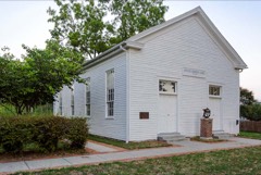
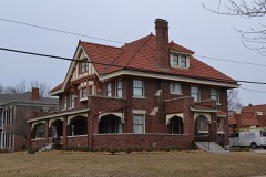
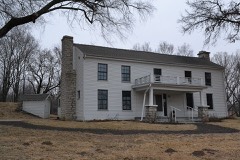
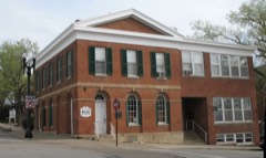
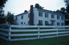
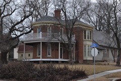
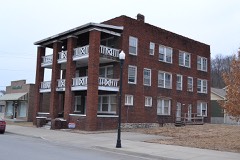
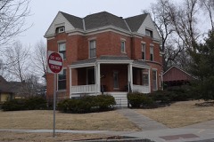
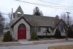
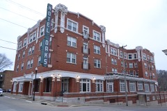
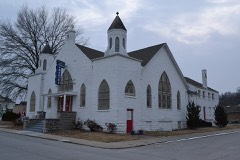
  • 39 properties here are on the National Register of Historic Places: 24 buildings, 12 districts and 3 sites.
  • 8 of the 39 listings were added during the 1970s.
  • The Geographic Names Information System records 60 populated places in this county; 60 are covered by at least one topographic sheet.
  • 3 public-domain county histories, 1885 and 1920, supply 45,065 words of narrative reproduced here.

What happened here

8 accounts

Among them: Chapter Xxii The Mormons; Chapter Xxiii The James Boys; Days. These passages come from the identified county-history source books. Each inset names its own source and opens the exact section it comes from.

From History of Clay County, Missouri, published 1920 - Washington Township

Chapter Xxii The Mormons

MORMON INFLUX TO JACKSON COUNTY IN 1832 - TROUBLE IN JACKSON COUNTYTOOK REFUGE IN CLAY AND OTHER COUNTIES- HOSTILITIES AGAINST MORMONS - MORMONS ARMED - FORCES CONCENTRATED AT FAR WEST - STATE MILITIA CALLED OUT - GENERAL DONIPHAN IN COMMAND^ - MORMONS SURRENDER - JOE SMITH .-YND OTHER LEADERS INDICTED - IN JAIL AT LIBERTY - LEADERS SAVED BY' DONIPHAN - GOVERNOR BOGGS MURDERED - MORMONS REMAIN AWAY FROM STATE FOR FIFTY' YEARS - AT INDEPENDENCE.

Read the rest of this passage

From History of Clay County, Missouri, published 1920 - Washington Township

Chapter Xxiii The James Boys

NATIVES OF THIS COUNTY - FATHER, REV. ROBERT JAMES, DIED IN CALIFORNIA - MOTHER'S SUBSEQUENT MARRIAGES - FRANK JOINS CONFEDERATE ARMYCAPTURED AND PAROLED - AGAIN ARRESTED - ESCAPES AND BECOMES A GUERILLA - RAIDS - MOTHER ARRESTED BY FEDERALS- JESSE "WENT TO THE BUSH" - TWICE WOUNDED - CAREERS OF BRIGANDAGE - PURSUIT KEPT UP BY LOCAL OFFICERS - PINKERTON DETECTIVE AND DANIEL ASKEW KILLED - END OF CAREERS - LITTLE KNOWN IN CLAY COUNTY 249-254

Read the rest of this passage

From History of Clay County, Missouri, published 1920 - Washington Township

Days

FIRST COUNTY COURT - A COURT INCIDENT - ROADS ESTABLISHED - OFFICXAXS APPOINTED - TAX LIST - FIRST ELECTION - SIMON COCKRELI^ - SECOND TERM - FIRST PATROL - FIRST CIRCUIT COURT - OFFICERS - JURORS - FIRST PERSON HANGED IN CLAY COUNTY - "THE RING TAILED PAINTER" - COURT HOUSE - JAIL - OTHER ROADS ESTABLISHED - TOWNSHIPS CREATED - FERRIES ESTABLISHED - SLAVE AND OTHER VALUES - STEAMBOATING - AN ATTEMPTED MURDER - A DOUBLE HANGING - A REVIEW OF THE EARLY DAYS.

Read the rest of this passage

From History of Clay and Platte Counties, Missouri;, published 1885 - Gallatin Township

Chapter Viii The Mexican War

Army of the West - Platte and Cole Infantry Battalion - Departure of the Expedition - Arrival of Kearney in Santa Fe - Col. Sterling Price - Capt. Morin's Platte County Company - Names of Members - The Ortiz Insurrection - Murder of Gov. Bent and Others - Battle of La Canada - Ambuscade at El Embudo - Storming and Capture of Fort Pueblo de Taos - Other Battles - Massacre and Subsequent Battle at Moro - Engagement at Cienega - The Return Home - Capt.

Read the rest of this passage

From History of Clay and Platte Counties, Missouri;, published 1885 - Gallatin Township

Chapter Xi Homicides, Trials, Etc

Murder of Hall L. Wilkerson - An Election Row - Affray in Platte County - Killing of Wm. Callahan - Ducote Killed by White - - G. S. Elgin Assassinated - Nathaniel Daniels Killed by Houston - Capt. Dan Jenkins Assassinated - Killing of Burge by Johnson - Thomas Morgan Killed by Israel Health and Benj. Fulcher- - .\lvis Homicide - Killing of Dr.

Read the rest of this passage

From History of Clay and Platte Counties, Missouri;, published 1885 - Gallatin Township

Chapter Vi

Government Surveys - Work and Improvements - Land Entries - Hard Times Among the Settlers - Great Flood of 1844, Followed by Much Sickness - Hemp Growing - Other Leading Products - Emigration to Oregon - Effect of the Mexican War upon the People - California Gold Excitement - Argonauts from Platte County - Salt Lake and Indian Trade - The Four Years Preceding the Kansas Troubles, and Drawbacks During that Period - Drought of 1854 - Four Years Preceding 1861 - Population and Property Valuation from 1840 to 1860 - State Roads, Bridges, Rail¬ roads, Ete .

Read the rest of this passage

From History of Clay and Platte Counties, Missouri;, published 1885 - Gallatin Township

Chapter Viii The Mexican War

Army of the West - Platte and Cole Infantry Battalion - Departure of the Expedi¬ tion - Arrival of Kearney in Santa Fe - Col. Sterling Price - Capt. Morin's Platte County Company - Names of Members - The Ortiz Insurrection - Murder of Gov. Bent and Others - Battle of La Canada - Ambuscade at El Embudo - Storming and Capture of Fort Pueblo de Taos - Other Battles - Massacre and Subsequent Battle at Moro - Engagement at Cienega - The Return Home - Capt.

Read the rest of this passage

From History of Clay and Platte Counties, Missouri;, published 1885 - Gallatin Township

Chapter Xi Homicides, Trials, Etc

Murder of Hall L. Wilkerson - An Election Row - Affray in Platte County - Killing of Wm. Callahan - Ducote Killed by White - G. S. Elgin Assassinated - Nathaniel Daniels Killed by Houston - Capt. Dan Jenkins Assassinated - Killing of Burge by Johnson - Thomas Morgan Killed by Israel Health and Benj. Fulcher - Alvis Homicide - Killing of Dr.

Read the rest of this passage

Places on the National Register

39

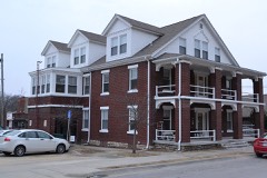
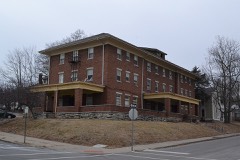
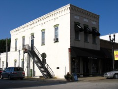
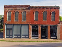
Every property in this county listed on the National Register of Historic Places, with the year it was listed and the federal nomination document.

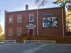
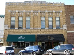
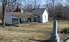
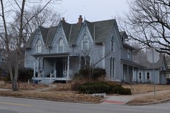
Photograph PropertyType ListedReference
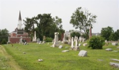
Aker Cemeterysite197474001071
Antioch Christian Churchbuilding197979001358
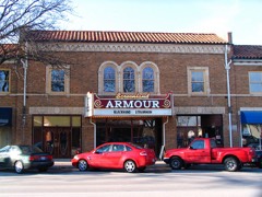
Armour Theatre Buildingbuilding200808000560
Arthur-Leonard Historic Districtdistrict200100001608
Atkins-Johnson Farmhouse Propertybuilding200707001154
Boarding House Districtdistrict2018100002791
Clay County Savings Association Buildingbuilding199292001675
Claybrook Housebuilding198181000332
Clinton Housebuilding197878001641
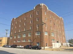
Colonial Hotelbuilding201010000392
Dr. James Compton Housebuilding197979003677
Dougherty-Prospect Heights Historic Districtdistrict200100001605
Downtown Smithville Historic Districtdistrict201414000159
Elms Hotelbuilding198585000648
Elms, The, Historic Districtdistrict201414000091
Excelsior Springs Hall of Waters Commercial East Historic Districtdistrict199999000638
Excelsior Springs Hall of Waters Commercial West Historic Districtdistrict199999000637
First Methodist Churchbuilding200909000856
Garrison School Historic Districtdistrict200100001607
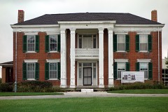
Hall of Watersbuilding198383000977
Frank Hughes Memorial Librarybuilding199292001676
IOOF Liberty Lodge No. 49building199292001677
James Brothers' House and Farmbuilding197272000709
James Brothers' House and Farm (Boundary Increase)site197878003417
Jewell Hallbuilding197878001642
Jewell-Lightburne Historic Districtdistrict200100001606
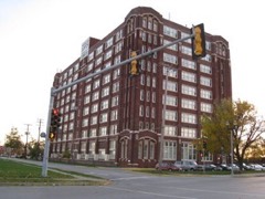
Ligon Apartmentsbuilding201010000265
Major Hotelbuilding199292001678
Miller Buildingbuilding199292001679
Missouri City Savings Bank Building and Meeting Hallbuilding201010000507
Mt. Memorial Cemeterysite201212000231
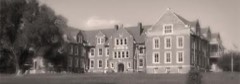
Odd Fellows Home Districtdistrict198787001595
Sears, Roebuck and Company Warehouse Buildingbuilding199797000411
South Liberty Courthouse Square Historic Districtdistrict199292001680
Watkins Milldistrict196666000416
West Liberty Courthouse Square Historic Districtbuilding199292001681
Wheeling Corrugating Company Buildingbuilding199494001220
Woodneathbuilding197878001640
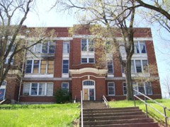
Wyman Schoolbuilding200808000695

Wildfire, 1992 to 2019

168 fires

Every wildfire the federal occurrence database records inside this county: 168 of them, burning about 308 acres. 2 started naturally and 15 were recorded as arson. Each settlement page carries the fires within five miles of it.

Reported cause Fires
Missing data/not specified/undetermined69
Debris and open burning34
Recreation and ceremony29
Arson/incendiarism15
Smoking9
Equipment and vehicle use7
Fireworks2
Natural2
Power generation/transmission/distribution1

The five largest, by the area the report gives. None of them was recorded as arson.

DateCause SizeReported by Name on the report
6 March 1995Smoking60 acresMissouri Department of Conservationnot named
6 March 1995Debris and open burning40 acresMissouri Department of Conservationnot named
8 January 2006Debris and open burning10 acresMissouri State Fire Marshal's Officenot named
3 April 2005Recreation and ceremony10 acresMissouri State Fire Marshal's Officenot named
6 March 1995Debris and open burning10 acresMissouri Department of Conservationnot named
18 March 2011Debris and open burning8.0 acresMissouri Department of Conservationnot named
30 April 1992Smoking8.0 acresMissouri Department of Conservationnot named
9 July 2018Debris and open burning7.1 acresMissouri Department of Conservation177358-08922-07092018-1629

Every settlement page carries the fires within five miles of it - see the settlement index below.

Storms, 1955 to 2026

60 of 958 shown

The NOAA Storm Events Database holds 958 reports for this county, causing no deaths, 34 injuries and about $125,546,060 in recorded property damage. Each settlement page carries the reports that name it.

Kind of event Reports
Hail463
Thunderstorm Wind373
Flash Flood63
Tornado36
Flood18
Funnel Cloud2
Lightning2
Heavy Rain1

The most serious of them, by death, then injury, then recorded damage. The accounts are quoted exactly as the forecast office filed them.

WhenEvent Place namedHarm What the report says
May 2003Tornado (F4)Gladstone13 hurt, $31,000,000New tornado touchdown near Shady Lane and Antioch in Gladstone...with F0 to F1 damage to trees and roofs. The tornado intensified quickly, and damage of marginal F4 intensity was noted around one mile northeast of this area, near the intersection of NE 63rd Terrace and North Jackson. Another small area of marginal F4 intensity was noted just northeast of this location, in the Carriage Hills subdivision, just south of Pleasant Valley Road near North Brighton. Areas of F1 to F3 intensity damage was noted around these specific neighborhoods. The tornado continued northeast, based on air surveys, to just shy of Interstate 435 before dissipating.
April 1979Tornado (F2)not stated9 hurt, $250,000no account filed
May 1977Tornado (F4)not stated5 hurt, $2,500,000no account filed
June 1969Tornado (F3)not stated3 hurt, $25,000no account filed
August 2000Thunderstorm WindSmithville2 hurt, $800,000Thunderstorm winds estimated at 80 mph tore through the Smithville Lake area. Extensive damage was done to a marina, where 40 to 45 boats were damaged, and two of four docks were damaged. A nearby campground was also hit hard, as approximately 20 camping trailers were damaged. Two campers were hospitalized, including one that was inside an RV that rolled over.
June 1994Thunderstorm WindKearney1 hurt, $5,000Power lines and large trees were knocked down. A motorists traveling through the storm was badly bruised by wind blown hail after trying to seek shelter in a nearby ditch. The size of the hail was unknown.
May 2019LightningParadise1 hurtA person was injured by lightning. The exact situation and extent of the injury is unknown.
May 2003Tornado (F2)Liberty$60,000,000Tornado reported on the ground near Missouri Route 291, south of Missouri Route 152, it produced spotty damage northeast to downtown Liberty. Substantial damage was noted near the square in Libery, and to William Jewel College. The tornado tracked east along Missouri Route H into rural portions of Clay county before dissipating. Maximum intensity damage noted in the area was F2, based on surveys and input from local emergency management.
May 2008Tornado (EF2)Gashland$10,000,000An EF2 tornado developed along a bow echo and touched down at 1:03 am in Gladstone. It then traveled northeast and dissipated at 1:08 am.|Numerous homes and businesses suffered damage or total loss.
May 2000Tornado (F1)North Kansas City$5,000,000The tornado formed rapidly in southwest Clay County in Kansas City, MO, causing considerable damage to two auto dealerships at 39th and North Oak Trafficway. A nearby apartment complex suffered roof damage. Many trees and power lines were downed as the tornado moved east, lifting near Parvin Road and Chouteau Trafficway.
May 2008Tornado (EF3)Liberty Mitchell Arp$4,000,000A brief EF3 tornado developed along the apex of a bow echo, and touched down northwest of Liberty at 12:56 am CST. The tornado tracked east-northeast for nearly one mile before dissipating at 1:00 am. Four homes were destroyed and 117 suffered damage.
October 1998Flash FloodMosby$4,000,000no account filed
April 1995HailGladstone$2,000,000Severe thunderstorms dumped hail from golf ball- to softball-size on parts of northern Kansas City and Gladstone. The storms then moved northeast to Kearney and Holt. Many homes received roof damage and at least four car dealerships received major damage to inventory. Baseball-size hail at the Metro North Mall smashed car windshields and broke windows.
November 2005Tornado (F1)Excelsior Spgs$1,200,000Tornado touched down 2 miles south southwest of Excelsior Springs along Highway H near Pratherville at 1744. The tornado moved north-northeast and crossed into Ray county around Lawson at 1759. The most significant damage was located on the west side of Excelsior Springs. At the Magna manufacturing plant a wall suffered damage and there was a partial roof collapse. The plant's conveyor line was also damaged. There was also damage to a car dealership with blown in plate glass windows on the showroom floor. Otherwise...damage was mainly to trees as it moved to the Ray county line. This was the second latest tornado on record within the six county Kansas City metropolitan region.
March 2006HailLiberty$750,000Car dealerships hit hard by afternoon hail storm. Roof damage also noted throughout town.
April 1995HailKansas City$750,000Severe thunderstorms dumped hail from golf ball- to softball-size on parts of northern Kansas City and Gladstone. The storms then moved northeast to Kearney and Holt. Many homes received roof damage and at least four car dealerships received major damage to inventory. Baseball-size hail at the Metro North Mall smashed car windshields and broke windows.
April 1994Thunderstorm WindLiberty$500,000The roof and front section of a roller skating rink were blown off from wind gusts estimated at 70 mph. Damages were estimated at just under $500,000. Other damage included home roofs, large trees limbs, as well as trees blown down. The storm also produced golf ball- size hail at Paradise Point.
April 1993HailGladstone$500,000Large hail, ranging from just under 1.00 inch to golf ball-size, produced substantial damage to automobiles on several dealership lots in Gladstone. Two-inch-diameter hail was reported near Lake Doniphan Road in Excelsior Springs.
March 2006Thunderstorm WindNorth Kansas City$250,000Roof blown off Block Road at 12th and Burlington. Multiple power poles snapped off...windows and structural damage to buildings...around 10th through 12th Street and Burlington.
March 2006HailGladstone$250,000no account filed
March 2006HailExcelsior Spgs$250,000no account filed
March 2006HailLiberty$200,000Widespread damage to cars and roofs.
March 2006HailNorth Kansas City$200,000no account filed
September 2010Thunderstorm WindSmithville$150,000Numrous reports of wind damage reported around Smithville Lake. Trees were reported down on homes and fences were blown down. Smith Forks church camp attendant, reported several tents were blown over into Smithville Lake. All persons were accounted for and uninjured. Thunderstorm wind gusts were estimated up to 80 mph.
August 2000Thunderstorm WindExcelsior Spgs$100,000A hangar and three aircraft were damaged at the Excelsior Springs Airport. Nearby, the door was torn off a pole barn.
April 2006HailExcelsior Spgs$100,000no account filed
May 2003Tornado (F4)Gladstone$50,000Tornado moved in from Platte county and dissipated just before 169 highway south of I-29.
October 2000Thunderstorm WindHolt$50,000A large maple tree fell on a home, causing severe damage to the house.
August 2000Thunderstorm WindKearney$50,000Several large trees were downed in Kearney. Property damage resulted from some of the trees landing on houses.
August 2000Thunderstorm WindClaycomo$50,000Storm spotters reported 80 mph winds near the interchange of I-435 and SR 210. Nearby in the Northland of Kansas City, a tree was uprooted and fell on a house.
July 1994Thunderstorm Windnot stated$50,000Large trees and power lines were blown down after wind gusts of 84 mph were reported.
June 1999FloodCountywide$50,000no account filed
December 2021Thunderstorm Wind(Mkc)Ks City Dntn Ar$25,000While a local reporter was on the air covering the strong winds a roof was ripped off of a hangar at Kansas City Downtown Airport. While this happened, the ASOS measured 77 mph wind at the location.
July 2000Thunderstorm WindGladstone$25,000The roof was blown off a building and equipment was blown over at a construction site in Gladstone.
October 1982Tornado (F1)not stated$25,000no account filed
May 1973Tornado (F2)not stated$25,000no account filed
June 1969Tornado (F1)not stated$25,000no account filed
June 1967Tornado (F1)not stated$25,000no account filed
May 1962Tornado (F1)not stated$25,000no account filed
March 1955Tornado (F2)not stated$25,000no account filed
July 2007Flash FloodExcelsior Spgs$20,000A 16 year old female driver drowned, when she drove her SUV into several feet of running water, at NE 144th and Rocky Hollow Road, where William Creek crosses the road. This was around one mile west northwest of Excelsior Springs.
March 2006HailLiberty$20,000no account filed
August 2006Thunderstorm WindLiberty$19,000Nine utility poles snapped and one transformer destroyed from thunderstorm winds.
August 2006Thunderstorm WindLiberty$15,000Street light poles damaged...street signs bent...and siding ripped off several homes.
June 2017Thunderstorm WindClaycomo$10,000A 10 inch diameter tree fell on a car. No one was injured.
February 2012Thunderstorm WindNashua$10,000A roof was blown off and a wall pushed in on a building,that was under construction. Thunderstorm wind gusts were estimated up to 60 mph.
April 2010Thunderstorm WindMissouri City$10,000Thunderstorm wind gusts to 85 mph were estimated in Missouri City. Numerous tree limbs were snapped and power lines were reported down.
September 2010Thunderstorm WindSmithville$10,000A roof was blown off a house. Docks on Smithville Lake were separated from the shore. Thunderstorm wind gusts were estimated up to 80 mph.
May 2007Heavy RainExcelsior Spgs$10,000Total rainfall since this morning was 3.75 inches.
March 2006Thunderstorm WindLiberty$10,000Barn damaged and power poles down 1 mile northeast of the Highway 291 and Highway 210 intersection.
April 1995HailHolt$10,000Severe thunderstorms dumped hail from golf ball- to softball-size on parts of northern Kansas City and Gladstone. The storms then moved northeast to Kearney and Holt. Many homes received roof damage and at least four car dealerships received major damage to inventory. Baseball-size hail at the Metro North Mall smashed car windshields and broke windows.
August 2001Thunderstorm WindExcelsior Spgs$8,000Tree down on roof of house.
June 1995Thunderstorm WindSouth part of Co$8,000Severe thunderstorms produced strong winds, knocking several tree limbs down, and causing numerous power outages. Damage mainly occurred over the southern part of the county.
July 2004Thunderstorm WindLiberty$8,000no account filed
July 1996Thunderstorm WindSmithville$7,000no account filed
July 2020Thunderstorm WindArley$5,000A swing set was damaged by a limb falling onto it.
April 2004Tornado (F0)Smithville$5,000Brief landspout tornado. Tore off part of a metal roof from a local business.
June 2004Thunderstorm WindNorth Kansas City$5,000Damage to Ameristar casino building.
June 2001Thunderstorm WindLiberty$5,000Large trees reported blown down by law enforcement.

Mines and quarries

110 recorded

The Survey's mineral resources record lists 110 workings inside this county. 6 still produce and 104 are closed or unrecorded. Each settlement page carries the workings within five miles of it.

Commodity Workings
Stone, Crushed/Broken95
Sand and Gravel, Construction8
Clay8

The least common of them first, because a county's hundredth gravel pit says nothing its first ten did not.

Where SiteCommodity StatusRecorded
Holliday Sand & Gravel PlantSand and Gravel, ConstructionProducer
Randolph DredgeSand and Gravel, ConstructionProducer
UnknownClayPast Producer
UnknownSand and Gravel, ConstructionPast Producer
UnknownClayPast Producer
UnknownSand and Gravel, ConstructionPast Producer
UnknownClayPast Producer
UnknownSand and Gravel, ConstructionPast Producer
UnknownClayPast Producer
UnknownStone, Crushed/Broken, ClayPast Producer
UnknownSand and Gravel, ConstructionPast Producer
UnknownClayPast Producer
Wren PitSand and Gravel, ConstructionPast Producer
Wren PitSand and Gravel, ConstructionProducer
Atwood QuarryStone, Crushed/BrokenPast Producer
Borrow PitStone, Crushed/BrokenPast Producer
Clay County Mine and MillStone, Crushed/BrokenProducer
Dever QuarryStone, Crushed/BrokenPast Producer
Doc Gould MineStone, Crushed/BrokenPast Producer
Everett Quarries #5Stone, Crushed/BrokenProducer
Hedges QuarryStone, Crushed/BrokenPast Producer
International Trade CenterStone, Crushed/BrokenPast Producer
Kearney QuarryStone, Crushed/BrokenPast Producer
Kelly QuarryStone, Crushed/BrokenPast Producer
Matthews QuarryStone, Crushed/BrokenPast Producer
Mclaughlin QuarryStone, Crushed/BrokenPast Producer
Missouri Rock Plant #2 QuarryStone, Crushed/BrokenPast Producer
Randolph Mine and MillStone, Crushed/BrokenProducer
Rice QuarryStone, Crushed/BrokenPast Producer
Schell QuarryStone, Crushed/BrokenPast Producer
Tobin QuarryStone, Crushed/BrokenPast Producer
Underground Storage IncStone, Crushed/BrokenPast Producer
UnknownStone, Crushed/BrokenPast Producer
Wolfert QuarryStone, Crushed/BrokenPast Producer

The townships, in 1920

45,065 words

History of Clay County, Missouri devotes a chapter to each township: its boundaries and streams, who settled it and when, the mills, the schools and the churches. All 4 are reproduced here in full. Each row shows the township's own shape and where it lies in the county, drawn from the Census Bureau's boundary. Which settlements belong to which township is computed from that same boundary, not taken from the book.

The county's history books

376,201 words

2 books written about this county, cut here where the book itself is cut, at its printed chapters: 29 chapters in all. Every chapter is public domain, machine-read from the scan and reproduced complete. A chapter already given under one of the county's towns is not repeated in this list.

History of Clay and Platte Counties, Missouri; (1885)

History of Clay County, Missouri (1920)

The people it describes

3 named

Everyone History of Clay County, Missouri stops to write about, with the section that describes them. Among them are the men who founded the place and governed the Territory. Each name opens the passage itself, in the words of 1920.

Every populated place in the county

60

Named settlements recorded in the Geographic Names Information System, each with the topographic sheets covering it. Villages, hamlets and abandoned places alike. Each is shown with the nearest named watercourse or landform and the survey quadrangle it falls on.

The vanished settlements of Clay County: the places named above that are no longer on the map.

Provenance

  • Topographic sheets. USGS Historical Topographic Map Collection, county index, measured from the bulk metadata.
  • Fire insurance maps. Library of Congress Sanborn collection, faceted to this county.
  • Photographs. Each place queried individually against the Library of Congress Prints and Photographs search.
  • Wildfire. Short, Karen C. 2022. Spatial wildfire occurrence data for the United States, 1992-2020 [FPA_FOD_20221014]. 6th Edition. Fort Collins, CO: Forest Service Research Data Archive. https://doi.org/10.2737/RDS-2013-0009.6 Collected with United States Government funding and usable without additional permissions or fees.
  • Mines and quarries. USGS Mineral Resources Data System (MRDS) https://mrdata.usgs.gov/mrds/ A work of the United States government, no copyright under 17 U.S.C. 105.
  • Storms. NOAA National Centers for Environmental Information, Storm Events Database https://www.ncei.noaa.gov/stormevents/ A work of the United States government, no copyright under 17 U.S.C. 105. Narratives are quoted verbatim from the National Weather Service report and are not edited or summarised.