 Block
Piedmont, Missouri
18 topographic sheets cover this place, the earliest surveyed in 1932 and the latest in 1989. It stands in Benton Township. It lies in ZIP code area 63957. It stands on Lick Branch. The Survey maps it on the Piedmont quadrangle. 1,897 people lived here at the 2020 count. It stands 495 feet above sea level.
Population over time
2 figuresPiedmont fell from 1,977 to 1,897 between 2010 and 2020. These are the recorded population figures Wikidata holds for this place, reached through the Geographic Names Information System number this page is keyed on rather than by name, so they belong to this place and not to another of the same name. Most are census counts, but not all are: an early figure may be a founding or settlement estimate, and an estimate published within five years of a census is left out. The change column is computed, and is left blank where more than 20 years separate a figure from the one before it, because a gap that long is not a change between two counts.
| Year | People | Change |
|---|---|---|
| 2010 | 1,977 | |
| 2020 | 1,897 | -80 (-4%) |
Topographic sheets covering this place
13 surveys from 18 printed sheetsMatched by testing this settlement's coordinate against the published boundary of every sheet in the United States Geological Survey's historical collection. Each opens the scanned sheet at the Survey.
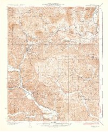
- 1932 USGS Piedmont quadrangle1:62500, 2 printings
- 1935 USGS Piedmont quadrangle1:62500, 2 printings
- 1949 USGS Rolla quadrangle1:250000
- 1953 USGS Rolla quadrangle1:250000
- 1954 USGS Rolla quadrangle1:250000, 2 printings
- 1958 USGS Rolla quadrangle1:250000
- 1959 USGS Rolla quadrangle1:250000
- 1960 USGS Rolla quadrangle1:250000
- 1966 USGS Rolla quadrangle1:250000
- 1968 USGS Piedmont quadrangle1:24000, 2 printings
- 1971 USGS Rolla quadrangle1:250000
- 1986 USGS Piedmont quadrangle1:100000, 2 printings
- 1989 USGS Rolla quadrangle1:250000



Fires near this place
60 since 1992Regional context, not property-specific evidence. The federal wildfire occurrence database lists 60 fires within 5 miles of Piedmont between 1992 and 2020, burning about 614 acres in total. None started naturally. 4 were recorded as arson. Distance is straight-line from the map coordinates, so a fire counted here may appear on a neighbouring settlement's page as well.
| Reported cause | Fires |
|---|---|
| Debris and open burning | 23 |
| Missing data/not specified/undetermined | 22 |
| Equipment and vehicle use | 6 |
| Arson/incendiarism | 4 |
| Power generation/transmission/distribution | 2 |
| Railroad operations and maintenance | 2 |
| Misuse of fire by a minor | 1 |
The most recent of them, most recent first, with the day each was reported and the service that recorded it.
| Date | Cause | Size | Reported by | Name on the report |
|---|---|---|---|---|
| 3 September 1996 | Arson/incendiarism | 1.0 acres | Missouri Department of Conservation | not named |
| 17 August 1994 | Equipment and vehicle use | 1.0 acres | Missouri Department of Conservation | not named |
| 10 August 2018 | Missing data/not specified/undetermined | 11 acres | Missouri Department of Conservation | 177400-02220-08102018-1730 |
| 5 July 1996 | Missing data/not specified/undetermined | 6.0 acres | Missouri Department of Conservation | not named |
| 13 June 2019 | Missing data/not specified/undetermined | under an acre | Missouri Department of Conservation | 178924-02220-06132019-1509 |
| 9 April 2016 | Missing data/not specified/undetermined | 25 acres | Missouri Department of Conservation | 135629-02220-04092016-2305 |
| 9 April 1995 | Debris and open burning | 1.0 acres | Missouri Department of Conservation | not named |
| 7 April 1992 | Equipment and vehicle use | 8.0 acres | Missouri Department of Conservation | not named |
Settlements close enough to share some of these fires:
Mines and quarries near this place
10 of 37 shownRegional context, not property-specific evidence. The federal mineral resources record lists 37 workings within 5 miles of Piedmont: 20 past producers, 9 occurrences, 6 prospects, 1 producer. 1 still produces. What was taken out: Iron, Stone, Crushed/Broken, Stone, Dimension, Sand and Gravel, Construction. Distance is straight-line from the map coordinates, so a quarry counted here may appear on a neighbouring settlement's page as well.
| Where | Site | Commodity | Status | Recorded |
|---|---|---|---|---|
| Unknown | Sand and Gravel, Construction | Past Producer | ||
| Eyerman & Schmaltz Quarry | Stone, Dimension | Past Producer | ||
| Sheahon Bros Quarry | Stone, Dimension | Past Producer | ||
| Unknown | Stone, Dimension | Past Producer | ||
| Cheeney Bank | Stone, Crushed/Broken | Prospect | ||
| Duncan Bros Quarry | Stone, Crushed/Broken | Unknown | ||
| Mccallister Quarry | Stone, Crushed/Broken | Past Producer | ||
| Unknown | Stone, Crushed/Broken | Past Producer | ||
| Unknown | Stone, Crushed/Broken | Past Producer | ||
| Unknown | Stone, Crushed/Broken | Past Producer |
Storms near this place
54 since 1993Regional context, not property-specific evidence. The National Weather Service names Piedmont in 54 storm reports between 1993 and 2025: 26 hail, 19 thunderstorm wind, 6 flash flood, 3 flood. The reports record 1 injury. Each account below is quoted exactly as the forecast office filed it, from the NOAA Storm Events Database, and each date opens the federal record of that event.
| When | Event | Place named | Harm | What the report says |
|---|---|---|---|---|
| January 1996 | Thunderstorm Wind | Piedmont | 1 hurt, $75,000 | no account filed |
| March 2008 | Flood | Piedmont | $9,200,000 | The hardest hit community during this historic flood was Piedmont. Between 200 and 300 homes and businesses were flooded in the town of about 2,000 residents. Severe flash flooding of McKenzie Creek inundated over one-third of the town. All buildings in southern Piedmont were flooded, along with homes within two blocks on either side of Main Street. All major roads were closed leading into Piedmont. A mandatory evacuation order was issued for the entire town of Piedmont. Three law enforcement agencies rushed boats into the area to help with evacuations. Hundreds of people were evacuated, including some by boat. Shelters were opened at a church and a school for evacuees. Vehicles and propane tanks were among the items that littered roads after the floodwaters receded. The force of the floodwaters broke windows and even tore bricks off one building. A major water line was washed out, leaving Piedmont without water. Schools closed early, but students were held at the schools due to major flood hazards. Across the county, U.S. Highway 67 from Route 34 to Greenville was among five flooded sections of state highways that were closed. The county sheriff department received hundreds of calls from people stranded in vehicles and homes. Local residents characterized the flooding as the worst in their memory. At the height of the flooding, road transportation across the county was difficult or impossible. Two schools were cut off by floodwaters while school was in session. Two bridges were closed due to washouts. A section of railroad track was washed out. Phone service and water service was disrupted in parts of the county. Severe flooding inundated a subdivision five miles south of Piedmont along the Black River, where water reached the eaves of several homes. About 30 people were rescued by boat from that subdivision, and several of those were rescued from trees after a boat sank. The town of Williamsville was partially evacuated in an area close to Williams Creek. |
| April 2011 | Flood | Piedmont | $1,000,000 | no account filed |
| May 1996 | Thunderstorm Wind | Piedmont | $200,000 | no account filed |
| May 1996 | Hail | Piedmont | $100,000 | no account filed |
| April 2008 | Flood | Piedmont | $75,000 | In an area that was severely impacted by record flooding in March, major creek flooding occurred. Voluntary evacuations were requested for Piedmont, where McKenzie Creek left its banks. A few people were rescued on the south side of Piedmont. About 40 people were sheltered at a church as a precaution. No more than a half dozen homes were affected by this flood in Piedmont. The levels of McKenzie Creek were reportedly only about one-third of the height of the March 18 flood. Main Street was partially covered by creek floodwaters, and water lapped at the base of a bridge. Along the Black River west of Piedmont, nine people were evacuated by boat from a subdivision along the Black River. Half of the subdivision was underwater. Some of the homes had over six feet of water in them. |
| May 1999 | Thunderstorm Wind | Piedmont | $40,000 | In Piedmont, a pontoon boat in a parking lot was moved six feet. In Taske, a porch was blown off a house, and a shed was damaged. Trees were down across roadways at scattered locations around the county. |
| April 1999 | Thunderstorm Wind | Piedmont | $30,000 | Two garages were blown down. |
| May 2023 | Flash Flood | Piedmont | $25,000 | Parts of Dogwood Lane in Piedmont were washed out. |
| February 2017 | Thunderstorm Wind | Piedmont | $15,000 | A storage shed at a lumber yard was heavily damaged. Several trees and power lines were down. Scattered power outages occurred. |
| May 2011 | Thunderstorm Wind | Piedmont | $15,000 | A large number of trees covered Highway AA. |
| April 2011 | Thunderstorm Wind | Piedmont | $15,000 | There was minor structural damage at a resort. Power lines were down. |
| June 2022 | Thunderstorm Wind | Piedmont | $10,000 | Five to ten trees were blown down across roads in western Wayne County from Piedmont to the Williamsville area. |
| March 2006 | Hail | Piedmont | $10,000 | A supercell thunderstorm dropped hail slightly larger than baseballs on Highway DD, about 4 miles northeast of Piedmont. In Piedmont, hail was the size of half dollars. Greenhouses were heavily damaged by hail that penetrated their heavy plastic sheeting. |
| May 1996 | Hail | Piedmont | $10,000 | no account filed |
| August 2004 | Thunderstorm Wind | Piedmont | $8,000 | A utility pole was down across a railroad track near Piedmont. The wall of a building under construction was blown down in Greenville. Large tree limbs were blown down throughout Greenville. |
| April 2015 | Thunderstorm Wind | Piedmont | $6,000 | Trees were blown down. |
| May 2005 | Thunderstorm Wind | Piedmont | $6,000 | Trees and power lines were blown down. |
| August 1998 | Thunderstorm Wind | Piedmont | $5,000 | Trees and signs were blown down near Piedmont. |
| July 2022 | Thunderstorm Wind | Piedmont | $4,000 | Trees were reported down on power lines. |
| December 2018 | Thunderstorm Wind | Piedmont | $4,000 | A deck was blown away, and a large glass table was blown into a neighbor's yard. Although no lightning was observed with the heavy rain showers, they had produced lightning earlier in Carter County. |
| July 2024 | Thunderstorm Wind | Piedmont | $3,000 | A couple of trees were downed by thunderstorm downdrafts in Piedmont. |
| July 1998 | Thunderstorm Wind | Piedmont | $3,000 | Trees were blown down. |
| August 2021 | Thunderstorm Wind | Piedmont | $1,000 | A tree was down in Piedmont. |
| May 2025 | Hail | Piedmont | - | Multiple quarter size hail reports were received out of Piedmont on the far northern end of a supercell storm. |
| July 2024 | Flash Flood | Piedmont | - | Street flooding occurred in Piedmont with water levels up to truck bumpers and substantial ponding of water in fields and yards. Radar estimated 3-hour rainfall totals were 2-3 inches with around 2 inches of rainfall occurring between 1200-1300CST. |
| March 2023 | Flash Flood | Piedmont | - | Low water crossings were flooded across the county. |
| January 2020 | Flash Flood | Piedmont | - | Water overtopped a few bridges around Piedmont, including Missouri Highway 34 at two different locations over McKenzie Creek. A cocorahs observer measured a 24-hour rainfall total of 3.62 inches near Patterson. |
| May 2017 | Hail | Piedmont | - | Baseball-size hail was photographed and relayed via social media. |
| February 2009 | Flash Flood | Piedmont | - | From Piedmont south to Mill Spring, flash flooding occurred as creeks and streams overflowed. Route C was closed from Highway 34 to Route E. |
| March 2006 | Thunderstorm Wind | Piedmont | - | Gusts from 55 to 60 MPH were estimated by law enforcement officials. |
| May 2006 | Hail | Piedmont | - | Nickel-size hail fell on the south side of Piedmont in "Beckville." |
| March 2003 | Hail | Piedmont | - | Dime size hail was reported on V Highway between Piedmont and Leeper. |
| April 2002 | Thunderstorm Wind | Piedmont | - | Trees were down in Piedmont. |
| April 2002 | Flash Flood | Piedmont | - | Some low-lying county roads were flooded. A bridge on Route C had water over it. Rainfall at Greenville was 2.75 inches, and Piedmont had 1.7 inches. Most of that rain fell within a few hours. |
| April 2002 | Hail | Piedmont | - | Golf ball size hail was reported. |
| April 1998 | Hail | Piedmont | - | Reported on Highway 34. |
| April 1998 | Hail | Piedmont | - | Occurred on Highway 49. |
| April 1994 | Hail | Piedmont | - | Reported by the county sheriff. |
| April 1993 | Hail | Piedmont | - | The Piedmont Police Department reported 1.00-inch-diameter hail in Piedmont. Missouri Highway Patrol Troop E reported 0.75-inch-diameter hail at Patterson. |
| May 2023 | Hail | Piedmont | - | no account filed |
| July 2023 | Hail | Piedmont | - | no account filed |
| April 2022 | Hail | Piedmont | - | no account filed |
| April 2021 | Hail | Piedmont | - | no account filed |
| November 2017 | Hail | Piedmont | - | no account filed |
| April 2008 | Hail | Piedmont | - | no account filed |
| March 2006 | Hail | Piedmont | - | no account filed |
| April 2006 | Hail | Piedmont | - | no account filed |
| April 2006 | Hail | Piedmont | - | no account filed |
| August 2003 | Hail | Piedmont | - | no account filed |
| May 2003 | Hail | Piedmont | - | no account filed |
| April 2003 | Hail | Piedmont | - | no account filed |
| May 2002 | Hail | Piedmont | - | no account filed |
| January 1997 | Hail | Piedmont | - | no account filed |
Nearest settlements
The eight closest, with where each one stands in the county. Distances are straight-line, computed from the Geographic Names Information System coordinates.
| Map | Place | Distance | Sheets |
|---|---|---|---|
| Beckville | 0.8 miles | 18 | |
| Platow | 3.0 miles | 18 | |
| Virginia Settlement | 4.0 miles | 18 | |
| Gaylor | 4.1 miles | 18 | |
| Damon | 4.8 miles | 19 | |
| Leeper | 5.5 miles | 18 | |
| Gads Hill | 5.8 miles | 18 | |
| Mill Spring | 6.4 miles | 18 |
Elsewhere
Matched on this settlement's Geographic Names Information System number rather than its name, so it cannot be a different place of the same name in another state.
| Wikipedia article on Piedmont | An encyclopaedic summary. Its text is share-alike, so it is linked here rather than copied. |
| Wikidata item Q963250 | The structured record the population and elevation above come from. Public domain (CC0). |
Provenance
This settlement is recorded in the Geographic Names Information System as feature 751576. The sheet list is computed by point-in-boundary test against the United States Geological Survey's historical topographic inventory. Both are works of the United States government and carry no copyright under 17 U.S.C. 105.
Wildfire. Short, Karen C. 2022. Spatial wildfire occurrence data for the United States, 1992-2020 [FPA_FOD_20221014]. 6th Edition. Fort Collins, CO: Forest Service Research Data Archive. https://doi.org/10.2737/RDS-2013-0009.6 Collected with United States Government funding and usable without additional permissions or fees.
Mines and quarries. USGS Mineral Resources Data System (MRDS) https://mrdata.usgs.gov/mrds/ A work of the United States government, no copyright under 17 U.S.C. 105.
Storms. NOAA National Centers for Environmental Information, Storm Events Database https://www.ncei.noaa.gov/stormevents/ A work of the United States government, no copyright under 17 U.S.C. 105. Narratives are quoted verbatim from the National Weather Service report and are not edited or summarised.