 Block
From the record
2 National Register listings published here.
Sources: the National Register database, National Park Service
92 topographic sheets cover 47 settlements here, and 2 properties are on the National Register of Historic Places.
2 National Register listings published here.
Sources: the National Register database, National Park Service
Every property in this county listed on the National Register of Historic Places, with the year it was listed and the federal nomination document.
| Photograph | Property | Type | Listed | Reference |
|---|---|---|---|---|
| Fort Benton | structure | 2002 | 02000212 | |
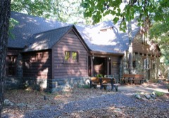 | Sam A. Baker State Park Historic District | district | 1985 | 85000540 |
Every wildfire the federal occurrence database records inside this county: 450 of them, burning about 7,192 acres. 2 started naturally and 173 were recorded as arson. Each settlement page carries the fires within five miles of it.
| Reported cause | Fires |
|---|---|
| Arson/incendiarism | 173 |
| Debris and open burning | 128 |
| Missing data/not specified/undetermined | 98 |
| Equipment and vehicle use | 18 |
| Power generation/transmission/distribution | 11 |
| Recreation and ceremony | 6 |
| Smoking | 4 |
| Railroad operations and maintenance | 4 |
| Fireworks | 3 |
| Natural | 2 |
| Misuse of fire by a minor | 2 |
| Other causes | 1 |
The five largest, by the area the report gives. Five of them were set deliberately.
| Date | Cause | Size | Reported by | Name on the report |
|---|---|---|---|---|
| 3 April 2011 | Arson/incendiarism | 430 acres | Mark Twain National Forest | BROWNS HOLLOW |
| 23 March 2011 | Arson/incendiarism | 285 acres | Mark Twain National Forest | TRAM NORTH |
| 3 November 2010 | Missing data/not specified/undetermined | 276 acres | Missouri Department of Conservation | THORNTON CEMETARY |
| 16 March 2006 | Missing data/not specified/undetermined | 273 acres | Missouri Department of Conservation | HOPE HOLLOW |
| 23 February 1996 | Arson/incendiarism | 244 acres | Mark Twain National Forest | BIG LAKE CREEK |
| 5 December 2020 | Arson/incendiarism | 221 acres | Missouri Department of Conservation | 251150-02220-12052020-1820 |
| 6 March 2005 | Missing data/not specified/undetermined | 179 acres | Missouri Department of Conservation | KELOW VALLEY FIRE |
| 3 November 1994 | Arson/incendiarism | 161 acres | Mark Twain National Forest | LOST CREEK ROAD |
Every settlement page carries the fires within five miles of it - see the settlement index below.
The NOAA Storm Events Database holds 349 reports for this county, causing 6 deaths, 42 injuries and about $48,708,000 in recorded property damage. Each settlement page carries the reports that name it.
| Kind of event | Reports |
|---|---|
| Hail | 117 |
| Thunderstorm Wind | 84 |
| Flood | 70 |
| Flash Flood | 38 |
| Tornado | 26 |
| Heavy Rain | 7 |
| Funnel Cloud | 5 |
| Lightning | 2 |
The most serious of them, by death, then injury, then recorded damage. The accounts are quoted exactly as the forecast office filed them.
| When | Event | Place named | Harm | What the report says |
|---|---|---|---|---|
| March 2025 | Tornado (EF3) | Gads Hill | 3 killed, $4,000,000 | An EF-3 tornado touched down 4 miles northeast of Garwood in Reynolds County and proceeded northeast into northwest Wayne County southwest of Gads Hill. Thousands of trees were uprooted or snapped along its path through northwest Wayne County. Significant damage occurred in Gads Hill, where three houses and several manufactured homes and camper/trailer homes were destroyed or sustained significant damage. The estimated peak wind was 155 mph. Three people were killed when their homes were destroyed. The tornado continued to produce extensive tree damage as it progressed northeast to the Iron County line just southwest of Des Arc. The tornado passed through Iron County and into Madison County before lifting. The total path length of the tornado was 38 miles. |
| March 2025 | Tornado (EF3) | Leeper | 2 killed, $3,000,000 | An EF-3 tornado touched down just northeast of Eastwood in Carter County and moved quickly northeast to the Wayne County line just southwest of Leeper. The tornado destroyed 3 homes in Leeper, including completely wiping the slab clean on one. A nearby house had its roof mostly removed and another had some broken windows. Three manufactured homes and one barn were destroyed, as well. Two people died when their camper home was thrown into the Black river. The tornado did extensive tree damage with thousands either snapped or uprooted along its path. It continued northeast from Leeper until it dissipated at County Road 361 just west of Maddox Lake. The estimated peak wind was 165 mph. The total path length was around 31 miles. |
| March 2025 | Tornado (EF2) | Burbank | 1 killed, 1 hurt, $1,500,000 | An EF-2 tornado touched down northeast of Greenville and moved northeast doing profound and extreme tree damage along its path. Thousands of trees were snapped or uprooted. The tornado directly impacted the River Valley Campground on Hidden Valley Road near the Castor River, killing one person and severely injuring another. The most severe structural damage occurred near the campground where a home lost its roof and had most of its exterior walls collapsed in. Several vehicles were tossed 50 to 100 feet. Another nearby home also suffered heavy damage. Numerous outbuildings were destroyed and a wooden power pole was snapped. The estimated peak wind was 134 mph. From the campground the tornado continued northeast and quickly entered Bollinger County where it did EF-3 damage. The total path length was 28.6 miles. |
| March 1964 | Tornado (F3) | not stated | 26 hurt, $25,000 | no account filed |
| December 1982 | Tornado (F1) | not stated | 8 hurt, $250,000 | no account filed |
| May 2011 | Tornado (EF3) | Leeper | 2 hurt, $500,000 | This tornado continued from Carter County into Wayne County. Three homes were destroyed. One log home in far southwestern Wayne County was levelled. Nine houses suffered major damage, and another 39 homes had minor damage. The vast majority of damage was in the Silva area. In Silva, a camper and a mobile home were destroyed. A Silva family reportedly did not make it to their tornado shelter in time. A large tree fell on one of the victims, resulting in a dislocated shoulder. Another family member received minor to moderate injuries to the hip, back, and head. Several vehicles were destroyed or damaged from flying debris and fallen trees. A couple of churches received mainly minor damage. Hundreds of acres of large trees were uprooted or snapped. A half-mile section of Highway 34 east of Silva was closed due to downed trees and power lines. Most streets in Silva were blocked by trees and limbs. Peak winds were estimated near 150 mph. The average path width was about 450 yards. The tornado continued northeast into Madison County. |
| May 2017 | Thunderstorm Wind | Greenville | 2 hurt, $60,000 | Multiple trees were uprooted on D Highway a few miles southeast of Greenville. One vehicle was struck by a falling tree, with minor injuries. Multiple trees were down in a campground. In Greenville, trees and power lines were down. |
| January 1996 | Thunderstorm Wind | Piedmont | 1 hurt, $75,000 | no account filed |
| May 2006 | Lightning | Lowndes | 1 hurt | An adult female was hospitalized overnight for injuries received due to a lightning strike. After running outside in the rain to retrieve a keyless entry device from her vehicle, she was holding the door knob of her house when she saw a flash. She was knocked unconscious. The inside of her hand was blistered, and she lost the use of her hand. She was expected to regain the use of her hand after weeks of physical therapy. |
| June 1997 | Lightning | Greenville | 1 hurt | A man who was struck by lightning was burned on the arm and abdomen. He refused treatment for his injuries. |
| May 2011 | Flash Flood | Wappapello | $20,000,000 | The record high level of Lake Wappapello exceeded the height of the emergency spillway at Wappapello Dam. The uncontrolled flow of water over the spillway berm washed out a 400-foot section of Highway T, taking out millions of dollars of communications infrastructure. County Road 404 was washed out. At least two homes along County Road 404 were inundated with at least a foot of water and were accessible only by boat. Five homes were directly affected by the spillway breach. |
| March 2008 | Flood | Piedmont | $9,200,000 | The hardest hit community during this historic flood was Piedmont. Between 200 and 300 homes and businesses were flooded in the town of about 2,000 residents. Severe flash flooding of McKenzie Creek inundated over one-third of the town. All buildings in southern Piedmont were flooded, along with homes within two blocks on either side of Main Street. All major roads were closed leading into Piedmont. A mandatory evacuation order was issued for the entire town of Piedmont. Three law enforcement agencies rushed boats into the area to help with evacuations. Hundreds of people were evacuated, including some by boat. Shelters were opened at a church and a school for evacuees. Vehicles and propane tanks were among the items that littered roads after the floodwaters receded. The force of the floodwaters broke windows and even tore bricks off one building. A major water line was washed out, leaving Piedmont without water. Schools closed early, but students were held at the schools due to major flood hazards. Across the county, U.S. Highway 67 from Route 34 to Greenville was among five flooded sections of state highways that were closed. The county sheriff department received hundreds of calls from people stranded in vehicles and homes. Local residents characterized the flooding as the worst in their memory. At the height of the flooding, road transportation across the county was difficult or impossible. Two schools were cut off by floodwaters while school was in session. Two bridges were closed due to washouts. A section of railroad track was washed out. Phone service and water service was disrupted in parts of the county. Severe flooding inundated a subdivision five miles south of Piedmont along the Black River, where water reached the eaves of several homes. About 30 people were rescued by boat from that subdivision, and several of those were rescued from trees after a boat sank. The town of Williamsville was partially evacuated in an area close to Williams Creek. |
| April 1989 | Tornado (F1) | not stated | $2,500,000 | no account filed |
| May 2017 | Flood | Silva | $1,400,000 | Record flooding occurred on the St. Francis River as the month began. The river crested at 37.05 feet on the Patterson river gage on the evening of April 30th. The old record was 35.77 feet in December of 1982. Numerous roads were closed, including Business Route 67 in Greenville and Route 34 at the St. Francis River Bridge. The record river flooding affected Lake Wappapello, which is formed by a dam on the St. Francis River near the town of Wappapello. Water poured over the emergency spillway of the dam. Mandatory evacuations were considered for areas below the dam. The lake levels in Lake Wappapello came close to the record set in 2011, but they did not reach it. Highway T just below the dam was washed out. |
| May 2017 | Flood | Piedmont Muni Arpt | $1,000,000 | Flooding of the Black River occurred below Clearwater Dam. The lake levels behind the dam reached a record height. For the first time in the dam's history, water passed through the emergency spillway of the dam. This prompted concerns about flooding below the dam. A mandatory evacuation was considered for some residents below the dam. Several roads were closed, including Route 49 at Mill Spring. Damage to public property, including roads, bridges, and utilities, was estimated near one million dollars. |
| May 2011 | Flood | Taskee Station | $1,000,000 | Moderate flooding continued from April on the St. Francis River. At the Patterson river gage, the river crested at 30.94 feet on the evening of May 2. This was the fifth highest flood crest on record, only an inch below the May, 2002 flood crest. Flooding was much more severe downriver near Greenville due to flooding of Lake Wappapello, which was formed by a dam on the St. Francis River. A storage facility and a restaurant in Greenville were flooded. County schools were closed for days due to numerous road closures. Residents in Greenville built a dirt levee across old U.S. Highway 67 to protect the town from flooding of the lake. The backwater from the lake reached all of the streets leading into town, effectively isolating the town. Floodwaters reached the girders of the four-lane bridge on U.S. Highway 67 south of Greenville. Lake Wappapello reached its highest level on record. A temporary dike three feet high was constructed of sandbags at Wappapello Dam's spillway in an attempt to control overtopping. The dike was eventually overtopped, and an uncontrolled release of water washed out Highway T. Lake levels impinged on sections of U.S. Highway 67 and State Route 34. State Route 34 was sandbagged east of Patterson in an attempt to keep it open, but Route 34 was closed between Highways 67 and 143. Up to four feet of water covered the road. The northbound lanes of U.S. 67 were closed for 1.5 miles near Otter Creek. Officials detoured northbound traffic into one southbound lane. |
| April 2011 | Flood | Piedmont | $1,000,000 | no account filed |
| November 2005 | Flash Flood | Countywide | $500,000 | Flash flooding occurred after persistent thunderstorms dumped 6 to 9 inches of rain overnight. In Piedmont, flooding of McKenzie Creek prompted the evacuations of 13 families. Several homes and businesses were flooded. A large storage shed was washed into the creek and became lodged against a bridge. A church in Piedmont had about three feet of water inside. Floodwaters topped all three of the city bridges in Piedmont, but not the State Route 34 bridge. City and county roads sustained substantial damage. Highway 34 West between Highway 67 and Patterson was closed due to flooding. A spotter in Piedmont reported his rain gauge overflowed at 6 inches. The co-operative observer at Clearwater Dam measured 8.10 inches from the overnight and early morning storms. An automated gage in Greenville measured 4.99 inches. |
| May 2002 | Flash Flood | Countywide | $250,000 | no account filed |
| April 2023 | Tornado (EF1) | Mill Spg | $200,000 | The tornado entered a heavily forested area of Wayne County after forming just over the county line in Carter County. The tornado produced a swath of tree destruction up to 300 yards wide. The tornado paralleled Highway A for about a mile or so. The only structural damage was observed where the tornado crossed Highway A. One garage suffered minor roof damage by a falling tree. The tornado caused shingle damage to a house located along Highway A. Where the tornado crossed Highway 49, the most intense tree damage was observed. This is where peak winds were estimated near 110 mph and where acres of trees were flattened. The tree damage swath became narrow and much less intense east of Highway 49 in hilly forested terrain. |
| May 1996 | Thunderstorm Wind | Piedmont | $200,000 | no account filed |
| July 2012 | Thunderstorm Wind | Greenville | $150,000 | Several trees were damaged or uprooted. Power lines were blown down. Half of the community was without power. There was minor structural damage. Two double-wide mobile homes were slightly damaged. Roof shingles were blown off. An awning in front of a church was blown off. The communications antenna tower at the sheriff department was bent over. A small statue was blown over. |
| April 2011 | Thunderstorm Wind | Piedmont Muni Arpt | $150,000 | The automated observing system at the Piedmont airport measured a wind gust to 66 mph. A hangar building at the airport was damaged. The doors were damaged, along with one plane in the hangar. Widespread damage occurred in and around Piedmont. Trees and power lines were blown down, and power poles were down. |
| January 1999 | Thunderstorm Wind | Greenville | $115,000 | Thunderstorm winds caused extensive damage to a house 4 miles east of Greenville. Another house about 6 miles east of Greenville was damaged. Numerous trees and power lines were down in eastern Wayne County. A National Weather Service damage survey indicated the damage was caused by microburst winds near 100 MPH. At the first residence, a modular home was nearly destroyed, with just the bathrooms left standing. An outbuilding 26 by 30 was also destroyed. At the second residence, a very old home was destroyed and two old outbuildings were heavily damaged. |
| April 2011 | Tornado (EF1) | Old Greenville | $100,000 | One mobile home was destroyed by a falling tree. Several outbuildings and a garage were destroyed. Dozens or perhaps hundreds of trees were uprooted. Two convergent path meso vortices were evident. The width of the tornado was difficult to determine due to the interaction with a downburst. There was a large swath of easterly falling trees on conservation land. Some of the pine trees within this area were snapped three feet above the ground. Highway V was blocked by trees and power lines in numerous places. Peak winds were estimated near 100 mph. |
| April 2004 | Tornado (F1) | Patterson | $100,000 | Trees and power lines were blown down. Two businesses and about six homes were severely damaged when most of their roofing was blown off. The businesses were a beauty shop and a post office. A dozen barns and sheds were destroyed. Several vehicles and some farm machinery was damaged. Peak winds were estimated near 100 MPH. Power outages affected about 100 people. Some county roads and secondary highways were blocked. The damage path began on Highway B and ended at the junction of Highway 34 and FF Highway. Most of the structural damage was in Patterson at the junction of Highways 34 and FF. |
| May 1996 | Hail | Piedmont | $100,000 | no account filed |
| April 2011 | Thunderstorm Wind | Silva | $75,000 | In Silva, a pontoon boat, two vehicles, and a carport were damaged. The 26-foot pontoon boat was lifted off a trailer and flipped over. The carport was blown about one-eighth of a mile. The two vehicles received minor damage from the airborne objects. Shingles were blown off a garage and shed. Large trees were blown down. U.S. Highway 67 was blocked by downed power lines. |
| April 2008 | Flood | Piedmont | $75,000 | In an area that was severely impacted by record flooding in March, major creek flooding occurred. Voluntary evacuations were requested for Piedmont, where McKenzie Creek left its banks. A few people were rescued on the south side of Piedmont. About 40 people were sheltered at a church as a precaution. No more than a half dozen homes were affected by this flood in Piedmont. The levels of McKenzie Creek were reportedly only about one-third of the height of the March 18 flood. Main Street was partially covered by creek floodwaters, and water lapped at the base of a bridge. Along the Black River west of Piedmont, nine people were evacuated by boat from a subdivision along the Black River. Half of the subdivision was underwater. Some of the homes had over six feet of water in them. |
| May 2011 | Tornado (EF1) | Mill Spg | $70,000 | The tornado was not on the ground for the whole path length. Numerous trees were uprooted and snapped, especially along Highway U between Highway B and FF. Mainly tree damage occurred to the southwest of that area. Along Highway 34, two outbuildings were destroyed and a small covered bridge on private property was destroyed. There was minor soffit damage to another house along Highway 34. Only a few trees were damaged to the northeast of this area. A few power poles were snapped. Peak winds were estimated near 100 mph. The average path width was 100 yards. |
| April 2011 | Tornado (EF1) | Clubb | $70,000 | At a horse ranch near Clubb, the tornado lifted wall panels from a horse arena, lifted a segment of roofing from a house, uprooted trees, and heavily damaged a 111-year-old barn. Numerous power poles were snapped. The trees exhibited a convergent pattern, and tin from the arena was circulated, including some that was found 200 yards south of the arena. The tornado continued on the ground uprooting trees, maximizing intensity as it crossed County Road 216. The remainder of the path was through forested areas, including a conservation area. Peak winds were estimated near 105 mph. |
| May 2023 | Thunderstorm Wind | Greenville | $50,000 | A line of thunderstorms produced widespread tree damage across much of the county. The county dispatch center reported trees were blown down. |
| December 2015 | Tornado (EF1) | Patterson | $50,000 | Peak winds were estimated near 105 mph. A couple dozen tree trunks were snapped, and several large tree branches were broken. Highway 34 was closed due to downed and uprooted trees. The tornado tracked along or just north of Highway 34, but it lifted before crossing U.S. Highway 67. The tornado tracked through forested areas and wetlands near the St. Francis River. |
| July 1997 | Hail | Williamsville | $50,000 | A severe thunderstorm tracked across southern Wayne County, producing nickel to golf-ball size hail near the Butler County line. |
| May 1999 | Thunderstorm Wind | Piedmont | $40,000 | In Piedmont, a pontoon boat in a parking lot was moved six feet. In Taske, a porch was blown off a house, and a shed was damaged. Trees were down across roadways at scattered locations around the county. |
| January 2020 | Thunderstorm Wind | Shook | $35,000 | A large portion of the roof was blown off a big wooden barn. A window pane was blown out of a house, and a few shingles were blown off. Numerous trees were blown down, blocking access to the area. One tree fell on an old abandoned camper, destroying it. |
| April 1999 | Thunderstorm Wind | Piedmont | $30,000 | Two garages were blown down. |
| May 2011 | Flood | Hiram | $30,000 | no account filed |
| May 2024 | Thunderstorm Wind | Lodi | $25,000 | Thunderstorm winds downed trees in Sam A. Baker State Park, with a tree falling onto a vehicle. |
| May 2023 | Flash Flood | Piedmont | $25,000 | Parts of Dogwood Lane in Piedmont were washed out. |
| May 2020 | Thunderstorm Wind | Taskee Station | $25,000 | Trees were blown down, including one that landed on a camper. The damaged camper was on Highway 172 east of U.S. Highway 67. |
| September 2012 | Thunderstorm Wind | Piedmont Muni Arpt | $25,000 | Numerous trees were blown down in northwestern parts of the county. In particular, trees were down around Highway HH at Clearwater Dam. Tree limbs and whole trees were on roads in the Piedmont area. A car crashed into a downed tree near Piedmont, causing major injuries (indirect). |
| April 2011 | Tornado (EF1) | Silva | $25,000 | Structural damage was limited to the side of a church. The tornado uprooted and snapped dozens of oaks and pines. The heaviest damage was in a forested area, where peak winds were estimated near 100 mph. |
| April 2011 | Tornado (EF1) | Clubb | $25,000 | A few trees were uprooted south of Highway 34 and west of Highway C. A rotational damage path of uprooted oaks and snapped cedars and pines was noted northeast of the intersection of Highways 34 and C. The peak winds of about 105 mph were noted along Highway M about a mile north of Highway 34. The tornado then crossed into heavily forested conservation land. The average path width was about 300 yards. |
| April 1989 | Tornado (F1) | not stated | $25,000 | no account filed |
| November 1984 | Tornado (F1) | not stated | $25,000 | no account filed |
| March 1964 | Tornado (F3) | not stated | $25,000 | no account filed |
| October 2021 | Tornado (EF1) | Shook | $20,000 | This tornado touched down in the heavily forested county of Wayne, just a few miles north of the community of Shook. Numerous trees were uprooted and snapped. The tornado passed mainly through wooded country during the Wayne County portion of its path. The tornado then crossed into Bollinger County. |
| July 2020 | Thunderstorm Wind | Piedmont Muni Arpt | $20,000 | A few small trees and tree limbs were blown down. One tree limb punctured a hole through the roof of a house before striking the floor of the house. |
| January 2013 | Thunderstorm Wind | Wappapello | $20,000 | Numerous trees were blown down near Lake Wappapello, including some that landed across roadways. |
| April 2011 | Thunderstorm Wind | Greenville | $20,000 | Trees were blown down on the west side of the community. |
| August 2011 | Thunderstorm Wind | Shook | $20,000 | Broken power poles were reported in the Lost Creek area. State road crews removed several trees and limbs from state roads. |
| April 2010 | Heavy Rain | Greenville | $20,000 | A home was damaged when a portion of a basement wall collapsed. About three inches of rain fell during the previous night and early morning. The collapse occurred due to water collecting in recently excavated soil. The weight of the saturated mud caused one of the basement's concrete walls to collapse. The roof of the house began sagging after the collapse. |
| August 1998 | Flash Flood | Patterson | $20,000 | A nearly stationary cluster of thunderstorms dumped excessive rainfall amounts over a very small portion of Wayne County near Sam A. Baker State Park. Unofficial rainfall estimates were between 4 and 6 inches just north of Patterson, most of which fell within 3 hours. Clark Creek overflowed across low water bridges near Patterson. |
| July 1998 | Thunderstorm Wind | Greenville | $20,000 | A trailer was blown over, and trees were down. |
| July 1997 | Thunderstorm Wind | Greenville | $20,000 | Limbs were down. Structural damage occurred to an ambulance shed. |
| July 1998 | Flash Flood | South Portion | $20,000 | no account filed |
| February 2017 | Thunderstorm Wind | Piedmont | $15,000 | A storage shed at a lumber yard was heavily damaged. Several trees and power lines were down. Scattered power outages occurred. |
| December 2015 | Thunderstorm Wind | Greenville | $15,000 | Roofs were damaged in the downtown area, including the roof of the courthouse and a bank. |
| May 2011 | Thunderstorm Wind | Piedmont | $15,000 | A large number of trees covered Highway AA. |
The Survey's mineral resources record lists 365 workings inside this county. 4 still produce and 361 are closed or unrecorded. Each settlement page carries the workings within five miles of it.
| Commodity | Workings |
|---|---|
| Iron | 326 |
| Stone, Crushed/Broken | 23 |
| Sand and Gravel, Construction | 9 |
| Stone, Dimension | 3 |
| Granite | 1 |
| Lead | 1 |
| Zinc | 1 |
| Flagstone | 1 |
The least common of them first, because a county's hundredth gravel pit says nothing its first ten did not.
| Where | Site | Commodity | Status | Recorded |
|---|---|---|---|---|
| Unknown | Granite | Past Producer | ||
| Unknown | Zinc | Prospect | ||
| Unknown - Usfs Land | Lead | Past Producer | ||
| Unknown - Usfs Land | Flagstone | Past Producer | ||
| Eyerman & Schmaltz Quarry | Stone, Dimension | Past Producer | ||
| Sheahon Bros Quarry | Stone, Dimension | Past Producer | ||
| Unknown | Stone, Dimension | Past Producer | ||
| Unknown | Sand and Gravel, Construction | Past Producer | ||
| Unknown | Sand and Gravel, Construction | Past Producer | ||
| Unknown | Sand and Gravel, Construction | Past Producer | ||
| Unknown - Usfs Land | Sand and Gravel, Construction | Past Producer | ||
| Unknown - Usfs Land | Sand and Gravel, Construction | Past Producer | ||
| Unknown - Usfs Land | Sand and Gravel, Construction | Past Producer | ||
| Unknown - Usfs Land | Sand and Gravel, Construction | Past Producer | ||
| Unknown - Usfs Land | Sand and Gravel, Construction | Past Producer | ||
| Unknown - Usfs Land | Sand and Gravel, Construction | Past Producer | ||
| Cheeney Bank | Stone, Crushed/Broken | Prospect | ||
| Duncan Bros Quarry | Stone, Crushed/Broken | Unknown | ||
| Duncan Quarry | Stone, Crushed/Broken | Producer | ||
| Farquher Quarry | Stone, Crushed/Broken | Past Producer | ||
| Gads Hill Quarry - Plant | Stone, Crushed/Broken | Producer | Surface | |
| Harris Lime Co. Quarry & Plant | Stone, Crushed/Broken | Producer | ||
| Harty Quarry | Stone, Crushed/Broken | Past Producer | ||
| Mccallister Quarry | Stone, Crushed/Broken | Past Producer | ||
| Seminole Ag-Lime Quarry | Stone, Crushed/Broken | Producer | Surface | |
| Unknown | Stone, Crushed/Broken | Past Producer | ||
| Unknown | Stone, Crushed/Broken | Past Producer | ||
| Unknown | Stone, Crushed/Broken | Past Producer | ||
| Unknown | Stone, Crushed/Broken | Past Producer | ||
| Unknown | Stone, Crushed/Broken | Past Producer | ||
| Unknown | Stone, Crushed/Broken | Past Producer | ||
| Unknown | Stone, Crushed/Broken | Past Producer | ||
| Unknown | Stone, Crushed/Broken | Prospect | ||
| Unknown | Stone, Crushed/Broken | Past Producer | ||
| Unknown | Stone, Crushed/Broken | Past Producer | ||
| Unknown | Stone, Crushed/Broken | Past Producer | ||
| Unknown - Usfs Land | Stone, Crushed/Broken | Past Producer | ||
| Unknown - Usfs Land | Stone, Crushed/Broken | Past Producer | ||
| Unknown - Usfs Land | Stone, Crushed/Broken | Past Producer | ||
| Aldrich Land | Iron | Past Producer | ||
| Allen | Iron | Past Producer | 1920 | |
| Alley Mine | Iron | Past Producer | Surface | |
| Alley Mine | Iron | Past Producer | 1907 | |
| Amy Eaton Property | Iron | Prospect | ||
| Anderson Bank | Iron | Occurrence | ||
| Anderson Bank | Iron | Prospect | ||
| Anderson Land | Iron | Occurrence | Limonite | |
| Anderson Mine | Iron | Past Producer | Surface | |
| Anderson Mine | Iron | Past Producer | ||
| Archie Garrison Mine | Iron | Past Producer | 1932 | |
| Armstrong Mine | Iron | Past Producer | ||
| Atkins Estate | Iron | Past Producer | ||
| Atkins Estate Land | Iron | Occurrence | Limonite | |
| Bailey Bank | Iron | Prospect | ||
| Bailey Mine | Iron | Prospect | ||
| Baker Mine | Iron | Past Producer | ||
| Bank # 1 | Iron | Prospect | ||
| Barker Bank | Iron | Occurrence | Limonite | |
| Barker Bank | Iron | Past Producer | ||
| Barrett Mine | Iron | Past Producer | ||
| Bear Mountain Bakk | Iron | Past Producer | ||
| Bear Mountain Bank | Iron | Occurrence | Limonite | |
| Beardon Property | Iron | Prospect | ||
| Bennett-Smith Mine | Iron | Past Producer | 1907 | |
| Bennett-Smith Mine | Iron | Past Producer | ||
| Berry Wm. Land No. 1 | Iron | Occurrence | Limonite | |
| Berry Wm. Land No.2 | Iron | Occurrence | Limonite | |
| Big Lake Creek Bank | Iron | Past Producer | ||
| Bingham Mine | Iron | Past Producer | Surface | |
| Bingham-Harness&Lundry-Eads-Sawyer- | Iron | Past Producer | ||
| Blan Property | Iron | Past Producer | ||
| Bob Raggin Jr. Wilson | Iron | Past Producer | 1914 | |
| Bossiban Bank | Iron | Past Producer | ||
| Bowman Bank | Iron | Prospect | ||
| Boyer Mine | Iron | Past Producer | ||
| Buffington Mine | Iron | Past Producer | 1910 | |
| Burton Mine | Iron | Past Producer | 1907 | |
| C.A. Hallbert Property | Iron | Past Producer | 1931 | |
| C.N. Hemmerlein Prospect | Iron | Prospect | Surface | |
| C.N. Hemmerlein Prospect No. 2 | Iron | Occurrence | Surface | |
| Cady Mine | Iron | Past Producer | 1908 | |
| Carlton Mine | Iron | Prospect | ||
| Cedar Bay Mine | Iron | Past Producer | 1882, 1888 | |
| Cedar Bay Mine | Iron | Past Producer | ||
| Chamois Mercantile & Iron Co Bank | Iron | Prospect | ||
| Cheeney Bank | Iron | Occurrence | Limonite | |
| Childress Mine | Iron | Past Producer | 1908 | |
| Childress Mine | Iron | Past Producer | ||
| Christman Mine | Iron | Past Producer | ||
| Clarks Mountain | Iron | Occurrence | ||
| Clarkson Bank | Iron | Past Producer | ||
| Clubb Mine | Iron | Past Producer | ||
| Clubb Mine | Iron | Prospect | ||
| Cockrell,S Million Mine | Iron | Past Producer | 1914 | |
| Crawford Mine | Iron | Past Producer | ||
| Cullnan Bank | Iron | Prospect | ||
| Dalton Mrs. N. T. Land | Iron | Occurrence | Limonite | |
| Daniel Mine | Iron | Occurrence | 1862 | |
| Daniel Mine | Iron | Past Producer | ||
| Deason Prospect | Iron | Prospect | ||
| Dickson Mine | Iron | Past Producer | 1910 | |
| Dickson Mine | Iron | Past Producer | ||
| Dunkett Property | Iron | Prospect | ||
| Dunn Mine | Iron | Past Producer | 1930 | |
| E. Huff and R.E. Hillis | Iron | Past Producer | 1931 | |
| Eads Bank | Iron | Prospect | ||
| Early Bank | Iron | Occurrence | ||
| Early Bank | Iron | Prospect | ||
| Eastman Mine | Iron | Past Producer | ||
| Effie Bernard Prospect | Iron | Prospect | Surface | |
| Elmer Reutter Property | Iron | Occurrence | Surface | |
| Estes Mine | Iron | Past Producer | ||
| Ethridge Mine | Iron | Past Producer | ||
| Fisher Mine | Iron | Prospect | ||
| Folsom Alexander Land | Iron | Occurrence | Limonite | |
| Forbes Mine | Iron | Past Producer | Surface | |
| Forbes Or Smoot Mine | Iron | Past Producer | 1909 | |
| Fox Den | Iron | Occurrence | ||
| Fox Den Mine | Iron | Past Producer | 1928 | |
| Franklin Mine | Iron | Occurrence | Surface | |
| Fredrick Mine | Iron | Past Producer | ||
| Garrison Tract | Iron | Occurrence | Limonite | |
| Garry & Moss Land | Iron | Past Producer | ||
| Green Tract | Iron | Prospect | ||
| Guest Bank | Iron | Occurrence | ||
| Guest Bank | Iron | Prospect | ||
| Guest Land | Iron | Occurrence | ||
| Guest Land | Iron | Occurrence | ||
| Haggard Land | Iron | Occurrence | Limonite | |
| Haggard Land | Iron | Past Producer | ||
| Harness and Lundy Mine | Iron | Past Producer | 1908 | |
| Harris Mine | Iron | Past Producer | 1924 | |
| Haynie Hollow Bank | Iron | Occurrence | Limonite | |
| Headrick Mine | Iron | Past Producer | ||
| Herb Mann Prospect | Iron | Prospect | ||
| Hicks Mine | Iron | Past Producer | ||
| Higgins Mine | Iron | Past Producer | 1905, 1907 | |
| Higgins Mine | Iron | Past Producer | ||
| Hilda Mine | Iron | Past Producer | 1910 | |
| Hilda Mine | Iron | Past Producer | ||
| Holliday-Klotz Mine | Iron | Past Producer | ||
| Holmes Property | Iron | Prospect | ||
| Horseshoe Mine | Iron | Past Producer | ||
| Hughes Mine # 1 | Iron | Past Producer | ||
| Hughes Mine # 2 | Iron | Past Producer | ||
| Iron Knob | Iron | Occurrence | ||
| J. E. Knox Mine | Iron | Past Producer | 1905 | |
| Janis Mine | Iron | Past Producer | Surface | |
| Janis Mine | Iron | Past Producer | 1909 | |
| Jennie Mine | Iron | Past Producer | Limonite | |
| Jennie Mine | Iron | Past Producer | ||
| Jines Bank | Iron | Occurrence | Limonite | |
| Jines Bank | Iron | Prospect | ||
| John Mcclure Property | Iron | Past Producer | 1953 | |
| Johnson Lewis Bank | Iron | Occurrence | Limonite | |
| Joiner Bank | Iron | Past Producer | ||
| Jones Land | Iron | Occurrence | Limonite | |
| Kallenbach Property | Iron | Prospect | ||
| Keele Bank | Iron | Prospect | ||
| Keener Mine | Iron | Past Producer | ||
| Kelly Land | Iron | Occurrence | ||
| Kinder Mine | Iron | Past Producer | 1930 | |
| King Mine | Iron | Past Producer | Surface | |
| King Mine | Iron | Past Producer | ||
| Kinkad Land | Iron | Occurrence | ||
| Kinkad Land | Iron | Prospect | ||
| Kister Bank | Iron | Occurrence | ||
| Kister Bank | Iron | Prospect | ||
| Knibert Property | Iron | Past Producer | ||
| Knox Mine | Iron | Past Producer | 1905 | |
| L.F. Ward Property | Iron | Prospect | 1941 | |
| Lambert Mine | Iron | Occurrence | Limonite | |
| Lambert Mine | Iron | Prospect | Surface | |
| Land # 2 | Iron | Past Producer | ||
| Landau Mine | Iron | Past Producer | ||
| Lemons Mine No9 2 | Iron | Past Producer | 1929 | |
| Lilly Hollow Mine | Iron | Past Producer | 1907 | |
| Lilly Hollow Mine | Iron | Prospect | 1907 | |
| Long and Colby Bank | Iron | Past Producer | Limonite | |
| Long and Colby Bank | Iron | Prospect | Surface | |
| Loyd Morris Property | Iron | Occurrence | Surface | |
| Magill Land | Iron | Occurrence | ||
| Marcus Sutton Mine | Iron | Past Producer | ||
| Mason & Clarkson Land | Iron | Past Producer | ||
| Maxwell Bank | Iron | Past Producer | ||
| Mayberry Tract | Iron | Occurrence | Limonite | |
| Mayberry Tract | Iron | Occurrence | ||
| McKenzie Bank # 1 | Iron | Prospect | ||
| McKenzie Bank # 2 | Iron | Prospect | ||
| McKenzie Bank No. 1 | Iron | Occurrence | Surface | |
| McKenzie Bank No. 2 | Iron | Occurrence | Limonite | |
| Meyers Mine | Iron | Past Producer | 1904 | |
| Morgan Mine | Iron | Past Producer | ||
| Morgan Mine | Iron | Past Producer | ||
| Morris Bank | Iron | Prospect | ||
| Moss & Clarkson Land | Iron | Prospect | ||
| Mountain Mine | Iron | Past Producer | ||
| Myers Mine | Iron | Past Producer | Limonite | |
| Neighbors John Land | Iron | Occurrence | Limonite | |
| Neighbors Land | Iron | Prospect | ||
| Nelson Mine | Iron | Past Producer | 1930 | |
| New America Prospect | Iron | Prospect | Surface | |
| No. 97 | Iron | Past Producer | 1949 | |
| Noah Edwards Mine | Iron | Occurrence | Surface | |
| Northwestern Consolidated Land # 1 | Iron | Past Producer | ||
| Northwestern Consolidated Land # 2 | Iron | Past Producer | ||
| Northwestern Consolidated Land # 3 | Iron | Past Producer | ||
| Northwestern Consolidated Land # 4 | Iron | Past Producer | ||
| Northwestern Consolidated Land # 5 | Iron | Past Producer | ||
| O'Keefe Bank No. 1 | Iron | Occurrence | ||
| O'Keefe Bank No. 1 | Iron | Occurrence | Surface | |
| O'Keefe Mine # 4 | Iron | Past Producer | ||
| O'Keefe Mine No. 1 | Iron | Past Producer | Marcasite | |
| O'Keefe Mine No. 3 | Iron | Past Producer | Surface | |
| O'Keefe Mine, No. 2 | Iron | Past Producer | Limonite | |
| O'Keefe Mines No. 1 and 3 | Iron | Prospect | 1910 | |
| Ojibway Mine | Iron | Past Producer | ||
| Otter Creek # 2 | Iron | Past Producer | ||
| Otter Creek Bank | Iron | Occurrence | ||
| Otto Schelin Property | Iron | Prospect | ||
| Owner Unknown | Iron | Past Producer | 1904 | |
| Petit Land | Iron | Past Producer | ||
| Pierce Property | Iron | Prospect | ||
| Pletz Mine | Iron | Past Producer | 1903 | |
| Poster Mine | Iron | Past Producer | ||
| R. White Mine | Iron | Past Producer | 1907 | |
| Railroad Bank No. 2 | Iron | Occurrence | ||
| Ras Pigg Property | Iron | Occurrence | Surface | |
| Rasttle Snake Mine | Iron | Past Producer | 1941 | |
| Richard Ayres | Iron | Occurrence | Surface | |
| Richard Duckett Mine | Iron | Past Producer | 1934 | |
| Ringering Property | Iron | Prospect | ||
| Roman J9 Pokorney Prospect | Iron | Prospect | Surface | |
| Rose Bowl Mine | Iron | Past Producer | ||
| Roy Sylvester Property | Iron | Past Producer | ||
| Rubottom L. Land | Iron | Occurrence | Pyrite | |
| Sam Kiser Property | Iron | Occurrence | Surface | |
| Sanders Bank | Iron | Prospect | ||
| Sanders Mine | Iron | Past Producer | ||
| Sanderson & Ladero Shaft | Iron | Unknown | ||
| Sanderson Mine | Iron | Past Producer | 1930 | |
| Sawyer Mine | Iron | Past Producer | 1905 | |
| Schafer Bank | Iron | Prospect | ||
| Scott Bank | Iron | Prospect | ||
| Sepers Diggings | Iron | Prospect | ||
| Shipton | Iron | Prospect | Surface | |
| Smith Pleasant Land | Iron | Occurrence | Limonite | |
| Smoot Mine | Iron | Past Producer | Surface | |
| Sneathen Estate | Iron | Past Producer | ||
| Sneathen and Company Land No. 1 | Iron | Occurrence | Limonite | |
| Sneathen and Company Land No. 2 | Iron | Occurrence | Limonite | |
| Sneathen and Company Land No. 3 | Iron | Occurrence | Limonite | |
| Sneathen and Company Land No. 4 | Iron | Occurrence | Limonite | |
| Sneathen and Company Land No. 4 | Iron | Occurrence | Surface | |
| Sollars Bank | Iron | Prospect | ||
| South Missouri Lumber Co Land # 3 | Iron | Prospect | ||
| South Missouri Lumber Co Land # 4 | Iron | Prospect | ||
| Speer's Mountain | Iron | Occurrence | Limonite | |
| Speers Mountain | Iron | Past Producer | ||
| St. Francois Mine | Iron | Past Producer | 1907, 1910 | |
| St. Francois Mine | Iron | Past Producer | 1907 | |
| Staggs Mine | Iron | Past Producer | ||
| Stanton Mine | Iron | Past Producer | 1930 | |
| Stevenson Bank | Iron | Occurrence | ||
| Stevenson Bank | Iron | Prospect | Surface | |
| Sutton Mine | Iron | Past Producer | ||
| Sutton Mine | Iron | Past Producer | ||
| Switchback Mine | Iron | Past Producer | 1909 | |
| Switchback Mine | Iron | Past Producer | ||
| Talley Land | Iron | Occurrence | Limonite | |
| Talley Land | Iron | Prospect | ||
| Tinker Mine | Iron | Past Producer | ||
| Tom Allen Property | Iron | Prospect | Surface | |
| Tower Geo. F. Land | Iron | Occurrence | Limonite | |
| Treadwell Mine | Iron | Past Producer | 1907 | |
| Twidwell Bank | Iron | Occurrence | Limonite | |
| U.S. Forest Service Land | Iron | Occurrence | Surface | |
| Unknown | Iron | Past Producer | ||
| Unknown | Iron | Past Producer | ||
| Unknown | Iron | Past Producer | ||
| Unknown | Iron | Past Producer | ||
| Unknown | Iron | Past Producer | ||
| Unknown | Iron | Prospect | ||
| Unknown | Iron | Prospect | ||
| Unknown | Iron | Past Producer | ||
| Unknown | Iron | Past Producer | ||
| Unknown | Iron | Past Producer | ||
| Unknown | Iron | Past Producer | ||
| Unknown | Iron | Prospect | ||
| Unknown | Iron | Past Producer | ||
| Unknown | Iron | Past Producer | ||
| Unknown | Iron | Past Producer | ||
| Unknown | Iron | Past Producer | ||
| Unknown | Iron | Prospect | ||
| Unknown | Iron | Past Producer | ||
| Unknown | Iron | Past Producer | ||
| Unknown | Iron | Past Producer | ||
| Unknown | Iron | Past Producer | ||
| Unknown | Iron | Past Producer | ||
| Unknown | Iron | Prospect | ||
| Unknown | Iron | Past Producer | ||
| Unknown | Iron | Past Producer | ||
| Unknown | Iron | Past Producer | ||
| Unknown | Iron | Past Producer | ||
| Unknown | Iron | Past Producer | ||
| Unknown | Iron | Past Producer | ||
| Unknown - Usfs Land | Iron | Past Producer | ||
| Unknown - Usfs Land | Iron | Past Producer | ||
| Unknown - Usfs Land | Iron | Past Producer | ||
| Unknown - Usfs Land | Iron | Past Producer | ||
| Unknown - Usfs Land | Iron | Prospect | ||
| Unknown - Usfs Land | Iron | Past Producer | ||
| Unknown - Usfs Land | Iron | Past Producer | ||
| Unknown - Usfs Land | Iron | Past Producer | ||
| Unknown - Usfs Land | Iron | Past Producer | ||
| Unknown - Usfs Land | Iron | Past Producer | ||
| Unknown - Usfs Land | Iron | Past Producer | ||
| Unknown - Usfs Land | Iron | Past Producer | ||
| Unknown - Usfs Land | Iron | Past Producer | ||
| Unknown - Usfs Land | Iron | Past Producer | ||
| Unknown - Usfs Land | Iron | Past Producer | ||
| Unknown - Usfs Land | Iron | Prospect | ||
| Unknown - Usfs Land | Iron | Past Producer | ||
| Unknown - Usfs Land | Iron | Past Producer | ||
| Unknown - Usfs Land | Iron | Past Producer | ||
| Unknown - Usfs Land | Iron | Past Producer | ||
| Unknown - Usfs Land | Iron | Prospect | ||
| Unknown - Usfs Land | Iron | Past Producer | ||
| Unknown - Usfs Land | Iron | Prospect | ||
| Unknown - Usfs Land | Iron | Past Producer | ||
| Unknown - Usfs Land | Iron | Past Producer | ||
| Unknown - Usfs Land | Iron | Past Producer | ||
| Unknown - Usfs Land | Iron | Prospect | ||
| Unknown - Usfs Land | Iron | Past Producer | ||
| Unknown - Usfs Land | Iron | Past Producer | ||
| Unknown - Usfs Land | Iron | Prospect | ||
| Unknown - Usfs Land | Iron | Past Producer | ||
| Unknown - Usfs Land | Iron | Prospect | ||
| Unknown - Usfs Land | Iron | Past Producer | ||
| Unknown - Usfs Land | Iron | Past Producer | ||
| Unknown - Usfs Land | Iron | Past Producer | ||
| Unknown - Usfs Land | Iron | Past Producer | ||
| W.G. Headrick Prospect | Iron | Occurrence | Surface | |
| Warmuck Land | Iron | Occurrence | Limonite | |
| Wayne Iron & Lumber Co # 1 | Iron | Prospect | ||
| Wayne Iron and Lumber Company, Land No. 1. | Iron | Occurrence | Limonite | |
| Wells Mine | Iron | Past Producer | ||
| White Land | Iron | Past Producer | Limonite | |
| White Mine | Iron | Past Producer | ||
| White Mine | Iron | Past Producer | ||
| White R. Mine | Iron | Past Producer | Limonite | |
| White W. Mine | Iron | Past Producer | 1907 | |
| Wickman Mine | Iron | Prospect | ||
| Wicox Bank | Iron | Past Producer | ||
| William Berry Laand # 2 | Iron | Past Producer | ||
| Williams Diggings | Iron | Prospect | ||
| Williamsville Mine | Iron | Past Producer | ||
| Williamsville Tower Prospect | Iron | Prospect | Surface | |
| Willis Mine | Iron | Past Producer | ||
| Wooden Shoe Mine | Iron | Past Producer | Limonite | |
| Wooden Shoe Mine | Iron | Past Producer | ||
| Yancey Mountain Bank | Iron | Occurrence | ||
| Yancey Mountain Bank | Iron | Occurrence | ||
| Zippy Mine | Iron | Past Producer | Limonite | |
| Zippy Mine | Iron | Past Producer |
Named settlements recorded in the Geographic Names Information System, each with the topographic sheets covering it. Villages, hamlets and abandoned places alike. Each is shown with the nearest named watercourse or landform and the survey quadrangle it falls on.
Mill Spring township · 63952 · On Eads Creek · Piedmont SE quadrangle
17 sheets, 1932 to 1989
No longer a settlement
St. Francois township · 63956 · Near Roach Hollow · Greenville quadrangle
20 sheets, 1934 to 1989
Williams township · 63952 · On Brushy Creek · Williamsville quadrangle
13 sheets, 1934 to 1983
Williams township · 63967 · On Brushy Creek · Williamsville quadrangle
13 sheets, 1934 to 1983
St. Francois township · 63944 · On Granny Branch · Lowndes quadrangle
20 sheets, 1934 to 1989
Cedar Creek township · 63655 · Near Jett Hollow · Cascade quadrangle
19 sheets, 1930 to 1989
Black River township · 63967 · On Lost Creek · Wappapello quadrangle
14 sheets, 1935 to 1983
No longer a settlement
Mill Spring township · 63957 · Near Clyburn Valley · Ellington SE quadrangle
17 sheets, 1943 to 1989
No longer a settlement
Cedar Creek township · 63964 · On Coon Creek · Coldwater quadrangle
19 sheets, 1930 to 1989
Williams township · 63967 · On Marler Branch · Piedmont SE quadrangle
17 sheets, 1932 to 1989
Lost Creek township · 63966 · Near Peoples Hollow · Wappapello quadrangle
14 sheets, 1935 to 1983
No longer a settlement
Benton township · 63957 · On Beckville Branch · Piedmont quadrangle
18 sheets, 1932 to 1989
Mill Spring township · 63957 · Near Evans Hollow · Mill Spring quadrangle
18 sheets, 1932 to 1989
Cedar Creek township · 63655 · In Gravelton Hollow · Cascade quadrangle
19 sheets, 1930 to 1989
St. Francois township · 63944 · Near Lone Hill · Greenville quadrangle
20 sheets, 1934 to 1989
Cedar Creek township · 63956 · On Cedar Creek · Coldwater quadrangle
19 sheets, 1930 to 1989
No longer a settlement
Black River township · 63944 · On Asher Creek · Greenville SW quadrangle
19 sheets, 1934 to 1989
Williams township · 63967 · On Miller Creek · Williamsville quadrangle
13 sheets, 1934 to 1983
Mill Spring township · 63952 · On Knox Branch · Piedmont SE quadrangle
17 sheets, 1932 to 1989
No longer a settlement
St. Francois township · 63944 · Near Happy Hollow · Greenville SW quadrangle
19 sheets, 1934 to 1989
Black River township · 63967 · Near Smoot Hollow · Hendrickson quadrangle
13 sheets, 1935 to 1983
Lost Creek township · 63944 · On East Fork Lost Creek · Shook quadrangle
19 sheets, 1934 to 1989
Mill Spring township · 63952 · Near Kenny Hollow · Mill Spring quadrangle
18 sheets, 1932 to 1989
St. Francois township · 63964 · Near White Hollow · Greenville quadrangle
20 sheets, 1934 to 1989
St. Francois township · 63944 · On Holliday Creek · Greenville SW quadrangle
19 sheets, 1934 to 1989
No longer a settlement
St. Francois township · 63964 · On Frazier Creek · Greenville quadrangle
20 sheets, 1934 to 1989
Black River township · 63967 · Near Smoot Hollow · Hendrickson quadrangle
13 sheets, 1935 to 1983
No longer a settlement
Logan township · 63957 · On Peachtree Fork · Piedmont quadrangle
18 sheets, 1932 to 1989
Lost Creek township · 63966 · Near Butter Shell Hill · Wappapello quadrangle
14 sheets, 1935 to 1983
Williams township · 63967 · On Williams Creek · Williamsville quadrangle
13 sheets, 1934 to 1983
The vanished settlements of Wayne County: the places named above that are no longer on the map.