 Block
University City, Missouri
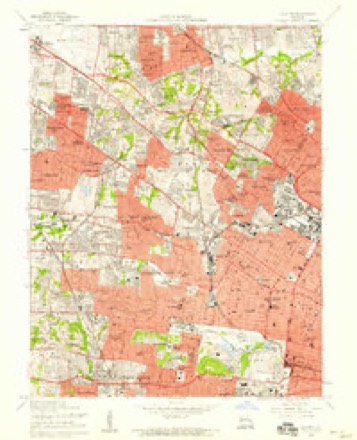
20 topographic sheets cover this place, the earliest surveyed in 1933 and the latest in 1985. It stands in Hadley Township. It lies in ZIP code area 63130. It stands on Engelholm Creek. The Survey maps it on the Clayton quadrangle. 35,065 people lived here at the 2020 count. It stands 528 feet above sea level.
On record in University City
Buildings and businesses the archive holds for this place. Each opens its own page, with the source record it came from.
On the National Register 12 of 15 shown
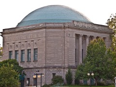 Assumption Greek Orthodox Churchlisted 1980
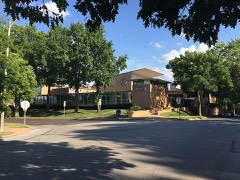 B'Nai Amoona Synogoguelisted 1984
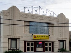 Beverly Theaterlisted 2005
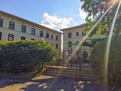 Donaldson Court Apartmentslisted 1983
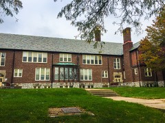 Nathaniel Hawthorne Elementary Schoollisted 2017
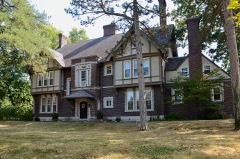 Theodore Link Historic Buildingslisted 1980
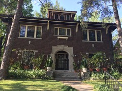 McGarry Houselisted 1982
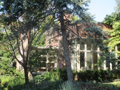 Joseph and Ann Murphy Residencelisted 2010
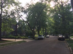 Parkview Historic Districtlisted 1986
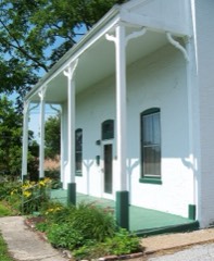 Sutter-Meyer Houselisted 1982
- Maryland Terrace Historic Districtlisted 1998
- Parkview Towerslisted 2024
Population over time
2 figuresUniversity City fell from 35,371 to 35,065 between 2010 and 2020. These are the recorded population figures Wikidata holds for this place, reached through the Geographic Names Information System number this page is keyed on rather than by name, so they belong to this place and not to another of the same name. Most are census counts, but not all are: an early figure may be a founding or settlement estimate, and an estimate published within five years of a census is left out. The change column is computed, and is left blank where more than 20 years separate a figure from the one before it, because a gap that long is not a change between two counts.
| Year | People | Change |
|---|---|---|
| 2010 | 35,371 | |
| 2020 | 35,065 | -306 (-1%) |
Topographic sheets covering this place
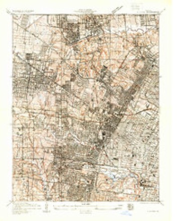
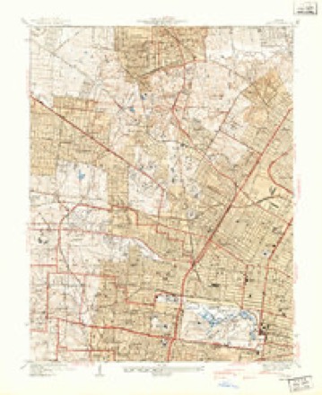
9 surveys from 20 printed sheetsMatched by testing this settlement's coordinate against the published boundary of every sheet in the United States Geological Survey's historical collection. Each opens the scanned sheet at the Survey.
- 1933 USGS Clayton quadrangle1:24000
- 1941 USGS Clayton quadrangle1:24000, 2 printings
- 1949 USGS Saint Louis quadrangle1:250000
- 1949 USGS St. Louis quadrangle1:250000
- 1954 USGS Clayton quadrangle1:24000, 6 printings
- 1962 USGS St. Louis quadrangle1:250000
- 1963 USGS St. Louis quadrangle1:250000, 4 printings
- 1966 USGS St. Louis quadrangle1:250000
- 1985 USGS St Louis quadrangle1:100000, 3 printings






Fires near this place
2 since 2006Regional context, not property-specific evidence. The federal wildfire occurrence database lists 2 fires within 5 miles of University City between 2006 and 2014, burning about 1 acre in total. None started naturally. None was recorded as arson. Distance is straight-line from the map coordinates, so a fire counted here may appear on a neighbouring settlement's page as well.
| Reported cause | Fires |
|---|---|
| Missing data/not specified/undetermined | 2 |
The most recent of them, most recent first, with the day each was reported and the service that recorded it.
| Date | Cause | Size | Reported by | Name on the report |
|---|---|---|---|---|
| 18 April 2014 | Missing data/not specified/undetermined | 1.0 acres | Missouri Department of Conservation | not named |
| 27 February 2006 | Missing data/not specified/undetermined | under an acre | Missouri State Fire Marshal's Office | not named |
Settlements close enough to share some of these fires:
Mines and quarries near this place
10 of 77 shownRegional context, not property-specific evidence. The federal mineral resources record lists 77 workings within 5 miles of University City: 74 past producers, 3 producers. 3 still produce. What was taken out: Stone, Crushed/Broken, Clay, Fire Clay (Refractory), Fire Clay (Refractory), Coal. Distance is straight-line from the map coordinates, so a quarry counted here may appear on a neighbouring settlement's page as well.
| Where | Site | Commodity | Status | Recorded |
|---|---|---|---|---|
| Bambrick-Bates Constr. Co. Quarry 1 | Clay, Stone, Crushed/Broken | Past Producer | ||
| Delore Barite Mill | Barium-Barite | Producer | ||
| Krummel and Buchner Mine | Coal, Fire Clay (Refractory) | Past Producer | ||
| St Louis Perlite Plant | Perlite | Producer | ||
| Parker-Russell Fireclay Mine | Fire Clay (Refractory), Coal | Past Producer | ||
| Tole and Thorp Fireclay Mine | Fire Clay (Refractory), Coal | Past Producer | ||
| Coffin Mine | Fire Clay (Refractory) | Past Producer | ||
| Evans and Howard Fireclay Mine No 7 | Fire Clay (Refractory) | Past Producer | ||
| Evans and Howard Fireclay Mine No.6 | Fire Clay (Refractory) | Past Producer | ||
| Gilker Fireclay Mine | Fire Clay (Refractory) | Past Producer |
Storms near this place
24 since 1994Regional context, not property-specific evidence. The National Weather Service names University City in 24 storm reports between 1994 and 2026: 12 hail, 9 thunderstorm wind, 1 lightning, 1 flash flood. The reports record 1 death. Each account below is quoted exactly as the forecast office filed it, from the NOAA Storm Events Database, and each date opens the federal record of that event.
| When | Event | Place named | Harm | What the report says |
|---|---|---|---|---|
| April 2007 | Lightning | University City | 1 killed | A 25 year old man was struck by lightning near the intersection of Columbia and Radcliffe Avenues in University City. He died from the lightning strike 5 days later on April 29th. |
| April 2024 | Thunderstorm Wind | University City | $10,000 | Small tree limbs of up to 1 inch in diameter were broken in University City. Shingles were also blown off at least 1 home. |
| April 2026 | Hail | University City | - | Photo of hailstone received on X. |
| April 2026 | Hail | University City | - | Estimated ping pong sized hail with photo and US quarter. |
| May 2017 | Thunderstorm Wind | University City | - | Several large tree limbs were blown down around University City. |
| August 2014 | Thunderstorm Wind | University City | - | Thunderstorm winds blew down several large tree limbs. |
| April 2012 | Hail | University City | - | Golfball sized hail was reported in University City and on the Washington University campus. |
| September 2011 | Thunderstorm Wind | University City | - | Thunderstorm winds blew down numerous large trees onto Midland Boulevard, with some of them blocking the road. Also, the winds blew gravel off of a roof on Delmar Boulevard damaging several vehicles in a parking lot. A couple of cars had several windows broken on them due to the gravel. |
| April 2010 | Tornado (EF0) | University City | - | The tornado initially touched down near the intersection of Duke Drive and Blackberry Avenue in University City. The tornado traveled northwest producing intermittent damage for approximately 0.6 of a mile. The damage became more continuous for the next 2.4 miles from just southeast of Olive Boulevard to near Dawes Place just southeast of Lackland Road. Intermittent damage continued beyond Lackland Road to the northwest for an additional 1.4 miles. The last discernible damage was located near St. Ann Lane. The vast majority of the damage along the path consisted of varying degrees of tree damage which included numerous tree branches broken, trees uprooted, and tree trunks snapped well above their base. The most significant structural damage occurred on Wallis Avenue just north of Trescott Avenue where a three foot diameter tree caved in the corner of a home. The tornado reached a maximum width of 325 yards as it crossed Trescott Avenue. This is also where the damage was most intense with wind speeds estimated at 85 mph. Other notable damage was located near the intersection of Woodson Road and Harney Road where there was roof damage to a storage facility. Minor structural damage was noted at other locations along the path caused by tree limbs or trees falling on homes. Any direct tornadic damage to homes and businesses was minor superficial damage which consisted of siding, soffit and shingles. No injuries were reported. |
| May 2009 | Flash Flood | University City | - | Up to three inches of rain fell in a short amount of time causing flash flooding. The River Des Peres as well as smaller creeks were out of their banks flooding some roads and homes in the area, especially along Wilson Avenue. |
| June 2009 | Thunderstorm Wind | University City | - | Two large sycamores were uprooted. Both were at least 2 and a half feet in diameter. Also, a three foot diameter oak tree was uprooted and fell onto a house causing moderate damage. |
| July 2006 | Thunderstorm Wind | University City | - | Numerous large trees were blown down. |
| August 2000 | Thunderstorm Wind | University City | - | Amateur radio spotters reported trees down. |
| April 1994 | Hail | University City | - | The public reported 0.75-inch-diameter hail in numerous other suburbs of St. Louis. |
| April 2026 | Hail | University City | - | no account filed |
| May 2025 | Hail | University City | - | no account filed |
| April 2018 | Hail | University City | - | no account filed |
| May 2017 | Hail | University City | - | no account filed |
| April 2016 | Hail | University City | - | no account filed |
| May 2016 | Hail | University City | - | no account filed |
| April 2014 | Thunderstorm Wind | University City | - | no account filed |
| May 2014 | Hail | University City | - | no account filed |
| May 2004 | Hail | University City | - | no account filed |
| May 2004 | Thunderstorm Wind | University City | - | no account filed |
Nearest settlements
The eight closest, with where each one stands in the county. Distances are straight-line, computed from the Geographic Names Information System coordinates.
| Map | Place | Distance | Sheets |
|---|---|---|---|
| Clayton | 1.2 miles | 20 | |
| Wellston | 1.3 miles | 20 | |
| Pagedale | 1.9 miles | 20 | |
| Richmond Heights | 2.0 miles | 20 | |
| Hanley Hills | 2.2 miles | 20 | |
| Vinita Terrace | 2.3 miles | 20 | |
| Hillsdale | 2.3 miles | 20 | |
| Velda Village | 2.5 miles | 20 |
Elsewhere
Matched on this settlement's Geographic Names Information System number rather than its name, so it cannot be a different place of the same name in another state.
| Wikipedia article on University City | An encyclopaedic summary. Its text is share-alike, so it is linked here rather than copied. |
| Wikidata item Q959885 | The structured record the population and elevation above come from. Public domain (CC0). |
Provenance
This settlement is recorded in the Geographic Names Information System as feature 756828. The sheet list is computed by point-in-boundary test against the United States Geological Survey's historical topographic inventory. Both are works of the United States government and carry no copyright under 17 U.S.C. 105.
Wildfire. Short, Karen C. 2022. Spatial wildfire occurrence data for the United States, 1992-2020 [FPA_FOD_20221014]. 6th Edition. Fort Collins, CO: Forest Service Research Data Archive. https://doi.org/10.2737/RDS-2013-0009.6 Collected with United States Government funding and usable without additional permissions or fees.
Mines and quarries. USGS Mineral Resources Data System (MRDS) https://mrdata.usgs.gov/mrds/ A work of the United States government, no copyright under 17 U.S.C. 105.
Storms. NOAA National Centers for Environmental Information, Storm Events Database https://www.ncei.noaa.gov/stormevents/ A work of the United States government, no copyright under 17 U.S.C. 105. Narratives are quoted verbatim from the National Weather Service report and are not edited or summarised.