 Block
Watson, Missouri
12 topographic sheets cover this place, the earliest surveyed in 1915 and the latest in 1986. It stands in Nishnabotna Township. It lies in ZIP code area 64496. The Survey maps it on the Rock Port quadrangle. 61 people lived here at the 2020 count. It stands 899 feet above sea level.
Population over time
2 figuresWatson fell from 100 to 61 between 2010 and 2020. These are the recorded population figures Wikidata holds for this place, reached through the Geographic Names Information System number this page is keyed on rather than by name, so they belong to this place and not to another of the same name. Most are census counts, but not all are: an early figure may be a founding or settlement estimate, and an estimate published within five years of a census is left out. The change column is computed, and is left blank where more than 20 years separate a figure from the one before it, because a gap that long is not a change between two counts.
| Year | People | Change |
|---|---|---|
| 2010 | 100 | |
| 2020 | 61 | -39 (-39%) |
Topographic sheets covering this place
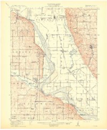
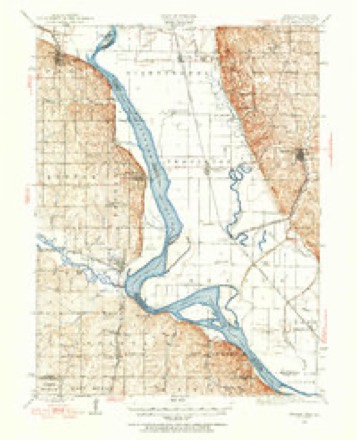
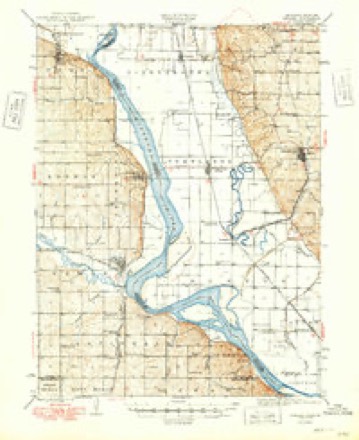
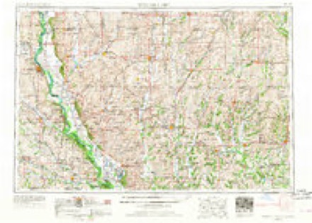
8 surveys from 12 printed sheetsMatched by testing this settlement's coordinate against the published boundary of every sheet in the United States Geological Survey's historical collection. Each opens the scanned sheet at the Survey.
- 1915 USGS Nemaha quadrangle1:62500, 2 printings
- 1939 USGS Nemaha quadrangle1:62500
- 1949 USGS Nemaha quadrangle1:62500
- 1955 USGS Nebraska City quadrangle1:250000, 3 printings
- 1957 USGS Nebraska City quadrangle1:250000
- 1958 USGS Nebraska City quadrangle1:250000
- 1981 USGS Rock Port quadrangle1:24000
- 1986 USGS Falls City quadrangle1:100000, 2 printings
What happened here
An account from the chapter on Nishnabotna township. The inset identifies its exact source book and publication year.
J. T. Maxwell
TAMES T. MAXWELL, son of Thomas and Morning Maxwell, was born in Putnam J county, Tennessee, on March 11, 1864, and was the second of six children. lie never saw his father, who was killed in the war of the rebellion. He was raised on a farm and began fanning' for himself in his twenty-first year. I le afterward had charge of a hoisting machine three years, in a coal mine in Lucas county, Iowa.
In the county-history sources
69,548 words on this townshipBiographical History: Atchison County, Missouri, published 1905 names this settlement in its chapter on Nishnabotna Township. These are the passages that mention it, exactly as the scans read.
S a shipping' point Watson is perhaps the equal of any town in the county - situated on the main line of the Burlington railroad and in the midst of one of the richest farming communities in the world - farms on the choicest of Missouri valley soil. The town has a population of about 400; two elevators, one bank, one furniture store, three general stores, one mill, one hardware store, one blacksmith shop, two livery barns, two hotels, one lumber yard, one grocery store, one drug store, one confectionery, one harness shop, one restaurant, two barber shops, one meat market, three physi¬ cians, four churches, one public school building.
Passage source: Biographical History: Atchison County, Missouri, published 1905.
Mrs. Boettner's parents are numbered among the pioneers of Nishnabotna township. Her father was Justice of the Peace of that township thirty-eight years. Her mother yet resides at Watson, in the township mentioned above.
Passage source: Biographical History: Atchison County, Missouri, published 1905.
On July 0. 1902, Mr. Bayless and Miss Pearl Brady were united in marriage. She is a daughter of Mr. and Mrs. John Brady, of Watson. At the time of taking the accompany¬ ing views they lived at the home of Mr. Bayless' parents, and it is one of the elegant homes of the county, with its well-kept lawn and all kinds of shrubbery. The house is a two-story, ten-room brick structure, in size 28x30 ft. and 16x16 ft. There is also a large barn and other necessary outbuildings, and a complete system of water-works. Mr. and Mrs. Bayless now reside in a neat brick cottage of their own. The Bayless elevator is, in size, 30x30x50 ft. and has a capacity of 12,000 bushels. Near the elevator is a neat scale office. The building in which the funiture store is conducted is of frame, 50 ft. long, 25 ft. wide and of two stories. A brick structure, to replace this building, is contemplated. Mr. Bayless, Sr., also owns the two-story brick building occupied by the Watson Banking Co. Also a vacant lot and ten acres of land adjoining the town. Mr. Bay less, Jr., owns (540 acres of land in Colorado and his father owns land in Nebraska.
Passage source: Biographical History: Atchison County, Missouri, published 1905.
Machine-read from a century-old scan, so expect the errors a machine makes: misspelled names, dropped words, stray characters.
Read the whole chapter on Nishnabotna Township - it names this place 28 more 28 times.
Fires near this place
6 since 2014Regional context, not property-specific evidence. The federal wildfire occurrence database lists 6 fires within 5 miles of Watson between 2014 and 2020, burning about 80 acres in total. None started naturally. None was recorded as arson. Distance is straight-line from the map coordinates, so a fire counted here may appear on a neighbouring settlement's page as well.
| Reported cause | Fires |
|---|---|
| Debris and open burning | 3 |
| Missing data/not specified/undetermined | 2 |
| Power generation/transmission/distribution | 1 |
The most recent of them, most recent first, with the day each was reported and the service that recorded it.
| Date | Cause | Size | Reported by | Name on the report |
|---|---|---|---|---|
| 19 August 2017 | Power generation/transmission/distribution | 1.0 acres | Nebraska Forest Service | not named |
| 6 March 2020 | Missing data/not specified/undetermined | 3.5 acres | Missouri Department of Conservation | 230702-00310-03062020-1443 |
| 24 March 2014 | Missing data/not specified/undetermined | under an acre | Nebraska Forest Service | not named |
| 14 March 2015 | Debris and open burning | under an acre | Nebraska Forest Service | not named |
| 14 March 2015 | Debris and open burning | 50 acres | Nebraska Forest Service | not named |
| 13 March 2015 | Debris and open burning | 25 acres | Nebraska Forest Service | not named |
Settlements close enough to share some of these fires:
Mines and quarries near this place
1 within 5 milesRegional context, not property-specific evidence. The federal mineral resources record lists 1 working within 5 miles of Watson: 1 producer. All of them still produce. What was taken out: Sand and Gravel, Construction. Distance is straight-line from the map coordinates, so a quarry counted here may appear on a neighbouring settlement's page as well.
| Where | Site | Commodity | Status | Recorded |
|---|---|---|---|---|
| Mikkelson Sand & Gravel Pit | Sand and Gravel, Construction | Producer |
Storms near this place
26 since 1997Regional context, not property-specific evidence. The National Weather Service names Watson in 26 storm reports between 1997 and 2021: 12 hail, 11 thunderstorm wind, 2 tornado, 1 flood. No death or injury is recorded in these reports. Each account below is quoted exactly as the forecast office filed it, from the NOAA Storm Events Database, and each date opens the federal record of that event.
| When | Event | Place named | Harm | What the report says |
|---|---|---|---|---|
| June 2005 | Thunderstorm Wind | Watson | $5,000 | Several tractor trailers blown over on I-29 between mile markers 120 and 124. |
| May 2011 | Thunderstorm Wind | Watson | $3,000 | Three power poles were reported blown down. Thunderstorm wind gusts were estimated up to 70 mph. |
| August 2004 | Thunderstorm Wind | Watson | $1,000 | Tractor Trailer blown over at mile marker 116 on Interstate 29. |
| December 2021 | Thunderstorm Wind | Watson | - | A trained spotter near Watson, Missouri reported 80 mph wind. |
| May 2019 | Flood | Watson | - | Heavy spring rains caused ongoing flooding along the Missouri River to Continue through the month. Some locations along the Missouri River experienced major flooding at times during the month. Damage estimates from roads washed out and crop damage are unknown at this time. |
| August 2017 | Thunderstorm Wind | Watson | - | Emergency Manager in Atchison County, Missouri reported several 10-12 inch tree limbs down, along with some minor structural damage. Winds were estimated to be in the 50-60 mph range. |
| September 2014 | Thunderstorm Wind | Watson | - | An Emergency Manager from Atchison County reported a 60 mph wind gust near Watson, Missouri. |
| June 2014 | Hail | Watson | - | In addition to the hail, 60 mph winds were reported. |
| June 2014 | Thunderstorm Wind | Watson | - | Storm chaser estimated 70 mph winds. |
| June 2014 | Thunderstorm Wind | Watson | - | A storm chaser estimated 60 mph winds. |
| June 2008 | Tornado (EF0) | Watson | - | A brief EF0 tornado touchdown 1 mile southeast of Watson at 1755CST, on June 5, 2008. No damage was reported. |
| September 2006 | Thunderstorm Wind | Watson | - | Railroad car full of soybeans derailed from the wind. |
| September 2006 | Thunderstorm Wind | Watson | - | Several trees downed with one large tree blocking lanes near the intersection of Highways 275 and B. |
| April 2004 | Tornado (F0) | Watson | - | Brief tornado touchdown caught on video near exit 116 on I-29. |
| August 2004 | Thunderstorm Wind | Watson | - | Trees reported down. |
| July 1997 | Hail | Watson | - | One inch hail was reported at the Missouri State Weigh in station 2 miles south of Watson. A severe weather spotter also reported one inch hail 2 miles north of Phelps City. An area of crop damage 2 miles wide was reported about 1.5 miles north of Watson. Golfball-size hail fell from a miles east of Phelps City to a mile and half southeast of Watson resulting in the damage to the corn. |
| June 2021 | Hail | Watson | - | no account filed |
| June 2019 | Hail | Watson | - | no account filed |
| April 2016 | Hail | Watson | - | no account filed |
| June 2016 | Hail | Watson | - | no account filed |
| May 2016 | Hail | Watson | - | no account filed |
| September 2016 | Hail | Watson | - | no account filed |
| September 2014 | Hail | Watson | - | no account filed |
| March 2012 | Hail | Watson | - | no account filed |
| March 2011 | Hail | Watson | - | no account filed |
| April 2002 | Hail | Watson | - | no account filed |
Nearest settlements
The eight closest, with where each one stands in the county. Distances are straight-line, computed from the Geographic Names Information System coordinates.
| Map | Place | Distance | Sheets |
|---|---|---|---|
| Sonora | 2.5 miles | 13 | |
| Linden | 4.4 miles | 12 | |
| Phelps City | 5.2 miles | 12 | |
| Rock Port | 7.1 miles | 12 | |
| Langdon | 8.6 miles | 14 | |
| Farmers City | 10.5 miles | 10 | |
| Tarkio | 13.1 miles | 12 | |
| Nishnabotna | 13.8 miles | 14 |
Elsewhere
Matched on this settlement's Geographic Names Information System number rather than its name, so it cannot be a different place of the same name in another state.
| Wikipedia article on Watson | An encyclopaedic summary. Its text is share-alike, so it is linked here rather than copied. |
| Wikidata item Q2602449 | The structured record the population and elevation above come from. Public domain (CC0). |
Provenance
This settlement is recorded in the Geographic Names Information System as feature 728422. The sheet list is computed by point-in-boundary test against the United States Geological Survey's historical topographic inventory. Both are works of the United States government and carry no copyright under 17 U.S.C. 105.
Wildfire. Short, Karen C. 2022. Spatial wildfire occurrence data for the United States, 1992-2020 [FPA_FOD_20221014]. 6th Edition. Fort Collins, CO: Forest Service Research Data Archive. https://doi.org/10.2737/RDS-2013-0009.6 Collected with United States Government funding and usable without additional permissions or fees.
Mines and quarries. USGS Mineral Resources Data System (MRDS) https://mrdata.usgs.gov/mrds/ A work of the United States government, no copyright under 17 U.S.C. 105.
Storms. NOAA National Centers for Environmental Information, Storm Events Database https://www.ncei.noaa.gov/stormevents/ A work of the United States government, no copyright under 17 U.S.C. 105. Narratives are quoted verbatim from the National Weather Service report and are not edited or summarised.