 Block
Woodlawn, Missouri
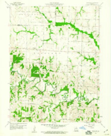
8 topographic sheets cover this place, the earliest surveyed in 1953 and the latest in 1981. It stands in Woodlawn Township. It lies in ZIP code area 65263. The Survey maps it on the Woodlawn quadrangle.
Topographic sheets covering this place
6 surveys from 8 printed sheetsMatched by testing this settlement's coordinate against the published boundary of every sheet in the United States Geological Survey's historical collection. Each opens the scanned sheet at the Survey.
- 1953 USGS Moberly quadrangle1:250000
- 1954 USGS Moberly quadrangle1:250000, 3 printings
- 1957 USGS Moberly quadrangle1:250000
- 1959 USGS Woodlawn quadrangle1:24000
- 1960 USGS Moberly quadrangle1:250000
- 1981 USGS Macon quadrangle1:100000




Fires near this place
18 since 2007Regional context, not property-specific evidence. The federal wildfire occurrence database lists 18 fires within 5 miles of Woodlawn between 2007 and 2020, burning about 297 acres in total. None started naturally. None was recorded as arson. Distance is straight-line from the map coordinates, so a fire counted here may appear on a neighbouring settlement's page as well.
| Reported cause | Fires |
|---|---|
| Debris and open burning | 8 |
| Missing data/not specified/undetermined | 5 |
| Equipment and vehicle use | 4 |
| Smoking | 1 |
The most recent of them, most recent first, with the day each was reported and the service that recorded it.
| Date | Cause | Size | Reported by | Name on the report |
|---|---|---|---|---|
| 14 September 2007 | Debris and open burning | 5.0 acres | Missouri State Fire Marshal's Office | not named |
| 24 April 2020 | Missing data/not specified/undetermined | 1.8 acres | Missouri Department of Conservation | 190445-06902-04242020-1644 |
| 8 March 2017 | Debris and open burning | 25 acres | Missouri Department of Conservation | not named |
| 6 March 2016 | Equipment and vehicle use | 1.0 acres | Missouri Department of Conservation | 133908-06949-03062016-1148 |
| 21 March 2020 | Missing data/not specified/undetermined | 60 acres | Missouri Department of Conservation | 190447-06902-03212020-1718 |
| 19 March 2017 | Debris and open burning | 60 acres | Missouri Department of Conservation | not named |
| 29 February 2016 | Debris and open burning | 2.0 acres | Missouri Department of Conservation | 133722-06949-02292016-1500 |
| 27 February 2017 | Smoking | 2.0 acres | Missouri Department of Conservation | not named |
Settlements close enough to share some of these fires:
Mines and quarries near this place
1 within 5 milesRegional context, not property-specific evidence. The federal mineral resources record lists 1 working within 5 miles of Woodlawn: 1 past producer. None of them still produces. What was taken out: Stone, Crushed/Broken. Distance is straight-line from the map coordinates, so a quarry counted here may appear on a neighbouring settlement's page as well.
| Where | Site | Commodity | Status | Recorded |
|---|---|---|---|---|
| Inknown | Stone, Crushed/Broken | Past Producer |
Storms near this place
11 since 1996Regional context, not property-specific evidence. The National Weather Service names Woodlawn in 11 storm reports between 1996 and 2010: 5 thunderstorm wind, 3 flash flood, 2 tornado, 1 flood. The reports record 1 injury. Each account below is quoted exactly as the forecast office filed it, from the NOAA Storm Events Database, and each date opens the federal record of that event.
| When | Event | Place named | Harm | What the report says |
|---|---|---|---|---|
| October 2007 | Tornado (EF2) | Woodlawn | 1 hurt, $60,000 | The tornado first touched down briefly about a mile north northeast of Woodlawn on CR 1109 knocking down a few trees. It lifted and continued to move to the northeast, touching down again on Highway A, just south of the intersection of CR 182 and CR 284. It damaged more trees as it travelled to the northeast. It then struck a residence just northwest of the intersection of Highway 15 and Highway CC. The house had half of its roof removed with debris and insulation blown 100 yards northeast, into a grove of trees. Numerous trees were damaged at this location, including a 5 foot diameter tree that was twisted and snapped off five feet above the ground. The tornado briefly lifted again before touching down near CR 317, between CR 394 and CR 390. As it travelled to the northeast, it produced its greatest damage when it struck a single wide mobile home just east of Highway PP, approximately 1.7 miles south of US Highway 36. The mobile home was completely destroyed and the 85 year old male occupant of the mobile home suffered severe injuries. The tornado then lifted and dissipated. |
| June 2010 | Thunderstorm Wind | Woodlawn | - | Thunderstorm winds blew down a large tree onto Highway 151 just south southeast of Woodlawn. |
| October 2009 | Flash Flood | Woodlawn | - | Up to three inches of rain fell in a short amount of time on saturated soils causing flash flooding. Numerous roads were flooded including State Route A northeast of Woodlawn. |
| September 2008 | Flood | Woodlawn | - | An additional two to four inches of rain fell in a short amount of time as the remnants of Hurricane Ike moved through the region. Numerous roads remained flooded. |
| July 2008 | Flash Flood | Woodlawn | - | Between 3 and 5 inches of rain fell onto already saturated soils causing flash flooding. Numerous roads were flooded and several vehicles were stranded in the flood waters requiring water rescues. |
| August 2008 | Thunderstorm Wind | Woodlawn | - | Thunderstorm winds blew down several power lines northwest of Granville. |
| April 2007 | Flash Flood | Woodlawn | - | Up to 4 inches of rain fell over a three hour period over the northwestern portions of Monroe county. Numerous roads were flooded including the intersection of Highways 151 and J near Woodlawn and Highway A near Granville. Up to 3 feet of water was flowing over these roads at several locations. |
| March 2007 | Tornado (EF1) | Woodlawn | - | A second tornado touched down in Monroe County about 1.5 miles west of the intersection of County Roads 182 and 169 completely destroying a machine shed. The debris area stretched approximately half a mile to the northeast from the original location. Four cows were killed by the flying debris. As the tornado moved to the northeast, it briefly touched down a second time on County Road 211 damaging trees and a pole barn. Debris from the pole barn was thrown over 100 yards. The tornado then lifted and dissipated. |
| March 2007 | Thunderstorm Wind | Woodlawn | - | Thunderstorm winds blew down several large tree limbs and a few trees. |
| March 2007 | Thunderstorm Wind | Woodlawn | - | Thunderstorm winds damaged a grain bin and machine shed approximately 2 miles west of the intersection of Highway A and County Road 182. The grain bin and a fuel tank were ripped loose from their moorings and pushed north-northeastward 40 to 60 yards. Debris from the machine shed was observed as much as 50 yards to the northeast. |
| June 1996 | Thunderstorm Wind | Woodlawn | - | no account filed |
Nearest settlements
The eight closest, with where each one stands in the county. Distances are straight-line, computed from the Geographic Names Information System coordinates.
| Map | Place | Distance | Sheets |
|---|---|---|---|
| Duncans Bridge | 2.7 miles | 10 | |
| Ash | 6.0 miles | 10 | |
| Granville | 6.2 miles | 9 | |
| Madison | 7.2 miles | 15 | |
| Holliday | 7.3 miles | 15 | |
| Fowkes | 10.0 miles | 18 | |
| Evansville | 10.1 miles | 15 | |
| Middle Grove | 13.0 miles | 15 |
Provenance
This settlement is recorded in the Geographic Names Information System as feature 729107. The sheet list is computed by point-in-boundary test against the United States Geological Survey's historical topographic inventory. Both are works of the United States government and carry no copyright under 17 U.S.C. 105.
Wildfire. Short, Karen C. 2022. Spatial wildfire occurrence data for the United States, 1992-2020 [FPA_FOD_20221014]. 6th Edition. Fort Collins, CO: Forest Service Research Data Archive. https://doi.org/10.2737/RDS-2013-0009.6 Collected with United States Government funding and usable without additional permissions or fees.
Mines and quarries. USGS Mineral Resources Data System (MRDS) https://mrdata.usgs.gov/mrds/ A work of the United States government, no copyright under 17 U.S.C. 105.
Storms. NOAA National Centers for Environmental Information, Storm Events Database https://www.ncei.noaa.gov/stormevents/ A work of the United States government, no copyright under 17 U.S.C. 105. Narratives are quoted verbatim from the National Weather Service report and are not edited or summarised.