 Block
From the record
One of 414 National Register listings published here for Jackson County · listed in 2007 · category: District.
Sources: the case file at the National Archives · the National Register database, National Park Service
Listed on the National Register of Historic Places in 2007.
One of 414 National Register listings published here for Jackson County · listed in 2007 · category: District.
Sources: the case file at the National Archives · the National Register database, National Park Service
Regional context, not property-specific evidence. The federal wildfire occurrence database lists 114 fires within 5 miles of South Hyde Park Historic District between 2007 and 2020, burning about 45 acres in total. None started naturally. 13 were recorded as arson. Distance is straight-line from the map coordinates, so a fire counted here may appear on a neighbouring settlement's page as well.
| Reported cause | Fires |
|---|---|
| Missing data/not specified/undetermined | 70 |
| Arson/incendiarism | 13 |
| Recreation and ceremony | 7 |
| Smoking | 7 |
| Equipment and vehicle use | 6 |
| Debris and open burning | 6 |
| Misuse of fire by a minor | 2 |
| Power generation/transmission/distribution | 2 |
| Fireworks | 1 |
The most recent of them, most recent first, with the day each was reported and the service that recorded it.
| Date | Cause | Size | Reported by | Name on the report |
|---|---|---|---|---|
| 7 September 2007 | Missing data/not specified/undetermined | 1.0 acres | Missouri State Fire Marshal's Office | not named |
| 7 September 2007 | Missing data/not specified/undetermined | under an acre | Missouri State Fire Marshal's Office | not named |
| 5 September 2007 | Missing data/not specified/undetermined | under an acre | Missouri State Fire Marshal's Office | not named |
| 30 September 2007 | Missing data/not specified/undetermined | under an acre | Missouri State Fire Marshal's Office | not named |
| 3 September 2007 | Missing data/not specified/undetermined | under an acre | Missouri State Fire Marshal's Office | not named |
| 29 September 2018 | Debris and open burning | under an acre | Kansas Forest Service | 24406 |
| 29 September 2017 | Missing data/not specified/undetermined | under an acre | Wyandotte County | 23456 |
| 28 September 2007 | Recreation and ceremony | 2.0 acres | Missouri State Fire Marshal's Office | not named |
Regional context, not property-specific evidence. The federal mineral resources record lists 46 workings within 5 miles of South Hyde Park Historic District: 39 past producers, 7 producers. 7 still produce. What was taken out: Stone, Crushed/Broken, Clay, Sand and Gravel, Construction, Perlite. Distance is straight-line from the map coordinates, so a quarry counted here may appear on a neighbouring settlement's page as well.
| Where | Site | Commodity | Status | Recorded |
|---|---|---|---|---|
| Lite Weight Products Perlite Plant | Perlite | Producer | ||
| Unknown-Ls and Shale | Clay, Stone, Crushed/Broken | Past Producer | ||
| Holliday Sand & Gravel Plant | Sand and Gravel, Construction | Producer | ||
| Randolph Dredge | Sand and Gravel, Construction | Producer | ||
| Unknown | Clay | Past Producer | ||
| Unknown | Clay | Past Producer | ||
| Unknown | Clay | Past Producer | ||
| Unknown | Sand and Gravel, Construction | Past Producer | ||
| Unknown | Stone, Crushed/Broken, Clay | Past Producer | ||
| Unknown | Sand and Gravel, Construction | Past Producer |
Regional context, not property-specific evidence. The National Weather Service names Kansas City, the town this property stands in, in 195 storm reports between 1993 and 2026: 73 thunderstorm wind, 68 hail, 48 flash flood, 6 flood. The reports record 9 deaths. Each account below is quoted exactly as the forecast office filed it, from the NOAA Storm Events Database, and each date opens the federal record of that event.
| When | Event | Place named | Harm | What the report says |
|---|---|---|---|---|
| October 1998 | Flash Flood | Kansas City | 9 killed, $20,000,000 | no account filed |
| August 2004 | Flash Flood | Kansas City | $1,000,000 | The most significant flooding since 1998 in the downtown area as 4 to 6 inches of rain falls across the area. Numerous water rescues and homes and businesses flooded. |
| March 2006 | Hail | Kansas City | $200,000 | no account filed |
| June 1995 | Thunderstorm Wind | Kansas City | $85,000 | Severe thunderstorms produced damaging winds up to 80 mph, which caused widespread damage across the area. Power lines were downed at 8th Street and Brighton Avenue, and at 83rd Street and Paseo Avenue. Considerable tree damage occurred in and south of the Country Club Plaza area. In many parts of town, trees were down across city streets, partially blocking traffic. A 55-foot maple tree fell onto a house, crushing the front porch and creasing the roof. Several cars were damaged by trees and limbs falling on them. There was also a large power outage over the south end of Kansas City along Red Bridge Road between Wornall Road and U.S. Route 71. About 60,000 customers lost power in the Kansas City area from the storm. |
| August 2018 | Thunderstorm Wind | Kansas City | $50,000 | Broadcast media reported a couple were trapped in their home when a large tree fell onto it. The extent of the damage to the home is otherwise unknown. |
| August 2000 | Thunderstorm Wind | Kansas City | $50,000 | A 68 mph wind gust was recorded in downtown Kansas City. At least two windows in a downtown high-rise were shattered. A light pole fell on a police car, and windows were damaged on at least 5 other patrol cars. |
| May 1995 | Thunderstorm Wind | Kansas City | $50,000 | Severe Thunderstorms moved through downtown Kansas City with damaging winds and torrential rains. 60 mph winds were reported at the Federal building, and the roof was blown off of the Lincoln Academy Prep School at 22nd and Woodland. Heavy rains causing flash flooding, with Southwest Trafficway closed near 25th street, in addition to other flooding of city streets. The storms continued east to Blue Springs, where numerous small tree limbs were broken off. Lightning struck a house in the south part of Kansas City, igniting the wood shingles. The home and its contents were nearly a total loss due to the ensuing fire. |
| July 1994 | Thunderstorm Wind | Kansas City | $50,000 | The Kansas City Downtown Airport reported wind gusts of 58 mph, which downed trees and power lines across parts of Kansas City. |
| August 2001 | Thunderstorm Wind | Kansas City | $15,000 | A roof collapsed due to high winds and heavy rains. |
| June 2000 | Thunderstorm Wind | Kansas City | $15,000 | The KC Fire Department reported numerous downed power lines. |
| March 2006 | Thunderstorm Wind | Kansas City | $10,000 | Roof blown off residence at 16th and Jackson. |
| May 2005 | Thunderstorm Wind | Kansas City | $10,000 | Trees down on houses and power lines down. |
| April 2001 | Flash Flood | Kansas City | $10,000 | Law enforcement reported flooding around downtown Kansas City. Up to 2 inches of rain fell in a 30minute period. Several roads had to be closed due to high water. |
| August 1997 | Thunderstorm Wind | Kansas City | $10,000 | The Kansas City Fire Department reported downed trees from thunderstorm winds at 126th and Holmes. |
| July 2024 | Flash Flood | Kansas City | $5,000 | Up to 6 inches of rain fell across portions of Jackson County within a span of a couple hours, causing widespread flash flooding across much of Jackson County. Major roadways were flooded and closed down, with several water rescues. |
| July 2024 | Flash Flood | Kansas City | $5,000 | Up to 6 inches of rain fell across portions of Jackson County within a span of a couple hours, causing widespread flash flooding across much of Jackson County. Major roadways were flooded and closed down, with several water rescues. |
| June 2011 | Thunderstorm Wind | Kansas City | $5,000 | A large tree was reported to have fell on a home at 35th and Woodland. Thunderstorm wind gusts were estimated up to 60 mph. |
| July 2004 | Thunderstorm Wind | Kansas City | $5,000 | Tree fell on apartment roof at 39th and Central. |
| April 1994 | Thunderstorm Wind | Kansas City | $5,000 | Large trees were knocked down along with power lines. Several hundred Kansas City Power & Light Company customers were without power. One man was injured when he walked on down power lines. Reported by a local newspaper. |
| July 1994 | Thunderstorm Wind | Kansas City | $5,000 | Numerous power lines and trees were blown down within Kansas City and across southern parts of the county. |
| April 1993 | Hail | Kansas City | $5,000 | Golf ball-size hail fell at the Crown Center shopping area. |
| April 2026 | Thunderstorm Wind | Kansas City | - | Downed tree limbs and wires near Blue Hills Park. |
| May 2025 | Hail | Kansas City | - | Ping pong ball sized hail in downtown Kansas City. |
| May 2025 | Hail | Kansas City | - | Quarter sized hail reported in downtown Kansas City. |
| May 2025 | Thunderstorm Wind | Kansas City | - | Multiple trees snapped or downed near Smart Avenue. |
| May 2025 | Thunderstorm Wind | Kansas City | - | Reports of downed trees and wires in the Beacon Hill neighborhood south of downtown Kansas City. |
| March 2025 | Thunderstorm Wind | Kansas City | - | Large tree down near Bales Avenue. |
| March 2025 | Thunderstorm Wind | Kansas City | - | Report of tree limbs down at this location. |
| August 2025 | Thunderstorm Wind | Kansas City | - | Numerous trees and tree limbs blown down from near West 47th Street and Roe Boulevard to West 55th Street and Wornall Road, and from West 34th Street and Southwest Trafficway to Shawnee Mission Parkway and Mission Road. |
| August 2025 | Thunderstorm Wind | Kansas City | - | Large tree down at 58th and Wornall due to microburst as reported by KMBC. |
| August 2025 | Thunderstorm Wind | Kansas City | - | Large tree uprooted near Brookside Blvd and 53rd Street due to microburst as reported by KMBC. |
| March 2025 | Thunderstorm Wind | Kansas City | - | Downed tree near Ward Parkway. |
| June 2025 | Thunderstorm Wind | Kansas City | - | Downed tree at 55th and Troost. |
| June 2025 | Thunderstorm Wind | Kansas City | - | Downed wires near 24th Street. |
| June 2025 | Thunderstorm Wind | Kansas City | - | Downed tree and wires near Quincy Avenue. |
| June 2025 | Thunderstorm Wind | Kansas City | - | Two tree limbs down about 8 inches in diameter near the UMKC campus. |
| March 2024 | Hail | Kansas City | - | Golf ball sized hail was reported in the western portions of the Crossroads south of downtown Kansas City. |
| March 2024 | Hail | Kansas City | - | Golf ball sized hail was reported in the western portions of the Crossroads south of downtown Kansas City. |
| August 2024 | Thunderstorm Wind | Kansas City | - | Estimated 60 mph wind gusts. |
| July 2024 | Thunderstorm Wind | Kansas City | - | Large tree fell on top of a house near 38th and Agnes. |
| May 2024 | Hail | Kansas City | - | Quarter sized hail was reported at Crown Center in Kansas City. |
| May 2024 | Hail | Kansas City | - | Quarter sized hail was reported near the intersection of Highway 71 and Linwood Blvd. |
| May 2024 | Hail | Kansas City | - | Ping pong ball sized hail was reported in the West Plaza neighborhood. |
| May 2024 | Hail | Kansas City | - | Ping pong ball sized hail was reported near the Power and Light District in downtown Kansas City. |
| May 2024 | Thunderstorm Wind | Kansas City | - | Downed tree and wires near Westwood Terrace. |
| April 2022 | Thunderstorm Wind | Kansas City | - | A large tree fell onto a house. This report was received via social media. |
| May 2021 | Flash Flood | Kansas City | - | Moderate rain over the KC metro caused some minor flash flooding on Brush Creek, along Ward Parkway. |
| April 2019 | Hail | Kansas City | - | This report was received via MPing. |
| June 2019 | Hail | Kansas City | - | Reported from 41 Action News near Country Club Plaza. |
| June 2019 | Hail | Kansas City | - | Reported from Liberty Memorial. |
| June 2019 | Flash Flood | Kansas City | - | A water rescue occurred near 21st and Central. |
| June 2019 | Flash Flood | Kansas City | - | Significant flooding near 25th and Jefferson occurred due to heavy rain. Road damage was reported by KC Fire, but the extent is not known. |
| June 2019 | Flash Flood | Kansas City | - | Water was reported over the roadway near WWI Memorial. |
| June 2019 | Thunderstorm Wind | Kansas City | - | Large tree down behind the house. |
| May 2019 | Flash Flood | Kansas City | - | Water rescue in Kansas City occurred. |
| August 2018 | Thunderstorm Wind | Kansas City | - | Numerous large tree limbs were down across the Rockhurst University campus. |
| July 2017 | Flash Flood | Kansas City | - | Water was over Interstate 35 near Broadway, causing the interstate to shut down for a couple hours. |
| July 2017 | Flash Flood | Kansas City | - | A water rescue of two occupants in a vehicle took place at 12th and Jackson. |
| July 2017 | Thunderstorm Wind | Kansas City | - | Large tree limbs were snapped along Gillham Road near the UMKC Campus. |
| July 2017 | Thunderstorm Wind | Kansas City | - | Numerous trees of unknown size or condition, along with large tree limbs were down across County Club Plaza and Ward Parkway areas. |
No historic map-sheet match is published for this property yet. That does not mean no map exists. This record needs a coordinate-quality review before it can be joined to a sheet boundary. Browse the county's mapped places while that work is pending.
Other National Register properties close enough to walk or drive between, ordered by distance from this one. Both positions come from the same geocoding pass that matched these properties to their map sheets.
| Photograph | Property | Distance | Listed |
|---|---|---|---|
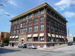 | Helping Hand Institue Building | 1.7 miles | 2000 |
| WILLIAM S. MITCHELL (dredge) | 1.9 miles | 1985 | |
| Smith and Sons Manufacturing Company Building | 1.9 miles | 2007 | |
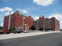 | Kansas City Cold Storage Company Building | 2.0 miles | 2005 |
| Old Town Historic District (Boundary Increase III) | 2.0 miles | 2006 | |
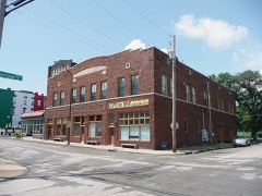 | Joe Vaccaro Soda Water Manufacturing Company Building | 2.1 miles | 2003 |
| National Archives record | The nomination case file for reference 07001186 in Record Group 79. |
| Jackson County | All 414 listed properties in this county. |