 Block
From the record
One of 76 National Register listings published here for Greene County · listed in 2008 · category: Building.
Sources: the case file at the National Archives · the National Register database, National Park Service
Listed on the National Register of Historic Places in 2008.
One of 76 National Register listings published here for Greene County · listed in 2008 · category: Building.
Sources: the case file at the National Archives · the National Register database, National Park Service
The chapter on Springfield Township in Personal Reminiscences and Fragments of the Early History of Springfield and Greene County, Missouri : Related by Pioneers and Their Descendants at Old Settlers' Dinners Given at the Home of Capt. Martin J. Hubble, March 31, 1907, 1908, 1909, 1910, 1911, published 1914 names Springfield. This is what it says, exactly as the scans read.
This book would not have been published except for the suggestion of Father J. J. Lilly, after he had read of the first dinner I gave to the old settlers of Springfield. He suggested that my guests were the only persons now living who could tell of the early days as they really were, and of matters and things as they really existed, during the first few years of the settlement of Greene County. Realizing the truth of his statement, I herewith present the recollections of my guests, largely in their own language, which may not attract the hypercritical, but will satisfy all those wanting to know our early history and of early settlers, their integrity, perseverance and forcefulness. There is nothing about the late Civil War or things which occurred during or after it, except as to the death and burial of General Nathaniel Lyon, which is truthfully told by the only man living who knows the facts, Dr. S. H. Melcher, now of Chicago, Illinois.
Passage source: Personal Reminiscences and Fragments of the Early History of Springfield and Greene County, Missouri : Related by Pioneers and Their Descendants at Old Settlers' Dinners Given at the Home of Capt. Martin J. Hubble, March 31, 1907, 1908, 1909, 1910, 1911, published 1914.
You ask how this could be done ? I will illustrate by one or two instances. There was an old man who lived in the west portion of this county, familiarly known as Uncle Davy Reynolds. It was his custom when he came to Springfield to stay one night at my father's house and, as a boy, I had heard him tell of the working of this plan. On one occasion a man moved in and stopped near his place - had four horses to feed - and he, Uncle Davy, soon found that he was not buying corn sufficient to feed those four horses, for the county was sparsely settled and he knew every man who had corn to sell. He watched his crib and found his corn missing. He went to his crib on Saturday, selecting the day on purpose, arranged his corn so that he would know if any was taken, and in the cobs of several ears inserted a slip of paper with his name written on it. Next morning it was gone. On Sunday he visited this man and while there walked out to the lot, and on examining the cobs, found several with his name in them. He suggested to the man that it was a strange incident. Of course the man was confused. Uncle Davy suggested the best way out was for him to move and by the time the sun was an hour high the next morning he was gone.
Passage source: Personal Reminiscences and Fragments of the Early History of Springfield and Greene County, Missouri : Related by Pioneers and Their Descendants at Old Settlers' Dinners Given at the Home of Capt. Martin J. Hubble, March 31, 1907, 1908, 1909, 1910, 1911, published 1914.
Machine-read from a century-old scan, so expect the errors a machine makes: misspelled names, dropped words, stray characters.
Read the whole chapter on Springfield Township - 41,758 words on its settlement, mills, schools and churches.
Regional context, not property-specific evidence. The federal wildfire occurrence database lists 19 fires within 5 miles of Wilshire Apartments between 1992 and 2020, burning about 23 acres in total. None started naturally. None was recorded as arson. Distance is straight-line from the map coordinates, so a fire counted here may appear on a neighbouring settlement's page as well.
| Reported cause | Fires |
|---|---|
| Debris and open burning | 10 |
| Missing data/not specified/undetermined | 5 |
| Equipment and vehicle use | 2 |
| Smoking | 1 |
| Power generation/transmission/distribution | 1 |
The most recent of them, most recent first, with the day each was reported and the service that recorded it.
| Date | Cause | Size | Reported by | Name on the report |
|---|---|---|---|---|
| 9 September 2011 | Missing data/not specified/undetermined | 1.0 acres | Missouri Department of Conservation | not named |
| 31 August 1997 | Debris and open burning | 1.0 acres | Missouri Department of Conservation | not named |
| 21 July 2011 | Equipment and vehicle use | 1.0 acres | Missouri Department of Conservation | not named |
| 1 July 1997 | Smoking | 1.0 acres | Missouri Department of Conservation | not named |
| 25 June 2017 | Missing data/not specified/undetermined | 1.0 acres | Missouri Department of Conservation | not named |
| 24 June 1998 | Missing data/not specified/undetermined | 1.0 acres | Missouri Department of Conservation | not named |
| 27 May 2003 | Debris and open burning | 1.0 acres | Missouri State Fire Marshal's Office | not named |
| 9 April 2019 | Debris and open burning | under an acre | Missouri Department of Conservation | 178561-03905-04092019-1340 |
Regional context, not property-specific evidence. The federal mineral resources record lists 22 workings within 5 miles of Wilshire Apartments: 17 past producers, 5 producers. 5 still produce. What was taken out: Stone, Crushed/Broken, Zinc. Distance is straight-line from the map coordinates, so a quarry counted here may appear on a neighbouring settlement's page as well.
| Where | Site | Commodity | Status | Recorded |
|---|---|---|---|---|
| Badger Mine | Zinc | Past Producer | ||
| Missing Link Mine | Zinc | Past Producer | ||
| Ash Grove Cement Co - Plant | Stone, Crushed/Broken | Producer | Surface | |
| Ash Grove Mine | Stone, Crushed/Broken | Producer | ||
| Ash Grove Quarry | Stone, Crushed/Broken | Producer | ||
| Brown Quarry | Stone, Crushed/Broken | Past Producer | ||
| Denton Quarry | Stone, Crushed/Broken | Past Producer | ||
| Doling Park Quarry | Stone, Crushed/Broken | Past Producer | ||
| Edwards Quarry | Stone, Crushed/Broken | Past Producer | ||
| Griesemer Plant #1-Mine | Stone, Crushed/Broken | Producer |
Regional context, not property-specific evidence. The National Weather Service names Springfield, the town this property stands in, in 470 storm reports between 1993 and 2026: 193 thunderstorm wind, 165 hail, 83 flash flood, 15 heavy rain. The reports record 5 injuries. Each account below is quoted exactly as the forecast office filed it, from the NOAA Storm Events Database, and each date opens the federal record of that event.
| When | Event | Place named | Harm | What the report says |
|---|---|---|---|---|
| October 2001 | Tornado (F1) | Springfield | 5 hurt, $250,000 | no account filed |
| March 2016 | Flash Flood | Springfield | $500,000 | There were numerous water rescues and stalled out vehicles due to flash flooding over the central and eastern portions of Springfield. Numerous streets were flooded and impassable. The Springfield Fire Department and the swift water rescue team performed approximately 50 water rescues in central and eastern Springfield at a total cost of just over $11,000 to the department in staff time and equipment costs. At least a dozen homes and businesses experienced flash flooding or flood damage near the downtown area and along Jordan Creek. The intersection of Chestnut Expressway and U.S. 65 saw the highest rainfall amount in the city limits at 6.42 inches in about 2 hours. This storm report will include the entire estimate of damage for this flash flood event including damages to buildings, cars, and infrastructure. |
| March 1995 | Hail | Springfield | $400,000 | A severe thunderstorm with up to baseball-size hail damaged hundreds of homes and automobiles across extreme southern Greene County. |
| May 1995 | Tornado (F1) | Springfield | $300,000 | A severe thunderstorm became tornadic on the east side of Springfield. Pockets of cyclonicly orientated damage within the debris path indicated the tornado was multi-vortex. The tornado downed numerous trees, heavily damaged outbuildings and blew a garage door into a garage. |
| June 2013 | Thunderstorm Wind | Springfield | $250,000 | Numerous trees, several utility poles, and power lines were reported down across the city. A tree fell on a house causing significant roof damage. Several trees fell on cars. Several yard fences were blown down. Several area firework vendors had their tents destroyed and lost of firework inventory. The power company reported several thousand people were without power after the storm. This storm report will include the cost of damage estimates for the entire Springfield area. |
| June 2025 | Thunderstorm Wind | Springfield | $200,000 | Numerous trees down in southwest Springfield. |
| July 2001 | Flash Flood | Springfield | $200,000 | no account filed |
| April 2025 | Thunderstorm Wind | Springfield | $100,000 | Numerous large branches and trees were reported down. Several homes had shingles removed. |
| April 2025 | Thunderstorm Wind | Springfield | $100,000 | Significant tree damage along Scenic Road was reported with a large tree falling on a home causing moderate to severe roof and structural damage. |
| April 2025 | Thunderstorm Wind | Springfield | $100,000 | Multiple trees and powerlines were reported down. |
| July 2013 | Tornado (EF0) | Springfield | $100,000 | A NWS storm survey indicated that an EF-0 tornado touched down near the intersection of East Cairo Street and South Pickwick Avenue. The tornado traveled east along East Cairo Street and lifted at the the intersection of East Cairo Street and Glenstone. The tornado caused several large tree branches to be blown down and damage to roofs to several houses along with several power lines to be blown down. Several windows to homes and businesses were broken or blown out. At least two businesses had roof and window damage. Winds were estimated around 60 mph with a path width of 50 yards and about half a mile length. |
| June 2012 | Thunderstorm Wind | Springfield | $100,000 | A historic church sustained roof damage due to severe wind gusts. Estimated 70 mph wind gusts ripped the roof off the Crimson House ministries. Rain water soaked the sanctuary and flooded much of the historic building. |
| July 2001 | Flash Flood | Springfield | $100,000 | no account filed |
| April 2026 | Thunderstorm Wind | Springfield | $80,000 | Several power lines were reported down in northwest Springfield from high winds. |
| April 2025 | Thunderstorm Wind | Springfield | $50,000 | Multiple trees and powerlines were reported. |
| April 2025 | Thunderstorm Wind | Springfield | $50,000 | Multiple trees and powerlines were reported. |
| September 2014 | Flash Flood | Springfield | $50,000 | There were numerous stalled cars across Springfield due to minor street flooding. |
| January 2008 | Tornado (EF1) | Springfield | $50,000 | A National Weather Service storm survey revealed that an EF-1 tornado touched down on a warehouse owned by Harry Cooper Supply. This warehouse is located on Chestnut and Sherman and was completely destroyed. The tornado continued to track along Chestnut Expressway causing minor damage to several homes. The tornado lifted just north of the intersection of Glenstone and Chestnut Expressway, where it destroyed the Krispy Kream donut sign. |
| May 1998 | Thunderstorm Wind | Springfield | $50,000 | Thunderstorm winds estimated over 60 knots blew down many trees in a path from just northwest of Springfield, through the north side of the city of Springfield, then to the Strafford area. Several utility poles were snapped in north Springfield. An estimated 5000 people were without power after the stormhit. |
| May 1995 | Thunderstorm Wind | Springfield | $50,000 | A macroburst damaged many homes, schools and businesses across northern Springfield. A smaller microburst also downed trees in Brookline. |
| July 2000 | Lightning | Springfield | $50,000 | no account filed |
| June 1997 | Thunderstorm Wind | Springfield | $40,000 | no account filed |
| April 2026 | Thunderstorm Wind | Springfield | $30,000 | Several power lines were reported down. |
| June 2000 | Thunderstorm Wind | Springfield | $30,000 | no account filed |
| May 1999 | Thunderstorm Wind | Springfield | $30,000 | no account filed |
| July 1999 | Thunderstorm Wind | Springfield | $30,000 | no account filed |
| August 2022 | Thunderstorm Wind | Springfield | $25,000 | Several power poles were snapped with lines down. |
| August 2018 | Thunderstorm Wind | Springfield | $25,000 | Numerous reports of large trees and branches down occurred in western and southern Springfield. Some minor damage occurred to a few houses. |
| June 2017 | Thunderstorm Wind | Springfield | $25,000 | A carwash lost the entire roof near the intersection of Golden Ave and Battlefield Road. The roof was blown on to a nearby duplex with damage to the residential property. Powers lines and poles were knocked down due to flying debris. |
| September 2014 | Thunderstorm Wind | Springfield | $25,000 | A tree was blown down onto a mobile home on Kearney Street. |
| July 1997 | Hail | Springfield | $25,000 | A thunderstorm developed westward across the southern and eastern sections of the city bringing a widespread and prolonged period hail event to areas south of Sunshine and east of Kansas Expressway. Most of the hail was in the the nickel to quarter size range with a few golfball size hailstones mixed in. Damage was mainly limited to small dents in vehicles and roofs. |
| April 2026 | Thunderstorm Wind | Springfield | $20,000 | A few power lines were reported down. |
| April 2025 | Thunderstorm Wind | Springfield | $20,000 | High winds caused a portion of a roof to peel off a building in downtown Springfield. |
| May 2015 | Thunderstorm Wind | Springfield | $20,000 | A large tree fell on to a car which caused severe damage to the car. There were no injuries. |
| June 2005 | Thunderstorm Wind | Springfield | $20,000 | Thunderstorms produced 80 mph winds across south Springfield. A few homes experienced minor structural damage with several large trees downed. |
| August 2005 | Thunderstorm Wind | Springfield | $20,000 | Downburst winds destroyed a barn and uprooted several trees across western Greene County. |
| October 2004 | Thunderstorm Wind | Springfield | $20,000 | A microburst caused significant damage across central and eastern sections of the city of Springfield. Numerous trees were downed on houses and vehicles. |
| July 2024 | Flash Flood | Springfield | $18,000 | A car was stranded in flood waters near Mt. Vernon street. |
| October 2019 | Thunderstorm Wind | Springfield | $15,000 | A large tree was reported down and power poles were snapped at Fremont and Madison Avenues in Springfield. |
| March 2007 | Thunderstorm Wind | Springfield | $15,000 | Severe thunderstorm wind gusts downed trees and damaged a few vehicles on the campus of Missouri State University. |
| April 1996 | Thunderstorm Wind | Springfield | $15,000 | no account filed |
| April 2000 | Thunderstorm Wind | Springfield | $12,000 | no account filed |
| April 2026 | Thunderstorm Wind | Springfield | $10,000 | A power line was reported down. |
| February 2019 | Thunderstorm Wind | Springfield | $10,000 | A report was relayed by the media of a downed utility pole on a car from thunderstorm wind gusts. |
| March 2017 | Thunderstorm Wind | Springfield | $10,000 | Multiple reports of shingles were blown off roofs and damage to gutters of homes. |
| September 2014 | Flash Flood | Springfield | $10,000 | Fassnight Creek was out of the banks near Parkview High School. There were several stalled cars near Kansas Expressway and Interstate 44 due to street flooding. |
| June 2012 | Thunderstorm Wind | Springfield | $10,000 | Trees and power lines were blown down. A 68 mph wind gust was recorded. |
| May 2009 | Lightning | Springfield | $10,000 | A lightning stike caused a house to catch on fire. |
| August 2005 | Thunderstorm Wind | Springfield | $10,000 | Downburst winds downed a few power lines at the intersection of West Bypass and Kearney Streets. |
| August 2005 | Flash Flood | Springfield | $10,000 | A slow moving thunderstorm with heavy rain caused the South Dry Sac Creek to rise out of its banks and flood a section of East Valley Water Mill Road in northeast Springfield. Several other sections of Springfield experienced flash flooding, which prompted numerous water rescues by Springfield Fire and Police Departments. One house experienced six inches of flowing water. |
| August 2001 | Thunderstorm Wind | Springfield | $10,000 | no account filed |
| June 1998 | Thunderstorm Wind | Springfield | $10,000 | no account filed |
| May 1997 | Hail | Springfield | $10,000 | no account filed |
| July 1996 | Thunderstorm Wind | Springfield | $10,000 | no account filed |
| November 2020 | Thunderstorm Wind | Springfield | $9,000 | Three power poles were reported down along Glenstone Avenue near Primrose Street. |
| June 2025 | Thunderstorm Wind | Springfield | $8,000 | A large tree broke near the base. Shingles blown off of pawn shop off Battlefield and Kansas. |
| June 2010 | Thunderstorm Wind | Springfield | $6,000 | Thunderstorm winds downed tree limbs in Springfield. One home had siding damage. |
| May 2024 | Thunderstorm Wind | Springfield | $5,000 | Report of tree limbs broken and shingles blown off. |
| March 2017 | Thunderstorm Wind | Springfield | $5,000 | Several buildings in the downtown area sustained roof damage. |
| March 2017 | Thunderstorm Wind | Springfield | $5,000 | A tree was blown on to a roof of a home. |
No historic map-sheet match is published for this property yet. That does not mean no map exists. This record needs a coordinate-quality review before it can be joined to a sheet boundary. Browse the county's mapped places while that work is pending.
Other National Register properties close enough to walk or drive between, ordered by distance from this one. Both positions come from the same geocoding pass that matched these properties to their map sheets.
| Photograph | Property | Distance | Listed |
|---|---|---|---|
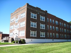 | Camp Manor Apartments | under 500 feet | 2005 |
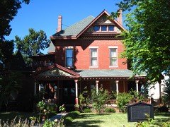 | Keet-McElhany House | 0.1 miles | 1984 |
 | Marquette Hotel | 0.1 miles | 2000 |
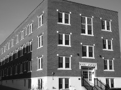 | Beverly Apartments | 0.1 miles | 2017 |
| South Avenue Commercial Historic District | 0.2 miles | 1999 | |
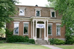 | Day House | 0.2 miles | 1976 |
| National Archives record | The nomination case file for reference 08000266 in Record Group 79. |
| Greene County | All 76 listed properties in this county. |